Category: Mobile

  • Live from CTIA Super Mobility Week 2014

    Live from CTIA Super Mobility Week 2014

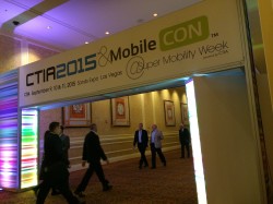
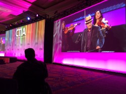
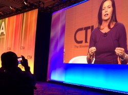
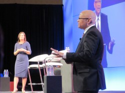
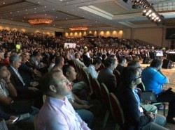
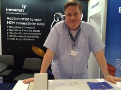
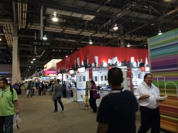
    GPS World reports live from CTIA Super Mobility Week in Las Vegas Sept. 9-12. The first ever Super Mobility Week now combines the former CTIA annual conference and MobileCON, and is expected to draw 1,100 exhibitors from around the world and features major product launches and trade news.

    GPS World Digital Editor Bethany Chambers, Wireless Editor Janice Partyka and LBS Editor Kevin Dennehy will be reporting all week here on GPSWorld.com, on Facebook and on Twitter @GPSWorld. The convention has some unique twists, including a house band led by Thomas Dolby (producer of 1982 hit “She Blinded Me With Science”) and the largest-ever tradeshow heat map, showing event popularity by tracking Wi-Fi connections throughout the conference.

    Blogs


    What Mattered Most at CTIA (9/18/14)

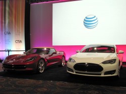
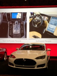
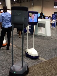
    CTIA SMW Features Large Connected Car Presence  (9/18/14)

    Septentrio Collaboration Part of Altus Growth Plans, CEO Says (9/12/14)

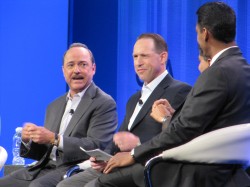
    CTIA Connected Car Panel Highlights Safety, Innovation (9/10/14)

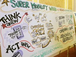
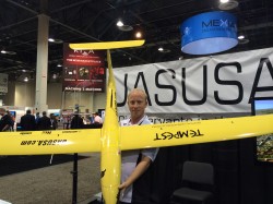
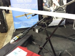
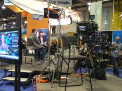
    MobileFocus Event Showcases Technology Demos (SLIDESHOW) (9/9/14)

    FCC Chairman to CTIA: Competition, Net Neutrality, Spectrum Top Priorities (9/9/14)


    News


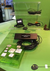
    Parsec Introduces PTA1.5M-9 Active GPS/GNSS Antenna (9/10/14)

    New Broadcom Chip Provides Always-On Location and Sensing for Mobile Applications (9/10/14)

    TEOCO’s AIRCOM Device Test Lab Strengthens Carrier Aggregation, LBS Testing with Rohde & Schwarz Equipment (9/9/14)

    Want to Track Your Luggage? Open Garden Offers Network for IoT Devices (9/8/14)

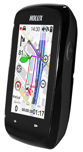
    Holux Launches Touchscreen Bike Computer with u-blox GPS (9/8/14)

    Hertz Joins with Navigation Solutions on NeverLost GPS System (9/8/14)

    AT&T to Host Hackathon, Demonstrate Connected Platforms at CTIA (9/2/14)

    Security, Spectrum in the Connected Vehicle (8/1/14)

    Photos


    Videos


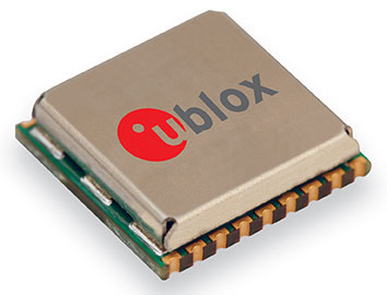
    Current Highlights from u-blox —And What They’ll Release Next (9/18/14)

    Thomas Seiler, CEO of u-blox AG, and Nick Papadopoulos, president of u-blox America, speak exclusively to GPS World about what makes u-blox the industry leader in embedded wireless technology and about the innovations on display at CTIA. They also give a preview of new products that will be coming out soon.

    Telit’s Plan for Becoming No. 1 (9/18/14)

    GNSS modules are a relatively new area of business for the London-based Telit, already the leader in cellular modules. Taneli Tuurnala, CEO of Telit GNSS Solutions, admits that Telit is currently the No. 2 player in the GNSS market. But that won’t last, he says. And here’s why.

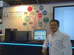
    Rohde & Schwarz DST200 Demonstration: Live with the Engineer (9/18/14)

    Thorsten Hertel, PhD, OTA Specialist for Rohde & Schwarz, gives GPS World a demonstration of the DST200 RF Diagnostic Chamber, which provides accurate radiated testing of wireless devices. He also highlights some recent updates.

    Get to Know Maxtena (9/11/14) – On the CTIA show floor, Vanja Maric, Director of Sales & Marketing for Maxtena, explains more about Rockville, Md.-based Maxtena, “the antenna innovations company.”

    What Parsec Technologies Is Bringing to the Market at CTIA Super Mobility Week (9/10/14) – CEO Michael A. Neenan introduces Parsec’s micro antennas in this first clip about the Plano, Texas-based company.

    What To See at the u-blox Booth at CTIA  (9/10/14) – In this first clip of our interviews with u-blox executives, Nick Papadopoulos, president of u-blox America, Inc., tells CTIA Super Mobility Week show-goers what they should see at the u-blox booth, #5229 on the show floor.

    Taneli Tuurnala: What’s New from Telit (9/9/14) – See the first clip of our interview with Telit GNSS Solutions CEO Tuurnala, on what to expect in the next six months from the company.


  • FCC Chairman to CTIA: Competition, Net Neutrality, Spectrum Top Priorities

    Crowds streamed into the Sands Expo and Convention Center, Las Vegas, to the sounds of ’80s music icon Thomas Dolby and a string quartet covering the ’90s hit “Bittersweet Symphony,” but the buzz wasn’t about the morning keynote speech that would kick off CTIA Super Mobility Week. Instead, the impending Apple Live Event had taken over as a countdown clock ticked on the big screen.

    The Apple circus — though alluded to in introductory remarks by CTIA Chairman Dan Mead, CEO of Verizon Wireless, and CTIA President Meredith Atwell Baker — would have to wait. First on the agenda: Several topics affecting the industry, with an emphasis on spectrum allocation.

    Atwell Baker set up the three-day show, the first combining the CTIA conference with MobileCON. She cited dozens of figures about the incredible growth of the industry before focusing in on the need for a successful spectrum incentive auction with projected 886% mobile data usage growth by 2019.

    “The U.S. had the third-lowest amount of spectrum dedicated to LTE,” she said. “How do we close the gap? The AWS-3 and 600MHz auction are a great start. We hear the wireless carriers may sit out of these auctions. Really? Given our track record, I’m incredulous wireless carriers wouldn’t bring billions of dollars to these auctions.”

    The Federal Communications Commission (FCC) has been pushing for the spectrum incentive auctions to reallocate spectrum from television broadcasters to wireless providers for ever-increasing mobile usage.

    In introducing Tom Wheeler, chairman of the FCC, Atwell Baker lauded his determination to bring the auctions to fruition.

    Wheeler jumped right into his list of the Top 3 issues facing the business for the standing-room only crowd: the incentive auction, net neutrality and competition in the wireless industry.

    Wheeler balanced his concerns with equal doses of praise, lauding CTIA for a “very thoughtful” paper arguing that mobile broadband should not be subject to the same rules as fixed broadband while alternately questioning why some consumers have been led to believe they have unlimited data usage or why others are targets for throttled usage.

    “I’m hard-pressed to understand how either practice, much less the two together, could be a reasonable way to manage a network,” he said.


    RELATED: CTIA’s “Net Neutrality & Technical Challenges of Mobile Broadband Networks”   |   Chairman Wheeler’s Prepared Remarks to CTIA


    He also touched on the need to keep competition alive in the business and avoid the “walled gardens” of the past that created barriers to entry in the market.

    “Where competition exists the commission must protect it. This industry has always told policymakers, ‘We’re different, we’re competitive, but in the last couple of years the FCC and Department of Justice had to be poised to protect that dynamic.”

    Wheeler pointed out the wireless industry’s $260 billion 10-year infrastructure investment as “living proof that profit and progress can go hand in hand” before concluding on the topic of a shared front: spectrum allocation.

    “Our greatest public asset is that which we cannot see: Spectrum. Your government has heard your cry for more spectrum. The Congress responded with a creative and courageous solution,” he said, “an incredibly complex, never-before attempted undertaking.”

  • Want to Track Your Luggage? Open Garden Offers Network for IoT Devices

    Open Garden, a finalist at CTIA’s Super Mobility Week Startup Showcase, has announced a new generation Mobile Network for IoT devices, and a tracking device is the first to leverage the new technology.

    With the increasing number of connected devices and the need for ubiquitous data transmission, device manufacturers are faced with very few options that fit their constraints in terms of cost, device size, battery life, and reliable connectivity, Open Garden said.

    The TrackR easily attaches to valuable items that can then be located via an app using TrackR’s Distance Indicator or via Crowd GPS. Photo: Open Garden
    The TrackR easily attaches to valuable items that can then be located via an app using TrackR’s Distance Indicator or via Crowd GPS. Photo: Open Garden

    The Open Garden Network makes it easy for devices to seamlessly access other devices and the Internet via secure peer-to-peer connections. Devices automatically detect nearby enabled smartphones or tablets via Bluetooth LE (Low Energy) and can pass data through them securely until the proper destination or recipient are reached. No pairing or configuration are required on the device owner’s part. To enable access to the network, device manufacturers use a simple digital access key, available from Open Garden and its partners.

    TrackR, the first device to leverage the new technology, is a small, coin-sized device that attaches to valuable items such as keys, wallet, luggage, or bike. Using the TrackR app for iPhone and Android, a user can locate lost items in seconds. When an item goes missing, the device broadcasts a wireless signal.  When another TrackR app user comes within 100 feet of the lost item, their phone sends a message to TrackR’s server with the updated GPS location of the item, and then the owner receives a GPS update on where the item is located.

    With the Open Garden Network, TrackR users will also receive GPS updates when users of Open Garden’s apps or partners’ apps or devices come within the range. The system is completely secure and anonymous, the “finder” never knows they found anything.

    “Open Garden provides an elegant solution to scale the TrackR community,” said Christian Johan Smith, TrackR’s President and co-founder. “We are excited to partner with Open Garden to expand our Crowd GPS network to deliver the best tracking experience.”

    “With the 250,000 devices in the market, TrackR is one of the most successful IoT devices to date. IoT devices require connectivity and simplicity. Because the Open Garden Network  is 100-percent software based, it scales infinitely and the costs are extremely low,” said Micha Benoliel, Open Garden’s CEO and co-founder. “Open Garden’s technology also enables operators to generate additional revenues while embracing the IoT revolution.”

    Devices can access the Open Garden Network via an API that is available to devices manufacturers and operators.

  • Telit Introduces Cloud-Ready Modules

    Telit Wireless Solutions, a global provider of machine-to-machine (M2M) modules and services, has debuted its first m2mAIR Cloud-ready wireless modules, designed to simplify the development and deployment of comprehensive M2M and Internet of Things (IoT) applications using the m2mAIR Cloud service. Telit said this is an important step toward realizing the company’s vision of the Internet of Things made Plug & Play.

    Telit Cloud-ready modules let developers connect and integrate things-to-cloud with just a few simple clicks in little time. Cloud-ready modules feature embedded APIs that are compatible with the well-known Telit on-board AppZone and Python environments and reduce hundreds of lines of code to 16 simple AT commands to move data automatically between remote devices in the field and relevant applications.  All the necessary developer resources and support are included and an Evaluation Kit is available for rapid prototyping of custom m2m and IoT device solutions.

    The m2mAIR Cloud Platform-as-a-Service, powered by deviceWISE, offers a simple “pay-as-you-grow” usage-based subscription plan — reducing risk, time-to-market, complexity and cost versus building your own point-solution. deviceWISE is an open, developer-friendly, carrier-grade platform, compatible with the TIA TR-50 standard. m2mAIR Cloud features comprehensive management and configuration capabilities to connect, collect, and control anything with bi-directional data transfers between remote devices and the Cloud — from basic entry-level solutions to full-scale enterprise-grade deployments across the globe.

    Interested developers can register for a free trial of the m2mAIR Cloud service. According to Telit, the easy-to-use portal has all the necessary visualization tools and dashboards needed for most remote tracking, monitoring and control applications across all industries and markets, out of the box. m2mAIR Cloud also meets the stringent requirements of global organizations that rely on mission-critical reliability, security, scalability and enterprise-grade performance with built-in business system integration. Furthermore, it includesAPIs that lets developers create their own web-based and mobile applications and dashboards, from simple functions to big data analytics.

    “When we acquired ILS Technology this time last year, we added the final element needed to become a true one stop shop for companies building IoT applications,” said Oozi Cats, CEO of Telit Wireless Solutions. “Today, we are pleased to have completed not only personnel and operational integration, but also the technology integration to realize our ONE STOP. ONE SHOP vision. Connecting your “things” to the cloud has never been easier. We fully intend to populate the Internet of Things with hundreds of millions of m2mAIR Cloud-ready modules in the coming years to drive innovation that makes businesses and industries operate more profitably, and will change the way people live, work and play.”

    The click-to-Cloud simplicity of Cloud-ready Telit modules and the m2mAIR Cloud service will be on display this week in the M2M Zone at CTIA, booth #5628.

  • Holux Launches Touchscreen Bike Computer with u-blox GPS

    The Holux SporTrek 1305 for avid cyclists features a u-blox positioning module. Photo: Holux SporTrek
    The Holux SporTrek 1305 for avid cyclists features a u-blox positioning module. Photo: Holux

    Holux Technology, a maker of professional and consumer GPS products, has launched its next-generation bike computer, the SporTrek 1305, which integrates a u-blox MAX GPS/GNSS module. The new device delivers GPS and wireless health-monitoring features on a compact, three-inch color touchscreen display.

    The device delivers a variety of useful information such as speed, heart rate, distance, altitude, map, and route, and comes with a calendar and stopwatch. SporTrek 1305 is the designed for touring, competitive cycling and mountain biking.

    The device integrates a compact u-blox MAX GPS/GNSS module that supports GPS as well as GLONASS, QZSS and all SBAS. The module is targeted at applications requiring small size, low power, fast acquisition, and reliable operation in GPS hostile environments.

    “Since 1994, Holux has been manufacturing a wide range of battery-operated GPS products for sports, automotive and safety devices. We count on extremely fast, low-power and accurate global positioning technology to deliver the features our customers demand,” said Eddy Huang, director, Marketing & Sales at Holux. “u-blox’ advanced satellite positioning module provides us with the performance, small size, and low power consumption that we need in a consistent, future-proofed form factor.”

    u-blox MAX GPS/GNSS module. Photo: Holux
    u-blox MAX GPS/GNSS module. Photo: Holux

    The SportTrek 1305 is shock and water resistant able to operate in all weather conditions. Equipped with Bluetooth Smart for accessories (such as heart-rate straps), it can also connect to heart-rate monitor / combo (speed and cadence) sensors and smartphone connection and notification, providing navigation and performance training data.

    It also integrates a patented “carbon reduction” feature that informs the user about the amount of equivalent carbon emissions saved compared to driving, and converts the data into the corresponding number of trees planted to achieve the same effect.

    SporTrek 1305 can be integrated with ezTour Plus software to share track route and analysis of physical states, and it can also be used to plan routes using the ezTour Planner feature. Users can integrate their own paper maps and third-party application as well.

  • Samsung Offers Gear S Smart Watch with GPS + GLONASS

    Samsung Offers Gear S Smart Watch with GPS + GLONASS

    RNG_SamsungGearS_three-view-O
    Photo: Samsung

    Samsung Electronics has unveiled its next-generation smart wearable device, the Samsung Gear S watch. The Gear S has assisted GPS+GLONASS, as well as 3G connectivity, allowing users to be active while always being able to access their smartphone information.

    Designed with a  two-inch curved Super AMOLED display and flexible band, the Samsung Gear S is also equipped with an accelerometer, a gyroscope, a compass, a heart rate monitor, and a barometer. The AMOLED display has an easy-to-use interface that allows users to read messages and notifications in a single glance with features such as conversation view and condensed font.

    Connected to 3G networks, people can receive notifications from social networks, calendars and applications, even when away from their phones. Users can instantly receive incoming messages and easily reply to SMS using the onscreen keyboard or enhanced S voice functionality. The Samsung Gear S also lets users make and receive calls directly from their wrist as well as getting calls forwarded from a smartphone. The device lets users enjoy seamless communication by freely switching between connections, automatically connecting and synchronizing information once it is paired to a smartphone.

    Samsung Gear S smart watch face detail. Photo: Samsung
    Samsung Gear S smart watch face detail. Photo: Samsung

    It also provides standalone features such as turn-by-turn pedestrian navigation provided by HERE. Health and fitness features include enhanced multi-sensors, built-in GPS, robust S Health features and applications like Nike+ Running so users can track their runs while leaving their smartphone at home.

    “Samsung is leading the exciting and rapidly developing wearable category with continuous innovation that aims to enhance the lives of technology fans,” said Ines van Gennip, marketing director, IT & Mobile Division, Samsung UK & Ireland. “The Samsung Gear S is set to redefine the idea of the smart wearable device and the culture of mobile communication, enabling people to live a truly connected life anywhere, anytime.”

    The smart watch will be available in October.

  • Vibrating GPS Shoes Help Lead the Way


    An Indian high-tech start-up is offering a GPS-enabled smart sports shoe that vibrates to give the wearer directions, according to an article in gulfnews.com.

    The red sneakers count the number of steps taken, the distance traveled, and calories burned. The shoes go on sale this month under the name LeChal, which means “take me along” in Hindi.

    The shoes come with a detachable Bluetooth transceiver that links to a Lechal smartphone app to direct the wearer using Google Maps, sending a vibrating signal to indicate a left or right turn.

    They are the brainchild of 30-year-old Krispian Lawrence and Anirudh Sharma, 28, two engineers who founded their tech start-up Ducere in a small apartment in 2011 and now employ 50 people. They say they have 25,000 advance orders for the shoes, which will retail at between $100 and $150.

    Lechal_app_screen
    The Lechal app works with Google Maps. Photo: Lechal
  • AT&T to Host Hackathon, Demonstrate Connected Platforms at CTIA

    AT&T will be a major participant during CTIA’s Super Mobility Week in Las Vegas next week. Connected car, connected home and wearables will all be on display throughout AT&T’s activities:

    • The first AT&T Hackathon to take place at CTIA will give developers access to new APIs for the car and home.
    • A 60-foot x 40-foot booth showcasing the latest Connected Life products.
    • A keynote address delivered by AT&T Mobile and Business Solutions President and CEO Ralph de la Vega and AT&T Mobility President and CEO Glenn Lurie, in which they will host a panel on the Future of Connected Car.

    AT&T Hackathon at CTIA 

    AT&T is kicking off the week’s events with its very first CTIA Hackathon, Code for Car and the Home, which will match developers with companies, tools and services to innovate in the connected car and automated home marketplace.  Developers will turn ideas into apps using APIs and other technology resources from 30-plus industry sponsors. More than 300 developers are expected to compete in the two-day Hackathon which begins at 10 a.m. PT on Saturday, September 6, in the Chelsea Theater at the Cosmopolitan Hotel. More than $100,000 in cash and prizes are available.

    Connected Life Booth

    When the Super Mobility Week show floor opens at 11 a.m. PT on Tuesday, September 9, AT&T will showcase the latest in wearables, connected cars and homes. Volvo and Audi will demo their connected car experiences and a simulator will be on-site to showcase AT&T Drive, the company’s connected car platform. AT&T Drive is a modular, global solution that allows automakers to pick and choose what services and capabilities are important to them in order to differentiate their solutions in the marketplace.

    Attendees can also explore how to stay connected to the home by visiting the AT&T Digital Life station. Digital Life is an all-digital, all-wireless automation and home security platform that equips customers with control of their homes from virtually anywhere.  On-site activations will include demos such as augmented reality so visitors can learn about the Digital Life service and products, an interactive wall to experience the simple, easy to use Digital Life app and a hologram home to showcase how Digital Life integrates everything you need in one place, to help make your life safer and easier, and provide you with more freedom to live your life.

    AT&T is the leader in emerging devices and will showcase the latest wearables from Fitbit, Jawbone, LG, Martian and Pebble. Additionally, Timex, the first authentic watch brand to enter the smartwatch space, will be on-site showcasing the new Timex Ironman One GPS+. The new smartwatch is the first GPS-connected fitness watch to connect to the mobile internet wirelessly, transmitting performance data, location, messages and more.

    Also on display will be the AT&T EverThere and FiLIP safety devices.  AT&T EverThere is a small wearable device that can detect falls and quickly identify location, automatically connecting the user to a 24/7 call center for response and support. FiLIP is a smart locater for kids that keeps parents and kids in touch at the push of a button.

    The  booth, number 4423, will be in the Connected Life section of the show floor at the Sands Expo and Convention Center. Visitors can locate the booth by using the interactive floor plan.

    Connected Car Keynote

    On Wednesday, Sept.10, Ralph de la Vega, president and CEO, AT&T Mobile and Business Solutions and Glenn Lurie, president and CEO, AT&T Mobility, will wrap up the show when they take the stage to discuss the Future of Connected Car.

    The following guest panelists will join them on stage to discuss this rapidly growing landscape:

    • Mary Chan, President, Global Connected Consumer, General Motors
    • Arun Bhikshesvaran, CMO, Ericsson
    • Mike Kennewick, Co-Founder and CEO, VoiceBox
    • Diarmuid O’Connell, VP, Business Development, Tesla Motors

    The keynote will kick off at 9 a.m. PT.

  • ION Seeks Abstracts for Pacific PNT 2015, PTTI Registration Opens

    Abstract submissions are now being accepted for The Institute of Navigation’s (ION) Pacific PNT Conference, to be held April 20-23, 2015, at the Waikiki Beach Marriott, Honolulu, Hawaii. Abstracts are due November 14, 2014.

    Pacific PNT, where “East Meets West in the Global Cooperative Development of Positioning, Navigation and Timing Technology,” brings together policy and technical leaders from Japan, Singapore, China, South Korea, Australia, the United States, and more for policy updates, program status and technical exchange.

    “Global cooperative interoperability” will frame the technical program. Leaders representing academia, government, industry and the scientific community will convene to solve PNT challenges that impact Pacific Rim development.

    Pacific PNT 2015 is organized by a Pacific Rim advisory board and will feature technical papers presented on a diverse array of topics including:

    • Aircraft Navigation and Surveillance
    • Agricultural, Construction and Mining
    • Algorithms and Methods
    • Alternative Navigation and Signals of Opportunity
    • Aviation Applications of GNSS
    • Challenging Navigation Problems
    • Collaborative Navigation Topics
    • Earthquake & Tsunami Prediction and Monitoring with GNSS
    • GNSS Augmentations
    • GNSS Correction and Monitoring Networks
    • GNSS Environmental Monitoring
    • GNSS Policy/Status Updates
    • GNSS Signal Structures
    • Inertial Navigation Technology and Applications
    • Interference and Spectrum
    • Ionosphere Monitoring with GNSS
    • Magnetic Field Navigation and Mapping
    • Maritime Navigation
    • Nature-Inspired Navigation
    • PNT and Automobile Safety
    • PNT and Social Media
    • PNT for Domestic and Healthcare Applications
    • Precision Agriculture and Machine Control
    • Time and Frequency Distribution
    • UAS Technologies

    Abstracts are being accepted through November 14, 2014.  For more information the ION’s Pacific PNT 2015, visit www.ion.org/pnt.

    PTTI 2014 Registration Opens

    Registration is now open for the ION Precise Time & Time Interval Meeting (PTTI) 2014 to be held December 1-4 at the Seaport Boston Hotel, Boston, Massachusetts. The technical program is available online.

    The annual PTTI conference has a technical program designed to disseminate and coordinate PTTI information at the user level; review present and future PTTI requirements; inform government and industry engineers, technicians, and managers of precise time and frequency technology and its problems; and provide an opportunity for an active exchange of new technology associated with PTTI.

    The Distinguished PTTI Service Award, which recognizes outstanding contributions related to the management of PTTI systems, will be presented on Thursday, December 4.

  • deCarta Powers POI Search for Major Mobile Handset Maker

    Advanced Search Engine Replaces Google Local Search in 122 Countries

    deCarta, Inc., an independent LBS platform company, is now providing the local search function for a worldwide, top-five mobile handset manufacturer. deCarta has been hosting and running the search service since August 7 using its advanced geosearch engine — L2 — and has replaced the search service previously provided by Google. The service delivers millions of responses per day to this handset manufacturer’s local search and mapping application to users in 122 countries.

    deCarta’s L2 is a high-performance, scalable local search engine with single line input and intuitive user interface. deCarta sources and indexes map and POI (points of interest) content from a wide variety of sources globally but also enables customers to easily index, control and search on their own content. The customer service announced utilizes TomTom map and POI content.

    deCarta’s L2 can be used as a pure geocoder for address search, or for POI search, or simultaneously as a combination of the two mixed in a single-line search query — with the additional ability to tune this behavior at runtime. This gives developers maximum flexibility and creativity in producing their applications. deCarta recently expanded country coverage to enable its customers to offer global services.

    The L2 Search engine is an integral component of deCarta’s LBS platform which provides specialized geospatial technologies for maps, routing, navigation, geocoding, local search and geo-data integration and processing. deCarta provides its white-label LBS platform to companies that wish to offer their own customized, branded LBS services as opposed to utilizing industry standard services such as Bing or Google.

    deCarta has two deployment options for its platform: a hosted LBS Platform Service (PaaS) or, alternatively, customers can self-host either on-premise or in a cloud service such as Amazon’s AWS.  Both approaches utilize deCarta’s REST API architecture and can scale to support billions of maps and searches and millions of users per month.

    “We are quite happy with the market reaction to L2 since its introduction last year,” said J. Kim Fennell, CEO of deCarta. “We’re seeing large mobile, telematics and automotive customers switch to L2 in competition against other local search engines and geocoders such as Google, Bing, Nokia/Here and Pitney Bowes. Customers appreciate L2’s technology advantages, customization capabilities, flexible content offerings, less restrictive license terms and our superior customer service — all of which creates a more satisfied end customer experience.”

    L2 enables deCarta’s customers to offer flexible, advanced local search capabilities that are on par with Google Maps but beyond other search engines. Examples include:

    • Single line entry of POI or address or both
    • Fast typeahead, predictive entry – ideal for mobile devices
    • High tolerance for misspellings and partial entries
    • Random ordering of address parameters
    • Search for a POI near a POI such as “ATMs near AMC Theater” or “Parking near SFO”
    • Search for POI near a specific address, i.e. “Parking near 1234 Main Street”

    Furthermore, L2 can be integrated with deCarta’s patented “Search Along A Route” technology. This combined with the ability to index custom content and boost result rankings gives automotive OEMs and service providers the ability to offer more advanced and helpful “driver-centric” connected car services.

    For more information visit www.decarta.com or go to the demo at http://labs.decarta.com. Developers can find technical details at http://developer.decarta.com.

  • Indoor Location Has Major Growing Pains, but Big Upside

    A number of factors are holding the proximity marketing/indoor positioning markets back: standardization issues, consumer acceptance/privacy, retailer awareness and the technology itself. However, as one location executive put it, it may be the one way that retailers with brick and mortar stores can compete with Amazon and other online giants. 

    Indoor location and proximity marketing may be the way large and small brick and mortar stores can compete with online retailers in the future, said panelists at the New York Place conference, held July 22. But all of this indoor location market talk doesn’t mean much if consumers don’t find a need for it.

    “I am in an aisle at a grocery store and you sent me a coupon for cat food, and I don’t have a cat, I am not going to be interested. The retailer gets to own the data by providing a great experience to the consumer, not the spontaneous ‘you are in a store — here’s some information,’” said John Dempsey, Datalogix head of mobile and video.

    While having a broad picture of a consumer’s “mobile moment” is important, there is something to be said about bombarding a consumer with too many location-based applications, said Doug Kilponen, Wanderful Media chief operating officer. “There are a limited number of apps consumers are willing to have, but not 200 different ones. It’s one thing to have an app for say, Target, but trying to find out what is broadly available during shopping makes shopping too much work,” he said. “Trying to find out what’s available becomes too much work as there are too many options [for the consumer].”

    From a retailer’s perspective, they want consumer’s data, and will share it with partners, but they also want control, said Catherine Lindner, Shelfbucks chief marketing and merchant officer, who was an executive at Walgreens.  “If you think about your own shopping behavior, there is only a few places you actually go to and spend money — a grocer, drug store.  That retailer wants your data, and it makes sense,” she said.  “How do we spend the money to grow the business?  The idea that there is one bucket of money to transfer is not going to happen.”

    One company says that consumers don’t want to be “advertazed” by retailers. “Their job is to show you Calvin Klein, but sometimes there is not enough information or context.  They hijack moments, rather than create them,” said Scott Townsend, Urban Airstrip director of agency programs.

    Still, retailers are increasingly using indoor location as part of their mobile strategies. Jewelry chain Alex and Ani has three beacons in their Boston and New York stores, said Ryan Bonifacino, Alex and Ani vice president, digital strategy. “We really want to prove that this [indoor location] can really work.  We really want to get in front of people who wouldn’t have discovered us,” he said.

    Indoor Location Standardization? What Standardization?

    Like any new technology and market, industry standardization will have growing pains, and a lot of the problem may be with the retailers, said panel members. “There are issues with standardization. If Walmart puts a [indoor positioning] in to its store — they don’t care if it works anywhere else,” said Don Dodge, Google developer advocate.

    Indoor location is the classic chicken-before-the-egg situation, said Chris Goodall, Trusted Positioning founder and CEO. “There currently are no standards for indoor [positioning], maybe we need it.  Databases are not standardized,” he said.

    A lot of the reason that standardization has not be resolved is that no big application, the old killer app, has appeared. “Indoor is something that has not emerged yet, it’s a long tail story,” said Dan Ryan, ByteLight co-founder and CEO.  “Every location company is trying to build a network — and naturally attract developers.”

    Making Proximity and Indoor Location Relevant to Retailers 

    Some retail chains like Walgreens have used indoor positioning technology for years and are considered some of the major early adopters. However, making consumer-purchasing behavior data relevant to retailers is the only way for indoor marketing to take off.

    The concept of geofencing each store has been tested in several locations. One company envisions an image of a celebrity greeting consumers in a store with an offer. “Walgreens focused on not invading people’s privacy. But they basically asked users, what’s important to them when they walk into a store,” said aisle411 founder and CEO Nathan Pettyjohn. “[Bluetooth Low Energy] beacons can do this very elegantly.  When a consumer walks through a store, perhaps they see a celebrity popping out to greet them.”

    In many successful mobile marketing campaigns, all have a common theme — proximity components always enhance sales, said James Smith, Verve chief revenue officer.  “Every one of our studies says it drives sales. Sometimes we hear that geofences don’t work — my answer to that is they are in the wrong places,” he said. “A person can go into a place 15 days later and a beacon locks on them — the retailer is happy because it works. Consumers are more empowered because they have a research device in their hand to go where they want to go.”

    Case Study: Walkbase

    A Finland-based company is delivering market research to retailers that examines consumers’ in-store shopping behavior and loyalty patterns. Walkbase, which signed a deal with Helsinki airport operator Finavia, started in 2007 when it spun off from an indoor location company.

    “It’s a retail tool that analyzes indoor performance of marketing campaigns and [sales] conversion. It measures when consumers come into a store — do they bounce out or are they engaged?” said Juha Mattsson, Walkbase vice president, sales and marketing.  “A retailer can launch a campaign that is affected by a consumer’s indoor journey. Whether that is through coupons, or not, as some retailers don’t want that.”

    Mattsson says that the company is operating primarily in Europe — and is waiting for what indoor technologies will win. “It is just a matter of time before the market takes off. Retailers are very interested in these types of consumer spending analytics,” he said. “We will be launching a U.S. white paper on in-store optimization as it’s all about education. We also are rolling out a version 2.0 of our product in the third quarter.”

    In other LBS news:

    • According to published reports, Michael Halbherr, CEO of Nokia’s HERE mapping unit, will be stepping down. Halbherr, who is based in Berlin, steps down after eight years at the company.  As recently as 2012, HERE, then called Navteq, had been losing money but had stabilized recently. Cliff Fox, HERE senior vice president, will be acting CEO until a replacement is found.
    • I will be covering CTIA’s Super Mobility Week in Las Vegas, Sept. 8-11.  To arrange an interview with me for Wireless LBS Insider, or to submit press releases, contact me at [email protected].


  • Majority Support FCC Rule Requiring Carriers to Provide Accurate Indoor Locations

    A new survey of more than 1,000 consumers found a dramatic gap between the limited location requirements for cell-phone carriers and broad public expectations that wireless callers can be found by emergency responders if they dial 9-1-1 in an emergency.

    According to the survey, two-thirds of cell-phone owners (66 percent) thought that wireless companies could help emergency responders locate them at least to their block, if they call 9-1-1 from inside their homes. Only 6 percent of cell-phone owners correctly responded that the information would likely only be accurate to the neighborhood level or worse.

    When told that current FCC regulations do not require cell-phone carriers to provide an accurate location for callers inside buildings, 83 percent said it was very or critically important to public safety for the FCC to adopt a rule to require cell-phone companies to generate that information. Reinforcing those findings, 79 percent said the FCC should begin enforcing the rule within two years, with nearly half (46 percent) saying the FCC should begin enforcement immediately.

    “When people dial 9-1-1 on their cell phones, they think the operator can find their location to send help,” said Jamie Barnett, director of the Find Me 911 Coalition and former chief of the FCC’s Public Safety and Homeland Security Bureau. “Unfortunately, the carriers have chosen cheaper, less-effective location technologies, and people are dying because emergency responders can’t find them. If you call 9-1-1 on your cell phone inside or in an urban canyon, the carriers’ technologies will often fail to accurately locate that call. Happily, technologies exist now that can find callers indoors and save lives. The carriers’ responsibilities should match consumer expectations that they can be found when they dial 9-1-1 from indoors.”

    Survey respondents also said that they would be willing to vote with their wallets, with nearly two-thirds (63 percent) saying they would consider switching cell-phone companies to a provider who could more accurately and reliably find 9-1-1 callers.

    Among the survey’s findings:

    • Most think all wireless 9-1-1 calls can be found. By a 7-1 margin, respondents thought that emergency responders could find their cell phone’s location if they dialed 911 in an emergency (59.0 percent to 8.5 percent).
    • Indoor callers think 9-1-1 locations are accurate to the block or house level.  Two-thirds of respondents (66 percent) said that cell-phone companies would share location information accurate at least to their block, and 55 percent believed it would be accurate at least to their house if they called 9-1-1 while at home.
    • Cell phones are the most common way to reach 9-1-1. Of respondents who have dialed 911, 57 percent most recently used a cell phone, not a traditional land line.
    • Half of 9-1-1 calls come from indoors or urban canyons. On their last 911 call from a cell phone, half of the respondents were inside a physical building (42 percent) or in an urban canyon (8 percent), where GPS technology is not reliable.
    • Most deeply concerned over lack of indoor location requirements. More than two-thirds of respondents (69 percent) said they would be extremely or very concerned if they learned that cell-phone companies were not required to provide an accurate indoor location to emergency responders.
    • Proposed FCC rule is vital to public safety. A large majority (83 percent) said the proposed rule is critically or very important to public safety in their communities.
    • FCC should implement requirements of rule within two years. Four-fifths (79 percent) said the FCC should begin enforcing the rule within two years, with nearly half (46 percent) saying the FCC should begin enforcement immediately.
    • Most oppose any delay in indoor location requirements. A large majority (71 percent) oppose any delay in implementation of the FCC’s rule.
    • Consumers willing to switch companies for better 9-1-1 accuracy.  Nearly two-thirds (63 percent) would consider switching their cell provider to a company with a more accurate system for 911 callers, with one in three (30 percent) saying they would definitely or probably do so.

    According to FCC estimates, at least 10,000 lives a year could be saved by improvements in response time through the FCC’s proposed rule.

    The survey was conducted online among 1,048 adult cell-phone owners in the US from August 15-18, 2014.  The survey was conducted via SurveyMonkey.com using a custom audience sample selected from the site’s 30 million users.  The survey had a margin of error of +/- 3 percent at a 95 percent confidence level.

    Find Me 911 is an effort supported by more than 200,000 individuals, as well as national and local organizations. The individuals and organizations represent a broad range of 911 operators and first responders — emergency medical services personnel, fire fighters and police.  Find Me 911 seeks to ensure that the Federal Communications Commission (FCC) move forward quickly to establish a reasonable, measurable level of location accuracy for emergency calls made indoors, enabling first responders to locate emergency calls from wireless phones from all locations rapidly and efficiently.