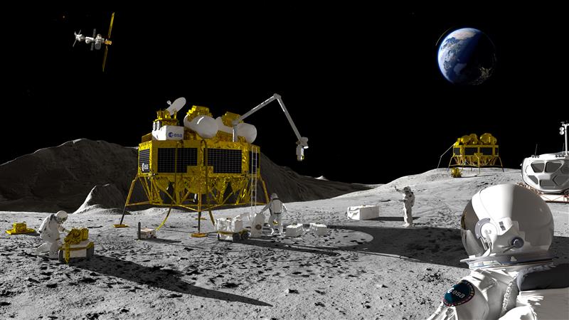
An artist’s impression of a Moon exploration scenario. (Image: ESA)
As there are several missions to the moon planned within the next decade, space agencies have started to consider how to keep time on the moon. To address time concerns, the LunaNet architecture, designed for lunar communications and navigation services, was introduced at the ESTEC technology center of the European Space Agency (ESA) in the Netherlands in November 2022.
“LunaNet is a framework of mutually agreed-upon standards, protocols and interface requirements allowing future lunar missions to work together, conceptually similar to what we did on Earth for joint use of GPS and Galileo,” said Javier Ventura-Trav
eset, ESA’s Moonlight navigation manager, coordinating ESA contributions to LunaNet. “Now, in the lunar context, we have the opportunity to agree on our interoperability approach from the very beginning, before the systems are actually implemented.”
“During this meeting at ESTEC, we agreed on the importance and urgency of defining a common lunar reference time, which is internationally accepted and towards which all lunar system and users may refer,” said Pietro Giordano, ESA navigation system engineer. “A joint international effort is now being launched towards achieving this.”
Each mission to the moon has operated on its own timescale from Earth. Deep space antennas have been used to keep onboard chronometers synchronized with terrestrial time at the same time to facilitate two-way communications. ESA stated that this way of working will not be sustainable in the coming lunar environment.
Time to think about time
Should a single organization be responsible for setting and maintaining lunar time? Also, should lunar time be set on an independent basis on the moon or kept synchronized with Earth? And what about time on other planets?
“Of course, the agreed time system will also have to be practical for astronauts,” said Bernhard Hufenbach, a member of the Moonlight Management Team from ESA’s Directorate of Human and Robotic Exploration. “This will be quite a challenge on a planetary surface where in the equatorial region each day is 29.5 Earth days long, including freezing fortnight-long lunar nights, with the whole of Earth just a small blue circle in the dark sky. However, having established a working time system for the moon, we can go on to do the same for other planetary destinations.”
To efficiently collaborate, the international community will have to settle on a common “selenocentric reference frame,” similar to the role played on Earth by the International Terrestrial Reference Frame, allowing the consistent measurement of precise distances between points across the planet.
A roundup of recent products in the GNSS and inertial positioning industry from the February 2023 issue of GPS World magazine.
SURVEYING & MAPPING
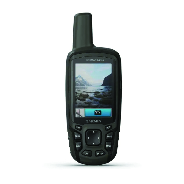
GPSMAP 64csx handheld GPS receiver (Image: Gamin)
Handheld GPS With navigation sensors and camera
The GPSMAP 64csx handheld GPS receiver comes with multi-GNSS support, TopoActive mapping, barometric altimeter, three-axis compass, and wireless connectivity via Bluetooth and ANT+ technology. It also has an 8 MP autofocus camera. The GPSMAP 64csx is built to withstand rugged terrain and is water-resistant. The highly sensitive receiver and quad helix antenna provide support from GPS, GLONASS and Galileo. Preloaded TopoActive maps include waterways, natural features, buildings and international boundaries. It is compatible with smartphones so users can receive email and text messages and share location data with others. Garmin, garmin.com
The Venus Laser RTK receiver comes with an inertial measurement unit. It can be used in its traditional mode with a range pole, or in laser mode without a pole, enabling GNSS surveying beyond typical limitations. In traditional mode, it has tilt compensation of up to 60° with an accuracy of 2.5 cm; in laser mode, it has the same tilt compensation but an accuracy of 5.5 cm. The receiver is powered by a SinoGNSS K8 high-precision module capable of up to 1,590 channels. It can survey using GPS, BDS-2, BDS-3, GLONASS, Galileo, QZSS and SBAS constellations. Other features include Bluetooth connectivity, more than 20 hours of battery life, and ruggedness (it is dust and waterproof and is designed to survive a two-meter drop). ComNav Technology Ltd., comnavtech.com
Leica iCON gps 160 (Image: Leica Geosystems)
Smart Antenna With features to increase productivity on the construction site
The Leica iCON gps 160 is a next-generation construction smart antenna designed to increase productivity in stakeout and measurement applications on the jobsite. It features a large color display with clear navigation for quick and easy setup without additional hardware. It is optionally available with an inertial measurement unit (IMU) for tilt-compensation functionality up to 20°. It seamlessly integrates with all Leica iCON construction instruments and controllers as well as the iCON field software for precise, real-time verification. Leica Geosystems, leica-geosystems.com
The Xsens Vision Navigator (Image: Movella)
GNSS inertial navigation Integrates position inputs from three high-accuracy sources
The Xsens Vision Navigator integrates position inputs from three high-accuracy sources including dual-antenna real-time kinematic (RTK) GNSS receivers; an inertial measurement unit (IMU) incorporating a three-axis accelerometer, a gyroscope and magnetometer; and a visual inertial odometry system. It can optionally accept input from an external wheel-speed sensor. The positioning sensor achieves centimeter-level accuracy when operating in GNSS mode with an RTK fix. When GNSS signals are not available, the product alone achieves accuracy of 2% of travel distance, or 0.75% when supplemented by wheel speed. Xsens Vision Navigator is suitable for outdoor positioning applications such as material handling equipment, commercial and specialist vehicles, last-mile delivery, inspection equipment and UAVs, agricultural equipment, mining equipment and utility robots. Movella, movella.com
SILC Eyeonic Vision System (Image: SiLC)
Coherent Vision Solution Delivers high levels of vision perception
The Eyeonic Vision System is a frequency-modulated continuous wave lidar solution, which delivers high levels of vision perception to identify and avoid objects with low latency. At the core of the Eyeonic Vision System is a fully integrated silicon photonics chip. It provides more definition and precision than legacy lidar solutions, with roughly 10 milli-degree of angular resolution coupled with millimeter-level precision. These features enable this solution to measure the shape and distance of objects with high-precision and at a large distance. The system combines the Eyeonic Vision Sensor and a digital processing solution based on a powerful field-programmable gate array. The flexible architecture enables synchronization of multiple vision sensors for unlimited points per second.
SiLC, silc.com
OEM
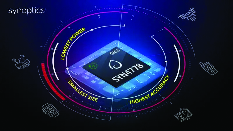
The SYN4778 (Image: Synaptics)
Integrated Circuit Designed for the internet of things
The SYN4778 is a small, low-power GNSS integrated circuit designed to extend battery life, reduce product size, and enhance performance of advanced location-based services for internet of things (IoT) devices — wearables, mobile accessories, asset trackers, UAVS and transportation devices. It includes advanced multipath interference mitigation using L5-band signals from GPS, Galileo, BeiDou, NAVIC, SBAS and QZSS. The chip also uses the L1 satellite band to reduce both the time to first fix, and the power consumed, improving the end-user experience and enabling product developers to add additional functionality and features to their IoT devices. Synaptics, synpatics.com
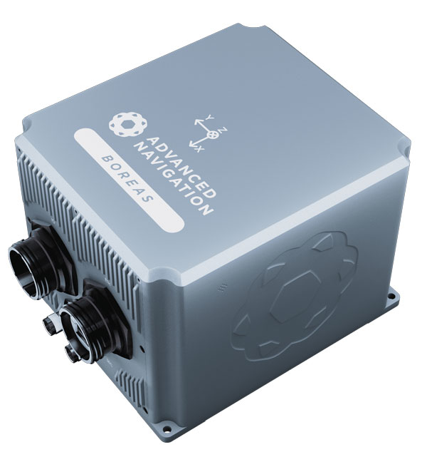
The Boreas D70 is a fiber-optic gyroscope (FOG) inertial navigation system (INS), part of the Boreas digital FOG series. The technology is suited to surveying, mapping and navigation across subsea, marine, land and air applications. It also could be adopted for vehicular applications, including autonomous vehicles and aircraft where weight and size are at a premium. The Boreas D70 combines closed-loop DFOG and accelerometer technologies with a dual-antenna real-time kinematic (RTK) GNSS receiver. These are coupled with an artificial-intelligence-based fusion algorithm to deliver accurate and precise navigation. Advanced Navigation, advancednavigation.com
The u-blox NEO-F10T (Image: u-blox)
Timing Module Dual-band and secure for 5G communications
The u-blox NEO-F10T offers nanosecond-level timing accuracy, meeting the stringent timing requirements for 5G communications. It is compliant with the u-blox NEO form factor (12.2 mm x 16 mm), allowing space-constrained designs to be realized without the need to compromise on size. The NEO-F10T is the successor to the NEO-M8T module, providing an easy upgrade path to dual-band timing technology. This allows NEO-M8T users to access nanosecond-level timing accuracy and enhanced security. u-blox’s dual-band technology mitigates ionospheric errors and greatly reduces timing error, without the need for an external GNSS correction service. u-blox, u-blox.com
TRANSPORTATION
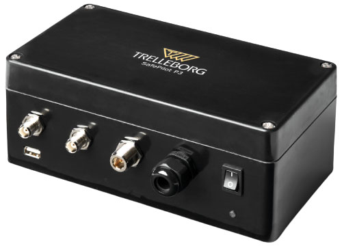
SafePilot P3 (Image: Trelleborg)
Maritime Systems Provides data on vessel positioning
The SafePilot P3 navigation system provides real-time data on vessel positioning and movement in tight waterways. It uses motion sensors and two GNSS antennas to measure the position and heading of vessels in three dimensions, minimizing time and difficulty associated with piloting procedures. SafePilot P3 has a backup battery to maintain functionality in the event of a power outage. This navigation system improves situational awareness while navigating waterways and ports globally, and also enhances communication between the captain, pilot, tug operators and canal personnel while vessels are transiting a canal and approaching a port.
Trelleborg, trelleborg.com
FusionEngine software (Image: Point One Navigation)
Positioning Engine Assures functional safety of ASIL-B
FusionEngine software, which is rated for automotive safety integrity level (ASIL), is now compatible with STMicroelectronics’ Teseo ASIL Precise Positioning GNSS chipset TeseoAPP. This assures functional safety of ASIL-B, a requirement for Level 3+ advanced driver assistance systems (ADAS). It can be integrated into several different host processors to enable high-level ADAS and autonomous driving systems. The combination of TeseoAPP’s receiver and the STA5365S external RF front-end provides dual-band measurement data for all visible GNSS satellites to the main host processor into which
FusionEngine is integrated. Point One Navigation, pointonenav.com
Ghost Autonomy Engine (Image: Ghost)
Autonomous driving software for level 4 driver assistance
The Ghost Autonomy Engine achieves the reliability required to bridge the gap between driver assistance capabilities L2 or L2+, and self-driving that does not rely on a human backup (L4). The software provides a stereo-vision neural network that delivers per-pixel depth in real time. It is capable of detecting and segmenting key features in a scene without needing to classify or recognize them. The physics-based perception system can handle the long tail of obstacles on the road, even those never seen before. Ghost, ghostautonomy.com
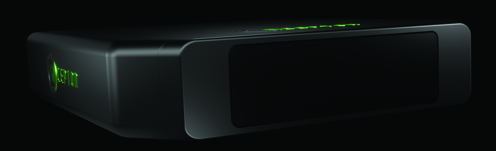
Vista-X120 Plus (Image: Cepton)
Lidar Provides 3D perception
The Vista-X120 Plus is a slim automotive lidar device for real-time adaptive 3D perception for advanced driver assistance. Its software-definable region of interest enables higher dynamic perception capabilities, while an adjustable central field of view with increased angular resolution improves accuracy in detection and classification of objects when driving. The region of interest is also configurable in real time in both horizontal and vertical directions. The Vista-X120 Plus is compact at 140 mm x 30 mm, improving OEM integration and placement options without disrupting vehicle appearance. Cepton, cepton.com
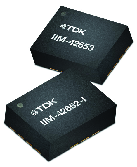
IIM-42653 and IIM-42652-I sensor platforms (Image: TDK Corporation)
Sensor Platforms Targets industrial and navigation applications
The IIM-42653 and IIM-42652-I sensor platforms consist of 6-axis IMUs, which target industrial and navigation applications requiring high force sensitive resistor (FSR) performance or inertial navigation software. The IIM-42653 platform — a robust, low-noise, low-power, 6-axis IMU — is capable of a gyro-programmable output of 4,000 dps and an accelerometer-programmable output of 32 g. These features make the IIM-42653 suitable for industrial-grade or high-end automated guided vehicles, automated mobile robots and unmanned aerial vehicles. The IIM-42652-I platform offers hardware authentication and can be integrated with TRACK dead-reckoning software from Trusted Positioning. TRACK filters GNSS multipath errors and provides a continuous navigation solution when GNSS signals are unavailable. TDK Corporation, invensense.tdk.com
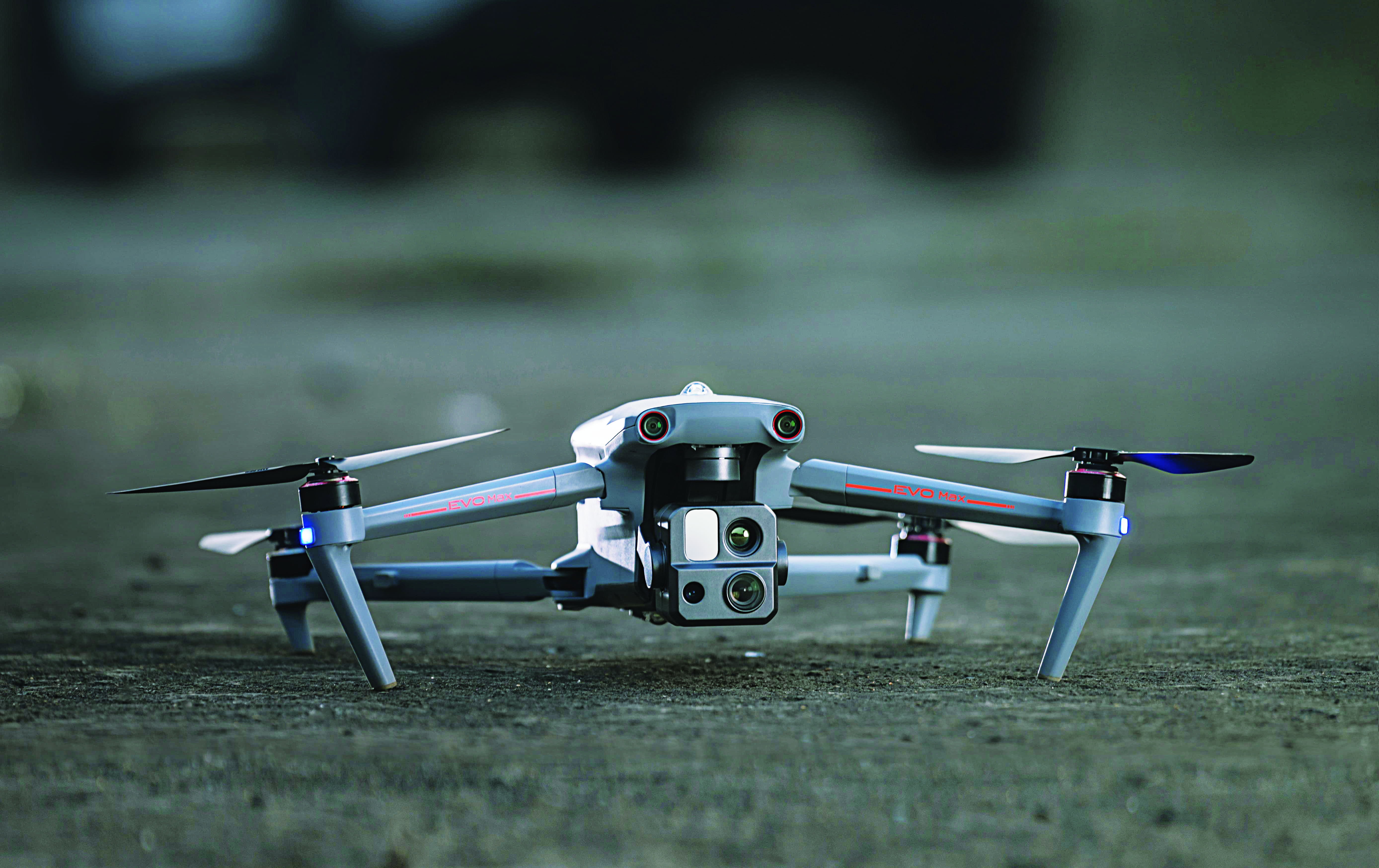
VO Max 4T (Image: Autel Robotics)
Flight Platform
For enterprise and professional applications
The EVO Max 4T autonomous flight platform provides omnidirectional obstacle avoidance and tri-anti-interference capability to ensure flight safety and stability in high-interference environments. It is equipped with three high-quality cameras including a 48 MP telephoto camera, a 50 MP wide-angle camera and an infrared camera. The platform has a range of navigation and data-acquisition functions, including 3D flight routes, PinPoint Mode, Team Work, Polygon Mission, Waypoint Mission and Oblique Photography. EVO NEST is a base for automatic take-off, landing, charging and mission planning for EVO series UAVs. It is designed for all-weather operation and can be easily transported. Autel Robotics, autelrobotics.com
Pasternack has released a series of GNSS antennas that meet military specifications for use in several small form factor and mobile applications.
The mil-spec GNSS antennas are engineered for environmental performance according to the MIL-STD-810G standard and include multi-standard GPS L1, Galileo E1 and GLONASS options.
The MIL-STD-810G GNSS antennas are IP67 rated. They are available in passive and active versions and provide coverage from 1,597 MHz to 1,607 MHz. The GNSS antennas feature linear polarization for cross-polarized isolation, nominal gain options of -3 dBic and 10 dBic, and SMA mounts.
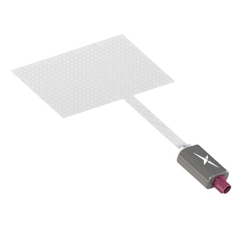
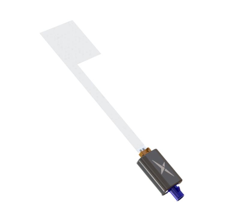
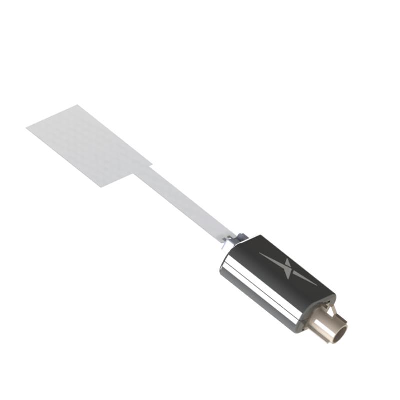
Taoglas has released three near-invisible antennas supporting cellular, Wi-Fi and GNSS technologies, the TFX62.A, TFX257.A and TFX125.A . With “peel and stick” mounting to any nonmetal surface, the TFX series antennas offer an alternative to standard opaque antennas.
The TFX62.A, TFX257.A and TFX125.A come with an adhesive and have an enclosed carrier terminated with a FAKRA connector for easy installation. The series leverages a sub-millimeter thick hybrid transparent conductive film that offers designers an invisible antenna solution.
The TFX series antennas are suitable for mobility, public infrastructure, medical devices, transportation and emerging IoT applications. Use cases for the antennas include electric vehicle chargers and parking meters, smart buildings and transportation vehicles.
On Dec. 20, ComNav Technology launched its Venus Laser RTK, a GNSS receiver with a millimeter-level laser that enables rod-less surveying. This product is a part of ComNav’s Universe Series of GNSS receivers.
Venus Laser RTK comes with an inertial measurement unit (IMU), which can be used in its traditional mode, with a range pole or in laser mode, which does not require a range pole, enabling GNSS surveying beyond typical limitations. In traditional mode, it has tilt compensation up to 60 degrees with an accuracy of 2.5 cm; in laser mode, it has the same tilt compensation but an accuracy of 5.5 cm.
This GNSS receiver is powered by a SinoGNSS K8 high-precision module, capable of up to 1,590 channels. It can survey using GPS, BDS-2, BDS-3, GLONASS, Galileo, QZSS, and SBAS constellations.
Other features include Bluetooth connectivity, more than 20 hours of battery life, and the fact that it is dust and waterproof. Venus Laser RTK can also withstand harsh environments and is designed to survive more than a two-meter drop.
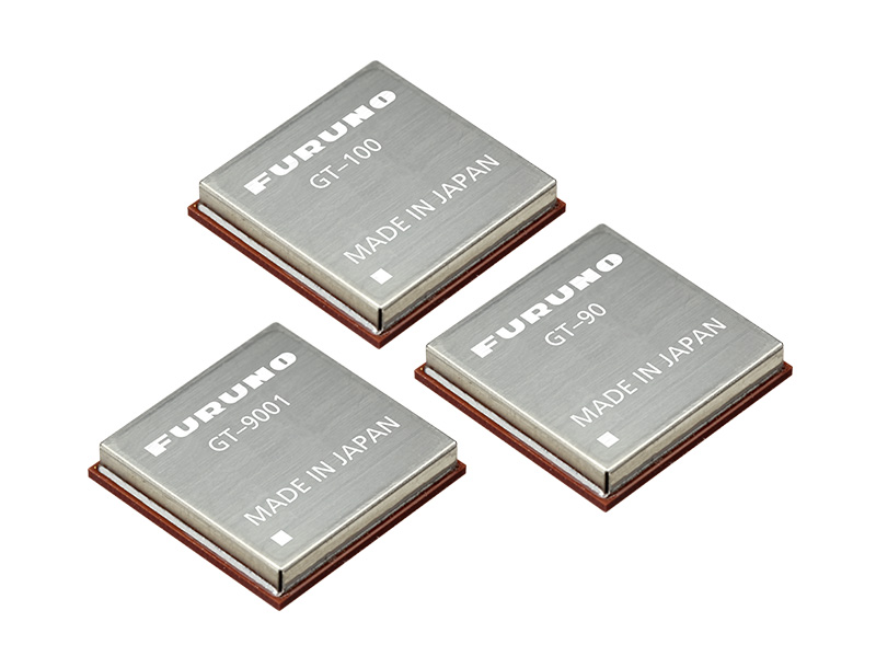
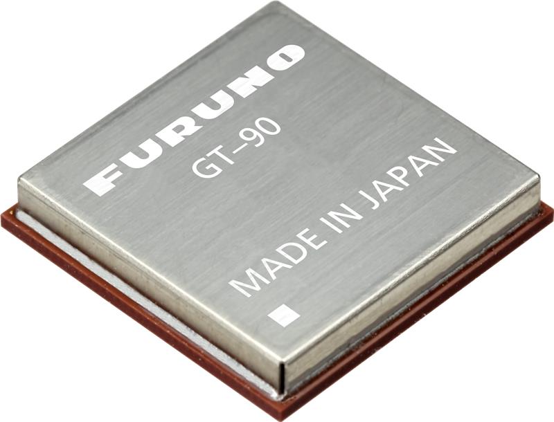
Furuno Electric has announced a new global timing solution, GT-100, compatible with all GNSS constellations. The GT-100 realizes the world’s highest robustness and standard of time accuracy and stability. Interruption of GNSS satellite signals is a major concern for critical infrastructure systems. The GT-100 features advanced multipath mitigation, anti-jamming and anti-spoofing as well as short-term holdover, ensuring superior performance even if only L1 or only L5 are jammed.
The module delivers best-in-class nanosecond precision for 5G wireless systems, radio communications systems, smart power grids and grand master clocks.
Along with the GT-100, our GT-9001 and GT-90 achieve a level of time stability of 4.5ns (1σ) and offer superior features and performance.
The third Innovative, Connectivity, Autonomous (ICA) Summit will take place May 15-16, 2023, in Frankfurt, Germany.
The ICA Summit 2023 will focus on the various levels of automated vehicles and how the industry is being redefined by fast-changing technology. Industry professionals will discuss how manufacturers and suppliers will integrate key connectivity requirements to achieve advanced levels of autonomous driving.
The closed-door ICA Summit will dive into innovative solutions and regulatory framework of development and validation. Attendees will have a chance to explore the latest developments in the industry and share their insights on the following topics:
• “Autonomous vehicles: Future is today”
• “Connectivity should not be an option for today’s vehicle”
• “ADAS: From ABS to level 5”
• “Software and hardware: The key to superior AI”
For more information and to register, visit the ICA Summit 2023 website.
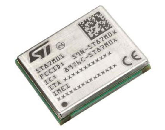
STMicroelectronics has released an ultra-compact, low-power, narrow-band internet of things (NB-IoT) industrial module with GNSS geo-location capabilities, the ST87M01. The fully programmable, certified LTE Cat NB2 NB-IoT industrial module covers worldwide cellular frequency bands and integrates advanced security features.
The ST87M01 is an integrated native GNSS receiver with multi-constellation access, which ensures enhanced and accurate localization. The module has a diminutive 10.6 mm x 12.8 mm land grid array footprint, making it suitable for applications where a small form factor is key.
The STM8701 offers flexibility for product developers, presenting a fully programmable IoT platform enabling users to embed their own code into the module for simple applications. A variety of protocol stacks are available to handle popular IoT use cases.
The ST87M01 targets wide-ranging IoT applications that require ultra-reliable low-power wide-area network connectivity and has ultra-low power consumption with less than 2 µA in low-power mode and transmit output power up to +23 dBm.
Suitable applications for the module include smart metering, smart grid, smart building, smart city and smart infrastructure applications, as well as industrial condition monitoring and factory automation, smart agriculture and environmental monitoring. The module can also be combined with a separate host microcontroller, permitting many more use cases.
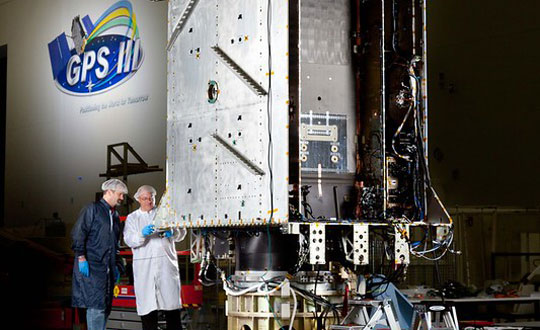
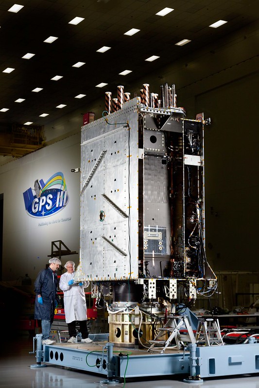
Space Systems Command (SSC) has declared GPS III Space Vehicle 10 (SV10) available for launch, marking completion of constellation modernization efforts and production for the GPS III program.
“The completion of the tenth, and final, GPS III space vehicle is a significant milestone for GPS modernization,” said Scott Thomas, GPS III program manager for the GPS Space Vehicles Acquisition Delta within SSC’s Military Communications and PNT directorate. “This would not have been possible without the collaboration, communication, and accountability of our industry and government partners. The GPS III program contributions underpin U.S. national security needs for our warfighters and for more than four billion GPS users worldwide.”
GPS III satellites deliver enhanced performance and accuracy through a variety of improvements, including increased signal protection with improved accuracy. GPS III also delivers a new L1C signal designed for interoperability with similar GNSS, and expands the civilian L5 signal, dubbed safety-of-life, which is not yet operational.
GPS III SV06 was launched on a SpaceX Falcon 9 Block 5 vehicle on Jan. 18, and Operational Acceptance was declared on Jan. 31. GPS III SV07, SV08, SV09 and SV10 are awaiting launch at Lockheed Martin’s GPS III processing facility in Waterton, Colorado.
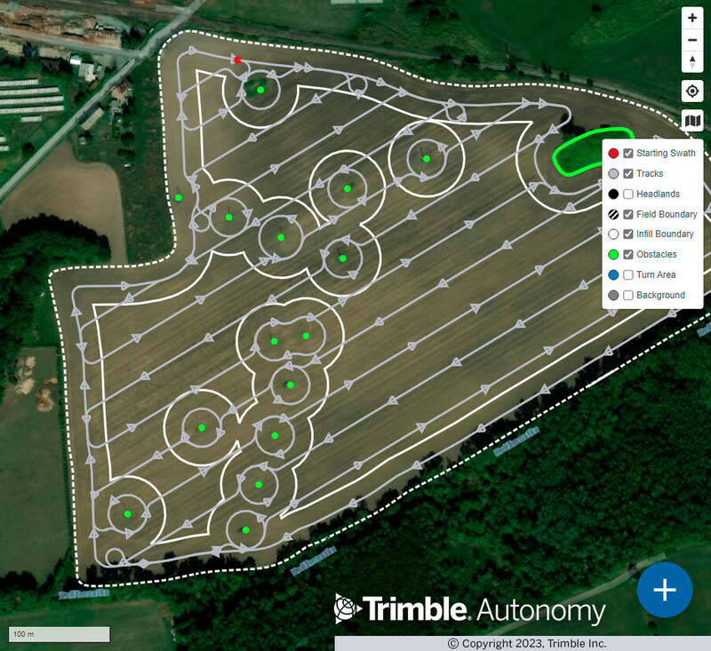
Trimble has released advanced path planning technology, which enables end users and equipment manufacturers to optimize and automate the trajectory, speed and path design of industrial equipment to increase efficiency.
The technology allows plans to be created in the office and adjustments made in the field or worksite. In addition, it is optimized for complex fields, unique site shapes, obstacles and avoidance zones. The software capability enables a broad range of autonomous applications across a variety of industries, including construction and agriculture.
The path planning technology gives users an easy-to-integrate, automated solution that works with Trimble systems and with equipment manufacturers’ existing systems. The technology will also be available within Trimble Connected Farm and Trimble Construction Cloud, offering a seamless, end-to-end experience to Trimble end users.
Trimble field tested the technology with Horsch, a company that specializes in agriculture, by integrating path planning technology into its self-propelled PT and VL sprayer series to provide an autonomous, four-wheel-drive solution. Trimble is also field testing this technology with Dynapac as part of its autonomous compactor for paving.
“Our new path planning technology is the next step in Trimble’s vision of making fully autonomous solutions available across industries, regardless of brand, type of equipment or use case,” said Finlay Wood, general manager, Off-Road Autonomy, Trimble. “With this easy-to-integrate solution, we’ve taken another significant step towards full autonomy.”
Alex Murdaugh (Image: Pool reporter photo from trial)
Cellphone and vehicle location data is at center stage as former South Carolina attorney, Alex Murdaugh, takes the stand in the trial for the murder of his wife, Maggie Murdaugh, and son, Paul Murdaugh. Troves of data including call logs, text messages, steps recorded, app information, coordinates determined by GPS and more from Alex, Paul and Maggie, are being retrieved for the ongoing trial.
Records retrieved from Murdaugh’s cellphone show that after the murders occurred, he proceeded to Google an area restaurant, check group messages, and made other calls that night, which he testified were accidental, according to CNN reports. Vehicle location data was also pulled and presented at trial to identify a timeline of events for the court, according to reports from AP.
Location data retrieved from Murdaugh’s cellphone on the night of the double murders is not the only time this type of data comes into play for the Murdaugh family.
In February 2019, Paul Murdaugh and his friends were involved in a boating accident, which killed one of the boaters, Mallory Beach. In the new Netflix documentary regarding the Murdaugh family, Murdaugh Murders: A Southern Scandal, a relative of one of the boaters mentions in Episode 2 that Beach always wore an Apple Watch, and asked why investigators failed to look into location data to find her sooner.
GPS III Space Vehicle 06 (SV06) reached Operational Acceptance on Jan. 31 according to the Space Systems Command (SSC) of the United States Space Force. SV06 was launched on a SpaceX Falcon 9 Block 5 vehicle on Jan. 18.
SSC also transferred Satellite Control Authority (SCA) of SV06 to the 2nd Space Operations Squadron at Schriever Space Force Base, Colorado. GPS III SV06 joins the GPS PNT constellation of 31 operational satellites.
This is the first time SCA and Operational Acceptance has occurred on the same day enabling faster delivery for users. SSC’s Military and Communication positioning, navigation and timing (PNT) enterprise collaborated with the U.S. government acquisition team, industry and space operators on the achievement.
“The Operational Acceptance of GPS III SV06 further contributes to SSC’s ongoing modernization efforts, as it brings our overall suite of capabilities ever closer to our target dates for deployment to the warfighter,” said Col. Heather J. Anderson, transition director within SSC’s PNT directorate. “GPS III SV06 will be set healthy to all global users in February 2023.”
The first-stage booster used in the SV06 launch previously sent the NASA Crew-5 mission to the International Space Station on Oct. 5, 2022.