Category: Applications

  • Guide, Assist, Automate: Why GNSS remains a key element for most construction automation applications

    Guide, Assist, Automate: Why GNSS remains a key element for most construction automation applications

    Image: CHC Navigation
    Image: CHC Navigation

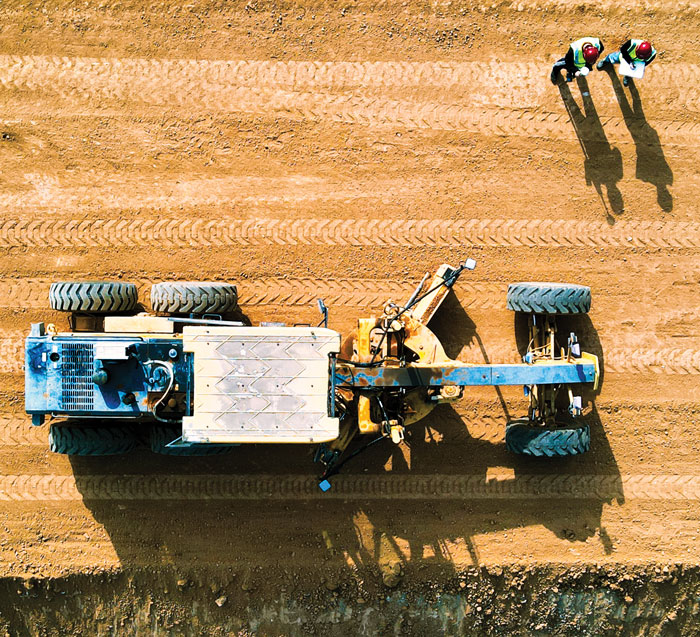
    Industry experts noted in our November 2022 issue that heavy equipment autonomy may be a distant future. However, the steady innovation in machine-control technology to get there is yielding substantial value. To drill deeper into those technologies, we interviewed additional industry experts with a focus on the key role of GNSS in such systems.

    1D, 2D and 3D

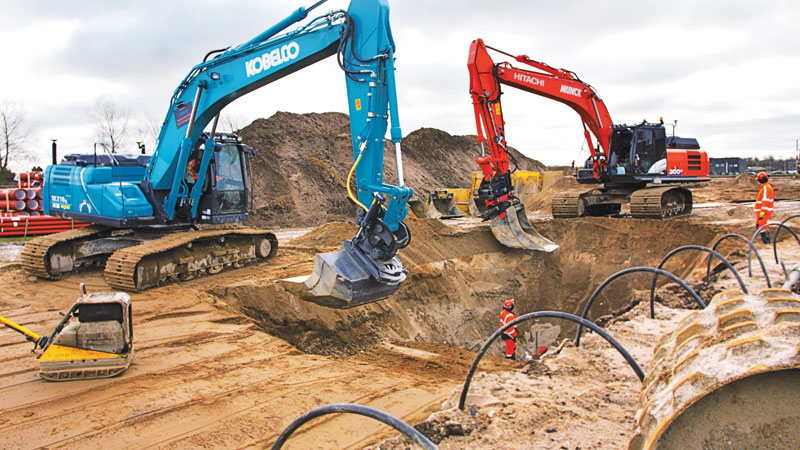
    There is currently a sharp growth in the adoption of 3D systems, according to Jordan Van Wie, product specialist with SANY America, a prominent manufacturer of construction equipment. “The fact is that many jobs are requiring this. They’re more efficient in their bidding process. They know exactly where they need to cut and where to fill — this means being more productive in less time.”

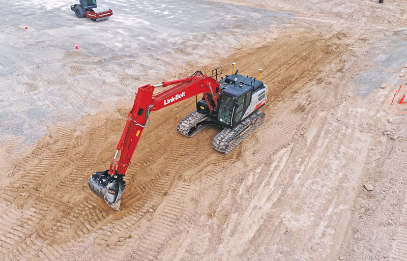
    SANY America is based in Peachtree City, Georgia, where many of its construction equipment systems are manufactured, including the SY225C, a popular medium excavator.

    The process of automating to the levels the operators desire is a matter of which sensors are added and how they sense the active geometry of the equipment in use.

    For an excavator, SANY installs four sensors, then measures the machine, said Mukesh Selvaraj, product manager, medium and large excavators, SANY America.

    “We know the distance between the bucket pin and the stick pin, up through the boom, and the angles on the sensors. We can compute in the system and report where the tip of the bucket is in relation to the body, and construct a 3D model in real time. This reporting can be as fast as 200 Hz.”

    Among the machine-control systems implemented on SANY construction equipment are those from Hexagon | Leica Geosystems. Leica produces precision guidance and control sensors and systems for construction, agriculture and mining that are integrated onto various heavy equipment brands.

    While 3D is becoming more popular, systems need to be scalable. Hexagon | Leica Geosystems has variants for different levels of guidance and automation, said Kert Parker, U.S. channel development manager for the company.

    “For instance, if you start with our PowerDigger Lite, it has a control box, a display, a boom sensor, an angle sensor for the stick (which includes a laser catcher) and a 360° bucket sensor. This lets you know where the bucket tip is in relation to the model — call it a 1D system.” The cost of such a system might only be 5% or 10% of the cost of the machine on which it is installed — a modest investment for the productivity gains it can deliver.

    To upgrade and run automatics, users could add a machine control panel and docking station with just 2D software. “That will give you a semi-automatic solution even on 2D. Then you can upgrade and add the GNSS receiver and antenna — or antennas — and 3D software to make it 3D, semi-automatic,” Parker said.

    Two-thirds of the price of the base system is for the sensors on the boom, stick, bucket, the pitch and roll sensor, and the wires that communicate throughout the system, Parker explained.

    “So, it’s completely scalable. You can start with a low-cost system upgrade to do GNSS fully and semi-automatic. We can automate any pilot-controlled machine, then we set the pressure. And when we sense the stick pressure, if the system is going automatic, then we automate the boom and the bucket.”

    Third ‘D’ Options

    “When you’re using something to give the machine a northing, an easting and a height at all times — that is when it becomes full 3D,” Parker said.

    3D systems can be configured with a single GNSS receiver, with dual GNSS receivers, or off of a robotic total station. “The only difference between single and dual is that, with single, every time you move the machine you have to do a calibration swing, about 90° to get your heading again.”

    “You can dig curves and complex designs working in 2D,” Van Wie said. “But every time you move the machine, you have to re-bench to a known reference, either by pinching with a bucket’s teeth, or hit the stick sensor that has an incorporated laser catcher. When you move the machine, you catch the laser beam again, and you use that for your known reference to dig back from the 3D model.”

    Excavators are a high-growth class of heavy equipment for machine-control adoption, with many excavators ready for system integration. Shown here, Leica iCON iXe3 systems on a Kobelco SK210 (left) and Hitachi 300-02 (right). (Image: Hexagon | Leica Geosystems)
    Excavators are a high-growth class of heavy equipment for machine-control adoption, with many excavators ready for system integration. Shown here, Leica iCON iXe3 systems on a Kobelco SK210 (left) and Hitachi 300-02 (right). (Image: Hexagon | Leica Geosystems)

    For certain operations — such as excavating in a straight line or moving materials to the side —higher levels of automation may not be needed, so some users appreciate the option of starting with a cheaper system.

    “For the small operator, of course, but even for a large operator, it’s a big investment to go full 3D,” Van Wie said. “They don’t want to go full 3D right away, or not on all equipment at once. They start off with just the basics and get familiar with it. Then when they want to upgrade, they have some of the stuff that they’re going to need for their machine already on it.”

    System Examples

    eSurvey GNSS manufactures GNSS-based equipment, software and systems for surveying, mapping, agriculture, UAV and construction. Better known in other global markets than in North America, the company has seen a steady rise in the market for construction automation  — outpacing other sectors utilizing heavy equipment automation such as agriculture and mining combined. For construction, in many parts of the world excavators are the prime focus for automation.

    Figure 1. A common configuration of sensors for excavators: GNSS receiver, dual antennas, control tablet and tilt sensors on the body, boom, stick and bucket.(Image: eSurvey GNSS)
    Figure 1. A common configuration of sensors for excavators: GNSS receiver, dual antennas, control tablet and tilt sensors on the body, boom, stick and bucket.(Image: eSurvey GNSS)

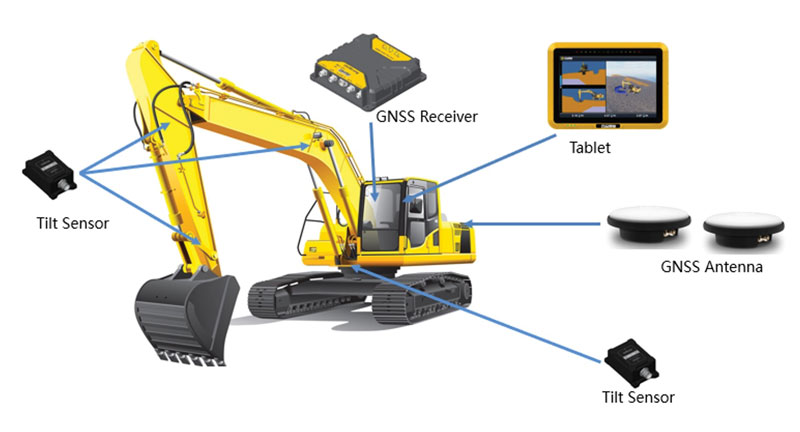
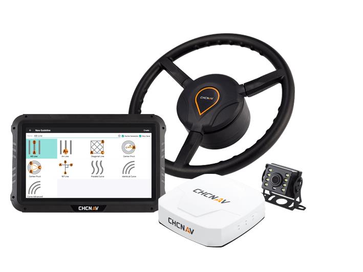
    Their eME10 system for excavators includes a dual-antenna GNSS receiver, three single-axis tilt sensors, one dual-axis tilt sensor, a tablet and software (Figure 1). “The eME10 does not support a rotating bucket at this time,” said Edward Zhang, product manager for machine control technology. “We support standard excavators, excavators that reach into the water (for instance on dredging barges), and with different bucket tools such as quartering hammers and milling tools.”

    Another popular system for compactors is the eMC10, with a single-antenna GNSS receiver, tablet and software, and optional temperature and vibration sensors.

    Managing Positioning

    Both the excavator and hydro survey boT have dual GNSS antennas for position and orientation, ensuring fidelity between the 3D model and operation of the excavator for dredging. (Image: Gavin Schrock)
    Both the excavator and hydro survey boT have dual GNSS antennas for position and orientation, ensuring fidelity between the 3D model and operation of the excavator for dredging. (Image: Gavin Schrock)

    High-precision GNSS, as implemented for architecture, engineering and construction (AEC) applications, can yield centimeter-grade results. However, as many AEC professionals and practitioners know, achieving repeatable and consistent results requires an experienced and skilled GNSS operator. Is the operator examining the results for statistical consistency? How have the observations been constrained to the desired reference framework? Have sources of error such as multipath and space weather been considered?

    However, Nick Fifarek, general manager at SITECH Pacific LLC, a construction technology provider, said that equipment operators only need to learn the user interface.

    “They are mostly concerned with how the grade is shown in the model, and what actions are required to meet the grade. They should not need to be concerned with the working of the GNSS receiver.”

    A larger firm with multiple systems will usually have a technician or surveyor on board, Fifarek explained. This expert would have the experience needed to set up a GNSS site base, ensure corrections are received, and troubleshoot causes of anomalies and poor results.

    To be efficient, an operator should not have to deal with a complex set-up.

    “It should be more like Google maps in your car,” Fifarek said. “They do not need to know how the model was created, and how the GNSS delivers positions to the interface. All the sensors should work seamlessly, like tilt sensor and IMUs [inertial measurement units] and how they work together with the GNSS to put positions on the blade or bucket. Once this is all working well and the model is applied, they should just be able to take directions.”

    Nevertheless, sometimes this expert will need coaching, or a small firm may not have an expert at hand.

    “We may need to teach them about some fundamentals, such as signal-to-noise ratio, PDOP [positional dilution of precision], and other quality indicators — especially when setting up the site base station,” Fifarek said.

    Additionally, he pointed out, the control must be set up — this is mostly done by engineering or surveying firms along with site calibrations — and operators need to know how to check it.

    Multipath Issues. Fifarek has not experienced problems with short masts for GNSS antennas, saying that the height of the cab is sufficient. Modern multi-constellation receivers, have improved multipath mitigation, and are able to work in sites with limited sky view or obstructions. Equipment such as excavators and dozers typically have dual-antenna GNSS systems, or two receivers and antennas. This provides not only position, but orientation and heading. These are usually installed on the body or cab, although some systems have a GNSS antenna on each end of the blade. Some systems use a method that only fixes one of the antennas/receivers, and then performs a fixed baseline solution for orientation.

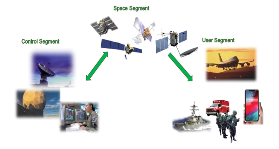
    The Chain of Components

    Much like autonomy in vehicles, machine control implementation can be defined as various levels.

    Level 1: GNSS-assisted guidance. The most basic level of implementation provides the equipment’s location and heading. It acts the same way as a navigation device or phone in your car. The technology has been around for decades for precision agriculture and construction.
    Level 2: Implement Control. Control of the blade or bucket.
    Level 3: Assist. Implement control plus a level of automation where the operator moves the control stick to initiate an action the machine completes by moving the blade or bucket to meet the design model geometry. This can include steering for various types of equipment.
    Level 4: Autonomy. More on that later.

    The power of tilt-compensated GNSS+IMU smart antennas may be the key to reducing the number and complexity of synchronizing a “chain of sensors.” In this example, a Trimble R780 smart antenna has been added to the stick of an excavator. (Image: Trimble)
    The power of tilt-compensated GNSS+IMU smart antennas may be the key to reducing the number and complexity of synchronizing a “chain of sensors.” In this example, a Trimble R780 smart antenna has been added to the stick of an excavator. (Image: Trimble)

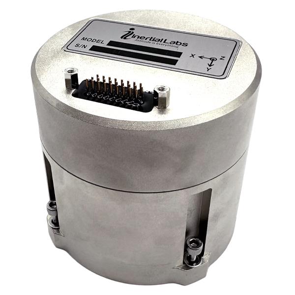
    For levels 2 through 4, continuously updating a position on the blade or bucket requires a chain of sensors to work in tightly controlled harmony. An excavator could be equipped with one or two GNSS receivers and antennas and a tilt sensor on the body, explained Geoffrey Kirk, product manager, autonomy and assist for Trimble. The GNSS will provide the position and orientation of the body, or rotating section of the body, on an excavator, and the tilt sensor reads how level it is. Another option is positioning with a total station and prism on the body, such as when GNSS is not available. “Either way, you need to know where you are in 3D space to be able to work on any 3D model,” Kirk said. “Today there are usually about 30 satellites in view. We can do so much more now compared to the days when we had fewer satellites, things that would have been impractical,” Kirk continued.

    Sensors on the boom, stick and bucket can be likened to an upper arm (boom), forearm (stick) and hand (bucket), with rotating buckets acting like a wrist.

    “We put a six-degrees-of-freedom IMU at each of these locations,” Kirk said. This is a chain of highly dependent geometry extended out to the bucket. However, Kirk said there may be a better way.

    Reducing the Links

    In recent years, a new technology has been implemented for GNSS smart antennas (rovers), like those that surveyors and grade checkers use, which tightly couples IMUs and movement of the GNSS antenna for calibration-free tilt compensation. Examples include the Trimble R12i (for surveying) and R780 (for construction), Leica GS19 T, and many more — few high-precision rovers made today lack tilt compensation. The observed acceleration and direction of the antenna adds orientation to the tilt angle (from the onboard tilt sensors), so the position of the tip of the survey rod can be computed precisely and in real time.

    At the Bauma construction trade fair held in November 2022 in Munich, Germany, Trimble gave participants a peek at something new: putting a tilt-compensating GNSS smart antenna out on the stick of an excavator.

    “With current systems, every time you hit one of those joints on an excavator, you need to understand what it is doing, calculating angles along the way,” Kirk said. “By mounting a tilt-compensated GNSS receiver on the stick, this becomes a lot easier to do.” Such innovations dovetail well with another trend in construction equipment: a move from purely hydraulic steering to drive-by-wire. This trend makes for more simplified and often less costly processes for adding implement control and automatics, but may also be key in implementing autonomy.

    The Path Toward Automation

    “One of the big changes in the industry is understanding what tasks operators are trying to do, so that we can help them do those tasks,” said Kirk. “We want to help people be more productive. We know autonomy is a thing. We’re actively working on autonomy; it’s going to be a while. In the interim, we want to make sure that we are providing value to the manual operators for the tasks that we can’t do autonomously.”

    Key foundational components of what would go into autonomous systems are already in place.

    “With automatics, you already have implement control, and in some implementations, you even have steering,” Kirk said. “What is missing in terms of the mechanics is speed control — that may be the easy part.” Adding the crucial situational awareness, other sensors for feedback, and the brains for automation is what might take a lot of time to work out.

    “Autonomy for cars is where you are trying to avoid hitting things,” said Kirk. “For construction, we are in the business of hitting piles of dirt and spreading them around.” For a car, the sensors see something, recognize it, know how far away it is, and can issue such commands as “stop” or “slow down” — which is not so simple for construction.

    Three key technologies you’ll see being used for situational awareness are radars, cameras and lidar, mostly used in combination. “Radars have some really nice behaviors,” explained Kirk, but cautioned that they cannot tell what they are doing.

    A demonstration implementation of an autonomous excavator. (Image: Trimble)
    A demonstration implementation of an autonomous excavator.(Image: Trimble)

    For instance, adaptive cruise control in cars, which is nearly always done with radar, works very well and reliably. Most such radars are now solid state and safety certified. Unfortunately, he points out, while radar is very good at alerting drivers that there is something in front of them, it is not very good at telling them what it is.

    “That’s why developers put in cameras, so that you can see whether what’s in front of you is a person, another vehicle, or something else. That’s why you have those combinations of sensors.”

    One of the reasons it will take longer to automate construction, Kirk explained, is that operators need to know much more about the nature of other objects in the construction environment than cars do on the road. The operators need to know not only what people, equipment and materials are around them, but also whether there is something or someone standing in front or on top of the pile of dirt.

    “For situational awareness, you need to be able to do real-time mapping,” Kirk said. “Lidar and cameras, such as stereographic cameras, can be used as classifiers. Lidar can have limitations, such as when driving directly into the sun.”

    “The smarts for autonomy are knowing what the task is and how to perform that task,” Kirk said. “However, from the standpoint of a machine’s sensor and setup, we’re not controlling speed, though we do on agricultural machines. So, machines are matched really well for autonomy — you can make them do whatever you want today.”

    Examples of autonomous conduction systems were demonstrated in the off-site “sandbox” exhibit of Trimble Dimensions+ held in November 2002 in Las Vegas. There was an autonomous excavator, a compactor and a remote-control dozer.

    Yet these were operating in a controlled environment. Kirk said that for safety reasons, early adoptions of autonomy might be confined to sites that are not along roads and highways.

    Read more of this cover story, “Why GNSS is the glue for construction.” 

  • Pilot project analyzes climate change for Caribbean nations 

    Pilot project analyzes climate change for Caribbean nations 


    Image: TommL/E+/Getty Images
    Image: TommL/E+/Getty Images

    NV5 Geospatial has forged a contract with the Caribbean Community Climate Change Center (CCCCC) to conduct aerial lidar and orthoimagery surveys across the Caribbean. The pilot project will provide advanced geospatial data to help the island nations understand natural and man-induced climate changes, develop programs to support resilience and sustainable development, and establish a foundation for future work.

    NV5 Geospatial will conduct topographic and topobathymetric lidar surveys, as well as orthoimagery, via a fixed-wing aircraft. Data collected will help CCCCC address the impact of climate variability and identify potentially hazardous impacts.

    The project will cover 10 sites spread across more than 3,000 km. The sites include areas in Suriname, Guyana, Tobago, Barbados, St. Vincent and the Grenadines, Saint Lucia, Antigua and Barbuda, St. Kitts and Nevis, Turks & Caicos and Belize.

    Other logistical considerations include the combination of microclimates inherent around tropical islands, highly variable weather conditions, cloud formations and jungles, some of which are in high relief areas or covering the entire area.

  • Inertial Labs releases multi-application IMU

    Inertial Labs releases multi-application IMU

    Inertial Labs has released its IMU-FI-200C, a compact, self-contained strapdown, advanced tactical-grade inertial measurement unit (IMU) device. The IMU-FI-200C measures linear accelerations and angular rates with its three-axis, tactical-grade, closed loop, fiber-optic gyroscopes and three-axis, high-precision MEMS accelerometers in motionless and high dynamic applications.

    The IMU-FI-200C is fully calibrated, temperature compensated and aligned to an orthogonal coordinate system. It contains more than 0.5 deg/hr gyroscopes and less than 2 mg bias repeatability over operational range accelerometers with low noise and high reliability.

    Continuous built-in test, configurable communications protocols, electromagnetic interference protection, and flexible input power requirements make the IMU-FI-200C suitable for a wide range of integrated system applications.

    Image: Inertial Labs
    Image: Inertial Labs
  • AUVSI launches Green UAS

    AUVSI launches Green UAS

    AUVSI_NewLogo2023.png

    AUVSI has launched Green UAS, a program to expand the amount of commercial UAS that have been verified to meet high levels of cybersecurity and National Defense Authorization Act supply chain requirements.

    Green UAS meets the Blue UAS certification program of the Defense Innovation Unit. It is designed for users who do not immediately require Department of Defense authority to operate.

    Green UAS also offers a streamlined pathway to the Blue UAS 2.0 cleared list.

    Green UAS is suitable for users who rely on commercial, off-the-shelf UAVs to conduct diverse operations. These users include federal government agencies, local law enforcement, first responders and state departments of transportation.

    Green UAS is also suitable for industrial enterprise users such as energy and utility companies, telecoms, manufacturers, food and agriculture, and logistics and mapping/surveying companies.

  • Mikroe releases LBand RTK Click

    Mikroe releases LBand RTK Click


    Image: Mikroe
    Image: Mikroe

    LBand RTK Click is a compact add-on board that provides access to L-band GNSS corrections. The board features the NEO-D9S-00B, a professional-grade, satellite data receiver for L-band corrections from u-blox.

    Operating in a frequency range from 1,525 MHz to 1,559 MHz, the NEO-D9S-00B decodes the satellite transmission and outputs a correction stream. This enables a high-precision GNSS receiver to reach accuracies down to centimeter-level. An independent stream of correction data, delivered over L-band signals, ensures high availability of position output.

    LBand RTK Click also uses several mikroBUS pins. The EIN pin routed to the AN pin of the mikroBUS socket is used as an external interrupt feature activated through a population of the R6 0Ω resistor.

    In addition, LBand RTK Click contains an SMA antenna for connecting a Mikroe-brand antenna. This antenna easily allows positioning in space, supporting GNSS L-band frequencies.

    LBand RTK Click implements advanced security features such as signature and anti-jamming mechanisms. It can also be integrated with other GNSS receivers from the u-blox F9 platform.

  • NASA partners with Firefly Aerospace for lunar GNSS mission

    NASA partners with Firefly Aerospace for lunar GNSS mission

    As a part of the NASA Commercial Lunar Payload Services initiative, Firefly Aerospace will land the Blue Ghost lander on the lunar surface in 2024. Onboard, the Lunar GNSS Receiver Experiment (LuGRE) payload will determine whether signals from two GNSS constellations can reach the lander and provide precise navigation on the moon for future missions.

    During a 12-day mission in the moon’s Mare Crisium basin, LuGRE will obtain the first GNSS fix on the lunar surface and receive signals from both GPS and Galileo. The LuGRE payload is managed by NASA’s Space Communications and Navigation program office.

    This payload is a collaborative effort between NASA and the Italian Space Agency to expand the capabilities of Earth-based navigation systems. Navigation engineers at NASA’s Goddard Space Flight Center in Greenbelt, Maryland, have been testing the payload’s GNSS receiver and low noise amplifier. The receiver was developed and built by the Italian company Qascom.

    These components will be critical to LuGRE obtaining signals from the GPS and Galileo satellites. To prepare for operating on the moon, NASA engineers used a GNSS simulator to test and configure the payload to accurately receive and process the signals.

    The LuGRE payload GNSS receiver and low noise amplifier. (Image: NASA/Dave Ryan)
    The LuGRE payload GNSS receiver and low noise amplifier. (Image: NASA/Dave Ryan)

    The Goddard team delivered in February the flight hardware to Firefly Aerospace in Cedar Park, Texas, where it will be integrated into the Blue Ghost lander.

    Astronauts and rovers traversing the lunar surface will need precise location and tracking data for their exploration endeavors. The data gathered from the LuGRE payload will be used to further develop GNSS-based navigation systems for future missions to the moon.

    Image: NASA
    Image: NASA
  • Trimble partners with Nissan on driver assistance system

    Trimble partners with Nissan on driver assistance system

    Image: Nissan
    Image: Nissan

    Trimble has partnered with Nissan Motor Company to use Trimble’ RTX network as the positioning source to enhance the capabilities of the ProPILOT Assist 2.0 driver assistance system in Nissan vehicles.

    The Trimble RTX network is supported by a globally redundant and resilient infrastructure and is backed by a team of ISO 20,000 certified network engineers and IT specialists, which monitor operations to ensure optimal signal performance and reliability for drivers. Trimble’s RTX positioning technology can provide decimeter-level accuracy in seconds, making it suitable for autonomy applications, including automotive driving.

    The ProPILOT 2.0 Assist system enables hands-off driving while cruising in a single lane and when the vehicle approaches a road divide. When the car is passing a slower vehicle, the system judges the appropriate timing of branching off or passing based on information from the navigation system and 360-degree sensing.

    The ProPILOT 2.0 Assist system with Trimble’s RTX network will be initially available on the 2023 Nissan Ariya.

  • Hoptroff livestreams GNSS vulnerabilities roundtable

    Hoptroff livestreams GNSS vulnerabilities roundtable

    Hoptroff will host its thought leadership industry roundtable, “GNSS, the time is up,” on March 21. The virtual roundtable will explore the impact of escalating GNSS vulnerabilities to business continuity and how organizations can best protect business-critical operations.

    “Businesses and financial institutions need to accept and start planning how they are going to mitigate the risks associated with GNSS,” said Tim Richards, CEO at Hoptroff. “This livestream roundtable will allow business and financial institutional decision-makers to better understand the impact and disruption GNSS vulnerabilities can have on their bottom line, and why they need to act now.”

    The roundtable is an opportunity for those in the financial and business sector to learn more about the status of GPS, the growing potential risks from increased jamming, spoofing and cyberattacks, what disruption looks like, and the new technologies available to provide complementary positioning, navigation and timing (PNT) technologies to help mitigate risk.

    “GNSS vulnerabilities create serious consequences for critical infrastructure,” said Richard Hoptroff, founder and chief time officer at Hoptroff. “To effectively mitigate these threats, complementary PNT solutions need to be deployed.”

    The event will be moderated by Robert Hampshire, deputy assistant secretary for Research and Technology, U.S. Department of Transportation.

    Speakers at the roundtable event include:

    • Robert Hampshire – Deputy Assistant Secretary for Research and Technology, U.S. Department of Transportation
    • Diana Furchtgott-Roth – Heritage Foundation and George Washington University
    • Judah Levine – Fellow, National Institute of Standards and Technology (NIST)
    • Karen Van Dyke – Director for PNT, U.S. Department of Transportation
    • Steve Suarez – Global Head of Innovation, Financial Services
    • Kathryn Condello – Senior Director, National Security/ Emergency Preparedness, Lumen Technologies
    • Richard Hoptroff – Founder and Chief Time Officer, Hoptroff

    Areas of discussion at the roundtable include:

    • The rising GNSS vulnerabilities and the potential consequences of GNSS disruption such as service outages, errors, or inaccuracies.
    • Example use cases where GNSS vulnerabilities can have a significant impact on your business continuity.
    • How to enable new resilient complementary technologies for your disaster recovery plans.
    • How to start utilizing these technologies today in your real-life applications such as precision timing for global financial services.
    • Practical advice for businesses on reducing GNSS risk in financial transactions, fraud detection, compliance and data integrity.

    Those interested in attending the livestream roundtable can sign up on the Hoptroff website.

  • Seen & Heard: Monitoring hurricanes and the power of TikTok

    Seen & Heard: Monitoring hurricanes and the power of TikTok

    “Seen & Heard” is a monthly feature of GPS World magazine, traveling the world to capture interesting and unusual news stories involving the GNSS/PNT industry.


    Car in snow. (Image: BanksPhotos/E+/Getty Images)
    Image: BanksPhotos/E+/Getty Images

    Dozens Stranded in Tundra

    Several vehicles in Rock Springs, Wyoming, were stranded after being led by their map apps or vehicle navigation systems to an unmaintained county road in a blizzard. Several calls were made to the Sweetwater County Sheriff’s Office about stranded vehicles stuck after they were directed to the detour when Interstate 80 was closed due to winter conditions. Similar incidents were reported by other counties, resulting in discussions between the Wyoming Department of Transportation and the companies that develop navigation software. 


    Screenshot: CBS video
    Screenshot: CBS video

    UAVs contain Western Technology

    A Ukrainian intelligence assessment obtained by CNN and CBS reported an Iranian UAV downed in Ukraine contained technology from companies in the United States and other western countries. The White House has since launched an investigation as to how the technology — including semiconductors, GPS modules and engines — were obtained by Iran. The components removed from an Iranian Shahed-136 UAV totaled 52, 40 of which were manufactured by 13 different U.S. companies. The remaining components were manufactured by other western companies and by companies based in Japan, Taiwan and China.


    Hurricane. (Image: Harvepino/iStock/Getty Images Plus/Getty Images)
    Hurricane. (Image: Harvepino/iStock/Getty Images Plus/Getty Images)

    Machine learning helps monitor hurricanes

    Researchers may now be able to monitor climate-induced natural hazards by combining satellite technology with machine learning. Researchers were able to use machine learning to study hurricanes that made landfall over the Gulf of Mexico in a series of recent experiments. C.K. Shum, the co-author of the study and a professor at the Byrd Polar Research Center, uses geodesy to study global climate change phenomena. Using geodetic data gathered from satellites, Shum tested whether a mix of remote sensing and machine learning analytics could accurately monitor weather phenomena. Accurate measurements could help improve hurricane forecasting. 


    Sailboat. (Image: valio84sl/iStock / Getty)
    Sailboat. (Image: valio84sl/iStock / Getty)

    The power of TikTok is real

    TikTok changed Jeff Foulk’s life when his daughter posted about his free marine navigation app, Argo, when they attended a boat show in Chicago. Foulk was promoting Argo with little success, until his daughter shared with the social media platform his struggle as the owner of a small business. Since then, the app has been downloaded more than 200,000 times and remains at the top of the charts for boat navigation apps. Argo was launched more than four years ago and, until now, had only 100,000 total downloads. Now that Argo is viral, Foulk wants to launch a premium subscription.

  • CHC Navigation releases GNSS RTK steering system

    CHC Navigation releases GNSS RTK steering system

    Image: CHC Navigation
    Image: CHC Navigation

    CHC Navigation has released the NX510 SE Auto-Steer, an automated steering system that retrofits several types of new and old farm tractors and other vehicles. It can be connected to local real-time kinematic (RTK) networks or GNSS RTK base stations.

    NX510 SE is a guidance controller powered by multiple corrections sources and five satellite constellations: GPS, GLONASS, Galileo, BeiDou and QZSS. It has a built-in 4G and UHF modem that connects to all industry-standard differential GPS and RTK corrections to achieve centimeter-accuracy steering.

    NX510 SE contains GNSS and inertial navigation system terrain compensation technology, which maintains high accuracy in challenging environments and terrain. This makes NX510 SE suitable for ditching, planting and harvesting applications.

    In addition, AgNav multilingual software, operating on a 10.1 in industrial display, supports multiple guideline patterns that include AB line, A+ line, circle line, irregular curve and headland turn.

  • Directions 2023: Advancing GPS to Meet the Future

    Directions 2023: Advancing GPS to Meet the Future

    GPS is the gold standard for precise positioning, navigation, and timing (PNT), impacting the lives of more than six billion users worldwide. The United States economy alone depends on the free, government-provided service across 900 million GPS receivers supporting vehicle navigation systems, general aviation, financial transactions, the electrical grid, precision agriculture, surveying and construction. The GPS enterprise must remain consistent and reliable, while keeping pace with emerging technology without interruption for the end user.

    Space Systems Command (SSC) at Los Angeles Air Force Base in El Segundo, California — the U.S. Space Force’s space development, acquisition, launch and logistics field command — is responsible for maintaining and modernizing the GPS enterprise. The enterprise consists of three segments: the space segment, the control segment and the user segment. Each achieved specific milestones during an exciting and productive 2022.

    Military people navigating on battlefield
    A new MGue for warfighters is moving closer to completion. (Image: EvgeniyShkolenko/iStock /Getty Images Plus/Getty Images)

    Space Segment

    There are currently 37 GPS satellites on-orbit with 31 set healthy. The constellation requires 24 operational satellites for worldwide coverage and a receiver needs to receive transmissions from four of them to determine its position in three dimensions. GPS continues to operate impressively with an average 45-cm accuracy throughout the past year with the most precise day on record at 31.5 cm. The space segment of GPS modernization focuses on GPS III and GPS IIIF satellite development with significant milestones rounded out in 2022.

    For GPS III, after the successful launch of Space Vehicle 5 (SV05) on June 17, 2021, it was set healthy (usable) on May 25, 2022. The significance of SV05 is its full operational capability of the improved civilian L2 (L2C) signal. L2C improves service speed for commercial users via access to two frequencies, improves accuracy when combined with legacy civil GPS signals (L1 C/A), and is less susceptible to ionospheric interference. SV05 is the 24th satellite enabled with the Military Code (M-code), providing worldwide M-code coverage. M-code is designed to give military receivers better defense against jamming, improved accuracy, a more secure and flexible cryptography architecture, and the ability to detect and reject false signals.

    On Jan. 18, 2023, SV06 successfully launched into orbit aboard a SpaceX Falcon 9 Block 5 rocket from Cape Canaveral Space Force Station, Florida. The launch of SV06 marks a key step in the larger goal of modernizing the GPS constellation. Additionally, the 10th and final satellite in the GPS III fleet finalized production and has a target launch date of 2026. GPS III Space Vehicles 7–10 are in storage and available for launch.

    The next generation of GPS satellites continues development. The October 2022 contract award for GPS III Follow-On (GPS IIIF) satellites will onboard additional capabilities. In addition to introducing new civil signals designed to enhance search-and-rescue efficacy and aviation safety, laser retroreflector array for precise ranging, and a fully digital navigation payload, the GPS IIIF satellites will offer a new Regional Military Protection (RMP) capability providing up to 60 times greater anti-jamming measures. A new port on the Lockheed Martin LM2100 Combat Bus supports a substantial increase in flexibility, providing rapid integration of payloads in response to emerging threats in space.

    GPS Enterprise interrelated segments. (Image: Space System Command)
    GPS Enterprise interrelated segments. (Image: Space System Command)

    Control Segment

    The Next Generation Operational Control System (OCX) will replace the current GPS Operational Control System (OCS), supporting the latest U.S. Department of Defense standards and practices for cybersecurity. The updated system includes a modernized and expanded monitor station network, improved anti-jam capabilities, and enhanced operational capability to control modernized military signals.

    In March 2022, OCX completed its fourth and final legacy ground antenna element (LGAE) installation on Kwajalein Island in the Republic of the Marshall Islands. OCX Block 1 and 2 are undergoing Hewlett Packard (HP) Formal Qualification Test (FQT). This event will qualify much of the system’s previously certified mission software functions. The event will also demonstrate system maturity and readiness for system acceptance, operator training, and specific developmental testing milestones with both GPS space and user segments.

    The next-generation control system, OCX 3F, will modify OCX Blocks 1 and 2 to use the enhanced capabilities of GPS IIIF satellites. OCX 3F received Milestone B and Acquisition Program Baseline (APB) approval from the Milestone Decision Authority (MDA) and was authorized to enter the Engineering and Manufacturing Development (EMD) phase in May. In November, the OCX 3F program deployed 3F mission software into OCX’s Near Operations Environment (NOE) for the first time after completion of the program’s first Integration Readiness Review (IRR). The IRR event ensures that the software meets integrity standards and receives approval to be integrated and tested on the NOE prior to software releases to the operational users. OCX 3F anticipates achieving operational acceptance in 2027.

    The GPS III government and industry team recently core mated GPS III SV10 and nicknamed it “Hedy Lamarr” after the actress and inventor. (Image: Lockheed Matin)
    The GPS III government and industry team recently core mated GPS III SV10 and nicknamed it “Hedy Lamarr” after the actress and inventor. (Image: Lockheed Matin)

    User Equipment Segment

    Among the arsenal of GPS user equipment, very few pieces have the technology to use the M-code signal. Maintaining a competitive advantage against the adversary requires use of these signals; the GPS Enterprise is focused on developing Modernized GPS User Equipment (MGUE) capable of accessing these signals. The MGUE program is a joint service program developing modernized M-code-capable military GPS receivers. The program is broken into two increments (Inc 1 and Inc 2). Both are designed to deliver secure PNT performance, allow navigation warfare operations, enhance anti-jam, enhance anti-spoof and anti-tamper, and enable Blue Force Electronic Attack.

    As part of the multiple elements under the MGUE Inc 1 umbrella, L3Harris delivered its final Build 7 ground card to the government on Nov. 16, 2021, and completed regression testing on that kit in February 2022. The final Delta Security Certification and Approval were completed on April 13 and April 29, 2022, respectively. Development of the L3H Ground-Based GPS Receiver Applications Module (GB-GRAM-M) card, which delivers geolocation and precise positioning capabilities for space-constrained applications while providing increased security and anti-jam capabilities, is complete and available for services procurement. MGUE Inc 1 completed qualification testing for the aviation and maritime cards on Sept. 9, 2022, with updated software builds. This build allows the program to progress to 98% of the requirements verified and enables B-2 Bombers and Guided Missile Destroyers (DDG) to continue progress toward operational testing. Completion of this commitment means significant progress toward operational testing for stakeholders and warfighters.

    MGUE Inc 2 held Preliminary Design Reviews for the Miniature Serial Interface (MSI) in summer 2022, bringing the project another step closer to finalizing the EMD phase. Once all closure and action items are completed for the reviews, the government will consider each event complete. Critical Design Review (CDR) is scheduled for this summer and will validate the system design and the ability to meet system performance requirements. MGUE Inc 2 continues to execute the second competitive objective under Phase I for the Joint Modernized Handheld component; the effort is moving closer to completion of the handheld prototype and will ultimately make for a more seamless transition to operations.

    GPS ground antenna at Schriever Space Force Base in Colorado. (Image: U.S. Air Force)
    GPS ground antenna at Schriever Space Force Base in Colorado. (Image: U.S. Air Force)

    Conclusion

    The SSC’s mandate is paramount to maintaining our modern way of life. The space professionals dedicated to developing GPS technology are committed to delivering advanced capabilities to the warfighter, the civil sector, and the world. An interconnected world is ready for us. We’re on our way.

    SSC is the U.S. Space Force field command responsible for acquiring and delivering the capabilities needed by warfighters to protect our nation’s strategic advantage in and from space. It manages an $11B budget for the U.S. Department of Defense and works in partnership with joint forces, industry, government agencies, academic and allied organizations to outpace emerging threats.


    For analogous updates on the other three GNSS constellations, please see:

  • Linx Technologies releases remote antenna base series

    Linx Technologies releases remote antenna base series

    Linx Technologies has released the MAG Series SMA and RP-SMA magnetic antenna bases, which are suitable for GPS, Galileo and QZSS applications. The antennas are designed to combine a strong magnetic mount with typical connectors to create different mounting options for a variety of whip/blade-style connectorized antennas.

    “This versatile mounting option provides the capability to extend the placement of the antenna to a remote location and allows the flexibility for the antenna to be used in a mobile application, making it especially well-suited for the growing internet of things (IoT) market,” said Tolga Latif, senior director of product management for IoT and micro-markets.

    The MAG Series antenna bases are IP67 rated (connectors, base and coax) and are also suitable for LTE-M (Cat-M1), NB-IoT, 5G/4G LTE/3G/2G, LoRaWAN, Sigfox, Wi-Fi, HaLow (802.11 ah), Bluetooth and Zigbee, as well as GNSS applications.

    The MAG Series antenna bases are available now via Linx Technologies’ distributor and manufacturer representative networks.

    Image: Linx Technologies
    Image: Linx Technologies