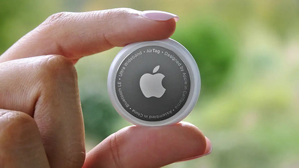
Two women have filed a class-action lawsuit against Apple for privacy concerns as Apple AirTags are being widely used for malicious and criminal purposes.
Both women and their families were tracked and stalked by ex-partners using Apple AirTags hidden in their personal belongings. They are now suing Apple for negligence and privacy violations stating the company failed to protect its customers. They are both seeking damages and are hoping to prevent Apple from continuing to manufacture this product with “design flaws.”
The location device was designed by Apple in 2021 and its intent is to be attached to such items as keys, suitcases and purses to make them trackable. However, the $29 Bluetooth-enabled AirTags can be used as a weapon by abusers, stalkers and traffickers to easily find and track their victims.
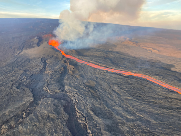
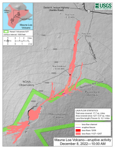
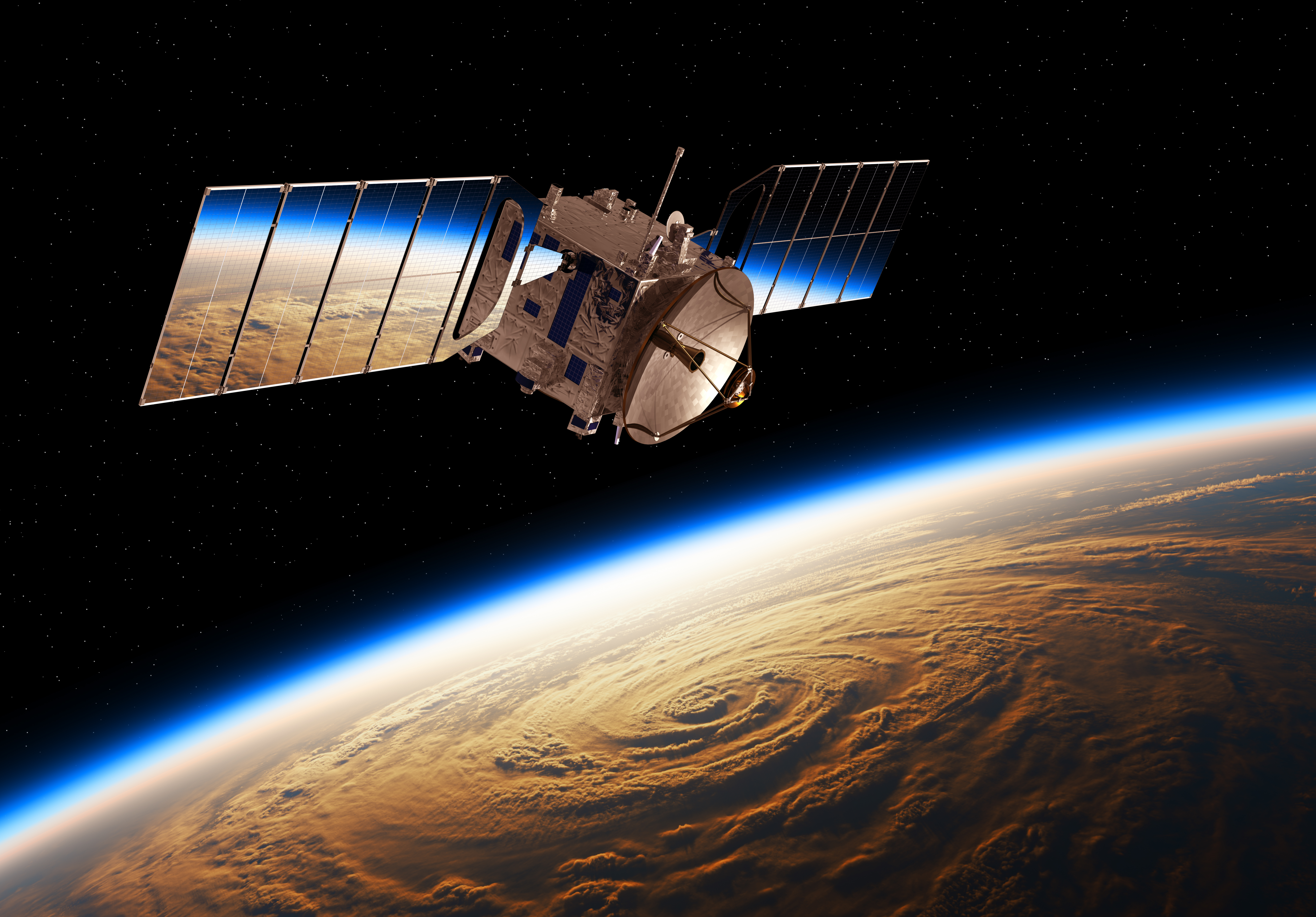
In late November, the Mauna Loa volcano in Hawaii erupted for the first time since 1984 and is currently in an active volcanic eruption. Scientists are using satellites and helicopters to record and map the flow of lava on the Big Island.
The active eruption is in a remote area on the island, making it difficult to map it and the lava flow. It is critical to have accurate emergency information during the eruption in order to have appropriate resources and have ample time to evacuate, if necessary.
The easiest and most accurate way to map the lava from this eruption is via satellite. Based on satellite observation, scientists have been able to create a mobile app to support helicopter crews in making maps of lava flow that update in real time. This real time evaluation is sent to emergency personnel and geologists tracking the eruption patterns.
Image: USGS
Mauna Loa has erupted 33 times, the most recent of which was 38 years ago. The volcano typically averages an eruption every 5 years, making Mauna Loa’s most recent dormant period longer than normal. According to the U.S. Geological Survey (USGS), this eruption was caused by an increase in earthquakes below the Mauna Loa Summit, an increase of inflation tracked by GPS stations, and several additional geologic factors.
Live footage of the Mauna Loa eruption can be seen here.
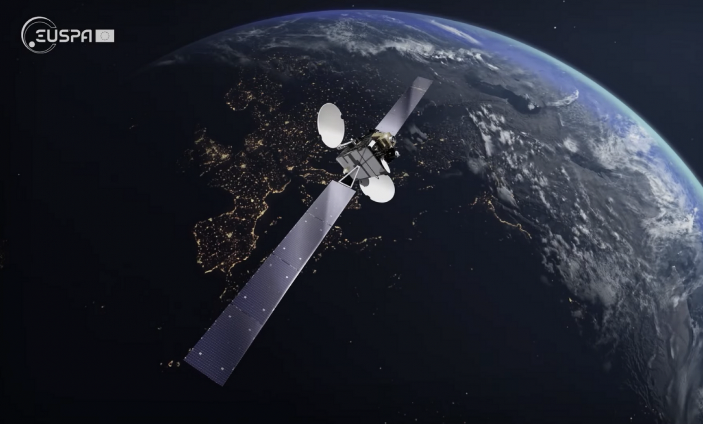
Europe’s regional satellite-based augmentation system (SBAS), EGNOS, has received upgrades to advance the reliability of GNSS positioning information, according to EUSPA.
Historically, EGNOS has provided safe, uninterrupted satellite navigation services to aviators, and some maritime, railroad, and land-based users in Europe. This system upgrade includes extending its service area, adding advanced functionalities, and reinforcing dual-frequency and multi-constellation services.
The EGNOS V242B system upgrade will expand services outside of its service area and enhance availability to users. Additionally, the upgrade ensures aviator access to lifesaving services such as Localizer Performance with Vertical Guidance (LPV)-200. The upgrade also includes more advanced data processing functions to cater to increased issues with peak solar activity and ionospheric phenomena that interfere with EGNOS signals and services.
Dual-frequency and multi-constellation services were also improved in the EGNOS upgrade. The improvements revamped EGNOS Version 2, and reinforced EGNOS services before launching EGNOS Version 3 (V3).
EGNOS delivers two frequencies and has amplified Galileo signals, hence creating a multi-constellation capability. When EGNOS V3 is launched, it will offer additional services and enhance protection against cyberattacks, further advancing EGNOS’ safety-critical applications across Europe.
The private spaceflight company, SpaceX, has undertaken a partner project in addition to its existing space efforts ranging from sending satellites and people to space, to providing a brand of commercial internet connection to remote areas.
The new partner project, Starshield, will join Starlink in providing secure, broadband internet connection to customers. However, there is a stark difference between the partner projects.
Starlink technology has end-to-end user data encryption to secure its network as it was designed for commercial customers. However, the Starshield project is intended for government use in national security efforts. Therefore, it is equipped with an additional high-assurance cryptographic feature to host payloads and process data in a secure way aligning with government national security requirements.
As reported by SpaceX, Starshield has three focus areas including: Earth observation, global communications, and hosted payloads. Starshield’s satellites can integrate with a variety of different payloads and the constellation has a low-Earth orbit (LEO) design making it robust to on-orbit assets.
SpaceX continues to work closely with the United States Department of Defense by providing innovative space technology.
Mapbox, a maps and location platform, has created new productsand platform updates to aid developers in making more accurate, data-driven decisions and improving overall user experience with advancement in location technology.
Navigation SDK v2.9 was introduced to provide pre-built navigation applications, compatible with Android and IOS, which will provide all the primary navigation components across a workflow using lines of code instead of starting from square one. The Drop-in UI is customizable to create applications that reflect a developer’s brand, rather than needing to manually develop a full end-to-end application.
Image: Mapbox
Navigation SDK Copilot, a backend analytics tool for CX on navigation applications, was launched and designed by Mapbox to collect trace files of navigation sessions and search analytics data from users. Developers can use this data to gather feedback and collective user data to create touch points with users and improve application experience based on their data-drawn conclusions.
Mapbox’s platform updates and product innovation also include improvements to its Matrix API, which can now support scheduled departure times and provide optimal driving routes creating a more accurate ETA. This innovative location technology is also designed to enhance fuel efficiency and decrease emissions.
Image: Mapbox
As map boundaries are constantly changing, Mapbox has expanded its visualization of map lines to update as frequently as the lines change. The expanded visualization makes updates quicker and improves the ability of Mapbox’s platform to give users the most up-to-date information.
The Ministerial Council of the member states of the European Space Agency (ESA) has pledged 351 million euros to ESA’s board of directors for navigation to aid in multiple satellite navigation endeavors.
This funding helps support ESA’s FutureNAV program, the Navigation Innovation and Support Program (NAVISP), and the Moonlight Initiative, developed for lunar telecommunications and navigation coverage and innovation.
The FutureNAV program is aimed at addressing the rapidly growing need for more ubiquitous, resilient and reliable positioning, navigation and timing (PNT). Its first mission consists of an initial in-orbit demonstration, small constellation of low-Earth-orbit (LEO) navigation satellites. The LEO-PNT satellites will test a multi-layer approach to deliver more accurate and robust PNT services, supplementing Galileo.
The second FutureNAV mission, GENESIS, will map the moving contours of Earth, while enhancing the accuracy of Galileo.
The expanded funding will also be invested in NAVISP. The program has already began working on over 200 projects relating to satellite navigation, PNT research, and backing Member States in research priorities.
Lastly, funding is being delegated to the Moonlight Initiative, a project designed by ESA to extend satellite navigation and telecommunications coverage to the Moon. The advancement and launch of Moonlight infrastructure on the Moon will undertake several missions bolstering future Moon exploration.
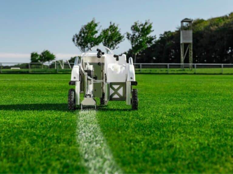
TinyMobileRobots’ has introduced TinyLineMarker to the field painting market. TinyLineMarker is designed to accurately paint field lines in stadiums using GPS technology.
In addition to GPS signals, the robot receives corrections signals from an RTK network in order to accurately trace the markers onto the field. Even if the GPS signal is disrupted, the numerous RTK network reference stations make it possible for the robot to correct its position and continue painting.
As TinyLineMarker is compatible with handheld tablets, the robot will begin painting in accordance with the markers when it is started from a tablet. Once the robot completes a line marking job, the line pattern can be saved to the cloud and saved for future use. Line patterns can also be updated or changed from a tablet as needed.
SpirentCommunications has revealed its latest low-Earth-orbit (LEO) satellite solution software named SimORBIT, developed in partnership with space-borne receiver developer SpacePNT. The software is designed to aid developers in determining LEO orbits accurately for GNSS/PNT lab testing.
SimORBIT calculates LEO orbits as well as their environments and intricate characteristics to provide an accurate result to developers for testing. The software replicates LEO orbits so that simulations can provide the realistic environment of a LEO satellite, including gravitational and atmospheric impacts the satellite could encounter in space.
SimORBIT was created in partnership with spaceborne receiver developer SpacePNT. “Until now, PNT testing on LEO applications has been limited due to the lack of an integrated solution that could offer realistic LEO orbital data together with GNSS simulation capabilities,” explained Adam Price, Spirent’s vice president of PNT Simulation. “By working in close collaboration with SpacePNT, we have been able to develop the SimORBIT tool to bring a new level of accuracy and realism to LEO application testing by combining the simulation of precise LEO orbits and highly accurate GNSS signals.”
With Spirent’s release of SimORBIT, developers can create non-ICD signals via I/Q injection, or by the Spirent “Flex” feature, generating space-centered PNT signals to be developed in the lab as realistically as possible.
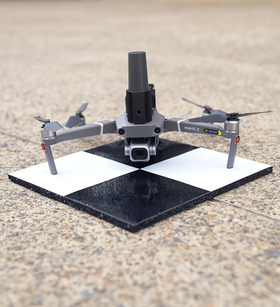
Position Partners has unveiled SmartSurveyor, which facilitates accurate, survey-grade aerial mapping and photogrammetry without the need for a connection between a camera shutter and a GNSS receiver.
The fully compact, handheld, aerial mapping survey rover is compatible with DJI Mavix 2 and 3 series and Phantom 4 Pro drones.
Image: Position Partners
The design is dissimilar to other drone mapping systems in that it works from a drone or smartphone and with two or more ground control points (GCPs) while using an ultra-matching technique.
Once data is captured by SmartSurveyor, all the photos and the GNSS file are uploaded to a PC and analyzed through the Agisoft UltraMatch workflow to confirm their accuracy before they are exported. Data can be managed in the cloud or on a local PC using software designed by MapSender.
Additionally, this mapping tool works in tandem with the AllDayRTK subscription GNSS network service so collected data can be uploaded to Tokara to remotely manage a project.
Geodesy without math equations: Is that possible? The answer is no, but basic geodetic concepts can be described without using complex math equations.
My previous column addressed the geodesy crisis in the United States. (See also this.) The newsletter was highlighted on LinkedIn (thanks, Jay); more than 235 individuals reacted to the post and there were 25 reposts.
I’m pleased so many people are interested in highlighting the discussion of the inverted pyramid. One reader of my column asked for material for non-geodesists to obtain a better understanding of geodetic concepts.
Geodesy does involve advanced mathematics that may not be familiar to some people. That said, there are various online lessons and tutorials that describe the basic concepts without using complex math equations.
As mentioned in my previous column, geodesy is involved with anything related to positioning. For example, have you ever wondered how your phone appears to know where you are on a digital map while you’re walking or driving down the street? Geodesy provides the foundation for all geospatial products and services.
Image: Dave Zilkoski
Location on a Map
A goal of mine has always been to get individuals (young and old) interested in obtaining a better understanding of geodesy. In my opinion, high schools and colleges should include courses that explain to students how their phones know where they are, why the Earth is not a sphere, how the movement of tectonic plates are measured and why, basic concepts of how satellites orbit the earth, and how geographic coordinates are important to making maps and their use in establishing an accurate geographic information system (GIS).
A good first step is to get high school teachers interested in the topic. When I was employed by the National Geodetic Survey (NGS), a group of us worked with local high school students to map their football field using GPS. They acquired observations in the field, and then downloaded the coordinates into their GIS. The teacher was instrumental in integrating the application into the students’ curriculum.
A reader of my last column suggested I provide concrete, meaningful things to lower the barrier of entry. I’m not exactly sure how to lower the barrier of entry — geodesy does require an individual to have a certain level of mathematical knowledge.
Since I retired from NGS, I have helped homeschool my eight grandkids. The one thing that I’ve found is that young students apparently either “like” math or they “hate” math. At least with my grandkids, there doesn’t seem to be an in between.
At this moment, I don’t believe any of my grandkids will become geodesists; well, actually, there’s still a possibility that one may have a “love for mathematics.” It appears that most students don’t really see a reason to learn math. They can use their phones or calculators to do what they need.
The reader suggested that the geodesy community could publish free, high-quality, web-based resources for the public. The reader made the following suggestions:
A set of 3D-printable designs for rudimentary survey tools; alternatively, how to acquire/build the tools in the most economical way possible. Even something that would be considered a “toy” that can be given to a child would be good.
A list of software tools (preferably open source) relevant to the subject and how to use them in this context.
Introductory material intended for young audiences.
This column will provide some free online lessons and tutorials that describe the concepts associated with geodesy and surveying. Some of the online videos are at a level for young audiences, and some are aimed at individuals with more advanced education. Let’s start with the young audience.
Lessons for Kids
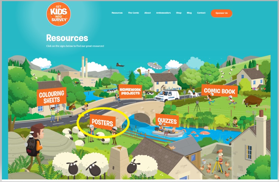
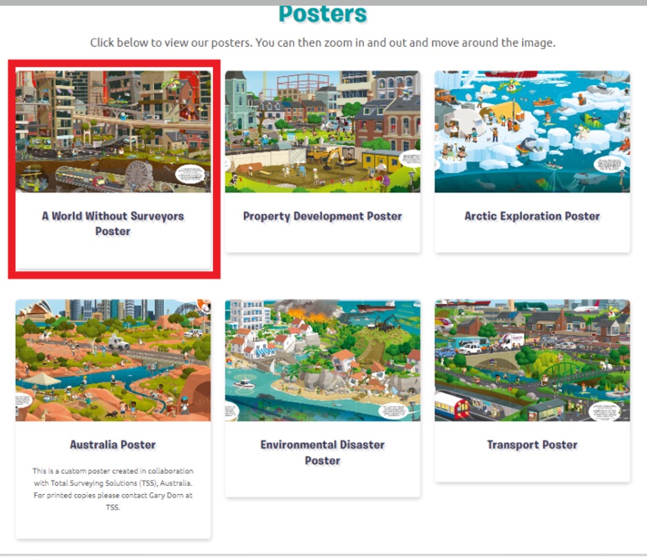
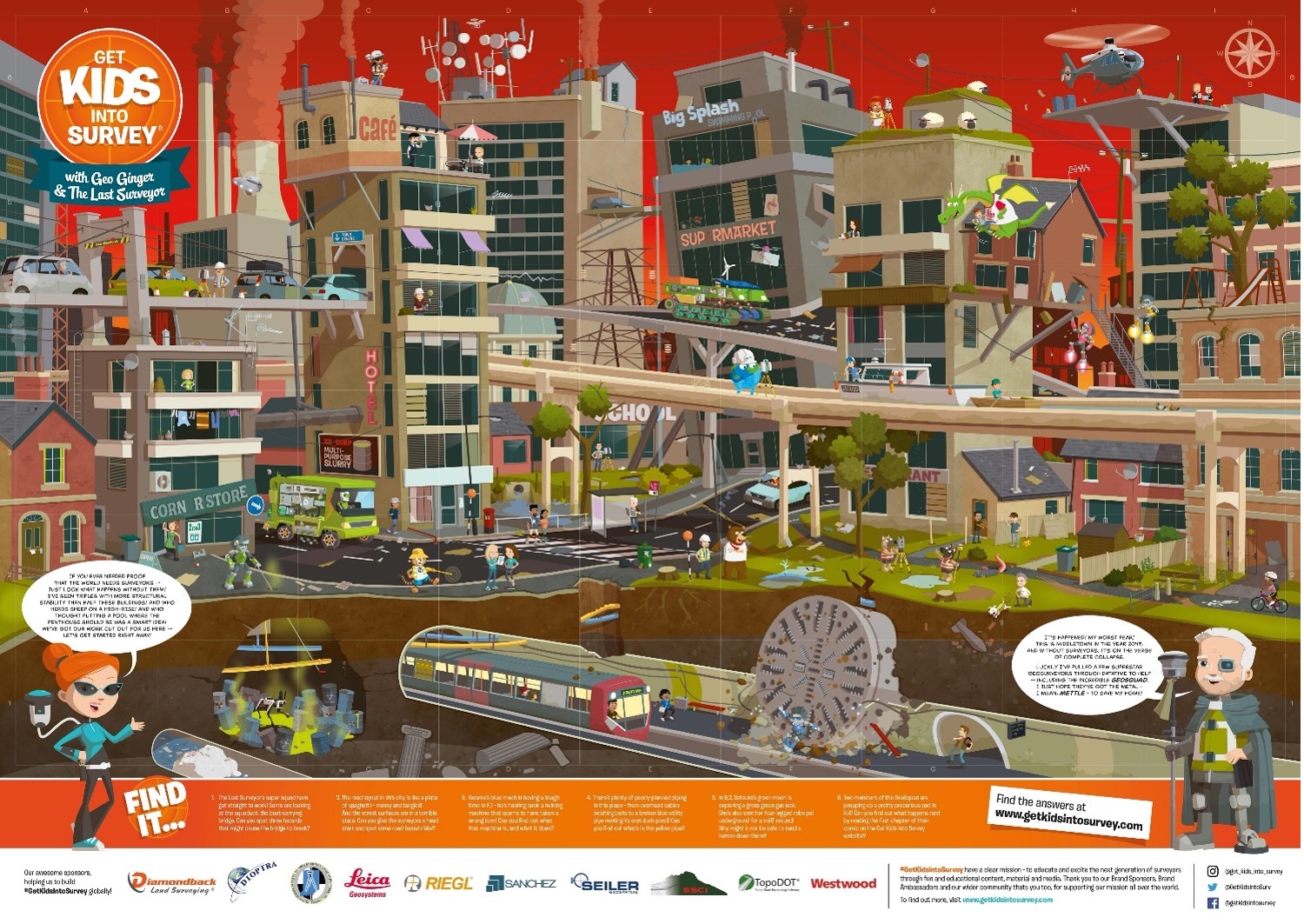
The website “Get Kids into Survey” provides materials focused on kids. The website states: “Bringing young people into the exciting world of survey through pioneering content and engaging experiences.” See the boxes titled “Get Kids into Survey Website,” “Get Kids into Survey Website – Poster Page,” and “Get Kids into Survey Website – World Without Surveyors Poster.”
Get Kids into Survey Website
Screenshot: Get Kids lnto Survey
Get Kids into Survey Website – Poster Page
Screenshot: Get Kids into Survey
Get Kids into Survey Website – World Without Surveyors Poster
Screenshot: Get Kids into Survey
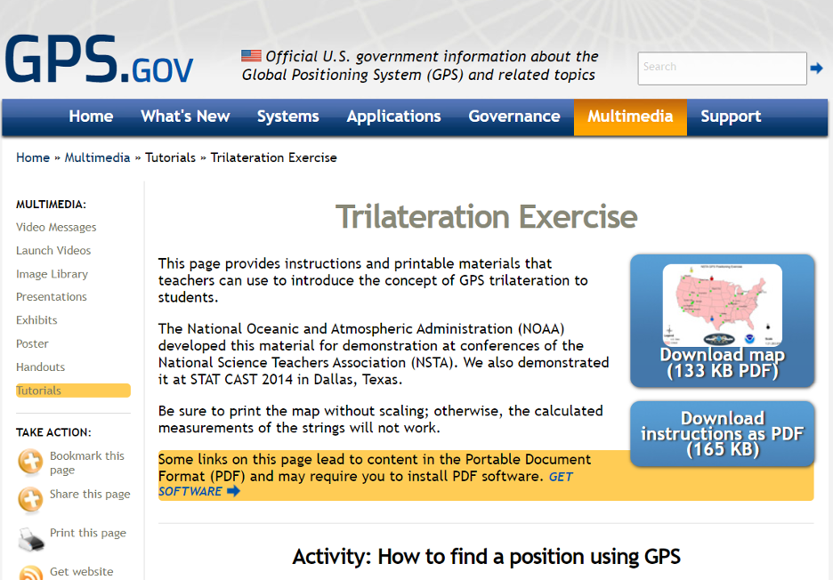
The GPS.gov website has lessons describing GPS that are designed for kids. One lesson introduces the concept of GPS trilateration. The lesson explains how GPS positioning works on two basic mathematical concepts:
trilateration, which literally means positioning from three distances, and
the relationship between distance traveled, rate (speed) of travel, and amount of time spent traveling.
This was developed by NGS for a National Science Teachers Association Conference. You can download both the instructions and map.’
GPS Trilateration Lesson
Screenshot: GPS.gov website
The following are several videos that describe the concept of trilateration.
This video explains trilateration and how the GPS ranges (distances from the satellite to the receiver) are computed.
This video uses distances on a map to describe trilateration.
Here is a detailed description of trilateration and why you need the fourth satellite.
Now, let’s look at some free online lessons and tutorials that describe the concepts associated with geodesy. As previously stated, some of the online videos are at a level for young audiences, and some are aimed at individuals with more advanced education. Most of them describe the concepts using diagrams with narratives, and without complex math equations. NGS provides a number of videos that can be downloaded here.
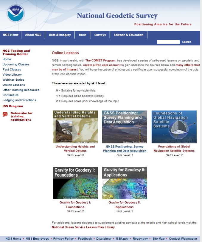
NGS, in partnership with the COMET program, has developed a series of self-paced lessons on geodetic and remote sensing topics. Users have to create a free user account to gain access to the courses. Users will have the option of printing out a certificate upon successful completion of a quiz at the end of each lesson.
The lessons are rated by skill level ranging from “Suitable for Non-Scientists” to “Requires some Prior Knowledge of the Topic.”
The COMET program provides teaching and training resources for the geoscience community. All of the content is completely free, but an account does need to be created. The COMET program is part of the University Corporation for Atmospheric Research (UCAR) Community Programs.
NGS Online Lessons
Screenshot: NGS Website
NGS and COMET Educational Videos
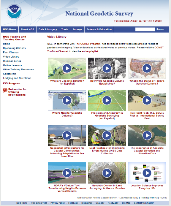
NGS also has a website that contains educational videos. Again, NGS, in partnership with the COMET Program, has developed short videos on topics related to geodesy and mapping.
NGS Educational Videos
Screenshot: NGS Website
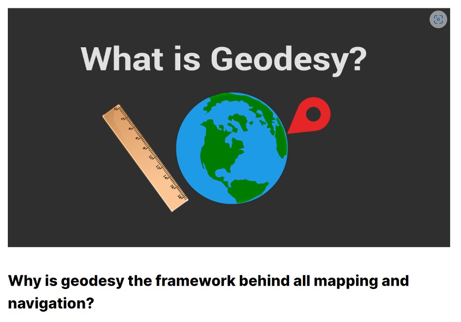
This link provides a tutorial on “Why is geodesy the framework behind all mapping and navigation?” The article states. “If you think about it, the whole field of geomatics lies on the shoulders of geodesists. Because it’s really geodesy that is the framework behind all surveying, mapping and navigation.”
What Is Geodesy?
Screenshot: Gisgeography Website
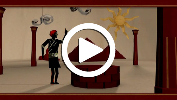
NASA’s Eratosthenes Estimating the Circumference of the Earth by Looking Down a Well
NASA offers a video titled “Looking Down a Well: A Brief History of Geodesy.” This video explains how it all started when Eratosthenes estimated the circumference of the Earth by looking down a well. It highlights how, over time, the field of geodesy has expanded and evolved dramatically, and how NASA uses technology such as radio telescopes, ground surveys, and satellites to contribute.
NASA’s Video on Looking Down a Well
UNAVCO Measures Plate Tectonics with Geodesy
UNAVCO, a non-profit university-governed consortium, facilitates geoscience research and education using geodesy. UNAVCO has a video that describes the tectonic plates and how geodesists measure their movements. Another UNAVCO video describes what geodesy actually is, as well as geodesy’s application in our everyday lives (UNAVCO’s 2017 USIP geoscience video production). Visit UNAVCO’s website to learn more about its mission.
Geodetic Software Tools
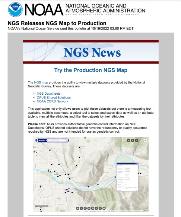
NGS provides tools that focused on meeting the needs of the surveying and mapping community. A few may be of interest to non-geodetic individuals. A map tool can be used to locate marks near someone’s location.
Production NGS Map
Screenshot: NGS Website
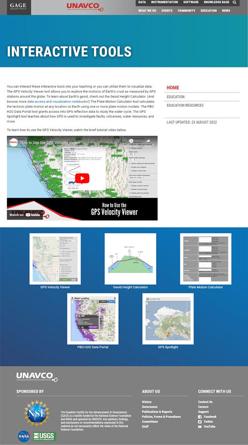
UNAVCO also has interactive tools that may be of interest to geospatial users. See the boxes below titled “UNAVCO Interactive Tools” and “UNAVCO Spotlight.”
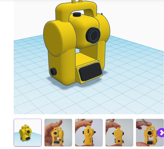
Now, let’s address the 3D printing of surveying equipment and tools. I’m not familiar with using a 3D printer, but I found several websites that provide information on surveying equipment. Some of the sites provide free information and others charge for their services. See the websites 3D Printer of Total Station and 3D Printer of GNSS Equipment.
3D Printer of Total Station
Screenshot: CULTS Website
3D Printer of GNSS Equipment
Screenshot: 3dmdb Website
I’m pleased a lot of people are interested in highlighting the discussion of the inverted pyramid. As commented by several individuals in the LinkedIn responses, the surveying and remote sensing (which includes photogrammetry) communities are experiencing the same crisis as geodesy. In my opinion, they are all related, because the surveying and mapping community provides tools other disciplines use.
As stated in my last column, the surveying and mapping community can do the following to help:
actively market geodesy in high schools as a rewarding career for the math stars before college entry
build back, support and sponsor geodesy programs at select universities; this support needs to be strategic with backing from the highest levels of the U.S. government
encourage U.S. government support in the form of grants, professional development of staff, and research collaborations/affiliations.
As previously mentioned, one of my goals has always been to get individuals (young and old) interested in obtaining a better understanding of geodesy. I hope this column helps to whet the appetite of some individuals to obtain a better knowledge of geodesy. Maybe even some high school and college teachers will introduce geodetic concepts in their lectures.
Writing about the geodesy crisis is a good first step, but we need to find champions that can influence high school and university teachers and administrators, federal and state government program managers, and congressional representatives.
Please feel free to email me at [email protected] if you have suggestions on how to lower the barrier of entry into the world of geodesy.
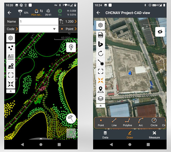
CHC Navigation has released LandStar8, a field surveying and mapping application for Android devices. LandStar8 is designed to be flexible and user-friendly for surveying and mapping tasks.
LandStar8 is versatile, modular and customizable for topographic tasks such as surveying, stake out, cadastral, mapping and geographic information systems (GIS). Building on the legacy of LandStar7, the new LandStar8 provides features such as a refined user interface, streamlined workflows, faster operation, and integrated cloud services.
“With LandStar8, we want to provide our users with unprecedented field experience,” said Rachel Wang, product manager of CHC Navigation’s Surveying and Engineering Division. “LandStar8’s modular design allows users to customize the interface according to their usage habits, making it easier and more efficient for field crews to work.”
Cloud connectivity is built in, for backup, data storage or remote technical support.
LandStar 8 has a simple and intuitive layout with large map windows and sharp graphics. Users can hide features they rarely use and display only those they need.
On LandStar8, users can copy coordinate settings, control and staking points from another handheld controller by scanning a QR code. Projects can be edited and sorted by history and attributes. Custom coordinate systems, geoid models and coding libraries can be updated at any time by using resource packages. LandStar8 also features a terrain calibration wizard designed specifically for non-expert users.
A proprietary MetaCAD graphics engine opens DWG and DXF base maps faster and with smoother rendering. DXF files up to 200 MB can be opened in less than 10 seconds. LandStar8 also supports opening external reference files, automatically recognizes CAD length units, and allows editing of CAD base maps directly in the field.
LandStar8 is designed around a comprehensive cloud-based architecture that supports project backup, collaborative work and data storage. Its remote support capabilities help the office helpdesk resolve user problems and provide personalized technical assistance. A “share code” feature allows users to transfer project data between desktop computers and field controllers or among field controllers quickly to further boost work efficiency.
The National Geospatial-Intelligence Agency (NGA) is seeking information from the GNSS community on upgrades to its Stardust program.
Stardust develops models of the Earth used in geomatics. The upgrades will result in modernization of geomatics information technology systems and infrastructure. The update includes migration of models to the cloud.
Stardust is run by the NGA Foundation GEOINT Integrated Program Office, partnered with the Foundation GEOINT Group (NGA/SF) within the Source Operations and Management Directorate.