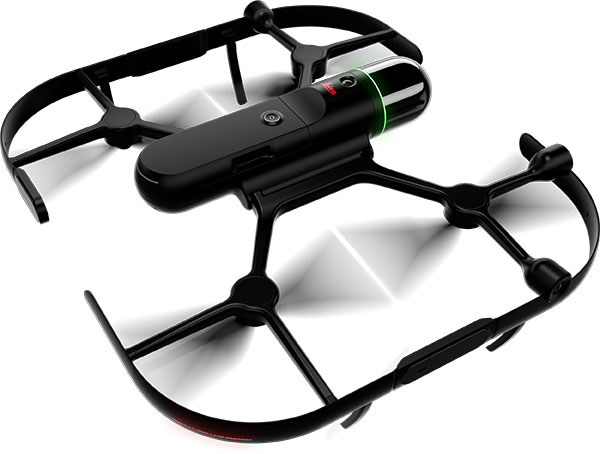
The BLK2FLY, recognized for its productivity and innovation, is a fully integrated autonomous flying laser scanner. It’s part of Hexagon’s BLK suite of autonomous reality capture sensors designed for speed, portability, ease-of-use and mobility.
To compile the list, TIME solicited nominations from TIME’s editors and correspondents around the world, and through an online application process, paying special attention to growing fields — such as the electric vehicle industry, green energy and the metaverse. TIME then evaluated each contender on key factors including originality, efficacy, ambition and impact.
“Having our reality capture technology recognized by TIME as one of the year’s best inventions is both humbling and inspiring. It validates our mission to build Smart Digital Realities that empower an autonomous, sustainable future,” said Hexagon President and CEO Ola Rollén. “Our technologies aim to change the world for the better, turning concepts that were once thought impossible into real solutions that benefit everyone. By optimizing quality, productivity, efficiency and safety — profitably — we can help industry achieve sustainability through mitigated risk, less waste and reduced cost.”
As a lidar-based unmanned aerial vehicle (UAV), the BLK2FLY addresses costly and complex issues, quickly and accurately capturing everything from large outdoor spaces to complex structures and environments.
For example, when renovating building structures, it can easily capture the exterior dimensions of previously inaccessible or difficult-to-reach areas such as rooftops and facades. The resulting colorized 3D point clouds are instrumental in building information modeling (BIM) processes, documenting site conditions and improving an asset’s operation, from infrastructure to utilities to industrial facilities.
Septentrio’s mosaic-T is built specifically for resilient and precise time and frequency synchronization under challenging conditions. (Photo: Septentrio)
Fugro has signed a tri-party cooperation agreement with GNSS receiver company Septentrio and synchronization equipment manufacturer Meinberg to launch the Fugro AtomiChron real-time synchronization and authentication service.
Numerous sectors rely on resilient and highly accurate time synchronization, including telecommunications, finance and energy. The timing technology eliminates time drift caused by clocks counting time at slightly different rates, and provides extreme stability that surpasses current precision frequency standards.
With up to sub-nanosecond accuracy, Fugro AtomiChron includes Navigation Message Authentication (NMA), ensuring reception of genuine GNSS signals and time synchronization improvements. Integrated anti-spoofing detection further prevents interference with GNSS timing signals providing accuracy, authentication, validity and security for end users.
The agreement ensures that the Fugro AtomiChron service will be available in new Septentrio mosaic-T GNSS receivers, as well as a selection of Meinberg GNSS clocks, without the need for additional physical interfaces or separate antennas.
“Septentrio is a forerunner in the area of robust and resilient GNSS solutions,” said Jan Van Hees, business development director at Septentrio. “With the addition of the unique Fugro AtomiChron service, we are pleased to further strengthen our offering and provide our customers even more accurate and reliable solutions for resilient GNSS timing.”
A roundup of recent products in the GNSS and inertial positioning industry from the November 2022 issue of GPS World magazine.
OEM
GNSS Module
For UAV, precision agriculture and autonomous machines
Photo: Unicore Communications
The UM982 GNSS module is a high-precision, dual-antenna real-time kinematic (RTK) positioning and heading module. It supports BeiDou B1I/B2I/B3I; GPS L1/L2/L5; GLONASS L1/L2; Galileo E1/E5a/E5b, QZSS L1/L2/L5; and SBAS in dual-antenna mode. The highly integrated, compact (16 mm × 21 mm × 2.6 mm) module can reduce the design area of an OEM board by 72% compared to previous modules. Power consumption is less than 0.6 W. The NebulasIV GNSS system-on-chip is a key part of the UM982’s navigation system. The NevulasIV integrates RF, baseband and high-precision algorithms on a single chip, with supporting functions built in. High-level performance indicators include raw observation accuracy, RTK positioning accuracy, precise point positioning accuracy, and time to first fix. The two antennas can independently participate in deriving an RTK solution and outputting the positioning results.
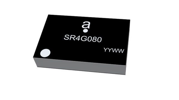
Alternative to ceramic patch provides omni-directional performance
Photo: Antenova
The Agosti (part number SR4G080) is a new miniature surface-mount-designed (SMD) antenna for GNSS applications. It measures 9.0 mm x 5.8 mm x 1.7 mm and operates with exceptional efficiency in a reduced space on a corner of a printed circuit board. It has a small ground-plane requirement of 40 mm x 20 mm, 70 mm x 25 mm and 80 mm x 30 mm, making it suitable for small form-factor designs such as wearable devices, trackers and onboard diagnostics.
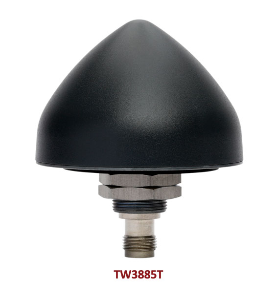
Housed Dual-Band antenna with Accutenna technology
Photo: Tallysman
The dual-band TW3885T antenna supports GPS/QZSS L1/L5; Galileo E1/ E5a/b; BeiDou B1/B2/B2a; GLONASS G1/G3; and satellite-based augmentation systems in the region of operation: WAAS (North America), EGNOS (Europe), MSAS (Japan) or GAGAN (India). It is housed in a through-hole mount, weatherproof (IP69K) enclosure. It mitigates the effects on GNSS receivers of new signals or harmonic frequencies from adjacent LTE bands on the radio-frequency spectrum. For permanent installations, L-bracket (PN 23-0040-0) or pipe (23-0065-0) mounts are available. Tallysman provides an antenna installation guide that recommends a 100 mm –125 mm ground plane and provides antenna installation and cable connector waterproofing best practices.
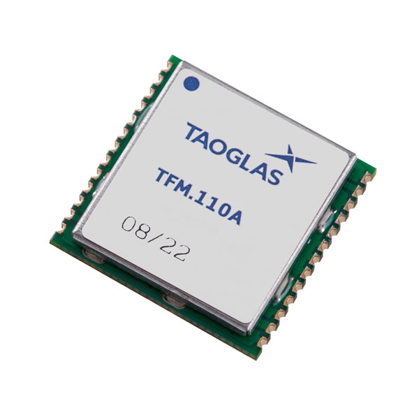
Simplifies product development for high-precision applications
Photo: Taoglas
The TFM.110A is the first in a new series of high-precision, multi-band GNSS front ends for autonomous vehicles, precision agriculture, automotive applications and robotics. It comes fully integrated with two cascaded low noise amplifiers (LNA) and pre-filters in a small, low-profile, shielded surface-mount package. When used between the device’s GNSS receiver and antenna, the two-stage amplifier solution eliminates the need for complex and challenging onboard filter and amplifier circuits. It supports L1, L2 and L5 bands and enables seamless signal transmission, signal purity and position accuracy in high-precision applications.
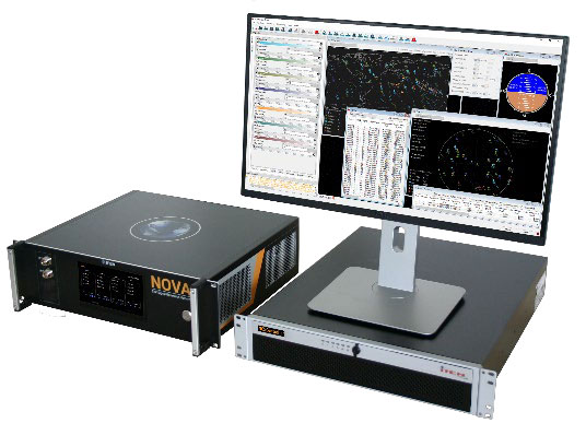
Provides interference, spoofing, encryption and authentication capability
Photo: IFEN GmbH
Version 2.8 of the NCS Nova RF signal simulator offers advanced capabilities. With integrated interference generation capability, the Nova can generate coherent interference signals with a signal power of up to –30 dBm. The ability to assign two users to one RF output enables integrated spoofing scenarios with a single RF output, meaning spoofing is available even with an entry-level single RF Nova. The new release has advanced navigation message authentication simulation capability compliant to User ICD 1.0 for the Galileo E1-B OSNMA, meaning specific OSNMA events can be simulated — key to ensuring compliant receiver behavior. Supported events include renewal and revocation of both a public key and a TESLA keychain. GPS cross-authentication and generation of Galileo E6-C encrypted codes are also supported.
Enables first responders to locate callers on floor levels
Photo: Polaris Wireless
Z-axis location service enables the pinpointing of a smartphone user within one floor level inside a multi-story building. The technology — demonstrated to meet the 3-meter vertical location accuracy requirement of the Federal Communications Commission (FCC) — is integrated into Schok Gear’s newly released flip phones. The Schok phones provide consumers with a simple, powerful device. Adding indoor and vertical location to these phones enables first responders to locate all wireless 911 callers with floor-level accuracy in multi-story buildings.
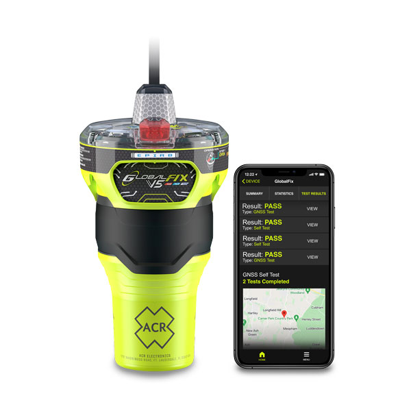
The new ACR Electronics GlobalFix V5 Emergency Position-Indicating Radio Beacon (EPIRB) and ResQLink AIS Personal Locator Beacon (PLB) have integrated the automatic identification system (AIS) to increase the speed of location and aid. They also are compatible with Return Link Service (RLS) alerting. The combination of services ensures faster rescue and increases chance of survival of both boat (EPIRB) and crew (PLB). The safety beacons deliver mobile connectivity to a cell phone with a free mobile app, made possible with the addition of near-field communication technology in the beacons. With the app, users can monitor their beacons, review self-test results, view GNSS test locations, and monitor beacon performance and maintenance by scanning the beacons with their mobile phones. Besides GNSS positioning, the lightweight beacons have 406-MHz Cospas-Sarsat distress signal with MEOSAR compatibility and 121.5-MHz local homing signal.
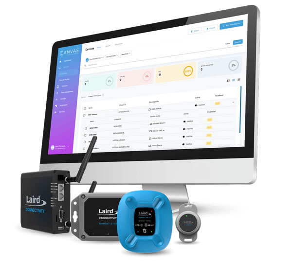
The Canvas Device Manager simplifies workflows for configuration and maintenance of internet of things (IoT) device deployments. It enables users to easily set up devices, monitor performance, and keep software up-to-date across the entire IoT device fleet. Device parameters can be remotely managed, and performance monitored. Canvas enables users to organize large numbers of devices to quickly build and maintain IoT solutions, and software updates can be remotely and rapidly deployed, thwarting security attacks.
The N2 Palm RTK GNSS receiver is suitable for surveying, mapping and construction. It has a highly integrated main board and a three-in-one antenna, yet weighs 0.72 kg with battery and measures 48 mm. Powered by ComNav’s SinoGNSS K8 high-precision module, the N2 can track 1,590 channels, including all existing and planned signals of GPS, BDS-2, BDS-3, GLONASS, Galileo, QZSS and SBAS. Its advanced satellite-tracking technology ensures it works well even in harsh environments, such as under heavy foliage or close to buildings. A third-generation inertial measurement unit (IMU) makes the N2 immune to magnetic disturbance, which greatly improves its reliability. Pole-tilt compensation of up to 60° allows surveyors to locate points within 2.5 cm. By using the company’s Quantum algorithm, the N2 achieves calibration-free operation — after 10 seconds of initialization, users can make tilt measurements with centimeter-level accuracy for an extended period, greatly improving efficiency.
Airbus has added 30-cm Pléiades Neo imagery to its OneAtlas Living Library service. The new data source will complement the service which already allows users to instantly access a premium catalogue of Pléiades 50 cm and SPOT 1.5 m data via streaming, download and API. The Living Library provides frequent updates over urban areas, airports, harbors and military sites to name a few. Imagery is updated every day and processed in the cloud, with flexible options for integration into GIS workflows. With the OneAtlas Living Library, Airbus offers a pay-per-order option but also a subscription-based service that allows users to access premium content quickly available into their account, as well as a deeper archive of more than 10 years of imagery by Pléiades and SPOT satellites at a higher incidence angle and cloud coverage threshold, which will be available in just a few hours. OneAtlas also provides access to several other data services, such as reactive tasking, that allows users to task a full suite of optical and radar satellites, including Pléiades Neo, or access more than 15 years of global radar data, as well as the ability to download the WorldDEM product suite among others.
Free, user-friendly tool shows the Earth’s changes
Photo: Kermap
The Nimbo Maps platform provides monthly 10 m-resolution images of changes on Earth in a user-friendly format. The images are chronological, seamless and free of clouds, and include intuitive comparison timelapse features. The platform, developed by French startup Kermap, relies on innovative artificial intelligence methods to process satellite images supplied by the European Union’s Copernicus program through its Sentinel missions. APIs automatically retrieve data extracted from satellite imagery, providing Kermap customers with real-time, strategic, value-added information in the fields of agriculture, land planning and environmental transitions. Current coverage includes Europe, the Middle East and the United States, with plans to provide global coverage by early 2023.
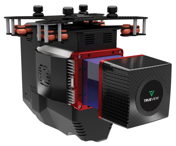
The TrueView 655/660 3D imaging system uses the Riegl miniVUX-3UAV laser scanner and three fully integrated mapping cameras (right, left and nadir) for high-accuracy mapping with excellent vegetation penetration and wire detection. Previous TrueView 3D systems carried dual oblique cameras to maximize mapping coverage. The TrueView 655/660 adds a third RGB camera, allowing for imagery directly below the sensor to be captured. The third camera provides a direct view of the ground below to maximize data collection for time flown, while improving the quality of photogrammetry and colorized point clouds.
“Seen & Heard” is a monthly feature of GPS World magazine, traveling the world to capture interesting and unusual news stories involving the GNSS/PNT industry.
Screenshot: Lying in State Queue tracker
Queue Tracker for the Queen
After the passing of Queen Elizabeth II on Sept. 8, the British government launched a live queue tracker app to give people an idea how long they would have to wait to pay their respects at her lying in state at the Palace of Westminster. The app also used What3Words to help locate the end of the line using a three-word tag. The queue grew dramatically in the days before the funeral as tens of thousands lined up, some waiting as long as 16 hours. The app also showed locations of public toilets, drinking water and first-aid stations along the queue route.
Lake Sarez. (Photo: Astronaut Photography Collection/NASA)
A Dam Problem Solved
Lake Sarez, deep in the Pamir mountains of Tajikistan, was created only a century ago when a strong earthquake triggered a massive landslide. The area experiences considerable seismic activity, which could result in massive flooding downstream should a landslide dam break. With the help of 40 donkeys, 10 scientists and 30 staff from the National Time Service Center of the Chinese Academy of Sciences transported and installed a BeiDou-based deformation monitoring system at the dam. The team had to resolve technical problems in the rugged area, such as providing sufficient solar power and communications. With the system now operating, the dam is being monitored in real time down to the millimeter.
Figure 3. (Image: CC BY 4.0, Remote Sensing 14, no. 17: 4274)
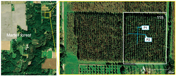
Counting the Forest for the Trees
Integration of aerial and ground-based mobile mapping sensors and systems is enabling a team of Purdue digital forestry researchers to locate, count and measure more than a thousand trees in a matter of hours. “The quick, accurate inventory of the global forest ecosystem will improve our ability to prevent forest fires, detect disease, perform accurate carbon counting and make informed forest management decisions,” said Songlin Fei, the Dean’s Remote Sensing Chair. The Purdue-made systems integrate GNSS and inertial navigation devices with lidar and cameras, deployed with manned aircraft, drones and backpack-mounted systems. The technology gathers a variety of information about each tree, including height, trunk diameter and branching formation. The team maintains the precise location and time tags of all acquired features.
Photo: Skeiron
Saving Ukranian Heritage
By the end of May, at least 367 incidences of destruction had occurred to Ukraine’s museums, churches, theaters and libraries. Through the project #SaveUkranianHeritage, mapping company Skeiron is capturing sites in high detail using laser scanning and photogrammetry. For a UNESCO-protected church in Lviv, the team gathered more than 300 individual laser scans and 6,000 photos to create a 3D model. The company has two laser scanners — a Leica C10 and Leica ScanStation P20, DLSR cameras and a drone. To support the project with funding or equipment, visit skeiron.com.ua/en/saveukrainianheritage/.
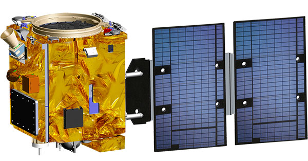
Taiwan will launch its first indigenously developed meteorological satellite in March 2023, reports Taiwan News.
The Triton satellite was designed and made by the National Space Organization (NSPO) over eight years. The satellite has completed testing and is undergoing review.
The 250-kg Triton carries GNSS-reflectometry equipment (GNSS-R) — independently developed by NSPO — to collect GNSS signals reflected by the Earth’s surface. Its mission is to research air-sea interaction to help predict typhoons.
Taiwan is hit by typhoons every year. Information on wave height and sea-surface wind speed, retrieved from the reflected signals, will be useful for research on typhoon intensity and path prediction.
The satellite will be transported to the Guiana Space Center in January. It is scheduled to launch in March aboard a Vega C rocket manufactured by Arianespace.
Canadian-based technology company SJAWS Technologies has developed a GPS monitoring system to assure the reliability of signals. The company’s Skysweeper service monitors the integrity of GPS signals and alerts users when interference occurs.
“The GPS navigation signals that maritime, terrestrial and aviation industries rely on are all vulnerable to interference and manipulation,” said SJAWS CEO Peter Mueller, adding that thousands of spoofing and jamming incidents occur every year, including to U.S. Navy vessels and commercial aircraft.
SJAWS will be at the Canadian Aerospace Conference in Ottawa, Ontario, on Nov. 8–9, and will be available to meet ITB obligors and strategic partners in person or by video to present the latest update on their technology.
Mueller started SJAWS this year with Liz Hennessy after 15 years of GNSS network technology experience with Rx Networks. Hennessy co-founded Goldtouch Technologies Inc., manufacturer of ergonomic PC peripherals.
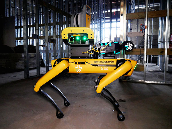
Trimble and Exyn Technologies are developing multi-platform robotic autonomy for complex, GPS-denied environments. (Photo: Trimble)
Trimble and Exyn Technologies are working on a proof of concept for a fully autonomous surveying solution for construction.
The solution will integrate the Boston Dynamics Spot robot, the ExynPak powered by ExynAI, and the Trimble X7 total station. It will enable fully autonomous missions inside complex and dynamic construction environments, which can result in consistent and precise reality capture for production and quality-control workflows.
Autonomous robots powered by ExynAI can sense and avoid obstacles, dynamically adapting to the complexity of construction environments. To ensure safety and efficiency, the ExynPak integrates with a robot, supporting Level 4 of autonomous exploration missions without requiring the robot to “learn” about its environment beforehand.
A surveyor can define a 3D volume for a mission, and then the integrated robotic solution handles the complexities of self-navigation without needing a map, GPS or wireless infrastructure.
The integration of the Trimble X7 provides high-speed, high-accuracy 3D laser scanning to capture the state of the environment. The captured data can be uploaded to the Trimble Connect collaboration platform and shared with project stakeholders for further analysis, including a comparison to building information models (BIM) and previous scans to monitor quality and progress. The result is a detailed and accurate map collected with minimal human intervention and risk.
Exyn and Trimble will be demonstrating their technology at the Trimble Dimensions+ Conference Nov. 7-9 in Las Vegas.
Chinese scientists say they have succeeded in an experiment that could improve satellite navigation and redefine the second as a unit of time, reports the South China Morning Post.
The scientists performed the experiment in Urumqi, capital of Xinjiang Uygur autonomous region in western China. They placed two terminals in laboratories 113 km (70 miles) apart. Each terminal was equipped with a laser, a telescope and two optical frequency combs that measure exact frequencies of light. Laser pulses sent between the terminals allowed researchers to confirm the time.
The research team was led by quantum physicist Jian-Wei Pan at the University of Science and Technology of China (USTC).
Sending signals over long distances would enable a global network of optical clocks that can help improve the accuracy of satellite navigation services.
China also is sending three atomic clocks to its Tiangong space station to establish a space-based timekeeping system of exceptional accuracy. The clocks can work together to measure time with 10-19 stability, missing only one second every few billion years, and is expected to be thousands of times more accurate than a hydrogen maser.
The Ricoh Theta X 360° camera uses a u-blox module for its location metadata. (Photo: Ricoh)
The ZOE-M8B GNSS module from u-blox is integrated into the new RicohTheta X camera. The camera allows users to shoot high-quality 360-degree spherical images and videos in one click and visualize them immediately on an LCD touch panel.
The u-blox ZOE-M8B enables the Ricoh Theta X’s built-in location system, one of its key features. The module is listed on the u-blox site as receiving GPS, BeiDou and GLONASS signals as well as QZSS, but the Ricoh Theta X specifications list only GPS + QZSS along with assisted GPS.
The u-blox receiver automatically embeds highly accurate location information for each image taken, without the need for a smartphone or another external device.
An icon on the LCD touch panel displays the availability of the GPS signals depending on the user’s location, ensuring the location information has been reliably acquired before shooting begins. The location is accurate down to a 5-meter radius, suitable for a wide range of industrial and consumer applications.
The u-blox ZOE-M8B GNSS module is an ultra-small (4.5 mm x 4.5 x 1.0 mm) system-in-package offering highly accurate positioning with concurrent reception of up to three satellite constellations. The Super-E (Super-Efficient) mode guarantees power consumption as low as 12 mW, and built-in SAW and LNA make it suitable for passive antennas. The u-blox ZOE-M8B targets applications that require a small size without compromising performance.
Part of a 360° spherical image shot with the Theta X. (Photo: Ricoh)
“We chose the u-blox module because of the highly accurate location information it offers, alongside easy integration and low power consumption,” said Kenji Daigo, GPS Function Developer for Theta X at Ricoh.
The Algiz 10XR’s screen features a glove/rain mode. (Photo: Handheld)
Handheld Group, a manufacturer of rugged mobile computers, has released the Algiz 10XR, a rugged 10-inch Windows tablet that combines durability with a GNSS receiver, 5G and future-proof features.
The Algiz 10XR was developed for field work or other challenging environments in markets such as logistics, mining, public transport, public safety, waste management or geographic information systems (GIS). It also has also been designed with customization in mind.
The tablet has a dedicated multiband GNSS u-blox NEO-M8U receiver for accurate positioning. The NEO-M8U module offers u-blox’s untethered dead-reckoning technology, which provides continuous navigation even under weak GNSS conditions.
Other key features
future-proof 5G communication for live video streams and bandwidth-heavy tasks such as mapping
Intel Elkhart Lake x6000 platform for reliable performance
Windows 10 Enterprise LTSC (64 bit)
high-resolution, sunlight-readable 10-inch touchscreen with super-hardened glass and rain-and-glove mode
future-proof 5G capabilities, 4G/LTE high-speed data, Wi-Fi, Bluetooth
IP65 and MIL-STD ruggedness
full-day, hot-swappable battery
optional, integrated barcode scanner and near-field communications.
The tablet is supported by a broad set of accessories for field professionals: carry cases, vehicle cradles, pole mounts, extended batteries, and a vehicle dock with antenna pass-through for both GPS and Wi-Fi.
“The Algiz 10XR will bring some great performance gains for our partners and customers who rely on Windows tablets in the field,” says Johan Hed, Handheld chief product officer. “We’ve worked with this segment for decades now and are confident that we’ve developed a device with not only great specs, but a complete accessory package to help our customers with their fieldwork.”
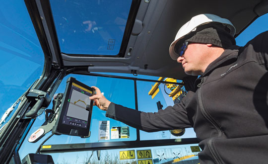
Guidance and precision control, the base elements of modern machine control for construction, have continued to evolve since broad productization began in the mid-1990s. However, the value proposition has become even sweeter since, with value being realized beyond the return on investment (ROI) of the general contractors and the total project price tag for the clients. While the majority of equipment globally is still non-digital, new levels of simplicity and affordability are helping to fill that gap.
The roots of machine control stretch back a century. The Historical Construction Equipment Association (HCEA) posits that the A.W. French & Co. “utility grader” of the 1920s, a crawler-mounted unit that used stringline control, may be the very first example — and this before electronics and computing. However, it was the advent of real-time kinematics (RTK) for GPS in the mid-1990s that brought machine control as we know it to the construction site, and coincidentally to precision agriculture.
Initially, the focus was on guidance. Then it moved to precision control, such as blade control, and later propagated to more classes of motorized equipment, improved with further sensor integration.
The impact on construction and agriculture has been undeniable: productivity gains, less rework, more efficient handling of materials, shorter timelines, site safety improvements, and more. These benefits are as obvious to clients and operators as they were in the early days of adoption, gains from nearly three decades of innovation.
What form have these growing benefits taken, and who is realizing them? We sought insights from industry experts to find out.
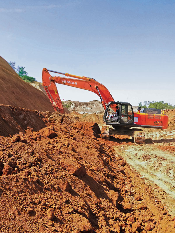
Grading and Excavation
Automation is not just about speed; it is also about better control of the load and stress on the equipment and moving just the right amount of materials so as not to place a burden on it. (Photo: CHCNAV)
These two activities, as each of our interviewed experts attest, represent the lion’s share of realized productivity gains.
While not the complete picture of overall value, the sheer volume of equipment that has been, or could be, automated speaks, well, volumes. “Apart from the skid steer systems, there are more excavators manufactured than all the other equipment types combined,” said Daniel Sass, product manager of machine control at Hemisphere GNSS. “Excavators are the workhorse. And people use them differently, and they use other pieces of equipment to complement excavators somewhat differently. Certainly, the bulk of our sales is excavators, and in fact a key part of our value proposition is focused on compact machines, but also all the way up to mining shovels. Certainly, by volume it is excavators and compact excavators.”
Numbers help tell the story. “In the United States, at least in a three-year period from 2019 to 2022, about 253,000 excavators were sold, for which I have pretty reliable data, but only 61,000 dozers and only 7,000 scrapers,” Sass said. “That’s North America, where we also use a lot of dozers and scrapers. If you go to Europe, where they use excavators for many other tasks, the proportional impact might be higher.”
Operators can easily gauge the ROI of going digital for individual pieces of equipment such as excavators, but part of the incentive could be that general contractors are requiring subcontractors to be equipped and ready to fit into a more complete digital site. “Some definitely require it,” said Randy Noland, vice president of global sales at Hemisphere GNSS. “A lot of … larger sites. I wouldn’t say everybody mandates it yet, but that it is growing.”
“Operator assistance is not only helping someone cut to grade faster, but is also the best way to cut to grade,” said Cameron Clark, earthmoving industry director, Trimble Civil Construction. “How do you move the material? That directly ties into productivity by only moving the material you need to move, which also equates to less fuel because you can do it faster.” With operator assistance, Clark said, it is not uncommon to see productivity gains of 30% to 40%, even with inexperienced operators. And with automatics, this could exceed 75%, depending on the work done.
There are substantial gains to be made in operator assistance for less complex heavy equipment, such as compactors. “Often a contactor will put a less experienced operator in the compactor,” Clark said. “In manual days, to overcome the potential of under-compaction and missing spots, they’d create quite a big overlap, maybe up to 40% of overlap between paths. By adding steering control, we can automate the compactor to where it needs to be — to stay on line every day, all day. And you can reduce the overlap to 10% or 15%; having to compact a smaller area means that you’re quicker, say 30% quicker.”
“Grade control gains can be 30% to 50%,” said Magnus Thibblin, president, machine control division, Hexagon Geosystems. “Depending on the machine and the job application, and how experienced the crew is, it can be similar for excavators.” Thibblin was an end user from the early days of machine control. He saw its potential and how it might work better. Its benefits came not just from automating elements of the equipment, he said, but from implementing a more complete digital workflow.
“How much are you working with the digital design from the start?” Thibblin said. “I’m one of those who believes you should have 3D from the start; for any kind of layer that the machines can build to. Incidentally, in North America, working to models is implemented for a lot of graders and dozers. In Europe, there is a large excavating market, but it’s the same foundation. If you work from the design, you will have savings in fuel, time, efficiency, safety, etc. Depending on all of these things, the total value proposition may be 30% to 70%.”
Wenming Sun, vice general manager for digital construction, CHCNAV, reiterates these points. “Currently, our machine control solutions are mainly installed on earthmoving machines, including bulldozers, excavators and motor graders,” Sun said. “The greatest value of these solutions is to improve construction efficiency, shorten construction time, reduce fuel consumption and mechanical wear while ensuring construction quality.”
CHCNAV is a relatively new player in the construction machine control market, launching initially in Europe and Asia. The company has been developing automation and steering systems for equipment that can yield the highest gains for their customers. “For example, our 3D TG63 automatic control system for motor graders can double efficiency compared to manual operation of machines and reduce time by 50% for the same workload,” Sun said.
Getting to the designed grade, or trench line, of earthworks geometry faster is a huge benefit, while reducing or removing finishing steps is a bonus. “Now we’re seeing that with excavators that have automatics, the finishing we can get out of an excavator is amazing,” Clark said. “You used to get dozers cleaning up after excavators. Now, with the performance you can get with an automatic excavator, you often don’t need to run the dozer — the excavator can get it done the first time.”
However, dozers are used for many other tasks. Clark noted that about 95% of blade-control systems for dozers sold have automatics. He said grade control brings tremendous productivity gains, but that excavation is right up there as well. “When you look at the number of machines out there, it’s in a different league,” Clark added. “In 2021, for example, globally about 370,000 crawler excavators and 325,000 mini excavators were sold.”
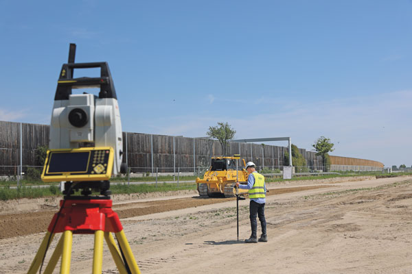
Lateral Benefits
GNSS has revolutionized automation for many classes of heavy equipment. However, for certain high precision work, particularly finished elevations, site levels and totals stations are essential. (Photo: Hexagon)
For the general contractor, ROI is a key measure. This can be reasonably easy to gauge, as this ROI calculator shows: intelligent-construction.com/roi-calculator/. However, what matters is not just the upfront time and cost for grading and excavating, but also avoiding lateral time and costs. “If you can do jobs faster and more accurately, it lends itself to less rework,” Clark said. “You do it right the first time, which again goes into less fuel, and then also less material. For example, let’s say your excavator is digging down to a trench and the operator digs too deep, which happens often. That material dug out of the trench potentially needs to be carted away. So, extra fuel and trucks are needed to take the material away. They’ve got to put high quality material back in, so that means they actually have to cart more material back to put in the trench, and you have to spread the material.
Again, it’s a flow-on effect — a chain reaction. When you look at sustainability, what we do has direct and indirect effects — it’s 1 gallon of fuel you don’t use that saves about 22 pounds of carbon emissions.”
The green dividend goes beyond just what individuals and firms wish to see. Increasingly, infrastructure developers and owners may be subject to sustainability requirements. Depending on where the work is being done, sustainable development goals are being acted on. This includes not just the environmental goals, but also requirements for the digitalization of design and construction, and ultimately smarter and more sustainable infrastructure. Machine control in construction can deliver some of the most substantial benefits in meeting these goals.
Like overall value for the operators and clients, gauging the highest green dividend becomes a proposition of sheer volume. “On average, your dozer is going to burn much more fuel. However, we sell four times as many excavator solutions as we do for dozers,” said Miles Ware, vice president of marketing and global customer care, Hemisphere GNSS. “The excavator solution is critical for both an ROI and an environmental impact.” Among the most-sold excavators in the United States are the Kubota 4-ton, the John Deere 3.5-ton and 5-ton, and the Caterpillar 5-ton. “The smaller excavators are going to use a lot less fuel,” Ware added. “If we compare this to mid- and large-sized excavators and dozers, we might be getting close to a point of equilibrium, when it comes to environmental impact. Those that consume huge amounts of fuel move massive amounts of earth. However, the ability to have the larger units operate much more efficiently, complete jobs much faster, and get on site and off site quicker with fewer passes in fewer hours adds up to a green dividend. Then you take the smaller volumetric scale of so many excavators and the environmental benefit really starts to balance out. There are huge incentives for all these platforms, whether it be dozers or excavators, to have the technology in place.” Hemisphere announced at the Bauma Exhibition in October that it now has systems to support loaders and scrapers.
“One of the things that’s really intriguing to me about the loader solution is that it represents a crossover point between construction earthmoving and agriculture,” Ware said. “There’s a huge benefit for feedlots and agriculture-related operations, where they use machine-controlled loaders to avoid damaging base layers. We have a growing machine-control audience, and a substantially growing precision agriculture audience. It is just one example of how technologies are cross-pollinating in different verticals.”
The benefits of machine control are broadly recognized across the industry. “Improved construction efficiency and shorter construction time means that the machine operating time is shortened for the same workload,” Sun said. “According to our own calculation results, using for instance our system for motor graders, fuel consumption can be reduced by 35% to 50% under different working conditions. Thanks to the full real-time automation of its blade, the grader can achieve the expected finish accuracy in one or two passes, whereas an unequipped machine would require four to five passes. This effectively reduces fuel consumption and, as a result, minimizes the carbon footprint of construction projects.”
Automation means you can build to the model in less time and refine the movements of the equipment to move just the right amount of material — enough to improve productivity, but not so much as to put an undue strain on it. “Any time you have a piece of equipment that needs to be repaired or is out of service, it is disruptive to the project of course, but it can also have an environmental impact, and sustainability is something we all work toward,” Thibblin said.
Connectivity and Collaboration
Going to a fully digital site means working fully in 3D, from a digital model, and seeking to eliminate 2D plans sets. No more interpretation, no more estimation—the right amount of material is moved rapidly and reliably by multiple machines working in harmony. (Photo: Hemisphere GNSS)
Moving forward, there may be additional incremental gains in the productivity of individually automated equipment, yet this may be modest in contrast to the time since the introduction of machine control decades ago. For the next sea change in construction productivity, we should be looking beyond simply the machines. “Let’s take the holistic viewpoint,” Thibblin said. “You have everything from the machines that of course have either machine control or different levels of autonomy, everything from semi-autonomous to semi-automatic. Then you have the trucks, which can be connected also with the tracker devices, which enables optimal routing, enhanced safety, and coordinating material handling cycles.”
Total project and site coordination has been in the works for vertical construction for quite some time; we hear a lot about building information modeling. However, heavy civil is catching up. “We anticipate that the ongoing integration of digital construction solutions with internet of things technologies will bring more choice and functionality to customers,” Sun said.
Further, real-time collaborative software platforms are already in use. Many vendors for machine control have added live connectivity for such coordination.
“Our customers are using ConX,” Thibblin said, referring to Leica ConX, a cloud-based collaboration tool. “It is remotely connecting to the mission, which is support, service, file transfers, project updates.” While online collaborative tools have been around for years, current offerings have reached such a level of maturity that they have driven a boom in adoption for even smaller operations. Customers need to make sure that projects are working optimally, and continuously.
Another major difference from the early days of machine control is that the relative cost of outfitting equipment with automation components is far less. Therefore, it is more practical to automate nearly all equipment on a site, making a truly coordinated digital site possible. “It’s not just the larger businesses that are investing, it’s also the smaller businesses that understand and can calculate the ROI. It is also a difference in competency level: how complex and support-intensive the system was. Now, it’s much more integrated,” Thibblin said.
Today’s systems are tighter, work better, connect better with original equipment manufacturers (OEMs), and the learning curve not as steep. The machines have become smarter, yet easier to use and integrate. “You do not have to be a nuclear scientist to understand the systems,” Thibblin said. “The equipment and collaboration tools are now much simpler. Not simple to make, but we do that for you.”
It is a chain reaction: the equipment gets smarter yet simpler, and both characteristics drive more adoption. More of a site gets automated, enabling digital collaboration, and with that comes more efficiency, saving on time, costs, materials and fuel. The sum of the parts yields productivity gains, the site gets safer, and of course there is a green dividend as well. “It is not just the one thing that gets to this,” Thibblin said. “It is many parts.”
Clark reiterates, “The biggest driver and the biggest impact is when we can actually control the site, optimize how we coordinate groups of machines working together, and efficiently run the job site. That’s where you’re going to see the biggest benefit for sustainability and reducing the carbon footprint. You don’t just optimize productivity at the machine — it’s the coordination of the site and how the machines work together.”
What about the smaller firms and short-duration projects? Should the same level of full site integration happen for each job? Perhaps not. However, there are alternative ways to realize nearly all the benefits of automation without a full digital site. “There’s a lot of focus on short-duration jobs, not only for the typical small contractors, but also for large contractors,” Clark said. “Some large contractors actually target a decent portion of jobs for smaller duration, to balance out changes in market dynamics.” There is a lot of demand for small contractors with technology, and many small contractors have to automate just to stay in the game.
“People using grade control see all the benefits, and that affects their costs,” Clark said. “They can get jobs at a different price than someone who isn’t benefiting from grade control. We’re seeing this a lot in the adoption of our earthworks and grade-control products.”
A challenge to adoption by smaller firms used to be that with a small staff, they might not have the necessary office software, a surveyor, a design engineer, or a 3D modeler. While there is a cottage industry of drafters who do small 3D modeling contracts for that market, there are now more alternatives. “We’ve added features to our systems that enable these contractors, on these short duration jobs, to create designs without requiring office software,” Clark said. “Typically, without a 3D design, you are eyeballing, and you have to do grade checks. There are conventional systems that can include lasers and line tracers, but now that simple designs can be added to the machine-control systems without additional office steps, more operators will be able to use them on a greater number of small jobs.”
Multi-sensor integration has enabled more equipment on the site to be automated. Not long after the first GPS-guided machine control systems came along, more sensors were added, such as inertial measurement units (IMUs). Besides IMUs, the sensors in play can include GNSS receivers, lasers, lidar scanners, sonics, optics, cameras, displacement sensors, pressure sensors, thermal sensors, inclinometers, vehicle distance measurement instruments and telematics.
Beyond GPS, the wealth of additional GNSS satellites and signals has brought more robust and reliable solutions in mixed environments. Recently, a heavy equipment operator called to ask if there was “something wrong with GPS” that day. He reported having spotty fixes and wildly varying results. After some standard troubleshooting of his communications and correction sources, we determined he was using a legacy broadcast format, and his GNSS receiver, while fully multi-constellation enabled, was only using one constellation. Once a newer correction format was chosen — bam! — he was fixed instantly with results as good as he’d ever seen. Things are getting better on all tech fronts.
Coordination of a fully digital site often involves integrating as many operations as possible through a back-end site management software, connecting as much equipment as possible, and working from standard models. This can be a relatively simple proposition if a site is under a single solution. However, general contractors may not be in a position to use equipment from a single brand. They may have a diverse equipment portfolio and seek flexibility in being able to onboard subcontractors. Vendors have recognized this and offer different levels of interoperability. “In addition to high-performance and real-world site-smart software features, our systems play well with mixed fleets,” Noland said. “Meaning multi-brand GNSS systems, radios and various file formats. This is key for firms that have already made investments, as well as new users entering the market concerned about how compatible their equipment will be.”
“If you have a mixed fleet, you can easily grow it,” Ware said. “Or, you can interoperate with other contractors or entities. So, if there’s a brand X already working, and if a Hemisphere GradeMetrix contractor is added to that project, they can seamlessly come in and handle most of the files, go immediately to work, and further expand the use of the technology on that particular project.”
The Underserved Market
Machine control has evolved in the decades since initial productization from navigation and guiance to include precision control of blades, buckets and more, and the ability of even smaller equipment to work from 3D models. (Photo: Trimble)
If the construction industry is going to help meet growing global infrastructure needs, to fill the existing multi-trillion-dollar infrastructure gaps, then a lot more equipment needs to be automated.
“Let me just make a general comment that speaks to both productivity gains and a lower carbon footprint: as an industry, we can do much better,” Noland said. “Only about 15% to 20% of the equipment that could be outfitted for machine control has been, and the other 80% is up for grabs.” Noland credited other key players — such as Trimble, Topcon, and Leica — with providing excellent solutions for certain sectors of machine control, yet he sees an opportunity for Hemisphere to excel.
“The next wave is the underserved part of the market,” Noland said. “If we’re successful, then your climate impact is greater and your productivity gains higher.” He noted that in addition to systems for large equipment, a particular focus for Hemisphere has been providing a range of affordable solutions for smaller equipment. “We feel like we are tapping into that part of the market that has been underserved. It’s not necessarily new features from what everybody already has, as much as it is democratizing the technology to that underserved 80%.”
Autonomy and the Near Future
It is exciting to think about, but is the next sea change for construction machine control going to be full automation? Is that truly an inevitability? Or is the road to autonomy already paved with productivity gold?
“The autonomous machine, and the autonomous site; it is what we are doing to get there that continually boosts productivity,” Clark said. “As more operator assistance is added, the semi-autonomy that many systems already provide means that the operator can concentrate on more aspects of the operation; and this definitely enhances site safety.”
Autonomy might not necessarily reach every piece of equipment, and contractors may not want it for every task. With the prospects of anything like a fully autonomous site being on a sliding horizon, contractors and clients are not waiting around — they are already reaping the benefits of automation on the individual equipment level. Productivity gains and a green dividend will only increase as sites become more fully integrated. In some ways, the best parts of such a future are already here.
Gavin Schrock is a practicing surveyor, technology writer and operator of a cooperative GNSS network.
Leica Geosystems, part of Hexagon, has launched of Leica iCON gps 160 — a significantly enhanced, next-generation construction smart antenna with features that increase productivity in all stakeout and measurement applications on the jobsite.
The Leica iCON construction portfolio offers a broad range of smart antennas to fit every construction professional’s needs. From basic level to sophisticated high-end applications, Leica Geosystems’ smart antennas are designed and built to withstand challenging site conditions. All of them seamlessly integrate with all Leica iCON construction instruments and controllers as well as the iCON field software for precise, real-time verification.
To expand its portfolio of smart antennas, Leica Geosystems has launched the iCON gps 160, a versatile solution for various applications. It can be used as a base station, as a rover or for machine guidance. The Leica iCON gps 160 is a modernization and enhancement of the successful Leica iCON gps 60, which has been well accepted in the market. The result is a smaller, more compact GNSS antenna with additional features and a larger display for ease of use.
The new Leica iCON gps 160 is particularly suited to complex construction environments with different GNSS requirements — the ability to switch between the different applications is at the users’ fingertips. Besides checking grade, cut and fill, stakeout points and lines, users can also benefit from using this solution for basic-level GNSS machine guidance.
Construction technology must be easy to adopt. Thus, the iCON gps 160 comes with an integrated color display, a user-friendly interface, smart setup wizards and an intuitive construction-specific workflow to help contractors get the most out of their investment from day one.
Size and weight reductions make the iCON gps 160 easy to handle, while the latest GNSS and communication technologies improve data reception, resulting in increased productivity and efficiency.
Photo: Leica Geosystems
The optional tilt feature allows users to measure and stake out points with a tilted pole, which saves time and extends the measurement possibilities on any construction site.
“At Leica Geosystems, we understand that construction surveyors are under pressure and tight schedules to provide accurate, on-demand data that helps deliver projects on time and on budget,” said Matthias Schmidt, manager, Portfolio Field and GNSS, Leica Geosystems. “The iCON gps 160 Smart Antenna sets new standards in construction GNSS antennas. It solves several challenges simultaneously, enabling precise measurement, avoiding mistakes and extra trips on-site, ultimately helping to work toward a more sustainable future.”