Category: Applications

  • ComNav releases unmanned aerial mapping package

    ComNav releases unmanned aerial mapping package

    Photo: ComNav
    Photo: ComNav

    ComNav Technology has released a powerful and reliable UAV aerial mapping solution capable of centimeter-level positioning, providing high-precision photos and data for mapping professionals.

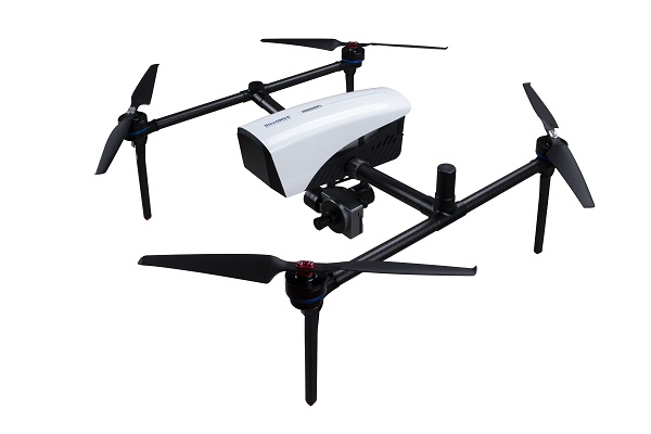
    Based on the company’s K8 platform, the package consists of an E300 real-time kinematic (RTK) drone, flight-control software and an optional camera.  

    Featuring high accuracy, strong compatibility, long endurance, high performance and an easy workflow, the E300 drone package can meet the requirements of many different applications, including topographic survey, urban construction, forestry investigation, emergency rescue, 3D modeling, mining and surveying.

    High Accuracy. The E300 RTK drone is embedded with a high-precision K8 GNSS module that supports GPS L1/L2/L5, BeiDou B1/B2/B3/B1C/B2a, GLONASS L1/L2, Galileo E1/E5-a/E5-b/AltBOC/E6 and QZSS L1/L2/L5. With Quantum III technology, the K8 GNSS module provides reliable and stable RTK positioning results.

    The professional post-processed kinematic (PPK) software Compass Solution supports the full-constellation calculation, providing accurate positioning results.

    RTK/PPK provides dual backup, one as a failsafe for another, to ensure acquisition of data. The built-in antenna further increases precision of photo position. EVENT synchronization technology can reduce camera trigger error and ensure high performance of the solution. 

    With its intelligent recognition algorithms, the E300 is able to capture high-resolution images consistently even in complex environments. Moreover, the E300 has a multipath redundancy design with key modules for safety. The solution can provide centimeter-level positioning results without ground control points, saving time.

    Compatibility. Featuring a carrying capacity of 3 kg, the E300’s payload bay is compatible with a wide range of cameras, including C20, C50, LiAir VH2 and others. Payloads can be quickly and easily swapped in the field for maximum versatility. 

    Besides supporting standard NTRIP protocol, the E300 is compatible with all brands of base stations and continuously operating reference stations.

    Long Endurance. The E300 is characterized by an ultra-efficient aerodynamic design. It reaches a 60-minute flight time without payload and 50 minutes with a basic payload, covering areas with a maximum 10-km radius per flight. In one flight, the E300 can map about 0.62 km² in 1.5-cm/px ground sample distance with one battery. 

    The E300 RTK drone features a simplified design for easy and rapid assembly within minutes while providing excellent stability and vibration resistance.

  • TomTom and SWARCO enter strategic partnership for urban mobility

    TomTom and SWARCO enter strategic partnership for urban mobility

    TomTom logoTomTom and SWARCO have entered a strategic partnership to enable customers to improve their mobility-management operations by using floating car data-based traffic services to complement physical sensor hardware already installed in the field.

    The high-quality traffic services from TomTom, generated from millions of anonymously collected GPS data from apps, cars and devices, are now integrated and available for public entities via SWARCO’s urban mobility management suite MyCity. This data source will enable SWARCO to offer a high-value enhancement to the traffic information it already provides to its customers.

    Benefits to MyCity customers include:

    • real-time travel times for user-defined routes
    • historical reports on travel time to enable data-driven decision making and impact analysis
    • triggering strategies based on real-time floating car data to automatically adjust signal plans, reroute traffic or take other traffic management actions
    • filling potential blind spots between existing roadside sensors to get a complete picture of the traffic situation.

    The strategic partnership between SWARCO and TomTom also includes a joint thought leadership program to educate the market further, regular alignments about new features and product updates, and intensified collaboration on funded research projects.

    Experts from both companies are available to take city officials, traffic managers, consultants and partners on a test drive of the newly available solutions as well as offer free trials.

  • DeepRoute.ai unveils autonomous ‘Robotaxi’ fleet

    DeepRoute.ai unveils autonomous ‘Robotaxi’ fleet

    DeepRoute.ai, an international autonomous driving technology company, is offering a Robotaxi fleet equipped with its Level 4 autonomous driving solution, Driver 2.0.

    Level 4 autonomous vehicles do not require human interaction in most circumstances, but a driver still has the option to manually override.

    Photo:
    Image: GPS World

    According to DeepRoute.ai, its advancement in autonomous technology previews the future of Level 4 consumer vehicles.

    Composed of 30 SAIC Motor Marvel R SUVs, the Robotaxi fleet will deploy in Shenzhen, China, in the coming months.

    Mass Production. Driver 2.0 was engineered for mass production and adoption by automakers. DeepRoute.ai projects mass production of Level 4 autonomous vehicles equipped with Driver 2.0 will begin in 2024 and be available for consumer purchase afterward.

    DeepRoute.ai is collaborating with global automakers to achieve series production of Level 4 autonomous driving vehicles and expects to further reduce the current $10,000 cost of the solution by approximately 70%.

    Driver 2.0 sensor configurations can be customized to meet automakers’ needs, equipped with two to five solid-state lidar scanners and eight cameras. Its proprietary low-energy consumption computing platform and inference engine combined with Nvidia Drive Orin systems-on-chip will allow the company to meet automotive-grade standards for series production more quickly, the company said.

    DeepRoute.ai’s camera-based redundancy perception system guarantees autonomous capabilities should other sensors malfunction, in addition to 5G remote control and network safety redundancy fused into the safety-critical systems.

    Level 4 self-driving can first be achieved in areas supported by rich data. Level 4 consumer vehicles on the road operating in a hybrid model will continuously gather additional data, laying the foundation for the scalability of Level 4 autonomous driving in other cities, the company said.

    DeepRoute.ai plans to accelerate Level 4 commercialization through technology iterations in data collection and analysis, algorithm improvement, simulation and road testing.

    Photo: DeepRoute.ai
    Photo: DeepRoute.ai

    With a 360-degree view and 200-meter perception range, the fleet offers high-performance Level 4 autonomous driving in an urban environment. The sensors are designed to be less noticeable and part of the auto’s chassis design.

    The entirety of DeepRoute.ai’s Robotaxi fleet across Wuhan, Shenzhen, Hangzhou and Fremont, California, now encompasses a variety of models: GAC Aion, SAIC Motor Marvel R, Lincoln MKZ, Geely, Dongfeng Motors E70 and Ford Mondeo.

  • Honeywell demos alternative nav in GPS-denied environments

    Honeywell demos alternative nav in GPS-denied environments

    Stringent testing on both fixed-wing plane and helicopter proves reliability and performance

    Honeywell has successfully demonstrated several advanced alternative navigation technologies intended to help ensure seamless navigation, even when GPS signals are blocked, interrupted or unavailable.

    Testing took place on both an Embraer E170 aircraft and an AgustaWestland AW139 helicopter.

    Alternative navigation systems use sensors such as cameras, star trackers, radars and radios to augment and or aid inertial navigation systems. These systems correct inertial navigation systems in environments where GNSS are denied.

    “Our customers are seeing an increase in both intentional and unintentional navigational disruptions, including jamming for GNSS-based navigation,” said Matt Picchetti, vice president and general manager, Navigation and Sensors, Honeywell Aerospace. “There hasn’t been a single set of solutions that meet all our customers’ operational needs, so we decided to create one. Our modular and scalable alternative navigation technologies are setting a new benchmark in terms of reliability and performance in GNSS-denied environments compared with what is available in aviation today.”

    Alternative navigation technologies provide vital position, velocity and heading information in GNSS-denied environments. The successfully demonstrated technologies onboard the E170 and AW139 include:

    • Vision-Aided Navigation. Honeywell’s vision-aided navigation system achieved GPS-like performance on both the Embraer E170 and AW139 platforms during GPS-denied conditions. Additionally, the technology showed 67% improvement in GPS-denied performance compared with earlier testing in 2021. The system uses a live camera feed and compares it with maps to provide a passive, not jammable, and highly accurate absolute position.
    • Celestial-Aided Navigation. Honeywell’s celestial-aided navigation system on the Embraer E170 achieved an accuracy of 25 meters circular error probability of 50% (CEP50). This represented a 38% improvement in GPS-denied performance compared with tests in 2021. Most importantly, this is the first time a resident space objects-based (RSOs) navigation solution was demonstrated on an airborne platform, as most competing solutions rely only on star-based navigation. The system uses a star tracker to observe stars and RSOs to provide a passive, not jammable solution with GPS-like accuracy in GPS-denied or spoofed conditions.
    • Magnetic-Anomaly-Aided Navigation. Honeywell conducted  real-time magnetic-anomaly-aided navigation on the Embraer E170 airborne platform. This is a historic milestone, as almost all previous magnetic tests were done in special environments to mitigate electromagnetic noise. Honeywell demonstrated this passive, not jammable, all-weather 24/7 technology on an embedded platform, which measures Earth’s magnetic strength and compares it with magnetic maps to accurately identify the position of the vehicle.
    Photo: InifiDome
    Photo: InifiDome

    Additionally, Honeywell demonstrated that inertial navigation systems, when paired with the GPSDome (an anti-jamming device), showed significant improvement in position accuracy and integrity performance in the presence of GPS jamming. The ability of GPSDome to enable tracking of GPS satellites under more aggressive jamming environments reduces performance degradations that come with GNSS-denied conditions.

    Alternative navigation prototype systems will be available in 2022, with initial deliveries expected to start in 2023.

  • The Moon: Where no satnav has gone before

    The Moon: Where no satnav has gone before

    News from the European Space Agency

    The test version of a unique satellite navigation receiver has been delivered for integration testing on the Lunar Pathfinder spacecraft.

    The NaviMoon satnav receiver is designed to perform the farthest ever positioning fix from Earth, employing signals that will be millions of times fainter than those used by smartphones or cars on Earth.

    The NaviMoon receiver and low-noise amplifier. (Photo: SSTL)
    The NaviMoon receiver and low-noise amplifier. (Photo: SSTL)

    “This engineering model of our NaviMoon receiver is the very first piece of hardware to be produced in the context of ESA’s Moonlight initiative, to develop dedicated telecommunications and navigation services for the Moon,” explained Javier Ventura-Traveset, head of ESA’s Navigation Science Office and manager of ESA lunar navigation activities.

    “It will be flown aboard the Lunar Pathfinder mission into orbit around the Moon, from where it will perform the furthest satellite navigation positioning fix ever made, at more than 400,000 kilometers away to an accuracy of less than 100 meters,” Ventura-Traveset said. “This represents an extraordinary engineering challenge, because at such a distance the faint Galileo and GPS signals it uses will be barely distinguishable from background noise. This demonstration will imply a true change of paradigm for lunar orbiting navigation.”

    Relaying signals for multiple lunar missions
    Relaying signals for multiple lunar missions

    The washing-machine-sized Lunar Pathfinder is being built as a commercial mission by Surrey Satellite Technology Ltd. (SSTL), in the United Kingdom. ESA is funding guest payloads for it, including the 1.4-kg NaviMoon receiver that will be accommodated beside the spacecraft’s main X-band transmitter that links it with Earth.

    “Receiving physical hardware for a mission is always fantastic,” said Lily Forward, SSTL system engineer. “This engineering model receiver will be integrated into our FlatSat Test Bed version of the mission to test that all our systems communicate and work together properly, ahead of receiving the flight-model receiver and antenna later this year.”

    Lunar Pathfinder will relay communications from orbital and surface missions
    Lunar Pathfinder will relay communications from orbital and surface missions

    This will be SSTL’s first full-fledged mission beyond Earth, she added. “Laying the foundations for numerous scientific missions that will come after it, Lunar Pathfinder is a communications relay satellite, intended to serve assets on both the nearside and farside, orbiting in an elliptical lunar frozen orbit for prolonged coverage over the South Pole — a particular focus for future exploration. Then, during regular intervals, we will orient the spacecraft towards Earth to test out the NaviMoon receiver.”

    Satnav position fixes from the receiver will be compared with conventional radio ranging carried out using Lunar Pathfinder’s X-band transmitter as well as laser ranging performed using a retroreflector contributed by NASA and developed by the KBR company.

    Laser ranging station
    Laser ranging station

    “This will be the first time these three ranging techniques will be used together in deep space,” explained ESA navigation engineer Pietro Giordano. “There is a long heritage of lunar laser ranging, going back to the Apollo missions, and the retroreflector we are using is an evolution from NASA’s Lunar Reconnaissance Orbiter. The combination of all ranging techniques will improve the orbit estimation further, potentially beyond what radio ranging can achieve.

    “In principle, this could mean that future missions could navigate themselves to the Moon autonomously using satellite navigation signals alone with no help from the ground.”


    Galileo 'side lobe' signals
    Galileo ‘side lobe’ signals

    Finding ultra-faint satnav signals

    The satnav signals employed here on Earth are already vanishingly faint, equivalent to a single pair of car headlights shining all across Europe. By the time these signals reach the Moon, they have crossed distances of more than 20 times further, attenuating through space like ripples from a stone splashed in water.

    “Adding to the difficulty, the satnav constellations are not designed to transmit up into space, but to keep their antennas facing Earth,” Giordano said. “So we are reliant on much weaker side-lobe signals, like light spilling from the sides of a flashlight. To be able to make use of these signals, we turned to a specialist in space-based satellite navigation, whose signal-processing techniques have really proven the magic ingredient.”

    Testing the NaviMoon receiver and Low Noise Amplifier engineering models at SSTL ahead of integration testing. The flight models of the receiver and amplifier will be delivered later in 2022. (Photo: SSTL)
    Testing the NaviMoon receiver and Low Noise Amplifier engineering models at SSTL ahead of integration testing. The flight models of the receiver and amplifier will be delivered later in 2022. (Photo: SSTL)

    SpacePNT, based in Switzerland, oversaw the NaviMoon receiver design.  “We began working on the idea of lunar-distance satnav positioning back in 2013 as something of a scientific challenge,” said Cyril Botteron, company head.

    “The combination of Galileo dual-frequency signals with those of the existing GPS satellites is what started to make it feasible,” Botteron said. “Although, along with the extreme sensitivity that is demanded, the other big problem is that from the Moon all the satnav satellites are in the same narrow geometry of sky around Earth, periodically rotating out of view.”

    Lunar navigation satellites will ultimately help guide Moon landings, such as with the European Large Logistic Lander. (Image: ESA)
    Lunar navigation satellites will ultimately help guide Moon landings, such as with the European Large Logistic Lander. (Image: ESA)

    The solution that SpacePNT came up with leverages more than half a century of lunar exploration. The company installed a dynamic software model of all the forces acting upon the satellite into the receiver, including the gravitational influences of the Moon, Earth, Sun and planets as well as the very slight push from sunlight itself — solar radiation pressure — along with factors such as clock error and the radio signal direction.

    “As we experience a given acceleration the receiver can judge it is most probably at one particular point in its orbit,” Botteron said. “Usually a satnav receiver needs signals from four satellites to fix its position, but with this approach, less than four signals is still enough to obtain useful information, constraining the model to minimize any error drift.”

    European Engineering & Consultancy (EECL) in the UK was assigned the task of turning SpacePNT’s design into fully tested hardware, and also designed the crucial low-noise amplifier that sifts through noise to boost usable signals.

  • U-blox tech applied in Japan and Oceania for high-precision positioning

    U-blox tech applied in Japan and Oceania for high-precision positioning

    Photo: u-blox
    Photo: u-blox

    BizStation,  a database company based in Japan, and u-blox have announced a highly accurate, compact and low-cost high-precision positioning solution for markets in East Asia and Oceania.

    Featuring two u-blox modules, the solution delivers centimeter-level positioning accuracy where mobile network service is unavailable, including in maritime offshore surveying, agricultural and industrial vehicle guidance, and UAVs.

    BizStation’s precise point positioning (PPP) system covers all territories served by Japan’s Quasi-Zenith Satellite System (QZSS) MADOCA correction service.

    The solution leverages the strengths of two u-blox components. The first, a u-blox ZED-F9P multi-band high precision GNSS receiver module, is at the heart of BizStation’s DG-PRO1RWS GNSS receiver.

    The second, a u-blox NEO-D9C correction-data receiver module specific to Japan, enables their virtual reference station to receive data on the QZSS L6E-band used by MADOCA.

    The PPM (PPP positioning by MADOCA) Android application developed by BizStation then determines the location of the tracked device using the high-precision positioning data transferred via Wi-Fi from BizStation’s DG-PRO1RWS GNSS receiver as well as GNSS correction data from the virtual reference station. The PPM application performs all required calculations using the MADOCA positioning library developed by NEC Solution Innovators Co., Ltd.

    The high-precision GNSS solution can be deployed either using a static or a mobile virtual reference station for a wide range of applications such as agriculture, drones, motor sports or surveying systems.

  • Iris Automation launches ground-based surveillance system for UAVs

    Iris Automation launches ground-based surveillance system for UAVs

    Photo: Iris Automation
    Photo: Iris Automation

    Iris Automation has announced the commercial availability of Casia G, a ground-based version of its detect-and-avoid surveillance solution.

    Using the same patented artificial intelligence (AI) and computer-vision technology as Iris Automation’s onboard solutions, Casia G provides 360° optical detection with alerts. It enables operators to avoid both cooperative and non-cooperative aircraft for safe beyond-visual-line-of-sight (BVLOS) flight.

    Casia G creates a perimeter of monitored airspace for UAVs to perform work safely, without additional payload. It’s suitable for operations in fixed or temporary locations, supporting drone-in-the-box operations and augmenting or replacing human visual observers. BVLOS flight for unmanned systems has been challenging due to right of way concerns, specifically the inability for unmanned aircraft to successfully see and avoid other aircraft.

    “A human has sufficient visual acuity to see airborne traffic only within a +/-5 degree field of view around our focal point. We have to scan the sky, and are frankly not very good at it,” said Jon Damush, CEO, Iris Automation. “Casia G sees the entire sky, with uniform probability and resolution, 10 times per second — without distractions or breaks. This  solution for airspace awareness covers a large majority of small UAS use cases, but at a price point that is economically viable and without complex integration.”

    Casia G can be expanded by adding additional units in a mesh to create a network of detection nodes for large-area air risk mitigation. The system then provides a single feed of cooperative and non-cooperative air traffic, available to an operator’s traffic management system. This provides a path to approvals for both larger area and one-to-many operations by enabling a holistic view of the airspace, the company said.

    Casia G has already obtained a BVLOS waiver on behalf of the City of Reno. Iris Automation is in the process of proving additional deployment patterns and concepts of operation with the FAA.

  • GatesAir introduces GNSS timing and signal reference generator

    GatesAir introduces GNSS timing and signal reference generator

    New Maxiva GNSS-PTP solution for broadcast and telecom facilities seamlessly connects to second-generation GNSS and other timing sources

    GatesAir-LogoGatesAir, specialist in television and radio technology, will soon ship a new timing and signal reference solution for broadcast and telecom facilities, the Maxiva GNSS-PTP.

    GatesAir is demonstrating the Maxiva GNSS-PTP at the National Association of Broadcasters 2022 NAB Show, taking place April 23-26 in Las Vegas.

    The new Maxiva GNSS-PTP is a standalone one-rack-unit solution with a sophisticated switching algorithm that assures high-precision 10 MHz and 1 PPS reference signals to mission-critical components in the signal chain, including transmitters, networking and studio equipment.

    Each GNSS-PTP device feeds up to twelve 10 MHz and 1 PPS references in the technology infrastructure, removing the need to integrate a standalone timing source in each component. This substantially reduces equipment costs and installation timelines while providing a single, yet highly redundant, point of failure for engineers.

    Precise timing and frequency generation is assured because of the product’s high level of redundancy, according to GatesAir. The product design includes redundant AC power supplies with built-in battery backup for always-on protection, and diverse timing sources including redundant GNSS receivers.

    The GNSS receivers include OCXO temperature control to prevent frequency changes, and support GPS, GLONASS, Galileo, BeiDou and QZSS.

    Timing sources also include a hardware-based precision time protocol (PTP) module and an external 10 MHz and 1 PPS reference. Built-in switching control logic ensures reliability and flexibility for selecting the highest priority source as a reference at all times.

    Support for PTP v2  adds further reliability and flexibility for customers. Available as a modular option, users can prioritize PTP as a facility’s primary source, or configure PTP as a backup to one of the GNSS receivers. The PTP module can function as a master or slave and, as with the unit’s GNSS receivers, provide reliable timing and frequency reference to 12 external devices.

    “GatesAir has strong experience in the area of timing and synchronization for video, audio and telecom networks, and the Maxiva GNSS-PTP represents a major step forward in timing reliability, network redundancy and cost reduction,” said Keyur Parikh, Vice President of Engineering, GatesAir. “Our Intraplex SynchroCast solutions have long provided timing and frequency reference generation to synchronize SFN networks, and the GNSS-PTP product builds upon that capability to provide precision timing to broadcast and telecom networks. Our customers can rest assured that they have a proven solution that will work in any broadcast studio, RF plant and telco facility worldwide with the rock-solid reliability they expect from GatesAir.”

    GatesAir has further simplified the user experience with an integrated web interface that allows users to easily and flexibly select frequency bands for each GNSS constellation and configure timing source selection in automatic and manual modes. The user interface also offers useful visual aids, including detailed tracking maps and tables, satellite status and signal quality.

  • Esri, HALO Trust join to map unexploded bombs in Ukraine

    Esri, HALO Trust join to map unexploded bombs in Ukraine

    A Russian short-range ballistic missile, believed to be an unexploded Iskander missile, was found near Kramatorsk, Ukraine, in this photo released March 9 by Ukrainian authorities. (Photo: National Guard of Ukraine handout via Reuters)
    A Russian short-range ballistic missile, believed to be an unexploded Iskander missile, was found near Kramatorsk, Ukraine, in this photo released March 9 by Ukrainian authorities. (Photo: National Guard of Ukraine handout via Reuters)

    As a geopolitical and devastating humanitarian crisis unfolds in Ukraine, the HALO Trust is partnering with Esri to map unexploded ordnance as part of an immediate humanitarian response.

    More than 10 million Ukrainians have been displaced by the war and many are forced to move across a landscape littered with unexploded rockets, bombs and landmines.

    In response, Esri has committed its cutting-edge geographic information system (GIS) software resources, expertise and staffing in support of HALO’s mission in Ukraine.

    The organizations’ collaboration will allow them to map areas contaminated with explosives so HALO can remove the hazards when conditions allow. This will provide safe land to house displaced families and clear routes for humanitarian aid to reach those in desperate need.

    HALO is already using GIS to map the heaviest conflict zones, and the partnership with HALO will support planning for future clearance operations.

    As experts in their field, HALO is the world’s largest humanitarian landmine clearance and weapons disposal organization, clearing more than 13.9 million landmines and unexploded ordinance across 28 countries torn apart by conflict.

    In addition to technical expertise, HALO staff provide safety education for those in contaminated areas to avoid life-changing injuries and death, emergency medical aid, and humanitarian support for displaced persons as they face conflict, and in many cases are forced to flee their homes.

    Esri has collaborated with HALO since 2008 helping to map war-ravaged regions where specific locational awareness of landmines and other hazards is necessary to protect the lives of people in those areas.

  • US bans anti-satellite weapon tests, seeks global agreement

    US bans anti-satellite weapon tests, seeks global agreement

    Vice President Kamala Harris speaks to media representatives alongside leadership from the U.S. Space Force and U.S. Space Command during her visit to the Combined Space Operations Center (CSpOC). (Photo: USSF)
    Vice President Kamala Harris speaks to media representatives alongside leadership from the U.S. Space Force and U.S. Space Command during her visit to the Combined Space Operations Center (CSpOC). (Photo: USSF)

    Updated April 20 with additional information.


    The United States government has committed to ending the practice of anti-satellite missile tests, Vice President Kamala Harris announced April 18 at Vandenberg Space Force Base. She also urged other nations to follow its lead.

    On Nov. 15, 2021, the Russian military destroyed a defunct satellite with its anti-satellite technology (ASAT), a test it followed with verbal threats to the U.S. GPS.

    The Russian test created thousands of pieces of debris in low Earth orbit, and sent astronauts on the International Space Station into shelter as it passed through the debris field.

    Image: janiecbros/iStock/Getty Images Plus/Getty Images
    Image: janiecbros/iStock/Getty Images Plus/Getty Images

    Harris made the announcement during an all-call in front of more than 200 members of the Space Force and Air Force.

    Harris, who chairs the National Space Council, called on other nations to make similar commitments and to work together in establishing this as a norm, saying such efforts benefit all nations. “It is clear there is strong interest among our international partners to develop these norms. We must write the new rules of the road, and we will lead by example,” she said.

    “The destruction of space objects through direct-ascent ASAT missile testing is reckless and irresponsible,” Harris said. “The long-lived debris created by these tests now threaten satellites and other space objects that are vital to all nations’ security, economic, and scientific interests, and increases risk to astronauts in space. Overall, these tests jeopardize the long-term sustainability of outer space and imperil the exploration and use of space by all nations.”

    In addition to making this announcement, Harris toured the Combined Space Operations Center (CSpOC) and met with U.S. Space Force Maj. Gen. DeAnna Burt, Combined Force Space Component Command commander, as well U.S. and coalition personnel who work in space operations, to learn about U.S. efforts in space and the dangers posed by anti-satellite missiles.

    The CSpOC is comprised of both U.S. and allied partners and operates 24 hours a day, seven days a week. It executes the operational command and control of space forces to achieve theater and global objectives. Additionally, the CSpOC hosts a Commercial Integration Cell representative to enhance cooperation with several commercial partners.

    This was the first vice presidential visit to the nation’s premier West Coast launch installation since it was redesignated in May 2021 from an Air Force base to a Space Force base. The department of the Air Force announced April 4 that the base is the possible future home of the U.S. Space Force’s training headquarters.

    While Harris toured the CSpOC, her husband, Second Gentleman Douglas Emhoff, met with military and civilian spouses to discuss employment, mental health programs and diversity and inclusion.

    Also in attendance at the all-call were Deputy Secretary of Defense Kathleen Hicks; Gen. James Dickinson, U.S. Space Command commander; Gen. John “Jay” Raymond, chief of space operations for U.S. Space Force; Sen. Alex Padilla, Rep. Salud Carbajal and Rep. Ted Lieu.

  • Septentrio’s AsteRx-U3 receiver launched for machine control

    Septentrio’s AsteRx-U3 receiver launched for machine control

    Photo: Septentrio
    Photo: Septentrio

    Septentrio has launched the AsteRx-U3 ruggedized GNSS receiver, successor to the AsteRx-U for construction, mining and other machine control applications.

    The new receiver combines Septentrio’s latest triple-band precise positioning GNSS core with extended wireless communication features including Wi-Fi, UHF and 4G LTE. The versatile connectivity features of this receiver make it easy to fit it into any control system and enable simple and cost-effective overall design.

    “We are excited to introduce AsteRx-U3 to the market of industrial automation,” said Silviu Taujan, product manager at Septentrio. “Its advanced connectivity package offers manufacturers and integrators access to reliable high-accuracy positioning in a system which is versatile, easy to use and easy to integrate.”

    The AsteRx-U3 offers a unique feature, a guaranteed low latency of under 10 msec with a high data rate, which allows machines to work with rapid as well as accurate movements. An IP68-rated housing with fixing brackets and robust M12 connectors ensures a quick and reliable installation.

  • ComNav offers P300 high-precision, rugged tablet for machine control

    ComNav offers P300 high-precision, rugged tablet for machine control

    Photo: ComNav
    Photo: ComNav

    ComNav Technology has released the P300 Series GNSS tablet to the global market. Based on the company’s K8 GNSS OEM platform, the high-precision in-cab Android rugged tablet brings innovative performance and ease of use to various operations in precision agriculture, autonomous driving, machine control and other industries, the company said.

    Embedded with the new-generation K8 OEM module, the P300 series GNSS tablet can track all current and planned constellations (including GPS, BeiDou, BeiDou-3, GLONASS, Galileo, QZSS) and reach centimeter-level accuracy. Using the advanced Quantum III technology in combination with upgraded SinoGNSS ASIC chip and advanced microprocessor unit, the P300 series is capable of providing enhanced heading and positioning performance for everyday field use.

    Photo: ComNav
    Photo: ComNav

    Features of the P300 include dual-card, dual-standby, various interfaces, multiple wireless connections and data transmission modules for CAN, PPS and Event. The P300 can adapt to a variety of application scenarios to meet different needs of users. The aluminum-magnesium alloy body makes the P300 robust, able to cope with the rigors and demands of tough construction jobs and strenuous vibrations.

    The P300 series runs the Android operating system and is compatible with most Android apps. Compared to traditional GNSS receivers the high-definition color touchscreen and intuitive interface make it easy for both beginner and advanced users to operate.

    The P300 series tablet includes P300 Plus (10.1-inch) and P300 Mini (8-inch). Both deliver the same high performance, user-friendly design, powerful connectivity and rugged construction to users. Both sizes are available now.