Geospatial mapping company GeoSLAM has expanded its mining offerings.
The company also announced an automated processing platform, GeoSLAM Connect, which provides users with the flexibility to process data to their specifications through interactive, customizable script-based workflows.
The new innovations can be used alongside GeoSLAM solutions already available, including GeoSLAM Volumes for stockpile volumetric calculations.
GeoSLAM Production Progress Mapping allows operators to make short-term decisions on newly mined production areas when coupled with the ZEB scanner and its own internal coordinate system. Once the data from each scan has been automatically processed and georeferenced using GeoSLAM Connect, it can be uploaded to compatible third-party software. Operators can overlap collected data and precisely visualize changes over time to compare with project plans.
Convergence Analysis provides mine owners with a rapid and cost-effective way to understand the environment while keeping miners safe by measuring rock support at a safe distance.
A shaft inspection cradle is built for collecting data during inspections and analyzing change. It allows users to understand the erosion of a shaft wall, view blockages and identify hanging points for ore in hard-to-reach shafts.
Of the hundreds of papers researchers presented at 2020’s annual Institute of Navigation (ION) GNSS+ conference, which took place virtually Sept. 21–25, the following six focused on combating jamming and spoofing. The papers are available at www.ion.org/publications/browse.cfm.
Using Direction of Arrival
The author presents a scheme to combine multiple measurements for GNSS spoof detection for safety-of-life applications. The author’s algorithm combines both independent and correlated direction of arrival measurements that result in an analytic solution for the detection threshold, which can be computed online by the receiver. The scheme is validated for correlated azimuth measurements with data recorded by a dual-polarization antenna mounted on a C12 aircraft in flight, and applied to data from a live spoofing event. Results show an increase in detections of 47% using just two sequential measurements, with equal robustness for false alerts compared to snapshot-based detection. The results also show using sequential spoof detection is a powerful way to improve the detection capability of an anti-spoof defense, costing only added computational complexity while introducing a timely component to the detection.
Citation. Rothmaier, Fabian; “Optimal Sequential Spoof Detection Based on Direction of Arrival Measurements.” https://doi.org/10.33012/2020.17538
Using Neural Networks
Spoofing attacks are difficult to model and counteract. Data-driven schemes become useful if enough training data is available. This article explores such an approach using the cross-ambiguity function delay/Doppler map as input to a deep neural network for classification purposes. Several neural network models are trained, and their performance compared for detection and false-alarm probabilities. Results are promising, particularly with more complex neural networks, which are able to capture the nature of spoofing attacks. The method operates on a per-satellite basis.
Information cross-validation can be a powerful tool to detect manipulated, dubious GNSS timing data. Opportunistic time providers, Wi-Fi beacons and dedicated timing infrastructures provide largely available, precise sources of time information. A promising approach is to leverage time obtained over networks to which a mobile device can connect, and detect discrepancies between the GNSS-provided time and the network time. The paper investigates different options to secure augmentation time information, notably Network Time Security (NTS) and modified Wi-Fi beacons to support authentication. This scheme requires limited overhead, does not disrupt the normal operation of the Wi-Fi access points, and can be readily deployed.
Citation. Spanghero, Marco; Zhang, Kewei; Papadimitratos, Panagiotis; “Authenticated Time for Detecting GNSS Attacks.”
Using Cooperative Positioning
This paper highlights possible metrics to be checked to identify malicious attacks to the positioning and navigation systems in mass-market connected devices. The network-based exchange of GNSS data — such as GNSS raw measurements recently disclosed in Android smart devices — could offer the possibility to compare or combine such metrics to better identify spoofing and meaconing attacks.
This paper provides experimental tests and analysis toward devising an anti-spoofing strategy in connected GNSS devices. Included are a classical spoofing approach (simplistic RF attack) and its effects on the raw GNSS observables. With two synchronized devices in a cooperative framework, possible metrics are highlighted to identify a spoofing attack to one of the devices by observing anomalies.
Also included is work on simulated meaconing of an already-developed collaborative positioning framework based on the exchange of raw GNSS measurements through the network. The different approaches of an attack to the framework are laid down, and the anomalies to be considered to detect an attack in a network of cooperating devices are presented.
This paper represents a part of a larger goal to develop an anti-spoofing detection and coping mechanism in connected commercial GNSS devices.
Citation. Rustamov, Akmal; Gogoi, Neil; Minetto, Alex; Dovis, Fabio; “GNSS Anti-Spoofing Defense Based on Cooperative Positioning.”
Using OSNMA in the GIANO GNSS receiver
In recent years, the awareness about jamming and spoofing risks has been increasing, particularly in the timing community because they may cause the disruption of critical services and infrastructures in the telecommunication, energy and finance sectors, which rely on GNSS timing to operate. To overcome these hazards, the European GNSS Agency (GSA) has funded the development of timing receivers for professional applications, with the aim to address specifically the above vulnerabilities, improving the receiver’s robustness and the accuracy and reliability of time transfer.
In this context, the GIANO (Galileo-based timing receiver for critical infrastructures robustness) project consortium, coordinated by Thales Alenia Space Italy and with the support of Deimos Engenharia S.A. (Portugal), the Space Research Centre PAS in Poznan (Poland), Piktime System SP. Zoo (Poland) and Business Integration Partner S.p.A. (Italy), has been awarded a contract in the framework of the GSA’s “Fundamental Elements” program to develop a timing receiver for critical infrastructure applications. Besides the implementation of some interference and spoofing detection and mitigation techniques, the GIANO receiver makes use of Galileo’s authentication service OSNMA (Open Service Navigation Message Authentication), which can be employed as an added defense against some types of spoofing.
OSNMA exploits the TESLA (Time Efficient Stream Loss-tolerant Authentication) scheme, which is a protocol based on the transmission of message authentication codes generated with a key broadcast with some delay. The receiver authenticates the satellite messages through a digital signature algorithm and a public key known by the receivers, which also validates the root key of the TESLA chain, and through message authentication codes (MAC) used to authenticate specific fields of the navigation message. The receiver will also support public key renewals over the air.
This paper presents the OSNMA implementation within GIANO receiver, including the cryptographic operations required. The GIANO OSNMA capability will be extensively tested and validated with the support of the European Commission Joint Research Centre (Ispra, Italy).
Chimera is a signal authentication enhancement suitable for protecting the L1C GPS signal. As specified by the acronym itself (chips-message robust authentication), Chimera is based on the insertion of authentication features both at the message and spreading code levels. The data are digitally signed, while the spreading code is protected by the insertion of cryptographically generated punctures.
The Chimera interface specification document was made public in 2019, while its first transmission is expected to be broadcast from the Navigation Technology Satellite 3 (NTS-3) satellite, set for launch in 2023.
This paper describes the software implementation of the functions required to enable a GNSS software receiver to elaborate the Chimera authentication service. It includes a description of the development work and a detailed software profiling analysis, allowing for evaluation of the additional computational burden required by the Chimera verification and useful for providing important guidelines for receiver implementation.
“Seen & Heard” is a monthly feature of GPS World magazine, traveling the world to capture interesting and unusual news stories involving the GNSS/PNT industry.
Screenshot: Global News video
Our Spinning Globe
A highlight of the opening ceremony at the Tokyo 2021 Olympics was a revolving globe above the Olympic stadium. The 1,824 Intel Shooting Star 3 drones formed a complex set of geometrical shapes before transitioning into the games’ emblem, and then a 3D representation of Earth. The Intel Shooting Star 3 drones are designed for entertainment purposes. Each drone weighs 340 grams, is equipped with four extremely bright LEDs, and features real-time kinematic (RTK) GPS for the increased positional accuracy needed for high-resolution animations, sharp imagery and dynamic 3D animations.
Illegal coffee plantations have appeared inside Bukit Barisan Selatan National Park in Indonesia, a key habitat for the endangered Sumatran tiger and other species. Conservationist Matt Leggett noticed in satellite images the declining size of the forest, and sent a team of researchers on an undercover operation on dirt bikes with cameras and GPS receivers, reports the Aug. 11 New York Times Magazine. Leggett’s team mapped hundreds of small coffee farms and investigated the complex chain of custody, which ends with major brand names. No solution has been found, though some farmers have promised to replant the forest over the next 15 years, while others continue to clear park land.
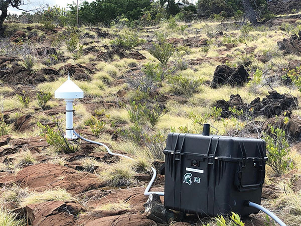
Seven scientific-grade GPS stations are joining a network of 65 that the USGS Hawaiian Volcano Observatory operates on the Hawaiian Islands. As Hawaiian volcanoes erupt and grow, they add weight to the Earth’s surface, causing the Pacific Plate to flex downward and possibly causing the shelf to splinter. Earthquakes this spring in Hawaii likely were related to weight on the underlying crust and mantle from eruptions. Collecting years of data from these stations should help scientists better understand motions of the Pacific Plate, according to researcher Jeff Freymueller, Michigan State University. The first three GPS stations were installed in May; others are being installed this summer.
Nikon could be launching a consumer camera equipped with GNSS instead of only GPS, providing a major upgrade for the geolocation coordinates provided with photo metadata. Filings with the governments of Russia and Indonesia describe a camera dubbed N2014, which will be equipped with GNSS as well as Wi-Fi and Bluetooth. A number of Nikon CoolPix digital cameras have built-in GPS, while other cameras — Nikon D-SLRs and select Nikon 1 — can use optional accessory GPS devices.
Topnet Live has increased types of correction services and subscription options. (Image: Topcon)
Topcon Positioning Group has expanded its Topnet Live GNSS network of correction solutions to support today’s work environments. The global network now has more types of correction services and subscription options.
This growth is a result of the increasing demand for digitalization in various industries including construction, surveying, machine control, and agriculture.
The flexible service options include Realpoint, the real-time kinematic (RTK) service, and Starpoint, a precise point positioning (PPP) service. The different services have varying delivery methods, coverage and reliable centimeter-level accuracy. Under a flexible subscription model, customers can purchase to suit their needs.
Additionally, Skybridge — an RTK service supported by PPP — is available to maintain connectivity and productivity if the customer temporarily leaves RTK coverage.
“The Topnet Live RTK network, first established over a decade ago, continues to grow with 5,100 reference stations globally, a 14% increase in the last year,” said Ian Stilgoe, Topcon vice president. “We are growing throughout the world in areas where there is an increasing demand for productivity and accuracy through digitalization, with strong growth particularly in North America and Europe. We are focused on continued expansion to maximize support for our customers, so they always have the best options globally.”
Original equipment manufacturers (OEMs) supplying automotive, industrial Internet of Things (IoT), autonomous robotics and all sectors that require positioning, navigation and guidance also benefit from the enhanced robustness of the network. OEMs can sell their hardware with correction services onboard and preconfigured for immediate use by customers, regardless of geographic location, with flexible subscription and licensing options to suit the exact need.
Topnet Live uses all four GNSS constellations: GPS, GLONASS, Galileo and BeiDou. The customer benefits from continuous accuracy and always-on service coverage. This service provides these distinct advantages in the industries it supports:
Survey, construction and machine control. Topnet Live removes the need for individual base stations, dramatically increasing flexibility, productivity and safety and can drive large-scale projects with constant, reliable accuracy.
Precision agriculture. The solution delivers fast, consistent, accurate positioning at any time day or night for soil preparation, seeding, spreading, spraying and harvesting.
OEMs, system integrators, product designers. The solution provides scalable precise positioning and supports the implementation of flexible business models tailored to fit both OEMs’ and their customers’ needs.
The BCM4778’s third-generation dual-frequency GNSS receiver features advanced multipath mitigation, L5 acquisition capability, LTE filtering and jamming protection
Broadcom Inc. has launched the BCM4778, its lowest power L1/L5 GNSS receiver chip optimized for mobile and wearable applications. Equipped with the latest GNSS innovations, the third-generation chip is 35% smaller and consumes five times less power than the previous generation.
Broadcom will be presenting further information on the chip in the Session B5, Panel: GNSS Chipset Technology – Trends, Opportunities and Challenges panel at the ION GNSS+ 2021 on Sept. 24.
Dual-frequency GNSS continues to be an important location feature for modern mobile and wearable devices, providing greater positioning accuracy for location-based applications. The advanced L5 signal enables sidewalk-level accuracy for pedestrian navigation in urban environments, as well as lane-level accuracy for vehicle navigation.
Reduction in GNSS power consumption is crucial to extending the battery life of a mobile or wearable device. Compared to GNSS receivers used in integrated platforms, Broadcom’s single-chip BCM4778 delivers significantly lower power consumption and higher performance while offering more advanced GNSS features, such as the next-generation Grid Tracking urban multipath mitigation technology.
“We are excited to see this impressive power reduction, combined with the L5 Grid Tracking technology in the new Broadcom GNSS chip. This will increase the impact of Google’s 3DMA ray-tracing for urban multipath mitigation,” said Frank van Diggelen, principal software engineer at Google.
Longer battery life. The BCM4778 increases the GNSS always-on battery life on a smartwatch by 30 hours compared to the previous generation chip operating on a 300-mAh battery. The extended battery life helps drive new experiences in smartwatches and phones, including keeping the GNSS always-on for fitness applications for multiple days on a single battery charge.
In addition, the BCM4778 features fully integrated LNAs for L1 and L5 bands, which reduces RF front-end BOM costs and footprint requirements, suitable for space-constrained applications. The chip offers increased flexibility to smartwatch and phone designers with its small size. Having the ability to place the BCM4778 closer to the antenna helps improve signal reception and enhances overall GNSS performance.
The BCM4778 dual-frequency chip is designed for small mobile and wearables. (Photo: Broadcom)
Product Highlights
7nm CMOS technology
Typical power consumption
4mW L1 band only
6mW L1+L5 simultaneous
FCBGA package
New Grid Tracking technology
Advanced multipath mitigation
Continuously tracks the full L5 channel
Capable of L5 acquisition
Increased processing capability and throughput
Advanced LTE filtering and jamming mitigation
Enhanced LTE Band 13 and Band 14 filtering
Spoofing and jamming detector
Jamming mitigation through multiband and multi constellation
Reduced BOM cost and footprint
Flexibility in using internal LNAs
Optional operation without interstage SAW filters
Integrated switching regulator with direct connect to battery
“With the launch of this third generation dual-frequency GNSS receiver chip, Broadcom continues the tradition of raising the bar for mobile GNSS,” said Vijay Nagarajan, vice president of marketing for the Wireless Communications and Connectivity Division at Broadcom. “Always-on dual frequency GNSS is a key request from mobile and wearable OEMs, and we are thrilled to deliver it.”
“Consumer electronic companies have been faced with the challenge of managing power consumption versus performance, often having to choose one over the other. Broadcom’s innovative approach to the BCM4778 allows their customers to realize improvements on both fronts,” said Ramon T. Llamas, research director for mobile devices at IDC. “The result: device manufacturers can enable new experiences and run applications over a sustained period of time. In addition, by reducing its BOM cost and its physical footprint, Broadcom is enabling further benefits from cost savings and design configurability.”
Broadcom is currently sampling the BCM4778 to its early access partners and customers. Please contact your local Broadcom sales representative for samples and pricing.
The next-generation SLAM algorithm — GeoSLAM Beam — powers the new software
GeoSLAM has released a software update, Connect 2.0, at the Intergeo 2021 trade show. Intergeo is taking place this week in Hannover, Germany.
Connect 2.0 enables GeoSLAM scanners to achieve a higher level of accuracy compared to other SLAM-based mapping systems. Colorization from the new ZEB Vision panoramic camera provides even more visual context to a point cloud, as well as interactive “bubble” walkthroughs and measurements.
The update is powered with the next generation of GeoSLAM’s algorithm GeoSLAM Beam, which includes new filtering and georeferencing tools to help users get the best results from their datasets.
Connect 2.0 also simplifies data processing through a series of workflow scripts. This includes automatic data processing, stop-and-go georeferencing and stop-and-go alignment, all available as standard.
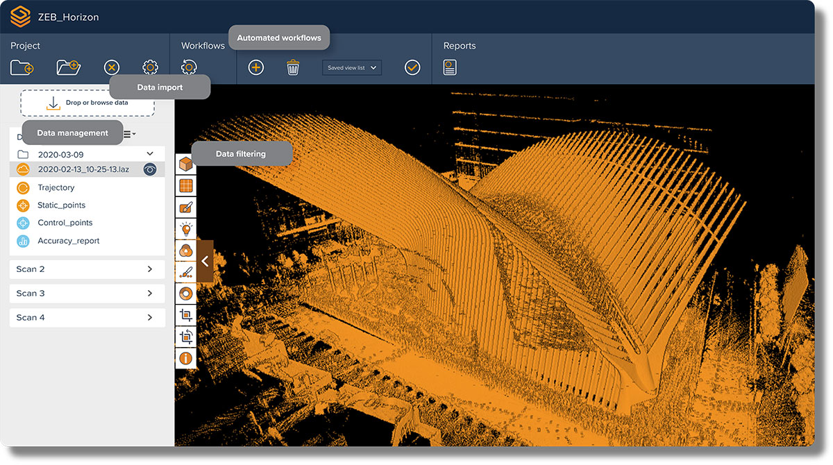
Screenshot: GeoSLAM
Connect 2.0 Features
Intuitive interface – The Connect viewer is integrated into the main software interface, making it easy to view multiple point clouds simultaneously and measure the distance between data points.
Change detection – Multiple point clouds can be compared, and any areas that have changed are automatically highlighted. Point clouds also can be compared with CAD models to track progress on a construction site or view changes between scans.
Floor slices – Horizontal and vertical slices can be taken from any location within the point cloud. Horizontal floor slices can also be automatically taken at any given height above the floor.
Environmental presets – Data is processed according to the environment it was captured in (indoor, outdoor, UAV or vehicle).
Draw 4.0 – Draw projects can now be created automatically for any dataset.
GeoSLAM customers with a Care subscription will have full access to Connect 2.0. Any new product shipped starting today comes with both Connect and Hub software.
Real-time processing
GeoSLAM has also launched real-time SLAM processing through remote access. Using an API for remote data capture or automated robotic navigation, users can see the point cloud and trajectory in real time. The ZEB Revo RT can be used on and off a robotic platform.
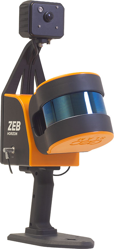
Photo: GeoSLAM
ZEB Vision panoramic camera
The ZEB Vision 16MP panoramic camera is now available for pre-order. Suitable for any ZEB Horizon, the new camera provides better colorization, image walkthroughs and pointcloud measurements using optional Draw software.
Use on UAVs. Further updates mean that GeoSLAM customers can now take a ZEB Horizon from handheld to UAV usage to get a more complete picture of projects. ZEB Horizon is compatible with the DJI Matrice 300 UAV.
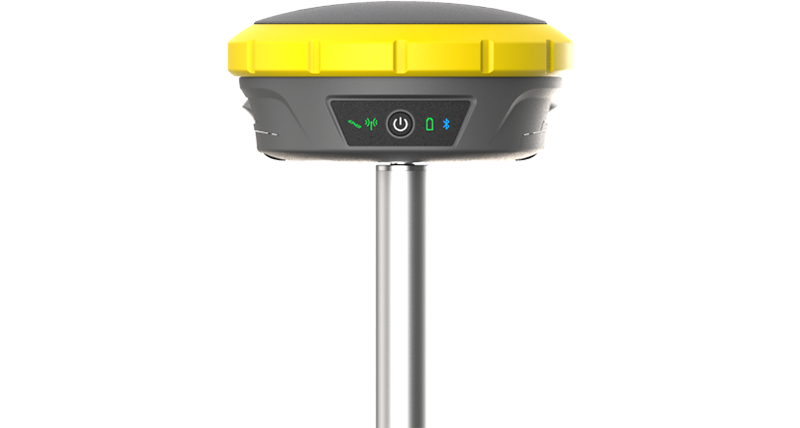
GeoMax has announced a new GNSS smart antenna, the Zenith60.
The Zenith60 is a calibration-free tilt compensating GNSS smart antenna that incorporates state-of-the-art technology. The antenna’s tilt capability makes surveys faster and more convenient, hence more productive and efficient, the company said.
The incorporated calibration-free inertial measurement unit (IMU) technology is designed to save time. The Zenith60’s resistance to magnetic fields ensures reliable data collection.
The antenna reaches its maximum performance when combined with X-PAD Ultimate field software and GeoMax field controllers, the company said.
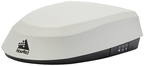
Fendt machines in North America, Europe and the Middle East equipped with Fendt Guide guidance systems powered by Fuse Smart Farming now come with NovAtel’s SMART7 GNSS receiver as the default configuration choice.
“We have been working with NovAtel for years, and their support and willingness to adapt to meet our needs makes them the key GNSS receiver supplier for our Fendt Guide guidance system,” said Bernhard Schmitz, director, FendtONE Market Readiness and Agronomy EME. “They are easy to work with and have high-quality products that integrate seamlessly into our machines.”
The SMART7 combines a powerful GNSS receiver with a precision antenna in a durable, all-in-one enclosure designed to stand up to the vibration, weather and temperature demands of harsh agricultural environments. Delivering exceptional positioning, the SMART7 is optimized to succeed in demanding agriculture and off-road applications.
Photo: NovAtel
The SMART7 uses multi L-band tracking to access TerraStar Correction Services globally, bringing repeatable centimeter-level accuracy to any application, anywhere in the world. Access to multi-frequency GPS, GLONASS, BeiDou, Galileo and QZSS signals provides better satellite availability in challenging environments.
Resiliency to radio frequency interference is ingrained in NovAtel’s hardware designs, and the company’s Interference Toolkit firmware suite provides detection and additional protection from any potential intentional or unintentional interference.
Powered by NovAtel GNSS+INS technology, the SMART7 uses an optional integrated inertial measurement unit (IMU) to provide continuous 3D positioning, velocity and roll/pitch/azimuth for deeper integration with vehicle guidance and steering systems. Additional optional features on the SMART7 include Wi-Fi and Ethernet for remote connectivity and monitoring.
The Trimble DA2 receiver boosts the performance of the Trimble Catalyst GNSS positioning service. (Photo: Trimble)
Trimble has launched the Trimble DA2 GNSS receiver for the Trimble Catalyst positioning service. The DA2 — the second-generation receiver and antenna for the Catalyst service — now includes the Trimble ProPoint GNSS engine for enhanced performance.
Unique to the latest Trimble GNSS solutions, ProPoint technology reduces convergence times and improves positioning accuracy when operating near trees and buildings.
Trimble Catalyst is a subscription-based GNSS positioning service for location-enabled field applications. The service is available in accuracy-based packages from centimeter- to submeter-level for a wide range of mapping and mobile geographic information system (GIS) data-collection projects. Catalyst continues to support a broad range of GIS field applications, including Trimble TerraFlex software, for form-based GIS data collection.
“Trimble Catalyst brings easy-to-use precise positioning to location-enabled workforces,” said Gareth Gibson, marketing director, Trimble Mapping & GIS. “The addition of ProPoint technology, together with the DA2’s support for iOS devices, means Catalyst can now deliver Trimble quality positioning to more geospatial professionals than ever before.”
Trimble Catalyst subscriptions are available through Trimble’s Authorized Distribution Network. The Catalyst DA2 digital GNSS receiver, sold separately, is expected to be available in the fourth quarter. Trimble TerraFlex software subscriptions are available separately through Trimble Geospatial distribution partners.
Integrated solutions address GNSS test requirements defined by 3GPP and major U.S. carriers
Orolia and Keysight Technologies Inc. have joined forces to advance 5G services by addressing GNSS test requirements defined by 3GPP and major U.S. carriers.
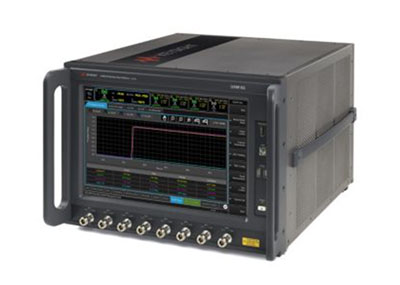
Working with Orolia allows Keysight to extend its 5G device test solution portfolio with advanced GNSS simulation capabilities. As a result, existing users of Keysight’s 5G device test solutions can easily address GNSS-related 3GPP protocol conformance and carrier acceptance test requirements by upgrading the software in Keysight’s E7515B UXM 5G Wireless Test Platform and combining it with Orolia’s GSG-8 simulator.
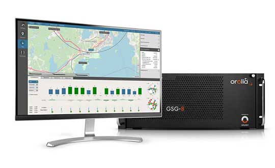
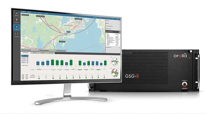
Skydel GSG-8 (Photo: Orolia)
The efforts of Keysight and Orolia will enable chipset and device makers to verify functionality to accurately position mobile phone users within a geographic area.
“Working with Orolia has enabled Keysight to deliver GNSS-based LBS test solutions for 5G protocol conformance and carrier acceptance validation,” said Muthu Kumaran, general manager of Keysight’s device validation solutions business. “Keysight’s LBS solutions also support assisted GNSS test functionality, enabling users to comprehensively address 5G new radio conformance requirements mandated by both the Global Certification Forum (GCF) and PTCRB.”
Accurate positioning is important in a wide range of sectors including healthcare, road and aerial transportation, entertainment and homeland security.
Future applications, such as drones and autonomous vehicles, will depend on highly precise positioning services for reliable navigation and safe transportation of people and goods. Mobile operators use GNSS technologies and non-GNSS technologies, such as beamforming, angle-based positioning and round-trip time to deliver personalized services and support emergency calls.
Keysight’s UXM 5G Wireless Test Platform. (Photo: Keysight Technologies)
The GSG-8 simulator, powered by the Skydel Simulation Engine, offers high performance, flexibility and an easy-to-use software-defined platform to deliver superior jamming and spoofing options that can help ensure accurate, continuous operations for critical applications during interference or signal loss. Automated and scalable, the simulator supports GPS, Galileo GLONASS and BeiDou, with upgrade paths for future constellations.
Keysight offers in-built positioning capabilities in the UXM 5G wireless test platform for non-GNSS positioning test requirements.
“We are pleased to collaborate with Keysight on developing solutions that improve PNT testing for 5G communication networks and devices,” said Lisa Perdue, Orolia’s Simulation Product Line director. “Our GSG-8 simulator, powered by Orolia’s Skydel Simulation Engine, offers ultra-high performance and unmatched flexibility. The easy-to-use software-defined platform also delivers superior jamming and spoofing options that can help ensure accurate, continuous operations for critical applications during interference or signal loss.”
Boeing will build the U.S. Navy’s MQ-25 Stingray unmanned aerial refueler at a new 300,000-square-foot facility at MidAmerica St. Louis Airport in Illinois. (Photo: Boeing)
Boeing will build the MQ-25 Stingray — the Navy’s first carrier-based unmanned aircraft — at a new high-tech facility in Illinois. The 300,000 square-foot facility at MidAmerica St. Louis Airport, Illinois, is scheduled for completion in 2024.
The MQ-25 facility will include state-of-the-art manufacturing processes and tools, including robotic automation and advanced assembly techniques, to improve product quality and employee ergonomics. The facility initially will employ 150 mechanics, engineers and support staff, but could grow to 300 with additional orders.
Boeing digitally engineered the entire MQ-25 aircraft and its systems, resulting in high-fidelity models used to drive quality, efficiency and flexibility throughout the production and sustainment process.
For two years, Boeing and the Navy have been flight testing the Boeing-owned MQ-25 test asset from MidAmerica Airport. In recent missions, the T1 model has refueled an F/A-18 Super Hornet, an E-2D Hawkeye and an F-35C Lightning II.
The U.S. Navy intends to procure more than 70 MQ-25 aircraft to help extend the range of the carrier air wing, and the majority of those will be built in the new facility. Boeing is producing the first seven MQ-25 aircraft, plus two ground test articles, at its St. Louis facilities, and they will be transported to MidAmerica for flight test. The MQ-25 program office, including its core engineering team, will remain based in St. Louis. MidAmerica is adjacent to Scott Air Force Base.
The new MQ-25 facility will be in addition to existing manufacturing operations at Boeing St. Clair, which produce components for the CH-47 Chinook, F/A-18 Super Hornet, F-15 and other defense products.
T1 Stingray refuels a Navy F/A-18. (Photo: U.S. Navy/Boeing)
Hemisphere GNSS has announced the Outback Guidance MaveriX for precision agriculture. The solution is built around the new MaveriX agriculture application software platform to provide state-of-the-art guidance, steering and application control.
The MaveriX application software includes a new user interface that provides an innovative tablet-like user experience with improved 3D graphics. The included adjustable widgets give users the freedom to customize their UI experience.
“The announcement and the upcoming release of our new MaveriX solution is a key milestone for the Outback Guidance business and our loyal customer base,” said Jeff Farrar, general manager of Outback Guidance. “We are looking forward to building the Next Generation of Outback success for our customers on this new platform.”
New M7 and M10 terminals (7 inch and 10 inch) are the centerpiece of the MaveriX. The M-series terminals deliver the latest display technology. They provide enhanced situational awareness for users and preferred features like auto-scaling and pinch-to-zoom capabilities.
The MaveriX solution provides superior centimeter-level performance via the new eDriveM1 steering controller. The eDriveM1 offers AB Straight, AB Contour, Freeform Contour and Circle Pivot guidance modes and supports Shuttle Shift, Reverse Steer and the Outback Guidance eTurns feature for automated headland turns.
The eDriveM1 can be paired with the proven ESi2 Electric Wheel, existing OEM Steer Ready, or hydraulic retrofit interfaces.
Outback Guidance continues to offer machine specific installation kits for more than 1500 machine models. The A631 GNSS Smart Antenna delivers GNSS performance at scalable accuracy levels using real-time kinematic (RTK), SBAS and Hemisphere’s Atlas L-band service.
The A631 supports RTK base functionality when paired with the Outback RTK radio option. The powerful MaveriX technology platform supports the AC110 Rate and Section control to maximize implement functions during planting, spraying and application tasks.