Category: Applications

  • GPS military code installs complete at master control sites

    GPS military code installs complete at master control sites

    The United States Space Force’s Space and Missile Systems Center on July 27 completed the military code (M-code) Early Use (MCEU) hardware and software upgrade to the GPS Operational Control System (OCS).

    Completion of the upgrade is a major step toward Operational Acceptance of the long-awaited GPS M-code.
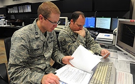
    Photo: U.S. Air Force photo/Dennis Rogers
    Photo: U.S. Air Force photo/Dennis Rogers

    The encrypted M-code signal enhances anti-jamming and anti-spoofing capabilities for the warfighter. M-code signals are currently available on all 22 GPS Block IIR-M, IIF and III space vehicles currently on orbit.

    The installs were completed at the Master Control Station at Schriever Air Force Base, Colorado, and Alternate Master Control Stations at Vandenberg Air Force Base, California.

    The MCEU upgrade allows the OCS Architecture Evolution Plan to task, upload and monitor M-code within the GPS constellation, as well as support testing and fielding of modernized user equipment.

    Operational Acceptance Set for November. MCEU will be in a trial period before Operational Acceptance in November. Once Operational Acceptance is granted, upcoming Military Ground User Equipment (MGUE) will be able to leverage the M-code signal-in-space to provide more secure position, navigation and timing (PNT) to warfighters.

    “Working closely with Lockheed Martin and our other mission partners — with the common national goal of providing enhanced PNT signal security and safety always in sharp focus — means we’re able to deliver the right mission capability faster to our warfighters,” said Lt. Col. Steven A. Nielson, program manager of the MCEU project.

    MCEU serves as a gap-filler for M-code operations before the entire GPS constellation’s operational transition to the Next Generation Operational Control System Block 1, which is now in development.

    A key to enabling M-code is a new software-defined receiver being installed at all six Space Force Monitoring Sites. The M-code Monitor Station Technology Improvement and Capability receiver uses commercial, off-the-shelf hardware to cost-effectively receive and process M-code signals, enabling OCS operators to monitor the signals.

  • Cohda Wireless launches advanced C-V2X software development kit

    Cohda Wireless launches advanced C-V2X software development kit

    Cohda Wireless has released an updated version of its C-V2X software development kit (SDK). According to the company, the SDK now features an extensive range of useful applications and tools, as well as a virtual simulation tool. The virtual simulation tool allows users to test their applications before real-life deployment, through high-quality, simulated drives that provide full playback capabilities for actual drive tests.

    The Cohda C-V2X SDK is a self-contained virtual machine that allows anyone with previous embedded Linux experience to quickly compile and run C-V2X applications in conjunction with C-V2X development platforms, such as those featuring the Qualcomm 9150 C-V2X chipset solution, the company said.

    The SDK includes source code for red light warning and road side alert to demonstrate the various APIs and enable quick application development. It also features binaries for forward collision warning, emergency electronic brake light, curve speed warning, RoadWorks warning, blind spot warning, hazard location warning for China, abnormal vehicle warning for China, speed limit warning for China, red light violation warning for China and green light optimal speed advisor for China. It includes tester control interfaces for performing conformance tests, as well.

    “The functional benefits of this SDK, especially the vsim component, have significant tangible value in the C-V2X ecosystem,” said Fabien Cure, chief engineer at Cohda Wireless.

    As they are radio agnostic, Cohda’s V2X solutions support C-V2X and dedicated short-range communication.


    Feature image: Cohda Wireless

  • Spectra Geospatial, Aplitop partner on tunneling survey solution

    Spectra Geospatial, Aplitop partner on tunneling survey solution

    Image: Spectra Geospatial
    Image: Spectra Geospatial

    Spectra Geospatial is partnering with Aplitop for a comprehensive tunnel survey solution designed to increase productivity for survey service providers.

    According to the companies, the collaboration provides surveyors and geospatial professionals with a complete hardware and software solution for performing efficient tunnel construction surveys.

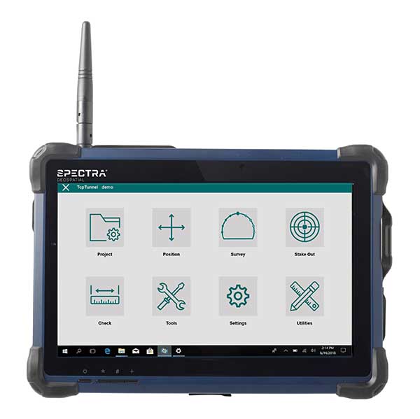
    Through the partnership, the Spectra Focus 35 robotic total station will be integrated with the workflows of the Aplitop TcpTUNNEL, running on the ST10 or Ranger 7 data collector. This will enable surveyors to perform excavation control, automated survey and stakeout of tunnel cross-sections, the companies said.

    In the office, data and designs can be transferred seamlessly between TcpTUNNEL CAD, a plug-in for several CAD platforms, and TcpTUNNEL field software.

    The Spectra Geospatial and Aplitop solution provides a full featured workflow for tunnel constructions surveys including definition of project design elements; tunnel drill and blast setout and reporting on the difference; automated data collection; accurate stake-out-of-key design features and anchor belts; and graphical reporting of the differences between design and survey data.

    “Collaborating with Aplitop enables Spectra Geospatial to provide customers with a world-class tunneling solution to increase productivity working in underground environments,” said Olivier Casabianca, vice president at Spectra Geospatial. “The combination improves the tunnel construction process by providing customers with increased confidence in the field and streamlining final deliverable creation in the office.”

  • NGS releases modernized National Spatial Reference System updates

    NGS releases modernized National Spatial Reference System updates

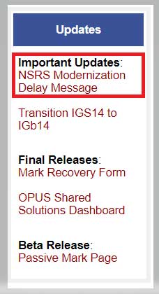
    The National Geodetic Survey (NGS) recently announced two new items related to the modernized National Spatial Reference System (NSRS). First, it announced that there will be a delayed release of the modernized National Spatial Reference System (NSRS). See the box titled “Updates notices from NGS Homepage” for the link to the notice.

    Updates notices from NGS Homepage

    Image: National Geodetic Survey
    Image: National Geodetic Survey

    The box titled “Delayed Release of the Modernized NSRS” provides a summary of the notice. The announcement stated they are performing a thorough review of all tasks and will provide regular updates on their progress. What this means is that the modernized NSRS will not be completed by 2022. Even if it’s delayed a couple of years, it’s never too early to obtain an understanding of the new, modernized NSRS, and start preparing for the transition to the new NSRS.

    Delayed Release of the Modernized NSRS

    (https://www.ngs.noaa.gov/datums/newdatums/delayed-release.shtml)

    NOAA’s National Geodetic Survey (NGS) is announcing a delay in the release of the modernized National Spatial Reference System (NSRS).

    In 2007, NGS began planning for the modernized NSRS, acquiring its first airborne gravimeter, creating and initiating the Gravity for the Redefinition of the American Vertical Datum (GRAV-D) project and by 2008 had codified its modernization plans into a Ten Year Plan. At that time, the target completion date was 2018. By 2013, that date seemed unlikely, due to both the broadening of the GRAV-D coverage area and the experience of five years of operational planning and execution.

    In 2013, NGS revised its 2008 Plan, and targeted 2022 as the date of the release of the modernized NSRS. This date was reinforced with a 2018 Strategic Plan revision. By 2017, confidence in hitting the 2022 target was high enough to reach final agreement with Canada and Mexico on a naming convention for certain components, to include “2022” in their names.

    Since 2017, operational, workforce, and other issues have arisen and compounded, causing NGS to recently re-evaluate whether a successful roll-out by 2022 is possible. The most significant impacts have been in workforce hiring and retention, and in meeting GRAV-D data collection milestones, which underpin the NSRS modernization efforts.

    NGS is currently conducting a comprehensive analysis of ongoing projects, programs and resources required to complete NSRS modernization and will continue to provide regular updates on our progress. To get the latest news on NSRS modernization and track our progress, subscribe to NGS News or visit our “New Datums” web pages.

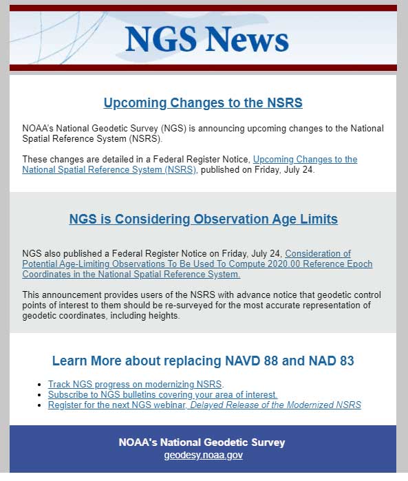
    The second important announcement by NGS was that two Federal Register Notices related to the modernized NSRS were published on July 24. See the box titled “NGS News.”

    Image: National Geodetic Survey
    Image: National Geodetic Survey

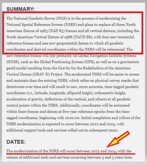
    The first Federal notice was titled “Upcoming Changes to the National Spatial Reference System.” See the box titled “Federal Register Notice titled Upcoming Changes to the National Spatial Reference System” for the summary. This announcement provides a statement about the new, modernized NSRS and that it’s going to be published between 2022 and 2025. The information about the modernized NSRS shouldn’t be new to anyone that’s been reading my newsletters, but the Federal Notice makes it official and NGS provides dates of when the modernization will be rolled out.

    Federal Register Notice titled “Upcoming Changes to the National Spatial Reference System”

    (https://www.govinfo.gov/content/pkg/FR-2020-07-24/pdf/2020-16068.pdf)

    Image: Federal Register
    Image: Federal Register

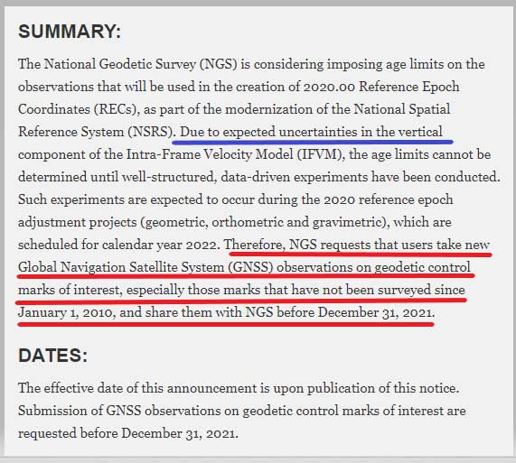
    The second Federal Notice was titled “Consideration of Potential Age Limiting Observations To Be Used To Compute 2020.00 Reference Epoch Coordinates in the National Spatial Reference System.” This is a very important notice that users of NGS published coordinates should read and understand. NGS is considering imposing data age limits that will be part of the new, modernized NSRS. See the box titled “Imposing Age Limits of Data in 2022” for a summary of the Federal Register Notice announcement.

    Imposing Age Limits of Data in 2022

    (https://www.federalregister.gov/d/2020-16084)

    Image: Federal Register
    Image: Federal Register

    My last column highlighted that in the modernized NSRS the only way to get “into the datum” will be through a GNSS survey. It noted that leveling projects generate relative height differences not absolute heights. It emphasized that in the new modernized, time-dependent NSRS, the absolute height will be provided by up-to-date GNSS data; and the relative height differences between leveling marks will be provided by the leveling data. Many of my previous newsletters have explained different aspects of the new NSRS and how it may affect the surveying and mapping community products and services. As the Federal Register Notice implied, at this moment, NGS expects large uncertainties in the vertical component of the Intra-Frame Velocity Model (IFVM) which will translate into the GNSS-derived height Limiting the age of data will help to reduce the amount of uncertainty in the vertical component based on older data. Saying that, this could have an impact on users that rely on coordinates established using data acquired prior to 2010. NGS is requesting that users take new GNSS observations on all stations of interest that haven’t been occupied since the year 2010. The supplementary information in the Federal Register notice contains some very important statements. I have highlighted several statements in the box titled “Supplementary Information from Imposing Age Limits of Data in 2022.”

    NGS hasn’t decided on the date of the age limit but the notice states that “For instance, it is unlikely that such an age-limit will be fewer than 10 years.” This is why NGS recommends the following “that users take new GNSS observations on geodetic control marks of interest that have not been surveyed since January 1, 2010, and asks the users to submit the observations to NGS before December 31, 2021.” Another important item in the supplemental information section is that NGS is enhancing the OPUS-Projects tool to include real-time kinematic and real-time network (RTK/RTN) observations. This should help to facilitate users submitting data on marks of interest so that they will have 2020.0 Reference Epoch Coordinates (REC).

    Supplementary Information from Imposing Age Limits of Data in 2022

    (https://www.federalregister.gov/d/2020-16084)

    SUPPLEMENTARY INFORMATION:
    In 2017, the National Geodetic Survey (NGS) announced its plans to estimate RECs on a five-year cycle in NOAA Technical Report NOS NGS 67, 2019, starting with the first reference epoch at 2020.00, as part of the modernization of the NSRS. In the Technical Report, the exact observations to be used for this estimation were listed as “To Be Determined.” NGS is considering imposing age limits upon the observations that will be used, particularly because of expected uncertainties in the vertical component of the IFVM. These age limits cannot be determined until additional well-structured, data-driven experiments are conducted. Such experiments are expected to occur during the 2020 reference epoch adjustment projects (geometric, orthometric, and gravimetric), which are scheduled for calendar year 2022.

    However, since the cut-off for new observations to enter those adjustment projects is December 31, 2021, any decision to age-limit input observations will come too late for submissions to impact the 2020 RECs. While the cut-off for age-limited observations is unknown, certain assumptions are safe to make. For instance, it is unlikely that such an age-limit will be fewer than 10 years. Older observations may be used in the estimation of 2020 RECs, but this cannot be guaranteed. As such, NGS requests that users take new GNSS observations on geodetic control marks of interest that have not been surveyed since January 1, 2010, and asks the users to submit the observations to NGS before December 31, 2021. Users may either (a) submit existing unsubmitted observations through the OPUS-Share tool or (b) conduct new GNSS observations and submit the data to NGS via the OPUS-Share tool.

    In order to increase the submission of GNSS observations on marks, NGS is prioritizing the finalization of an expanded OPUS-Projects tool, which will allow real-time kinematic and real time network (RTK/RTN) observations to be submitted, rather than the standard four-hour observations required in OPUS-Share. Initial roll-out of this new tool is expected to occur during calendar year 2020.

    This action is designed to increase both the number and the coordinate accuracy of geodetic control points, which in the modernized NSRS will have an estimated 2020.00 REC. Historically, NGS has combined data across multiple decades to estimate geodetic coordinates, yet such efforts have not fully accounted for the lack of information about vertical motion of geodetic control points throughout the years. Since height information is critical to the understanding of floods, failure to compute heights accurately can have negative impacts on property and lives. NGS views periodic re-surveys of geodetic control points, rather than the estimation of coordinates from observations that are years (or even decades) old, as the most effective way to maintain accurate and up-to-date knowledge of geodetic coordinates, including heights. As such, this announcement provides users of the NSRS with advance notice that geodetic control points of interest to them should be re-surveyed for the most accurate representation of geodetic coordinates, including heights.

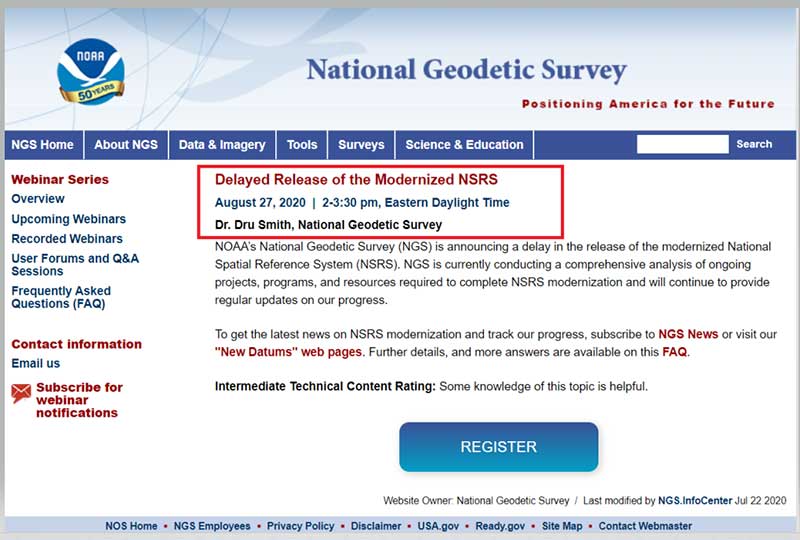
    NGS has scheduled a webinar for August 27, 2020, to discuss the delayed release of the modernized NSRS. See the box titled “Webinar on Delayed Release of the Modernized NSRS” for the announcement and web link to register for the webinar. I would encourage all users of the NSRS to register for this webinar.

    Webinar on Delayed Release of the Modernized NSRS

    (https://geodesy.noaa.gov/web/science_edu/webinar_series/delayed-release-nsrs.shtml?utm_medium=email&utm_source=GovDelivery)

    Image: National Geodetic Survey
    Image: National Geodetic Survey

    Many users are probably wondering if the delay in the new, modernized NSRS will change the dates of other deadlines. The FAQs webpage addresses some of these questions. I have highlighted a few FAQs in the box titled “Questions from NGS FAQ Website.”

    Questions from NGS FAQ Website

    (https://www.ngs.noaa.gov/datums/newdatums/FAQNewDatums.shtml)

    How will the delay affect the GPS on Benchmarks Phase II deadlines?

    The deadline for submittal of GPSonBM data for the 2022 Transformation tool will remain December 31, 2021

    If SPCS2022 zone designs are completed before other parts of NSRS modernization, will SPCS2022 be released sooner?

    No. SPCS2022 is explicitly defined with respect the four 2022 terrestrial reference frames (not NAD 83), and SPCS2022 will be released along with the roll-out of those frames. If the frames are rolled out prior to other parts of the NSRS modernization, the frames will be accompanied by SPCS2022 (see the previous FAQ about phased roll-outs).
    However, complete definitions of all SPCS2022 zones will be made available as soon as they are finalized. NGS expects that to occur by the end of 2021. Providing zone definitions early will give software vendors, database administrators, and others ample time to adopt and test them in their systems. Doing so will ensure SPCS2022 is available for immediate use upon roll-out of the 2022 terrestrial reference frames.

    My projected height change seems to return me to NGVD 29 heights. Is this a coincidence?
    This is coincidental. It so happens that, in some areas of the country the actual orthometric height in a region happens to be numerically closer to NGVD 29 than NAVD 88. NGVD 29 itself has biases and tilts which make it as inappropriate of an estimate of true orthometric heights as NAVD 88

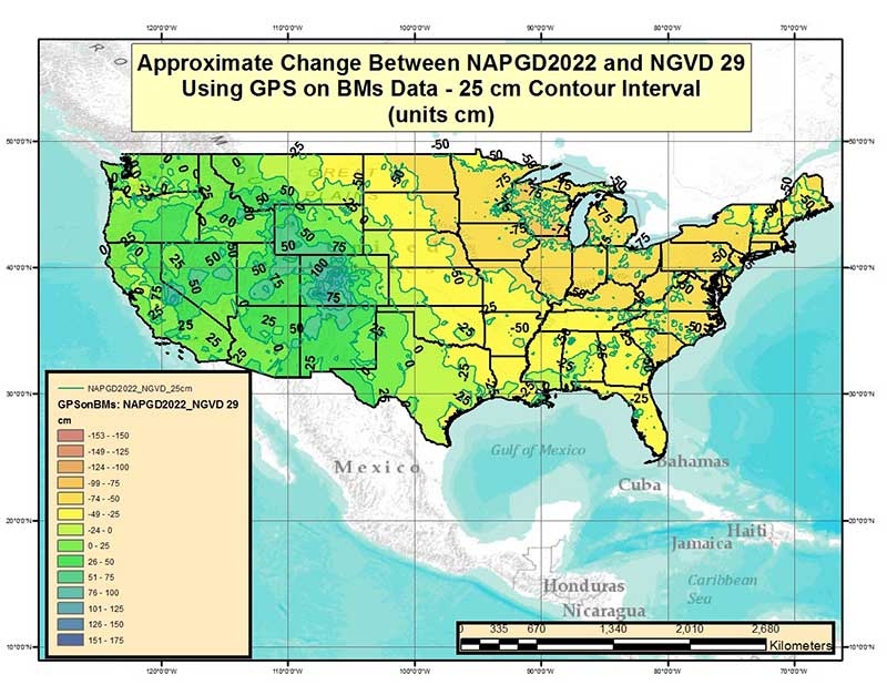
    [NOTE: I have heard this question from many of my readers so I provided an approximate estimate of the differences between NAPGD2022 orthometric heights and NGVD 29 height values in my June 2017 Survey Scene column. See figure below labeled “Figure 2 from June 2017 Survey Scene Newsletter.”]

    Image: National Geodetic Survey
    Image: National Geodetic Survey

    Figure 2 from June 2017 Survey Scene Newsletter

    Future newsletters will address updates on the modernized NSRS as they become available to the user community.

  • GPSIA asks FCC to reexamine Ligado decision

    GPSIA asks FCC to reexamine Ligado decision

    GPSIA logoThe GPS Innovation Alliance (GPSIA) sent a letter to FCC Commissioner Michael O’Rielly on July 30 regarding Ligado Networks.

    The letter highlights what appears to be different characterizations of the engineering information in the FCC’s record, and suggests that these contrasting statements “support a careful re-examination of the bases of the Ligado Order and a stay of the decision while that occurs.”

    “GPSIA appreciates your continued interest and efforts in this proceeding, and your willingness to consider whether a stay of the Ligado order may be appropriate,” the letter states. “As the record in this proceeding makes clear, sound technical analyses were conducted on Ligado’s network by DOT — a neutral third-party U.S. government expert on GPS. Further evaluation of those analyses should prompt the Commission to set aside the Ligado order so that its understanding of the DoT ABC Report can be better aligned with the authors of the report.”

    Read the full text of the letter.

    Hold on Third FCC Chairmanship. In a related report, the chairman of the Senate Armed Services Committee Sen. Jim Inhofe (R-Okla.) on July 28 placed a hold on the nomination of O’Rielly to another five-year term chairing the commission.

    Inhofe said he would block O’Rielly until the nominee “publicly commits to vote to overturn the current Ligado order,” according to a report from Space News.

    “Over the past few months, I have sent letters, held hearings and called countless officials to highlight what we all know to be true: the FCC’s Ligado order is flawed and will lead to significant harm to our military and the thousands of individuals and businesses that rely on GPS,” Inhofe said.

  • Microchip introduces timing GPS with embedded M-code receiver

    Microchip introduces timing GPS with embedded M-code receiver

    New SyncServer S650 M-Code secures military communication systems, radar and networks reliant on GPS signals

    Photo: Microchip
    Photo: Microchip

    Threats from intentional jamming and spoofing of GPS signals, as well as cybersecurity risks to critical infrastructure, demonstrate the need for powerful and secure time and frequency systems that ensure continuing operability and performance.

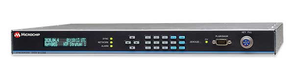
    Microchip Technology’s SyncServer S650 M-Code time server has received approval from the U.S. Air Force GPS Directorate of the Los Angeles Air Force Base for use in support of military communication systems, radars and networks.

    M-code, an encrypted military signal broadcasted in GPS frequency bands, is required by congressional mandate for mission critical Department of Defense (DOD) applications in hostile environments. Microchip’s SyncServer S650 M-Code equipped time and frequency server provides a secure, accurate, flexible platform for synchronizing mission-critical electronic systems and instrumentation.

    For DOD programs requiring jam-resistant, encrypted time and frequency signals from the GPS military M-code Precise Positioning Service (PPS), the SyncServer S650 M-Code is a secure time and frequency instrument with a fully integrated M-code GPS receiver.

    “As the first time and frequency instrument enabling DOD compliance for M-code-based GPS systems, this technology demonstrates Microchip’s continuing commitment and investment in the security of time and frequency systems,” said Randy Brudzinski, vice president, Frequency and Timing Solutions business unit. “This time server represents a new level of security hardening built on Microchip’s proven commercial SyncServer S650 time server that provides extreme timing accuracy, security and flexibility.”

    The SyncServer S650 M-code equipped time and frequency instrument is a rack mounted server device that synchronizes to the atomic clocks aboard GPS satellites via M-code. The S650 M-code leverages new technology to provide enhanced anti-jamming protection and further hardening against spoofing, providing greater accuracy, and improving operator ease-of-use for key loading.

    Harder to jam than commercial CA-Code GPS, M-code provides a more secure signal than the commercial CA-Code or SAASM P(Y) signal, with greater accuracy. The instrument also is easier for operators to load crypto keys.

    Staff Sgt. Daniel Pennington, a flight engineer assigned to B Co "Big Windy," 1-214th General Support Aviation Battalion, takes in his 'office' view from the ramp of his CH-47 Chinook while flying over the island of Cyprus on Jan. 14, 2020. (Photo: U.S. Army/Maj. Robert Fellingham)
    Staff Sgt. Daniel Pennington, a flight engineer assigned to B Co “Big Windy,” 1-214th General Support Aviation Battalion, takes in his ‘office’ view from the ramp of his CH-47 Chinook while flying over the island of Cyprus on Jan. 14, 2020. (Photo: U.S. Army/Maj. Robert Fellingham)

    The SyncServer S650 M-Code can utilize Microchip’s FlexPort technology for multiport, user definable output signal configurations for Inter-Range Instrumentation Group (IRIG) timecodes, pulses and a variety of signal types essential for military communication, radars and network system synchronization. This is coupled with Microchip’s NTP Reflector technology for robust security, accuracy and reliability of network-based time services such as Network Time Protocol (NTP) and Precision Time Protocol (PTP). Other features include:

    • Four standard GbE ports, all with patented NTP hardware time stamping, with two additional 10 GbE ports optional
    • Contains most popular timing signal inputs/outputs standard in the base timing I/O module (IRIG B, 10 MHz, 1PPS)
    • Web-based management with high security cipher suite
    • Rubidium atomic clock or OCXO oscillator upgrades
    • Superior 10 MHz low phase noise options

    Microchip has been delivering the SyncServer S650 to synchronize business critical and mission critical operations, across all industry segments, since its commercial introduction in 2016.

  • Readiness confirmed for July 31 WAAS satellite launch

    Readiness confirmed for July 31 WAAS satellite launch

    Logo: Arianspace

    Approval is given for Arianespace’s Ariane 5 flight on July 31

    Arianespace’s fifth mission of 2020 has been given the green light for liftoff following a July 29 launch readiness review conducted at the Spaceport in French Guiana.

    The launch will deliver the Intelsat Galaxy 30 (G-30) satellite into orbit. G-30 will become part of the  Wide Area Augmentation System (WAAS), the air navigation aid developed by the U.S. Federal Aviation Administration to augment GPS and GNSS.

    Besides G-30, the Ariane 5 launch vehicle will also carry the Mission Extension Vehicle-2 (MEV-2) and BSAT-4b. All satellites are flight-ready, along with the Spaceport’s infrastructure and the network of downrange tracking stations.

    With approval granted, Ariane 5 also is cleared for rollout on July 30 from its Final Assembly Building to the ELA-3 launch zone. Liftoff will occur on July 31 during a 46-minute launch window opening at 6:30 p.m. local time in French Guiana. To watch the launch live, visit the Arianespace website.

    Ariane 5 will deliver a total payload lift performance of approximately 10,468 kg. on the mission to geostationary transfer orbit (GTO), which is designated Flight VA253. This total factors in the three passengers, plus the workhorse vehicle’s multi-payload deployment system and integration hardware.

    G-30 and MEV-2 — both produced by Northrop Grumman to serve the operational needs of Intelsat — are stacked together in the upper position of Ariane 5’s payload configuration. G-30 will be deployed first during the 47-minute flight sequence, followed by MEV-2.

    To be released last as the mission’s lower passenger, BSAT-4b is being launched by Arianespace as part of a turnkey contract between the Japanese operator B-SAT and the satellite manufacturer, Maxar.

  • Fibocom to acquire Sierra Wireless automotive module product line

    Fibocom logoFibocom, a global provider of internet of things (IoT) wireless solution and wireless communication modules, has reached an agreement with three investment institutions to acquire the automotive embedded module product line of Sierra Wireless through its joint venture company.

    The funds will be used to acquire the automotive embedded module assets of Sierra Wireless through Rolling Wireless (H.K) Ltd., the subsidiary of Rolling Wireless Technology Co., Ltd. After the acquisition, the joint venture company Rolling Wireless (H.K.) Limited will operate the global automotive embedded module business independently.

    Fibocom signed an agreement with three professional investment institutions — Shenzhen Capital Group Co., Ltd., Shenzhen Jianxin Huaxun Equity Fund Management Co., and Shenzhen Qianhai Red Earth M&A Fund Partnership (Limited Partnership) — planning to jointly increase investment in Rolling Wireless Technology Co., Limited, a joint venture company invested in by the four parties.

    According to a Fibocom press release, “As an important milestone in Fibocom’s globalization, this strategic move will strengthen Fibocom’s industrial advantage in the IoT sector and will help to further enhance its global market share in the automotive embedded module business.”

    “We have been dedicated to providing high-speed, stable and reliable embedded wireless modules to the IoT industry for more than twenty-one years,” said Zhang Tianyu, chairman of Fibocom. “The acquiring will allow us to dive deeper into the automotive vertical industry and continue to provide more market-oriented high-performance embedded wireless modules and total IoV solutions for global customers in the automotive industry.”

  • In aftermath of ransomware attack, Garmin services begin to return

    In aftermath of ransomware attack, Garmin services begin to return

    Following a ransomware attack last week that left Garmin Connect and other services offline, the company is gradually restoring its internet capabilities.

    For those who make use of fitness tracking, however, Garmin Connect workouts are still not able to sync to devices and the app is under maintenance, reports CNN.

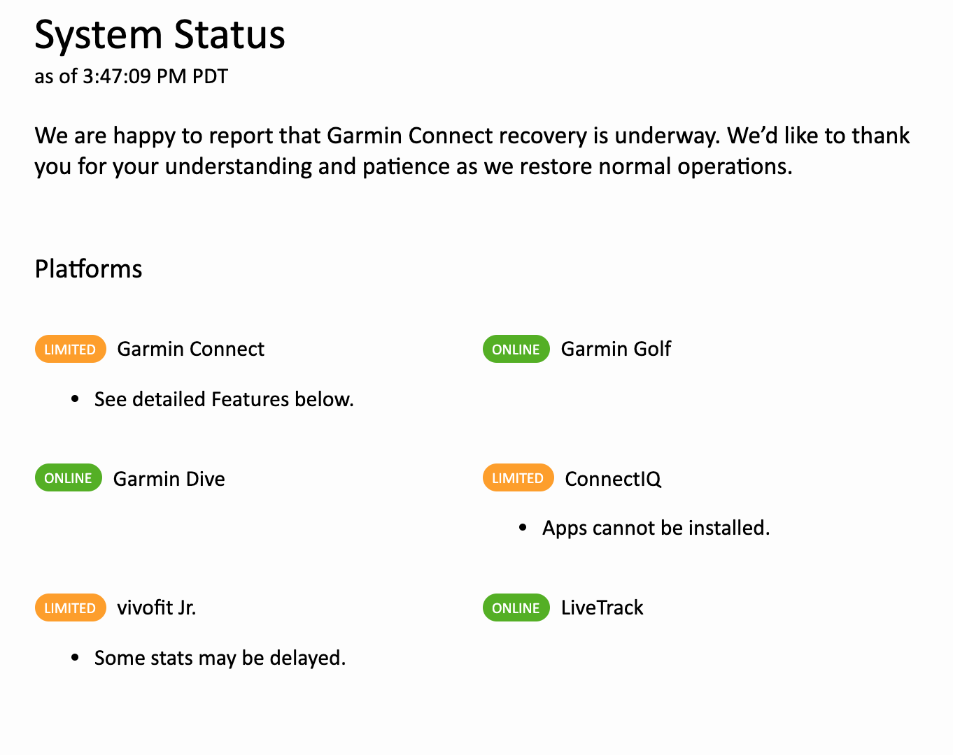
    “We are happy to report that Garmin Connect recovery is underway,” the company announced on the Garmin Connect website. Some platforms have been given the green light, while others are offering limited services.

    The company also said in a statement that there is “no indication” that customer data was accessed, stolen or lost.

    Screenshot of Garmin Connect website, July 27.
    Screenshot of Garmin Connect website, July 27.
  • Editorial Advisory Board PNT Q&A: Opportunities with GNSS correction services

    Editorial Advisory Board PNT Q&A: Opportunities with GNSS correction services

    New players are offering GNSS correction services — pushing prices down and offering new business models. What opportunities does this open up?

    Jules McNeff
    Jules McNeff

    “This trend is encouraging, as new entrants bring energy and new ideas, keeping the PNT technology sector fresh. GNSS corrections enhance the value of dynamic mapping coupled with grid-coordinate systems such as the U.S. National Grid in producing user-friendly geolocation values for delivery of people and things and especially enabling efficient, precise, land mobility activities such as spatial awareness for autonomous vehicle movement and command and control of emergency response operations.”
    — Jules McNeff
    Overlook Systems Technologies


    Greg Turetzky
    Greg Turetzky

    “In a 5G world where most devices regardless of size are connected, it make sense that those devices that are mobile are going to need to be located. Correction services are key to providing enhanced accuracy, and new business models are needed to address these new markets that are fundamentally different than traditional high-accuracy markets.”
    — Greg Turetzky
    Consultant


    Jean-Marie Sleewaegen
    Jean-Marie Sleewaegen

    “Traditional correction services rely on bidirectional communication between a user and a local correction provider. They offer centimeter accuracy over small regions. Instead, new services broadcast corrections applicable to larger areas and with flexible accuracy levels, from centimeters to decimeters. They bring benefits not only in pricing, but also in terms of accessibility, scalability and ease of use. They make accuracy transparent to the user, opening up the opportunity of high accuracy to mass-market and industrial applications.”
    — Jean-Marie Sleewaegen
    Septentrio

  • Garmin hit by massive ransomware attack

    Garmin hit by massive ransomware attack

    Fitness wearables disconnected for one day and counting

    Garmin fitness devices have been disconnected for nearly a day after the company suffered a major outage, reports the Verge.

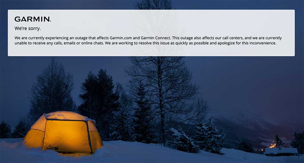
    The outage may be caused by a ransomware attack. The outage was first reported by Garmin July 23. It affects Garmin wearables, apps and call centers, which has made customer support impossible.

    The message on the Garmin Connect website reads, “We’re sorry. We are currently experiencing an outage that affects Garmin.com and Garmin Connect. This outage also affects our call centers, and we are currently unable to receive any calls, emails or online chats. We are working to resolve this issue as quickly as possible and apologize for this inconvenience.”

    Garmin Connect allows customers to obsessively track their exercise performance and fitness goals. FlyGarmin, the navigation service that supports Garmin’s aviation devices, has also been down affecting some pilots, reports ZDNET.

    The ransomware attack has encrypted Garmin’s internal network and some production systems, according to ZDNET. The company is planning a multi-day maintenance window to deal with the attack’s aftermath, which includes shutting down its official website, Garmin Connect, FlyGarmin, and even some production lines in Asia.

    Screenshot: Garmin website
    Screenshot: Garmin website
  • Multi-platform lidar enables digital twin cities

    Multi-platform lidar enables digital twin cities

    Digital twin technology emerged a decade ago to provide 3D virtual replicas of physical assets. Today, with Big Data and internet of things (IoT) capabilities, it is a complex and comprehensive method to support the construction of smart cities.

    Mapping Shanghai with the AlphaUni 900. (Image: CHC Navigation)
    Mapping Shanghai with the AlphaUni 900. (Image: CHC Navigation)

    As a virtual model, a digital city can be an indispensable tool to visualize the life of a city in real time. It provides layered data about buildings, urban infrastructure, utilities, businesses, and the movement of people and vehicles. By providing this information, digital twins enable intelligent urban development and modernization.

    Traditional methods of collecting and representing 2D spatial data, such as maps and images, are insufficient to meet the requirements for digital twin city models, where digital data provides the foundation for large-scale projects.

    For example, the derived 3D models must have a high capacity to be merged and correlated with social or economic spatial data from IoT and Big Data. Because of this, a high demand exists for global, accurate, real-time geospatial data that provides high-precision 2D and 3D information.

    Proof-of-concept

    To illustrate a typical digital cities project, CHC Navigation (CHCNAV) carried out a proof-of-concept demonstration in the Jinshan district of Shanghai for one month in March and April.

    The total area of the Jinshan district is approximately 600 km2. This area contains rich terrain features and typical characteristics of large, modern cities, such as high buildings, power lines, rivers and vegetation.

    Extracted 3D mesh created from the data. (Image: CHC Navigation)
    Extracted 3D mesh created from the data. (Image: CHC Navigation)

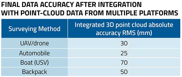
    The traditional method of capturing with a single-platform lidar system may leave some areas blank in the point-cloud data. CHCNAV’s AlphaUni 900 lidar solution, with its multi-platform capability, was able to capture complete data with four different platforms: an unmanned aerial vehicle (UAV), a car, a backpack and a boat or unmanned surface vehicle (USV).

    The AlphaUni series provides optimized data sets powered by advanced GNSS/inertial navigation system (INS) sensors and long-range scanners.

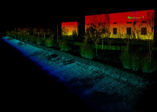
    Point cloud from aboard an Apache6 USV mapping a water channel. (Image: CHC Navigation)
    Point cloud from aboard an Apache6 USV mapping a water channel. (Image: CHC Navigation)

    During the project, the CHCNAV AlphaUni 900 seamlessly integrated the district’s buildings in the data sets and provided a sophisticated 3D image from both indoor and outdoor environments. Its high-accuracy capability and multi-platform design can improve the way high-precision data is collected. It successfully provides an innovative solution for the problems of 3D geospatial data acquisition required for the development of smart cities.

    Table Data: CHC Navigation
    Table data: CHC Navigation