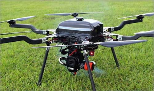
SPH Engineering has launched a new product to make bathymetric surveys of inland and coastal water.
The system — an unmanned aerial vehicle (UAV) integrated with an echo sounder — is time- and cost-efficient. It is suitable for mapping, measuring and inspecting tasks as well as environmental monitoring.
The system allows field workers to collect data with high accuracy quickly. It is easily transported, quickly deployed and twice as cost-efficient as traditional methods.
The UAV/echo sounder system can be operated in hard to reach locations, and unsafe or hazardous environments. Locations not reachable by foot or that are dangerous for a human (steep coasts, mining pits, contaminated waters, terrain obstacles, etc.) as well as waters of ponds, lakes, and canals can be reached by the drone.
“Since autumn 2018 we have been getting bathymetry-related requests,” said Lexey Dobrovolskiy, CTO of SPH Engineering. “Analyzing about 150 inquiries, we have come to the conclusion that a drone-based solution could open a new business opportunity for drone service companies to do bathymetry surveys of coastal and inland water, especially those for industrial needs.
“Compared with a standard approach using a boat or an unmanned surface vehicle, a drone could save a lot for its user,” Dobrovolskiy said. “An echo sounder itself could be integrated into a client’s drone with no need to purchase additional equipment. Moreover, it is small and easy to transport and operate. At the same time, such research method guarantees data accuracy and employee safety.”
Cobham Explorer 323 and Explorer 6075LX terminals receive Inmarsat type approval
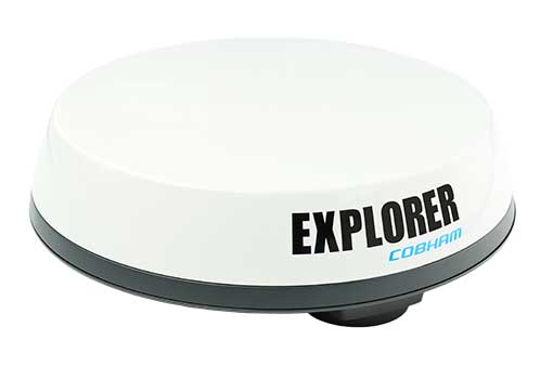
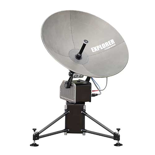
Two Cobham SATCOM land satellite terminals have received Inmarsat type approval. The low-profile vehicular Cobham Explorer 323 BGAN terminal and the auto-point “fly-away” Cobham Explorer 6075LX VSAT terminal are now fully operational on the Inmarsat network with commercial shipments of each beginning immediately.
Explorer-323. (Photo: Cobham)
The new Explorer 323 terminal represents the first class 12, electronically steerable terminal for use on Inmarsat’s L-band Broadband Global Area Network (BGAN). It combines the slimmest form factor of any vehicular BGAN terminal with a number of new innovative features and sets a new standard in robustness due to its lack of moving parts. In conjunction with Inmarsat’s highly reliable network, offering up to 99.9% uptime, it promises a new standard in mobile communications to organisations operating in remote locations across a wide array of industries.
The class 12 terminal features speeds of up to 384kbps, support for BGAN (data and voice) and BGAN M2M (data) operations, and an integrated antenna and receiver, meaning only a rooftop unit is needed. Additionally, the Explorer 323 has an integrated Wi-Fi Hotspot for setup, management and data access. Developed to integrate seamlessly with Cobham’s PRISM PTT+ offering, the Explorer 323 will enable telemetry and voice communications as well as other uses in remote rail operations, utilities, mining, aid and NGO operations, agriculture, public safety and emergency response.
Explorer-6075. (Photo: Cobham)
Inmarsat has also approved the new auto-point ‘fly-away’ 0.75m Cobham Explorer 6075LX VSAT terminal for its high-speed Ka-band Global Xpress service. The new terminal offers the most reliable and stable connection in its class and features a simplified design, enhanced usability, quick setup and built-in WiFi. With a dynamic auto-pointing correction the terminal maintains its connection even in windy conditions or when pushed or moved, optimising its connection constantly. The Explorer 6075LX also features a considerable reduction in weight versus the Explorer 5075GX for greater portability and will support high-bandwidth applications in broadcasting, resilience and field-office operation.
“We are proud to offer these two game-changing terminals to our partners and customers,” said Mike Carter, president of Inmarsat Enterprise. “Their launch follows an important period of industry consultation, innovation and collaboration between Cobham and Inmarsat. With the Explorer 323 ideal for vehicular tracking and communications and the Explorer 6075 optimised for high-bandwidth operations, both terminals improve upon their predecessors and are set to make ultra-reliable connectivity easier to access in the remotest areas, wherever it is needed most.”
“These two new terminals from Cobham prove that there continues to be innovation occurring in both our L-band and Global Xpress networks,” said Todd McDonell, president of Inmarsat Global Government. “For government users, the 6075LX (or GX6075) provides a fast to set up, easy-to-use, automatic acquisition broadband terminal ideal for first responders who need to access communications at a scene quickly.
“In addition, the Explorer 323 provides government users with a way to maintain on-the-move connectivity regardless of the situation,” McDonell said. “When fixed networks become disabled or degraded, due to events such as natural disasters, the Explorer 323 provides an ideal, low-profile system for routing radio and data connectivity and can be integrated with the emergency services’ existing radio and data networks. We thank Cobham for bringing these products to market. We believe that they will help to deliver new capability for a number of government departments and agencies.”
Inmarsat owns and operates mobile telecommunications satellite networks around the globe, and holds a multi-layered, global spectrum portfolio covering L-band, Ka-band and S-band.
Inmarsat has provided global, L-band services for many decades, which are used by governments, the maritime and aviation industries, and commercial users on land, in sectors ranging from mining and agriculture to rail and transportation.
The frequencies used by Inmarsat to deliver these services are different to those used for GPS/GNSS. All terminals approved for use over Inmarsat’s L-band network (and their other networks) conform to international standards.
In the case of GPS, Inmarsat has exceed these standards by a considerable margin.
Open space: the final frontier. These are the voyages of the professional surveyor and their crew. Their mission: to explore and survey strange new lands. To retrace old boundaries and to create new parcels and subdivisions. To boldly go where no one has gone before (unless it has been previously surveyed and platted…)!
With a nod to Star Trek fans (and apologies to Mr. Roddenberry), the surveyor has been the terrestrial version of the Captain Kirk and Science Officer Spock, exploring existing and uncharted territories. While most surveys completed in the modern day are retracements of previous parcels, there are still areas where surveyors are completing various tasks where no one has been before.
There are very few instances where a survey is performed near others. By this simple fact, one can argue that the surveyor is the original social distancer. The real question, however, lies within the determination of the value of the surveyor and if the work we perform is an “essential service.”
This article is not attempting to debate the value of the surveyor versus all the first responders, doctors, nurses, healthcare personnel and the hardworking employees doing their best to keep up with our basic needs. We are here to discuss the challenges faced by the surveyor and how technology has provided much-needed tools for crossing this abyss of doom and despair called COVID-19.
But first, let us talk about how we arrived at this extraordinary time for nearly everyone on the planet.
Photo: LeoPatrizi/E+/Getty Images
Worldwide upheaval or some close facsimile thereof
Every generation has a historical event, moment or era for which they remember exactly what they were doing:
“Greatest” generation (born before 1924): the Stock Market crash of 1929 and subsequent depression
“Silent” generation (born 1925-1945): Pearl Harbor and World War II
Baby Boomers (born 1946-1964): Korean War, the Kennedy assassination, the Moon landing and the Vietnam War
Generation X (born 1965-1980): Reagan assassination attempt, Challenger explosion, death of Princess Diana
Millennials (born 1981-1996): 9/11, Aurora and Sandy Hook shootings
Unfortunately, the series of events leading up to the nationwide shutdown because of the COVID-19 pandemic will unseat most of those events and eras. While previous pandemics (for instance, the Spanish flu of 1918) struck and killed many more people, the mobility of today’s population coupled with instantaneous media coverage provides a much different environment for this situation.
Image: CDC.gov
Obviously, we are not alone, and this virus has spared few countries and races. Different cultures across the globe have adapted for the pandemic in a variety of ways, and the U.S. has faced the same challenges across our diverse environments.
Depending on where one is located, they face a different set of challenges due to the pandemic. Several heavily populated urban areas are subject to a strict lockdown while states with mostly rural areas are less restrictive. One size does not fit all when dealing with limiting public exposure to others, but let us leave the debate of how much restriction is needed to the scientists and public officials. Many today do not agree with the rules we have been dealt with in going about with our lives. That is a discussion for another time and different forum.
Instead, let us discuss what we face going forward with our “new reality” of some form of social distancing and how the need for surveying and geospatial information remains for a large portion of this world. We must simply adapt to this situation with the adoption of new technologies and a revamped workflow.
Everything changes, whether we like it or not
The surveying profession is not unlike many other service-oriented and public-serving occupations, even with most of the field work being performed in solitude. We still deal with clients, governmental agencies, other consultants and the public.
The COVID-19 pandemic has changed the way we are now interacting with those outside partners with technological advances and modified communication conduits. Many of these methods existed well before this situation, but the rapid advancement of the pandemic forced many companies and employees into adapting very quickly.
Surveyors are no different, so let us run through the changes we have seen within the industry.
Project communication
The biggest challenge facing most surveyors in dealing with the pandemic atmosphere has been communication. Whether it is with employees, clients, government agencies or other consultants, communication has been affected mostly because of the elimination of face-to-face opportunities.
Technology to allow remote communication has existed for many years, but not many of us have taken advantage of it because of the convenience of in-person interaction. Who does not want to leave the office to meet with a client, shake their hand and close the deal? Or have the client come to your office and go over the intricacies of a complex survey?
Regardless of whether one is introverted or extroverted, human contact has always helped establish and solidify relationships. For most of us, this is how business has always been done, be it your client or your employees.
Obviously, the biggest area affected has been daily interaction with employees. Controlling workflow, handling projects and troubleshooting any situation is more difficult when the team is not physically in the same location. If a team member is overwhelmed, another one can immediate meet with them and help. Work is easily passed between teammates with little effort.
But working remotely? That takes more effort, consideration and technology to accomplish. Yes, video conferencing has been in place for many years, but mostly in large companies and only implemented it in a dedicated conference room. Not many employees were previously afforded a webcam, microphone and speakers along with the necessary software; all of these components are now standard issue. For many, programs like Zoom, Skype and Microsoft Teams are now a critical communication tool for timely and efficient sharing of information.
What about communication with field crews? Many would say that even a pandemic would not change how we stay in touch with field crews, but even these relationships have been affected. While there are survey companies operating with limited physical contact as a norm (large firms with projects regionally or nationwide), most surveyors still have a substantial amount of direct communication between field and office. This situation has forced many firms to take precautions, with crew members only handling specific pieces of equipment or performing a thorough cleaning if sharing during a project.
Project documents and files have typically been been handled manually with some electronic data files being transferred via email or internet. Depending on the size of the original document, having a full-size paper copy of a previous survey or subdivision plat has advantages to looking at a PDF image on a tablet or computer screen while in the field. Many companies outfit their field crews with 11 x 17-inch printers to be able to print larger detailed areas of bigger documents. Additional care must be taken if these items will still be used for field operations.
Image: Tim Burch
The transfer of data between office and field has become faster, more efficient and safer with technology. As data collectors have become more capable, direct connections via the internet to cloud storage is making transfer of project files and photos faster and more secure by providing immediate backup to guard against data loss. What used to take a trip to the office, connecting to a computer and downloading is now done in a matter of minutes without leaving the job site.
Field personnel are also benefiting from technology within our devices. Apps like FaceTime and programs like Microsoft Teams provide a gateway to video chatting so teammates can discuss projects in real time. Shared pictures, computer screens and face-to-face interaction provides an avenue to more effective communication and enhancing relationships between team members.
The pandemic has forced many surveyors to adapt and learn several new apps and programs to connect in new ways; however, this pandemic has also affected how we go about our field operations, too.
Enhanced data collection
Not many of the surveyor’s field activities are affected because of social distancing requirements, but the pandemic has forced our profession to be compliant with the new rules in case we are in proximity with others. Newer technology, using both terrestrial and aerial platforms, are now being utilized by more surveyors for their data collection needs.
Train employees now. As many companies have seen a slowdown in work due to pullbacks from projects moving forward, now is the time to get employees trained with the new technology and software to be better prepared for when the market comes back.
Using photogrammetry tools. Photogrammetry, lidar and laser-scanning systems are being purchased and implemented for everyday use and not just “special” projects with larger budgets. Not only are surveyors finding it keeps them further away from other people, it also allows for more efficient data collection and representation of existing conditions.
Flying unmanned aerial vehicles. UAVs continue to grow in popularity, and like the other technology discussed above, many firms are investing in becoming remote pilots and implementing aerial photography and lidar into their workflow. Previously, most surveyors (and the general public) would use Google Earth, Bing and other resources for aerial imagery to gain a better perspective on their project sites. Vendors are coming out with aerial products with more recent flights at a higher resolution, but do not offer the ability to extract reliable topographic data easily. In-house UAVs provide more flexibility and control over the information needed, and many are using their downtime to become familiar with aerial products.
Photo: GPS World
Dipping toes into remote sensing. Another sector of surveying equipment seeing increased use during this situation are new total stations with remote-sensing capability. Many surveyors may not have the need for a standalone laser or lidar scanner, so several manufacturers have introduced a total station that provides limited remote sensing for everyday use. While the built-in scanner is not nearly as robust as a traditional remote-sensing unit, it provides enough capability and accuracy for most users. This intermediate step of remote sensing helps a firm decide how much scanning they will produce and if an investment in a full function unit is right for them.
Upgrading GNSS receivers. We would be amiss if we did not mention that more surveyors are now upgrading their GNSS receivers to take advantage of more constellations, integration with IMUs and increased computing power of the latest data collectors. Some surveyors who are not as economically affected during this pandemic are taking advantage of great deals on new equipment and using this time to increase their capability and efficiency. As more satellite vehicles become available, the ability to gain accurate and precise locations is better than ever, so staying ahead of technology is still important in these times. We will continue to see more gains with L5 and L1C signals from the new GPS Block III satellites within the next few years, so staying current now is very important.
QA/QC — The electronic method
One trouble spot seen within the new paradigm is the ability to provide a thorough quality assurance/quality control (QA/QC) process on all surveying operations. Without the ability to print/plot original surveys at full scale, it becomes a more difficult procedure to review and analyze information on a computer screen.
The monitors used for drafting and calculations are getting bigger, but studies have shown the human eye will focus differently on an electronic screen compared to a survey on paper. There must be many other professions and occupations using similar technology who have yet to solve the QA/QC dilemma. Hopefully, our industry will find a way to help address this issue and provide guidance.
Image: Tim Burch
More connected than ever, yet still so alone
The COVID-19 pandemic of 2020 (let us hope that is all it encumbers) will be forever etched in our memories as frightening and unbelievable. More than 100 years has past since the last pandemic of this proportion has overwhelmed our population. We are much more advanced in our education of health, medicines and technology than the previous event, yet we were caught off-guard by the speed in which the virus spread throughout our lands. It taxed most of our health infrastructure beyond its limits and took its toll emotionally and financially to most of the population.
We were forced to adapt very quickly to a new norm of working remotely and independently of our co-workers and teammates. Did it hurt our productivity and profitability initially? Absolutely. Were our employees forced to learn new ways of doing their work and communicating by other means. Yes, they did. Was there a need for rapid troubleshooting of new procedures and task management? Of course. Has every transition of remote work been a success story? I doubt it, but it was not for lack of trying.
We are doing the best we can, and the surveying profession is rapidly trying to adapt. Like the rest of the world, the surveying profession will not be the same coming out of the restrictions placed upon us because of the pandemic. We have learned more about ourselves and how capable we are with tools we have. We also learned how we will transition with these skills into new technology not invented yet.
Surveyors are a tough bunch, so the social distancing and adaptation required to survive the COVID-19 pandemic of 2020 — while not easy by any stretch — has been handled with grace and professionalism. I would say to bring on the next one, but would rather this pandemic be in our rearview mirror quickly and not see anything like it ever again.
One-inch GNSS accuracy in under a minute, delivering seamless high-precision performance across the U.S. and southern Canada
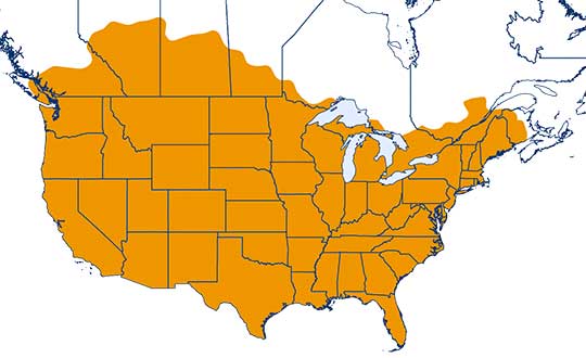
Trimble has completed expanding its CenterPoint RTX Fast correction service, with coverage now spanning the contiguous U.S. and southern Canada. This expansion is central to Trimble’s vision to transform how and where users can leverage precision and accuracy.
Coverage of Centerpoint RTX Fast. (Image: Trimble)
Designed for autonomous applications in both on-road and off-road markets, the coverage and performance of the service enables industry professionals to re-think what is possible when using augmented positioning for improving safety, performance, productivity and operational efficiency.
The CenterPoint RTX Fast subscription service delivers horizontal positioning accuracy of 1 inch (2 centimeters) or less in under a minute, with the versatility of satellite or cellular delivery. This expanded coverage makes it the largest, high-performance GNSS correction network in the world, according to Trimble.
Base stations not required. The service encompasses more than 5 million square miles across North America and Europe. By using the service, said Trimble, farmers, land surveyors and GIS professionals can untether from the cost and complexities of GNSS base stations.
In addition, Trimble RTX Fast offers a single, continuous correction technology platform for enabling a broad range of safety-critical autonomous applications in markets such as automotive, agriculture and construction.
“This achievement is a major milestone in the continuous evolution of our correction service and autonomy strategy. We are delivering unmatched access to fast, reliable, highly accurate positioning in more areas than ever before,” said Patricia Boothe, senior vice president of Trimble’s Autonomy Sector. “Whether enhancing performance in the autonomy ecosystem or simplifying traditional mapping and surveying workflows, RTX Fast users can gain greater accuracy to improve productivity and operate safely — ultimately transforming the way they work and drive.”
CenterPoint RTX Fast subscriptions for Trimble RTX-compatible GNSS receivers are available through Trimble’s Authorized Business Partners or Trimble’s online store.
Qinertia, SBG Systems’ PPK software, now supports third-party IMUs and offers a GNSS post-processing license covering all major GNSS receivers
Screenshot: SBG Systems
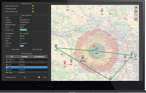
SBG Systems’ INS/GNSS post-processing kinematic (PPK) software Qinertia now covers all surveyors’ projects by offering a license dedicated to GNSS post-processing. Open to the world, Qinertia supports all major GNSS receivers and is now open to third-party inertial measurement units (IMUs).
Qinertia has been designed to offer a comprehensive suite of post-processing software to geospatial professionals. It accepts all major GNSS manufacturers, and supports proprietary protocols from NovAtel, Septentrio, Trimble and u-blox for a straight-forward workflow.
The full-featured post-processing software offers native support for u-blox F9 real-time kinematic (RTK) receivers, reducing the workflow to a simple “drag and drop” to guarantee data integrity and accuracy.
Qinertia has been designed to help surveyors get the most of their surveys easily with a simple workflow, powerful quality control tools and tightly coupled algorithms. All of this is available to any surveyor with the new support of third-party IMUs or GNSS receivers. Several IMUs and inertial navigation systems (INS) have already been successfully integrated with Qinertia including Northrop Grumman’s LN-200 and LCI-100 and the Inertial Sense µIMU.
The new Qinertia GNSS license allows surveyors to post-process both static and kinematic GNSS data. In just a few clicks, surveyors can improve their trajectories, access RTK corrections worldwide, or even control a base-station’s precise location using precise point positioning (PPP) static computations.
GIS and Photogrammetry. Whether they fly a UAV or drive a car, professionals can improve their image location accuracy. Qinertia has been designed to help surveyors get their GIS or photogrammetry projects way more precise, by exporting a centimetric position for each picture at the exact shutter event.
Fibocom’s 5G modules FG150 and FM150 have completed the first data call and end-to-end data transmission services under China Mobile’s Standalone-Structured 5G network. The download rate exceeds 100 Mbps.
Fibocom is a leading provider of cellular embedded wireless module solutions for the internet of things (IoT).
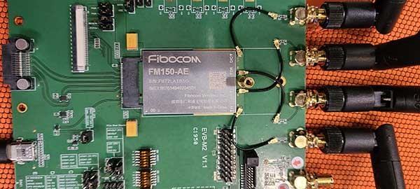
Fibocom FG150 and FM150 5G modules are the first 5G modules based on the Qualcomm SDX55 platform to offer the data-transmission services under the SA-structured 5G network in China, Fibocom said. Its IoT wireless modules incorporate GNSS receivers that receive GPS, GLONASS, Galileo and Beidou signals.
See a test video here:
“Wireless modules are essential for communication between IoT terminals and the base stations. As the world’s leading IoT wireless module solution provider, we are proud that our 5G modules have achieved another R&D milestone in the industry,” said Tiger Ying, CEO of Fibocom. “The completion of the first data call under SA-Structured 5G network is a significant step towards realization of all the three 5G features (eMBB, uRLLC, mMTC) in IoT industry and helps our customers to accelerate the large-scale deployment of 5G industry applications.”
The test was run on the Fibocom FM150 5G module with China Mobile’s 5G SIM card under the n41 network frequency band in the Shenzhen Mobile 5G Joint Innovation Center.
The Fibocom FM150 5G module has been successfully registered on the 5G SA network and established the PDU session. In the 5G SA communication process, the establishment of the PDU session is a symbolic link for successful dialing.
Photo: Fibocom
Fibocom FG150 and FM150 5G modules support both 5G SA and NSA network architectures, providing an integrated multi-network solution that is compatible with the global 5G Sub 6 and millimeter-wave bands. Fibocom 5G modules are compatible with both LTE and WCDMA standards, reducing customers’ investment in the early stages of 5G deployment and helping customers to switch their older product lines to 5G product lines quickly.
Fibocom’s 5G modules have global coverage, accelerating scale deployment of the 5G IoT applications. Applications include: 4K/8K video live broadcast, cloud office (ACPC), drone, robot, AR/VR, 5G virtual dress mirror, 5G cloud game, 5G digital signature, 5G wireless gateway, 5G CPE, 5G SD-WAN, smart grid, telemedicine, connected cars, intelligent transportation system, autonomous driving, smart homes and smart cities.
There’s no question that GPS is an essential service. The Second Space Operations Squadron (2 SOPS) is continuing to provide a global utility during the COVID-19 pandemic.
“No matter what, we need to ensure this mission continues so the American people and the world know they can depend on us to be the gold standard in precision navigation and timing,” said Lt. Col Stephen Toth, 2 SOPS commander. Services that use GPS include ambulances, hospitals, police departments and fire departments.
“It would make a global pandemic that much worse if we were to go down,” Toth said. “It could prevent a lot of the day-to-day things we rely on from happening, it could be catastrophic.”
GPS supports 14 of 16 essential industries in the United States. “We’ll remain reliable no matter what the condition the world is in,” Toth said. “Whether it be a pandemic, hurricane, tornado or any other type of crisis, we have plans and training for whatever threat we may face so the mission doesn’t stop.”
Unlike other jobs across the Department of Defense, those directly conducting operations can’t telework. They need to be in a sensitive compartmented information facility or restricted area in a secured area to access specific terminals and networks.
“The American people can count on space and they can count on our military to continue to provide the level of capability that’s expected no matter what’s going on in the world,” Toth said. “In times of crisis, people shouldn’t have to question whether we’ll be here or not, because we will and the mission won’t stop.”
Welcome to the Space Force
The official Space Force emblem was unveiled on Jan. 24.
Organized as a military service branch within the U.S. Department of the Air Force, the newly created Space Force has taken the reins of the GPS program.
Established on Dec. 20, 2019, under the Fiscal Year 2020 National Defense Authorization Act, the Space Force will be set up over the following 18 months. Commander of U.S. Space Command, Gen. John “Jay” Raymond, was sworn in Jan. 14 as the first chief of space operations of the U.S. Space Force, and is stationed at the Pentagon.
The same staff who have operated satellites and conducted space activities in the Air Force are continuing under the Space Force. Under the Space Force are the Space and Missile Systems Center at Los Angeles Air Force Base and the GPS Master Control Station, operated by the 50th Space Wing’s 2nd Space Operations Squadron (2 SOPS) at Schriever Air Force Base, Colorado. The 50th Space Wing is under Space Operations Command, located at Vandenberg Air Force Base, California.
25 years. The U.S. Space Force celebrated the 25th Anniversary of GPS reaching Full Operational Capability (FOC) on April 27, 2019. Over the past 25 years, GPS has become an integral technology that affects the lives of billions of people across the world.
Check out more case studies where GPS and inertial technology are supporting defense missions.
Featured image: U.S. Space Force / Kathryn Calvert; Capt. Jeff Wagner discusses a routine health check on a GPS satellite. 2 SOPS performs the command and control mission for the constellation.
In the United States, trucking companies and the Army are both developing systems to automate moving groups of trucks. While trucking companies are mostly interested in “platoons” of trucks drafting off of each other to save fuel, the Army wants its “convoyed” trucks to be hundreds of meters apart to improve their chances of surviving an enemy attack.
Battlefield challenges
While the biggest danger for platoons of commercial trucks is crashing, military convoys can be threatened by attacks with improvised explosive devices (IEDs) or rocket-propelled grenades.
Civilian truck drivers also benefit from a robust infrastructure, said Bernard Theisen, division chief for Ground Vehicle Robotics at the U.S. Army’s Ground Vehicles Systems Center (GVSC). For example, nearly all platooning trucks are limited to using roads and highways that have been mapped at centimeter-level resolution with lidar, can communicate over 3G or 4G networks, and have excellent GNSS signals. “I would love to have all that information,” Theisen said, “every time I send a robotic convoy vehicle out there.”
By contrast, the military must design a system that assumes “no comms, no prior data, and no infrastructure,” Theisen explained. “Sometimes a bridge that used to be there has been blown up or we may have put a new bridge across the water overnight. A building that was there yesterday got blown up and is now blocking the road. You cannot pre-plan that in the map and expect it not to change.”
Nevertheless, the civilian and military efforts share some challenges, Theisen acknowledged, including “perceiving the world, understanding it, processing the data, and making the right decisions.” Unlike robots, humans are very good at coping with the unexpected. “You can only train a robot so much, there will always be situations that it does not know how to handle.”
In a military convoy, every fourth or fifth truck may have a mounted gun to protect the convoy. The convoy will typically include one or more ambulances, wreckers and fuel tankers. “It is a different application than for Amazon or FedEx to send a couple of trucks down the highway,” Theisen said.
Leader-follower
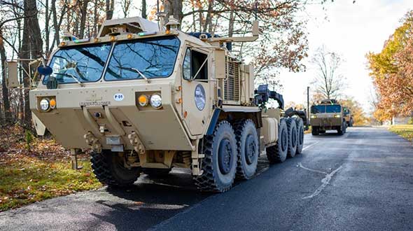
In leader-follower applications, GVSC installs the same hardware on all its trucks. “This facilitates software maintenance, because you don’t need to have different versions,” Theisen said. If the convoy’s leader is disabled from a mechanical or battlefield issue, it is easy for a soldier on the next truck to authorize his truck to take over as the convoy’s new leader. “We have also created cases where the leader takes that road months ahead of the followers,” said Alberto Lacaze, co-founder and president of Robotic Research. “So, the leader does not need to be a part of the convoy.”
Rough terrain doesn’t affect navigation, except that in hilly terrain trucks might have more side-to-side drift than in a flat area. “We often use a three-axis IMU [inertial measurement unit] instead of a two-axis IMU, which might be all you need for a commercial application on flat roads,” Theisen said.
“The commercial problem is almost like carrying a group of trailers that are not mechanically connected,” Lacaze said. It is crucial to be able to tie in the vehicles’ low-level controls so that they maintain a very short separation. If those vehicles were trying too hard to maintain those very close distances by frequently accelerating and decelerating, the fuel-savings advantages from drafting would go away. By contrast, for military applications the exact distance between the trucks doesn’t matter much, but their side-to-side error does. “You would like all vehicles to be driving within one tire width of the lead vehicle’s tracks,” Lacaze said. “That has many advantages — for example, if that road has been demined.”
While commercial and military software largely overlap, their sensor requirements are fundamentally different. “Most commercial vehicles are not checking to see whether there is a crater in the middle of the road,” Lacaze said. Military vehicles need to detect such damage to the infrastructure and respond quickly.
Still, the military is interested in “the gigantic amount of mapping of the available infrastructure” being done by private companies, Lacaze said, because most military convoys are not in war-torn areas, but delivering materiel to bases in areas with some infrastructure.
Robotic modes
GVSC purchases commercial off-the-shelf (COTS) systems and integrates them into its trucks, Theisen explained, producing five robotic modes:
Warning, which consists of “idiot lights” and buzzers alerting human drivers that, for example, they are straying out of a lane or are about to hit something
Driver assist mode, which helps drivers brake, accelerate and steer
Teleoperation, which consists of driving the truck from a remote location
Waypoint navigation, which uses a GNSS waypoint path that can either be pre-programmed or pre-driven and then replayed
Leader-follower, in which the first vehicle leads and potentially any number of vehicles follow.
Regarding the driver assist mode, Theisen pointed out that “all these features are very common in high-end cars and you are seeing them coming into many Class 8 trucks. We don’t do any development in the Army from that standpoint.” Regarding the leader-follower mode, the first truck can be driven in any of the other four modes.
GVSC is the lead system integrator for 30 robotic palletized loading systems (PLSs) that the Army has at Fort Polk, Louisiana, and another 30 at Fort Sill, Oklahoma. Nevertheless, a human driver usually leads the robotic convoy. The driver determines the best route, assesses the situation, and is normally followed by three unmanned systems. “That is why we call our system semi-autonomous,” Theisen said.
The role of GNSS
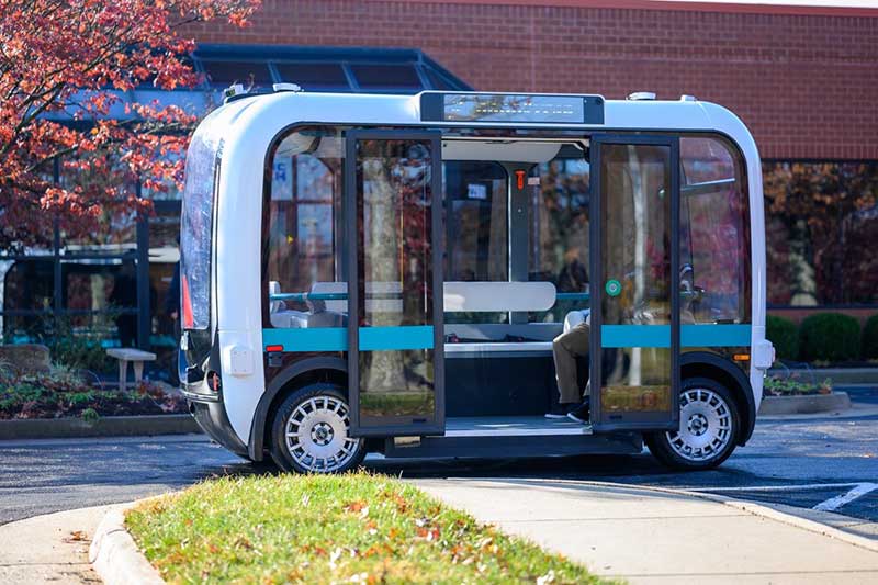
The Olli shuttle, equipped with Robotic Research’s AutoDrive kit, is deployed on busy boardwalks, campuses and public roads. (Photo: Robotic Research)
For both commercial platooning and military convoying, GNSS signals are used for redundancy but not as the primary source of measurement of the distance between the trucks. “None of the systems that we have deployed on the commercial side — for example, with Local Motors vehicles (the Olli shuttle) — rely on GNSS,” Lacaze said, though they will use those signals if available. The high accuracy of their inertial systems make it hard to spoof or jam GNSS receivers, because the system would detect any changes in the GNSS solution and the vehicles would continue running on inertial navigation if the GNSS signal were jammed.
“We assume that we will not have GNSS information because sometimes we are jamming ourselves or are being jammed or the enemy could be spoofing us,” Theisen said. Most of GVSC’s systems use “nav boxes” sold by multiple vendors that enable vehicles to navigate for long periods without GNSS signals. They typically combine one or two GNSS receivers, an IMU or several smaller ones, a combination of wheel encoders or ground sensors to determine ground speed, and a digital compass.
GVSC’s trucks also use lidar to generate voxel maps of their current surroundings, and then share them with the other trucks in the convoy. Each vehicle tracks the vehicle in front of it and can just follow it, if it has insufficient position information or good visual cues.
GVSC looks for the highest possible GNSS accuracy, whether using civilian GNSS receivers or military Selective Availability Anti-Spoofing Module (SAASM) units. “We also take advantage of the future M-code,” Theisen said. “We do have capabilities that the civilian marketplace does not have.”
Remaining obstacles
The remaining bottleneck in the development and implementation of convoys of autonomous military vehicles is the approval process, Lacaze said. “Currently, if we make changes to the autonomy systems, the testing parts of the government are asking us to drive hundreds of thousands of miles before providing approvals. It is still a challenge to figure out at what point these vehicles are safe enough to provide to the soldiers and what the cost of doing so is.”
For these systems to take off, better processors, sensors (cameras, radars and lidars) and algorithms are required, Theisen said. “There is way more sensor data that you can collect and process in real time.”
Featured photo, provided by Robotic Research: Army convoys can stretch for miles. The U.S. Army’s Autonomous Ground Resupply trucks shown here are connected with Robotic Research’s autonomous technology.
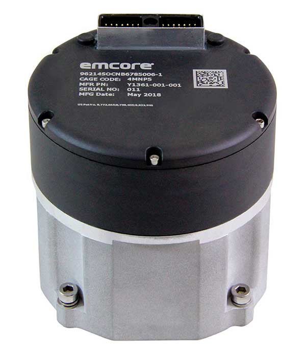
Emcore is offering two inertial measurement units (IMUs) suitable for the defense market.
SDI500 Tactical Grade IMU. Emcore’s Systron Donner Inertial SDI500 is a high-performance MEMS-based IMU that demonstrates true tactical grade performance with 1°/hour gyro bias and 1-mg accelerometer bias stability with very low 0.02°/hr angle random walk. Its performance is based on Emcore’s quartz MEMS inertial sensor technology. The SDI500 is designed to achieve the demanding performance levels required in sophisticated systems applications. Packaged in a highly miniaturized, cylindrical configuration with a volume of 19 cubic inches, it is suitable for use by integrators and OEMs.
The SDI500 is a compact IMU constructed with SDI’s next generation quartz gyros, quartz accelerometers, and high-speed signal processing that achieves tactical grade performance. The SDI500 IMU is rated for rugged military environments.
EN-300 Precision Fiber Optic IMU/INS. The EN-300 inertial system is designed to be compatible in form, fit and function with a legacy equivalent, but with the higher accuracy and performance needed for GPS-denied navigation, precise targeting and line-of-sight stabilization.
It features navigational-grade performance with 0.04°/hr gyro bias and 0.1-mg accelerometer bias stability with ultra-low 0.007°/hr angle random walk.
Internal signal processing provides full stand-alone or aided navigation, and as an option can provide standard IMU delta velocity and delta theta.
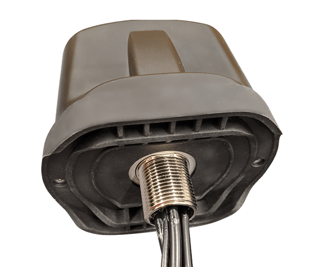
PCTEL has launched its Trooper TRP-20INT platform, featuring models with a purpose-designed footprint to allow seamless installation on the leading 2020 police sports utility vehicles.
Photo: PCTEL
The Trooper TRP-20INT antenna platform supports the high-speed requirements of complex RF communication systems used for critical communications in FirstNet public safety and intelligent transportation systems (ITS).
These antennas feature two 5G elements compatible with leading cellular routers supporting 600-MHz to 6-GHz frequencies. In addition, PCTEL’s proprietary high-rejection multi-GNSS technology is included for high-precision tracking and asset management.
“In order to meet the communication demands of law enforcement, our Trooper TRP-20INT platform was specifically designed for installation on the raised ridges of police vehicle roofs. This method makes installation easier and optimizes RF performance,” said Rishi Bharadwaj, PCTEL’s chief operating officer.
“PCTEL brings strong RF and mechanical design capabilities to develop high-performance antenna systems for deployments in harsh environments in mission critical applications,” added Bharadwaj.
PCTEL also announced its new and improved PCTWSLMR-2 full-spectrum LMR mobile antenna, designed to support the leading OEM multi-band land mobile radios that enable interoperability among emergency management and response personnel. The new antenna incorporates a strong and ultra-flexible spring structure designed for maximum impact shock absorption, providing solid installation integrity even in low overhead-clearance situations.
PCTEL will showcase its new antenna platforms at IWCE, Aug. 24-28, at the Las Vegas Convention Center, Las Vegas, Nevada, booth 1215. Contact PCTEL for more details on product specifications and availability.
Honeywell is providing Leonardo’s helicopter division with a significant cockpit upgrade — Honeywell’s innovative Primus Epic 2.0 — for its AW139 helicopters. Primus Epic 2.0 will deliver better maps, improved situational awareness at night and in marginal weather, and easier access through wireless connectivity, improving safety and saving time. It is track based, meaning navigation follows the actual path of the helicopter and accounts for wind and other environmental factors.
The “synthetic vision” system enables pilots to fly a variety of challenging approaches. Helicopter-specific missions supported include corporate VIP transport, emergency medical services, oil and gas, and search and rescue.
The SmartView synthetic vision system is usable all the way down into the hover, helping pilots navigate during low-visibility conditions. These missions can include steep 9-degree descents into landing areas in challenging terrain and oil-rig approaches. Flight crews will also benefit from a more user-friendly, iNAV map visual interface with easy-to-use displays and an improved cursor that makes map manipulation and menu navigation more comfortable.
“Technology innovations are crucial to reducing pilot workload and making flights safer for crew and passengers,” said Mike Ingram, vice president and general manager, Cockpit Systems, Honeywell Aerospace. “With the Epic 2.0 Phase 8 upgrade, AW139 pilots will not only reduce the time and cost of some operations, especially those in weather and around challenging terrain, they will also experience some of the best safety features available anywhere in the helicopter market.”
The Phase 8 upgrade also increases connectivity capabilities, with Wireless Data Loading that lets pilots access data at high speeds remotely without a hardwire connection, transferring flight plans wirelessly and accelerating preflight actions.
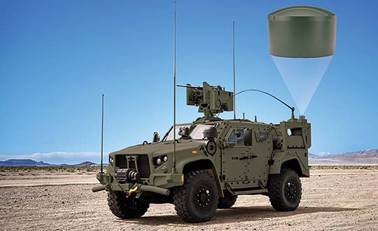
Hexagon | NovAtel launched the GAJT-410ML GPS anti-jam system in 2019. The compact design of the new, smaller version of NovAtel’s GPS Anti-Jam Technology (GAJT) can be rapidly integrated into space-constrained military vehicles (see photo). The system is easy to use while protecting GPS-based navigation and precise timing receivers (including M-code) from intentional jamming and accidental interference, according to NovAtel.
Spoofing, or the ability to give false data to a receiver, is a different challenge from jamming, with potentially even graver consequences. The GAJT portfolio provides protection from both jamming and spoofing to best defend military systems.
Spoofing Detection. As a trusted partner for guidance, navigation and control, NovAtel is developing robust spoofing detection technology that will be available in the company’s product portfolio soon. The additional spoofing information empowers users to make informed decisions about the radio frequency environment they are operating in, alerting them if malicious actors are present. This provides actionable intelligence as part of a layered approach to defend against jamming and spoofing.
NAVWAR Support. NovAtel OEM components and military off-the-shelf items are engineered to deliver precise, assured positioning and timing. Deep GNSS expertise and lean manufacturing capabilities enable the effective delivery of high-performance products in large volumes with minimal production and delivery times. This approach is combined with a high level of support to achieve low product return rates.