Enhanced Oscilloquartz portfolio enables seamless transition to PTP timing from the core to the substation
Photo: Business Wire/Oscilloquartz
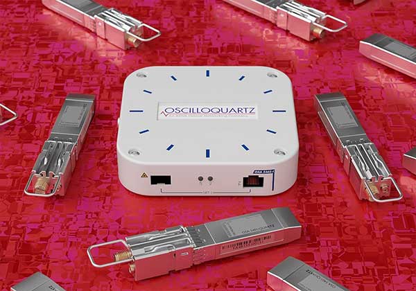
ADVA has upgraded its portfolio of Oscilloquartz PTP grandmaster clocks, enabling power utilities to smoothly transition to packet network synchronization.
The enhanced technology will empower electricity providers to evolve their infrastructure into smart grids based on precision time protocol (PTP) power profiles, while at the same time supporting all legacy timing signals.
Updates to ADVA’s Oscilloquartz pluggable solution, its compact small cell device, its mid-size PTP grandmasters and its fully redundant core timing technology ensure ultra-precise timing throughout a utility network.
The technology also removes the risk of relying purely on satellite-based time sources through continuous monitoring, jamming and spoofing detection and AI-assisted analytics.
ADVA’s entire range of Oscilloquartz grandmaster clocks has been upgraded to meet the latest PTP profiles for time, frequency and phase synchronization in power utility networks. This includes:
OSA 5401 small form-factor pluggable,
OSA 5405 for indoor and outdoor substation deployments,
OSA 5420 Series,
Highly scalable OSA 5430 and 5440 with 10Gbit/s interfaces and fully redundant hardware.
The technologies enable an easy migration to an Ethernet-based timing network with support for PTP, Network Time Protocol and SyncE, as well as IRIG-B, PPS and BITS legacy interfaces.
PTP-based backup combined with multi-band GNSS receivers and advanced monitoring capabilities ensure that the upgraded solutions provide highly reliable delivery of precise timing information even during long GNSS outages.
To create an ePRTC solution, ADVA’s Oscilloquartz cesium clocks can also be combined with the OSA 5420, 5430 or 5440. This delivers extended holdover of up to 70 nanoseconds for 14 days, even when GNSS signals are unavailable.
Particle — an edge-to-cloud internet of things (IoT) platform — is offering a new tracking system that allows organizations to track the locations of a wide variety of mobile assets.
Particle’s Tracker SOM (system-on-module) builds on its tracking services foundation. It provides a powerful GNSS, microcontroller and advanced peripherals in a compact form factor. Tracker SoM serves as an accelerated starting point for organizations that require a tailored tracking solution for sophisticated applications as well as a fully certified foundation for OEMs developing commercial products.
All of the company’s tracking solutions come with a high-gain GNSS antenna accurate to 1.8 meters.
A forthcoming study from Particle surveyed more than 1,000 IoT engineers and industry experts. Asset tracking was ranked as one of the top three most in-demand applications for IoT technology.
The asset tracking system is built on the Particle platform, spanning integrated internet-of-things (IoT) hardware, edge software, connectivity and cloud-based management software. The field-ready solution is configurable.
With it, customers can track the real-time location of critical assets and capture additional intelligence via sensor data including temperature and acceleration as well as remotely control mobile equipment and vehicles.
Research shows Internet of Things growing in use; free IoT maturity tool enables miners to measure readiness
Cover: Inmarsat
The latest research study conducted by Inmarsat, a global, mobile satellite communications company, found that the global mining sector is undergoing an internet of things (IoT) revolution with respondents reporting significant increases in adoption of connected technologies.
Inmarsat employed market research company Vanson Bourne to interview 200 respondents with either decision-making or influencing responsibilities for IoT-related initiatives at organizations of more than 500 personnel.
Mining organizations reported successes in implementing projects to safeguard workers via remote tracking, monitor drilling and observing acid mine-drainage remotely. However, despite this progress, a range of challenges are hindering the sector’s ability to reap the rewards IoT has to offer.
‘The Rise of IoT in Mining is the third IoT-focused research project undertaken by Inmarsat and focuses on the use of, attitude to and predictions for IoT across the global mining sector. As part of the initiative, Inmarsat is also offering mining companies the opportunity to measure their IoT readiness versus the 200 respondents to the survey, using their free online IoT maturity tool.
According to the research, most organizations (65%) have fully deployed at least one IoT project, while 33% are trialling or have trialled a project, with only 2% of respondents not having begun an IoT project.
These findings echo the predictions reported in Inmarsat’s 2018 mining research, where only 2% had fully deployed an IoT solution, 29% were trialling one and 69% were planning on beginning IoT projects within the next two years.
Noticeably, there is a considerable geographical variance in IoT adoption and maturity across different regions, with 98% of North American respondents having successfully deployed IoT-enabled projects, compared with only 50% in Africa and 38% in South America.
While this increase in full deployments represents progress, the use cases and data management are on the simple side and there are many challenges to overcome if the mining industry is to fully realise the potential of IoT, particularly in regard to using it as driver for organisational change.
A lack of skills, investment and cultural challenges, as well as unreliable connectivity, patchy cybersecurity processes and underdeveloped data management processes were also highlighted in the report and will all need to be remedied in the coming years.
“Two years on from our last research, Inmarsat wanted to get a measure of what had changed in the mining industry,” said Joe Carr, global mining director at Inmarsat. “IoT has begun to take a foothold in the sector with increased rates of adoption across the board. What we discovered was an industry that — historically slow to adopt radical ideas — is now beginning to embrace the use of IoT, but still working out how to make the most of it.”
The mining industry faces significant challenges around skills, security, connectivity, investment and data management. These will need to be addressed for the industry to progress past a point of using IoT in a simple, siloed capacity, according to the report.
Despite the challenges being faced, mining organizations are looking to increase their investment in IoT and are overwhelmingly positive about the value that IoT can bring to their operations and the benefits it is either already delivering or will deliver in the future.
“We want to help drive IoT adoption in the mining sector and encourage mining companies to plot a route to IoT success using our free online IoT Maturity Tool,” Carr concluded. “The tool allows miners to understand their progress in IoT adoption across a number of areas and to compare this with the 200 respondents who contributed to our research. Using these findings miners can start to develop a roadmap for improvement and provide a tangible proof point for influencing internal conversations.”
Aceinna was recognized as a partner-level supplier for 2019 and was inducted into the Supplier Hall of Fame in the John Deere Achieving Excellence Program.
Aceinna is a supplier of high-performance inertial sensor modules to John Deere’s operation in Fargo, North Dakota, for autonomous navigation and positioning.
Hall of Fame status is given after a supplier attains a Partner-level rating for five consecutive years. The Partner-level status is Deere & Company’s highest supplier rating.
According to John Deere, “Aceinna has earned this award in recognition of its dedication to providing products and service of outstanding quality as well as its commitment to continuous improvement.” Company employees accepted the recognition during formal ceremonies held on Jan. 29 in Davenport, Iowa.
Suppliers who participate in the Achieving Excellence program are evaluated annually in several key performance categories, including quality, cost management, delivery, technical support and wavelength, which is a measure of responsiveness.
John Deere Supply Management created the program in 1991 to provide a supplier evaluation and feedback process that promotes continuous improvement.
“We are honored to be recognized by John Deere for our fifth straight year for the technical merits of our IMU (inertial measurement unit) and our focus on product quality and on time delivery,” said John Newton, vice president for inertial products. “This John Deere award further adds to the industry recognition that Aceinna has earned over the last couple of years, positioning us as one of the industry leaders and innovators in the autonomous vehicles navigation and positioning space.”
Pointfuse and Leica Geosystems, a Hexagon company, have established a global cooperation and entered into a development agreement. According to the companies, the agreement aims to streamline the use of reality capture in established digital construction, space management and visualization workflows.
This strategic cooperation demonstrates the shared focus of Pointfuse and Leica Geosystems to democratize technology and create intuitive and accessible reality capture tools that bring advanced project efficiencies to their users, the companies added.
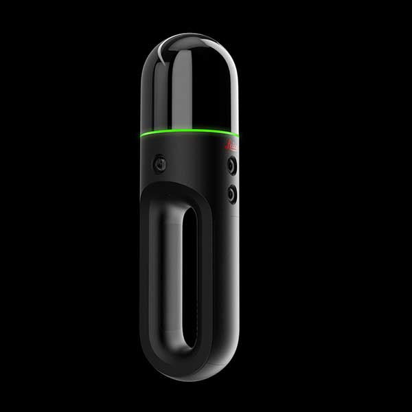
To launch the new cooperation, Pointfuse developed a new version of its Pointfuse software, powered by Jetstream, that provides Leica Geosystems users with a Scan-2-BIM workflow within the Leica Jetstream ecosystem. Pointfuse is configured with tailored profiles specifically for Leica Geosystems 3D laser scanners, including the Leica Geosystems LGS file format. The adoption of the LGS file format enables Pointfuse to extract data contained within the LGS file to assist in the classification of building information and substantially automate the workflow process. This centralized solution ensures a simple Scan-2-BIM workflow for space and facilities management as a companion solution to the new Leica BLK2GO handheld imaging laser scanner, the companies said.
“With functionality and developments implemented specifically for Leica Geosystems users, Pointfuse, powered by Jetstream, harnesses the unique benefits of the Jetstream ecosystem with the power of Pointfuse to deliver a seamless capture-consume-collaborate workflow,” said Steve Salmon, general manager at Pointfuse. “This integrated solution overcomes many of the barriers associated with laser scanning and photogrammetry, through providing an optimised storage solution, instant data loading and production of intelligent outputs. This platform enables Leica Geosystems users to exploit the intelligence captured in the point cloud, easily share outputs, and produce deliverables that drive the advancement of workflows in the digital age.”
According to Quectel, this paper details the challenges eMobility providers face in enabling vehicles such as eScooters and eBikes to be located in deep urban canyons. The white paper also examines why accurate location data will be vital in enabling the ride-sharing industry to comply with regulation to restrict eMobility usage on sidewalks and other areas, Quectel said.
The report also details drive test data conducted on an eScooter in San Francisco. The data demonstrates the enhanced accuracy offered by L1 and L5 plus dead reckoning capability.
Finally, the white paper discusses how the Quectel LC79D is enabling the eMobility industry to harness the fusion of different sensors in a very small footprint at low incremental cost with unparalleled accuracy, the company added.
“eMobility providers face substantial challenges when dealing with location in deep urban environments,” said Mark Murray, vice president of sales for GNSS and automotive at Quectel. “First and foremost, customers need to be able to find the vehicle and cities need to have the assurances that these eBikes and eScooters are operated in mutually agreed locations.”
The all-in-one reality capture capabilities of NavVis VLX include both survey-grade point clouds and high-resolution panoramas. (Photo: NavVis)
NavVis has launched NavVis VLX, a wearable mapping system that captures high-quality data in built environments such as construction sites, staircases and small technical rooms.
The all-in-one reality capture capabilities of NavVis VLX include both survey-grade point clouds and high-resolution panoramas. The combination of high-quality data capture and a compact, economical design will transform the way architecture, engineering and construction (AEC) projects are captured with fast, efficient scanning for BIM and CAD applications, while also extending the scope of projects to new deliverables such as web-based digital twins, the company said.
NavVis VLX is equipped with two lidar sensors and captures survey-grade point clouds using the company’s SLAM technology, which was originally developed for the the NavVis M6 indoor mobile mapping system. NavVis VLX also captures high-resolution panorama images in a complete 360-degree field of view.
According to the company, this wearable device gives the operator more control over where the sensors are scanning. It also allows the user to view and interact with the built-in screen that provides live feedback of what has been scanned and the quality of the data being captured.
“We designed NavVis VLX to provide the AEC industry with a compact, versatile device that efficiently captures buildings and still delivers survey-grade point clouds,” said Georg Schroth, NavVis CTO. “Knowing that there is still an unmet need for high-quality mobile data capture in a wider range of building documentation applications, we set out to develop a more versatile device that can achieve what NavVis M6 does at a smaller scale and on a lower budget.”
According to NavVis, the data captured by the VLX can be applied to a wide range of applications, including conventional building documentation such as CAD drawings and BIM models, as well as to innovative digital twin solutions, such as NavVis IndoorViewer.
NavVis, headquartered in Munich, Germany, is a global provider of indoor spatial intelligence technology and solutions for enterprises. The company also has offices in New York and Shanghai.
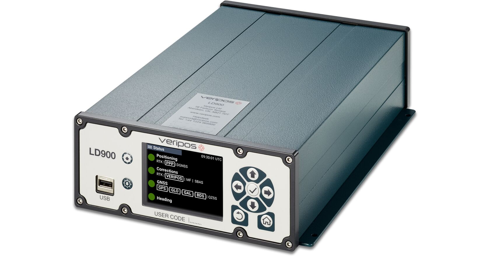
Veripos has released the LD900, a quad-band GNSS receiver capable of tracking GPS, GLONASS, BeiDou, Galileo and QZSS constellations to provide reliable and accurate positioning. Access to multiple GNSS signals allow for better satellite availability and reduce the impact of satellite masking or blockage, which can affect positioning.
LD900 also receives L-band signals on multiple channels, providing access to the worldwide independent correction links and services provided by Veripos. With correction data available simultaneously from up to three correction satellites, the impact of satellite masking can be minimized to ensure reliable reception of correction data. Using the independent L-band RF input on the LD900 allows the connection of a dedicated L-band antenna ensuring optimal reception of correction services, especially at high latitudes, the company said.
Veripos provides accurate and reliable positioning for all marine applications via their redundant positioning and multi-frequency precise point positioning (PPP) Apex and Ultra services.
The Apex5 correction service utilizes all GNSS constellations delivering 5cm positioning accuracy for use in the most demanding offshore applications. Real-time kinematic (RTK) corrections can be utilized by the LD900 for applications where this service is required.
The intuitive color display and navigation menu makes setup, configuration and system status monitoring simple. The display also helps troubleshoot issues with the LD900 allowing faults to be quickly diagnosed and resolved. The LD900 can also be configured remotely through the Veripos Quantum software.
Features and Benefits
Supports decimeter-level multi-constellation positioning with Veripos Apex and Ultra PPP correction services
Multi-channel L-band allows simultaneous tracking of 3 Veripos correction service satellites
Independent L-band RF input
Easy-to-use, intuitive, color display for simple configuration and monitoring
Advanced signal filtering mitigates the effects of interference from other transmitters
Optional ALIGN GNSS heading solution
Optional MSK Beacon receives corrections from IALA marine radio beacon network
Automatic 72-hour rolling data log for incident support
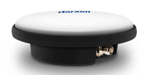
Harxon has launched a ruggedized GNSS antenna for applications subject to high shock and vibration environments such as i-construction machining applications. Integrated with reliable signal tracking and strong anti-interference performance, the IP69K ruggedized HX-CVX600A antenna provides end users with millimeter accuracy, durability and productivity, the company said.
I-construction promotes the use of automated machines on construction sites to improve productivity and provide support to workers.
The Harxon HX-CVX600A offers full support for reliable and consistent satellite signals tracking, including GPS, GLONASS, Galileo and Beidou, QZSS, IRNSS and SBAS, as well as L-band correction services.
By exhibiting a very stable phase center that adopts multipoint feeding technology, exceptional low elevation satellite tracking with symmetric radiation patterns, high gain with ultra-low signal loss, as well as outstanding wide-angle circular polarization (WACP), the Harxon HX-CVX600A performs with remarkable positioning accuracy and provides end users with full control of the job site, performing tasks more productively, meeting tighter positioning specifications, and avoiding rework caused by inaccurate positioning.
The HX-CVX600A GNSS antenna of Harxon also provides superior anti-interference performance. Its advanced low noise amplifier (LNA) excels in improved signal filtering and out-of-band rejection and restrains electromagnetic interference. It also provides strong multipath reduction capacity over all GNSS frequency bands for consistent and reliable GNSS signals, even under complicated environments such as congested urban areas or communication base stations.
The Harxon HX-CVX600A compact and low-profile antenna is Harxon’s first antenna with exceptionally firmness for hash operation environment as construction industry. The upper cover of the antenna is made of material with excellent chemical and high heat resistance. Its aerodynamic enclosure withstands exposure against dust, rain, splash or sunlight. Screws and pole mounts are both available, offering flexible installation.
The Harxon HX-CVX600A ruggedized antenna is now open for pre-sale; contact [email protected].
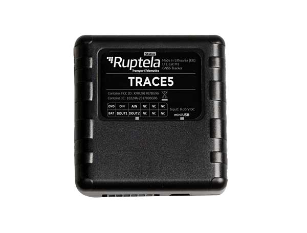
Fast-growing European transport telematics company Ruptela has expanded its global presence to the United States with a tailored ready-to-use telematics solution, the Trace 5 GPS tracker and multifunctional fleet management platform TrustTrack.
The Trace 5 plug-and-play GPS-based automatic vehicle location (AVL) tracker has LTE Cat M1 (4G) connectivity and an integrated battery. It is fully certified according to North American requirements and has a two-year warranty.
TrustTrack is an advanced telematics platform that helps businesses manage their transport resources more efficiently. It connects dispatchers and drivers and enables real-time monitoring and drivers’ management. It also generates trip reports.
To create the North American solutions, Ruptela’s research and development team analyzed the needs of prospective clients and ran product tests on various roads in the United States.
Andrius Rupsys, founder and CEO of Ruptela, calls the release of a telematics solution tailored to the U.S. market a significant milestone in the further expansion of the company. “We are entering the U.S. market confident about our solution for businesses eager to improve their efficiency, whether these are delivery, service fleets, vehicle leasing and financing (BHPH) or car rental companies.
“As a customer-centric company, we always seek to reduce our clients’ efforts by accelerating ease of use, prediction and automation. We believe that with the right measures, less effort can lead to more growth,” Rupsys said.
“Beyond that, our goal is to provide clients with solutions to the issues they are not even aware of yet. To do so, we offer the full solution including hardware and software manufactured and developed in the European Union, which is completed by cellular connectivity and the highest European quality support valued by Ruptela’s clients across the globe,” Rupsys said.
Ruptela also offers individual onboarding (covering software and hardware) and free technical support, which ensures that clients can start using the product instantly. Depending on the expressed need, their manufactured hardware can be bought separately.
For a limited time, first-time users are entitled to a special offer saving them software activation fee and gifting valuable extras.
Highly cost-effective autonomous marine drone for bathymetric surveys
Photo: CHC Navigation
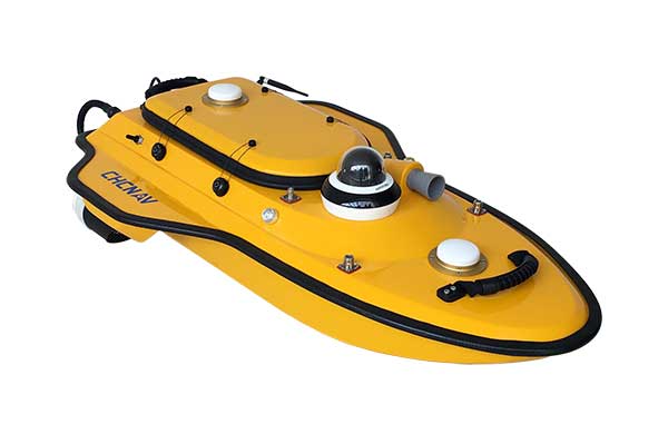
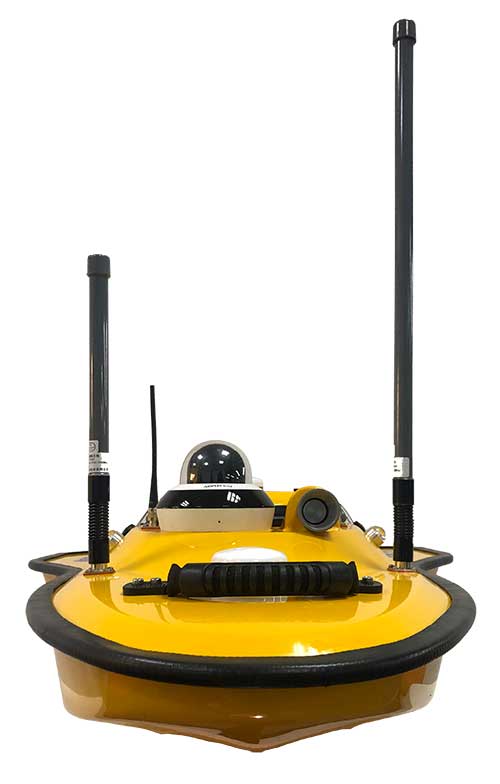
The new Apache3 Marine Drone — 2020 Edition provides a series of new features and additional enhancements to make lake, river and coastal hydrographic surveys more productive, according to maker CHC Navigation.
Combining a dual GNSS positioning and heading sensor, a stable and reliable hull attitude and an inertial measurement unit (IMU) sensor, the Apache3 unmanned surface vehicle (USV) allows an uninterrupted survey while passing under bridges.
Its high-efficiency 8-meters-per-second motors and absolute straight-line technology enable a fully automatic, predetermined course in adverse current conditions.
The Apache3 features include:
GNSS/INS control box to maintain high accuracy during transient GNSS outage
Integrated 4G and LAN transmission module
Sonic radar for obstacle avoidance
Automatic return to base planning
360° PTZ camera (pan, tilt, zoom)
Overspeed engines to allow operation in most water conditions
According to CHC Navigation, the Apache3 — 2020 Edition offers an exceptional feature/price ratio, making it one of the most competitive professional marine UAV solutions for single-beam bathymetric surveys.
Trimble WorksOS is an upcoming civil construction software-as-a-service (SaaS) operating system. The cloud-based system will integrate data from Trimble and third-party providers across the entire civil construction project lifecycle, including estimating, scheduling, designs and the field.
Beta testing is now taking place for WorksOS, before it is released in the third quarter. Users interested in participating can go to WorksOS.trimble.com.
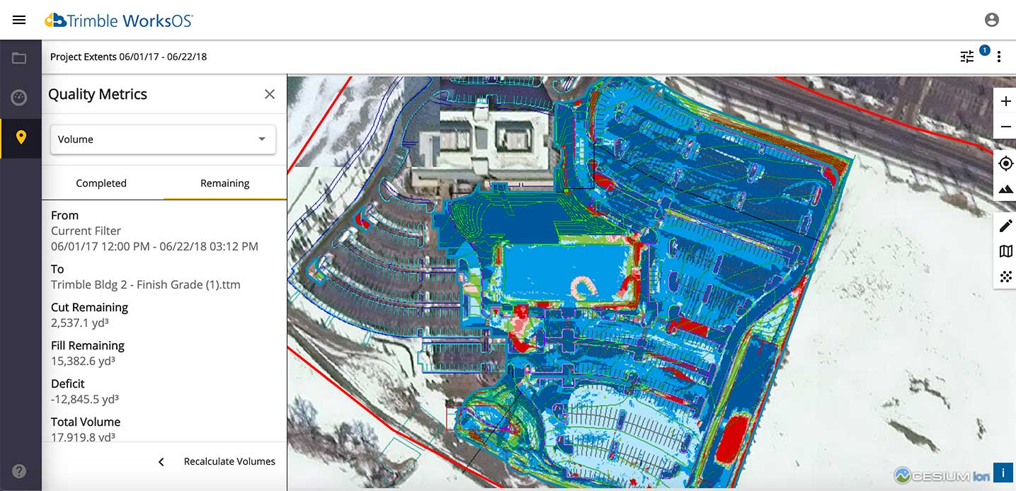
One-Stop Software. With WorksOS, site supervisors and project managers will be able to log into a single application to track daily production quantities, labor and equipment hours, and equipment maintenance schedules. They will be able to view real-time visibility of cut, fill, volume and compaction data to maximize jobsite productivity.
A user-friendly dashboard enables key personnel, including site supervisors, to adjust daily work targets to ensure work is progressing to plan. Site supervisors will also gain live daily volume calculations, compaction quality metrics and visibility into which machine is working, to monitor progress and determine if the project is on schedule.
Software Connections. Connecting workflows, Trimble WorksOS will integrate Trimble Business Center, Trimble WorksManager, Trimble Siteworks Positioning System, Trimble Earthworks Grade Control Platform and Trimble PULSE Fleet and Equipment Management Software.