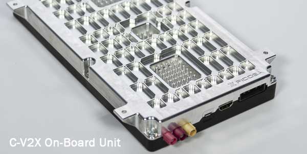
Qualcomm Technologies’ 9150 C-V2X Platform, among several other products from automotive and infrastructure suppliers, has completed certification in accordance with the European Radio Equipment Directive (RED) Certification in Europe, a requirement for placing radio equipment on the market.
This is a major step forward toward the commercial introduction of cellular vehicle-to-everything (C-V2X) in Europe, the company said. C-V2X is a global solution for vehicle-to-vehicle and V2X communication, designed to enhance road safety and facilitate smart transportation systems. C-V2X establishes the foundation to support safety use-cases with a path for integration into next generation 5G technologies, while tapping into the broader 3GPP ecosystem to drive wider adoption. With its evolution to 5G New Radio, C-V2X offers rich and differentiated experiences consumers continue to demand as we usher in the world of 5G and autonomy, the company added.
A new European Standard defining the use of C-V2X as an access layer technology for Intelligent Transportation System (ITS) devices was recently approved through the European Telecommunication Standardization Institute (ETSI). According to Qualcomm, all the ETSI standards and specifications that define other ITS protocols above the access layer have been updated to support utilization of C-V2X as the underlying access layer. These standards and specifications have been included in the ETSI ITS Release 1 specification set and provide the basis for development of interoperable C-V2X ITS implementations and devices from multiple vendors.
Several products, all of which feature the Qualcomm 9150 C-V2X chipset solution, have achieved RED certification, including the Commsignia On-Board Unit, Commsignia Roadside Unit, Ficosa OBU, Kapsch RSU, Savari MobiWAVE 2000 OBU, Savari StreetWAVE SW2000 RSU and WNC module.
“By being one of the very first to achieve the OBU RED certification in June 2019, Ficosa continues its commitment to accelerating and expanding C-V2X as a path to 5G,” said Joan Palacin, business unit director of Ficosa Advanced Communications. “Not only in Europe but also China, USA and globally, we see C-V2X as a key technology to achieve automotive industry challenging safety goals by significantly reducing fatalities on our roads.”
Qualcomm expects early product availability to accelerate adoption of the solution in the region.
Tilt rotation support for automatic excavation, bring-your-own device, mobile apps included
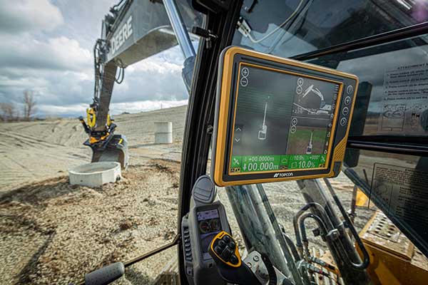
Topcon Positioning Group announces advances to its portfolio of machine control solutions that are designed to provide contractors with better performance and profitability in earthmoving applications. The new solutions include tilt rotator functionality for the Automatic Excavator system, mobile and bring your own device (BYOD) display options, and other additions.
Topcon made the announcement at ConExpo, taking place this week in Las Vegas.
Tilt and rotation for Automatic Excavator
Photo: Topcon
Advanced tilt rotator functionality will allow Automatic Excavator operators to easily swivel or tilt the bucket with automatic boom control for faster and more efficient excavation.
“If excavator operators are in situations such as at the top of the slope, grading a long incline and not totally perpendicularly lined up, positioning the cutting edge of the bucket to the surface is now more easily attainable with the tilt rotator functionality,” said Murray Lodge, senior VP of construction.
“Operators can excavate more quickly, moving the excavator fewer times, with less wear and tear on the chassis — all with the proven hydraulic, automated control the system offers,” Lodge said. “It is also extremely beneficial when navigating around manholes, trenches, and generally tight spaces.
“We have had tilt rotation functionality for a number of years, but in previous systems,” he said. “Now, it will be available for the Automatic Excavator as well. Operators are ready for this tool, and once they see the new capabilities it will bring, they will not want to work without it.”
Bring your own device – MC Mobile
Photo: Topcon
Another resource in the small excavator and compact track loader machine control offering includes bring your own device (BYOD) options that can work as a substitute for control boxes in some applications. This solution incorporates the same hardware for Topcon 3D machine control with an indicate-only option running on Android devices with a free app, Pocket-MC, which is part of the new MC Mobile system family.
“Pocket MC can be downloaded from the Google Store and used right from a phone or tablet either as a simple entry-level machine controller option for contractors who want an inexpensive way to speed up the productivity of their fleet, or as a backup on the job site to a fully featured controller — so, operators are still working, timelines keep moving,” Lodge said.
Pocket MC also allows for a local positioning system (LPS) option for excavation. Now, an LN-150 Layout Navigator total station can be used as an economical alternative to fully featured traditional total stations.
Sitelink3D enhancements
Enhancements also have been made to the Sitelink3D job site monitoring and management system, including a pay-as-you-go point-based service model and a Haul Truck app, giving contractors more visibility into workflow management and the flexibility to use it in the way that best fits their operation.
“These latest releases strengthening the earthmoving portfolio are part of our commitment to continually developing greater connectivity and automation for today’s job site to accelerate efficiency across all aspects of a project,” Lodge said.
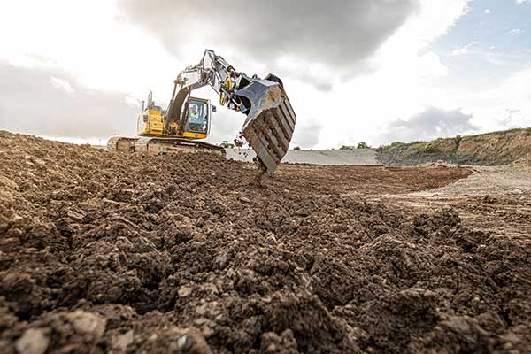
Dynapac and Trimble are partnering to develop commercial-ready autonomy functionality for Dynapac soil rollers.
The companies first demonstrated automation of the soil compaction process at this week’s ConExpo 2020 in Las Vegas, and plans another demonstration during the Trimble Dimensions User Conference Nov. 2-4 in Nashville, Tennessee.
The Dynapac CA3600PD single-drum vibratory roller. (Photo: Dynapac)
Dynapac’s “Road to Autonomy” was launched with the introduction of Seismic Soil Rollers in 2019. The Dynapac-exclusive Seismic technology takes the guesswork out of the equation for operators, regarding soil type or frequency settings, the company said.
Dynapac Seismic monitors the soil properties and automatically adjusts the frequency of vibration for optimal compaction and energy efficiency. The Active Bouncing Control System automatically cuts off the vibration of the drum when the material reaches maximum compaction characteristics.
The next step on the “Road to Autonomy” is automatic steering and speed functions on the roller. The operator/site manager can use the machine to map the boundaries of the area to be compacted.
Once the machine is placed in autonomy mode, the system will take over the controls for steering and speed. This functionality will be shown at the Dynapac and Trimble booths during ConExpo 2020.
By automating these functions, operator skill gaps can be bridged, while consistent speed and steering improve compaction quality results.
The autonomous solution is built on Trimble’s control platform and utilizes Trimble’s field-proven positioning technology. Compaction documentation systems, such as Dyn@lyzer or Trimble CCS900 Compaction Control System, work together with automatic speed and automatic steering to provide documentation of the improved quality.
Trimble’s Earthworks Grade Control Platform version 2.0, unveiled at ConExpo-Con/Agg 2020, includes new features for all machine types.
Trimble also released the Trimble Earthworks Assistant App for in-cab learning material.
ConExpo-Con/Agg 2020 is North America’s largest trade show for construction machinery, building material machines, mining machines, construction vehicles and construction equipment. The Trimble booth is located in the Las Vegas Convention Center North Hall #N-1140.
New Features
The improvements are designed to enable faster return on investment, increase productivity and decrease training time for operators.
Horizontal Steering Control for dozers automatically controls the machine to follow any horizontal alignment such as a back of a curb, breakline, roadway centerline or bottom of slope, without operator assistance.
Augmented Reality for excavators enables users to easily understand 3D models, cut/fill information, slope data and other bench points and reference points on the in-cab display in context, without the need to interpret complex 2D plans or stakes.
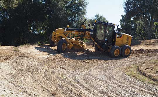
A new mastless motor grader configuration gives operators an improved range of blade motion, allowing for machine control in applications where it was previously not possible.
Integrated Trimble Loadrite Payload Management displays grade control and accurate payload data on one screen, increasing mass haul productivity and efficiency by preventing underloading, and improving safety by avoiding overloading. Contractors can maximize their investment in Trimble Earthworks by leveraging the versatility of these added options.
Trimble Earthworks is also now available for compact grading attachments with dual GNSS, single GNSS and total station guidance options.
Horizontal Steering Control for Dozers
Horizontal Steering Control allows the operator to focus on the grade and machine productivity rather than worrying about steering, reducing operator fatigue and errors. It enables the machine to follow the horizontal guidance from the 3D model, providing operators increased awareness of their surroundings, better accuracy and improved productivity with decreased overlap and fewer passes.
“Trimble is on the forefront of innovation and cutting-edge technology along the path to automation,” said Scott Crozier, vice president, Trimble’s Civil Engineering and Construction. “Using proven steering technology from Trimble Agriculture, we are continuing to advance construction machine control yet again.”
Mastless motor grader
A new mastless motor grader configuration gives operators an improved range of blade motion. (Photo: Trimble)
Trimble Earthworks for motor graders mastless configuration mounts one GNSS receiver on the cab and one on the gooseneck of the machine to eliminate masts and cables traditionally located on the blade. Mastless GNSS receivers are ideal for the blade’s maximum range of motion, which is needed for steep slope work and complex designs with tight tolerances. The new configuration enables contractors to decrease risk of damage to the machine, keep valuable receivers safer as well as reduce the time needed to remove and reinstall them each day.
Augmented reality for excavators
Augmented Reality was first released in the Trimble SiteVision™ system and is now available on excavators with Trimble Earthworks. Using a camera mounted on the outside of the machine, operators can view 3D models in a real-world environment at a true-life scale, in the context of existing surroundings. On the Trimble Earthworks display, the model is overlaid onto the existing ground giving the operator a better understanding of the work that needs to be done. Visibility of the bucket gives operators better situational awareness to be able to keep surrounding people and objects safe.
“With the intersection of physical and digital worlds, Trimble is empowering contractors to accelerate their business,” said Cameron Clark, business area manager, Trimble’s Civil Engineering and Construction. “Augmented Reality simplifies complex concepts by allowing users to see a blend of digital content and real-world environments.”
Earthworks Assistant App
Trimble now has an easier way to access critical Earthworks learning material and documentation, allowing for a shorter learning curve and less downtime for operators. This stand-alone app consolidates and simplifies access to training guides and videos inside and outside of the cab. The Earthworks Assistant App makes it easy to learn and troubleshoot using an Android cell phone, even from remote sites.
Microsoft Azure customers now have access to HERE Location Services within its self-hosted Azure environments. HERE is providing a new set of application programming interfaces (APIs) for developers to build location-aware applications.
Microsoft Azure is a cloud computing service for building, testing, deploying and managing applications and services through Microsoft-managed data centers.
According to HERE, HERE Location Services such as Routing, Geocoding and Map Tiles APIs offer developers useful tools while ensuring high performance for an application’s most critical processes.
Software developers rely on the accuracy and scale of HERE Location Services to incorporate core location-oriented components into the enterprise-grade applications they build and manage, the company said.
The HERE Location Services available for self-hosting in Azure Virtual Machine environments are:
Routing – provides access to and use of global, real-time and historical traffic information.
Forward Geocoder and Reverse Geocoder – provides comprehensive coverage in 196 countries and several territories with a high-precision mapping of geo-coordinates or addresses.
Map Tiles– shows fresh day-time map tiles in multiple styles (for example, base and aerial) including rendered live-traffic tiles for flow overlay.
Applications for HERE Location Services include the following.
Fleet management and emergency services
Create safe and efficient routing solutions for multiple vehicle types
Provide the most efficient routing options based on real-time traffic conditions
Seamless mobility
Provide routing options for pedestrians and public transportation
Help cities run more smoothly with improved traffic flow and transportation network usage
Business intelligence:
Understand trends and behavior of citizens in relation to their location and mobility patterns
Understand shifting market dynamics to inform real-estate investments
Verify insurance claims and authenticate transactions
HERE Location Services are available to Azure customers who want to manage and deliver highly available location-based services. The self-hosted architecture ensures maximum availability and resiliency for Azure customers running critical business applications that rely on “always-on” location services.
“Location anchors our connected world and HERE Location Services enable industries to solve complex challenges while delivering valuable new products and experiences,” said Mithun Dhar, General Manager, Developer Relations at HERE Technologies. “Demands on business require flexibility in software architecture, and HERE is proud to offer robust and high-quality location services to customers operating across public cloud, self-hosted or hybrid environments.”
HERE Location Services are also available as Serverless Functions on the Azure Marketplace. For the latest Azure developer content, go to HERE | Azure Marketplace.
1Spatial has released 1Data Gateway, an intuitive self-service web-portal for handling data validation, data processing and data enhancement.
1Data Gateway forms part of 1Spatial’s Location Master Data Management (LMDM) suite of products which ensures spatial data quality and consistency across the enterprise.
Available in the cloud or on-premise, 1Data Gateway offers internal and external users a secure, fully scalable and customisable product to handle both spatial and non-spatial data files. Transportation and infrastructure companies, government agencies, and utility companies are among the types of organisation that can utilise 1Data Gateway to help improve productivity, lower costs and guarantee control, compliance and data governance, for their data supply chains.
1Data Gateway applies 1Spatial’s renowned rules-based approach to help users manage their data. For organisations dealing with complex and varied supply chains, 1Data Gateway ensures data is checked at source. Using the centralised management of suppliers, partners and rules to create a collaborative approach, it promotes efficiency in data capture and submission across the supply chain.
Users simply upload their data files by dropping them onto the interface and 1Data Gateway applies the high-performance rules that have been pre-configured by an administrator in order to perform validation, correction or enhancement. This process means that users do not require training and can get results within minutes.
Once processed, results can be previewed on a map or downloaded into a local system. 1Data Gateway empowers administrators by providing analytics and dashboard capabilities to track and analyse the quality of the data that groups or organisations are submitting.
“We believe 1Data Gateway has the power to transform the manipulation of spatial data. We’re always driven by the needs of our customers, and in identifying the requirement for an easy to use, yet powerful portal for data quality and integration, we’ve developed 1Data Gateway,” Seb Lessware, CTO, 1Spatial said.
“Our customers need to unlock information contained within spatial data from multiple suppliers, in multiple formats, often submitted via different means. 1Data Gateway provides a single place for data submission, allowing the data to be validated, harmonised, cleaned and enhanced, making it fit for purpose and allowing the insight it can provide to be unlocked. It’s an exciting update to our product range, and should help revolutionise the way organisations manage their data flow.”
The Naval Strike Missile is a GPS-guided long-range, precision strike weapon that can find and destroy enemy ships at distances up to 100 nautical miles. The stealthy missile flies at sea-skimming altitude, has terrain-following capability (it banks to turn) and uses an imaging infrared seeker for precise targeting in challenging conditions. The missile employs a semi-armor-piercing warhead optimized for anti-surface warfare.
According to Raytheon, the missile also is suited for land attack missions because it can climb and descend with the terrain. It was successfully tested in a land-based mobile launcher configuration in 2018 as part of a multination military exercise. In 2019, the U.S. Marine Corps integrated a land-based Naval Strike Missile into its force structure, sharing costs and interoperability with the Navy.
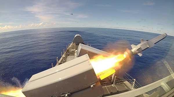
The missile was first fired in the Indo-Pacific region, according to the Navy. Then, on Oct. 1, it was launched from the USS Gabrielle Giffords (LCS 10) during Pacific Griffin, an exercise conducted with the Singaporean navy near Guam Sep. 27 through Oct. 10, 2019.
The OTH-WS program is a long-range, surface-to-surface warfare system intended to offensively engage maritime targets both inside and beyond the radar horizon. The system consists of an operator interface console, Naval Strike Missile, and the Missile Launching System. The OTH-WS is intended to be a stand-alone system requiring minimal integration into the ship’s platform.
The Navy selected the Naval Strike Missile in 2018, with Raytheon as the contractor for its over-the-horizon defense of littoral combat ships and future frigates.
Also in 2019, the Navy conducted a structural test firing of the OTH-WS to assess the integrity and safety of the weapon system installation on the launch platform. The test showed there were no problems regarding integration of the missile launching system with the platform.
The Navy is planning to conduct Initial Operational Test and Evaluation and Live-Fire Test and Evaluation in fiscal years 2020-2022. and is developing a test and evaluation plan and live-fire test strategy.
The USS Gabrielle Giffords launches a Naval Strike Missile during exercise Pacific Griffin. (Photo: U.S. Navy//Chief Mass Communication Specialist Shannon Renfroe/Released.)
Shom, the French national hydrographic and oceanographic office, selected SBG Systems’ inertial navigation systems to renew its fleet.
The office chose the Navsight Apogee inertial navigation systems (INS) for its speedboats and survey vessels for both shallow and deep-water real-time bathymetric surveys and Qinertia PPK software for post-processing tasks.
As a public institution, Shom (Service hydrographique et océanographique de la marine) has three major objectives: national hydrography and cartography, defense support in hydro-oceanographic fields, and support in maritime geospatial products and services for public policies on the sea and the coast.
Shom’s fleet is based in Brest. It is composed of eleven boats, including seven speedboats, and three 59-meter long BH2 survey vessels. They operate on shallow and deep water in France, Africa, the Indian Ocean and in the Caribbean Sea. Shom also uses a fleet based in New Caledonia composed of two boats, one speedboat and a buoy-laying vessel used part of the time for hydrographic surveys.
French agency Shom’s survey vessel. (Photo: Shom)
Renewing the fleet. When it came to renewing the fleet’s INS, Shom looked at INS complying with standards set by the International Hydrographic Organization (IHO) for bathymetric surveys, with a focus on roll and heave that have the biggest impact on the multibeam echo-sounder data compensation.
After having conducted several tests in their official test zone where each element’s location is strictly and precisely known, Shom selected SBG Systems for replacement of its INS.
Shom first acquired a Navsight Ekinox (0.02° roll) for shallow-water survey in New Caledonia, and then decided to outfit the fleet in Brest with the Apogee (0.008° roll).
“The BH2 is highly versatile; it fits both deep and shallow water requirements. Having a homogenized fleet of sensors for speedboats and the BH2 is easier to maintain,” said Rémi Labonde, who is in charge of positioning and hydrographic equipment at Shom.
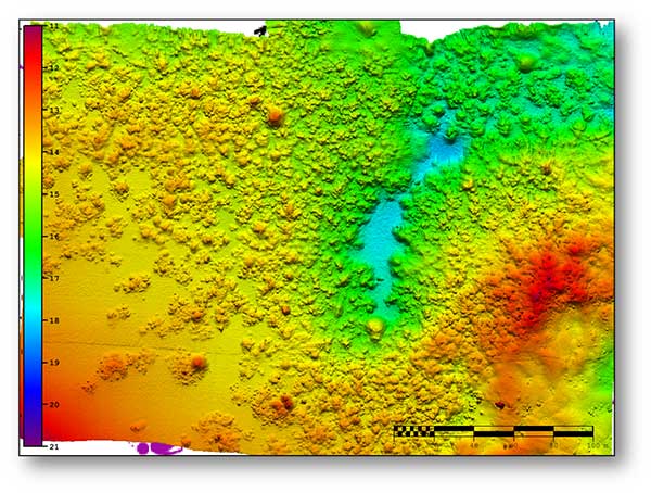
A seafloor survey conducted by Shom. (Image: Shom)
Navsight Apogee INS
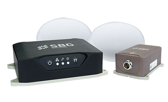
Designed for hydrographers, the Navsight Apogee is composed of a GNSS receiver and a processing unit enabling real-time fusion of inertial and navigation data.
Navsight provides connections to external equipment such as echo sounders and computers. With its titanium enclosure, the Apogee sensor can be installed in the floodable engine compartment, close to the multibeam echo sounder.
Navsight marine solution. (Photo: SBG Systems)
Navsight Apogee is a high-performance cost-effective inertial navigation system based on state-of-the-art micro-electrical mechanical (MEMS) technology, and therefore requires no annual maintenance. The SBG solution includes free unlimited firmware updates and technical support.
Once connected through Ethernet, the Navsight web interface guides the installation. For example, a 3D view of the boat shows the entered parameters so that the user can check the installation in real-time.
The embedded filter also controls and validates lever arms and antenna alignment during this procedure, which can be a plus if the Shom needs to calibrate a new system abroad. “We are big fans of SBG’s web interface. It is modern, extremely clear, and easy to use; it really makes a difference in our team’s work,” Labonde said.
Qinertia post-processing software. Navsight Apogee INS accepts real-time corrections from real-time kinematic (RTK) or precise point positioning (PPP).
In its daily surveys, Shom uses PPP positioning, which doesn’t require installation compared to RTK. It also allows offshore surveying, or even near shore when no RTK correction is available.
SBG Systems’ in-house post-processing software Qinertia fixes data issues due to communication cut-outs. The onboard team checks the data and corrects it with Qinertia if needed.
A roundup of recent products in the GNSS and inertial positioning industry from the March 2020 issue of GPS World magazine.
OEM
NavIC modules
Support both L1 and L5 bands
Photo: Allystar
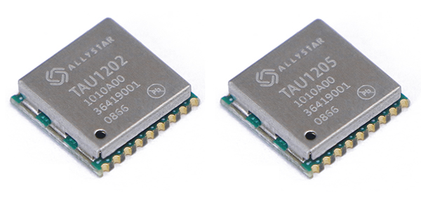
The dual-band multi-GNSS modules TAU1202 and TAU1205 support both the L1 and L5 bands to enhance sub-meter positioning accuracy. Constellations received include GPS, Galileo, GLONASS, BeiDou, QZSS and NavIC. Besides the L1 band, TAU1202 and TAU1205 also support L5/B2a/E5a, which are expected to have lower noise and significantly reduced multipath mitigation because of the higher chipping rate of L5 signals relative to L1 C/A code. TAU1205 supports NavIC (IRNSS), improving navigation in India and the Middle East. Powered by the Cynosure III GNSS chipset and with built-in low-noise amplifier and surface acoustic wave (SAW) filter, TAU1202 and TAU1205 provide higher sensitivity, ensuring exceptional acquisition and tracking performance even in weak signal areas.
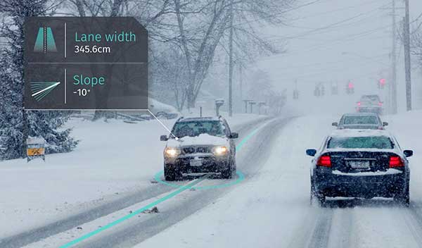
The BCM47765 dual-frequency GNSS module is capable of using the BeiDou-3 constellation’s B2a signals (the Chinese indicator for L5). It can track 30 new L5 signals (60% more) with a significant impact on accuracy. End users will experience much higher reliability of the submeter accuracy inherent to dual-frequency L1/L5. The enhanced L5 signal improves the accuracy of GNSS in an urban scenario by mitigating reflections from nearby buildings (multipath). It also improves GNSS in an open-sky scenario, allowing for submeter accuracy. Second generation dual-frequency GNSS will enable lane-level driving navigation, allowing applications to know in which highway lane a vehicle travels.
The MAC-SA5X miniaturized rubidium atomic clock is a high-performance atomic clock that delivers a wide thermal range, critical performance improvements and other enhancements over previous clocks. The MAC-SA5X produces a stable time and frequency reference that maintains a high degree of synchronization to a reference clock, such as a GNSS-derived signal. Its low monthly drift rate, short-term stability and stability during temperature changes allows the device to maintain precise frequency and timing during extended periods of holdover during GNSS outages or for applications where large rack-mounted clocks are not possible. Operating over a temperature range of –40 to +75 Celsius, the MAC-SA5X is designed to quickly achieve atomic stability performance with a fast lock.
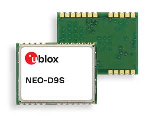
The NEO-D9S GNSS correction data receiver module provides an affordable approach to bringing centimeter-level accuracy to GNSS receivers. The NEO-D9S receives corrections from correction service providers broadcast on the L-band (1525–1559 MHz). A host processor can then decrypt this correction data and provide it to a high-precision GNSS receiver, combining corrections directly with readings from the satellite constellations to enable much more accurate position readings than those offered by GNSS signals alone. Use of the NEO-D9S will also increase the availability of high-precision GNSS positioning data in areas with limited connectivity and reduce the amount of cellular data consumed by positioning receivers. Expected customers are Tier 1 and OEM carmakers, industrial system integrators, and any other applications that rely on very accurate positioning at low cost. The NEO-D9S module is a correction-only receiver. Based on the latest u-blox ninth-generation (D9) platform, it will integrate easily with the u-blox F9 RTK GNSS receivers from u-blox, or can be used as part of a modular product roadmap.
The Qualcomm Snapdragon 720G, 662 and 460 enable enhanced user experiences across connectivity, gaming and entertainment. The new mobile platforms support dual-frequency (L1 and L5) GNSS to improve location positioning accuracy and robustness. The system-on-chip solutions also support NavIC. For the first time on mobile, the Qualcomm Location Suite supports up to seven satellite constellations concurrently, including NavIC.
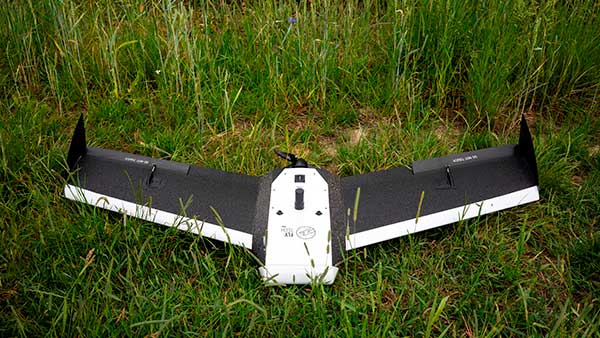
Dedicated to surveying and agriculture, the UAV Birdie is tailor-made, combining intuitive use and high-quality data through precise sensors and GPS RTK L1/L2 onboard. Features include a 24-megapixel camera or optional full-frame 42-megapixel camera; flight time up to 60 minutes; and coverage up to 8 square kilometers in one flight. A vertical-takeoff-and-landing (VTOL) upgrade is available.
Skyfront’s Perimeter 8 drone is equipped with Silvus Technologies’ SteamCaster Radio system, a powerful user-customizable radio system for the military, police and broadcast. The new long-range drone will allow operators to inspect pipelines and other assets as well as conduct long-range surveillance missions. The octocopter can fly for five hours and travel up to 100 kilometers without losing connection from the ground station. Currently, five models are available to suit uses including mapping, lidar and medium, long, or extra-long surveillance. SteamCaster radio system uses the latest beam-forming technology, spatial multiplexing, and space-time coding to ensure the drone can be controlled in environments in which other radio systems are likely to fail. The combination of the technologies allows the range to be increased from 40% to 100%. SteamCaster comes with SteamScape, a network management interface to allow for key metrics and statistics to be viewed and collected in real time. The system also allows the drone to be overlayed onto a map showing the current location and path of the drone.
Delivers critical tools on the ground or in the air
Photo: Robotic Research
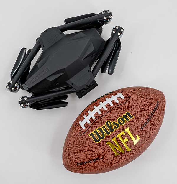
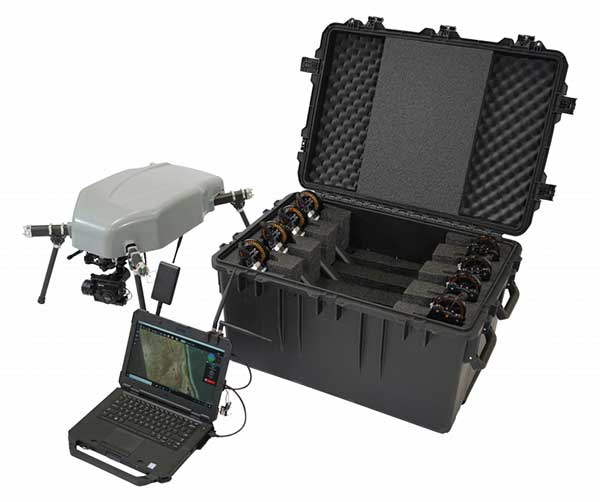
The Pegasus Mini is a smaller version of the Pegasus, a hybrid unmanned aircraft system/unmanned ground vehicle. The Pegasus hybrid UAS/UGV configuration delivers advanced GPS-denied mapping with fully autonomous high-speed flying and driving capabilities. Pegasus Mini is designed to provide the extra reach that a UAV or UGV alone cannot provide. Uses include inspection, rescue, rapid response, and applications that strongly benefit organizations in oil and gas, public transportation, law enforcement, public safety, and more.
The Silent Falcon E1 UAV has completed 500 hours of successful flight testing and operations. It’s maker, Silent Falcon UAS Technologies (SFUAS), is based in Albuquerque, New Mexico. The E1 solar-electric, fixed-wing UAV is noise free, emission free, and provides long-range, low-cost intelligence, surveillance and reconnaissance (ISR) capability. It has a payload capacity of 20 pounds and a ceiling of 20,000 feet above ground level. SFUAS has an application pending before the FAA for type certification of the E1. The 500-hour milestone confirms for federal regulators that it is safe and durable. Silent Falcon aircraft have operated in eight foreign countries and are not ITAR restricted.
The High Definition (HD) GNSS cloud-based solution enables mass-market devices to achieve sub-meter accuracy across the globe. HD GNSS enables lane-level navigation, augmented reality and virtual reality. It combines precise point positioning (PPP) and real-time kinematic (RTK) positioning methods, allowing for fast convergence time, high availability and global coverage. It also supports off-the-shelf mobile devices and internet of things (IoT) trackers equipped with dual-frequency chipsets.
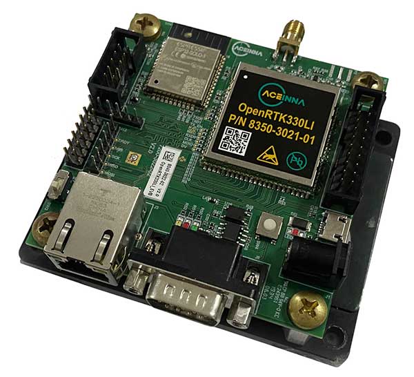
The OpenRTK330L GNSS/INS module is designed for developers creating guidance and navigation systems for autonomous vehicles, robots, drones, industrial, construction and agricultural machinery. OpenRTK330L is a low-cost, high-performance triple-band RTK/GNSS receiver coupled with redundant inertial sensor arrays to provide cm-level accuracy, enhanced reliability, and superior performance during GNSS outages. The module is aimed at automotive, robot, drone, construction and agriculture systems. The multi-band GNSS receiver can monitor all global constellations (GPS, GLONASS, BeiDou, Galileo, QZSS, NavIC, SBAS) and simultaneously track up to 80 channels. The module has RF and baseband support for the L1, L2 and L5 GPS bands and their international constellation signal equivalents.
On April 2, a new museum exhibit will open that focuses on the U.S. Air Force’s role in the management of GPS satellite systems.
The National Museum of the United States Air Force is holding a grand opening event for the new GPS Exhibit from 2-3:30 p.m., with remarks by U.S. Air Force personnel involved with the exhibit followed by light refreshments.
The museum is located at 1100 Spaatz Street, Wright-Patterson Air Force Base, Riverside, Ohio.
On April 2, 2020 a new exhibit will open focusing on the U.S. Air Force role in the management of GPS satellite systems. (Artist’s concept: USAF)
History and Benefits. GPS began as a military navigation tool in the early 1960s. Later, the U.S. Air Force became the lead organization for developing the system. It manages the system, providing highly accurate position, navigation and timing information to users worldwide, for free.
The exhibit describes what GPS is and how it works by outlining satellite and ground systems and their historical development. It explains how atomic clocks and GPS satellites enable all kinds of important activities.
These include mapping and navigation for everyday users and the military, commerce, farming, construction, cell phone systems, the power grid, and climate research.
The exhibit also explains how satellite orbits work, and it outlines the problem of “space junk.”
Hands-on. Interactives and videos help all ages better understand GPS, learn how to find their location on the Earth, and see how orbits and satellites work.
The museum will be open late on opening day, allowing guests to tour the museum until 8 p.m., with an opportunity to walk inside an AC-130A. The Lockheed AC-130 gunship is a heavily armed, long-endurance, ground-attack variant of the C-130 Hercules transport, fixed-wing aircraft.
The exhibit opening will take place in the Space Gallery (fourth building).
Engineers are monitoring in real time the effects on Casablanca’s aging buildings during tunnel construction using a Spectra Precision GNSS receiver.
Vibrations during the construction of a new 1,890-meter tunnel adjacent to Casablanca’s Old Medina, the 250-year-old section of the famed Moroccan city, challenged the stability of its historically important buildings.
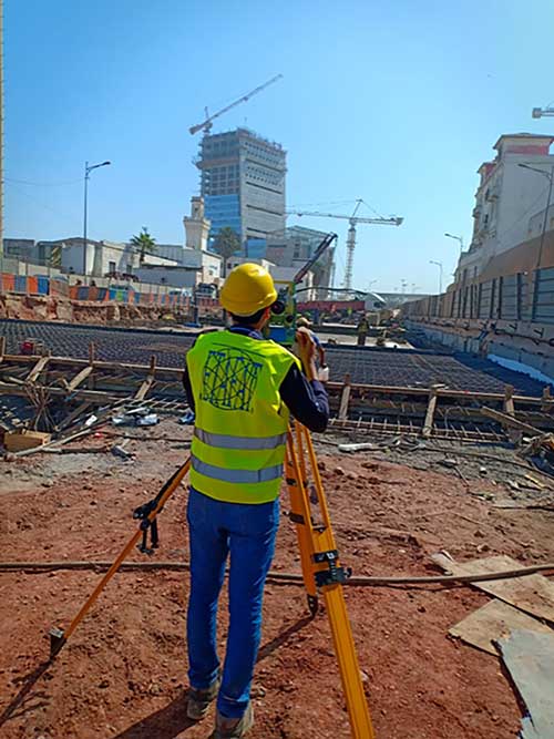
To monitor in real time the effects on the Medina’s aging buildings and to confirm that the construction work meets all engineering standards and guidelines, ETAFAT, a geospatial information acquisition and processing company, used the Nikon XF Total Station to perform more than 100 daily inspections. The ETAFAT team relied on optical targets placed on building facades whose coordinates were determined by forced centering to complete the inspections.
The new Les Almohades tunnel, beneath the Boulevard des Almohades, runs parallel and adjacent to the old Medina. Together with its 380 meters of access roads, the twin-tube tunnel, which carries traffic in two unidirectional lanes in each tube, was constructed to reduce traffic congestion.
According to ETAFAT engineers, the Nikon XF 1” with its fast autofocus function, saved considerable field time. The Nikon XF enabled fast collection of highly accurate observations throughout the monitoring and control of the planimetric and altimetric locations of the structure. The monitoring of the buildings during the various phases of the tunnel’s construction generated a large amount of data essential for understanding the consequences of the work and defining any necessary corrective measures.
The Nikon FX 1,” with its advanced options and Survey Pro software, enabled survey teams to quickly yet accurately perform a variety of other essential field tasks.
These tasks include digital terrain modeling (DTM), cubature calculations, coordinate geometry (COGO) topometric calculations and layout control with customized report generation. The use of Survey Pro software enabled ETAFAT engineers to fully integrate their total station work with their fleet of Spectra Geospatial SP60 GNSS receivers.
The Nikon XF 1” is a mechanical total station that stands up to tough worksite conditions. It is designed to quickly capture accurate measurements, and it offers crisp, clear optics for sighting in both bright and low-light conditions.
Its dual-color touchscreen displays run Survey Pro, Survey Basic and Layout Pro.
It is also equipped to take advantage of the optional Trimble Protected L2P device for asset security to locate lost, stolen or missing equipment. Its hot-swappable batteries reduce downtime and a PIN enhances security in the field.
Using data from GPS receivers and seismographs, three seismologists may have found a way to identify tsunami earthquakes in time to warn people
A few times a century, a medium-sized earthquake causes a large and devastating tsunami. The most recent occurrence was in 2010, when a magnitude 7.8 earthquake off the Mentawai Islands in Indonesia set off a tsunami that was more than 50 feet high in some places, killing 509 people and displacing 15,000.
While rare, these tsunami earthquakes are particularly dangerous because they can hit coastal communities within five to 15 minutes, before officials can issue a warning. Now, however, using data from GPS receivers and seismographs near the 2010 Mentawai event, three seismologists — Valerie Sahakian and Diego Melgar at the University of Oregon and Muzli Muzli at the Earth Observatory of Singapore — may have found a way to identify tsunami earthquakes in time to warn people.
Very large earthquakes under an ocean break both the deeper part of a subduction zone, where one tectonic plate is sinking beneath another, as well as its shallow part, in a rapid motion that creates a tsunami. Tsunami earthquakes, on the other hand, happen almost entirely in the soft, weak section of a fault, moving slower and creating much more movement on or near the sea floor compared to earthquakes of the same size that happen in rigid rock. This creates much larger tsunamis than expected. A tsunami earthquake might have the same magnitude as an earthquake that occurs in rigid rock but produces much less of what seismologists call high-frequency energy.
Currently, officials issue tsunami warnings within tens of minutes of detecting an earthquake above a certain magnitude within a certain distance of a coastal area. This method, however, fails in the case of tsunami earthquakes, which produce tsunamis that are disproportionate to their magnitude.
Indian Ocean (Jan. 2, 2005): A village near the coast of Sumatra lays in ruin after a tsunami struck South East Asia. (Photo: U.S. Navy/Photographer’s Mate 2nd Class Philip A. McDaniel)
Traditionally, scientists have detected tsunami earthquakes by comparing their seismic magnitude with the amount of high-frequency energy they radiate, both recorded by distant stations. Tsunami earthquakes have a very low ratio of energy to magnitude; their energy, instead of strong shaking, produces a large slow movement of the seafloor.
In the past, scientists had to measure this ratio using seismic waves that had traveled from the earthquake’s epicenter to seismographs hundreds or thousands of miles away. This did not give them enough time to identify tsunami earthquakes and warn people before the tsunami’s wave hit the coast.
The recent analysis, however, enabled scientists to figure out a faster way to identify these rare tsunami earthquakes by using two proxies:
data from seismic stations onshore near the epicenters of 16 earthquakes that measured directly how much the ground shook in each case, to determine the amount of high frequency energy in each earthquake, and
data from GPS stations close to the earthquakes, to measure the magnitude of each one on the basis of how much it moved the ground.
The GPS stations used in this study were from the Badan Informasi Geospasial (BIG) network from Indonesia. The data were acquired in real-time but processed with final orbits and clocks using precise point positioning (PPP). The scientists averaged the 3-component displacement, using centimeter-level solutions, and saw 3-10 centimeter vertical displacement.
This methodology, using data available during and immediately after an earthquake, enables scientists to compare the amount of energy in each earthquake with its magnitude, without waiting for their seismic waves to travel to distant measuring stations. Seismologists will be able to use this approach to identify tsunami earthquakes immediately and warn nearby coastal communities before a tsunami wave reaches them.
Citation. Sahakian, V. J., Melgar, D., & Muzli, M. (2019). “Weak near-field behavior of a tsunami earthquake: Toward real-time identification for local warning.” Geophysical Research Letters, 46(16), 9519–9528.