Category: Applications

  • High-Precision GNSS for Smart Transportation

    High-Precision GNSS for Smart Transportation

    Industrial computing specialist Gateworks Corp. has developed a comprehensive solution that brings centimeter-level positioning accuracy to smart transportation.

    Based in Vista, California, Gateworks specializes in industrial-grade single-board computers and wireless communication solutions for embedded systems, serving sectors including smart transportation, smart factories and railway systems. 

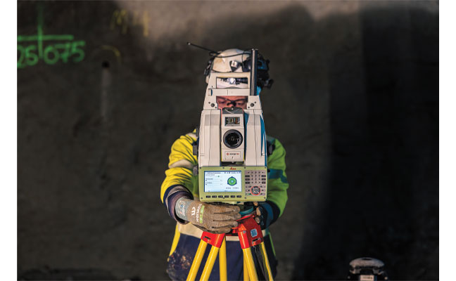
    Application developers working in smart transportation and industrial automation face increasing pressure to deliver solutions that combine high-precision GNSS positioning in variable outdoor environments with secure, low-latency wireless connectivity. The hardware must be rugged enough for harsh conditions while remaining compatible with diverse wireless standards. 

    Compliance and Reliability 

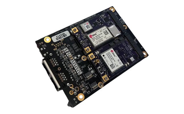
    Gateworks addressed these challenges by developing a modular, all-in-one evaluation platform and high-performance single-board computer development kit. The solution integrates u-blox ZED-F9P precision GNSS receivers, NINA-B301 Bluetooth Low Energy modules and Point One Navigation’s PointPerfect Flex GNSS correction services into one platform.

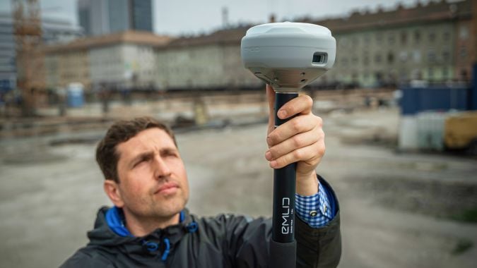
    The core components include the GW16143, a Mini PCIe card that integrates the u-blox ZED-F9P receiver to deliver positioning accuracy of less than 2 cm. The complete GW7200 Development Kit combines the Venice single-board computer with the GW16143 card, GW16132 wireless module and a one-month trial of PointPerfect Flex correction services, along with all accessories needed for immediate evaluation.

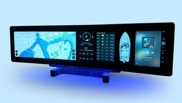
    This approach allows application developers to easily evaluate and deploy precise, real-time positioning and connectivity for smart transportation use cases without extensive integration work. PointPerfect Flex correction data eliminates the need for base stations while maintaining centimeter-level accuracy, which can be particularly valuable for fleet tracking, rail monitoring, health and safety applications, and autonomous vehicle systems. The wireless connectivity ensures correction data reaches GNSS receivers in real-time, enabling continuous high-precision positioning even in remote locations where cellular coverage is available.

    Safety Across Sectors 

    Modern fleet safety systems leverage Gateworks single-board computers to enable edge artificial intelligence processing that analyzes driver behavior and road conditions directly on the device. Modern fleet safety systems leverage Gateworks single-board computers to perform edge artificial intelligence processing, which analyzes driver behavior and road conditions directly on the device. This approach can lower latency compared to cloud-based systems and offers instant alerts for drivers and fleet managers to quickly respond to unsafe driving behaviors. alert mechanisms for drivers and fleet managers to promptly address unsafe driving practices.

    Process data in real time boosts driver safety through proactive monitoring. This results in fewer accidents and lower costs, while also helping compliance with transportation rules. Fleet operators notice notable improvements in safety performance and operational efficiency when they adopt edge-based monitoring systems. 

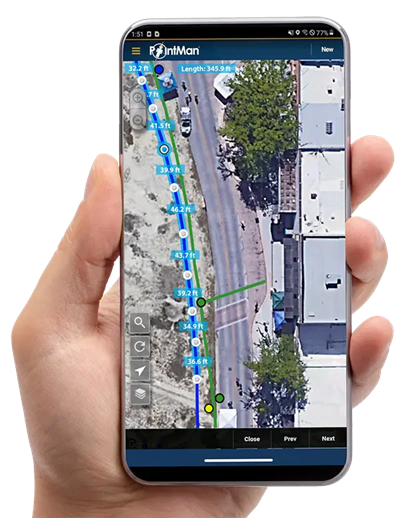
    In the rail industry, Gateworks single-board computers facilitate continuous infrastructure health monitoring through connected sensors that assess track conditions, vibrations and environmental factors. The systems also enable real-time location tracking of maintenance-of-way crews to ensure safety and efficient deployment of personnel. According to Gateworks, operators particularly value the enhanced coordination and safety benefits for on-site personnel working in potentially hazardous environments.

  • Transportation: Norway to Build Deepest and Longest Tunnel

    Transportation: Norway to Build Deepest and Longest Tunnel

    Norway’s geography presents persistent transportation challenges. The country’s complex network of fjords, islands and mountainous terrain forces travelers to rely heavily on ferry systems and intricate routes that can significantly extend travel times between major population centers.

    Norway is building an underwater tunnel, one of Europe’s most ambitious engineering projects, which is expected to boost the country’s transport links and infrastructure. Project Rogfast is a 27 km tunnel that will run 392 m below sea level at its deepest point, connecting the cities of Stavanger, Haugesund and Bergen. Upon completion, it will be both the world’s longest and deepest road tunnel. The project is expected to reduce travel times between these major cities by approximately 50%, while eliminating dependence on weather-sensitive ferry connections.

    “Traveling in Norway takes time. Efficient roads like Rogfast are crucial for progress,” said Trond Valeur, vice president of Skanska Norway.

    Skanska serves as the primary contractor and is executing the project’s construction using a dual-approach method. Two separate teams are drilling and blasting from opposite ends of the tunnel route, with the objective of meeting in the center with a tolerance of 5 cm or less.

    When describing the challenge, Rolf Christian Kværnæs, head of Geomatics at Skanska Norway, said, “It’s like two people sitting across from each other, blindfolded, trying to touch fingers.”

    Why Precision Matters

    The financial and environmental costs of measurement errors in tunnel construction are substantial. According to project data, a deviation of just 10 cm in drilling and blasting operations results in one to two additional truckloads of material removal per session.

    “If we are 10 cm out of a lane, it will build up all the way down. It’s not sustainable or economical to do it twice,” said Anne Brit Moen, project manager at Skanska Norway.

    This precision requirement has prompted the use of continuous monitoring systems that track, verify and record each construction phase to reduce rework. The strict accuracy standards for this type of construction pose considerable technical difficulties. Because underground environments block GPS signals, alternative measurement methods are necessary to ensure precision over the extensive length of tunnels.

    Technology Integration in Extreme Environments

    The surveying team at Skanska depends on Hexagon’s technology daily to ensure precision is up to 5 cm and minimize errors. Hexagon acts as Skanska’s “eyes” underground, without which projects like Rogfast would be impossible.

    “Hexagon’s technology scans, checks and documents everything for us, so we know we don’t have to go back,” Valer said.

    The surveying teams conduct 12 to 18 measurement scans daily using total stations and laser scanners provided by Hexagon. These instruments continuously monitor the tunnel’s alignment and document progress to ensure adherence to design specifications.

    The Skanska team is using several Leica Geosystems surveying instruments, including the Leica TS60 and Leica MS60 MultiStation. The Leica TS60 serves as an accurate total station, specifically designed for demanding precision applications such as underground construction.

    The Leica Nova MS60 MultiStation is a robotic total station that can measure points with an accuracy of 1 mm to 2 mm and capture 3D scans. This dual functionality combines traditional total station capabilities with integrated laser scanning, allowing the same instrument to perform both precise point measurements and comprehensive area documentation.

    In the Rogfast project, these total stations serve as the primary positioning reference system. They establish control networks throughout the tunnel construction, providing fixed reference points from which all other measurements are taken. The robotic capabilities enable automated target tracking and measurement, reducing human error and increasing efficiency in the confined underground environment.

    The hardware components work in conjunction with Hexagon’s data processing software, which manages the massive datasets generated by continuous scanning operations. Hexagon’s Geosystems division provides digital solutions that capture, measure and visualize the physical world, enabling data-driven transformation.

    The software processes raw measurement data into actionable information, comparing actual construction progress against design models and generating reports that identify areas requiring correction. This integration allows project managers to make real-time decisions based on accurate spatial data.

    Project Timeline and Scope

    Project Rogfast represents one of several major infrastructure initiatives designed to improve transportation efficiency across Norway’s challenging terrain. The tunnel’s completion, set for 2033, seeks to establish new technical benchmarks for subsea construction while addressing long-standing regional transportation limitations in Norway.

  • Researchers demonstrate centimeter-level positioning using smartwatches

    Researchers demonstrate centimeter-level positioning using smartwatches

    University of Otago – Ōtākou Whakaihu Waka researchers have developed algorithms that improve the precision of location tracking in smartwatches.

    Led by Associate Professor Robert Odolinski, a visiting researcher with Google from Otago’s School of Surveying, the research team demonstrated that a smartwatch determined its location with centimeter-level precision over four hours with a stationary setup. The result was achieved by using the Google GnssLogger app and combining precise signals from several GNSSs.

    The research was done in collaboration with Google’s Android Context group and the Chinese Academy of Sciences. Results are published in the scientific journal GPS Solutions.

    For decades, achieving centimeter-level positioning has required industries such as surveying, construction and engineering to invest in expensive GPS equipment.

    “While the use of the so-called carrier-phase signals has long been known to improve the positioning performance, the specialized antenna and receivers needed for this have traditionally come at a cost far beyond the reach of many who would benefit from the technology. This is just the beginning of what wearable high-precision positioning can potentially achieve.”

    GPS was introduced in a wearable watch in 1999, but hardware and power consumption limitations prevented it from tracking the carrier-phase signals needed for high-precision results. Recent advances in smartwatches now make this possible.

    Precise centimeter-level positioning on a smartwatch during 4 hours of data in Dunedin, New Zealand. The dots show the repeatability of one second of data in comparison to precise benchmark coordinates. The repeatability of the positioning is about 8 cm, at most twice as large as the smartwatch diameter of 4 cm (displayed to scale).

  • UAV Navigation-Grupo Oesía integrates Iridium terminal into flight control system

    UAV Navigation-Grupo Oesía integrates Iridium terminal into flight control system

    UAV Navigation-Grupo Oesía, a developer of flight control systems for UAVs, has completed integration and validation of ATMOSPHERE’s Iridium terminal into its VECTOR family of flight control computers. The integration was tested in flight conditions.

    ATMOSPHERE’s Iridium terminal has been integrated into UAV Navigation-Grupo Oesía’s flight control system via RS-232 serial communication. The integration enables command and control beyond visual line of sight.

    During flight tests, the communication link remained stable, with telemetry performance comparable to traditional radio systems.

    The guidance, navigation and control system allows autonomous operation without requiring a control station link during flight. The integration supports two-way communication for mission updates and re-tasking. UAV Navigation-Grupo Oesía said the integration expands options for beyond visual line of sight operations.

    The integration is part of the company’s effort to enhance operational capabilities for its clients. The system’s interoperability has been expanded to work with additional communication infrastructures and mission profiles. Iridium’s global coverage and low-latency service enable operators to maintain control of platforms in remote areas, over oceans or in environments where radio links may be unavailable.

    The development applies to defense, security and industrial applications where beyond visual line of sight (BVLOS) operations require reliable communication. UAV Navigation-Grupo Oesía provides autonomous flight solutions.

  • Greenland is twisting and stretching, GNSS data shows

    Greenland is twisting and stretching, GNSS data shows

    Greenland is being twisted, compressed and stretched, according to researchers in the Department of Space Research and Space Technology of the Technical University of Denmark (DTU Space). As a result, the entire island has shifted northwest over the past 20 years by about 2 centimeters per year.

    GNSS data shows plate tectonics and movements in the bedrock caused by the melting of large ice sheets, reducing pressure on the subsurface. The pressure is easing both because large amounts of ice have melted in Greenland in recent years, and because the bedrock is still affected by the enormous ice masses that have melted since the peak of the last Ice Age around 20,000 years ago.

    Horizontal land motion observed by the 58 GNET stations used in this study, processed in the IGS14 reference frame. Their location is shown by the colored circles together with their labels. The boundaries of Greenland's drainage basins are shown in green with numbers (1) to (7b). The Greenland Ice Sheet (GrIS) is represented in white and peripheral glaciers in Greenland (GrPG) and Arctic Canada (CanPG) are highlighted in black and purple respectively. (Image: Study authors)
    Horizontal land motion observed by the 58 GNET stations used in this study, processed in the IGS14 reference frame. Their location is shown by the colored circles together with their labels. The boundaries of Greenland’s drainage basins are shown in green with numbers (1) to (7b). The Greenland Ice Sheet (GrIS) is represented in white and peripheral glaciers in Greenland (GrPG) and Arctic Canada (CanPG) are highlighted in black and purple respectively. (Image: Study authors)

    The new measurements are based on 58 GNSS stations placed around Greenland. They measure Greenland’s overall position, elevation changes in the bedrock, and how the island is shrinking and stretching. The movements are causing Greenland to both expand and contract horizontally. The effect is that Greenland’s area is currently being “stretched out” and becoming slightly larger in some regions, while others are being “pulled together.”

    ”Overall, this means Greenland is becoming slightly smaller, but that could change in the future with the accelerating melt we’re seeing now,” said DTU Space postdoc researcher Danjal Longfors Berg, lead author of the article in the Journal of Geophysical Research.

    It is the first time the horizontal movements have been described in such detail.

    ”We have created a model that shows movements over a very long timescale from about 26,000 years ago to the present. At the same time, we have used very precise measurements from the past 20 years, which we use to analyze the current movements. This means we can now measure the movements very accurately,” Berg said.

    Important for surveying and navigation

    The new research provides useful information about what happens when climate change hits the Arctic with accelerating speed, as is the case in these years.

    ”It’s important to understand the movements of landmasses. They are of course interesting for geoscience. But they are also crucial for surveying and navigation, since even the fixed reference points in Greenland are slowly shifting,” Berg said.

    The GNSS stations are owned by the Climate Data Authority under the Ministry of Climate, Energy and Utilities. They are used for research purposes and operated in collaboration with DTU Space. The research is conducted under the DTU Space research center Center for Ice-Sheet and Sea-Level Predictions (CISP).

  • Adaptive model shields real-time positioning from ionospheric chaos

    Adaptive model shields real-time positioning from ionospheric chaos

    For users relying on centimeter-level accuracy — such as surveyors, engineers and autonomous systems — ionospheric disturbances can mean system downtime and significant losses. Traditional network real-time kinematic (NRTK) positioning methods assume smooth ionospheric conditions and thus fail during active solar periods.

    To meet these challenges, a research team from Wuhan University and Guangzhou Hi-Target Navigation Tech Co. Ltd. developed an NRTK positioning model capable of maintaining centimeter-level accuracy under intense ionospheric disturbances.

    This approach could serve as the foundation for next-generation, self-correcting navigation systems that operate reliably under any atmospheric condition.

    The study (DOI: 10.1186/s43020-025-00179-4), published in Satellite Navigation on Oct. 6, introduces a dual-optimization framework that integrates real-time ionospheric indices with adaptive functional and stochastic models. By learning from disturbance patterns and automatically recalibrating user-side algorithms, the system dramatically enhances GNSS reliability during the ongoing solar cycle peak — offering a key safeguard for positioning technologies in low-latitude regions most vulnerable to ionospheric turbulence.

    The innovation centers on leveraging the rate of the total electron content index (ROTI), a key indicator of ionospheric activity, to dynamically adjust both ionospheric residual estimation and observation weighting. When the system detects disturbances, it automatically reduces the influence of affected satellites and refines error models in real time.

    Using data from Hong Kong’s Continuously Operating Reference Station (CORS) network — one of Asia’s most active low-latitude regions — the researchers found that ROTI showed a strong positive correlation (0.91) with ionospheric interpolation errors and a negative correlation (–0.9) with signal-fixing rates.

    Compared to conventional NRTK methods, their adaptive “Method B” improved horizontal and vertical positioning accuracy by 37.6% and 41.6%, respectively. Moreover, it achieved a stable 84% average fixing rate, even during equinoctial months when ionospheric scintillation is strongest. The results reveal not just a technical upgrade but a practical solution for real-time navigation across regions frequently affected by solar-induced ionospheric noise.

    “Our method essentially teaches GNSS systems to think smarter under stress,” said Xiaodong Ren, senior researcher at Wuhan University and lead author of the study. “By allowing the model to ‘sense’ and adapt to space-weather disturbances in real time, we’ve moved beyond static correction systems toward intelligent positioning. This is crucial not only for maintaining accuracy but also for ensuring resilience as solar activity intensifies.”

    He added that this approach could serve as the foundation for next-generation, self-correcting navigation systems that operate reliably under any atmospheric condition.

    This adaptive NRTK framework marks a significant leap forward for industries that depend on precise, real-time location data — from autonomous driving and drone surveying to precision agriculture and infrastructure monitoring, Ren said. By integrating live ionospheric monitoring into everyday positioning workflows, it ensures continuous accuracy even when solar storms strike.

    Future developments may combine the model with artificial intelligence and multi-constellation GNSS networks to further enhance forecasting and resilience. As Earth moves through one of its most active solar cycles, Ren said, such innovations will be essential to keeping navigation, communication and automation systems firmly on course.

  • RIN conducts survey on maritime GNSS interference

    RIN conducts survey on maritime GNSS interference

    The Royal Institute of Navigation (RIN) Maritime Working Group is investigating GNSS jamming and spoofing in the maritime sector, starting with a survey. The survey is “aimed at anyone in the maritime sector who has experienced GNSS interference and who can provide us with further information on the impact that it is having,” the group stated.

    Interference have been pervasive for years now in areas such as the Baltic Sea and the Black Sea. In the Strait of Hormuz alone, almost 1,000 ships per day experience GNSS interference, impacting crew safety and the security of their cargo. Collisions and groundings are a very real threat, with the Frontier Eagle and MSC Antonia accidents being the most recent examples.

    The RIN will be producing a report similar to the September 2024 OPSGROUP report that focused on GPS spoofing in the aviation sector.

    The survey is available on the RIN website.

  • Emlid launches GNSS receiver line to simplify precision positioning

    Emlid launches GNSS receiver line to simplify precision positioning

    Emlid has introduced a new generation of all-band RTK receivers including the Reach RX2, Reach RS4 and Reach RS4 Pro. They are built for surveyors, GIS specialists and construction teams seeking reliable, high-accuracy positioning with consumer-level ease of use. This EU-based developer of high-precision GNSS receivers and software is on a mission to make professional-grade precision simple, fast and scalable.

    The Reach RS4 and RS4 Pro mark a significant step forward from previous Emlid models, combining rugged engineering with faster workflows and uncompromised accuracy. The flagship Reach RS4 Pro introduces innovative camera-vision technology that blends traditional RTK with visual positioning to cut survey time and simplify work in complex environments.

    Image: Emlid
    Image: Emlid

    Both receivers support all-band RTK reception (L1/L2/L5/L6) across every major satellite constellation, ensuring consistent performance even under canopy or in urban canyons. An integrated antenna system with diversity LTE, dual-band Wi-Fi and Bluetooth provides a clean GNSS signal and stable fix, while the Emlid multi-band radio system — up to 2W and interoperable with third-party gear — offers flexible correction transmission at 450MHz and 915MHz for both licensed and licence-free use.

    Further enhancements include next-generation IMU tilt compensation that initializes up to five times faster than before, a durable magnesium alloy body with IP68 protection, and Made for iPhone certification enabling smooth integration with iOS applications such as Esri ArcGIS. A new quick-release survey pole mount ensures fast and accurate setups, even when tilted.

    AR-based stakeout and measurement from images. Building on the RS4 platform, the RS4 Pro adds dual factory-calibrated full-HD cameras that enable augmented reality (AR) stakeout and measurement from images. The AR interface projects geometries directly in the Emlid Flow app, guiding users intuitively to stakeout points. The image-based measurement feature allows for accurate coordinate capture from photos, which is ideal for hard-to-reach places such as facades or active roadways. Together, these vision-based tools streamline fieldwork and reduce reliance on total stations in difficult conditions.

    For users prioritizing mobility, the Reach RX2 delivers professional RTK performance in a compact, plug-and-play format. Like its larger counterparts, it supports all-band RTK signals and features a second-generation IMU tilt compensation system for level-free measurements. A new quick-release mount enables rapid setup in the field.

    Designed for GIS, construction and asset management teams managing multiple projects, the Reach RX2 integrates seamlessly with Esri ArcGIS for data collection and Pix4Dcatch for mobile terrestrial scanning.

    Complete field-to-office workflow. Emlid’s product ecosystem — including the Emlid Flow mobile app and Emlid Flow 360 cloud platform — creates a complete field-to-office workflow for professionals who value simplicity without sacrificing precision. The system enables companies to assign surveying tasks to non-surveyor teams, reducing training requirements while maintaining professional accuracy standards.

  • Savvy Navvy charts integrated into CPAC Systems’ new product line

    Savvy Navvy charts integrated into CPAC Systems’ new product line

    Marine technology company Savvy Navvy will provide its chart solution to CPAC Systems for integration into CPAC’s Marivue product line, the companies announced.

    The Marivue product line offers infotainment, connectivity and display technology for recreational vehicles and marine applications, including pontoons and watersports vessels.

    “Integrating Savvy Navvy into the Marivue product line strengthens our ecosystem with a proven, user-focused navigation solution,” said Håkan Stigeberg, director of marine segment at CPAC Systems.

    Jelte Liebrand, CEO and founder of Savvy Navvy, said the integration aims to modernize chartplotters through cutting-edge technology. The system allows users to plan routes on their phones and transfer them to onboard displays.

    Savvy Navvy has recorded more than 3 million downloads globally. The application provides routing based on real-time data including departure time, chart information, weather conditions, tides, boat specifications and local regulations.

    The company launched Savvy Integrated less than 12 months ago to integrate its charts and features into built-in boat management systems.

  • SkyWire from Microchip makes it easier to compare clocks across locations

    SkyWire from Microchip makes it easier to compare clocks across locations

    Microchip Technology’s new SkyWire is a time measurement tool embedded in its BlueSky Firewall 2200. It’s designed to measure, align and verify time to within nanoseconds even when clocks are long distances apart. The technology enables highly scalable and precise time traceability to metrology labs to protect critical infrastructure systems.

    Network clocks are the backbone of critical infrastructure operations, with the precise alignment of clocks becoming increasingly important for data centers, power utilities, wireless and wireline networks and financial institutions.

    For critical infrastructure operators to deploy timing architectures with reliability and resiliency, their clocks and timing references must be measured and verified to an authoritative time source such as Coordinated Universal Time (UTC).

    With the BlueSky GNSS Firewall 2200 and SkyWire technology, geographically dispersed timing systems can be compared to each other and compared to the time scale systems deployed at metrology labs within nanoseconds. Measurement of clock alignment and traceability to this level has typically only been done between metrology labs and scientific institutes.

    With Microchip’s solution, critical timing networks for air traffic control, transportation, public utilities and financial services can achieve alignment within nanoseconds between its clocks to protect their infrastructure no matter where the clocks are located.

    “To ensure timing systems are delivering to stringent accuracy requirements, it’s important to measure and verify in an independent manner relative to UTC as managed by national laboratories and traceable to the Bureau International Poids et Mesures (BIPM),” said Randy Brudzinski, corporate vice president of Microchip’s frequency and timing systems business unit. “With the new SkyWire technology solution, we’re making UTC more widely accessible so that large deployments of clocks can be independently measured and verified against each other across long distances.”

    The concept originated as an extension to the National Institute of Standards and Technology’s (NIST’s) pre-existing service called Time Measurement and Analysis Service (TMAS), which is utilized by entities that are required to maintain an accurate local time standard. The BlueSky GNSS Firewall 2200 with SkyWire technology provides a commercial off-the-shelf (COTS) product to enable critical infrastructure operators to connect with the NIST TMAS Data Service for large-volume clock deployments.

    “At NIST, our goal is to enable the most accurate time to support our country’s infrastructure,” said, Andrew Novick, NIST engineer. “Our TMAS Data Service, in conjunction with commercial hardware, provides a scalable solution for anyone who needs traceable and accurate timing.” 

    Nations around the globe can replicate this solution using Microchip’s SkyWire technology capabilities within its TimePictra software suite, which delivers similar features and functionality as that provided by the NIST TMAS Data Service. Metrology labs, government agencies and enterprises worldwide can deploy TimePictra software suite and the BlueSky GNSS Firewall 2200 with SkyWire technology and have their own end-to-end solution for traceable time measurement, alignment and verification. 

    The TimePictra software suite provides customers with support to deploy BlueSky GNSS Firewalls at scale.

  • ProStar and Bad Elf team up on global mapping tech

    ProStar and Bad Elf team up on global mapping tech

    ProStar’s PointMan software will now be bundled with Bad Elf’s high-precision GNSS receivers for worldwide sales. PointMan Precision Mapping provides a powerful cloud and mobile precision mapping solution to surveyors and geospatial intelligence systems (GIS) professionals.

    This strategic partnership expands the market reach of both companies and directly addresses the growing demand for a complete mapping solution in the utility and critical infrastructure industries.

    By combining Bad Elf’s advanced GNSS receivers with ProStar’s patented precision mapping solution, utility owners, contractors, municipalities and engineering firms are able to capture, record and visualize the precise location of critical infrastructure at a low cost and with a complete solution.

    Bad Elf delivers accurate, compact, lightweight and cost-effective GNSS solutions compatible with a broad range of third-party vendors. Together with PointMan, the bundled solution provides customers with a comprehensive, ready-to-deploy precision mapping solution designed to reduce costs, improve efficiency and accelerate industry adoption.

  • Royal Navy trials quantum navigation systems with University of Sussex

    Royal Navy trials quantum navigation systems with University of Sussex

    The UK Royal Navy‘s Disruptive Capabilities and Technologies Office (DCTO) recently teamed up with scientists from the University of Sussex to test new navigation sensors developed to reduce reliance on GPS navigation.

    The ultra-sensitive quantum sensors measure tiny variations in the Earth’s magnetic field, offering a new way to pinpoint locations when satellite signals are jammed or unavailable.

    “We are excited and pleased to have supported this first sea trial with the University of Sussex and its quantum magnetometer technology,” said Commander Matt Steele, from DCTO. “We are also grateful to our colleagues in the Hydrographic Exploitation Group for providing one of its vessels and crew to provide a test platform.

    “To ensure it can resiliently operate in GNSS-denied and degraded environments, the Royal Navy continues to explore and accelerate the development of alternative means of navigation, such as this magnetic sensor, while positioning itself as a pioneer ‘quantum-enhanced navy’.”

    “GPS or GNSS signals are highly vulnerable to disruption: they can be jammed or spoofed, and they fail entirely underground, underwater, or in heavily obstructed environments,” said Tom Coussens, Research Fellow in Quantum Science and Technology at the University of Sussex. “This vulnerability has serious economic and operational consequences. While alternative systems such as inertial navigation and visual recognition exist, none simultaneously meet all critical requirements: long-term positional accuracy, weather independence, and resistance to jamming.”

    In the trials, a team from the university worked with the Royal Navy’s Hydrographic Exploitation Group who survey waters, recording details of depth, seabed objects and composition. The university used its Optically Pumped Magnetometers in open waters, with the trials taking place from His Majesty’s Naval Base Portsmouth.

    In addition to navigation, they also successfully mapped surrounding magnetic signatures, pointing to new methods for detecting vessels, undersea features, and potential hazards.