Category: Applications

  • GNSS chipset shipments to hit 2.4B by 2029

    GNSS chipset shipments to hit 2.4B by 2029

    Demand for GNSS chipsets is rising globally, driven by growth in key verticals such as automotive and transportation, consumer electronics, and asset tracking applications. According to global technology intelligence firm ABI Research, global GNSS chipset shipments are projected to grow to 2.4 billion by 2029. 

    China is expected to lead this growth with the highest Compound Annual Growth Rate (CAGR) of 7.2% between 2024 and 2029, followed closely by Western Europe at 6.7% and the rest of the Asia-Pacific region at 5.6%. In contrast, the Middle East and Africa is anticipated to see slower growth, with a CAGR of 2.7%.

    “We are seeing a growing demand for consumer electronics, especially in countries like India, Indonesia, Vietnam and Thailand,” explains Rachel Kong, research analyst at ABI Research. “This is fueled by the rapidly growing middle-class populations and smartphone penetration rates, which are boosting the adoption of GNSS-enabled smartphones, wearables and tablets. In particular, the Sport & Wearables category – which includes devices such as smartwatches, smart glasses, fitness and wellness trackers, and wearable cameras – is forecast to see the highest CAGR of 13.2% between 2024 and 2029.”

    Increased E6 band support

    Another key technology experiencing rapid growth is GNSS chipsets supporting the E6 band, an emerging GNSS frequency designed for high-precision applications. These chipsets are expected to achieve a strong CAGR of 36.7% between 2024 and 2029, largely driven by high-precision applications such as autonomous driving, aerospace, critical infrastructure monitoring, land surveying, and new location-based services.

    With increasing global interoperability and integration of multiple GNSS solutions, worldwide demand for seamless, high-precision navigation continues to rise.

    “Manufacturers are more willing to adopt multi-constellation chipsets to support a broader range of applications and geographies,” said Kong.

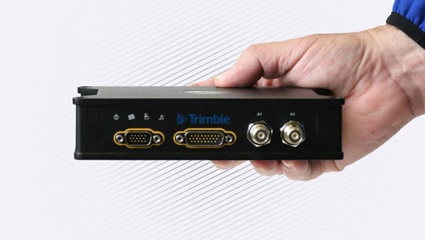
    In addition, vendors such as Quectel, Unicore, Trimble and ComNav Technology are increasingly launching and developing products that support the E6 band. Recent updates, including Trimble’s firmware enabling Galileo High Accuracy Service (HAS) on its devices, and Unicore introducing the UM981 high-precision positioning model, demonstrate the growing traction of this frequency band. Multi-frequency bands are also gaining significance by offering enhanced positioning accuracy, improved signal reliability, and better resistance to interference.

    “These bands are already widely used in sectors such as aviation, maritime and automotive, and their adoption will continue to grow as new use applications emerge and evolve over time,” Kong said.

    These findings are from ABI Research’s Outdoor/Wide Area Location Technologies market data report, part of the company’s Space Technologies and Innovation research service, which includes research, data and ABI Insights.

  • Maritime agency warns of AIS jamming in Red Sea region, ICAO condemns Russia and North Korea

    Maritime agency warns of AIS jamming in Red Sea region, ICAO condemns Russia and North Korea

    The UK Maritime Trade Operations (UKMTO) has issued an advisory following a surge in reports of interference affecting GNSS and Automatic Identification System (AIS) displays. The disruptions, which began Oct. 3, are concentrated around Bandar-e-Pars (Iran), the Strait of Hormuz and Port Sudan.

    “UKMTO has received numerous reports of GNSS interference from vessels in the Red Sea and Persian Gulf, between October 3 and 7,” the operations centre said in the alert. “This is a significant increase of reports compared with the same period in the previous week.”

    UKMTO urged vessels to exercise heightened caution. Ships in the Gulf, Port Sudan, and Suez Canal areas are experiencing consistent AIS speed anomalies, further complicating navigation.

    Russia and North Korea named as culprits

    Also this week, the International Civil Aviation Organization (ICAO) Assembly issued two resolutions condeming Russia and North Korea for recurring incidents of GNSS interference, citing the intentional interference as infractions of the 1944 Convention on International Civil Aviation. The agency urgently called upon both countries to comply strictly with their obligations under the convention.

    The assembly also deplored the fact that incidents of GNSS interference originating from the two countries have continued despite concerns repeatedly expressed by the ICAO Council about the harmful impact of GNSS interference on the safety and security of international civil aviation. 

    Photo: ICAO
    Photo: ICAO

    The assembly reiterated the paramount importance of preserving the safety and security of international civil aviation through strict compliance with the principles enshrined in the Chicago Convention and its Annexes. It also recalled Assembly Resolution A41-8, which recognized that the spectrum used by GNSS should be free from harmful interference and urged countries to refrain from any form of jamming or spoofing affecting civil aviation.

    The resolutions were issued as the ICAO triennial assembly in Montreal concluded on Oct. 5.

  • Q-CTRL’s quantum navigation named to TIME’s best invention list

    Q-CTRL’s quantum navigation named to TIME’s best invention list

    A software-ruggedized quantum navigation system was chosen as one of The Best Inventions of 2025 by TIME magazine.

    Ironstone Opal by Q-CTRL has been field-validated in air, land and maritime trials. It provides a solution to GPS denial, which has become an increasing danger in conflict zones and recently threatened a plane carrying European Commission president Ursula von der Leyen. Q-CTRL is based in Sydney, Australia.

    Ironstone Opal leverages quantum sensors – stabilized using software – to provide navigation immune to the kinds of interference plaguing commercial aviation, shipping and defense operations.

    In airborne trials, Ironstone Opal enabled GPS-free navigation with an accuracy up to 111 times better than the best conventional GPS alternative, even under highly dynamic maneuvers. It delivered GPS-like positioning accuracy down to just 4 meters over flights up to 700 kilometers long.

    Most recently, Ironstone Opal operated continuously for more than 144 hours on an Australian Navy vessel, the MV Sycamore, trialling gravimetric navigation capabilities. 

    “In today’s sophisticated threat environment — marked by jamming, GPS denial, and spoofing — quantum sensing offers a strategic advantage delivering resilient and precise capabilities where traditional systems fall short,” said Jonathan Green, Chief Technology Officer, Northrop Grumman Mission Systems. “As a leader in quantum technology, Northrop Grumman supports innovators like Q-CTRL in advancing the quantum industry to enhance national security through cutting edge innovation.”

    Each year, TIME recognizes 300 products, software and services that are changing the world, including scientific or technological breakthroughs and innovations that make life easier and more sustainable. Ironstone Opal was identified through research from TIME’s global network of reporters and expert contributors based on key evaluation factors like originality, efficacy, ambition and impact.

    The Key to Ironstone Opal

    Ironstone Opal’s quantum sensors detect tiny, otherwise imperceptible signals from Earth’s structure that serve as gravimetric or magnetic “landmarks” for navigation, which are then compared with geophysical maps for precise positioning. Q-CTRL’s proprietary software-ruggedization hardens these quantum sensors for operation in the real world, allowing resilient performance in demanding environments.

    The system can function as a robust backup for GPS on both crewed and uncrewed defense platforms, as well as in commercial settings. More than 1,000 commercial flights per day are affected by GPS denial, and many key players in the aerospace industry, including Airbus, are looking into quantum-assured navigation technologies as a solution.

    TIME’s recognition of Ironstone Opal follows August’s news that DARPA awarded Q-CTRL two contracts totalling $24.4 million USD to develop quantum sensors for navigation on defense platforms. Also, in March, the Department of Defense’s Innovation Unit (DIU) awarded a contract to Lockheed Martin and Q-CTRL to develop a quantum-enabled inertial navigation system.

  • JAXA selects ArkEdge Space to study low-Earth orbit positioning system

    JAXA selects ArkEdge Space to study low-Earth orbit positioning system

    Japan Aerospace Exploration Agency (JAXA) has selected ArkEdge Space to develop a satellite positioning system designed to complement existing GNSS.

    The company signed a contract begin the “Study of Elemental Technologies and Related Systems for Low-Earth Orbit Positioning Satellite Systems,” (Dedicated LEO-PNT). ArcEdge Space, led by CEO Takayoshi Fukuyo, provides solutions for microsatellite constellation planning, design, mass production and operation.

    The LEO-PNT satellite system uses small satellites orbiting at altitudes between 500 km and 1,200 km to provide high-intensity, high-precision positioning information globally. Traditional GNSS satellites orbit at approximately 20,000 km.

    Conventional GNSS technology faces growing threats from jamming and spoofing attacks because weak signals reach Earth’s surface. The LEO-PNT system’s high-intensity positioning signals seek to address these vulnerabilities.

    The project builds on JAXA’s feasibility study conducted from October 2024 to March 2025. Researchers will examine technologies and systems for providing robust position and time information to ground users as an alternative to GNSS.

    The system’s main feature is GNSS-independent service that can operate when existing systems are disrupted or jammed. Engineers will study transmitting LEO-PNT signals across C, S and L frequency bands, including C1 band (5010-5030 MHz) and C2-4 band (5030-5250 MHz).

    Project Details

    The study runs from September 2025 to March 2026 and includes signal design, reception technology research and system studies for GNSS-independent LEO-PNT systems.

    Key Advantages

    High intensity: Lower orbital altitude enables stronger positioning signals that resist attenuation and interference.

    High precision: Rapid changes in satellite line-of-sight vectors allow faster positioning convergence, supporting applications like autonomous driving and precision agriculture.

    Global coverage: Satellites in LEO can extend services currently limited to QZSS coverage, such as MADOCA-PPP.

    ArkEdge Space said the technology will contribute to highly automated societies and a safer future.

  • Quectel launches LR700A smart connected GNSS receiver

    Quectel launches LR700A smart connected GNSS receiver

    Quectel Wireless Solutions has introduced the Quectel LR700A smart connected GNSS receiver, an all-in-one high performance quad band base station solution, capable of connecting to the cloud to deliver GNSS correction data, usable either standalone or within an RTK station network.

    Available for use globally, the modular design integrates the GNSS receiver with cellular, Wi-Fi and antenna systems, while providing extension slots for Zigbee short-range communication.

    Cellular connectivity makes the system highly versatile, enabling deployment anywhere without requiring existing infrastructure, ideal for establishing RTK correction services in remote locations. The integrated short-range communication capabilities make it ideal for pairing directly with nearby rovers, creating a complete RTK solution for localized high-precision applications.

    The quad-band GNSS receiver enables simultaneous reception of signals from GPS, Galileo, BDS, GLONASS, QZSS and NavIC constellations across the L1, L2, L5 and E6 frequency bands. The Quectel LR700A supports 1040 channels, enabling flexible data transmission and remote management with cellular, ethernet and Wi-Fi networks. Easy monitoring and configuration over local networks are ensured via an intuitive web-based interface.

    “This highly versatile product enables developers to specify an all-in-one, full-constellation receiver that supports multi-frequency tracking while offering ultra-low power consumption and a robust, industrial-grade design,” said Windy Fang, director, GNSS Product Line, Quectel Wireless Solutions. “Its power efficiency and integrated, compact design make it ideal for use cases where space and energy are constrained.”

    Designed to function as a base station, the Quectel LR700A delivers precise GNSS corrections and positioning for high accuracy applications including smart agriculture and precision farming use cases, surveying and mapping, autonomous vehicles and outdoor robotics, such as lawnmowers.

    The LR700A’s ultra-low power consumption makes it ideal for power constrained use cases with typical consumption of up to approximately 2.1W with ultra-wide range voltage support from 9-36V. The LR700A weighs 2.1kg, has a diameter of 220mm and height of 149mm and operates in the -40oC to +85oC temperature range. Support for local Wi-Fi web user interfaces and remote cloud configuration ensure simplified field installation.

    Featuring an IP67 rated, industrial-grade design, the LR700A is resistant to shock, impact, drop, lightning and ultra-violet light damage, ensuring reliable operation and long-term durability in outdoor conditions. Certifications for CE, FCC, RoHS and REACH compliance are in progress.

  • Topcon and Amberg launch integrated solutions for rail and tunnel at Intergeo

    Topcon and Amberg launch integrated solutions for rail and tunnel at Intergeo

    Topcon Positioning Systems and Amberg Technologies are entering into a collaboration agreement and launching fully integrated solutions for rail and tunnel applications. The interoperability of hardware and software platforms is designed to allow professionals to seamlessly combine technologies from both companies to enhance workflow efficiency and accuracy.

    The announcement was made at Intergeo 2025, held Oct. 7-9, in Frankfurt, Germany.

    At the show, Topcon also announced an expansion of its geomatics portfolio, featuring advancements in mass data software solutions central to a connected workflow ecosystem. The producs follow
    the announcement of the dedicated business structure focused on delivering high-precision technology, software, and services for geomatics.

    The agreement with Amberg Technologies comes at a time when increased urbanization is driving demand for new underground infrastructure and placing demands on aging and existing infrastructure. Digitalization and automation can help contractors and civil engineering firms address these critical industry challenges, as well as labor shortages, tight project schedules, and increasingly complex design requirements.

    Key capabilities resulting from this collaboration include the ability to utilize Topcon’s advanced positioning technology directly with Amberg’s rail and tunnel hardware and software platforms. This integration streamlines tasks such as track alignment, tunnel profiling, and volumetric analysis. The integrations address the need for technology systems that reduce data translation gaps between different hardware and software platforms, eliminating potential errors that can occur when transferring data between systems. 

    Geomatics products and services

    Foundational tools for Topcon’s connected workflow are Collage and ClearEdge software, which allow for data, feature extraction, and the seamless delivery of results into GIS, BIM or CAD environments. Topcon Collage, available in Site, Office and Web versions, serves as a central data hub, enhancing data sharing among all project stakeholders in both the field and office. Topcon is also introducing the Collage Cloud Connector for improved connectivity with Autodesk platforms and ClearEdge solutions such as EdgeWise or Verity.

    Featured hardware and software include:

    • CR-H1 handheld scanner: The CR-H1 handheld mapping solution utilizes iPhone Pro devices with integrated LiDAR that collects georeferenced images and employs photogrammetry to create detailed, full-color 3D point clouds. The iPhone connects to the Topcon HiPer CR receiver, enabling centimeter accuracy with RTK corrections from the Topnet Live GNSS corrections service. The receiver and iPhone are both mounted on a specialized handle, so users can easily capture point clouds while walking throughout the job site. The devices needed can quite simply be held in one hand for maximum mobility in the field.
    • CR-M1 scanner and new Onami software: The CR-M1 is an indoor/outdoor mapping system that can be utilized on a backpack or on a survey pole. The CR-M1 is ideal for urban and construction mapping, multi-floor buildings, real estate, underground mapping, mines and tunnels, stockpiles, and forestry environments. Publishing and sharing the CR-M1 data with Collage Web allows the user fast, web‑based visualization and manipulation of their 3D point clouds and meshes.
    • CR-P1 multi-functional 3D terrestrial laser scanner: The CR-P1 provides real-time, georeferenced point cloud generation on-site, equipping the user with actionable data that can be used for various applications. Enhancements to the Topcon Collage Site software solution provide new mass data workflow capabilities designed to allow for the real-time acquisition and processing of data more accurately, efficiently, and quickly to provide the user with greater productivity.
    • CR-S2 handheld scanner with Magnet Flow and Bridge software: The CR-S2 is a handheld scanning system that uses multiple localization fusion-SLAM to perform mapping projects in challenging environments. It is designed to work in construction and infrastructure applications as well as open, featureless environments such as beaches, coastlines, farmland, and airports. In open environments, the RTK connection to the Topnet Live network ensures position quality. Publishing and sharing the CR-S2 data into Collage Web allows the user fast, web-based 3D point cloud and mesh visualization with easy-to-use measurement and annotation tools.
    • LN-1000i Layout Navigator withTopcon Digital Layout software: The LN-1000i is an addition to the Layout Navigator series that includes new features, including reflectorless measurement capabilities, green laser beam pointer and an integrated camera for live view, camera control and enhanced prism lock. When combined with the new Topcon Digital Layout 2.0 software, this instrument is designed to set new standards in building construction.
    • Expanded Hybrid Positioning capabilities with Topcon software updates for Field – Office – Tools – Enterprise: Allows for better cooperation switching between GT robotic total stations and the HiPer XR GNSS receiver as an optical and GNSS hybrid solution. The new version 10 Topcon Field software enables the user to use the tilt of the IMU when measuring to the prism in Hybrid Positioning mode.
    • Collage Cloud Connector: New Windows app designed to simplify and automate the process of downloading and synchronizing project data from Collage Web to a local machine for use with Autodesk, ClearEdge3D software, or Collage Office.
  • Septentrio demos tracking of Xona’s first LEO PNT satellite

    Septentrio demos tracking of Xona’s first LEO PNT satellite

    Septentrio and xonaspace.com have signed a Memorandum of Understanding (MOU) to deepen their collaboration on next-generation positioning and timing solutions.

    The agreement builds on Xona’s recent successful launch of Pulsar-0, its first production class LEO PNT satellite. Within days of launch, Septentrio began tracking and analyzing Pulsar signals, an early milestone toward unlocking the service’s full potential.

    Together, the companies will continue joint testing and validation to prove Pulsar’s full capabilities, including:
    •    native centimeter-level accuracy
    •    100x stronger signal strength that reaches indoors and under dense foliage
    •    robust protection against jamming and spoofing.

    Through this partnership, Septentrio and Xona will advance receiver development, evaluate real-world performance, and explore commercial opportunities across diverse set of industrial and defense applications. Potential use cases span drones and autonomous vehicles, precision agriculture, construction and mining, robotics, timing and critical infrastructure.

    This collaboration marks a significant step toward addressing the growing demand for robust, high-precision navigation in challenging environments. The MOU underscores a shared vision of both companies to advance satellite-based navigation technology and unlock the potential of hybrid GNSS-LEO solutions.

  • Juniper partners with Point One for cm-level accuracy

    Juniper partners with Point One for cm-level accuracy

    Juniper Systems is partnering with Point One Navigation to enable Juniper’s Geode GNSS receivers to achieve seamless, centimeter-level accuracy through Point One’s Polaris RTK corrections network.

    The partnership will deliver integrated, field-ready computing and high-precision positioning solutions for demanding industries across the U.S., Europe and globally. By combining Juniper’s rugged mobile devices with Point One’s professionally managed Polaris RTK corrections network, users will benefit from unparalleled accuracy, increased field uptime, and reliable operation even in harsh conditions, the companies said.

    Point One’s Polaris RTK corrections network, with thousands of actively monitored base stations, provides critical positioning in applications such as environmental sciences, utilities, construction and geospatial mapping. When integrated with Juniper Systems’ Geode GNSS receivers, the result is a reliable solution for collecting highly accurate data in remote locations, the companies said.

    The partnership is already underway, with collaboration on new product packages, regional support, and joint outreach initiatives planned throughout 2025. Customers will benefit from coordinated service, expert guidance, and access to bundled solutions tailored to their operational needs.

  • Trimble unveils mobile mapping systems for land and air applications

    Trimble unveils mobile mapping systems for land and air applications

    Trimble has released two positioning system portfolios for mobile mapping and direct georeferencing — Applanix POS LVX+ and Applanix POS AVX RTX — designed to meet evolving demands in the geospatial industry. The solutions are designed to deliver improved accuracy and efficiency for land-based and airborne mobile mapping applications.

    Trimble is showcasing both portfolios at Intergeo 2025, alongside Applanix POSPac Complete advanced post-processing software introduced last week.

    Both portfolios include a one-year subscription to the Trimble CenterPoint RTX correction service and Applanix POSPac Complete for desktop and cloud, which includes post-processed CenterPoint RTX. By integrating real-time and post-processed data, users can achieve global coverage without traditional GNSS base stations, avoiding complications from base stations in different local datums or epochs. Both systems achieve centimeter-level accuracy and support Trimble IonoGuard technology for advanced mitigation against ionospheric disruptions.

    “By bundling both real-time and post-processed RTX into the POS LVX+ land and POS AVX RTX air solutions for mobile mapping, these ready-to-use systems simplify procurement and enable immediate deployment,” said Steve Woolven, president and general manager of Applanix at Trimble. “These portfolios enable our customers to tackle the most complex mapping projects and ensure optimal accuracy for final deliverables.”

    Land-Based Systems

    The POS LVX+ portfolio offers six models with several key features: a smaller, lighter and more cost-effective design with rugged components suitable for diverse users and project types; the Applanix IN-Fusion+ multi-sensor aided inertial engine that maintains performance in challenging environments like urban canyons or tree canopy; suitability for projects using lidar sensors or cameras, plus fleet management and automotive applications; and onboard and external inertial measurement units that enhance reliability and performance.

    Airborne Positioning

    The Applanix POS AVX RTX portfolio includes four variants for mapping at different flying heights through improved orientation accuracy. Key features include over-the-air correction technology achieving positioning, velocity and orientation accuracy up to 0.03 horizontal meters root mean square (RMS) and 0.06 vertical meters RMS without additional setup or infrastructure; robust hardware with advanced inertial measurement units (IMU) and FAA-certified antenna and cabling; and combined real-time and post-processed RTX correction data for time-critical missions, large-scale corridor mapping and projects in remote or inaccessible areas.

    Availability

    The POS LVX+ and POS AVX RTX will be available in the first quarter of 2026 through Trimble Applanix sales channels. After the initial 12-month period, customers can purchase CenterPoint RTX license renewals and POSPac Complete term licenses. For more information or to request a demo, visit https://applanix.trimble.com/en/products/hardware/applanix-avx-rtx or https://applanix.trimble.com/en/products/hardware/applanix-pos-lvx+.

  • Unmanned systems updates: Government shutdown risks, UAS advances and eVTOL industry challenges

    Unmanned systems updates: Government shutdown risks, UAS advances and eVTOL industry challenges

    To echo the Association for Uncrewed Vehicle Systems International’s (AUVSI) pleas to Congress, a prolonged government shutdown could impact recent efforts to establish stronger counter-UAS protection for sensitive establishments across the U.S. and forestall key Federal Aviation Administration (FAA) hiring plans to support safe drone integration into the U.S. National Airspace System.

    Nothing is good about having roughly 750,000 people out of work and stalling their buying contributions to the American economy, not to mention that air traffic controllers, Border Patrol agents and other essential services are still working without pay. Hopefully common sense will prevail and the government will reopen soon.


    Originally known as the Boeing Airpower Teaming System or “Loyal Wingman,” the Boeing Australia MQ-28A Collaborative Combat Aircraft has been rechristened. Developed jointly by Boeing and the Royal Australian Air Force, the MQ-28A was not entered in the U.S. CCA competition and has remained fully employed in Australia with its team. Now referred to as the “Ghost Bat” — a name inspired by a north Australian flying bat by the same name, which uses “multi-spectral sensors” to hunt and learn in packs together — the name is a fitting analogy for the anticipated role of the MQ-28A.

    Ghost Bat taxies at RAAF base Woomera in Australia. (Credit: Beoing)
    Ghost Bat taxies at RAAF base Woomera in Australia. (Credit: Beoing)

    Flying since February 2021, the Ghost Bat has made significant steps toward operational readiness. Using AI-powered intelligence to perform autonomously, Ghost Bat has a replaceable nose section, each fitted with different sensor suites appropriate for different missions.

    With eight vehicles now available for a comprehensive operational verification test, in June and four months ahead of schedule, Ghost Bat completed a series of flights at both Woomera and Tindal bases in northern Australia. Capabilities demonstrated included autonomous missions, multi-ship operations and teaming with an E-7A Wedgetail early warning aircraft — including data fusion between multiple MQ-28A Ghost Bat aircraft and the crewed Wedgetail. The aircraft has flown for 150 hours and has accomplished more than 20,000 hours of virtual and ground testing. Able to find, fix, track and target, MQ-28A has proven its capability to carry out essential pieces of the air combat role — remaining elements include engage and assess, which will involve carrying air-to-air missiles later in 2025.

    This apparently brings the Boeing MQ-28A close to operational capability and ready for volume manufacturing. The eight aircraft have been built at an automated manufacturing facility in Melbourne, where two improved versions are currently being built that incorporate improvements developed through the testing phase, and a combined GPS/INS system will replace the commercial GPS on the aircraft. Ground has meanwhile been broken on a 100,000-square-foot high-volume manufacturing plant in the Wellcamp Aerospace and Defence Precinct in Queensland — expected to be complete within three years.


    While electric vertical take-off and landing (eVTOL) air-taxis under development progress towards certification by FAA and other agencies, introductory trials are also underway and agreements for future collaboration are being made all over around the world. While major players such as airlines and manufacturers have invested heavily to provide the capital for eVTOL development and manufacturing, one such agreement appears to be in trouble.

    Lilium jet eVTOL (Credit: Lilium)
    Lilium jet eVTOL (Credit: Lilium)

    Lilium, a jet eVTOL developer, and GlobeAir, an existing operator of an Austrian fixed-wing business aviation operation, signed a memorandum of understanding in September 2022. GlobeAir posted an article on its website that said it saw the agreement with Lilium as a step toward the “next generation of regional air mobility” and that it intended to buy 12 jet-powered Lilium eVTOL aircraft “to operate in Northern Italy and the French Riviera.” GlobeAir was also reported to have supported the inclusion of several potential key local suppliers to participate in the build of Lilium aircraft.

    Lilium went bankrupt in October 2024, and its assets and intellectual property have been up for bids. Emerging briefly from bankruptcy protection, Lilium again ended up broke and on the auction block in February 2025. Vaeridion has already purchased Lilium’s battery facility, and Ambitious Air Mobility is close to a deal to acquire the rest.

    The CEO of GlobeAir has now told the magazine Aviation Week in an interview that he expects the whole eVTOL adventure to fail, given the cost of not only vehicle development and construction but also the landing and charging infrastructure needed. Other hurdles include the level of test and verification and excessive levels of documentation — overall being “highly regulated, with low margins.” It’s an unfortunate, perhaps premature assessment from an existing fixed-wing operator who contracts out last-mile passenger transitions to third-party helicopter operators.


    So, there is another mixed bag of going ons in the world of unmanned and derivative eVTOL aircraft – hopefully following the restoration of funding for the government, paused programs will be restored to extend counter UAS defenses across the U.S., Ghost Bat will complete its combat engage and assess phases and there will be much better news on the eVTOL front.

  • Eos Positioning Systems to discontinue four arrow series GNSS receivers in 2026

    Eos Positioning Systems to discontinue four arrow series GNSS receivers in 2026

    Eos Positioning Systems has announced end-of-life planning for four models in its original Arrow Series GNSS receivers, with discontinuation set for March 31, 2026, or when current inventory is depleted.

    The company has began to phase out the Arrow Lite, Arrow 100, Arrow 200 and Arrow Gold receivers on Oct. 2, 2025. The models have been used by mapping professionals and organizations conducting field data collection.

    Eos will maintain technical support for the discontinued models for at least five years following the end-of-life date, according to company officials. Support will be available through the company’s technical team and global distributor network.

    “These products have served our customers well in a variety of field environments that I could not have imagined in the early days of our company,” said Jean-Yves Lauture, chief technology officer at Eos. “While their time in the spotlight is coming to an end, their impact will continue to resonate.”

    The company will continue to offer its Arrow Series plus models, which include the Arrow 100+ and Arrow Gold+ receivers currently in distribution. Eos plans to release two additional models — the Arrow 200+ and Arrow 300+ — though specific release dates were not provided.

    Eos is also developing the Skadi Series, described as precision GNSS solutions for professional applications. Additional product specifications and availability information will be announced at a later date.

    The original Arrow Series receivers have been part of Eos’ product lineup since the company’s early operations. The devices provided GPS and GNSS positioning capabilities for mobile data collection workflows.

  • Trimble launches POSPac complete post-processing software

    Trimble launches POSPac complete post-processing software

    Trimble as released its new post-processing software, Trimble Applanix POSPac Complete.

    The solution combines Trimble ProPoint positioning engine, post-processed Trimble CenterPoint RTX (POSPac PP-RTX) and Applanix IN-Fusion+ multi-sensor aided inertial engine. This integration offers geospatial professionals the ability to deliver accuracy and efficiency in the crewed and unmanned systems, land and marine mobile mapping and surveying industries.

    POSPac Complete will be showcased at INTERGEO 2025.

    A redesigned software solution embedded with POSPac PP-RTX, Applanix POSPac Complete is available exclusively as an all-in-one term license that bundles essential GNSS augmentation options — single base, Applanix SmartBase post-processed VRS and POSPac PP-RTX service — into a single, transparent annual fee. This eliminates hidden costs, simplifies budgeting and ensures access to software updates, while Trimble RTX removes the need for base stations and provides global coverage.

    Because Trimble RTX is embedded into the software, users around the world can attain seamless and efficient workflows with centimeter-level accuracy, even in remote or inaccessible areas, increasing productivity in their mapping process. Additional time savings are gained with the elimination of the time-consuming and challenging task of setting up and managing base stations that may be in different local datums or epochs.

    “The new POSPac Complete is more than just a software update; it’s a paradigm shift in how geospatial professionals achieve high-accuracy results because of Trimble’s unique RTX factor,” said Nico Jaeger, product manager at Trimble. “By integrating the power of PP-RTX directly into the software, we’ve eliminated the logistical headaches of base stations and streamlined the entire workflow, making mobile mapping more accessible than ever before. Altogether, it helps new and experienced users to produce survey-grade results with unprecedented speed and simplicity, truly representing the next generation of geospatial processing software.”

    Additional features in the new POSPac Complete include:

    • Modernized user interface: A new look and feel with a background map and a streamlined project wizard for easier and more efficient workflows, and a better user experience.
    • Trimble IonoGuard: Trimble’s latest technology that detects and mitigates the effects of ionospheric scintillation, which is especially important during the solar activity peaks, supported in single base and PP-RTX processing modes.

    Optional add-on features available for purchase:

    • Camera QC tools: The robust successor to CalQC, providing rapid IMU to camera boresight calibration for single-head and multi-head (oblique) camera constellations with minimal user interaction.
    • Lidar QC tools: Trimble’s leading software application for IMU to lidar boresight calibration and trajectory adjustment using SLAM techniques is now enhanced with support for automatic ground control point (GCP) detection, the RIEGL lidar native file format and reduced RAM requirements for faster processing.

    The POSPac Complete solution will be available in November 2025 through the Trimble sales channels. For more information or to request a demo, click here.