Trimble has expanded its portfolio of geospatial solutions for surveyors, engineers and mapping professionals. Highlights include new total stations, a new GNSS receiver and new field and office software features. The solutions save time, reduce costs, streamline workflows and produce high-quality geospatial deliverables across a wide range of industries, Trimble said.
“Trimble’s portfolio expansion will enable our customers to work in a more efficient, seamless and collaborative manner,” said Chris Gibson, vice president of Trimble. “Trimble’s solutions are best known for quality, dependability and performance. Our vision is to equip customers with the most innovative tools, which includes a focus on offering new software applications that streamline and elevate the value of geospatial data to guide smart decision-making and transform the way organizations work.”
The expanded portfolio of productivity solutions include:
Total Station Solutions
A range of new and enhanced robotic total stations — the Trimble S5, S7 and S9 — improve project efficiencies, productivity and deliverables. Times saving enhancements include improved Trimble VISION technology, SureScan technology included in the S7 and optional in the S9 total station, and the DR Plus electronic distance measurement technology as a standard feature.
Theft and loss risks are also minimized now with Locate2Protect technology embedded in each instrument, allowing users to remotely track the location of their equipment in real-time using Trimble InSphere Equipment Manager.
In the office, Trimble Business Center software can be used to create high-dynamic-range (HDR) images using data captured with total stations. A new total station data editor enables fieldwork to be rapidly reviewed and allows surveyors to create deliverables with confidence, Trimble said.
Scanning Solutions
Trimble continues to blend powerful 3D laser scanning and imaging hardware with workflow-based software to drive new efficiencies for survey applications and construction planning and design.
The Trimble TX8 3D laser scanner now offers greater accuracy (down to 1 mm) and streamlined onboard operation when measuring to longer ranges, decreasing the field time required for capturing reliable high-accuracy data.
Enhanced tools in Trimble RealWorks software version 9.1 further reduce the time to produce high-quality deliverables from Trimble TX8 data. The new version of Trimble RealWorks software includes improved workflows for creating floor settlement plans and 3D pipeline models as well as complete storage tank inspection and reporting capabilities.
GNSS Solutions
The new Trimble R8s Integrated GNSS receiver and updated version of Trimble Access field software combine to offer configurable and scalable settings. Surveyors have the flexibility across their workflows by being able to tailor the Trimble R8s receiver with the updated field software for their specific application. The ability to customize provides flexibility for future business requirements and allows customers to maximize efficiencies across their workflows.
Imaging Solutions
Trimble enhancements to Trimble VISION workflows increase the value of highly accurate image data. Survey, engineering and civil infrastructure professionals can now generate dense point cloud deliverables in Trimble Business Center from images captured using the Trimble V10 Imaging Rover. Users can also quickly generate 2D CAD and 3D real-world models from images captured with Trimble total stations using the streamlined workflows created within Trimble Business Center and SketchUp software.
Availability
Trimble Access field software, Trimble Business Center version 3.50 office software, the Trimble R8s GNSS receiver, Trimble S5, S7 and S9 Total Stations and TX8 3D Scanner are available now through Trimble’s Geospatial Distribution Channel.
Getmapping has partnered with PlanetObserver to offer customers a full range of global and regional Earth satellite imagery along with global height data. The partnership is in line with Getmapping’s wider strategy to extend its reach beyond its established markets in the UK and Africa and signals an intention to provide a global capability in geospatial products and services.
The key PlanetObserver offerings available from Getmapping include PlanetSAT 15, 15-m resolution global satellite imagery and two height data products, PlanetDEM 30 and PlanetDEM 90 with resolutions of 30 m and 90 m respectively.
The satellite imagery is the most up to date satellite dataset currently available and provides natural colour (RGB) imagery free from clouds. Available from a few square kilometers to global coverage, the data is especially suited to a wide range of sectors, including energy and utilities, tele-communications and smartphone apps, visualization and simulation, plus mapping and illustration.
The PlanetDEM height datasets are seamless global digital elevation models at 30m and 90m resolution and are derived from a combination of SRTM (Shuttle Radar Topography Mission v4.1) data corrected with multi-source cartographic data, and are perfect for 3D simulation and visualisation applications, base mapping, energy and geological surveys.
All PlanetObserver data is delivered in a range of standard formats, and is also available via WMS and as an additional layer in the Getmapping Online GIS software.
“We have been providing high-quality aerial imagery and elevation data across the UK and Africa for a number of years and it has always been our intention to provide our customers with a global offering,” said Pete Bonham, Getmapping’s Business Manager. We expect satellite imagery and DEMs to be particularly popular with our Online GIS customers who can subscribe to access the data from within the application. The high quality data from PlanetObserver covers the entire surface of the Earth, and provides excellent base layers for our expanding Online GIS application, it really adds value to our offering.”
Laurent Masselot, CEO of PlanetObserver added, “Our new cooperation with Getmapping is a major step forward to efficiently supply our geospatial data to a large user community. We’re particularly excited to reach out to users of Getmapping online GIS software and have them take advantage of our value-added products.”
TomTom is partnering with Mozilla and Telefónica to bring its Maps Online and Nav Online apps to HTML5-powered Firefox OS smartphone devices.
“We’re thrilled to offer Firefox OS users TomTom’s Maps Online and Nav Online apps in the Firefox Marketplace,” said Bertrand Neveux, director of Marketplace and Ecosystem at Mozilla. “Our priority is to empower users with a mobile experience that makes their lives richer and more efficient, and great content like TomTom’s ensures that.”
“Telefónica has now launched Firefox OS devices in 14 markets and is pleased to see high-quality maps and navigation solutions from TomTom that enhance these devices for our consumers in Latin America and Europe,” said Simon Callan, director Business Development at Telefónica.
“TomTom is excited to be embracing the openness of HTML5 to bring high quality maps and turn-by-turn navigation to the ecosystem,” said Charles Cautley, managing director of TomTom Licensing. “By partnering with Mozilla and Telefónica, we’re opening new markets and opportunities for smartphone users globally.”
TomTom Maps Online offers accurate and up-to-date maps, as well as Address and Point of Interest search capabilities with routing instructions, enabling Mozilla customers to quickly and easily find their favorite places, TomTom said.
With TomTom Nav Online, Telefónica’s Firefox OS customers can extend the mapping experience to full voice-guided turn-by-turn navigation.
Delta Airlines made a perfect Ground-Based Augmentation System (GBAS) Landing System (GLS) landing at Liberty Newark International Airport on Feb. 18, according to the Federal Aviation Administration’s SatNavNews newsletter.
Delta now joins United Airlines and British Airways as airlines that use the GBAS at Newark.
More GBAS locations around the world are reaching operational status, and airline operations using GBAS are increasing as additional GLS-equipped aircraft are entering service for the various airlines. Boeing has confirmed that many of the customers who have ordered multiple 787s, 747-8s or 737s have publicly stated their intention to use the GLS capability on these aircraft.
More than 1,000 Boeing GLS-equipped aircraft are now in use, and this number is growing by an estimated 25 airplanes per month. This estimate is based upon current production rates — one third of 737s are being equipped with the GLS option. GLS is standard on 787 and 747-8 aircraft.
The list below provides a summary of the airlines using GBAS and the airports where GLS approaches are flown on a regular basis.
U.S. Carriers
Delta Airlines – Houston, Newark
United Airlines – Houston, Newark
Non-U.S. Carriers
Air Berlin – Bremen, Malaga
British Airways – Newark
Cathay Pacific – Houston, Sydney (plans for Newark in the future)
Various Russian airlines (S7, Transaero, Utair, Sakhalin Energy, Gaspromavia Russia). Fifteen GBAS locations in Russia have been approved with each airline using different airports (Domodedovo, Pulkovo, Tyumen, Ostafyevo, Nogliki and others).
The commitment to GBAS development and implementation continues to grow, according to the FAA, with plans to implement GBAS in these additional locations:
It has been an interesting month for developments in location. Nokia is looking for a buyer for HERE, the mapping and navigation business that once set the industry gold standard. While carriers are planning how they will comply with new FCC mandates for locating indoor E911 calls, the commercial indoor location market has moved beyond “emerging” and is well underway. It is a confusing ecosystem for buyers of indoor location solutions. And there is yet another mega-entry into the connected vehicle market, Alibaba and China’s SAIC Motor.
With the likely merger of Nokia and Alcatel-Lucent, Nokia has started looking for a buyer for its digital map and LBS division. The mapping industry has changed dramatically since Nokia purchased the mapping leader Navteq in 2007. Google has become a mapping juggernaut, and less accurate free maps have become serviceable for many types of uses. In fall 2014, Nokia took a EUR1.2-billion impairment charge on HERE’s book value and now estimates the fair value for HERE at EUR2 billion. Possible buyers include Google, Microsoft, Apple and Uber, all companies with deep pockets and hardy appetites.
Indoor Location Market Is Messy. The indoor location market is pulling away from the station, as technology is ready and there are applications and use cases primed to get started. Unfortunately, the market is chaotic, teaming with companies offering solutions with various levels of accuracy, infrastructure requirements and cost. An ideal indoor location technology would provide at least 3-meter accuracy, be cost effective and fully universal, working anywhere on all devices. It doesn’t exist, but the competing technologies, all with trade-offs, will find applications that fit. For instance, the precision required in locating an apartment in the case of an E911 emergency call differs greatly from the pinpoint accuracy need by an app that directs a shopper to Lucky Charms cereal on an aisle crowded with boxes.
One Size Doesn’t Fit All. There is more to an indoor location technology than accuracy. “Accuracy is important, but so is universality, the ability to work everywhere and in all phones. So is cost, in terms of the investment required from a site deploying the technology,” asserts Bruce Krulwich of Grizzly Analytics. “Universal technologies can win in the market even if they’re less accurate, and technologies with cheaper infrastructure can win even if they’re less accurate than those with expensive infrastructure. High-end systems can deliver sub-meter accuracy to those willing to pay for it.” Grizzly Analytics just completed a comprehensive report on the indoor location market.
Test First. Each of the numerous companies vying for the indoor location market makes claims regarding accuracy, availability/coverage, latency and battery usage. Judicious companies that invest in indoor location systems would be wise to test the claims of vendors. “Making a fair comparison among different indoor location offerings is complex, and nuances in how the testing is performed need to be controlled to ensure an apple-to-apple comparison,” asserted Khaled Dessouky of ComVerity. “It is important to use an unbiased methodology that relates to your use cases.” Dessouky managed the neutral test bed for the FCC’s Communications Security, Reliability and Interoperability Council (CSRIC) for indoor E911 calls.
Quuppa. An interesting highly accurate offering comes from Quuppa, a Finnish company with a bunch of high caliber researchers spun off from Nokia. Like some others, they are using Bluetooth Low Energy (BLE) beacons, but add angle of arrival (AOA) algorithms that pump up the precision, which they self-report to be 30 centimeters to 1 meter. With this performance, Quuppa has been used in sports to track hockey pucks and athletes’ movements during game play for coaching, player load monitoring and infotainment that can be broadcast during the game. The use of this type of high-precision location in health care settings is compelling. Patient flow management, security and critical asset tracking can be improved with precise positioning technology. Quuppa is a system that likely wouldn’t be used in apps that locate a coffee shop at a mall, but for uses that demand high performance and can spare some expense, it is compelling.
And Yet Another Mega Entry. The number of companies vying for a piece of the connected-car market keeps expanding and getting more international. E-commerce giant Alibaba and SAIC Motor, China’s popular car maker, together set up a $160 million fund to develop “car on the Internet.” Alibaba will be leveraging its communications, entertainment, map and cloud-computing services. The company joins a group that includes Google, Apple, Baidu and Uber in challenging auto makers.
Fugro has commissioned an additional airborne laser bathymetry system to underpin its position in the development and application of bathymetric LiDAR technology. The combined Fugro LADS Mk 3 and Riegl VQ-820-G systems provide seamless measurements and mapping of nearshore and shallow water environments. The increased capability will enable Fugro to deliver simultaneous topographic and bathymetric surveys in multiple geographical areas.
With high power and frequency, the combined systems achieve superior coverage that minimizes gaps and outperforms lower energy alternatives and single-sensor systems in all conditions, particularly in difficult environments, Fugro said. They are highly adaptable and small enough to be installed in a variety of light aircraft.
With continued operations across the Middle East during 2015, Fugro will also begin a South West Pacific ALB survey campaign following the award of projects in multiple locations to support nautical charting, coastal engineering, scientific assessments, coastal management, benthic habitat mapping and climate change initiatives.
Since 2012, Fugro has operated simultaneous topographic and bathymetric LiDAR systems in France, Japan, New Zealand and the Middle East. Successful results from Japanese coastal areas include returns from the Fugro LADS Mk3 sensor to 50 meters while recent surveys in Saudi Arabia had even more impressive results, with 65-meter depth returns. The deep water returns combined with high-density shallow water and near coastal returns result in a seamless dataset from ridge to deep reef.
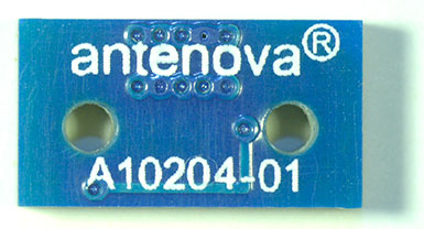
The Brevis GNSS antenna is the latest addition to Antenova’s gigaNOVA family of miniature antennas. The small antenna is designed to be used in portable handheld devices that have GNSS receivers — for example, in devices and applications that have a tracking capability or location accessories such as in transport, navigation, wearables and eHealth.
The multi-GNSS antenna is designed for embedded applications, with a high efficiency-to-size ratio. It is intended for use in applications where there is no ground beneath the antenna. It has near omni-directional characteristics which will provide good performance for any device.
The Brevis operates with the following GNSS bands: GPS, GLONASS, Galileo and BeiDou. Brevis GNSS is a low-profile, small-footprint antenna designed for surface-mount device (SMD) mounting, so it can simply be placed on a printed circuit board (PCB) to add wireless connections to any device.
Full technical specifications for the Brevis GNSS antenna and contact details for regional distributors are available on Antenova’s website.
The National Association of Broadcasters meeting in Las Vegas draws 100,000 attendees annually, making it one of the largest trade shows in the country. However, besides timing and some very niche markets, it has not been a big show for location companies. That is, until now, when NAB welcomed drone manufacturers, all of which embed GPS in their flying aircraft.
Kevin Dennehy
LAS VEGAS — Commercial drones, a growing market for location companies, was one of the most popular topics at the National Association of Broadcasters Show, held here April 13-16.
The market for drones has grown nearly five times in the last few years, said Eric Cheng of DJI, which uses GPS in its virtual positioning system that monitors and controls the aircraft. The company markets what they call “flying cameras” that look suspiciously like drones. “The market was initially hobbyists, but now some major broadcast players are buying the cameras,” Cheng said at the Showstoppers trade event the day before NAB.
Most of the drones offer GPS-based automatic flight stabilization technology. Some even offer a long-range wireless signal and low-latency video transmission.
Many of the drones are programmed so they don’t go higher than mandated FAA rules or go into restricted, no-fly aviation zones — and all use GPS to do this. Some of the drones even return to the user automatically when their batteries run low.
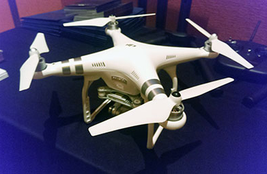
DJI drone with embedded GPS.
DJI offers three cameras for the drones. The high-end Phantom 3 Advanced offers 1080P HD video at 60 frames per second. The 1080P version costs $995.
In terms of privacy and government regulation, U.S. regulators are way behind Europe, Cheng said. “Other countries are way ahead of the [United States] in terms of working with drone companies,” he said. “In terms of privacy, the step ladder was the first tool for the invasion of privacy. They haven’t outlawed step ladders.”
The slow U.S. regulatory process has forced some manufacturers to go to other countries to test their drones, said Roger Sollenberger, 3D Robotics’ editorial director. “[U.S. regulations] have moved slowly here — despite the government knowing about worldwide drone rollouts. In Japan, they have been using drones to crop dust for 20 years,” he said.
Furuno’s Don Hanham with GNSS modules at NAB.
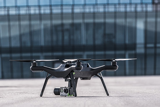
To signal increased interest in the commercial drone market, 3D Robotics raised $70 million dollars in funding, led by investor Qualcomm, Sollenberger said. The company, which partnered with action camera giant Go Pro, says its Solo drones can be used not only by broadcast companies, but for railroad track and building inspections.
As GPS World reported, Furuno Electric Co.’s latest multi-GNSS receiver module, GN-87, has been adopted for the new quadcopter Bebop Drone. The broadcast market has been a good one for company’s timing products, drone integration and even weather prediction, said Don Hanham, a Furuno sales and marketing consultant.
Furuno is marketing its Doppler Weather Radar System for broadcast. The system allows weather predictors to follow the development of short, localized rainstorms and extreme weather conditions.
Booz Allen Hamilton Releases Report on 2015 Automaker Priorities
The era of automotive connectivity, and subsequent heavy competition, is the focus of Booz Allen Hamilton’s new report, “Getting the Customer Experience Right: Auto Industry Priorities in 2015.”
The company says that automakers should consider six key priorities this year: deliver innovation in months, not model years; differentiate with new partnerships to catch customers’ attention; secure connectivity to reinforce a relationship of trust with customers; address the “so what” of connected cars; personalize the customer experience via the tremendous potential buried in data; and find and build the market for alternative fuel vehicles.
In terms of big connected vehicle technologies this year, Jon Allen, a principal with Booz, cites 4G pipe in GM and Audi vehicles and over-the-air updates by Ford and BMW, among others. “New parental controls in the Chevy Malibu report average speed and near misses while also preventing drivers from turning on the stereo until seatbelts are fastened. It’s easy to imagine this across vehicles, with parents receiving text messages in real time,” he said.
Allen said, in terms of vehicle connectivity, automakers must answer the “so what” to set themselves apart from the competition. “We have yet to see the seminal, game-changing connectivity plays. Most companies are still in the ‘features’ mindset, offering new à la carte enhancements,” he said. “They’re not yet articulating a top-down strategy for re-envisioning the customer experience with connectivity.”
One of the company’s six priorities concerns connected security, which has been a big industry issue since the recent release of the Markey Report, which focused on how vehicles can be hacked. “We have clients who get it. They’ve identified a senior leader to champion vehicle cyber security and backed them up with a cross-functional team that works closely with counterparts across the organization — in product engineering, supply chain, safety, privacy and IT,” Allen said. “Other OEMs are still formulating their approach. That said, there are pockets of cyber security across every organization, focused on implementing security controls on individual parts. The challenge is taking the next step —moving from this segmented, ‘assembly line approach’ to a more unified program that focuses on securing the complete vehicle ecosystem.”
Allen said the company has to speak honestly to customers and regulators about how to manage vehicle cyber security risk. “Industry leaders must prioritize their security approach to ensure that higher risk scenarios are addressed first, rather than try to take on all elements of the challenge at once,” he said.
Another priority addresses the long lead times, by automakers, to develop and roll out new features, which is a challenge, Allen said. “Consumer electronics, telecommunications and software companies are redefining the traditional industry boundaries that once distinguished them from OEMs. These companies focus on connectivity and services from the start of their product design process,” he said. “The key for automakers going forward is to continue learning from these new competitors, particularly around rethinking the vehicle lifecycle, connected product design, and managing vehicle software updates after purchase. In the near future, automakers will need different approaches to building and enhancing infotainment systems that can keep pace with customer demands.”
The marriage of autonomy and connectivity is a game-changer, Allen said. “It isn’t just about plugging vehicles in to the Internet of Things. Autonomy transforms transportation,” he said. “When a car drives you, it becomes a retail outlet, a personal assistant, even a trusted chaperone — that all depends on getting both autonomy and connectivity right.”
The rise of autonomous vehicles gets to the fundamental need for industry leaders to be willing to reimagine their product, Allen said. “Autonomous capabilities are not just about engineering a safer, more efficient, and more appealing mode of transportation. That’s important, but it’s really about a distinctly different product, one that creates a sustained, services-based relationship with the customer,” he said. “It will focus on the driving experience not just behind the wheel, but sitting comfortably inside of a self-driving vehicle. The connected, autonomous vehicle will change automotive for the better — and forever.”
Allen said his company is seeing OEMs look beyond their individual vehicles to see the emerging connected society that includes ride sharing, multi-modal transportation and connected cities. “The way we go from point A to point B will look and feel drastically different 25 years from now; many OEMs are beginning to accept the change and embrace the challenge,” he said.
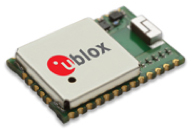
u-blox is offering the CAM-M8C — a small, low-profile GNSS positioning module with an integrated wideband chip antenna for reception across the entire L1 band. The module offers simultaneous GNSS operation for GPS/GLONASS, GPS/BeiDou, or GLONASS/BeiDou to deliver accurate, jamming-resistant and reliable positioning anywhere in the world.
The CAM-M8C integrates a u-blox M8 satellite receiver, crystal oscillator, SAW filter and low-noise amplifier. It also has an input for an external active antenna — when using this option, the internal antenna acts as a backup. Because of its design, the module maintains its performance regardless of physical orientation, making the product suitable for mobile applications with frequent change of bearing.
“Where space is at a premium, for example in emergency call systems, in handheld navigation or in wearable devices, the CAM-M8C module offers a very cost-effective way to bring products to market quickly due to its small size and high levels of integration,” said Kim Kaisti, product manager, Product Center Positioning. “It does this without compromising performance or reliability, and leaves system designers free to concentrate on other important aspects of their product development.”
The CAM-M8C is footprint-compatible with u-blox UC530 and UC530M modules, providing an easy upgrade path, the company said. The module is available now.
To further accelerate design and development, an evaluation kit, EVK-M8CCAM, provides a way to become familiar with the CAM-M8C module and assess its performance in specific applications.
The u-blox M8 GNSS receiver antenna module is delivered in u-blox Professional Grade, and is qualified to JEDS47 and ISO16750 standard “Road vehicles – Environmental conditions and testing for electrical and electronic equipment.” The product is manufactured in ISO/TS 16949 automotive-certified production sites, ensuring the high quality and reliability
Ford Motor Company and Telogis have expanded their exclusive partnership to bring Ford Telematics powered by Telogis to Ford’s commercial customers in the United Kingdom first, with other European markets to follow later this summer. Ford Telematics uses real-time information from Ford vehicles to enable businesses with workers in the field to have insight into vehicle location, driver behavior and fuel consumption.
The telematics can save companies up to 20 percent on fuel, according to a 2012 Frost & Sullivan report.
Since 2011, Telogis has been the exclusive technology provider to power Ford Telematics (formerly Ford Crew Chief) in the U.S. and Canada, with comprehensive and scalable telematics for commercial customers. The UK expansion of the Telogis-Ford partnership leverages the success of Ford Telematics in the U.S. and Canada and will meet the demand from current and new Ford customers in the UK for in the visibility into day-to-day operations including Ford vehicle diagnostics.
“Ford Telematics is an innovative system that can deliver reductions in cost of ownership for businesses that operate Ford’s Transit commercial vehicles,” said Paul McDermott, manager, CV aftersales, Ford of Britain. “Real-time vehicle location and diagnostic data provides fleet customers with a powerful tool to manage their vehicles more effectively and also encourage safer driving.”
Making its debut at the 2015 Commercial Vehicle Show, Ford Telematics will be available to fleet customers in May as a dealer-installed option, offered through Ford’s network of specialist Transit Centres.
Ford Telematics functions by securely transmitting vehicle data and metrics from the vehicle to a dedicated Telogis website via an embedded cellular connection. The telematics system’s ability to access proprietary Ford vehicle data enables operators to track details such as oil change warnings, water contamination in diesel fuel, tire pressure, safety belt usage and airbag status.
“The reality of being able to visualize field staff and the performance of each Ford vehicle — all on one screen — is here,” said Paul Reynolds, automotive director at Telogis. “This visibility enables Ford commercial customers to provide better service for their own customers and run their businesses more productively and efficiently — it’s no longer a ‘nice to have’ but a ‘have to have’ solution.”
Based on the real-time data, the Ford Telematics powered by Telogis software platform delivers a comprehensive range of actionable business information that enables fleet managers to operate their vehicles in the most efficient way and to help ensure drivers are following safe and economical driving practices.
Advances include a suite of more than 80 pre-loaded reports, integration with established business operating systems and fuel card services. Ford Telematics and the Telogis platform also allow for a BYOD (Bring Your Own Device) approach, helping to further reduce hardware costs and increase productivity.
Ford Telematics is compatible with Ford’s latest range of Transit commercial vehicles — including the all-new Transit, Transit Custom, Transit Connect and Transit Courier — as well as the Ford Ranger pickup. Additionally, the same Telogis hardware can be fitted to any other vehicles on the fleet, regardless of manufacturer, allowing informed fleet managers to view the whole fleet in one place, with all the usual driver performance and vehicle tracking information that they expect.
Ford Telematics also provides a gateway to the broader cloud-based Telogis platform that includes a suite of connected vehicle technologies including route optimisation and planning, commercial-grade navigation, work order management and mobile applications to drive additional efficiencies and productivity for mobile enterprises.
“Ford Telematics is another example of Ford facilitating the delivery of smart technology to help our customers enjoy the highest quality, safest and most sustainable operation of commercial vehicles available today,” said Nick Themistocleous, director, Fleet Operations, Ford of Britain.
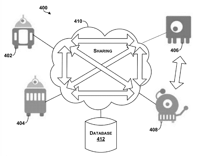
The Google patent shows an example system in which robotic devices interact with the cloud and share information with other cloud computing devices.
In a patent awarded April 14, Google describes “systems and methods for allocating tasks to a plurality of robotic devices,” reports Nextgov.com.
Google’s patent (Patent #9,008,839)outlines methods for connecting a series of robots over the cloud to complete tasks. A robotic device configured to perform a task could make use of a GPS receiver to determine its location. It might also use other sensors, such as a gyroscope or an accelerometer to measure movement. Other sensors could be encoders, infrared sensors, optical sensors, biosensors, Radio Frequency identification (RFID) systems, wireless sensors and compasses.
The patent suggests that the robots could be controlled by a smartphone — from anywhere in the world.
The patent could have value for Google’s self-driving car project, allowing the vehicles to communicate with each other.
In another patent (Patent #US008996429), awarded on March 31, Google describes how a robot’s personality can be defined using sensors and the cloud. According to the patent, “methods and systems for robot and user interaction are provided to generate a personality for the robot.” One aspect includes basing the robot’s personality on identifying the user’s location.
The personality and state may be shared with other robots so as to clone this robot within another device or devices. In this manner, a user may travel to another city, and download within a robot in that city (another “skin”) the personality and state matching the user’s “home location” robot. The robot personality thereby becomes transportable or transferable.
Again, GPS is mentioned as a possible sensor for use either in the user’s smartphone, the robot, or both.
So, in the future, when you leave home, you may be able to take an interactive non-human friend along. Talk about location-based services!
Fleetmatics has released the second edition of its FleetBeat Report, an in-depth analysis of tens of billions of data points extracted from thousands of commercial fleets managed using the company’s Software as a service (SaaS) platform over a span of four years. The report, “FleetBeat, Vol. 2: The Economy in Motion,” was co-authored by Stephen Fuller, Ph.D., professor and director of the Center for Regional Analysis at George Mason University.
Fleetmatics says the data included in the report reveals that performance of small businesses in the services industry directly reflects the health of the economy.
“It has long been said that retail sales trends are often impacted by the health of small business,” said Jim Travers, chairman and chief executive officer of Fleetmatics. “Fleetmatics is uniquely positioned to analyze small business services activity given we have one of the largest fleet management data clouds in the world. Also, our customers are typically in the earlier phases of consumer consumption, such as distribution of goods and home deliveries.”
As outlined in the report, the data extracted from Fleetmatics fleet management data cloud suggests that performance of small business services companies can be a highly credible indicator of national and regional economic health, even under changing conditions. The report also looks at small business services performance and retail sales in four Metropolitan Statistical Areas (MSAs), and concludes that geographic features can significantly define regional small business activity profiles.
“This is truly a groundbreaking new report, viewed from the perspective of the fleet management industry,” said Fuller. “Based on Fleetmatics’ FleetBeat second edition report, Fleetmatics data explains much of the variation and growth in retail sales. Furthermore, when comparing the Fleetmatics’ small business service fleet activity data with the retail sales data from Moody’s and the U.S. Bureau of Census, it’s clear the two data sets exhibit an extremely high correlation. I believe the ability to analyze real-time telematics data can now be considered an accurate data source on the small business flow of goods and service.”
With a dataset of over 10.7 billion telematics-generated data points from commercial vehicles managed with the Company’s SaaS platform in the United States, the report used regression analysis to compare the data with national monthly retail sales data.
There were eight telematics-derived, independent parameters considered in the analysis, both in aggregate and at the per vehicle level, including those related to mileage, number of vehicle stops, mileage per stop, number of active vehicle days per month and number of vehicles active in a month. The data was drawn from small business customers defined as entities having fleets from 5 to 100 vehicles, and only fleets from business types that were related to or supporting retail and service sectors were considered.
The report also examined regional differences that drive activities of small business services companies in four markets: New York, Chicago, San Francisco and Miami. The result was an in-depth breakdown of the most prominent indicators of small business economic activity and correlation to retails sales in each core market.
Fleetmatics’ first FleetBeat report highlighted the economic impact of telematics adoption and quantifiable benefits of business intelligence-driven fleet management. The report found that the total estimated economic impact of commercial fleet vehicles armed with telematics – assuming everyone had the same results as Fleetmatics’ optimized customers – would amount to $2.2 billion in fuel savings, a decrease in carbon dioxide emissions by 5 tons per year and $34.9 billion in total cost savings due to decrease in payroll hours.