Category: Transportation

  • Car Dealership’s GPS Tracking System Saves Philadelphia Kidnap Victim

    A GPS tracking device helped Philadelphia police rescue a woman who was kidnapped November 2 and apprehend the suspect who abducted her. A growing number of used car dealerships use the technology to protect their investments. This time it protected the life of an innocent victim of violent crime.

    The NBC affiliate in Philadelphia covered the story on the air and posted it on its website.

    Surveillance video showed the crime being committed. The brazen attack was shocking to watch — an innocent woman named Carlesha Freeland-Gaither was grabbed by a man who then forced her into a car parked at the curb. The man then got in the car and drove away.

    Police investigating the crime immediately checked the surveillance video and discovered they could read the license number of the vehicle used by the kidnapper. When they checked the license number, they discovered the vehicle had been purchased from a used car dealership specializing in helping people with bad credit get car loans.

    “‘Buy Here, Pay Here’ refers to the fact that the dealership is also serving as the lender,” said Eddie Bermudez, product development manager with Position Plus of Lake Forest, California. “These lenders take a big risk lending money to people who other lenders won’t touch.”

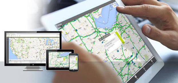
    The BHPH industry found GPS tracking systems to be a big help when a borrower is delinquent on their loan payments. The Position Plus system is used by almost 1,500 dealerships across the country.

    “The lender places a small GPS tracking device in the vehicle,” Bermudez said. “As long as their loan payments are current, there’s no problem. But if they go delinquent, the lender has the option of using the GPS tracking device to locate the vehicle. This makes the process of repossessing the vehicle much easier.”

    The lenders each have a policy as to how they handle these situations. In most cases borrowers receive emails or text messages warning them they’re behind before repossession efforts are initiated.

    Fortunately, the kidnapping in Philadelphia ended well. The vehicle was located in the parking lot of a shopping center. The suspect attempted to start the car, but he was completely surrounded by police. According to Bermudez, the PositionPlus system could have stopped him cold.

    “If it had been our system, he wouldn’t have been able to start the car,” added Bermudez. “We can’t shut down the engine while it’s driving, but we can keep the vehicle from starting the next time the ignition is turned on.”

  • Telit Introduces Jupiter GPS Module for Migration to Full GNSS

    Telit Introduces Jupiter GPS Module for Migration to Full GNSS

    The Jupiter SL871-S.
    The Jupiter SL871-S.

    Telit Wireless Solutions has debuted the Jupiter SL871-S, designed for easy migration between a full-GNSS solution for top-ranked applications and a simple GPS-only solution for less demanding applications. The Jupiter SL871-S is designed to track and navigate GPS and QZSS constellations while ensuring pin-to-pin and protocol compatibility with its multi-constellation companion module, the SL871.

    The module comes in a 9.7 x 10.1 millimeter LCC package with an ARM7 baseband processor, embedded ROM memory, and integrated LNA. It delivers geolocation data using NMEA protocol through a standard UART port. It supports ephemeris file injection (A-GPS) as well as Satellite Based Augmentation System (SBAS) for increased position accuracy.

    In addition, its extremely low power consumption in all conditions is suited to applications requiring long battery life.

    SL871-S has been designed to ensure hardware and software compatibility with SL871, allowing customers to design once and take advantage of the xL871 common form factor. Benefits include:

    • Pin-to-pin compatibility with SL871 family,
    • Same protocol used in SL871,
    • Straightforward migration between full-GNSS solutions and GPS-only solutions,
    • Satellite Based Augmentation System (SBAS) support for increased position accuracy, and
    • Assisted GPS.

    The SL871-S can replace the SL871, allowing customers to design once and interchangeably mount the appropriate solution depending on the required features.

    “The new SL871-S module designed to be easily swapped with other xL871 modules for enhanced simplicity and scalability,” said Taneli Tuurnala, CEO of Telit GNSS Solutions. “It is an ideal example of how buying a module from Telit enables our customers to avert the need to keep track of the latest chipset technology on their own. We keep them on top of the best available technology, pre-packaged in a module that is easy to replace as needed, without having to redesign their entire application to stay up to date.”

  • Teletrac’s Fleet Director Improvements Designed for Mobile

    Teletrac-fleet-director Photo: Teletrac, Inc.
    Photo: Teletrac, Inc.

    Teletrac, Inc., a GPS tracking and fleet management provider, is offering a new version of its Fleet Director GPS fleet tracking system that provides users with greater control and flexibility, Teletrac said.

    Users now have full access to Fleet Director’s management features via mobile device, in addition to desktop functionality. Also, the latest update offers robust fleet management tools, such as the ability to monitor fuel consumption, increase driver safety, and meet compliance mandates.

    “In the current climate, businesses have the ability to achieve high levels of profitability and growth with the help of an advanced fleet management platform,” said Tony Eales, president, Teletrac. “The latest version of Fleet Director churns millions of data transactions daily, providing vital information to help meet company goals across multiple industries and workforce sizes. Businesses are equipped with the actionable data necessary to cultivate and develop their company on multiple levels and gain a competitive advantage in their market.”

    Teletrac has modernized Fleet Director in four key fleet management areas: anywhere, anytime mobile access; deeper driver and vehicle behavioral data; enhanced mapping functionality; and advanced safety analytics.

    “Fleet management has historically been an at-a-desk job, limiting companies in their productivity and communication. The added flexibility of using modern devices — such as smartphones, laptops and tablets — to do business has increased productivity while also adding expectations from customers,” said Sid Nair, director of Product Management, Teletrac. “As the industry has evolved, so have we.”

    Enhancements include:

    Mobility: Fleet Director allows users to manage their vehicles from any mobile device or browser through new HTML 5 functionality. The software’s clear and user-friendly interface lets users navigate easily to a targeted location regardless of whether the manager is in the office or on a mobile phone in the field.

    Actionable Data: The updated software allows managers to move beyond basic track-and-trace functionality, offering an in-depth look at the overall health of a business. The new Fleet Director is built with more robust driver and vehicle behavioral data, providing businesses with insight into performance areas such as fuel management, power take-off time, engine performance and job-site delivery tracking.

    Cutting-Edge Mapping Technology: Mapping has moved beyond location tracking with Fleet Director’s enhanced interactive features. Vehicle and asset mapping is now accessible on easy-to-use Google Maps that toggle between single and multiple views. Managers can consult Fleet Director to pinpoint the exact road their drivers are on while using Google Street View to zoom into the terrain and makeup of the road. These added map enhancements provide fleet managers with tools to have better control of their business.

    Advanced Safety Behavior Data: Fleet Director Safety Analytics helps managers get closer to their fleet through insight into key driver safety events, such as speeding, harsh braking, accelerating, stop sign violations and fast cornering. New data-rich dashboards display relevant information that shows the time and date of each event and the number of infractions per vehicle and driver, including the best and worst performance rankings. Safety infractions can be replayed on the map interface to show how an unsafe driving incident occurred in real-time, providing useful data that can prevent the risk of a crash.

  • Omnitracs Completes Acquisition of XRS Corporation

    Omnitracs LLC, a provider of fleet management solutions to transportation and logistics companies, has completed the acquisition of XRS Corporation for $178 million. XRS is a provider of mobile-based solutions that enable trucking companies to manage fleets, comply with regulations, and reduce operating costs.

    Omnitracs acquired XRS to strengthen its core technology portfolio, adding complementary solutions designed to help fleets solve critical business problems, Omnitracs said. The combined company will continue to deliver transportation management products and services that empower fleets to control virtually every aspect of their business, from improving safety to complying with industry regulations to enhancing productivity and profitability, the company said.

    “This acquisition exemplifies Omnitracs’ commitment to delivering solutions that translate into real value and a true competitive advantage for customers,” said John Graham, CEO of Omnitracs. “By integrating XRS into the Omnitracs portfolio of businesses, we can now offer fleets an extended array of industry-leading solutions, helping fleets make intelligent decisions that positively impact all aspects of their operations.”

    Together, Omnitracs and XRS will provide end-to-end fleet management solutions to more than 30,000 customers with nearly 1,000,000 mobile assets in 63 countries.

    Omnitracs Outlook 2015. In related news, registration is now open for Omnitracs’ first joint user conference — Omnitracs Outlook 2015 — which takes place February 8-11, 2015, in Dallas, Texas.

    Omnitracs Outlook 2015 will unite fleet customers of Omnitracs and its business units Roadnet, Sylectus, and Omnitracs Analytics (formerly FleetRisk Advisors). The conference will bring together fleet executives, managers, power users, product experts, specialized technology providers and industry opinion leaders for educational, networking and peer-to-peer sessions designed to help fleets improve operational efficiency, safety and regulatory compliance.

    “With just a few months until this ‘don’t miss’ event, we look forward to bringing together our customers from across all Omnitracs business units for an opportunity to learn about the company’s strategic vision, product roadmap and more,” said John Graham, CEO of Omnitracs. “We’re thrilled to have this opportunity to host everyone in our new hometown, Dallas, and look forward to the unparalleled networking and education sessions at Outlook 2015.”

    The sessions at Omnitracs Outlook 2015 will include product-specific breakouts targeted to users of Omnitracs, Roadnet, Sylectus and Omnitracs Analytics; cover the latest transportation and logistics technology trends; and highlight user case studies. Peer-to-peer networking opportunities and the technology expo, featuring integration partners and hands-on solution demonstrations, will deliver additional value to conference participants.

    Interested sponsors and exhibitors should contact [email protected].

  • Geotab Offers Future-Proof Commercial Telematics Solution

    Geotab-GO7-Side-W
    Photo: Geotab

    Geotab, a telematics engineering company, has launched its new GO7 telematics device. The GO7 allows fleet management applications to receive vehicle data communications from the engine, drive train, instrument cluster and other subsystems.

    The Geotab GO7 is the newest device in Geotab’s line of telematics solutions and has added a number of new features such as programmable CANBUS, OBD, J1708 connection pins, enhanced auto-protocol detection and higher sensitivity accelerometer — making the solution future-proof and cost effective for any fleet to install and maintain, the company said.

    The GO7 is an plug-and-play device with internal antennas that eliminates installation and out-of service vehicle time, which significantly lowers installation costs and improves fleet productivity, according to Geotab. The latest edition of Geotab’s GO devices caters to more than one vehicle protocol at a time, allowing the device to collect data simultaneously for all possible datasets, such as RPM, VIN, fuel level, seat-belt detection and odometer. The secondary protocol support provides detailed engine data for a variety of vehicles, including Ford, GM, Chrysler, Volvo and Mazda. The technology is scalable, from light duty, medium duty, to heavy commercial trucks in addition to supporting all major vehicle manufacturers globally, Geotab said.

    GO7-Installation2-W Photo: Geotab
    Photo: Geotab

    “Our goal is to provide the most advanced and efficient telematics solution in the industry,” said Neil Cawse, CEO, Geotab. “Together with our MyGeotab software, the all-new GO7 device allows us to provide our customers with the most sophisticated end-to-end fleet management solution on an industry leading platform — providing great productivity enhancements, safety features and cost-savings to our fleet customers.”

    Top features of the GO7 include:

    • Easy plug-and-play installation
    • External device expandability via IOX Technology
    • Intelligent in-vehicle driver coaching
    • Small form factor device
    • Breakthrough accident detection and notification
    • Accurate engine diagnostics, DTC, and proprietary engine data
    • Real-time vehicle data
    • Fast GPS acquisition time using Almanac OTA support
    • Built-in auto-calibrating accelerometer.
  • iXBlue Launches Marins M Series Inertial Nav System

    iXBlue Launches Marins M Series Inertial Nav System

    The MARINS M series INS by iXBlue.
    The Marins M series INS by iXBlue. Photo: iXBlue

    iXBlue unveiled its Marins M series inertial navigation system (INS) at EURONAVAL 2014, held October 27-31 in Paris, France. The series includes the Marins M3, M5 and M7 systems and is designed to address the needs of the world’s most advanced navies for surface-vessel and submarine operations close to shore and in open-sea environments.

    Accurate and reliable navigation, including missile alignment, is critical to the success of submarine and surface-vessel missions. The Marins M series raises the bar in performance and scalability by addressing the needs of surface ship navigation under a GPS-denied environment. For submarines, Marins M7 enables three times longer autonomous stealth navigation compared with any available system by offering drifts of less than 1 Nm/72 h.

    The Marins M series represents the state of the art in strap-down, fiber-optic gyroscope (FOG) technology, and is combat-ready against GNSS denial, iXBlue said. The military-specification units output position, heading, roll, pitch, depth and velocities, and are perfectly silent. The systems are compatible with a wide range of aiding sensors and can be up and running within minutes.

    The extended iXBlue product range, including Quadrans, Octans, Phins and Marins M series systems, now represents even higher scalability of solutions, from attack craft to aircraft carriers and submarines.

    More than 30 navies worldwide have selected the iXBlue product range, including previous generations of Marins systems. For example, the UK Royal Navy has adopted advanced iXBlue solutions for its Astute Class submarines.

  • European Rail Supported by European GNSS

    European Rail Supported by European GNSS

    bernina-express-on-the-tirano-street-W Photo: European GNSS Agency (GSA)
    Photo: European GNSS Agency (GSA)

    By the European GNSS Agency (GSA)

    As European satellites offer a possibility to improve the efficiency of train control systems, GNSS technology is starting to gain momentum in the rail sector. To promote the role of GNSS in this important sector, the European GNSS Agency (GSA) recently exhibited at Innotrans — a leading rail transport tradeshow.

    EGNOS can and, in the future, Galileo will provide continuous and highly reliable positioning service — helping increase the competitiveness of rail among other modes of transportation. Currently, GNSS in European rail is primarily used within non-safety-of-life applications, including asset management and passenger information services. However, the latest technological developments show that augmented GNSS, together with specific sensors, can help satisfy the stringent CENELEC Safety and Integrity Level requirements.

    As a result, the rail sector has an increasing demand for cost-effective and innovative GNSS applications for both safety critical and non-safety critical purpose. For example, in the safety-critical domain, GNSS-based applications can provide signaling and autonomous train control. In the non-safety critical domain, GNSS is helping improve the performance of asset management and passenger information systems.

    Showcasing the E-GNSS Advantage

    With rail becoming an important market segment for GNSS technology, and to put emphasis on the many benefits E-GNSS can bring the rail sector, for the first time the GSA exhibited at a rail tradeshow. At Innotrans, one of the leading international tradeshows for the sector held September 23-26 in Berlin, the GSA showcased the EGNOS advantage for rail.

    Joining a panel discussion hosted by the European Railways Agency (ERA) entitled “How Heaven Could Support European Train Control System (ETCS),” GSA Head of Market Development Gian-Gherardo Calini explained how European GNSS can serve as a solution to some of the problems the sector currently faces.

    “Although rail will become a major market for E-GNSS, it is already providing benefits, such as helping to improve safety,” he said. “Our role at the GSA is to serve the end user by making sure the technology delivers the necessary solutions.”

    Calini acknowledged there are challenges to the sector’s full adoption of GNSS, but stated that other sectors have overcome challenges and are benefiting from E-GNSS: “It is a successful reality in other transport sectors, especially aviation, and we must focus on building from these experiences,” he said.

    The ERTMS/ETCS is a major industrial project that aims to replace Europe’s different national train control and command systems. The deployment of ERTMS will enable the creation of a seamless European railway system with aligned signalling — essential to increasing the competitiveness of European railways.

    Europe’s GNSS systems — Galileo and EGNOS — are actively contributing to the needed evolution of the ERTMS. One example of this long-term perspective is the Shift2Rail Joint Undertaking, whose objective is also to support the adoption of GNSS in the rail sector. Within this undertaking, it is foreseen that both Galileo and EGNOS will be brought into ERTMS standards and foster European GNSS adoption in the area of Low Density Lines.

  • Installed Base of Fleet Management Systems to Reach 7.1M in Europe by 2018

    According to a new research report from the analyst firm Berg Insight, the number of active fleet management systems deployed in commercial vehicle fleets in Europe was 3.65 million in Q4-2013. Growing at a compound annual growth rate (CAGR) of 14.2 percent, this number is expected to reach 7.10 million by 2018.

    A group of international aftermarket solution providers have emerged as the leaders on the European fleet management market. Masternaut reported an active installed base of close to 350,000 units in July 2014, mainly in France and the UK. TomTom Telematics was the fastest growing vendor also in 2014 and has now surpassed 400,000 subscribers in August 2014.

    The two companies share the number one spot in terms of active installed base in Europe. Digicore has also joined the exclusive group of fleet management providers in Europe having more than 100,000 active devices in the field. Transics is number one in the heavy trucks segment with an estimated 85,000 active units installed.

    A major trend in the past three years has been the announcements of standard line fitment of fleet management solutions among the HCV manufacturers. Scania, Daimler, Volvo and MAN now experience fast growth of telematics subscribers thanks to these initiatives. FleetBoard by Daimler, Dynafleet by Volvo and Scania Fleet Management are the most sold systems with cumulative shipments of 150,000 units, 135,000 units and 100,000 units respectively as of Q4-2013.

    A recent trend is that LCV manufacturers increasingly work together with aftermarket players to offer fleet management solutions. PSA Peugeot Citroën has for instance launched a new fleet management service on the French market in partnership with Orange Business Services in April 2014. Ford and Telogis recently partnered to deliver fleet management solutions to Ford customers in Europe. Teletrac has moreover for a long time collaborated with OEMs on the UK market, including Citroën and Mercedes Benz.

    M&A activities on this market continued with full force in 2014. “Seven major mergers and acquisitions have so far taken place this year among the vendors of fleet management systems in Europe,” said Johan Fagerberg, Senior Analyst, Berg Insight. At the beginning of 2014, Qualcomm finally divested also the majority of the European arm of its fleet business to Astrata Group, a fleet management company headquartered in Singapore.

    Later in February, WABCO acquired Transics and the transaction valued the company at about €100 million. Lysanda acquired UK-based TRACKER Network in February and plans to establish Tantalum Corporation from the combined business.

    In April, TomTom also acquired the French FM provider DAMS Tracking, adding another 27,000 subscriptions to the installed base. Francisco Partners, moreover, divested Masternaut to Summit Partners and FleetCor in the same month.

    In July 2014, Zucchetti Group acquired a majority share of Macnil from its founders. The latest transaction was done in October 2014 when Finder acquired its Polish competitor Autoguard to form the largest FMS provider in Poland. Fagerberg anticipates that the market consolidation of the still overcrowded industry will continue in 2015.

    Download the report brochure.

  • Singapore Transit to Develop GNSS Road-Pricing System

    The Land Transport Authority (LTA) of Singapore is seeking to develop Singapore’s next-generation electronic road-pricing system, based on GNSS technology, reports AsiaOne News.

    LTA has shortlisted three consortia to participate in a tender to develop the system: NCS Pte Ltd & MHI Engine System Asia Pte Ltd, ST Electronics (Info-Comm Systems) Pte Ltd, and Watchdata Technologies Pte Ltd & Beijing Watchdata System Co Ltd.

    The contract to design and develop the system is expected to be awarded in the second half of 2015. The system is to be implemented in 2020.

    Following an 18-month system evaluation test that concluded in December 2012, LTA said that it has found that it is technologically feasible to develop a GNSS-based road-pricing system in Singapore. The system will overcome the constraints of physical gantries, which are costly, difficult to maintain, and take up land space.

    The GNSS-based system will implement distance-based pricing along certain congested roads, where motorists will be charged proportionate to the distance traveled. An interactive and intelligent on-board unit in motorists’ vehicles will support additional services such as real-time traffic information and electronic payment for parking fees.

    LTA is considering new policies for off-peak travelers.

  • DARPA Program Addresses Degraded Visibility for Helicopters

    DARPA Program Addresses Degraded Visibility for Helicopters

    Degraded visibility — which encompasses diverse environmental conditions including severe weather, dust kicked up during takeoff and landing, and poor visual contrast among different parts of terrain — often puts both the safety and effectiveness of tactical helicopter operations at risk. Current sensor systems that can provide the necessary visualization through obscurants struggle with latency and are too large, heavy and power-intensive to comply with military rotary-wing operations.

    The Defense Advanced Research Projects Agency‘s (DARPA’s) Multifunction RF (MFRF) program seeks to overcome these challenges and enhance the survivability and combat effectiveness of helicopters facing degraded visibility. The program aims to develop multifunction sensor technology that would enable sensor packages small, light and efficient enough for installation on existing and future helicopter designs. MFRF would enable pilots to:

    • Take off, fly and land safely in degraded and zero-visibility conditions
    • Avoid collisions with other aircraft, terrain and man-made obstacles (e.g. power lines)
    • Improve target detection, identification and engagement

    MFRF completed successful flight demonstrations on a UH-60L Black Hawk combat helicopter (see video above) to demonstrate the Synthetic Vision Avionics Backbone (SVAB) technology portion of the program. The SVAB technology demonstration fused millimeter-wave radar with multiple terrain databases and onboard platform navigation to create high-resolution 2D and 3D visualizations of local environmental conditions.

    Pilots referred to the visualizations in real time to distinguish terrain features (slope, roughness, landing suitability), detect objects in a landing zone, detect and avoid obstacles, and navigate in GPS-denied conditions. The software architecture of the SVAB also demonstrated plug-and-play sensor control and display.

    “These successful tests take us closer to future cost-effective, ‘plug-and-play’ systems that would improve situational awareness and mission effectiveness for manned and unmanned platforms alike,” said Bruce Wallace, DARPA program manager.

    DARPA-helicopter_RF-W
    Photo: DARPA


  • China to Join Effort on Aircraft Satnav Standards

    China to Join Effort on Aircraft Satnav Standards

    EGNOS is Europe’s first venture into satellite navigation. EGNOS broadcasts augmented information through a trio of geostationary satellites linked to a network of monitoring ground stations, to sharpen the accuracy and reliability of GPS signals across the continent.
    EGNOS is Europe’s first venture into satellite navigation. EGNOS broadcasts augmented information through a trio of geostationary satellites linked to a network of monitoring ground stations, to sharpen the accuracy and reliability of GPS signals across the continent. Photo: EGNOS

    Europe’s EGNOS augmentation system sharpens the accuracy and reliability of GPS signals so they can safely be used for landing approaches across a growing number of European airports. But aviation is a global enterprise — so the aim is to develop a seamless network of augmentation systems in future.

    That is the task of an international group of experts, the Satellite Based Augmentation Systems (SBAS) Interoperability Working Group (IWG), whose 27th  meeting took place in Tampa, Florida, September 8-10, hosted by the Institute of Navigation.

    Satellite augmentation systems combine dedicated ground stations and satellite transponders to sharpen satnav accuracy and provide integrity data — providing continuously updated reliability levels — across given geographical regions. These systems are based on GPS for now, but plans are to move to a multi-constellation design in the post-2020 era, making use of Europe’s Galileo, China’s Beidou and Russia’s GLONASS systems as well.

    SBAS providers from around the globe gathered at Tampa, Florida, for the latest meeting of the SBAS Interoperability Working Group September 8-10. IWG 27 was hosted by the Institute of Navigation.
    SBAS providers from around the globe gathered at Tampa, Florida, for the latest meeting of the SBAS Interoperability Working Group September 8-10. IWG 27 was hosted by the Institute of Navigation. Photo: SBAS
    SBAS systems enhance any type of location-based satnav use, but in practice, aviation is the main driver. The ESA-developed European Geostationary Navigation Overlay Service, EGNOS, commenced its general-public Open Service in 2009, with the Safety-of-Life Service for aircraft vertical landing approaches following in 2011.

    For next-generation SBAS systems, the IWG is designing a multi-constellation and dual-frequency standard for heightened accuracy and reliability, building up to offering SBAS coverage on a worldwide basis.

    Didier Flament, representing ESA — which co-chaired this IWG meeting with the U.S. Federal Aviation Authority — commented: “Among the achievements of the Tampa IWG has been the presentation of an ongoing review of a standard message definition for the new and second SBAS channel — known as L5 — of the second-generation SBAS system, to be used along with the current L1 signal.

    ASECNA Member States.
    ASECNA Member States.
    “A single definition coordinated between ESA and the European Commission on one side and the U.S. Federal Aviation Administration on the other is progressing. The formal IWG review loop has  started, with the aim of finalizing the convergence for early 2015. The aim is to have it ready to submit to the international SBAS standardization bodies — the International Civil Aviation Organization (ICAO), the U.S. Radio Technical Commission for Aeronautics and the European Organization for Civil Aviation Equipment — in the first quarter of next year.”

    The meeting also introduced two new SBAS development projects, adding to the five existing projects presented at IWG 26. The first was presented by the Agency for Air Navigation Safety in western Africa and Madagascar (ASECNA), a public international organization with 18 member states.

    China's BeiDou SBAS development plan, presented at IWG 27 in September 2014.
    China’s BeiDou SBAS development plan, presented at IWG 27 in September 2014.

    ASECNA’s project aims to take a two-step approach, commencing with EGNOS-style vertical landing guidance for selected airports, based on EGNOS constituents, with a tentative schedule of 2018, moving to upgrade to the dual-frequency multi-constellation service across the whole of ASECNA airspace after 2020.

    The second new project is China’s own BeiDou SBAS. After discussions at ICAO level, China has committed to delivering SBAS services over China that are fully compliant with ICAO standards.

    “This new plan has been highly welcomed by the aviation community and other SBAS providers,” Didier said. “Chinese representatives have also confirmed their intention to become part of the SBAS IWG and contribute to the work done to finalise the future standard.”

    The follow-up IWG meeting will take place in February 2015 and will be hosted by ASECNA in Dakar, Senegal.

    About EGNOS

    EGNOS, the European Geostationary Navigation Overlay Service, is Europe’s first venture into satellite navigation. Its development was managed by the European Space Agency (ESA) under a tripartite agreement with the European Commission (EC) and the European Organization for the Safety of Air Navigation (Eurocontrol).

    The ownership of the EGNOS assets was transferred from ESA to the EC in April 2009 and EGNOS officially entered service on October 1, 2009. The service is delivered, through a contract with the European GNSS Service Agency (GSA), by the European Satellite Services Provider, ESSP SaS, founded by seven air navigation service providers. ESA is the design and procurement agent for EGNOS on behalf of the EC.


  • Aireon Plans Global Emergency Tracking Service for Aircraft

    Aireon LLC, developer of a space-based ADS-B global air traffic surveillance system, is planning the Aireon Aircraft Locating and Emergency Response Tracking (Aireon ALERT) service, a global emergency tracking service that will be provided free of charge to the aviation community beginning in 2017. The Aireon ALERT service will allow rescue agencies to request the location and last flight track of any 1090-MHz ADS-B equipped aircraft flying in airspace currently without surveillance.

    “A comprehensive, global aircraft tracking solution is essential in emergency situations, as evidenced by MH370 earlier this year and Air France 447 in 2009,” said Don Thoma, president and CEO, Aireon. “Aireon is being deployed to improve the efficiency and safety of aircraft operations in oceanic and unsurveilled airspace. The same technology behind these efficiency and safety gains can also make a significant difference in providing quick, accurate information in emergency situations. With one global view of ADS-B equipped aircraft, Aireon ALERT will provide accurate and real-time tracking data immediately to authorized search-and-rescue operations, without requiring airlines to equip aircraft with new avionics or the ANSPs and authorities to deploy new systems.”

    Aireon is deploying a global space-based ADS-B surveillance capability providing direct air traffic controller visibility of flights operating in oceanic or remote airspace, focused on improving the efficiency and safety of aircraft operations. When Aireon is fully operational, anticipated for 2017, it will create a powerful platform capable of tracking ADS-B equipped aircraft around the globe in real time.

    The Aireon ALERT service will be available soon after Aireon’s full deployment and will be provided through a 24/7 application and emergency call center. Historical track data will be available to pre-authorized users, including ANSPs, airlines, and search-and-rescue authorities, through Aireon ALERT soon after controller communications are lost with an aircraft. The system can also provide real-time tracking of aircraft in distress, provided ADS-B transmissions are still operational.

    “Tracking of aircraft in emergency and search-and-rescue situations is a complex issue,” said Cyriel Kronenburg, vice president sales and marketing for Aireon. “We plan to engage the various aviation stakeholders including the airlines, ANSPs, regulators, and search-and-rescue organizations over the next 12 months to define the technical, operational, and legal details of providing this data in emergency situations.”

    “We anticipate support from the world’s airlines for the approach taken by Aireon for emergency tracking,” said John Crichton, president and CEO of NAV CANADA. “Airlines already stand to gain over $125 million per year in fuel savings in the North Atlantic alone by using Aireon’s space-based surveillance service. The Aireon ALERT public service offers an additional benefit, free of charge, ensuring that ADS-B equipped aircraft can be tracked anywhere in the world, even in airspace managed by ANSPs that have not subscribed to the Aireon service.”

    Aireon is a joint venture among Iridium Communications Inc., NAV CANADA, ENAV, IAA, and Naviair, established to launch the Aireon system by hosting ADS-B receiver payloads on Iridium NEXT, Iridium’s second-generation satellite constellation, scheduled for first launch in 2015. This new capability will extend air traffic surveillance to the entire planet and increase the safety and efficiency of air travel over oceanic and remote regions.