Signal Sentry 1000, an Exelis product that detects and locates GPS interference sources in 3D by using longitude, latitude and altitude, was deployed during Super Bowl XLVIII at the MetLife Stadium in East Rutherford, New Jersey.
During the Super Bowl, GPS devices were used extensively to track and monitor the location of team members and officials. GPS was also used to ensure that event organizers and security knew the exact location of team vehicles en route to the stadium. If a vehicle were to break down delaying the arrival of a team or game staff to the event, logistics and scheduling could have been adjusted accordingly.
“Signal Sentry 1000 helped our law enforcement officials keep thousands of fans in attendance safe during one of the most exciting nights for millions of Americans,” said Mark Pisani, vice president and general manager of positioning, navigation and timing for Exelis Geospatial Systems. “Protecting critical GPS infrastructure is extremely important for public safety.”
Signal Sentry 1000 was designed to collect actionable intelligence for law enforcement and to protect GPS signal-dependent critical infrastructures. At the Super Bowl, Exelis deployed eight Signal Sentry sensors positioned in an array pattern to detect and locate the jamming source. Threats are detected through a network of sensors, which is part of a centralized server executing Exelis-developed proprietary location algorithms.
In addition to national special security events like the Super Bowl, sensors can also be used around different types of critical infrastructure, such as utilities and government facilities, to automatically sense and locate any intentional or unintentional source of GPS jamming. Once a threat is detected, users receive specific information regarding the location of the threat in order to stop or mitigate the interference.
A still from the movie Gravity, where space real estate feels really small and collisions frequently happen. (credit: Warner Bros. Pictures)
Wow, what a bevy of acronyms. If you already know what they mean, great. If you don’t, just hang in and all will be made clear.
E. L. Doctorow once wrote, “Writing is a socially acceptable form of schizophrenia.” Now, I am not sure how I feel about that or how my daughter who is a practicing Clinical Psychologist (PsyD) would interpret that, but as she publishes (publish or perish) behavioral science papers in the public domain, she did remind me of a paradigm shift in journalism today that has stuck with me. She said simply, “Dad, everything you publish today is out there and available to everyone, everywhere, all the time, in multiple venues.” As mundane as that may sound to everyone under 20 years of age, to those of my generation it is indeed profound, as it socially delineates the technical world we live in today that has afforded unprecedented data and document availability for the first time in history. Never before have so many had virtually instantaneous access to so much information. Can you say Siri?
The really interesting part of this instant-access phenomenon is that it not only applies to articles and columns that I and my fellow journalists pen today, but includes access to everything we, and anyone else, has ever written that has been preserved. As you read this, thousands of books (some moldering for more than two thousand years), reports and articles are being scanned daily and made available for the world to read in a digital or new print format.
Numerous major programs today are digitizing books, documents, magazines and newspapers daily, such as Amazon and the sometimes annoying Captcha program, which stands for Completely Automated Public Turing test to tell Computers and Humans Apart. In 2007 the Alfred P. Sloan Foundation awarded the Library of Congress more than $2 million for the “Digitizing American Imprints at the Library of Congress” effort. Thanks to this program and others, such as Project Gutenberg, most of the digitized volumes, 45,000 and counting for Project Gutenberg, include most of the writings of Thomas Jefferson, Benjamin Franklin and George Washington, and they are available online free of charge. Depending on your point-of-view and physical location (think Mainland China, Russia and North Korea) that can either be a scary thought or wonderfully liberating.
For almost everything written and published — and published has a new definition in this context — in the past ten years or so, and certainly for the knowable future, the digital and availability timeline equals immediate access. That is because today almost every written document originates in a digital format, while printing and publishing are secondary actions. Think about how this has changed the way you work and read today. It is truly a major revolution of epic proportions, taking place in an evolutionary manner.
USAF SAB
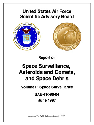
Recently, I was reminded of this new electronic availability as it concerns an academic paper I was honored to edit and minimally coauthor as the Executive Officer for a very distinguished committee of preeminent scientist and physicists, more than 17 years ago when I served on a USAF (United States Air Force) Scientific Advisory Board, or SAB. I have been honored to serve on several SABs and have written or contributed to several SAB reports, but this one was particularly intriguing albeit esoteric in nature, and unless you were interested in the hazards of space debris at the time, which many of us were, you may never have heard of it until now. The full title of the report is rather lengthy, as is common with scholarly scientific reports:
A snapshot of the locations of all cataloged space objects (from the report).
The report was, at the time, and many of us feel today is still, the quintessential and defining document on the hazards or non-hazards of space debris and has been liberally quoted in scientific documents and treatises for the last 17 years.
Meanwhile, NASA (the National Aeronautics and Space Administration) as an organization has always been a bit of a harridan concerning space debris, and it has been known to sensationalize the effects that cascading space debris may have on space assets. Of course, they are always quick to point out that we academics and scientists outside of NASA only worry about absolute numbers and probabilities, while they — as the recent blockbuster movie Gravity amply exemplifies — worry about human lives in an extremely hostile space environment. This is not to say that space debris is not a valid concern; however, this SAB report clearly points out that the NASA cascading theory is more sideshow sensationalism of the Hollywood blockbuster mentality rather than supportable scientific theory. Indeed, space is a very big place, and as Einstein stated, it is always expanding — so you be the judge.
Space Surveillance
But I digress, because for the first time in recent memory, it was not the space debris aspects or Volume Four of the SAB report that made it a document of interest, but rather the First Volume on Space Surveillance that evidently piqued the USAFs interest. In Volume One, the committee made a recommendation (remember, this was seventeen years ago), that to successfully surveil space, you must do it from space and not from the Earth’s surface. Our actual recommendation in part stated, “…the committee recommends that the Air Force pursue surveillance of space from space with search capability.” And then we proceeded to move into tens of pages of technical specifics, which is more than most of you would ever want to take the time to read.
In a nutshell, as it turns out when you surveil space objects, natural and manmade from Earth, you encounter a multitude of bothersome effects you must deal with, such as weather (clouds, storms and lightening — none of which are good for sensitive optical sensors), atmosphere, solar disturbances, signal disturbances, background noise, and more. Now when you surveil space from space, most of these bothersome effects are mitigated to a major degree by the vacuum of space. In the SAB report, in much more detail than I can relate here, we basically concluded that the only successful way to continually monitor and surveil space and objects in space, both natural and man made, is to undertake that surveillance effort from space — in other words, surveil space from space — ideally from a GEO or near Geosynchronous orbit spacecraft with multiple sensors, including multi-spectral sensors that surveil both natural and manmade objects and phenomenon. Seventeen years later it appears that someone listened, and fortunately that someone belonged to an institution, the United States Air Force.
The Secret’s Out
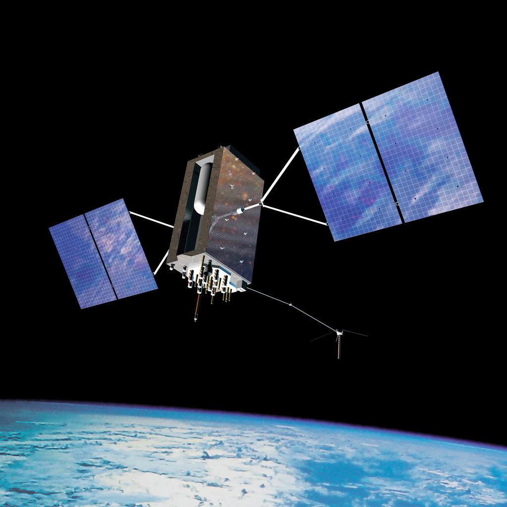
A few weeks ago, General William Shelton, the Commander of Air Force Space Command (AFSPC) announced that by the end of the year, under a program formerly in the SECRET domain known as the Geosynchronous Space Situational Awareness Program, or GSSAP, “…the USAF plans to launch two space surveillance spacecraft into high-altitude orbits later this year to monitor satellite traffic in the congested geosynchronous belt 22,300 miles above Earth…GSSAP will produce a significant improvement in space object surveillance, not only for better collision avoidance but also for detecting threats…GSSAP will bolster our ability to discern when adversaries attempt to avoid detection and to discover capabilities they may have which might be harmful to our critical assets at these higher altitudes.” Shelton made these remarks in a speech at the Air Warfare Symposium in Orlando, Florida, in February.
While these are not the first space surveillance satellites launched by the USAF, they are the first that peer down from on high. Currently the USAF also operates the SBSS or Space Based Surveillance Program, but these satellites surveil all of space from LEO (Low Earth Orbit) altitudes with an optical telescope. Their GEO targets are more than 22,000 miles distant. The newly announced GSSAP satellites will have much more fidelity and have the added advantage of surveilling GEO assets from GEO.
ANGELS and GPS
All very interesting, you say, but where does GPS come into play? Glad you asked. While the GSSAP mission will undoubtedly use limb-of-the-Earth GPS signals for guidance and orientation, the GSSAP mission will also host two other small satellites known as ANGELS, or Automated Navigation and Guidance Experiment for Local Space. The ANGELS job will be to test accelerometers and specialized algorithms that will utilize the GPS navigation signals being broadcast from 11,000 miles away in their MEO orbits, for precision guidance when in close proximity to other satellites, thereby reducing the probability of a collision. Think about this one for a while and all kinds of possibilities become apparent. Why not equip every U.S. satellite with ANGEL technology? Currently, the Air Force fact sheet on ANGELS states that the scope of the mission is limited to the space around the Delta 4 rocket’s upper stage, and while we all know from experience how dangerous inert, non-maneuverable upper stages can be, if you believe the AF fact sheet, I have some swamp land in Florida I would like to discuss.
Seriously, however the GSSAP and ANGELS missions evolve, it is still nice to know that someone is reading what you write, even if it is 17 years later.
Until next time, happy navigating and sleep well, because ANGELS really do exist.
What Is Don Reading?
Obviously I have been reading ancient but still pertinent SAB reports but more importantly this week I also read and highly recommend you read and comment on the latest Federal Register notice for comment submitted by DOT concerning deployment of GPS CNAV messages. The DOT comments are actually a bit misleading as they infer this is an early or pre-operational deployment of CNAV messages and that is a bit of a misnomer. Under the original guidelines CNAV signals would have been broadcast back in 2003 but events prevailed to prevent that from happening. However, and this is an update to the numbers in the original Federal Register Notice, there are currently 12 GPS SVs on orbit capable of broadcasting civilian L2C CNAV signals and military code or MNAV messages. Additionally there are five GPS satellites (IIFs) on orbit capable of broadcasting L5 safety of life signals for DOT.
Frankly, the DOT objects to these signals being broadcast now for, in my humble opinion, very nebulous reasons, and the USAF is working hard to and has, again in my opinion, negated all of the DOTs concerns. So please just take a couple of minutes and go to the Federal Register site and let them know how badly we need these new signals.
Hopefully, you read my February column affirming GPS as the reigning PNT Gold Standard. In order to maintain that status and indeed to continually exceed the capabilities of any of the current or planned PNT systems in existence today, the GPS needs these new signals. I predict CNAV and MNAV messaging capabilities will revolutionize the way PNT signals are utilized. These new signals bring about a capability heretofore unknown in the PNT arena. Just think about this, each CNAV and MNAV signal has the ability to broadcast 256 separate and definable messages to users globally. With 12 CNAV satellites on orbit today, global accessibility tests have shown that for the majority of users this means at least one CNAV SV in view at all times and you only need one CNAV SV in view to take advantage of the messaging capabilities. So the sooner the better I say. I don’t have the room to say much more than that this month but just imagine the possibilities. Please log onto the Federal Register site and let your opinion be heard.
The U.S. National Space-Based Positioning, Navigation, and Timing (PNT) Advisory Board has published the minutes of its December 4–5, 2013, meeting, opening with a quote from Albert Einstein, “We cannot solve our problems with the same thinking we used when we created them,” courtesy of Board Chair Dr. James Schlesinger. Among many other topics addressed, the Board heard a report from Major General Martin Whelan, Director of Requirements, Air Force Space Command, on the road ahead for implementation of the GPS Civil Navigation (CNAV) message on L2C and L5. The subject has stirred some controversy of late, particularly between the U.S. Departments of Transportation (DoT) and Defense (DoD), and DoT is currently seeking public comments on the plan.
The meeting minutes relay the gist of General Whelan’s CNAV remarks as follows:
“While sequestration is having various impacts on DoD budgets, thus far GPS quality, service and refresher plans are unaffected. The FY15 budget is under development.
“CNAV has been under discussion for a considerable time. Currently, L2C and L5 signals are being transmitted, but without a navigation message. AFSPC is working hard to activate these messages as soon as possible. One of the reasons for the delay is that additional time was needed to complete testing prior to activation. Testing began in late summer 2013 and, based on initial test results, a “way ahead” has been plotted. Gen William Shelton, AFSPC commander, wished to assure the Advisory Board of his unwavering commitment to providing full-time broadcast CNAV messaging capability on L2C and L5 as soon as possible.
“The CNAV capability will add diversity and robustness for dual frequency users. Gen Shelton intends to provide details plans to the NCO and a report to the next EXCOM meeting. Current plans are to begin initial broadcasting in the spring of 2014. CNAV uploads will occur twice weekly. The signal will meet GPS Standard Positioning System (SPS) standards, but may not achieve current accuracy levels until full implementation in late 2014.
“CNAV live sky testing occurred in June and was conducted in cooperation with civil, industry, and international partners. The two-week test series included independent assessment and verification. The tests identified four errors that required action. The first, which was addressed in real time, related to implementation of the test series. The second required improvement to the tools suite, which should be totally integrated into the ground segment by December 2014. The third and fourth errors required patches to satellite software. All four issues are now regarded as closed.”
The meeting minutes report this further discussion of CNAV.
“Dr. Schlesinger raised the topic of sequestration and how, based on his early career in budgeting, no budget item is sacrosanct. GPS has enjoyed protection from Deputy Secretary of Defense Ashton Carter, but he is now stepping down and his replacement not yet known. This could provide an opportunity for “the men with the green eyeshades” to come forward to eliminate things.
“Gen Whelan said he agreed that with sequestration, everything – including GPS – is on the table. However, AFSPC continues to strive to avoid any degradation in service. He also welcomed the continued support of the Advisory Board.
“Dr. Schlesinger quoted from a 2006 document: “Our position is to continue to provide the best space-based positioning, navigation and timing service in the world.” The Chinese are now “moving up” on GPS. How is GPS going to stay ahead?
“Gen Whelan said AFSPC is aware of China’s steps in capacity and signal diversity. This, however, does not alter his confidence that GPS remains the “Gold Standard” of world GNSS systems. AFSPC is committed to maintain GPS leadership. However, because of sequestration and budget cuts, this position could not be the position of some people outside of the Air Force.”
A subsequent presentation from the Department of Transportation given by Karen Van Dyke, Director for PNT, DOT Research & Innovative Technology Administration (RITA), did not directly mention CNAV, according to the meeting minutes, but did include this update on civil signal monitoring, taken from the meeting minutes.
“DOT is responsible for performance monitoring of GPS civil signals. She called attention to the International Committee on GNSS’s (ICG’s) transparency principle that “Every GNSS provider should publish documentation that describes the signal and system information, the policies of provision, and the minimum levels of performance offered for its open service.” Currently, this is only done on GPS L1 C/A signals. Performance standards for L2C and L5 have not yet been established. The crucial function of signal/service monitoring is to verify that commitments to GNSS performance are being met. Additionally, monitoring improves the situational awareness for GNSS operators, and provides assurance that any civil service failure is detected and resolved promptly. All these factors support the GPS performance history that has made it the world’s Gold Standard.
“The DOT “GPS Civil Monitoring Performance Specifications” (CMPS) document defines the measurements required to show if performance standards for monitoring GPS’ signals/service are met. The document’s first version was developed in 2005 and listed 193 requirements, covering performance monitoring, signal monitoring, non-broadcast data requirements, and reporting and archiving requirements. The document was later updated to align with the 2008 GPS SPS Performance Standard. The most current CMPS was completed in April 2009 and is available at GPS.gov. Since 1999, DOT has published quarterly reports providing analysis of SPS performance for the Federal Aviation Administration (FAA).”
Further Topics
Other reports delivered to the Advisory Board, and available in the the full meeting minutes, available here, include the following. In addition, many PDFs of the individual reports are available through the meetings Agenda page.
Global Differential GPS System as a Civil Monitoring Utility
Dr. Yoaz Bar-Sever, Manager, Global Differential GPS System, NASA Net Propulsion Laboratory
Automated Driving & Safety Considerations (collision avoidance warning, vehicle-to-vehicle communications, and driverless automobiles)
Russell Shields, PNT Board Member, founder of Ygomi LLC
GPS Disruptions: Efforts to Assess Risks to Critical Infrastructure
The Government Accountability Office’s (GAO) Report on Enhancing Interagency Actions
Eli Albagli, senior analyst, GAO
2013 National Infrastructure Protection Plan (NIPP)
Department of Homeland Security Implementation
Robert Kolasky, Director Strategy and Policy, DHS Office of Infrastructure Protection
Economic Impacts of GPS on Key Sectors in the U. S. Economy
Dr. Nam D. Pham, economist/managing partner, NDP Consulting Group
GNSS Signal Capability – Multi-Constellation Management
Cross-Correlation of Existing & Evolving C/A System Signals
Dr. A. J. Van Dierendonck, AJ Systems
How Far to Take GNSS Interoperability/Interchangeability?
Ken Hodgkins, Office of Space & Advanced Technology, Department of State.
Honeywell Aerospace’s LASEREF VI navigation system has been selected by Airbus Helicopters for its light helicopter platforms, the EC145 T2 and EC645 T2 family.
The LASEREF inertial reference unit (IRU) allows helicopter operators to always have an autonomous navigation source available in the absence of a GNSS and radio navigation. The capability is especially useful when navigating during a mission when the GNSS is unavailable due to terrain masking, limited satellite constellation availability, or unintentional or intentional jamming.
“LASEREF will provide Airbus Helicopters with exactly what they’re looking for — an always-available and highly reliable navigation system,” said Varant Panossian, customer business manager at Honeywell Aerospace. “When you’re in extreme situations, navigation is essential for everything from crew safety to completing critical missions.”
Designed for fixed-wing and rotary-wing applications, the LASEREF is a light, small IRU that delivers the highest reliability in the industry, according to Honeywell. Its integration with GPS prevents delays in information delivery and keeps operations running safely and efficiently even under harsh environments and demanding mission situations.
Too Much Sensitivity, Not Enough Robustness, Says Parkinson
Brad Parkinson, the founding architect of GPS, told a UK conference that the system needs to be made more robust to ensure worldwide availability of services to users. His concerns over GPS availability relate to threats such as the loss of authorized frequency spectrum (implicitly creating licensed jammers), space weather due to hyperactive ionospheric conditions, and deliberate or inadvertent jamming of GPS signals.
He warned that GPS is more vulnerable to sabotage or disruption than ever before, and charged that politicians and security chiefs are ignoring the risk. Western governments are “in their infancy in recognizing the problem,” he remarked further in an interview with London’s Financial Times. “[In the United States] I don’t know anyone that is really in charge of it. The Department of Homeland Security should be [but] … they don’t have any people that understand it very well. They’ve got one person without any budget to speak of.”
He also warned that Europe’s €5 billion Galileo system is equally at risk.
Parkinson proposed a three-stage program to:
Protect (legally) the signal and physically eliminate jamming sources;
Toughen the GPS/Galileo receiver’s resistance to interference;
Augment the GPS signals with other satellites or with ground-based transmitters such as eLoran.
To support his proposal, Parkinson stated, “The number one need for all GPS or Galileo users is availability. Over the years, manufacturers of signal receiver technologies have focused too much on sensitivity and not enough on resilience or robustness. The maritime industry is a particular concern where users have taken GPS for granted. They must increase preparedness and backups as they do in aviation or other GNSS using industries.
“Even today, most ships have only GPS and the vision of their crew to guide them when approaching harbours. As you can see from today’s conference there are a wealth of solutions to toughen and backup GPS, many of which are not technologically difficult nor expensive, but still their adoption in sectors such as global shipping is certainly not adequate.”
As part of his protection program, Parkinson urged that penalties for jamming GPS networks be coordinated worldwide. “In Australia, if you cause interference likely to cause prejudice to the safe conduct of a vessel, it’s five years in the jug [jail] and $850,000.” Contrasting this with a U.S. case that may simply impose a forfeiture of the culprit’s jamming device, Parkinson added, “I’m calling for the community of nations to move to the Aussie-type penalties.”
In the toughening regard, Parkinson alluded to integration of GPS data with information derived from an inertial positioning system. “If you combine all of these things, a good set should be able to fly within 1 kilometer of a jammer with a 10-kilometer range,” said Parkinson. “That’s what I call toughening.”
Parkinson made his remarks as the keynote speech at GNSS Vulnerabilities and Resilient PNT 2014, hosted by the Royal Institute of Navigation. He will also deliver the keynote address, “Assured PNT: Assured World Economic Benefits,” for the European Navigation Conference on April 15 in the Netherlands.
Our esteemed editor-in-chief and publisher at GPS World, Alan Cameron, penned an editorial in January concerning claims made by the People’s Republic of China regarding the Gold Standard for PNT (position, navigation and timing). The Chinese recently claimed that its BeiDou system averaged a user range error (URE) of 2.5 meters using zero age of data (ZAOD), 95% of the time.
Alan correctly made the point that today BeiDou is strictly a regional system, and that while the published and arcane (30-year-old) standard for GPS is 6 meters under the same conditions, this is merely a standard, a never-to-exceed boundary, and not an actual URE measurement. GPS has always provided significantly better than 6 meters accuracy, with a reasonable age of data, while the GPS numbers for URE have significantly improved on a consistent basis since 1978 and today are the best in the world for any global PNT system.
Dr. Bradford Parkinson, the father of GPS, after reviewing the Chinese data pointed out that, “ If a GNNS has full view and an immediate update (such as Compass [BeiDou]) they can drive the AOD down, effectively becoming a WAAS system. This result would not represent a global capability. Plus, there are other errors for a single-frequency receiver in addition to the ionosphere (that is calibrated by WAAS and EGNOS), including troposphere modeling errors, and multipath that drive the ranging error up for a civil user depending on the situation.”
This data is very useful for GDOP (Geometric Dilution of Precision) statistics, which are quite surprising – and come about because of the 30+ GPS satellites in view and the resulting excellent geometry available.
The public data clearly shows that the GPS system is every bit as accurate, and indeed comparatively nominally much more accurate, than BeiDou, and GPS covers the entire globe, not just an area over China and portions of Australia.
It All Starts Here — GPS SIS URE
The GPS accuracy equation begins with the signal in space (SIS). Since 1978, the SIS figures for GPS satellites have continuously improved, as I said primarily due to more accurate orbit determination and more stable atomic reference systems, while the GPS URE numbers have continued to decline. Which is a good thing – smaller URE numbers are better.
Indeed, this clearly explains, in my opinion, why SVN49, which is a perfectly healthy GPS satellite, has never been set to healthy status. While the SVN49 GPS signals are all well within the published 6 meter URE – a never exceed threshold – they are significantly greater than 2 meters. Accuracy matters with GPS, so until corrections can be made, the satellite will remain in test status. Today, it serves as a very useful orbiting GPS test bed but does not enter into the SIS or URE equation.
GPS SIS URE is best explained as the pseudo-range inaccuracy due to ephemeris (orbit) and clock (atomic reference system) errors, which are common to all modern space PNT systems. The SIS root-mean-square (RMS) URE for GPS has been steadily declining over time (smaller numbers are better) and, consequently, so have the user range errors for users on the Earth. However, for my technical readers and space physics buffs, SIS errors are not determined by simple equations and therefore are sometimes difficult to describe accurately because they are neither purely stochastic nor deterministic. Indeed, Ph.D.-level subject matter experts such as Liang Heng, Grace Xingxin Gao, Todd Walter, Sherman Lo and Per Enge, from Stanford University, have clearly shown that SIS errors do not necessarily have a normal distribution Also, the traditional statistics such as sample mean and sample standard deviation may be affected by extreme excursions or outliers. However, these deviations do not significantly affect URE for most users, as they are effectively smoothed by long-term trend analyses and an active Kalman filter.
Better Clocks
Certainly, better atomic reference systems with frequency stabilities on the order of 1×10-E13 or better are partially responsible for these improvements, since one nanometer of clock stability typically equals one foot of position accuracy on the Earth’s surface. That number is important because I clearly remember the day in 1990 at the 1CACS (1st Command and Control Squadron) in Cheyenne Mountain (the 1 CACS is now located at Vandenberg AFB in California), when it was explained that the nominal ephemeris tracking error via optical systems for GPS satellites was on the order of two kilometers. The 1 CACS was responsible for providing collision-avoidance support during NASA shuttle missions and is still responsible for maintaining an extensive space satellite and space object catalog. Today, that error, using different tracking methods — including a global network of dual-frequency GPS tracking and monitoring sites — for GPS SVs approaches two centimeters or better. Consequently, better (more stable) clocks and more precise orbit determinations have greatly reduced the signal-in-space errors and significantly improved the position accuracy for all GPS users on a global scale. And for me that is the crux of the issue for GPS versus any other space-borne PNT system in existence today, or for any system in the near future.
A Global System
GPS is and has always been a global system, since its inception (1973) 41 years ago this year and since President Reagan decreed on September 16, 1983, just 15 days after Korean Air Flight 007 was tragically shot down by fighter aircraft from the Soviet Union (there were four other similar tragedies involving the Soviet Union on record) for being off course, that the Global Positioning System would be a gift from the United States to the world for precise navigation, so that this type of disaster need never happen again. Since that time GPS has been a truly global system for all users, friend or foe, without distinction. Of course longevity and dependability are merely two of the important factors that makes GPS the PNT Gold Standard.
GPS Stands Alone
I do not intend nor do I need to defend GPS as the global Gold Standard for PNT, the figures speak for themselves, however I do feel that the words Gold Standard, as I and many other subject matter experts, interpret them, may need a bit of an explanation.
One of my professional colleagues and a dear friend, for more years than I care to count, and I have long disagreed on this terminology. He feels the term Gold Standard is easily misinterpreted and should not be applied to GPS simply because it is not always well understood; instead he prefers the term system of first choice. However, that just does not have the same ring or historical significance as the Gold Standard.
What is a Gold Standard?
Leaving aside the monetary or financial implications for our PNT purposes, a Gold Standard is defined as the best one or the very best example of its kind — with synonyms such as: a system benchmark, a yardstick, a touchstone, the criterion, a paradigm and the epitome. Add to these descriptors the sense of longevity, endurance, dependability, and quality the GPS engenders among users — and you may be approaching the true sense of the phrase “Global PNT Gold Standard.” I can say unequivocally that the GPS is the only space-based PNT system in existence today that meets all these exacting and more fluid definitions simultaneously.
Historical Perspective
The Global Positioning System has had a continuous on-orbit presence since the second NRL Test and Development satellite was launched in 1977. GPS achieved IOC or Initial Operating Capability with 24 SVs (satellite vehicles) on December 8, 1993 (2SOPS celebrated the 20th anniversary of GPS IOC in December 2013). GPS FOC or Full Operational Capability was achieved on April 27, 1995, just 16 months later. Since that date, the GPS has never been less than fully operational, providing both the military Precise Positioning Service (PPS) and the civil Standard Positioning Service (SPS) to global users. As the staff writers at GPS Daily stated in a recent anniversary article:
Amazingly, though many Navstar satellites have been launched and been decommissioned over the past 20 years, four of the original Block IIA satellites which made up the IOC constellation (SVN-23,SVN-26, SVN-34, and SVN-39) are still operating and providing reliable PNT services as of this 20th Anniversary of IOC.
GPS has grown to become a vital worldwide utility serving billions of users around the globe. GPS multi-use PNT services are integral to the United States global security, economy, and transportation safety, and are a critical part of our national infrastructure. GPS contributes vital capabilities to our nation’s military operations, emergency response, agriculture, aviation, maritime, roads and highways, surveying and mapping, and telecommunications industries, as well as recreational activities.
It is not an overstatement to say GPS is fundamental to today’s technical infrastructure and culture. GPS provides the ‘winning edge’ to our warfighters and allies by delivering premier space-based PNT services to the nation and the world.
This indeed supports the definition, as I see it, of a Gold Standard for global PNT. A system that is long-lived, dependable, and just keeps improving every day. A ubiquitous utility that has changed the world we live in and the way we live our lives for the better, a system that now defines not only the critical national infrastructure of the United States but of many nations around the globe.
As for GLONASS, Galileo and BeiDou, we can have this discussion again in 20 years or so when they have been IOC and FOC for a credible period of time and have proven their accuracy, longevity and utility. For now, there is only one Gold Standard and that is the Global Positioning System.
What Is Don Reading?
This month, my reading preferences centered around mythical and real life figures in the CIA or Central Intelligence Agency. And frankly, sometimes it was hard to tell the difference.
screenshot: “Command Authority”
Command Authority, by Tom Clancy with Mark Greaney Putnam and Sons, ISBN: 978-0-399-16047-9
I devoured this 740-page tome in one weekend and was looking for more when I finally finished. This is one of those books you don’t want to end. It describes the life of the young Jack Ryan as a CIA operative during the Cold War, and of his son, Jack Jr., today. The authors manage the timeline to and fro adroitly so that it is never an issue. As usual, the action spans the globe and as far as I can determine the historical facts are accurate and the scenarios are riveting but believable.
Tom Clancy passed way just about two months before this final book was published. He managed to write 28 books in 30 years, a prodigious feat considering most of them were on the order of 700 pages or more (Threat Vector runs 840 pages). But to my mind, they were all too short, and Tom managed to exit, as any writer would desire, leaving his avid readers yearning for more.
Until next time, happy navigating, and think about what a difference GPS, the PNT Gold Standard, has made in your life. You might be surprised. And then grab a good Tom Clancy book. You have 28 excellent volumes from which to choose.
Gen. William Shelton, chief of Air Force Space Command, said the date when prime contractor Lockheed Martin and payload manufacturer Exelis are expected to have the first GPS satellite ready for launch will slip from its original target at the end of this fiscal year, according to National Defense Magazine. Technical difficulties are slowing the development process, he said.
“We’re not happy at all. Is my patience wearing thin? Yes. Has it gotten to the place where I am going to step off the cliff? No,” he said at a breakfast sponsored by the Air Force Association’s Mitchell Institute.
Gen. Shelton said the Air Force is working closely with the contractors.
Shelton said the issue highlights the problem inherent in relying on one contractor for a critical technology, reports Space News. Exelis Geospatial Systems has supplied the payloads for all previous generations of GPS satellites.
“The payload hardware is built and is currently in test,” said Jared B. Adams, director of communications for Exelis geospatial systems, in an email to National Defense Magazine. “Last year, Exelis identified some development issues with the navigation payload for the first GPS III satellite that needed further work. Significant testing with flight-like engineering units and the first GPS III satellite’s flight hardware indicates that the known technical issues have been resolved, and GPS III will meet all mission and quality requirements.”
The payload delay is not expected to push back the first launch of the Lockheed Martin-built GPS III satellites in 2015. Lockheed Martin Space Systems is under contract to build eight GPS III satellites.
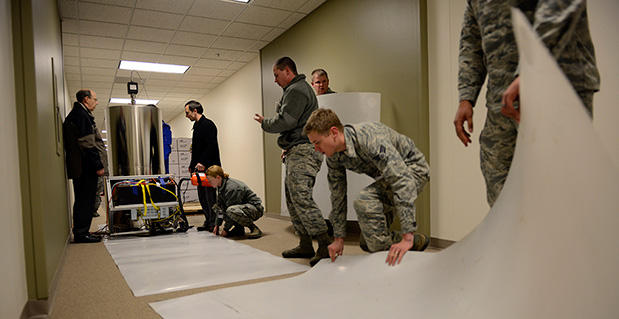
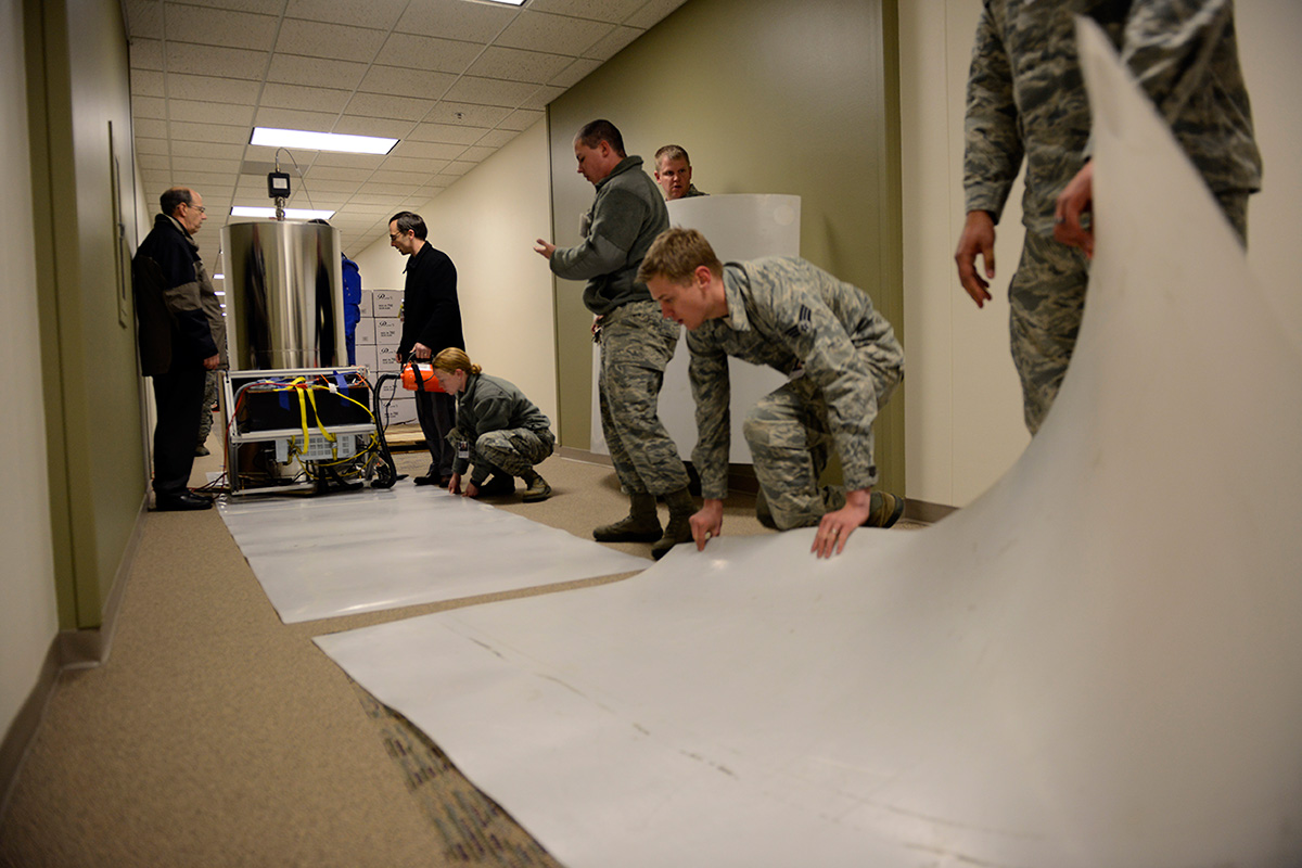
Personnel with the U.S. Naval Observatory-Detachment Colorado and 2nd Space Operations Squadron move the rubidium fountain clock into its new home Tuesday at Schriever Air Force Base. The USNO monitors the GPS constellation and provides time offsets to the 2nd Space Operations Squadron for their daily navigation uploads to each individual GPS satellite. (U.S. Air Force photo/Christopher DeWitt).
The U.S. Naval Observatory’s Alternate Master Clock on Schriever Air Force Base received its second rubidium fountain clock February 4 to ensure it has the most precise time in the world.
Both the USNO’s Washington D.C.-based primary and its local Alternate Master Clock facility serve as the Department of Defense’s common time reference. Additionally, the USNO monitors the GPS constellation and provides time offsets to the 2nd Space Operations Squadron for its daily navigation uploads to each individual GPS satellite.
“With the new rubidium fountain clock, we are going from the time standard of 1 to 2 nanoseconds down to 300 picoseconds,” said Bill Bollwerk, Head of USNO Detachment Colorado.
One nanosecond is equivalent to one billionth of a second, while a picosecond is equal to one trillionth of a second. Though these small slices of time may not sound important, every nth of a second is significant, especially in GPS operations.
“A nanosecond matters because it is equivalent to a 1-foot of error for GPS,” Bollwerk said. “If the GPS satellite clocks were off by 3 nanoseconds, you have 1-meter of error introduced into GPS.”
Designed and produced by physicists at the USNO laboratory in Washington D.C., the powered rubidium fountain clock traveled by dedicated truck to Schriever. Once the fountain clock arrived at Colorado base, with the help of members of the 2nd Space Operations Squadron, the 50th Security Forces Squadron and 50th Civil Engineering Squadron, the USNO team moved it to a climate controlled chamber in the USNO’s laboratory via an airsled hover lifter.
“The 2 SOPS men and women are able to operate and provide accurate instantaneous reliable support to U.S. military forces around the world, thanks to our partnership with the U.S. Naval Observatory,” said Lt. Col. Thomas Ste. Marie, 2 SOPS commander. “We are happy to be able to work together to support their upgrade. Our relationship allows 2 SOPS to continually reach our goal of record breaking time-transfer performance and navigation accuracies.”
Although 2 SOPS was happy to support the move, it’s not as easy as one might think.
“The process of moving the rubidium fountain was very complicated,” said Ken Dreiling, USNO Detachment Colorado. “We had to ensure the fountain clock was not actually in contact with the floor or the walls as we moved it from the loading dock through the hallways and elevator into our facility.”
The careful transport of the fountain was essential to prevent damage that could affect the clock’s performance.
“The fountain clock collects billions of rubidium atoms, encased in a spherical vacuum chamber and laser-cooled to a millionth of a degree above absolute zero degrees Kelvin, approaching the coldest temperature anything can be,” Bollwerk said. “The reason we do that is because we want to observe and measure the atoms for long time in an environment that minimizes unwanted noise like the Doppler Shift.”
Though the Alternate Master Clock provides precise timing for several communication and space systems, Missile Defense Agency, DOD facilities and several civilian infrastructures around the world, the new system was installed primarily to support GPS operations.
“It is great to have the most precise time standard in the world but it is useless unless you can get it to the user, not everyone can come to the facility and set their watch,” said Bollwerk. “GPS is USNO’s primary means of providing global precise time to the warfighter. It is a great partnership between the Navy and the Air Force.”
Dreiling said the new fountain clock will help improve GPS operations.
“The new rubidium fountain clock is the next-generation new frequency standard,” Dreiling said. “This will boost the GPS’s timing by 10-fold.”
Exelis has successfully completed several software upgrades for the new Global Positioning System Next Generation Operational Control System, or GPS OCX. Integration and testing were recently conducted on iteration 1.5 of the OCX navigation, encryption and Mission Upload Generator, or MUG, software.
The new version of GPS software will help ground controllers better understand the satellites’ exact positioning in space. The encryption software is also designed to automatically code and decode GPS signals, facilitating the exchange of user information by securely transmitting navigation payload data between the OCX ground system and the orbiting constellation of satellites.
The MUG software is responsible for creating spacecraft payload updates to refresh the navigation data transmitted to all GPS users. This data is typically generated for each satellite multiple times a day and helps to consistently minimize user error.
“These software milestones demonstrate a clear path to improved GPS accuracy and integrity,” said Drew Trainor, OCX program manager for Exelis Geospatial Systems. “Civilian and military users will have more accurate and secure GPS signals, and these milestones bring us one step closer to GPS modernization.”
Under a February 2010 contract award from Raytheon, Exelis is providing software that will simulate the behavior of GPS signals in space. In addition, Exelis is building high-precision receivers for use in ground monitoring stations placed strategically around the world. Exelis is also providing data encryptors that help ensure secure information exchange between the ground and space segments of the system.
Once the new operational control segment is implemented, GPS will improve a variety of business and economic practices, including air traffic control, crop management, and environmental monitoring, among others. The new capabilities offered by GPS modernization will also provide military users increased accuracy, availability, anti-jam power and international interoperability.
GNSS simulation expert Spirent Federal is inviting users to “a rigorous and thorough” one-and-a-half-day training conference, including a half-day of For Official Use Only (FOUO) sessions, set for March 26-27 in Salt Lake City.
The 2014 Spirent Federal GNSS Training Conference features hands-on training led by Spirent engineers on its latest GNSS simulation equipment. FOUO sessions will be held on Thursday, March 27, for U.S. citizens only.
Topics covered include:
SVN49 anomaly simulation
Utilizing remote control and motion
Advanced modeling and simulation techniques
Differential GPS and augmentation systems
Multi-GNSS constellation testing
Integrated GPS/inertial testing (FOUO Session)
M-code simulation (FOUO Session)
CRPA testing (FOUO Session)
General sessions will be held Wednesday and Thursday, March 26-27. FOUO sessions will be held Thursday, March 27.
For information and to register, visit the event website.
Public Works and Government Services Canada (PWGSC) has selected NovAtel’s GAJT-700ML antenna for testing on Canadian Army armored vehicles. The GAJT-700ML, developed in Calgary at NovAtel’s global headquarters, is a single-unit GPS anti-jam antenna system for land vehicles.
The testing is being conducted through PWGSC’s Build in Canada Innovation Program (BCIP).
NovAtel was selected to participate under the BCIP’s “safety and security” priority area. PWGSC will procure a number of GAJT-700MLs on behalf of the Department of National Defense (DND). The Directorate of Land Requirements (DLR) — with the assistance of the Quality Engineering Test Establishment (QETE) and the Land Force Trials and Evaluation Unit (LFTEU) — will oversee all testing on DND’s behalf.
Field testing, centered on battlefield days, is expected to take place in early March of 2014 at 4th Canadian Division Support Garrison Petawawa. The battlefield days will analyze the performance of GAJT on the Artillery Observation Post Variants (OPV) of the Light Armored Vehicle III (LAV III) in operational conditions to confirm the suitability and robustness of GAJT-700ML for this role. The process is expected to be completed by the end of March.
“NovAtel has worked closely with Canadian and Allied defence agencies to test the resilience of the GAJT-700ML in challenging jamming environments,” said Jason Hamilton, vice president, Marketing and Product Management. “The BCIP program provides an opportunity to expand this testing to incorporate end user soldier feedback on the installation and operational effectiveness of GAJT during battlefield usage of the LAV OPV. This invaluable feedback will be used by NovAtel to further drive product innovation in support of Canada and its Allied partners.”
“The Canadian Army requires accurate, secure and reliable access to Global Positioning Systems to conduct operations throughout the full spectrum of conflict in all potential theatres of operation,” said Colonel Andrew Jayne, Director Land Requirements. “With the ever-increasing demands on the electromagnetic spectrum and threat of harmful interference, technologies which contribute to the assurance of position and timing information are a critical enabler of Army and Canadian Armed Forces operations in today and tomorrow’s operating environment.”
GAJT is a null-forming technology that negates jammers, ensuring the satellite signals necessary to compute position and time are always available. Three categories of GAJT are manufactured by NovAtel:
GAJT-700ML: for use with military land vehicles, networks and timing infrastructure
GAJT-700MS: for marine vessels, from small boats to capital ships
GAJT-AE: for use with an external antenna in size and weight constrained applications
The BCIP was created by the Government of Canada to strengthen Canadian innovation. The program offers procurement and testing of pre-commercialized products and services, at a late stage of development. The BCIP:
Bridges the “pre-commercialization gap”
Supports Canadian suppliers by connecting innovators and government users and by testing innovations
Provides real-world evaluation of pre-commercial goods and services
Improves the efficiency and effectiveness of government operations
Epson Electronics America has announced a strategic partnership with Geodetics Incorporated of San Diego, California, for production of a new variant of its Geo-iNAV product.
According to the announcement, Geo-iNAV is a fully-integrated GPS-aided inertial navigation system that provides real-time, high-precision positioning and navigation for manned and unmanned air, sea and ground vehicles. It combines GPS and proprietary sensor fusion technologies to achieve centimeter-level real-time positioning and navigation for dynamic platforms. Geodetics will offer Geo-iNAV integrated with Epson’s new G362 and G352 IMU modules. The G362 and G352 are the world’s highest performance IMUs on the market in their size, weight and power class, the company said.
“Geodetics has the high-precision navigation expertise necessary to integrate IMU and GPS technologies, producing Inertial Navigation Systems (INS) that meet the performance requirements of very demanding applications,” said David Gaber, EEA’s IMU product line manager. “The combined solution, called Geo-iNAV Tactical, is a cost-effective, tactical-grade INS in a compact package with no EAR or ITAR export control restrictions.”
Geodetics President and CEO Lydia Bock added, “Epson has established a new benchmark for MEMS IMU performance, enabling Geodetics’ products to reach new applications and customers by delivering high performance for a significantly lower cost than competing devices.”
Epson says that with recent advances in unmanned vehicle technologies, the GNSS ecosystem has expanded to support mission-critical applications, which require more accurate navigation. Geo-iNAV Tactical delivers this capability with features to support reliable and precise navigation with a low SWaP (size, weight and power) profile for autonomous vehicles and payloads on manned vehicles. Geo-iNAV Tactical is offered in several configurations designed to meet a wide range of requirements and is available in commercial as well as SAASM configurations.