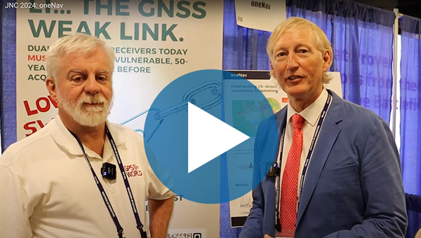
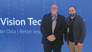
Paul McBurney, co-founder and CTO of oneNav, met with Matteo Luccio, GPS World editor-in-chief, to discuss the benefits oneNav’s L5-direct GNSS technology has for alternative navigation in military applications.
Category: Events
-
PNT Advisory Board hears reports on GPS, Galileo, QZSS and KPS
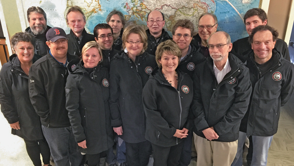
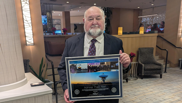
The National Space-Based Positioning, Navigation, and Timing Advisory Board continued its discussions on how best to protect, toughen and augment GPS at its 31st meeting, which took place Dec. 4-5 at the Sonesta Redondo Beach and Marina in Redondo Beach, California. The meeting was convened by James J. Miller, of NASA, who is the board’s executive director, and chaired by retired Adm. Thad Allen of the U.S. Coast Guard.
On the first day, after hearing reports from its six subcommittees, the board heard the following presentations:
- Karen Van Dyke, director, PNT & spectrum management, Department of Transportation (DOT), on DOT’s IDM and complementary PNT work.
- Maj. Christine Bonniksen, retired from the U.S. Air Force, deputy director for flight projects, NASA Langley Research Center, and Shachak Pe’eri, Ph.D., acting director, National Geodetic Survey, National Ocean Service, National Oceanic and Atmospheric Administration (NOAA), on NOAA’s implementation of a GDGPS-based GPS High Accuracy and Robustness Service.
- Anh Nguyen, Ph.D., NASA flight opportunities program (Bryce Space and Technology, LLC) and Lisa Valencia, NASA Space Communications and Navigation Program (Overlook Systems Technologies, Inc.) on the SpaceLoft 15 multi-GNSS flight experiment (see the article on p. 16).
- Allison Kealy, Ph.D., director of the Innovative Planet Research Institute, Swinburne University, Australia, on resilient PNT.
- Brad Parkinson, Ph.D., the board’s first vice chair, on a comparison of GPS with the other GNSS.
- Satoshi Kogure, senior chief officer of satellite navigation technology, Japan Aerospace Exploration Agency on Japan’s Quasi-Zenith Satellite System (QZSS).
- Moon Beom Heo, Ph.D., executive director of KPS R&D Directorate, Korea Aerospace Research Institute on the Korean Positioning System (KPS).
- Matt Higgins, international engagement subcommittee chair on Galileo.
- Cordell DeLaPena, executive officer, MilComm & PNT, Space Systems Command, USSF on the status of the GPS program, including L5, OCX, civil signal monitoring, resilient-GPS and low-Earth orbit PNT.
On the second day, the board held a roundtable discussion, then heard updates from its international members and representatives. For video of the proceedings, go to youtube.com/@nationalpntboardmeetings822/streams.
To celebrate Allen’s long service as this board’s chair, NASA conferred a beautiful plaque to him, bearing the following text:
“PRESENTED TO Admiral Thad Allen
With our deepest gratitude, the NASA community and our many partners are very thankful for the friendship and dedicated leadership you have provided as the Chair of the National Space-Based Positioning, Navigation, and Timing Advisory Board. Your advocacy on behalf of GPS users worldwide will always be remembered and cherished. December 2024
Kevin Coggins
Deputy Associate Administrator, Space Communications and Navigation
NATIONAL AERONAUTICS AND SPACE ADMINISTRATION” -
Los Angeles Geospatial Summit is quickly approaching
The 2025 Los Angeles Geospatial Summit will be held Feb. 28 at the USC Hotel in Los Angeles.
Each year, leading organizations in geospatial science — including Esri, Eclipse Mapping and GIS, NV5 Geospatial, HRL Laboratories — gather to explore innovative ways geospatial science can address urgent challenges in urban planning, environmental sustainability and public health through advanced spatial data and analysis.
Event highlights
The summit will commence with a keynote address by Daniel Gall, FACHE, deputy chief strategy officer of the Veterans Health Administration, titled “Geospatializing the Veterans Health Administration.” Following the keynote, John P. Wilson, Professor and Founding Director of the USC Spatial Sciences Institute, will moderate a discussion with Gall and Courtney Fassett from Deloitte Consulting, focusing on emerging trends in the geospatial industry.
Afternoon sessions will feature expert presentations and panel discussions exploring decision-making processes using geospatial data. Researchers and professionals from HRL Laboratories, Placer.ai, and other organizations will share insights into emerging geospatial technologies and methodologies. The University of Redlands Dean Thomas Horan will moderate a closing session on “Empowering the Geospatial Workforce of the Future,” featuring panelists from the Open Geospatial Consortium and Esri.
A highlight of the event will be the annual ArcGIS StoryMaps Competition, sponsored by Esri. Students from Southern California universities will compete for prizes in categories including innovative technology use, compelling map communication, and methodological analysis. Three selected students will also present research in a lightning talk session, with expert feedback from industry professionals.
GIS and geospatial sciences students from any college or university, as well as industry professionals, can register for the Summit and learn more here.
-
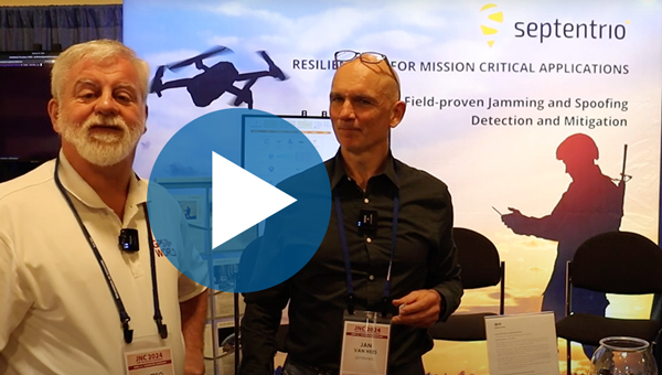
JNC 2024: Septentrio
Jan Van Hees, vice president of business development and product management at Septentrio, talks about the Joint Navigation Conference (JNC) 2024 and Septentrio’s jamming and spoofing solutions.
-
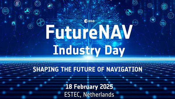
ESA releases plans for FutureNAV Industry Day 2025
The European Space Agency (ESA) will host the first FutureNAV Industry Day on Feb. 18, 2025 — at ESTEC, the Netherlands — to address the growing demand for advanced positioning, navigation and timing (PNT) technologies. This event aims to bring together European stakeholders in satellite navigation to discuss future developments and foster collaboration within PNT and GNSS sectors.
As the leading system developer and design authority for Galileo and EGNOS, ESA plays a crucial role in Europe’s satellite navigation landscape. The agency launched the FutureNAV program in 2022 to unify efforts in advancing navigation technologies. Two key missions under this initiative are low-Earth orbit (LEO) PNT, which will demonstrate the potential of navigation satellites in LEO and Genesis, which will combine four geodetic techniques in one satellite to improve Earth’s reference frame.
FutureNAV Industry Day seeks to provide attendees with insights into ESA navigation plans and potential opportunities for European industry. It will follow a Request for Information on LEO-PNT industrialization, gathering information on European production capabilities for payload building blocks and satellite platforms.
To complement these upstream initiatives, the Navigation Innovation and Support Programme (NAVISP) Industry Days will be held at the University of London on March 4-5, 2025, focusing on downstream applications and bringing together industry leaders and innovators.
Click here to register and learn more about the event.
-
Celebrating Richard Langley as he contributes final column to GPS World
The November 2024 issue of GPS World features Professor Richard Langley’s 300th and final “Innovation” column. His first one appeared in the January/February 1990 issue, the magazine’s very first. In celebration of Richard’s decades-long contribution to GPS / GNSS / PNT, we are publishing a selection of testimonials and photos (below) from some of his colleagues and friends, gathered by his former students Sunil Bisnath and Attila Komjathy.
Recollection from 1990, Trinidad – University of the West Indies
It was 1990, late into a — thankfully warm — night in Trinidad. I still remember that moment vividly — the sense of anticipation mixed with skepticism. A small group of us, undergraduates from the Land Surveying Department at the University of the West Indies, were standing outside in the middle of the night. We were waiting, eyes fixed on the sky, holding our breath for signals that were promised to come — signals that the foreign professor, Richard Langley, assured us would soon appear and change our lives forever. Back then, GPS satellites were in scarce supply. Only a few were up there, and getting a signal was not guaranteed. Richard’s confidence, however, was unwavering. He was convinced that this technology — this new way of understanding our position in the world — would revolutionize everything we knew about land surveying and navigation. That year was my last in Trinidad. I left with memories of those nights under the stars, waiting for those elusive signals that did eventually come. Over time, I’ve met Richard at numerous Institute of Navigation events, and like the GNSS constellations, we have continued to grow and evolve yet remain united by our passion for a technology that continues to grow beyond our wildest expectations. – Professor Allison Kealy, FRIN, GAICD Director, Innovative Planet Research Institute Professor, Civil Engineering Swinburne University of Technology
I was introduced to Richard more than 15 years ago. I learned quickly that he is not only a man of renown earned by his overarching knowledge on almost all aspects of satellite navigation, but also a man of action. Not surprisingly and probably well known, he was one of the first researchers investigating and improving the Precise Point Positing (PPP) technique. It is less well known that he was also an early adopter of the PPPPP concept. When asked what the abbreviation stands for, Richard would answer with a twinkle in his eye: “Proper preparation prevents poor performance!” I had the honor of seeing Richard in action during a joint measurement campaign where we applied both concepts. We wanted to collect observations of the new Galileo test satellites GIOVE-A and -B to use them for precise positioning. It happened that they had favorable visibility during the ION GNSS conference in Savannah, Georgia, in September 2009. So, we mounted a bunch of equipment onto Richard’s rental car and off we went through the streets, after carefully making sure that the GIOVE satellite were actually visibile and reference product generation back home in Munich, Germany, and New Brunswick, Canada, was properly working. Richard was steering the automobile in rapid turns on the parking lot to get some serious phase wind-up effect going. I was so concentrated on the data logging that I did not even feel the urge to throw up. The measurement collection went well and the data ended up being used for a joint publication the following year, potentially one of the first papers jointly using GPS and GIOVE. PPP using the PPPPP rule — there you go! – André Hauschild, Ph.D., Researcher German Aerospace Center (DLR)
I first knew of Richard Langley through his Innovation column in GPS World. It was largely through this column that I acquired my basic knowledge of GPS. The columns were always so clear and so well written. It was a time of rapid change — the Internet, rapid data transfer between sites, and many, many other challenges. I received a grant to fund the Westford Water Vapor Campaign, and along with Arthur Niell of Haystack Observatory, we set out borrowing as many receivers, radiometers, and radiosondes as we could. Thus began my first “international” phone call to Richard Langley (the University of New Brunswick is, of course, in a foreign country) asking him to borrow receivers. Richard, perhaps because he did his postdoc here at MIT, and spent many hours out at Haystack, was more than amenable. He not only lent us three receivers but also a foreign visitor, Pieter Toor from Delft, and Virgilio Mendes, one of his graduate students. From them I learned immeasurably about the troposphere and water vapor distribution. The Westford Water Vapor Experiment was an important series of measurements, that helped us realize the potential of GPS before it was fully recognized by the community. Later, I was invited to join Jack Klobuchar and the Canadian equivalent of the FAA to fly to the University of New Brunswick, where I met Attila Komjathy for the first time. Later I also came to know Sunil Bisnath. Richard Langley trained a remarkable set of students, many (if not most) of whom have gone on to stellar careers. – Anthea J. Coster, Ph.D., Assistant Director; Principal Research Scientist MIT Haystack Observatory
Professor Richard Langley is truly one of the masters of the GNSS community. He has been the mainstay of knowledge, scholarly activity, and mentoring to scholars and students for decades. His friendly demeanor and wiliness to help out wherever he can, makes him a pleasure to talk to and collaborate with. I look forward to seeing Richard at ION technical conferences with that big smile on his face and observing his love for and devotion to the art and science of navigation. – Professor Chris G. Bartone, Ohio University
Richard and I are of the same “vintage” (date/time: referring to the period when we ramped up our work and study activity) and “terroir” (space/environment: referring to discipline background, circumstances and opportunities). We were both educated as surveyors, we both became academics, and we both mastered the arcane applied science field of geodesy. Geodesy in the 1970-1980s was undergoing a revolution driven by advances of the Space Age, reflected in the increasing use of Earth-orbiting satellites for precise positioning, mapping, gravity field determination, sea surface mapping, and much more. Richard and I are of the generation of geodesists in the 1980s that recognized — before any other engineering or science discipline — that GPS was going to change our world in profound ways. We pioneered its use for geodetic surveying (at the sub-cm accuracy level) even before GPS was declared “fully operational” in the mid-1990s. We had more than a decade head-start in understanding the principles of differential GPS, of carrier phase-based static positioning, and of the system itself. It is a head-start that continues to this day. We developed the first university GPS courses, wrote the first textbooks, educated the first generation of GPS scientists, developed the first measurement processing software, and helped revolutionize the practice of navigation. Although GNSS is considered the most important geoscientific technology that we use today, precise GNSS-enabled positioning has impacted so many other professional, scientific and social applications. With the founding of GPS World’s “Innovation” column, Richard launched an amazing educational and industry outreach service. Those articles tracked the advances in GPS/GNSS technology and applications. While there are still some of our geodesy generation making contributions to their discipline, Richard has continued to promote GNSS for 35 years in a unique way, through his careful curation of “Innovation” column articles. They remain a joy to read. Richard, keep up this great service to the positioning, navigation and timing (PNT) community. – Professor Chris Rizos, President International Union of Geodesy & Geophysics (IUGG) School of Civil & Environmental Engineering UNSW Sydney Australia
I have had the pleasure of knowing Richard since the mid 1980s, when we were part of the team that produced the first and highly successful book on GPS, namely the Guide to GPS Positioning. We have interacted regularly ever since. I have always appreciated reading Richard’s papers for their clarity, thoroughness and novel content. His Innovation column in GPS World for 35 years is now a GPS classic that post-graduate students and experts alike learn from and enjoy reading. Richard has deservedly received major awards for his numerous and outstanding work. Richard, I hope that we will continue to benefit from your contributions for years to come. – Professor Gérard Lachapelle, University of Calgary
Despite being a highly respected leader in the field of PNT, Richard remains a humble human being. He sets a high standard for his work and is generous with his time to catch even the smallest errors in research papers. It has been a great pleasure to get to know him and to have the opportunity to work with and learn from him. He is an inspiration and a role model for me. – Professor Jade Morton, Ph.D., Helen and Hubert Croft Professor Ann and H.J. Smead Aerospace Engineering Sciences Department University of Colorado Boulder
I have had the privilege of knowing Prof. Richard Langley for my entire career in PNT and have always been greatly impressed with his wealth of knowledge and research on high-precision applications of GPS. I first met him in the late 1980s at meetings of the Civil GPS Service Interface Committee (CGSIC) and the early Institute of Navigation conferences on GPS in Colorado Springs. When I joined the navigation team at the U.S. Department of Transportation as a young engineer in 1988, we all had copies of The Guide to GPS Positioning, that Prof. Langley co-authored with David Wells and that we greatly utilized! Since that time, I have enjoyed interfacing with Prof. Langley at ION conferences and serving with him on the ION Council. I have learned so much from his research, including his development of the UNB-RTK system and the study of atmospheric effects for the FAA Wide Area Augmentation System (WAAS), as well as the very informative articles he has published in GPS World! – Karen Van Dyke, Director, Positioning, Navigation, and Timing U.S. Department of Transportation
The 35-year anniversary of Richard’s Innovation column in GPS World seems amazing, also recalling the recent 30-years celebration of the International GNSS Service (IGS), which to many of us seemed like an eternity. This is not surprising, however: from the Guide to GPS Positioning, co-authored by Richard (my first GPS handbook when I started learning about GPS in November 1989 at ICC, Barcelona); to the knowledge, motivation and empathy we have always enjoyed when meeting Richard in so many different workshops (ION, Beacon Satellite…) and collaborative works (e.g., IERS Conventions…). For him, this is normal. CONGRATULATIONS. – Professor Manuel Hernandez-Pajares, UPC-IonSAT, IEEC-CTE Head of the UPC-IonSAT Research Group, IGS Associate Analysis Center Department of Mathematics, Universitat Politècnica de Catalunya, Barcelona, Spain
Professor Langley has been a vital contributor to the Institute of Navigation (ION) for four decades, serving in various volunteer and leadership capacities. In his most recent role, Richard has served as the Editor-in-Chief of NAVIGATION, The Journal of the Institute of Navigation, our esteemed peer-reviewed technical publication. Since taking on this role in 2020, he has expertly led a team of associate editors, guiding NAVIGATION through a transformative period as it transitioned from a traditional print publication to a fully open-access journal. Under his leadership, the journal has seen a remarkable increase in its impact factor, most recently rising to 3.1. Beyond his editorial work, his most important contribution lies in his mentorship. He has profoundly influenced the next generation of GNSS experts, nurturing countless graduate students through ION’s programs and initiatives while fostering their professional development. His dedication to education and commitment to innovation has enriched our community. We deeply value our ongoing collaboration with Richard. His unwavering commitment, expertise, and passion for GNSS and ION have made him an integral part of our organization. It is a privilege to work alongside such a dedicated professional. – Lisa Beaty, Executive Director Institute of Navigation
Like many others, I look back to a long friendship with Richard, who’s always been a mentor and model for me. His sharp mind, paired with a distinct sense of very British humor makes each meeting with him a source of inspiration and memorable experience. From gentle spelling and grammar corrections in manuscripts to advice and leadership in GNSS-related projects, he always offers a helping hand, contributes in-depth knowledge and one or another personal anecdote. From him, I learned the “six P” rule: proper planning and preparation prevents poor performance. This unforgettable saying not only reflects the rigor Richard applies to his work, it also provided me a guideline that I’m now passing on to my own students. – Oliver Montenbruck, Ph.D. Head, GNSS Technology and Navigation Group German Aerospace Center (DLR)
I would like to say, as someone who is not his direct advisee, I’ve always appreciated his avuncular spirit, mentorship, and encouraging guidance over the years. I join you in toasting to him and his successes in growing and connecting the navigation community over his many years of service, in addition to all his technical achievements and innovations. Cheers to Richard! – Professor Seebany Datta-Barua Illinois Institute of Technology
Richard has been a highly respected leader in the GNSS community for more than 30 years, making his mark as a creative innovator, a mentor for generations of future leaders and contributors to the advancement of GNSS, and as an insightful and patient teacher. The well-worn copy of his Guide to GPS Positioning on my bookshelf has helped me and countless students quickly pick up the basics, while his cheerfully engaging series of “Innovation” columns in GPS World explored every feature, misconception, novel application, mystery, and intricacy of GNSS. And, he literally put Fredericton on the map for the GNSS community. – Penina Axelrad, Distinguished Professor University of Colorado
When I became GPS World’s managing editor, in 2000, my exposure to GPS was limited to a few journal articles I had read as a graduate student in international security at MIT in the mid-1990s. Much of my education on the subject during the steep learning curve that followed came from Richard’s “Innovation” column. Also, as his liaison to the magazine, I was responsible for entering his many, meticulous edits to each column, which, at the time, he sent me by fax. Nearly a quarter century later, Innovation is still my favorite section in the magazine. I will miss it greatly.” – Matteo Luccio, Editor-in-Chief, GPS World
Good memories of my collaborations with Richard span a long time to almost the operational beginnings of GPS. Examples range from our collaboration on the Handbook for GNSS to our shared lecturing at the “GPS for Geodesy” school, in Delft, 1996. I always experienced with admiration Richard’s encyclopedic knowledge and excellent lecturing and writing skills. The only one thing that I would have wished for is that Richard would have turned his excellent Innovation columns in GPS World into a book. That would have been a bestseller for sure. – Professor Peter Teunissen Delft University of Technology
I first met Richard in 1982 while a postdoc at MIT about the time that he joined the faculty at the University of New Brunswick, after his postdoc in the same MIT department. After research in VLBI and SLR, he was one of the early pioneers in the development of GPS for precise positioning applications, with contributions in several areas, such as signal multipath and tropospheric refraction. We both taught at the International School of GPS for Geodesy in Delft, first in 1995, and contributed to the resulting monograph, GPS for Geodesy. I have a vivid memory of drinking beer with him in a bar in Delft after a long day at the school. – Professor Yehuda Bock Scripps Institute of Oceanography
I first met Richard shortly after joining MIT as a Ph.D. student in 1979. He was a postdoctoral fellow for two years with MIT’s Department of Earth and Planetary Sciences, carrying out research in geodetic applications of lunar laser ranging and very long baseline interferometry after completing his Ph.D. at York University, Toronto. His research at MIT led to the discovery of a 50-day oscillation in atmospheric angular momentum and length of day determined from lunar laser ranging data. This work was published in 1981 in Nature. Richard has been publishing impactful papers on important topics since very early in his career. His contributions to GPS World’s “Innovation” column have followed that trend. – Professor Thomas Herring Massachusetts Institute of Technology
I did not have tons of personal contact with Richard, but the contact I did have showed me that he was a man of very high standards, and it’s clear that his dedication to the field is enormous. The combination of high standards and selfless dedication is what moves us forward. He also attracted and produced a cadre of highly talented and successful researchers that continue to have an enormous impact on the field. These are great things! – Anthony J. Mannucci, Ph.D. Deputy Manager, Tracking System and Applications Section Jet Propulsion Laboratory
Years ago when assembling material for my advanced GNSS signal processing course here at the University of Texas, I found that for several topics Richard’s “Innovation” column had just the discussion and analysis I was looking for my students to learn. His writing is unfailingly engaging and lucid! What a gift to the community his “Innovation” column has been! Richard is an amateur radio enthusiast. Many of the insights on radio in his columns are backed up by his practical experience with long-distance ham radio communications. He’s connected with people from continents away from his home base in New Brunswick. – Professor Todd E. Humphreys, Ashley H. Priddy Centennial Professorship in Engineering Dept. of Aerospace Engineering and Engineering Mechanics The University of Texas at Austin
I first met Richard Langley in 1989 at what was my first ION Satellite Division meeting. It was a young-looking crowd, but we both could pass for young men then. I also met another young man by the name of Glen Gibbons who was circulating among the attendees to gauge interest in a trade magazine devoted to GPS that he was thinking of launching. GPS World played an important role in my career as a GPS engineer, particularly for its “Innovation” column, edited by Richard. His early columns (such as “Why is the GPS Signal So Complex?”) are classics of cogent writing and served as an inspiration to me when I tried my hand at writing about GPS. His skills as an editor, and his generosity to help a friend avoid embarrassing himself, proved even more helpful to me. My debt to Richard has grown over the years, and so has my admiration and affection for him. – Professor Pratap Misra, Professor of the Practice of Mechanical Engineering Tufts University
When I googled “Richard Langley,” just for fun, I got multiple returns — among them “professional football player,” “state politician,” “actor,” “model maker” and I thought for a while that those are Richard’s other personalities that I didn’t know about. Well, a slight refinement of my search “Richard Langley, geodesy” got me what I was looking for — pages and pages on the accomplishments of the Richard Langley as one of the first scientists who recognized the great potential of GPS as a scientific and civilian tool and an everyday commodity, research publications that all GPS “insider wannabees” have read and memorized, and articles documenting his commitment to GPS World, especially its “Innovation” column — which has long been one of my favorite reads. I congratulate Richard on the 35th anniversary of this outstanding column! – Professor Dorota Grejner-Brzezinska, Vice-Chancellor for Research at University of Wisconsin-Madison
Richard and I first met when I spent a post-doc year at the University of New Brunswick in 1983/84. The nucleus of the Bernese GPS software emerged from this visit. Richard and I became friends and stayed in contact after this visit. We met last time in Bern at the 2024 IGS Symposium commemorating 30 years of the International GNSS Service. What I admire most about Richard is his scientific breath and his at times artistic use of the English language — he announced his visit to Bern with the words “I will be there if I don’t ‘keel over’ between now and then.” – Professor Gerhard Beutler University of Bern
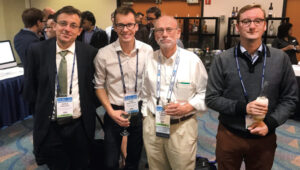
Attila Komjathy, Ivan Smolyakov, Richard, and André Hauschild. ION GNSS+ 2010 conference, Portland, Oregon, 2010. 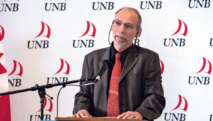
Richard, Fredericton, New Brunswick, 2014. 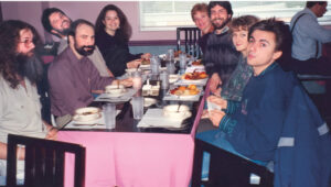
Andrew Morley, Richard, Anthony van der Wal, Katrina van der Wal, Denise Santos, Marcelo Santos, Katie Komjathy, and Attila Komjathy, Fredericton, New Brunswick, ~1994. 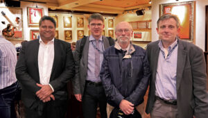
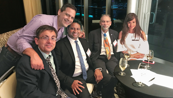
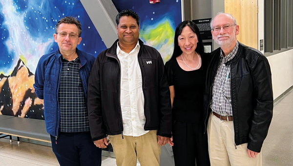
Sunil Bisnath, Steffen Schön, Richard and Attila Komjathy, Denver, Colorado, 2022. 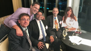
Attila Komjathy, Rodrigo Leandro, Sunil Bisnath, Richard and Fanni Komjathy, ION GNSS+ Miami, Florida, 2018. 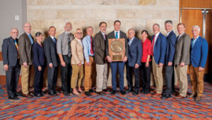
Richard, Gary McGraw, Penina Axelrad, Frank van Graas, Dorota Grejner-Brzezinska, Oliver Montenbruck, John Betz, Todd Humphreys, Bradford Parkinson, Jade Morton, Terry Moore, Boris Pervan, Todd Walter and Frank van Diggelen. ION GNSS+ 2023 conference, Denver, Colorado, 2023. 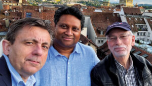
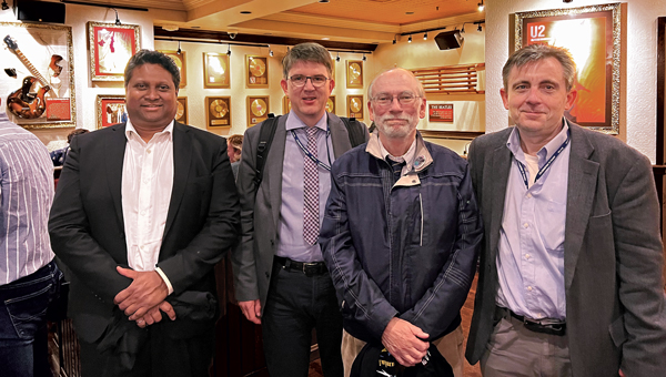
Attila Komjathy, Sunil Bisnath and Richard, IGS Symposium and Workshop, Bern, Switzerland, 2024. 
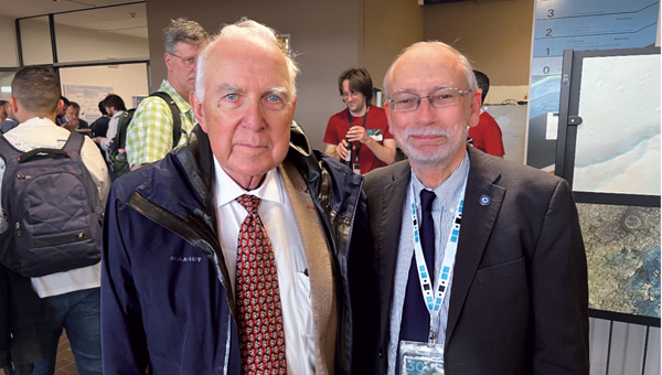
Gerhard Beutler and Richard, IGS Symposium and Workshop, Bern, Switzerland, 2024. 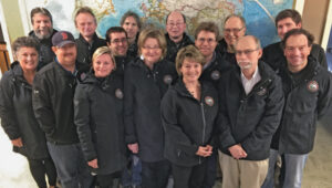
Department of Geodesy and Geomatics Engineering staff at the University of New Brunswick: Lorry Hunt, Marcelo Santos, Greg Smith, Peter Dare, Michelle Ryan, Robert Kington, David Fraser, Monica Wachowitz, Yun Zhang, Sylvia Whitaker, Emmanuel Stefanakis, David Coleman, Richard, Ian Church and Terry Arsenault, Fredericton, New Brunswick, Canada, 2016. 
Bill Boucher, Katie Komjathy, Richard, and George Dewar, Halifax Nova Scotia, ~1994. 
Richard, ION GNSS+ 2022 conference, Denver, Colorado, 2022. 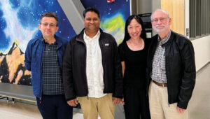
Attila Komjathy, Sunil Bisnath, Jade Morton and Richard, Ann and H.J. Smead Department of Aerospace Engineering Sciences, University of Colorado Boulder, Colorado, 2023. 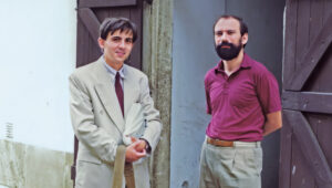
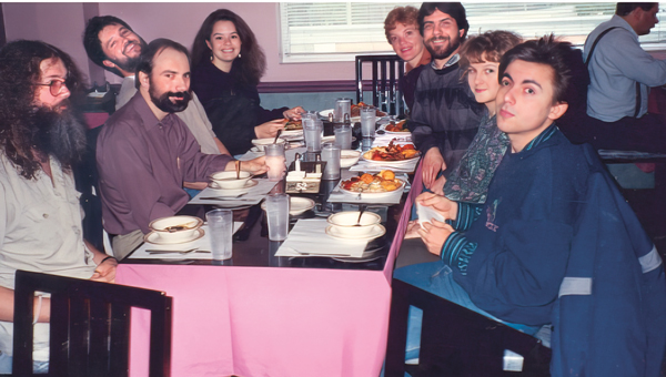
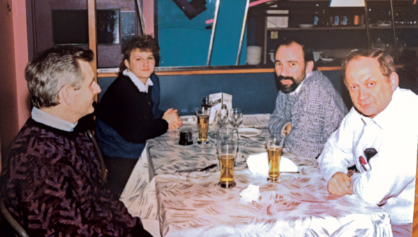
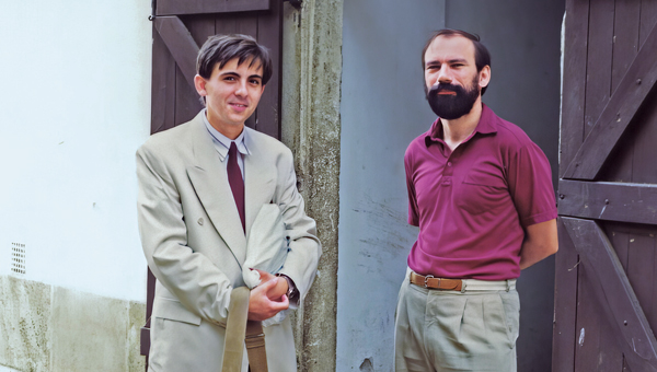
Attila Komjathy and Richard, Nagycenk, Hungary, 1991. 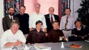
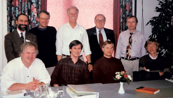
GPS-for-Geodesy lecturing team. Top-row, left-to-right: Richard, Oscar Colombo, Yehuda Bock, Gerhard Beutler, and Alfred Kleusberg. Bottom-row, left-to-right: Hans van der Marel, Geoffrey Blewitt, Clyde Goad, and Peter Teunissen, Delft, The Netherlands, 1996. -

Highlights from INTERGEO 2024
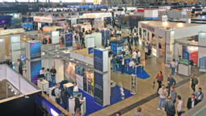
Photo: GPS World Staff The GPS World team touched down in Stuttgart, Germany, for INTERGEO 2024, held from Sept. 24-26.
This year’s expo and conference, which attracted more than 17,000 visitors from 121 countries and featured 579 exhibitors, showcased solutions to address critical global issues such as climate change, urbanization and GNSS jamming and spoofing.
Ray Weatherbee, CEO, Stonex USA, and Tim Carolin, Account Executive, GPS World. Photo: GPS World Staff GPS World Publisher Brian Kanaba and Account Manager Tim Carolin made their debut at the show, joining veteran Editor-in-Chief Matteo Luccio. The team had the opportunity to explore the expansive show floor, experiencing firsthand the latest innovations from around the world. With three floors of exhibits, Kanaba, Carolin and Luccio engaged with partners and established valuable connections with industry leaders. Their attendance highlights GPS World’s dedication to remaining at the forefront of geospatial technology and trends, emphasizing a strong commitment to collaboration and innovation within the industry.
GPS World staff: Matteo Luccio, Editor-in-Chief, Brian Kanaba, Publisher, and Tim Carolin, Account Executive. (Photo: GPS World Staff) -
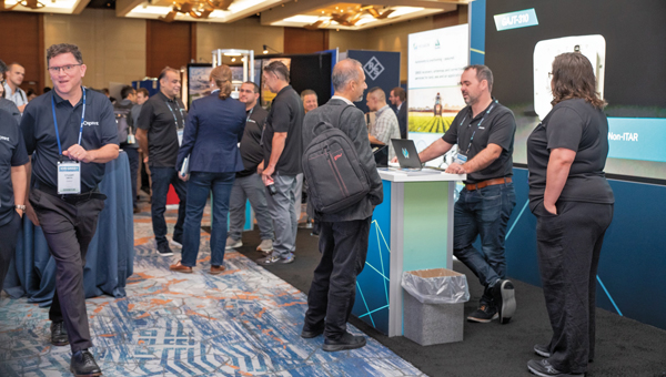
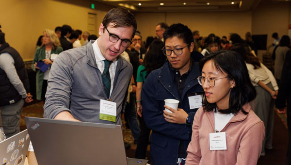
Highlights and insights from ION GNSS+ 2024
The GPS World team participated in ION GNSS+ 2024, held at the Hilton Baltimore Inner Harbor, Baltimore, from Sept. 16-20.
The event showcased more than 400 technical presentations spanning six sectors, addressing commercial and policy dimensions and research advancements. GPS World had the opportunity to engage in a series of discussions and panels, including a plenary session full of stories of space, and of circumnavigating the globe in a sailboat using only paper charts, a compass, and a sextant to navigate.
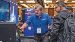
(Photo courtesy of ION) Bob Addiss, senior software engineer at CAST Navigation, demonstrated CAST’s latest GNSS simulation systems. CAST GNSS systems can be configured to simultaneously provide multiple constellation types on each antenna element, such as GPS (including Y-Code, SAASM, M-Code AES and MNSA), BeiDou and GLONASS.
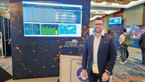
(Photo courtesy of ION) Joshua Morales, StarNav CEO, led a demonstration of cold start positioning and timing using a StarNav receiver and simulated Xona PULSAR signals. The receiver tracked up to 13 PULSAR satellites simultaneously, producing real-time signal tracking and PNT data with a Safran GSG-8 simulator. This demonstration showcased StarNav’s receiver capabilities for LEO satellite-based PNT.
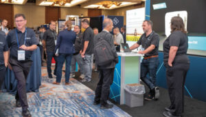
(Photo courtesy of ION) More than 1,000 in-person attendees explored the show floor, visiting 44 exhibits. They had the opportunity to network, engage with exhibitors and dive deeper into the latest products and trends in the industry.
-
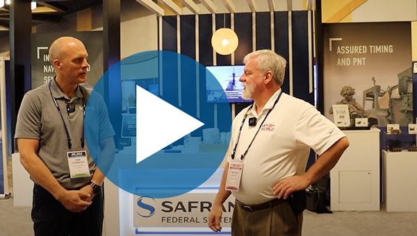
JNC 2024: Safran Federal Systems
At Joint Navigation Conference (JNC) 2024, GPS World Editor-in-Chief, Matteo Luccio, met with Jon Leombrone, executive vice president of navigation systems at Safran Federal Systems to discuss Safran’s latest assured positioning, navigation and timing (A-PNT) and simulator technology.
Read more about the BroadSim Duo, Safran’s latest navigation warfare simulator.
-
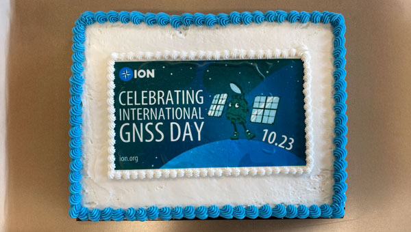
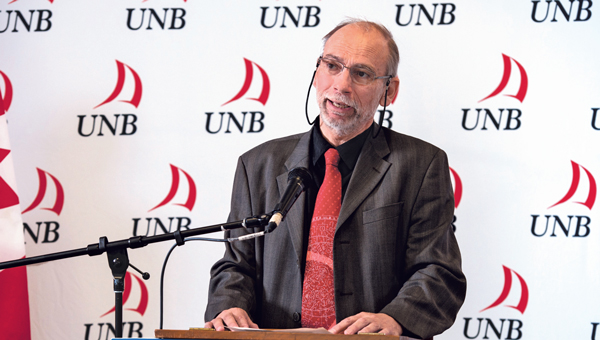
University celebrates International GNSS Day
The University of New Brunswick (UNB) in Fredericton, Canada, celebrated International GNSS Day on Oct. 23, hosted by the Department of Geodesy and Geomatics Engineering, with a cake imprinted with the Institute of Navigation (ION) announcement graphic. More than 50 people from all over the university showed up for a slice of cake. There was plenty to go around!
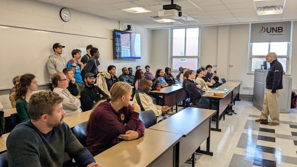
Students gathered to celebrate the second annual International GNSS Day. (Photo: Richard Langley) This global event, initiated by ION, commemorates the profound impact of GNSS on our world.
“International GNSS Day, celebrated on Oct. 23, is a tribute to the foundational 10.23 MHz frequency that underpins all GPS and GNSS technology. This frequency, which serves as the cornerstone of the signals for over 100 navigation satellites today, marks the date as a special occasion for those involved in positioning, navigation and timing (PNT) technologies.”
Share how you celebrated International GNSS Day with us at GPS World!
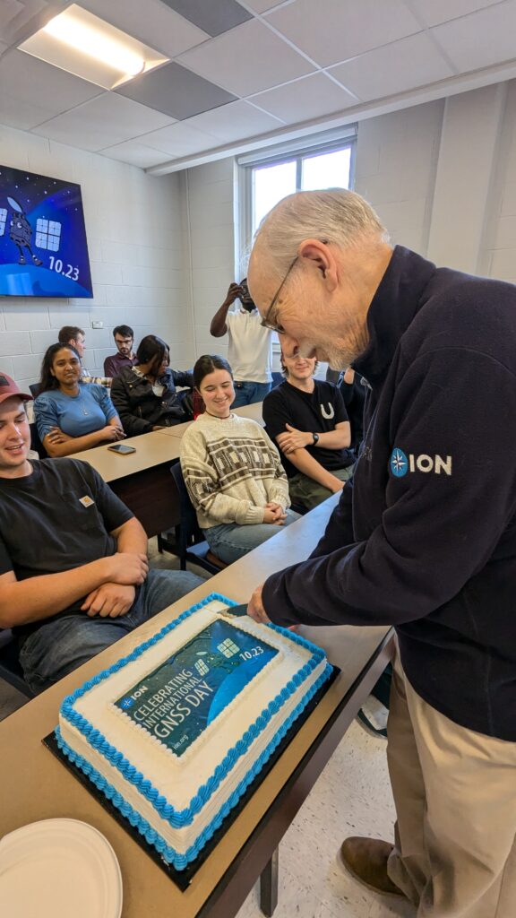
Professor, researcher, “Innovation” author and long-time friend of GPS World, Richard Langley, did the honors of slicing the cake. (Photo: Richard Langley) -
JNC 2024: BAE Systems
At ION Joint Navigation Conference (JNC) 2024, Justin Wymore, weapons PNT customer requirements manager at BAE Systems talked with Matteo Luccio, GPS World editor-in-chief, about BAE Systems’ new NavStorm-M. NavStorm-M is designed for military applications and is the latest addition to the BAE Systems M-Code receiver product line.
-

Secure your spot at INTERGEO 2024
INTERGEO 2024, the premier global event for geodesy, geoinformation and land management, will take place from Sept. 24 to 26, 2024, in Messe Stuttgart, Germany. This year’s theme focuses on the power of geoinformation technologies and their critical role in addressing global challenges.The event is expected to bring together more than 600 international brands, industry leaders and business professionals, providing a unique platform for networking, collaboration and knowledge exchange among geospatial professionals.
The event will cover a variety of topics, including building information modeling (BIM), Earth observation, digital twins, maritime solutions and developments in the UAV industry. A significant emphasis will be placed on how geoinformation technologies can help tackle pressing issues such as climate change, urbanization and resource management. Earth observation will be a focal point, featuring sessions dedicated to managing the green transition and discussing strategies for climate adaptation. This comprehensive event aims to showcase the potential of advanced geospatial technologies in contributing to solutions across the globe.The conference will feature keynote speeches from industry leaders and government officials, including Walther Pelzer Ph.D., Head of the German Aerospace Center, who will deliver a keynote on “Earth observation for a world in transition”. Burkhard Boeckem, Ph.D., CTO of Hexagon AB, will discuss developments at the forefront of geospatial technology.
Catch GPS World at INTERGEO 2024 from Sept. 24 to 26!
Click here to register and learn more about the conference.