Institute of Navigation (ION) GNSS+ is the world’s largest technical meeting and showcase of GNSS technology, products and services. This year’s conference will bring together international leaders in GNSS and related positioning, navigation and timing (PNT) fields to present new research, introduce new technologies, discuss current policy, demonstrate products and exchange ideas.
This year’s conference, scheduled for Sept. 16-20, 2024, at the Hilton Baltimore Inner Harbor in Baltimore, will bring together international experts in GNSS and related positioning, navigation, and timing (PNT) fields to share research, unveil new technologies and engage in critical policy discussions.
The conference will feature more than 300 technical presentations across six sectors, covering commercial and policy aspects as well as research advancements. Attendees can also attend insightful keynote speeches, including a presentation by Oscar Pozzobon, Ph.D., from Qascom, on pushing the limits of satellite navigation systems for lunar exploration.
The exhibit hall will be open on Sept. 18 -19, showcasing the latest GNSS technology, products and services. Attendees will have the opportunity to explore and engage with industry-leading innovations.
GPS World, a proud media partner of ION GNSS+ 2024, will attend the conference and be located at booth 215, next to Syntony GNSS and Iridium.
Click here to view the full ION GNSS+ Technical Program.
The Federal Communications Commission (FCC) has issued a public notice seeking comment on NextNav’s filing to reconfigure the Lower 900 MHz band (902 to 928 MHz band).
This action comes in response to NextNav’s April 2024 filing, which proposes a comprehensive restructuring of the band to enable the deployment of a 5G terrestrial positioning, navigation, and timing (PNT) network.
NextNav’s proposal aims to create a 5 MHz uplink in the 902-907 MHz band paired with a 10 MHz downlink in the 918-928 MHz segment. This reconfiguration is designed to complement and serve as a backup to GPS while also freeing up spectrum for 5G broadband services.
NextNav CEO Mariam Sorond said the spectrum band reconfiguration complements GPS to continue location mapping and tracking services and national security needs. “Our plan creates abundance from scarcity in this band by unleashing much-needed spectrum for wireless technology. These common-sense solutions can benefit consumers and our national interests at no cost to taxpayers,” Sorond said.
However, the FCC’s public notice raises several questions regarding the protection of incumbent users, including federal radiolocation systems, industrial, scientific, and medical (ISM) equipment, and unlicensed Part 15 devices. The Commission seeks input on how these existing operations would be safeguarded under NextNav’s proposal.
Comments are due Sept. 5, 2024. Following this comment period, the Commission will review the feedback to develop proposed rules for the potential reconfiguration of the Lower 900 MHz band.
North Coast Media (NCM) is proud to announce the addition of four seasoned media professionals to the GPS World team.
On the business side, Brian Kanaba has been appointed as Publisher and Tim Carolin as Account Executive. On the content side, Brian Richesson joins as Senior Editor in Chief and Joey Ciccolini as Senior Digital Media Specialist. All four will work closely with current Editor-in-Chief Matteo Luccio and Associate Editor Jesse Khalil.
“GPS World has been the industry’s most-trusted GNSS/PNT resource since 1990,” said Kevin Stoltman, President and CEO of NCM. “We are thrilled to have more resources dedicated to our market-leading GPS World brand. We will continue to create products designed to serve our readers and marketing partners, maximizing their growth for years to come.”
Richesson brings more than 17 years of business-to-business media experience, currently also serving as Editor in Chief of NCM’s sister publication, LP Gas magazine. Prior to his business media career, he spent about 10 years in the newspaper industry. Ciccolini brings five years of experience in the digital media realm, including with video, webinars and e-newsletters.
“Joey and I look forward to collaborating with Matteo and Jesse,” said Richesson. “Their reporting on new technologies and applications for GNSS receivers, antennas, simulators, and alternative PNT solutions has been exceptional. We’ll lean on their knowledge about this exciting industry as we get to know the companies and the individual leaders doing great work in this space.”
Kanaba, with over 20 years of media management and sales experience, will spearhead the business side of GPS World. He will work closely with Carolin, who brings about seven years of experience as a media account executive, to deliver the most comprehensive mix of products and innovative solutions designed to stimulate growth for its marketing partners.
GPS World, part of the North Coast Media conglomerate based in Cleveland, Ohio, has covered the business and technology of global positioning, navigation, and timing (PNT) since 1990. GPS World remains the multi-platform media leader, delivering the freshest and most comprehensive GNSS-related news to high-level corporate managers, project and engineering managers, product designers, researchers, and system developers — all of whom rely on GPS World for making critical purchase decisions in this multi-billion dollar market.
Photo:
Click here for more information on North Coast Media.
The U.S. Army has released a Request for White Papers (RfWP) to develop new C5ISR modular open Suite of standards (CMOSS) mounted form factor (CMFF) prototypes.
Through CMFF, the Army aims to easily and rapidly equip ground vehicles and aviation platforms with positioning, navigation and timing (PNT) and electronic warfare (EW), through capability cards plugged into a common chassis.
The chassis, which offers power, networks and radio frequency, allows Soldiers to “plug and play” capabilities right into the vehicle without the need to custom install and upgrade individual communication and computing systems.
In this prototype effort, the key needs are to develop, procure and furnish the Army with the CMFF chassis, also known as Mounted Common Infrastructure (MCI), plus the smart display for user interface, hardware development, software development and Plug-In Cards with the following capabilities:
Converging tactical communication waveforms.
Mission Command applications.
Assured Positioning, Navigation, and Timing (APNT.)
Force Protection capabilities.
The Army plans to award a contract using the Other Transaction Authority (OTA) with system of system and prototype integrators to provide the complete CMFF system offerings. Industry partners who respond to the RfWP will have an opportunity to showcase the fully functional CMFF system at a technology demonstration in late summer 2024.
“The power of the true concept is when you can take a chassis and put it in another vehicle and you can mix and match cards,” said Col. Shermoan Daiyaan, project manager for Mission Command. “That’s when you’re following a standard. You’re matching a standard, and it just works.”
Jamie Marraccini, president and CEO of Inertial Labs, met with GPS World Editor-in-Chief, Matteo Luccio, to discuss Inertial Labs’ latest IMU technologies for challenging environments.
At ION JNC 2024, GPS World Editor-in-Chief, Matteo Luccio, met with Mark Glover, sr. director of business development and assured PNT at AEVEX Aerospace. Glover discussed AEVEX’s new anti-jamming and spoofing technologies and more from the show.
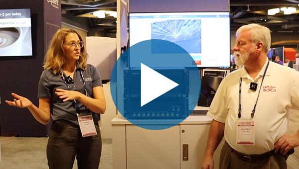
Anna Thorpe, marketing manager at Spirent Federal Systems showcases Spirent’s new PNT X simulator. This simulator is specifically designed for navigation warfare testing.
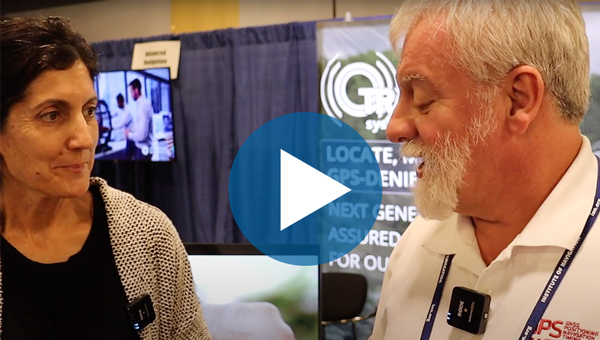
TRX Systems President and CEO, Carol Politi, met with Matteo Luccio, GPS World editor-in-chief, to discuss the TRX DAPS II system, designed to deliver an assured source of positioning, navigation and timing (PNT) to the warfighter.
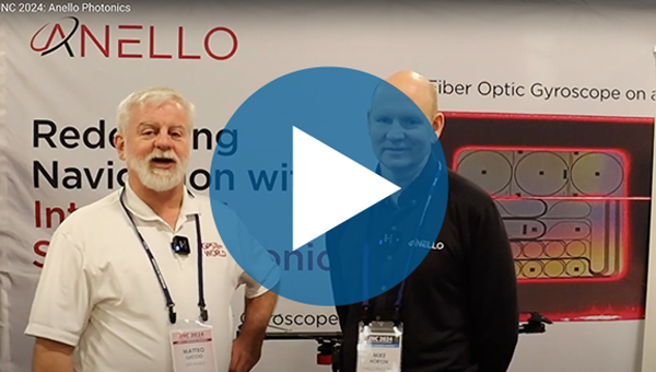
Mike Horton, chief technology officer at ANELLO Photonics, discusses the company’s new optical gyroscope technology and X3 IMU for UAVs and unmanned vessels. Watch to learn more about Anello’s latest technologies showcased at ION Joint Navigation Conference (JNC) 2024.
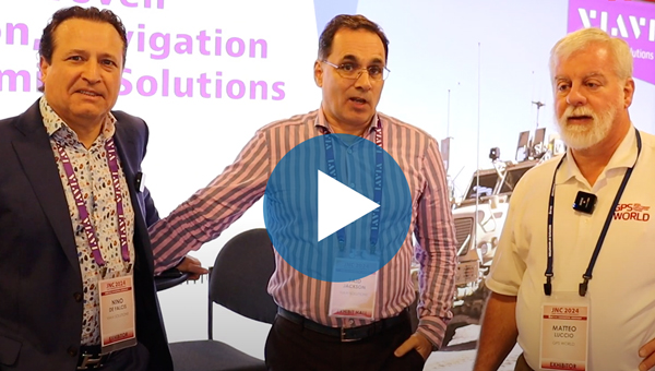
Said Jackson, vice president and general manager and Nino De Falcis, chief growth executive of VIAVI Solutions, highlight the company’s new line of secured time services to address GNSS vulnerabilities. Jackson and De Falcis also discuss the benefits of VIAVI’s new resilient positioning, navigation and timing (PNT) solution.
From May 14 to 16, more than 1,400 attendees gathered at the Huntington Convention Center of Cleveland, Ohio for Trimble’s Innovate 2024 User Conference.
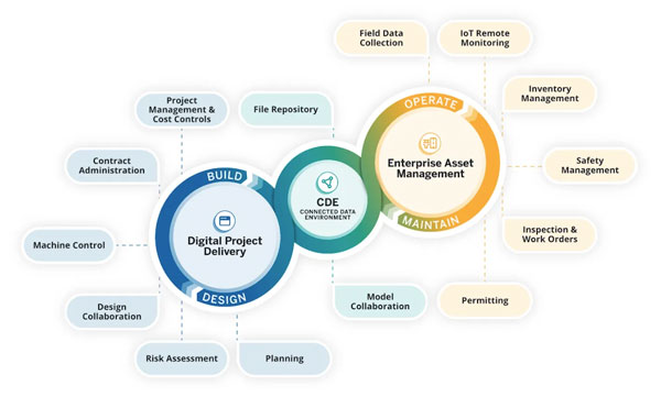
At the conference, Trimble announced its upcoming asset lifecycle management suite, Trimble Unity. The software suite offers comprehensive capabilities that enable owners to efficiently plan, design, build, operate and maintain their assets.
Trimble Unity provides an end-to-end solution that connects teams across all lifecycle phases, giving them access to critical data to make decisions. From designers, engineers and contractors to asset managers, inspection and maintenance crews, Trimble Unity offers all stakeholders visibility to reliable data across digital workflows that help foster collaboration, improve project outcomes and reduce the total costs of asset ownership.
Trimble Unity capabilities includes:
Trimble Unity Construct: A cloud-based construction project and program management capability that provides insights to improve process control and reduce cycle times. It is powered by Trimble e-Builder.
Trimble Unity Maintain: An enterprise asset management capability that streamlines work activity, planning and analysis to optimize resource allocation and infrastructure reinvestment. It is powered by Trimble Cityworks AMS, Trimble AgileAssets and Trimble Unity Work Management.
Trimble Unity Permit: A permitting, land management and licensing capability for streamlining public and back-office operations required to manage permits, licenses, right-of-way and code enforcement. It is powered by Trimble Cityworks PLL.
Trimble Connect: A connected data environment that unifies asset data in files, native file formats and 3D modes to streamline accessibility and collaboration.
In addition, Trimble Unity includes Trimble Unity Field, an all-in-one mobile application enabling field workers to design, build and maintain assets more efficiently, leading to improved productivity, reduced technology costs and improved community confidence.
GPS World met with Senior Vice President for Trimble’s Owner and Public Sector, Cyndee Hoagland, for an exclusive interview about the new product suite, how GIS plays a pivotal role in the asset management lifecycle and more.
Photo: Trimble
What sectors can benefit from this new product suite?
For the public sector side, federal, state and local governments. Think cities, municipalities, state departments of transportation (DOTs), airports and transit authorities. For the private sector, healthcare facilities and universities.
Is Trimble adding any new capabilities to the applications within the suite?
We added a GIS capability to e-Builder along with Trimble Unity Field, so the mobile application of e-Builder is new. We did not have a capability for location-based information within the application itself, but it is now included, which is the added GIS capability.
How do data strategy and GIS play a role?
Most of our users on the enterprise asset management side are GIS-centric, having GIS and GPS experience. They recognize and understand the value of location data combined with asset data. For example, it is so much better for an inspector to know the location of bolts that need to be repaired before the work begins.
Additionally, from a GIS perspective, if you are thinking about the GPS elements, and location and spatial data relative to an asset from the planning stage, through design and construction all the way to operation and maintenance, that data can be used to more efficiently operate and maintain the asset over its lifecycle. This asset lifecycle management approach allows the owner to reduce their total cost of ownership for that asset by as much as 40%.
Do you have an example?
Let’s say a bridge costs $1 million to plan, design and construct. Historically, $3 million would then be spent on operations and maintenance across the bridge’s service life, bringing the total cost of ownership of the bridge to $4 million. However, using an asset lifecycle management approach, owners can reduce that $4 million cost by up to 40 percent, saving $1,600,000 on the total cost of ownership of that bridge.
These enormous savings are possible because owners can track the location, condition and attributes of the bridge throughout the asset lifecycle and use that information to make better decisions for managing the asset. Owners can access information such as the location of the bridge, the type of asphalt used to build it, the geometry of all the components that create that bridge and more. All that asset-specific information is available in a GIS geolocated model, which is highly valuable not just for the owner, but for the design and contractor teams along the entire asset lifecycle.
Are there benefits of using a mobile mapping platform to collect data as opposed to using a UAV?
They serve different purposes. UAVs go up in the air at key points in a project to give owners an update on the project performance and how much is getting completed.
Another way of capturing rich asset data quickly is mobile mapping and terrestrial laser scanning. What you will see, for example, is that a state DOT will have to provide information to the Federal Highway Administration (FHWA) relative to all their lane miles. In large scale projects, a vehicle-mounted mobile mapping system can be used to capture highly accurate and immersive asset data at highway speed. That data will then go into an asset management system, where it can help users prioritize where the road repairs need to take place.
Will artificial intelligence (AI) be integrated into this suite in the future?
AI is already being used today to transform large amounts of real-world data into information. If an owner has collected data to inspect a bridge, for example, the highly accurate and rich data from mobile mapping and UAV systems can show an owner where exactly repairs are needed. The datasets are, however, extremely large, and AI built into processing and analysis software can help reduce tedious tasks, such as extracting features. This streamlined analysis of the data helps to inform owners on how to best manage and maintain their assets.
The key capabilities of the Trimble Unity Asset Lifecycle Management Suite will be available beginning in June 2024.
GPS World, in collaboration with GEODNET, will be hosting an upcoming webinar, “The science of precise positioning for autonomous systems.” The webinar is scheduled for Thursday, June 27, 2024, at 1:00 p.m. EDT / 10:00 a.m. PDT, with an additional hour allocated for Q&A.
In this webinar, attendees will learn about precise, reliable localization for autonomy using real-time kinematics (RTK), precise inertial measurement units (IMUs) and lidar. An example use case of autonomous yard vehicles will be used to motivate a discussion around new IMU and RTK technologies and how practical solutions fuse multiple technologies to achieve reliable localization for autonomy. Considerations of mixed indoor/outdoor operating environments, accuracy and cost will be explored. Localization requirements for perception and path planning will also be discussed as well as the role of lidar and other vision sensors.