This is part one of a two-part series.
As in January 2020, we are starting the year by providing insights from manufacturers of GNSS receivers. We asked these industry leaders to look back at the past two years and forward at the next two, and discuss key innovations in the following areas:
- utilizing Galileo and BeiDou
- dealing with jamming and spoofing
- integration with inertial measurement units (IMUs) and other sensors
- positioning using cell phones and other consumer devices
- any other areas or challenges they find particularly significant
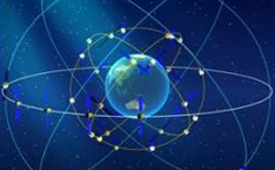
The single most important trend that emerges from manufacturers’ responses is the improvement in receiver performance due to the increase in the number of satellites (now 150) and signals (now more than 100). With four usable constellations, GNSS is now a reality. Multi-constellation receivers are quickly becoming the norm, even in consumer devices, and new user segments are benefiting from satellite-based PNT. Already, some smartphones and tablets are achieving decimeter-level or even centimeter-level accuracy. Over the next two years, new GNSS services will become available and, as the GNSS constellations continue to develop, the availability, reliability and repeatability of their signals will improve further.
A second important trend is the growth in satellite-delivered correction data, which substantially lowers the entry barrier for high accuracy applications by obviating the need for costly local infrastructure. This is starting to change the traditional cost-benefit calculation regarding real-time kinematic (RTK) vs. precise point positioning (PPP) corrections (see also our Editorial Advisory Board PNT Q&A).
A third and continuing trend is the increasing threat from intentional and unintentional jamming and interference across the globe, paralleling the increasing ubiquity of GNSS and potentially impacting most users. Therefore, receiver manufacturers continue to improve hardware and software techniques to defeat, or at least mitigate, this threat, greatly assisted by the increase in the number of available signals.
Finally, as automakers and high technology companies continue their efforts to develop autonomous vehicles (aka “self-driving cars”), the concept of GNSS integrity is getting renewed attention. Here, too, the increase in the number of available signals is extremely helpful.
| CHC NAVIGATION | EOS POSITIONING SYSTEMS |
|---|
| HEMISPHERE GNSS | HEXAGON | NOVATEL |
|---|
| JAVAD GNSS | SEPTENTRIO | TRIMBLE |
|---|

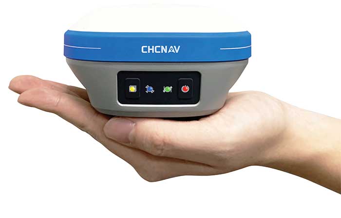
CHC Navigation
With François Martin, Vice General Manager, International Division
Utilizing Galileo and BeiDou
The addition of Galileo and BeiDou to GPS and GLONASS not only extends GNSS positioning to more obstructed environments, but also allows the use of new survey methods, such as the hybrid IMU-GNSS pole-tilt compensated surveying and stakeout with survey-grade accuracy. Further expansion of GNSS navigation systems will result in even greater availability, reliability and repeatability.
Dealing with jamming and spoofing
As an integrator and developer of GNSS systems, we focus our design on strong electromagnetic shielding and sealed isolation chambers. From a technology standpoint, the combination of advanced GNSS signal processing, optimized antenna design, and advanced filtering ensures minimal interference.
Integration with IMUs and other sensors
The integration of interference-free, high-dynamic IMU fused with GNSS technology brings an obvious benefit to surveying and autonomous navigation applications. The latest algorithm developments make it possible to get rid of tedious initialization processes, increase the productivity of typical survey tasks, bring extra safety to operators, and compensate for transient GNSS outages.
Positioning with consumer devices
Multi-constellation GNSS chips are accelerating the development of untapped user segments, but the repeatability of position accuracy remains an issue. The integration of high-performance GNSS chips and helical antennas as high-precision add-on modules on smartphones and tablets enables centimeter- or decimeter-level accuracy. This democratization of technology is increasing earlier adoption of GNSS technologies by a broader user base.
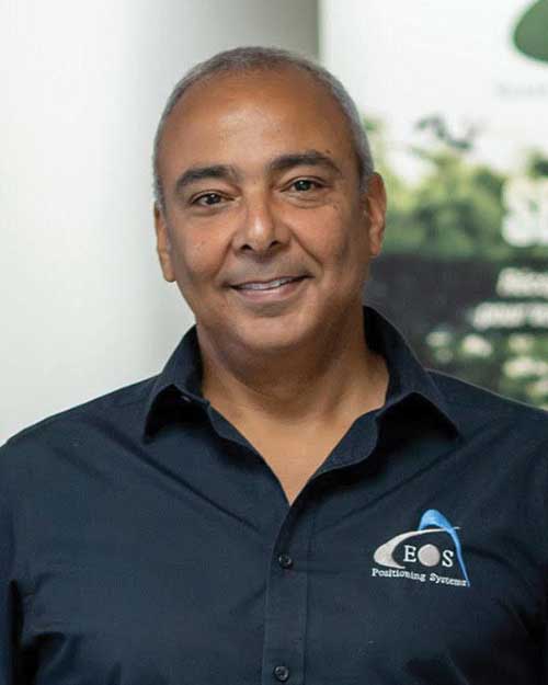
Eos Positioning Systems
With Jean-Yves Lauture, Chief Technology Officer
Utilizing Galileo and BeiDou
The past two years have seen considerable maturation of the Galileo and BeiDou constellations. Considering the now four usable GNSS constellations and the aggressive launches of Galileo and BeiDou, the number of available satellites and the list of frequencies they use have considerably increased. Accuracy itself is slightly improving with the availability of BeiDou phase 3 signals, whereas performance and productivity experience a significant boost under tougher conditions with more satellites and stronger signal availability. It is not uncommon for our customers to use 30 to 35 satellites out of 40+ in view using an Arrow Series GNSS receiver. We are waiting for the availability of the High Accuracy Service (HAS) (PPP) on the Galileo E6 frequency, hopefully in a couple of years.
Integration with IMUs and other sensors
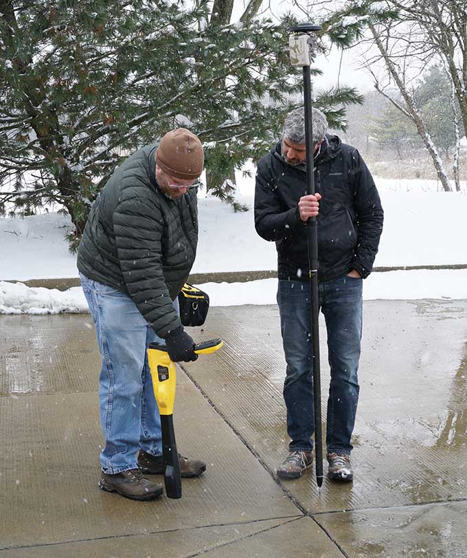
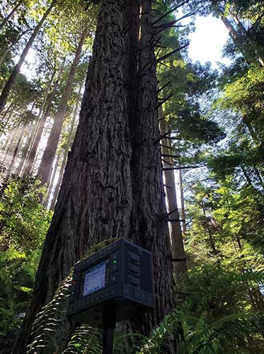
Eos has put a lot of effort recently in supporting external sensors and accessories to facilitate mapping of certain types of assets or mapping in certain types of conditions. For instance, this past year Eos released our underground mapping solution called Eos Locate for ArcGIS (see cover photo), which integrates with external utility locate devices to allow a user to precisely map buried assets. Eos Laser for ArcGIS interfaces with laser rangefinders to map assets in GNSS-impaired environments.
Positioning using consumer devices
With our bring-your-own-device (BYOD) approach on the market to support high-accuracy data collection for GIS, we have made it possible to override the consumer devices’ locations with accuracies down to the centimeter from our Arrow receivers. Customers can use any of their cell phones or tablets and immediately start mapping with submeter or centimeter accuracy.

Hemisphere GNSS
With Kirk Burnell, Senior Product Manager
Utilizing Galileo and BeiDou
The Galileo and BeiDou phase 3 systems introduce modern signal structures that allow more accurate measurements to be made than GPS first introduced. The new signals and increased satellite count are significantly improving receiver performance. Our Phantom and Vega product lines harness these new signals.
Dealing with jamming and spoofing
The increasing number of incidents of intentional and unintentional jamming and interference across the globe has impacted nearly every type of GNSS user. Our Cygnus interference mitigation technology automatically detects and mitigates the interference in real time, as well as providing spectrum analysis of the GNSS signal bands.
Integration with IMUs and other sensors
Today’s autonomous-focused environment increases the need to share data across platforms. Both Vector and Vega provide robust GNSS heading, position and velocity to marine, machine control, UAV and internet of things (IoT) integrators, helping augment their sensor data.
Positioning with consumer devices
Positioning in consumer products will continue to drive innovation, while chasing accuracy and precision requires a strong understanding of geodesy fundamentals. As design requirements push well beyond the limits of what consumer GNSS delivers, and with the help of our knowledgeable staff, our precision receivers are delivering reliable performance in some very impressive applications.
Other significant challenges and opportunities
New GNSS signals and new surrounding technologies continue to come online, and the RF environment continues to see increased activities. Our underlying Lyra II ASIC technology and Cygnus enable our Phantom and Vega integrators and users to reliably coexist with these changes.

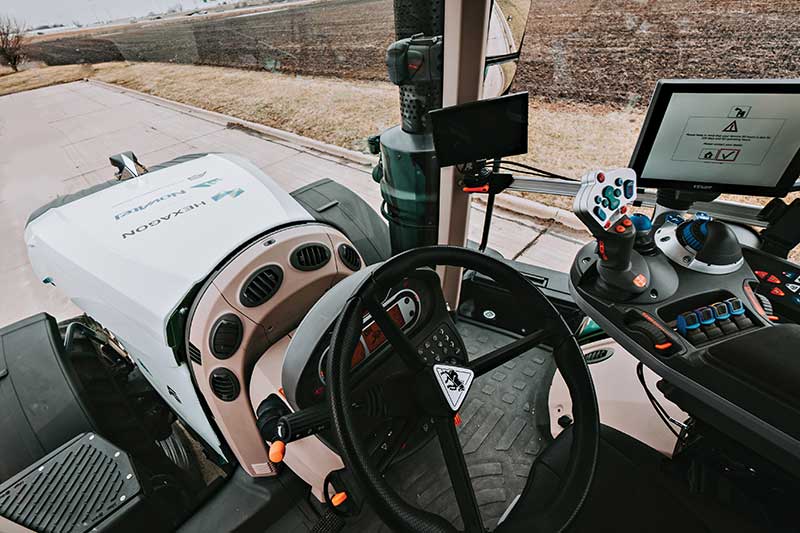
Hexagon | Novatel
With Sandy Kennedy, Vice President Innovation, Hexagon’s Autonomy & Positioning division
Utilizing Galileo and BeiDou
GNSS is now reality, not just inclusive phrasing to replace GPS. We are well into the era of multi-constellation receivers, and users will notice distinct improvements in solution availability with the addition of Galileo and BeiDou measurements. Over the next two years, we expect users in a variety of applications to start exploiting our globally available, fast-converging RTK From the Sky technology, which is enabled by the addition of quad-frequency signals supplied by Galileo and BeiDou (see page 29).
Dealing with jamming and spoofing
The RF spectrum is crowded and will only become more crowded over time. In 2020, we introduced our GNSS Resilience and Integrity Technology (GRIT), a suite of firmware options for the OEM7 receiver family. In addition to interference detection and mitigation, GRIT adds spoofing detection and time-tagged digitized samples for advanced situational awareness of the RF spectrum. With GRIT’s spoofing detection, opponents can try to spoof us. But fool us? Not a chance.
Integration with IMUs and other sensors
IMUs have become more accessible to more applications due to size, weight, power and cost reductions. At the same time, our algorithmic capability has significantly advanced to use lower quality inertial measurements for greater benefit. Originally reserved for truth systems, high-end mapping, and aerospace and defense applications, GNSS+INS solutions are now available in products like our SMART7 line of smart antennas for precision agriculture applications. Closer integration of the inertial and GNSS processing will bring further benefits in hostile RF or just plain difficult positioning environments. There is no perfect single sensor, but you can get more accurate by combining a set of sensors that offset each other’s vulnerabilities and limitations.
Positioning with consumer devices
The general population is accustomed to looking at their smartphone to see not only their location, but also the size of the “blue dot” of positioning uncertainty that accompanies it. We have always said accuracy is addictive, and we will no doubt start to see consumer demands for smaller blue dots with increasingly accurate positions. Making the digital reality match our real world demands continuously available and reliable positioning. Being lost is a terrifying feeling, especially for those who have been staring at their phone for the past 30 minutes and have no recollection of the physical world through which they have passed.
Other challenges and opportunities
The transition to autonomous vehicles, for both on-road consumer and off-road industrial applications, is inevitable. It is becoming increasingly necessary to prioritize the development of functional safety and integrity requirements to achieve the safe operations of autonomous systems. These requirements are necessary and entirely non-trivial to develop.
Javad GNSS
With the Javad GNSS Team
Utilizing Galileo and BeiDou
Simultaneous RTK and PPK processing of all available GPS, GLONASS, Galileo and BeiDou signals in receivers powered by our 874-channel TRIUMPH chip has resulted in significant productivity gains. User Darren Clemons told us “These Plus units are at least 40%–50% faster… The combination of the four super engines and the RTPK is unbeatable. You can get an accurate shot just about anywhere.”
Dealing with jamming and spoofing
Usually, more than 100 signals are available at any given time, and we need only a small number to compute a position. By tracking and verifying all these constellations and their signals, it is extremely unlikely that we can be spoofed without our knowledge. Javad GNSS receivers will immediately recognize spoofing and take corrective actions. Spoofing protection is available on all Javad GNSS receivers and OEM boards.
Integration with IMUs and other sensors
The Javad GNSS engineering team relentlessly works to identify and integrate the latest sensor technologies that can boost productivity. Our TRIUMPH-LS’s integrated camera sensor has for years supported onboard photogrammetry, and now our TRIUMPH-3 receiver’s integrated IMU provides high-precision tilt compensation.
Other challenges and opportunities
Our innovative RTPK feature is improving GNSS surveying and monitoring. Our Triumph-LS and Triumph-3 RTK rover systems combine the strengths of RTK and PPK into a system that can post-process RTK data and verify its results in parallel and real time. Users get the best of both worlds. If RTK fails, RTPK comes to the rescue in a fraction of a second.
Septentrio
With Gustavo Lopez (pictured) and Stef van der Loo, Market Access Managers
Utilizing Galileo and BeiDou [GL]
With 150 GNSS satellites in space, multi-constellation has been a natural transition for improved GNSS availability. We see this in rover applications and in upgraded reference networks modernizing correction services. The next two years will be transcendent as constellations finally start delivering new services. We see our products soon integrating
GAL-OSNMA for anti-spoofing and then moving to new high-accuracy services.
Dealing with jamming and spoofing [GL]
We have witnessed a large increase in jamming and spoofing events as GNSS ubiquity increases. Users are becoming conscious of this, yet many integrations are still using vulnerable receivers, and we see manufacturers falsely claiming to have proper resilience. Septentrio’s AIM+ technology uniquely mitigates all these risks, and users come to us for expert advice on this area. In the coming years, we expect further receiver innovations and developments in adjacent technologies.

Integration with IMUs and other sensors [SVL]
Integration of sensors and sensor fusion moved from the research stage to the major production and adoption phase as an element in autonomous systems. Using a GNSS/INS (see our AsteRx-i products) is crucial for various applications — for example, being able to work in difficult environments — and for vehicle orientation. The development of lower cost IMUs while keeping high performance will enable a shift in focus from hardware to software. This will result in multi-sensor technology that is better scalable, easier to use, and more stable to integrate in relation to a full system with various sensors.
Positioning with consumer devices [GL]
We see further integration of dual-frequency GNSS chipsets in mobile technology for increased accuracy, which is key for future consumer applications. Septentrio has also witnessed the important involvement of telecom operators in GNSS correction services. Septentrio products (such as the PolaRx5 or AsteRx-SB) are deployed on new generation networks as operators prepare for the new generation of positioning in cell technology.
Other significant challenges and opportunities [GL]
Two areas are emerging thanks to the autonomy era and due to further regulations in the market. The first is the concept of GNSS integrity, which has a strong link to the reliability of autonomous solutions. The second is security, which, beyond anti-spoofing, is linked to the cybersecurity of GNSS systems as the demand increases for the protection of electronics and software.

Trimble
With Stuart Riley, Vice President of GNSS Technology
Utilizing Galileo and BeiDou
Most Trimble precision receivers can utilize any combination of GNSS satellite constellations (GPS, GLONASS, Galileo, BeiDou and QZSS) to deliver centimeter accuracy and optimize performance, even in degraded conditions. Users can select the constellations they want the receiver to use.
Dealing with jamming and spoofing
Spoofing is rare and low risk in locations in which Trimble’s precision GNSS agriculture, construction and geospatial customers operate. However, to protect users, modern Trimble Maxwell-based GNSS receivers implement hardware- and software-based techniques to detect and mitigate spoofing. Jamming sometimes impacts customers, but is not their primary challenge. The same issues are still present today as they were in the early days of precision GNSS. The main productivity concerns remain related to multipath and problems around obstructions and trees. Trimble continues to improve our GNSS systems’ robustness with advances in processing algorithms and hardware enhancements such as integrating inertial technology.
Integration with IMUs and other sensors
The Trimble R12i and SPS986 represent Trimble’s third-generation receivers (preceded by the R10 and the R12) capable of integrating inertial measurements into 3D GNSS positioning. In addition to speed and convenience for the user, integration with IMU provides immunity to magnetic interference and real-time integrity monitoring.
With the introduction of the Trimble R12 with the ProPoint GNSS positioning engine, we significantly improved the performance in challenging environments. This was further enhanced with the addition of an IMU for tilt compensation in the R12i. The new solution provides a system that delivers more accurate results in more places and in less time.
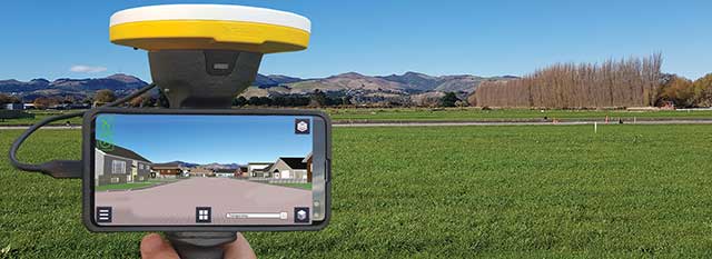
Positioning with consumer devices
The Trimble SiteVision augmented reality solution and Trimble Catalyst GNSS receiver operate on Android devices. Trimble Catalyst technology provides a software-defined GNSS receiver capable of survey-grade accuracy. Catalyst is the ideal solution for third-party applications that benefit from precise real-time positioning. Trimble SiteVision combines Catalyst positioning with augmented reality to deliver real-time, on-site visualization of proposed structures and existing underground assets.
Other significant challenges and opportunities
An ongoing challenge in GNSS positioning is the ability to obtain positions with suitable accuracy when and where they are needed. Solutions such as RTK and VRS provide solid performance at local and regional levels. Today, these technologies are complemented by subscription-based Trimble RTX positioning services, a global approach that uses a network of GNSS tracking stations and satellite-delivered correction data to achieve required accuracies. In 2020, coverage for Trimble CenterPoint RTX Fast, which enables users to achieve two-centimeter or better accuracy with initialization time of less than one minute, was expanded to cover the continental United States as well as much of Canada and Western Europe. The CenterPoint RTX Fast network now covers more than 5 million square miles worldwide. Trimble RTX coverage enables global users such as farmers, land surveyors and GIS professionals using RTX-capable receivers, to untether from the cost and complexities of GNSS base stations. In addition, the service offers a single, continuous corrections network ideal for enabling a broad range of safety-critical autonomous applications in markets such as automotive, agriculture and construction.
Feature photo: Emma Hardy/Eos Positioning Systems