Category: Galileo

  • The benefits of the multi-GNSS future

    Galileo, BeiDou, QZSS, IRNSS, and more join GPS and GLONASS to bring you wider, broader, greater, more accessible and above all more accurate PNT. How to get all that’s coming at you?

    Multi-GNSS paves the way for complete exploitation of new signals and constellations in navigation, surveying, geodesy and remote sensing.

    What exactly are the benefits of multi-GNSS, and how can you access them? For a start, download the multi-GNSS signal schema, and follow that up by attending a free webinar, “Multi-GNSS: Advantages, Challenges and Test Solutions.

    The free 1-hour webinar, which will take place at 1 p.m. Eastern [10 a.m. Pacific,  7 p.m. (1900h) Central European Time] on Thursday, Sept. 20, will review advantages of using multi-GNSS for the end-user and challenges in obtaining maximum efficiency when combining multiple constellations and signals. It will also discuss different approaches of testing GNSS receivers against jamming and spoofing attacks.

    You will learn:

    • Advantages of using multi-GNSS
    • Challenges when combining multiple constellations
    • Robustness of multi-GNSS receivers to jamming and spoofing
    • Test solutions for GNSS receivers.

    The webinar presents sponsored content by Skydel and Talen-X. Register for it here.

  • Geneq debuts multi-constellation GNSS survey receiver

    Geneq debuts multi-constellation GNSS survey receiver

    Geneq Inc. has released the F90, a multi-constellation GNSS receiver with a high level of technology integration. The new product is designed to fulfill surveyors’ demands for performance, flexibility and cost-effectiveness.

    The F90 tracks multiple constellations (GPS, GLONASS, Galileo and Beidou) and can maximize the acquisition and tracking process with all-in-view GNSS satellite frequencies, the company said.

    Providing maximum performance for accuracy and real-time measurements, the F90 also supports real-time kinematic correction services, including the RTX service that can achieve centimeter  accuracy without a base station.

    The F90’s advanced technology ensures a high performance even in harsh environment such as under heavy canopy, Geneq said.

    The F90 has an excellent combination of GNSS, 4G, Bluetooth and Wi-Fi antenna. With highly integrated Bluetooth, Wi-Fi and 4G network modules, and without affecting accuracy and efficiency, the innovative F90 GNSS receiver is light and small. Even with its magnesium-alloy casing, F90 weighs only 1 kilogram and measures 140 x 157 x 76 millimeters.

    With its integrated highly sensitive E-bubble and new tilt survey algorithm, the F90 becomes a calibration-free GNSS receiver, Geneq said. It is immune to magnetic disturbance and free from the limitation of tilt angles so that it can be used to measure inaccessible points.

    Equipped with an internal radio, enabling frequency band change from 410 to 470 MHz, the F90 can be used with different radio communication protocols. Another important feature is its integrated second-generation web user interfae control, which is fully compatible with all devices and all browsers.

    The user will benefit the F90’s two smart hot swappable Lithium batteries (the same battery used with Geneq’s SXPad 1000P data collector), allowing uninterrupted field work for up to 10 hours.

  • NovAtel launches TerraStar-C PRO correction service

    NovAtel launches TerraStar-C PRO correction service

    Image: NovAtel
    Image: NovAtel

    NovAtel Inc. has launched its TerraStar-C PRO correction service with multi-constellation support, including the GPS, GLONASS, Galileo and BeiDou constellations.

    Combined with NovAtel’s OEM7 positioning technology, TerraStar-C PRO cuts initial convergence times by nearly 60 percent and offers 40 percent better horizontal accuracy than the current TerraStar-C service, the company said.

    NovAtel’s TerraStar-C PRO offers a robust multi-constellation solution that provides greater positioning accuracy, availability and reliability than before, the company added. With the growing number of operational GNSS satellites, TerraStar-C PRO offers benefits in challenging signal conditions such as multipath, shading, interference and scintillation. High-rate TerraStar-C PRO corrections provide reconvergence in less than 60 seconds following brief GNSS signal interruptions.

    According to NovAtel, TerraStar-C PRO corrections are generated using TerraStar’s proprietary global network of more than 100 strategically located GNSS reference stations. The correction data is delivered worldwide through overlapping geostationary satellites directly to a NovAtel receiver or via cellular IP network.

    With OEM7 triple L-band support, TerraStar-C PRO correction signals from up to three satellites can be tracked and used simultaneously, providing continuous correction data reception when the primary satellite signal is blocked.

    “TerraStar-C PRO enables higher operational efficiency by allowing users to start operations sooner and continue to work through challenging conditions without interruptions,” said Sara Masterson, NovAtel’s positioning services segment manager. “We continue to build our TerraStar portfolio of services and with the addition of TerraStar-C PRO customers can trust that they have not only a highly-reliable precise positioning solution, but also services that immediately translate to increased productivity.”

    TerraStar-C PRO is available immediately as a termed subscription service for agriculture, unmanned, airborne and land applications, such as survey, mapping and GIS and supported on compatible OEM7 products with firmware version 7.05 and later.

  • Quectel releases quad-band GSM/GPRS/GNSS/Wi-Fi module

    Quectel releases quad-band GSM/GPRS/GNSS/Wi-Fi module

    Photo: Quectel Wireless Solutions
    Photo: Quectel Wireless Solutions

    Quectel Wireless Solutions has launched the MC90, a quad-band GSM/GPRS/GNSS/Wi-Fi module.

    According to the company, the module supports hybrid positioning technologies including GNSS, Cell ID and Wi-Fi aided positioning, and enables position tracking in both indoor and outdoor environments.

    Quectel’s MC90 integrates the multi-GNSS system, including GPS, GLONASS, Galileo and QZSS, which makes it suitable for urban areas with high-rise buildings and complex environments, the company added.

    The MC90 also adopts Wi-Fi hotspot positioning technology for blind spots and satellite coverage. It integrates multi-aiding positioning technologies to offer customers with optimized GNSS performance. It also supports EPO technology, which provides predicted Extended Prediction Orbit to speed up TTFF without the need of any extra server.

    The MC90 features a compact design, low power consumption and supports dual SIM single standby function. According to Quectel, it can be used for a wide range of internet of things applications, including bicycle sharing, student ID card, vehicle tracker, wearable device, pet tracker, asset tracker, driving recorder and more.

  • Opening presentations at ITSNT focus on PNT resilience

    Opening presentations at ITSNT focus on PNT resilience

    ITSNT logo

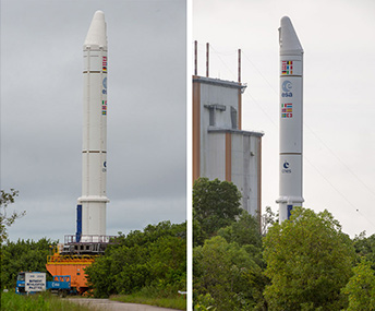
    Speakers and topics at the Nov. 13–16 International Technical Symposium on Navigation and Timing opening session have been announced.  They focus on comprehensive approaches for obtaining resilient PNT, supported by mega-constellations, and with new concepts to improve reliability.

    Logan Scott, a U.S. consultant specializing in radio frequency signal processing and waveform design, will speak on “Towards a Comprehensive Approach for Obtaining Resilient PNT.”

    As precise positioning and timing becomes ever more deeply embedded into worldwide critical infrastructure, numerous attacks have already been seen and the sophistication of attacks is growing. A layered defense with flexible responses provides the best hope for meeting the challenges of maintaining required navigation performance under adverse conditions.

    No single defense or offense, no matter how good, is capable of dealing with all threats.

    A comprehensive and integrated civil policy is needed that takes into account the nature of the threats, their motivations, their likely evolution, and the costs and approaches for mitigating them. This talk explores not only the technical countermeasures available to civil users but also the legal and social engineering approaches that can militate against jamming and spoofing. The importance of penetration testing is illustrated via real-world examples of what happens when receivers meet a threat for the first time. Effective strategies for civil applications are fundamentally different from those suitable for military applications. Specific and actionable recommendations at the policy, receiver and systems level will be made.

    Francis Soualle, a French engineer specializing in GNSS architectural concepts, orbit determination, signal design and receiver performances at Airbus Defense and Space, will address “Perspectives of PNT Services Supported by Mega-Constellations.”

    The development of so-called “Mega-Constellations” composed of several hundreds of spacecrafts, if not thousands, comprising low-Earth orbit (LEO)satellites among others, initially designed to provide communication services, could also support positioning, navigation and timing (PNT) applications.

    The architectural and technological specificities of LEO-based PNT systems could represent meaningful differentiators with regard to GNSSs and enhance their attractiveness. Hence, Doppler-based positioning techniques already proven in operational space systems, such as Argos or Cospas-Sarsat, shall strongly benefit of the geometry (i.e. velocity) and the large density of lines-of-sight. By combining range and range-rate positioning techniques, the availability for instantaneous and accurate positioning will thus be enhanced.

    The newly introduced Satellite Time & Location (STL) system, based on the Iridium constellation, and offering a global and resilient Timing and Position service will support this discussion.

    Finally, the main architectures for LEO-PNT systems will be described with special focus on the primary and ancillary payload units, but also on the supporting ground segment infrastructures.

    Karen van Dyke, director of PNT & Spectrum Management at the U.S. Dept. Of Transportation, will speak about “Resilient Positioning, Navigation, and Timing” and radiofrequency spectrum management services essential to critical infrastructure applications, including transportation for safety-of-life applications such as the Next Generation Air Transportation System (NextGen), Positive Train Control, and Intelligent Transportation Systems (ITS).

    Increasing occurrences of unintentional and intentional interference to GPS, including the spoofing of the signal have been observed. It is important to increase awareness of vulnerabilities of GPS, evaluate the impact, and to research complementary sources of PNT to increase resiliency and make intentional jamming and spoofing less desirable. Also, best practices should be adhered to for implementation and installation of GPS receivers in critical infrastructure applications.

    With an increased focus on autonomous vehicles for all modes of transportation, there is a need to focus on multi-sensor navigation technologies to ensure reliable operation of vehicles without a human in the loop. This research should be aligned with National PNT Architecture recommendations to overcome capability gaps predominantly resulting from the limitations of space-based PNT.

    As the civil lead for GPS, the U.S. Department of Transportation also has been conducting the GPS Adjacent Band Compatibility Assessment to understand the power levels that can be tolerated in the radiofrequency bands adjacent to GPS, given increasing demand for use of those adjacent frequency bands for non-space commercial applications. Van Dyke will address resilient PNT from the standpoint of both protecting GPS and GNSS from interference, as well as increasing resiliency by implementation of best practices and utilization of other PNT technologies.

    Matteo Paonni, scientific officer at the Joint Research Center of the European Commission in Italy, will deliver “New Concepts and Ideas to Improve the Reliability of PNT Services.”

    With early Galileo services already underway and full operational capability coming in 2020, a strong need for R&D activities in the field of navigation signal engineering has been identified by various programme stakeholders. Considering the long process required for introducing new signals and features in a system that is already deployed and finds itself in the exploitation phase, early R&D activities become essential to investigate potential evolutions and new concepts to improve the Galileo signals and services in the short, medium and long term.

    The presentation will provide some examples of recent R&D initiatives in this context. In particular, technical solutions developed in the context of the Future Navigation and Timing Evolved Signals (FUNTIMES) project will be presented. FUNTIMES is a European GNSS mission evolution study funded by the European Commission within the Horizon 2020 Framework for Research and Development. Main goals of the project was to identify, study and recommend mission evolution directions and to support the definition, design and implementation of the future generation of Galileo signals.

  • GMV and Tecnobit to tailor Skydel SDX GNSS simulator for Europe

    GMV and Tecnobit to tailor Skydel SDX GNSS simulator for Europe


    GMV, Tecnobit and Skydel are aiming to provide corporations, universities and research labs with a reliable, advanced simulation system that closely follows the latest Galileo capabilities.

    “Together with our partners at Tecnobit, and taking advantage of SDX’s unique software-defined architecture, we are currently working to add Public Regulated Service (PRS) support to Skydel SDX,” said Manuel Toledo, head of the GNSS Advanced User Segment Solutions Division at GMV. PRS provides position and timing data for sensitive applications that require the highest level of service continuity.

    Skydel and GMV are also joining efforts on developing SDX’s capabilities for signal authentication with Galileo Commercial Service and Open Service. The goal of such authentication is to increase the safety level of signals and to avert their falsification or fraud. It is currently a unique feature that only the Galileo constellation can provide, the companies said.

    Skydel and GMV are also collaborating on projects that aim to provide signal simulation solutions for Galileo’s second generation (G2G). Galileo’s second-generation satellites are scheduled to be launched in 2025 and beyond.

    “With Galileo’s full operational capabilities approaching soon, we must focus on the system’s upcoming G2G services,” said Pierre-Marie Le Véel, business development director at Skydel. “Skydel’s top priority for the European market is to provide simulation tools for the design of these next-generation GNSS devices.”

    The partnership among the three companies unites the unique strengths of each organization, GMV said. While GMV brings its expert knowledge of both the European market and the Galileo system and Tecnobit brings its expertise as developer of cryptographic systems, Skydel adds its versatile and extensible GNSS simulator, resulting in a solid technical and commercial synergy for establishing an improved GNSS service offering for Europe.

  • Latest satellite launch extends Galileo’s global reach

    Latest satellite launch extends Galileo’s global reach

    News from the European Space Agency

    Four more Galileo satellites were launched July 25 by an Ariane 5. Their arrival in orbit brings the Galileo constellation to 26 satellites, extending the global coverage of the constellation.

    Ariane 5 flight VA244, operated by Arianespace under contract to ESA, lifted off from Europe’s Spaceport in Kourou, French Guiana, at 11:25 GMT (13:25 CEST, 08:25 local time), carrying Galileo satellites 23–26. The first pair of 715 kg satellites was released almost 3 hours 36 minutes after liftoff, while the second pair separated 20 minutes later.

    They were released into their target 22 922 km-altitude orbit by the dispenser atop the Ariane 5 upper stage.

    In the coming days, this quartet will be steered into their final working orbits by the French space agency CNES, under contract to the Galileo operator SpaceOpal for the European Global Navigation Satellite System Agency (GSA).

    There, they will begin around six months of tests by SpaceOpal to verify their operational readiness so they can join the working Galileo constellation.

    “Galileo is ESA’s largest ever satellite constellation, built up to its present size in rapid time, with 22 Full Operational Capability satellites added within just the last four years,” remarked Jan Wörner, ESA’s director general.

    “We must thank our industrial partners OHB (DE) and SSTL (GB) for the satellites, as well as Thales Alenia Space (FR/IT) and Airbus Defence and Space (GB/FR) for the ground segment and all their subcontractors throughout Europe for their continued support to the programme. Together with ESA, the entire industrial team has worked hard for the point at which we now are and this cooperation have proven to be very successful, as we can show in the excellent performance of Galileo.”

    Paul Verhoef, ESA’s director of navigation, added, “Galileo has been providing Initial Services on a worldwide basis since 15 December 2016, and today has more than 100 million users, and rapidly increasing. Today’s satellites will increase the global coverage of Galileo with a performance that is widely recognized as excellent.

    “This is the end of the current phase of Galileo deployment, but our pace is not slacking. A further 12 Galileo ‘Batch 3’ satellites are in preparation as in-orbit spares and as replacements for the oldest Galileo satellites, first launched in 2011, in order to keep the system working seamlessly into the future.


    Photo: ESA

  • Galileo launches four more satellites

    Galileo launches four more satellites

    The European Space Agency launched the next four Galileo satellites on an Ariane 5 on Wednesday July 25, at 11:25 GMT (13:25 CEST, 08:25 local time) from Europe’s Spaceport in Kourou, French Guiana.

    These latest four Galileo satellites will bring the constellation in orbit up to 26 satellites.

    You can watch the launch live starting at 4 a.m. local time.

    Livestream coverage of the launch starts at 11:00 GMT (13:00 CEST) with liftoff at 11:25 GMT (13:25 CEST).

    Live coverage resumes with confirmation of the satellites separating from their upper stage from 14:50 GMT (16:50 CEST).

    Separation of the Ariane 5’s upper stage occurs about nine minutes after liftoff, followed by the first 10-minute firing of the upper stage.

    The upper stage — carrying four 715-kg Galileo satellites — flies in ballistic configuration for three hours and eight minutes, after which a second upper stage firing lasting just over six minutes will place it into circular separation orbit.

    Once stabilized at 3h 36 min after liftoff, the Galileo dispenser will release the first two satellites, followed by the second pair 20 minutes later.

    In the meantime, check out ESA’s new Galileo video.

    The Ariane 5 carrying Galileo satellites 23-26 is in place at the ZL3 launch site ready for liftoff. (Photo: ESA)
    The Ariane 5 carrying Galileo satellites 23-26 is in place at the ZL3 launch site ready for liftoff. (Photo: ESA)
  • Galileo satellites viewed in smartphone app

    Galileo satellites viewed in smartphone app

    The European Space Agency (ESA) has released an augmented reality view of Galileo satellites in the sky close to its technical centre in the Netherlands.

    The image comes from a Galileo-focused satnav app for Android smartphones, developed by ESA engineers. ESA ran an internal competition for its trainees to develop an app capable of making positioning fixes using only Galileo satellites.

    “As part of our support for the competition, we developed our own app on a voluntary basis to serve as a benchmark,” said Paolo Crosta of ESA’s Radio Navigation Systems and Technology section. “We included this augmented reality view, so users can ‘see’ the satellites their smartphone is using as they hold it up to the sky.”

    Galileo satellites viewed in smartphone app. (Photo: ESA)
    Galileo satellites viewed in smartphone app. (Photos: ESA)

    The positioning calculations and assistance data functions for the app were developed by Paolo, with telecom engineer Tim Watterton contributing the main structure of the app, together with how it looks and its user interface.

    “The satellites are overlaid in real time on the camera view in their predicted positions in the sky, based on ‘ephemeris’ information, assistance data that describes the current satellite orbits with high precision,” Watterton said. “When a signal is being received, the satellite is shown in green, overlaying the predicted position. The satellite shown in red is one of the two placed in elongated orbits, but these satellites are expected to be used soon in the operational constellation. Satellites colored orange are transmitting, but the signal is not detected, which may be due to obstruction by terrain or buildings.”

    Panning the phone around to position the crosshair over a green-colored satellite adds additional information, such as its signal status, pseudorange (the uncorrected distance the signal has traveled to reach the receiver) plus the satellite’s manufacturer and launch date, among other items.

    The reference app is now being tested with the hope of making it publicly available on the Google Play Store. Following the competition, the trainees are also testing their own apps with the goal of releasing them.

    There are 22 Galileo satellites in orbit, with four more satellites set for launch on July 25.

  • Combined orbital Galileo-GPS position fix achieved aboard ISS

    Combined orbital Galileo-GPS position fix achieved aboard ISS

    News from the European Space Agency

    Europe’s satellite navigation system Galileo is already in use worldwide, usable by itself or in combination with the U.S. GPS. Now a combined Galileo–GPS positioning fix has been achieved in space — aboard the International Space Station — through an ESA–NASA collaboration.

    In April, the chest-sized SCaN (seen left of center with an antenna on top) was used to make the first combined Galileo-GPS positioning fix in orbit from the ISS. (Photo: ISS)
    In April, the chest-sized SCaN (seen left of center with an antenna on top) was used to make the first combined Galileo-GPS positioning fix in orbit from the ISS. (Photo: ISS)

    Low-Earth orbiting satellites routinely make use of satellite navigation signals to pinpoint their position in space and allow their paths through space to be fixed with extremely high accuracy, known as “precise orbit determination.”

    So far, such positioning has mainly been performed using GPS, but this new test proves it can also be achieved on a dual-constellation basis with both GPS and Galileo — as well as through the sole use of Galileo.

    The experiment is based on the use of a reconfigurable NASA receiver called the Space Communications and Navigation Testbed, SCaN, attached to the exterior of the ISS.

    ESA’s Navigation Support Office, based at its ESOC control centre in Darmstadt, Germany, teamed up with its Radio Navigation Systems and Technology team, located at its ESTEC technical centre in Noordwijk, the Netherlands, and Italy’s Qascom company to develop the techniques, software and firmware required for the experiment, which was passed to NASA’s Glenn Research Center in Ohio for upload to the receiver.

    The International Space Station. (Photo: ESA)

    “SCaN is a versatile software-defined radio receiver in space for both telecommunications and navigation testing, delivered to the Station back in 2012,” said ESA radio-navigation engineer Pietro Giordano. “It made it possible, with suitable modifications, to demonstrate combined GPS-Galileo positioning determination of the ISS.”

    The algorithm developed for the SCaN Testbed had to take account of the high dynamics involved, and resulting Doppler shifting of signals: not only are the Galileo and GPS satellites moving at orbital velocity, so is the ISS itself. Orbital information of all the satellites in both constellations was included in the algorithm, allowing SCaN to make a ‘warm start’ – to search out signals in the correct segments of the sky.

    In February 2006, the Navigation Support Office inaugurated its modern Navigation Facility at the European Space Operations Center (ESOC) in Darmstadt, Germany. (Photo: ESA)
    In February 2006, the Navigation Support Office inaugurated its modern Navigation Facility at the European Space Operations Center (ESOC) in Darmstadt, Germany. (Photo: ESA)

    In February 2006, the Navigation Support Office inaugurated its modern Navigation Facility, at the European Space Operations Center (ESOC), in Darmstadt, Germany.

    “Dual constellation fixes offer many advantages for space, providing extremely robust and high-precision positioning,” Pietro added. “More signals become available overall, and the quality of the Galileo Open service and modernised GPS signals are extremely good.”

    Werner Enderle, overseeing the project at the Navigation Support Office noted, “These excellent first results, coming out of great teamwork within ESA, collaboration with industry and with our NASA partners, mark just the beginning of our project data analysis. Many other exciting results are expected related to signal aspects, precise orbit determination and positioning based on optimised algorithms.”

    James J. Miller, GPS Sr. Technologist within the SCaN programme office at NASA Headquarters, commented: “We’ve been promoting interoperability of GPS and Galileo through a number of activities within the United Nation’s International Committee on Global Navigation Satellite Systems (GNSS). In particular, NASA, with ESA and other national space agencies, has been identifying benefits to be gained for high altitude users in the multi-GNSS Space Service Volume under development. By further demonstrating multi-GNSS capabilities in low Earth orbit, the drive for additional utility at geostationary orbit and beyond is only strengthened.”

    Europe’s Galileo system began Initial Services for users in December 2016, and there are 22 Galileo satellites in orbit. The launch of four more Galileo satellites by Ariane 5 is scheduled for July 25, and will bring the constellation to 24 satellites plus two orbital spares.

    ESA is developing dual Galileo-GPS receivers for the next generation of Earth-observing Sentinel satellites. The more precise the orbit determination, the more accurate the environmental data that can be returned to Earth.

    Combined use of Galileo and GPS signals on an interoperable basis for positioning and precise orbit determination should bring significant advantages for space users in particular, set to provide a seamless navigation capability from low to high Earth orbits — and potentially beyond.

    “This shows the versatility of the Galileo system and the use of the system for scientific and other purposes, way beyond traditional navigation services,” said Paul Verhoef, ESA’s Director of Navigation. “We have also started work to determine whether we can use Galileo, in combination with GPS and other systems, for navigation to the Moon.”

  • ESA trainees compete in Galileo app contest

    ESA trainees compete in Galileo app contest

    News from the European Space Agency (ESA)

    Testing of the three Galileo apps took place in May. (Photo: ESA)

    ESA challenged its young graduate and national trainees to develop a smartphone app to perform satnav fixes using only Galileo satellites.

    Three teams developed apps in their spare time, presenting their results to a jury of experts from ESA, the European Global Navigation Satellite Systems Agency (GSA) and Google.

    “I’m very impressed,” said Javier Benedicto, ESA’s Galileo programme manager. “With little detailed knowledge of satellite navigation, these teams have developed something that didn’t exist just a few months ago. Working on Galileo we love to see that the systems we’re putting together can reach widespread application and inspire new uses.”

    The winning Galfins Team put together the GNSS Compare app that promises to turn a smartphone into a “research lab in your pocket” to test Galileo performance in isolation or in combination with other systems. Their prize is to attend an ESA and European Commission-sponsored GNSS Summer School in Austria.

    The final presentation and results of ESA’s internal Galileo smartphone app competition took place in the Erasmus centre of ESA’s Erasmus technical centre on May 31. (Photo: ESA)

    “Only one of our four-strong team started the challenge with any knowledge about satellite navigation,” said Mateusz Kraiński of the Galfins team. “The rest of us come from different areas — for example, I’m working on the European Robotic Arm project, due to launch at the end of next year. We have learnt a lot and the radio navigation experts at ESTEC were a great source of support.”

    “We see a need on the market for such an application, so we will definitely continue with the development. The application will be made available for download when ready, and the project will be released as open source soon after.”

    The other two teams were also commended for their work; Chocolateam developed a richly-designed game-based app, giving the user the feeling of observing the Galileo satellites from a spacecraft, while Team 5G distinguished themselves by writing all their own navigation algorithms from scratch rather than relying on open source software.

    The challenge was to design an Android smartphone app that allows users to compute and visualize their position based solely on Galileo measurements, as well as the possibility of selecting a combination of satnav constellations to assess their performance.

    Testing the three apps entered in the Galileo smartphone app competition in the grounds of ESTEC, working in pedestrian mode. (Photo: ESA)

    The receiver chipsets inside smartphones make use of Galileo signals in combination with several other satnav constellations — the U.S. GPS, Russian GLONASS and Chinese BeiDou. These chipsets function like “black boxes,” making the resulting positioning fix accessible to users, but not giving any option for the user to select which constellation to employ.

    Current phone applications only display general satnav status information, such as which satellites are contributing to the positioning fix, their visibility parameters and overall power levels. This is not sufficient to single out Galileo’s contribution to the phone’s overall positioning performance.

    However, in newer Android smartphones it has become possible to access the raw signal measurements used to compute position, opening the door to the development of applications where the user can indeed select which satellites to use.

    The teams received one Galileo-enabled smartphone each for developing and testing the app.

    ESA’s Director of Technology, Engineering and Quality supported the teams by supplying dedicated software modules to simplify computations of the phone position. During the competition, a technical advisory team also developed an internal app as a benchmark.

    The app, named Galileo PVT and developed by ESTEC engineers Paolo Crosta and Tim Watterton, includes an augmented reality system allowing users to “see” the Galileo satellites from which they were receiving signals in the local sky.

    “This was a very useful exercise because it helps us understand the needs of satnav app developers in Android,” said the lead advisor, Paolo Crosta. “Then, once the apps were complete, we tested them together, here on the grounds of ESTEC, working in stationary, pedestrian and vehicular modes.”

    “Congratulations to all the teams here today,” said Frank Van Diggelen from Google, who had just come from a satnav raw measurements workshop hosted by GSA. “It’s been great to be here and see all the activity around raw signal measurements. Our aim has always been to raise standards by making these measurements available, to let developers see what’s happening inside. And the work you’re doing here is feeding back to chip and smartphone manufacturers, to help change and improve them for the future.”

  • Satellites and rocket readied for July 25 Galileo launch

    Satellites and rocket readied for July 25 Galileo launch

    Ariane 5’s cryogenic main stage is moved into position over the mobile launch table inside the Spaceport’s Launcher Integration Building. (Photo: Arianespace)

    Four more Galileo satellites will be launched on a customized Ariane 5 on July 25.

    The next Arianespace rocket to orbit Galileo satellites has begun taking shape at the spaceport in French Guiana, reported Arianespace. Build-up of the heavy-lift vehicle is now underway inside the spaceport’s Launcher Integration Building.

    Following the established assembly flow, the rocket build-up began with this week’s positioning of the launch vehicle’s central core cryogenic stage over one of two mobile launch tables used for Ariane 5.

    Ariane 5’s two solid propellant boosters are rolled out. (Photos: Arianespace)

    It was followed by integration of the two large solid propellant boosters — installed directly on the launch table and mated to the core stage — clearing the way for placement of the upper stage, topped off with the vehicle equipment bay.

    Once the Ariane 5’s basic build-up is completed under the direction of production prime contractor ArianeGroup, it will be moved to the spaceport’s Final Assembly Building for installation of its four Galileo FOC (Full Operational Capability) satellite passengers, which are undergoing their own pre-flight preparations at the spaceport.

    The Ariane 5 will deploy its satellite passengers at a targeted orbital altitude of 23,222 kilometers in circular medium Earth orbit. The launch is designated Flight VA244 by Arianespace.

    Galileo satellites arrive

    In early June, Galileo satellites 25 and 26 landed at Europe’s Spaceport in Kourou, French Guiana, joining their two predecessors, satellites 23 and 24, according to the European Space Agency (ESA).

    One of the two Galileo satellites 25 and 26 is unloaded from a Boeing 747 cargo jet at Cayenne – Félix Eboué Airport in French Guiana on June 1. The satellites travel inside protective air-conditioned containers. (Photo: ESA)

    The pair left Luxembourg Airport on a Boeing 747 cargo jet on the morning of June 1, arriving at Cayenne – Félix Eboué Airport in French Guiana that evening.

    After they were off-loaded, they were driven by truck to the cleanroom environment of the S1A payload preparation facility at Europe’s Spaceport, still in their protective air-conditioned containers. In the cleanroom, they joined Galileo satellites 23 and 24, which arrived last month.

    The cryogenic main stage of the Ariane 5, known as the EPC — from its French title Etage Principal Cryogénique — arrived by sea at French Guiana’s Port Pariacabo on May 30.

    A further 12 Galileo “Batch 3” satellites were ordered in 2017, supplementing the 26 built so far to provide further in-orbit spares and replacements for the oldest Galileo satellites, first launched in 2011.

    A steady stream of orbital spares, ready to replace satellites reaching the end of their operational lives, is essential to ensure Galileo continues operating seamlessly, according to ESA.

    Looking further ahead, with the aim of keeping Galileo services as a permanent part of the European and global landscape, new satellites will be required by the middle of the next decade, offering improved performance and added features.