The next-generation GPS ground-control system, known as OCX.
The White House budget request for the Next Generation Operational Control System (OCX) comes to $393.3 million for fiscal year (FY) 2017.
The updated OCX budget appears as the Air Force officially acknowledges a two-year delay in the program, which could slide as late as 2023 for implementation.
The total cost for OCX now amounts to $4.81 billion.
In a cautionary move meant to span a suddenly yawning gap in ground control capabilities, the GPS Directorate awarded a $96 million contract modification to Lockheed Martin Space Systems to provide GPS III Contingency Operations services (COps).
By the end of 2019, Lockheed will “modify the current GPS control segment to operate all GPS III satellites that are launched prior to the transition” to OCX, as well as GPS III satellite vehicle simulation modules, a GPS simulator and updates to the GPS Positional Training Emulator.
Late delivery of OCX Block 1 “puts GPS constellation sustainment at risk since the current control segment cannot operate GPS III satellites,” according to a Pentagon statement.
The Air Force will “re-phase the GPS III space vehicle procurement profile,” delaying procurement of the 11th and all following GPS IIIs to FY18.
User Equipment. In contrast, the Pentagon substantially increased its request for developing user equipment to $278.2 million for FY17.
The added funds for Military GPS User Equipment (MGUE) seek to speed platform integration of M-code capability for munitions, warfighters, armored vehicles, planes and all military platforms: a stronger signal and data authentication capability.
OCX must navigate latest acquisition reforms
Acquisition reform mandated by Congress for the U.S. military, and known as Better Buying Power 3.0 guidance and initiatives, poses a tough new challenge for the Pentagon, not least for the Air Force and GPS.
This comes in the face of an impending (some say already underway) cyberwar targeting core infrastructure, much of it controlled or metered to some extent by GPS.
Under-Secretary of Defense for Acquisition, Technology and Logistics Frank Kendall stated in 2014 that the United States is “under attack in the cyber world” and “we’ve got to do a better job protecting our things.”
The cyber realm changes and innovates much faster than the material weaponry realm to which the acquisition cycle is obsolescently tied. Currently, funding, developing and fielding a new capability is a multi-year cycle.
At the heart of this storm is OCX, a new ground control system for GPS that is meant to be cyber-hardened.
“The dynamic nature of the cyber threat, the catastrophic implications to attacks on our GPS-related infrastructure, and the relatively slow acquisition cycle demands the Air Force follow through with added funding to OCX,” wrote Robert Newton, a retired Air Force acquisition officer, in Defense News.
“Consideration of scrapping such an important program may sound politically correct, but would be disastrous and place us years behind an already escalating threat,” Newton said.
In the longer term, Newton wrote, both the Pentagon and Congress must develop new methods and closer cooperation to quickly anticipate and counter threats before they fully materialize.
GPS OCX will be a key test of the government’s and the military’s joint sability to function.
LightSquared testing: The sequel
The U.S. Department of Transportation (DoT) announced in March that testing for the Adjacent Band Compatibility (ABC) Assessment will start in April. Conducted at the U.S. Army Research Laboratory, White Sands Missile Range, the tests seek to determine power limits for spectrum bands near the GPS L1 signal.
Later tests will focus on potential interference with the L5 signal and frequencies of other satellite navigation constellations.
In 2012, after tests at that time demonstrated that the proposed LightSquared network of ground-based transmitters would interfere with GPS, the Federal Communications Commission (FCC) denied LightSquared’s petition while authorizing further tests — never conducted until now.
Testing will take place across a 200-megahertz band spanning 1575.42 MHz, GPS L1. An interference tolerance mask is defined as the point at which the interference test signal power level causes a one-decibel degradation in the signal-to-noise ratio.
GPS and GNSS receivers designed for aviation (noncertified), cellular, general location/navigation, precision, timing, network-, and space-based application will be run through the high-powered gauntlet.
“The Department requests voluntary participation in this study by any interested GPS/GNSS device manufacturers or other parties whose products incorporate GPS/GNSS devices.” the DOT said.
Ligado, the renamed LightSquared company from 2012, came to separate legal settlements with GPS companies Garmin, Trimble and John Deere in 2015; the terms have not been disclosed.
“Use of a defined change in the noise floor (1 dB),” wrote a Deere attorney to the FCC, “provides a readily identifiable and predictable metric that all interested parties can take into account now and in the future.”
Lift-off of IRNSS-1F.(Photo: ISRO)
IRNSS nears completion
The sixth satellite in the Indian Regional Navigation Satellite System (IRNSS) launched on March 10, and all subsequent orbital steps proceeded according to plan. IRNSS-1F was injected to an elliptical orbit very close to its intended final orbit.
The Indian Space Research Organization’s (ISRO’s) Master Control Facility (MCF) at Hassan, Karnataka, took over the control of the satellite. Maneuvers will position the satellite in geostationary orbit at 32.5 degrees East longitude.
IRNSS-1F is the sixth of the seven satellites constituting the space segment of the Indian regional system. All five previosly launched satellites are functioning satisfactorily from their designated orbital positions.
A complete constellation of seven is planned for the second half of this year.
The first IRNSS position fix announced by ISRO, providing longitude, latitude and altitude, took place in April 2015. Since then, position fixes using stand-alone IRNSS receivers have obtained accuracies of better than 15 meters for a minimum of 18 hours in a day over India.
The regional SBAS broadcasts navigation signals in the L5 and S-band frequencies, and computes user position solutions for a restricted service and a standard positioning service.
GLONASS special K
A new-generation Russian GLONASS-K satellite began regular broadcasts on Feb. 15.
The K model line transmits five navigation signals in the GLONASS L1, L2, and L3 bands and carries a COSPAS-SARSAT payload for international search and rescue.
K satellites will gradually replace the GLONASS-M generation, bringing with them new CDMA civil signals compatible with GPS and Galileo.
Eleven new K satellites will take to space starting in 2018, using European and Chinese components as well as those being developed under an accelerated Russian import substitution program.
Question: What is the optimum number of GNSS signals to include/process in a consumer-grade PNT device?
Philip Mattos Receiver Designer Consultant
A: A chip should support four signals, being GPS/GLONASS/Galileo/Beidou, but only process two of them — choice depending on region, geopolitical sensitivity, constellation availability — dropping to one to save power when satellite availability is good. Two constellations give enough satellites for accuracy and availability in obstructed environments. Which two depends on needs regarding cost, power and so on, GPS and Galileo being better in the future for less power, but GPS and GLONASS being better today.
Greg Turetzky
Principal Engineer
Intel
A: The receiver should be capable of processing sufficient signals to provide optimum performance in all expected use cases. This means it should be able to support all GNSS and augmentation systems to provide maximum robustness to blockages and interference. The management of receiver resources to accomplish that is highly dynamic on individual epochs and should be invisible to the user in consumer-grade devices. Optimizing tradeoff between performance, power and cost is where the secret sauce lies.
Ruslan Budnik CEO SPIRIT Navigation
A: Two constellations give reliable, fast cold start even after long overseas flights. There is room for improvement in challenging conditions, so application of three constellations is the saturation point. Choose the best combination in different parts of the globe. In Russia that should be GLONASS + 2, in China BeiDou + 2, in Europe Galileo plus two, GPS + QZSS + another one in Japan, and so on. Navigation chipmakers should support all operating satnav systems to offer the best combination, taking into account battery drain.
Russian Space Systems (RCC) has completed work on the GLONASS navigation system, passing its final tests for the customer, the Russian Ministry of Defense, reports the TASS news agency.
The system has not yet been formally adopted by the Ministry of Defense, and remains in the research and development phase, RCC CEO Andrew PKC Tyulin the told the Izvestia newspaper.
“We presented the system to the customer for final tests, which are coming now,” Tyulin said. “During the tests, the customer gave us some comments, which we addressed, and Nov. 5 tests were resumed.”
He said every effort is being made to complete the work. “We hope that the results of the test system will be put into operation. ”
The test flight of the first GLONASS-K2 satellite — a new generation GLONASS satellite with a design life of 10 years — is expected to take place from late 2017 to early 2018, RIA Novosti reports. The Russian news agency quoted Nikolai Testoyedov, CEO of Information Satellite Systems—Reshetnev, speaking at the 2015 Dubai Air Show.
According to Testoyedov, the GLONASS-K2 satellites had difficulty being equipped following international sanctions imposed on a number of electronic components. The first unit of the series has been built, he said.
Nine GLONASS-M satellites are currently in reserve, and another nine GLONASS-K1 satellites are in production, Testoyedov said. Mass production of GLONASS-K2 satellites is expected to take place following the test, so that by the end of 2018 GLONASS-K2 satellites would be subsequently mass produced, while maintaining the regular structure of the orbital group.
With a GLONASS-M lifetime of seven years, and GLONASS K-1 and GLONASS-K2 of 10 years, the GLONASS system will be updated through 2028-2030, concluded Testoyedov.
Andy Yin, international sales director at ComNav Technology Ltd., talks about the company’s M300 Pro and new OEM boards at INTERGEO 2015, which was held Sept. 15-17 in Stuttgart, Germany.
The M300 Pro GNSS reference station receiver integrates ComNav’s new-generation OEM board and includes web service and remote control features.
The first OEM board, which can support all GNSS constellations (GPS, GLONASS, BeiDou and Galileo), will be released at the end of September, according to ComNav.
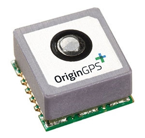
The Multi Micro Hornet by OriginGPS was designed small with wearables in mind.
OriginGPS has launched the Multi Micro Hornet, a tiny fully integrated multiple constellation antenna module. The innovative architecture packs functionality and high-quality components in a small space to improve wearables’ fashion and function, the company said.
“A recent study by the European Global Navigation Satellite Systems Agency (GSA) showed that multi-constellation is becoming a standard feature in today’s user equipment,” said Gal Jacobi, CEO of OriginGPS. “Developers of wearables need modules with these features in the smallest size possible to be competitive in a market the GSA predicts will reach 14 million by 2023.”
The Multi Micro Hornet is designed for devices that require a small form factor, low power consumption, and high sensitivity. In keeping with the company’s “Mini + Mighty” corporate mantra, OriginGPS has reduced the total volume in size by over 68 percent of other GNSS antenna modules without sacrificing performance, the company claims.
The Multi Micro Hornet by OriginGPS.
The Multi Micro Hornet has features that will improve the navigation experience of wearables and other Internet of Things devices, including:
Small size, high performance: Despite its miniature outline of 10 x 10 mm and height of 5.9 mm, the Multi Micro Hornet module offers superior sensitivity and outstanding performance, achieving rapid Time To First Fix (TTFF) of less than one second, accuracy within as little as one meter, and sensitivity at -165 dBm by tracking both GPS and GLONASS constellations simultaneously.
High sensitivity and noise immunity: The Multi Micro Hornet continues to leverage OriginGPS’ patented and proprietary Noise Free Zone NFZ technology to ensure high sensitivity and noise immunity even under marginal signal conditions.
Reduced power consumption without compromising connectivity: It detects changes in context, temperature, and satellite signals to achieve a state of near continuous availability. By opportunistically updating its internal fine time, frequency and satellite ephemeris data, the Multi Micro Hornet is able to stay connected while consuming mere microwatts of battery power.
An intelligent design that shortens time to market: The Hornet family of GPS / GNSS antenna modules integrates a GNSS receiver and patch antenna in a single module. As a cornerstone of the OriginGPS portfolio, the Multi Micro Hornet’s pin-to-pin compatibility with the Micro and Nano Hornet modules ensures a seamless migration from GPS to GNSS and gives developers the ability to create new product offerings in the shortest time to market while minimizing costly design risks. Developers can connect it to a power source on a single layer PCB and be off and running.
Additionally, the Multi Micro Hornet module combines OriginGPS’ proprietary low-profile GPS+GLONASS antenna with a dual-stage LNA, RF LDO, SAW filter, TCXO, RTC crystal and RF shield with SiRFstarV GNSS system on chip.
JSC “Russian Space Systems” (RCC), together with ISS Reshetnev, plan to remove imported components in construction of GLONASS satellites, according to an Izvestia article.
Production of the advanced GLONASS satellite “GLONASS-K” is scheduled to begin later this year.
According JSC CEO Andrew Tyulina, the company intends to stop the use of foreign electronic components as soon as possible. The plan is to have 80 percent of the satellites’ electronic components payload be domestically produced by 2019.
The move seems to be spurred by international sanctions in response to Russia’s occupation of Ukraine. Following the occupation, the United States began to prohibit supply of electronic components to Russia, and the British company E2V failed to get permission to import equipment for the Russian space observatory Spektr-UV, Izvestia reports. Russia had difficulty securing components before then, however. In 2013, as relations with the U.S. cooled following Russia’s harboring of Edward Snowden and events in Syria, the U.S. State Department did not authorize a supply of components for the spacecraft Geo-IK-2.
The expected component supplier will be the largest designer and manufacturer of electronic components in Russia, Roselectronika, an entity that unites 112 companies, research institutes and design bureaus. The total investment in Roselectronika will exceed 210 billion rubles to 2020, including provision for modernizing industrial sites that produce electronic payloads for space.
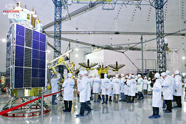
Seminar participants visit the GLONASS production facility. (Photo: Reshetnev)
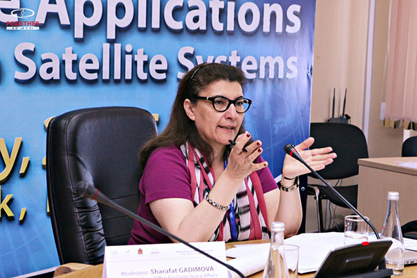
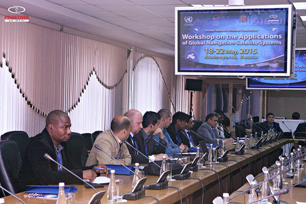
A United Nations workshop held in Krasnoyarsk, Russia, May 18-22 focused on sharing GNSS in various countries, as well as training in GNSS technologies.
The five-day workshop, organized jointly by the United Nations Office for Outer Space Affairs and the Russian Federal Space Agency (Roscosmos), sought to address the use of GNSS for various applications that can provide sustainable social and economic benefits, in particular for developing countries.
Titled “The use of global navigation satellite systems, GNSS/GLONASS,” the meeting was hosted by the Reshetnev Information Satellite Systems Joint Stock Company. This is the first time the workshop was held in Russia.
A key topic of discussion was the sharing of GNSS in different countries, according to the Reshetnev website. Particular attention was paid to training in the use of satellite navigation, with the most important outcome a proposal to create, under the auspices of the Reshetnev company, an international education center in the use of satellite navigation. The center will cooperate with the UN office in Vienna, as well as regional centers in Morocco, Nigeria, India, Brazil and China.
The seminar was held in nine sections. The sections considered topics such as the formation and development of GNSS, GNSS infrastructure, and national projects on the use of satellite navigation. Representatives from more than 20 countries in Asia, Africa, Europe, North and Latin America shared their experiences implementing GNSS services and spoke about the real and projected benefits of using these technologies for social and economic development.
During the seminar, participants visited the MFReshetnev satellite production company responsible for the space segment of GLONASS in Russia. Guests were shown current and future GLONASS-M and GLONASS-K satellites, as well as learned about the latest developments for GLONASS.
UN representative Sharafat Gadimova summarizes the workshop. (Photo: Reshetnev)Participants discuss the uses of satellite navigation. (Photo: Reshetnev)
Stani Licul, CEO of Maxena, displays some of its antennas for use in UAS (unmanned aerial systems) at Unmanned Systems 2015, held May 4-7 in Atlanta. Maxtena’s active rugged antenna is designed for L1/L2 GPS and GLONASS bands for GNSS satellite and RTK applications.
Planet Earth gained five new navigation satellites in late March, for four satellite systems.
GPS. The U.S. Air Force’s ninth GPS Block IIF satellite (GPS IIF-9) launched on March 25 from Cape Canaveral, Fla. The IIF-9 rode aboard a Delta IV rocket, the workhorse of the GPS fleet for successful launches. The satellite was declared operational on April 21.
“Many thought the Delta IV and GPS days were long gone, but the recent questions concerning reliable and proven launch vehicles have brought them back online, so to speak,” said GPS World Defense Editor Don Jewell. “The 20-year milestone for GPS space vehicles on orbit that occurred on April 27 translates to approximately 500 orbital years just for the IIR and IIF constellations alone. The IIAs may account for that many orbital hours as well.
“This is by far the most successful launch record ever put together by any nation or government. No other space-faring nation even comes close. The U.S. Air Force and all the players should be proud of all these records and more, plus we have one more GPS asset on orbit, providing GPS signals to the world and all they enable, courtesy of the USAF.”
Galileo. Two days later, March 27, a duo of Galileo satellites was successfully launched from Europe’s Spaceport in French Guiana. The seventh and eighth Galileo satellites rode aboard a Soyuz ST-B rocket. Both are in their planned orbits.
IRNSS. The next day, March 28, the fourth satellite (IRNSS-1D) ofthe IRNSS satellite navigation constellation was launched onboard PSLV-C27, and reached its orbital slot April 9. The Polar Satellite Launch Vehicle blasted off from the Satish Dhawan Space Center on India’s east coast, in the 28th consecutive successful PSLV mission.
BeiDou. On March 30, China launched the first of a new generation of navigation satellites, BeiDou-3 M1, for its BeiDou constellation. BeiDou-3 M1 is the first of 17 next-generation Beidou navigation satellites. It will have a new navigation signal system with inter-satellite links and other tests to verify the satellite navigation system. The new series of satellites is expected to mark an advancement in the completion of Beidou Phase III several years ahead of schedule, by as soon as 2017 rather than 2020.
GLONASS. Not making the March launch cut, GLONASS kept its hat in the orbit ring, so to speak, by issuing some far-sighted predictions. Nicholas Testoyedov, CEO of Information Satellite Systems Reshetnev, said that the first GLONASS-K2 spacecraft will be launched into orbit in 2018. “New code division (CDMA) signals will be emitted, so it will provide more accurate positioning for users.”
The GLONASS budget for 2015 will be cut by more than 5 billion rubles, a drop of more than 10 percent. GLONASS is also suffering through an embezzlement scandal, related to construction of a new ground control center.
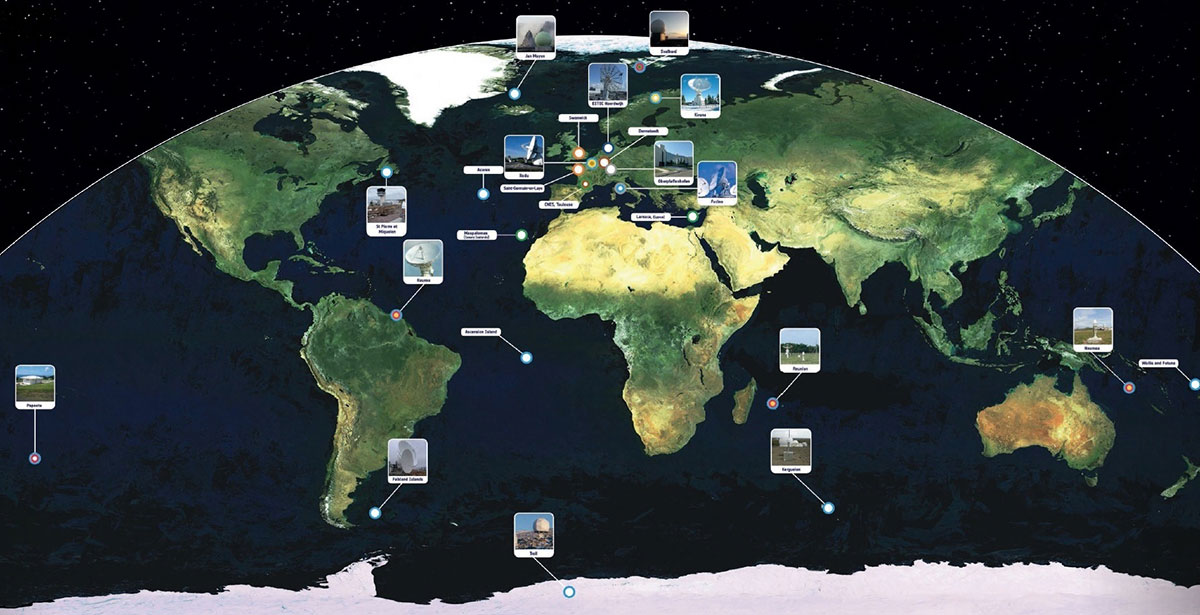
Galileo’s worldwide ground segment as of March 2013.
Galileo Ground Upgrade
On April 9, the European Space Agency announced completion of a full-scale hardware and software migration to version V2.0 of its global Ground Mission Segment providing all Galileo navigation messages. The Ground Mission Segment was turned off Jan. 26, allowing the migration to take place over the month of February. March was taken up with detailed checking by operations and system, concluding in a final check on March 31 to validate the successful migration.
“The upgrade has provided better overall performance and availability, along with improved robustness, security and operability,” explained Martin Hollreiser, overseeing mission segment development for ESA, with Thales Alenia Space France as prime contractor. “An overall 25 percent performance improvement is confirmed.
“Three new sensor stations, Kiruna, Ascension and Azores — used to monitor the satellite navigation signals — were added to the operations chain, as well as a new uplink station in Papeete, to uplink corrections incorporated in the navigation message to the satellites for broadcast to the users.”
The Ground Mission Segment at its core is determining the exact satellite orbits and synchronizing all the satellite and terrestrial elements of that clock: the relevant control center is linked to a global network of ground stations (sensor and uplink stations). The Galileo signals currently undergo technical testing, with early services for the public projected for 2016. “A further update is foreseen for the end of this year,” Hollreiser added, although this will occur with no interruption of services.
GPS Glitch Dates from 2011
On April 15, the U.S. Air Force GPS Directorate said data analysis shows that a technical error affecting some GPS IIF satellites first appeared in 2011. The error affects the way the ground control system builds and uploads messages transmitted by the satellites, but does not affect the accuracy of GPS signals. It involves the ground-based software used to index messages. “A GPS message indexing issue was recently identified that affects a limited number of active GPS IIF satellites, but does not degrade the accuracy of the GPS signal received by users around the globe. The result is an occasional broadcast not in accordance with U.S. technical specifications. ”
First and foremost, let’s give a big hand to Adam and Anastasia, the two Galileo FOC satellites that were successfully launched on March 27. Following the not-so-successful Galileo launch in August, it was imperative that this go smoothly.
Although the Double-A launch occurred after the conclusion of this year’s Munich Satellite Navigation Summit, anticipation of the event set the context for the entire convocation. The summit is a fixture on the European and global GNSS calendar. It is always intense, often spectacular and sometimes leaves one with contradictory feelings. This year it took place March 24-26 and sought to determine the future of PNT, encouraging delegates to look into the crystal ball and predict developments.
If we go by the number of times these words were repeated during the three days of the summit, the future will hinge around compatibility and interoperability. The multi-constellation GNSS is already here. The elephant in the room remains, as always, interference, but here integration of alternative sensors and signals should hold the key to continuous and possibly resilient operations.
As usual the summit kicked off with a high-level plenary in the imposing Allerheiligen-Hofkirche (Court Church of All Saints) in the Residenz München, the Bavarian royal palace. The welcoming speeches and presentations were interspersed with some pleasant jazz, and the atmosphere was relaxed.
Into the Crystal Ball
Matthias Petschke, director of EU Satellite Navigation Programmes at the European Commission, admitted that 2014 had been difficult, but he was looking forward to 2015. Clearly the deployment of the Galileo infrastructure — especially the space segment — was critical, and the March 27 launch was very much on his mind. However, he expressed confidence that the launch would be fine and that satellite production was, and would remain, on schedule. In the long view, he stated: “We will make it for 2020,” signifying full operational capability (FOC).
He also talked about stimulating global markets to foster uptake of Galileo and EGNOS, and this was discussed by Carlo des Dorides, executive director of the European GNSS Agency (GSA). The ground infrastructure is very much in place and preparing for the Galileo exploitation phase. A significant milestone in that process would be finding the right partner to lead Galileo operations for the next ten years. A tender was now in process to find that organization or consortium. Des Dorides described the process as a competitive dialogue with the emphasis on finding a partner who can inspire new ideas and provide innovative solutions. The contract is big, worth around 1 billion euros.
Carlo des Dorides, Executive Director of the European GNSS Agency (GSA), discusses the 1 billion euro tender, now in process to find the organization or consortium to lead Galileo operations for the next ten years. Photo: GSA
He also emphasized the successes for EGNOS in the year. Almost 180 airports now benefit from EGNOS-enabled approaches and more than 70 percent of “GNSS-enabled” farmers in EU use the EU’s SBAS.
Johann-Dietrich Wörner, chairman of the German Aerospace Centre (DLR) — and the nominated next Director-General of ESA – highlighted the growing dependence of critical services on GNSS. In this context multiple systems were not a question of competition; it was all about redundancy and safety. Multi-GNSS improves availability, accuracy and reliability.
The view from the United States was given by Harold “Stormy” Martin, Director, National Coordination Office for Space-Based Positioning, Navigation, and Timing in Washington, D.C. The GPS fleet was now 30 strong in orbit including four successful launches in 2014 and he stated the 2014 averaged user range error to be 70 cms — the best ever — and improving year on year.
One major upcoming trend is a realization that there’s a need to establish a U.S.-wide backup coverage for GPS outage due to natural or man-made interference. The U.S. is currently assessing alternatives with a decision likely in summer 2015.
There was a particularly warm welcome from the audience for Michael Khailov, deputy head of Roscosmos and co-ordinator for GLONASS. Last year the Russians were conspicuous by their absence at the Munich Summit, but for 2015, despite the intervening local difficulty in Ukraine, they were back in force. Khailov claimed that the sustainable development of the world depends on GNSS. On more esoteric ground he stated that GLONASS had maintained stable operations in 2014 and three more satellites had bene launched. Further launches would depend on operational circumstances. The user domains for GLONASS were continuously expanding. Continuing the summit text he said that it was better [working] together than separately — in fact separately often doesn’t work at all and therefore we must continue to promote interoperability and the Munich Satellite Summit is a good forum for this.
Jianyun Chen of the China Satellite Navigation bureau also took up the theme of all GNSS together. Sixteen Beidou (pronounced — for the avoidance of doubt — as ‘bay-doe’) had been launched since 2007 and the Chinese had been in discussion with Russia to ensure full interoperability with GLONASS. This process will be repeated with GPS and Galileo.
GNSS Updates
One of the idiosyncrasies of the Munich Summit is its very discreet signage. If you don’t know where it is — and specifically the correct side door that brings you up two floors to the main Max Joseph Saal venue — it is highly likely you’ll miss it! But once you are in it is two full-on days of updates on systems and discussions on a vast range of topics that impinge on the development and implementation of GNSS around the world.
Discreet signage. Photo: GSA
The first two session of the summit proper gave updates on the GNSS systems in operation and under development as well as the regional and augmentation systems. Much of the material was slightly more detailed versions of presentations at the plenary but a few news snippet emerged.
“Stormy” Martin said that a modified battery charge control had been implemented that would extend operational life for some of the fleet by one or two years. He also reiterated the improving accuracy performance of GPS which was now much better that its published standards. He predicted that the first GPS III would be available for launch in 2016 and said that GPS was improving every day.
Eric Chatre from the European Commission reiterated that Galileo was still expecting to start early services in 2016 with full operational capability in 2020. He expected 18 satellites to be launched by 2018. The new Ariane 5 launcher will enable the launch of four satellites at one time and the first launch with this system would be in 2016. In terms of the ground segment only one station in the Pacific was yet to be established.
Sergey Karutin of Roscosmos talked about a four-fold accuracy improvement for GLONASS with the use of new clocks and the introduction of new CDMA signals that will improve accuracy and access. According to Dongfeng Yu of the China Satellite Navigation Office the BeiDou constellation is moving from “regional to global, active to passive” and is aiming for global coverage by 2020.
U.S. SBAS developments were covered by Deborah Lawrence of the Federal Aviation Administration (FAA). The Wide Area Augmentation System (WAAS) now has 100 percent coverage for LPV200 in CONUS. More than 41,000 runway ends are now included, and she predicted full completion in 2016.
Jean-Marc Pieplu of the GSA talked about EGNOS status. The next system release (2.4.1) should be published in Q3 2015 and will include a significant input on ionospheric corrections. Further service evolution includes a plan to declare LPV 200 in Q4 this year and EGNOS coverage will be extended to 72 deg North and ensure full coverage of the 28 EU member states.
The Russian Augmentation system SDCM performs at 0.8 metre accuracy according to Grigory Stupak of JSC / Russian Space Systems. He noted new validated SDCM ground stations had been established in Antarctica and Brazil and stated that global exploitation was a key objective for SDCM as its satellite coverage was very wide. GLONASS and GPS together could ensure complete coverage. He also indicated that work was in hand for SDCM SBAS service certification for LPV 200 and he called for providers of all WAAS to work closely together.
2020 Vision
After lunch we were offered the chance to hear some expert views on the future of GNSS and PNT with Prof Vidal Ashkenazi of Nottingham Scientific Limited asking for their vision of GNSS in 2020. By that year there should be 100-120 GNSS satellites in orbit, multi-constellation receivers would be the norm, but what would be the new applications and what were the challenges?
Jamming and spoofing would still be issues. Pierre Bouniol of Thales thought that in civil aircraft receivers would probably incorporate jamming indicators by 2020 to inform users when signals may be compromised. For Stuart Riley of Trimble the key was integration of other sensor signals to bridge any GNSS signal outage. Gang Mao of Unicore Communications Inc. in China considered multiple frequencies to be a big help in reducing the threat of jamming. Nigel Davies of QinetiQ agreed saying there were a host of technical solutions but key for success would be solutions that use low power, are low cost and feature high usability. He also noted that safety certification of receivers for use in driverless vehicles would be required and this challenging application would need the provision of robust continuous navigation — and sub-metre accuracy.
The future market for GNSS was also discussed in a session that unveiled the GSA’s 4th Issue of its comprehensive GNSS Market Report. With almost four billion GNSS devices used worldwide and all regions experiencing growth, GNSS represents an unprecedented business opportunity. Over the past 15 months the GSA’s team of market monitoring experts has taken a close look at all aspects of the GNSS marketplace with analysis of both hardware and software market opportunities, technology trends and future developments.
Gian-Gherardo Calini, Head of Market Development at GSA, gives highlights of the comprehensive GNSS Global Market report. He will deliver this information in an April 16 webinar hosted by GPS World. Photo: GSA
The top-line results were presented by Gian-Gherardo Calini, Head of Market Development at GSA. GNSS is one of the few growing markets in the world showing 12.7 percent CAGR. It is a very attractive market with volumes and revenues driven by mass market segments: the dominant two being Location-based services and transport applications. This latest edition includes information a new market segment: Timing and Synchronisation. One area that is not included is security and government applications. Mr Calini indicated that this information has been collected by the GSA team but as it is essentially for users of the Public Restricted Service (PRS) it was not included in the open report.
Although the report is very much “Galileo flavored,” its findings are of great importance and value to whole GNSS community and will be the subject of a GPS World webinar with Mr Calini and myself on 16 April. You can register — free — for this informative global perspective now.
A panel discussion followed and covered a range of topics and applications from aviation to agriculture. Again the consensus was that chips would become multi-constellation and quickly. Philippe Prats of STMicroelectronic outlined automotive applications from insurance applications to advanced driver assistance systems (ADAS).
The role of government mandates in establishing markets was seen as positive. The e911 mandate in the states had provided the seed for GPS integration into smartphones. Similarly authentication was also seem as a significant future market driver.
Multi frequency was also showing on industry’s radar and in a couple of years will be a reality thought Philippe Prats with the main motivation being better accuracy. Frank van Diggelen of Broadcom highlighted the recent GPS World feature demonstrating cm accuracy on a smartphone.
Legal Issues
A dedicated session on legal issues was not the best attended part of the conference, which is a shame as it had some serious points to raise and highlighted a gap that is opening up between our technical abilities in GNSS and the legal basis for its use. The Munich Summit is to be commended for its commitment to providing a platform for these issues every year; they are often ignored elsewhere.
Oliver Heinrichs, a partner at BHO Legal in Cologne, emphasised the need to establish a firm regulatory framework and to ensure that any decisions did not cross World Trade Organisation (WTO) provisions and the General Agreement on Tariffs and Trade (GATT). In particular the idea of mandating a specific GNSS for applications such as emergency response systems in cars may well be incompatible with WTO rules.
Amedeo Arena of Universitá degli Studi di Napoli Federico II in Naples noted that all GNSS players were members of the WTO and considered that GNSS services and their trade was definitely “caught by the GATTs” so no favouritism for ‘home’ systems should be allowed.
Another area of controversy is automated vehicles. In discussion after the session I learnt that current international conventions governing the use of motorised vehicles require a human supervisory role at all times. There will need to be some fundamental legal groundwork done before the first driverless vehicles will be allowed out on the road for real.
These are legally complex issues and certainty will only come from test cases. Talking of complexity Aleksey Bolkunov of the Russian Federal Space Agency revealed that the legal, regulatory and standardisation measures governing GLONASS and GNSS in Russia consisted of more than 900 documents originating at various different levels of the state. This clearly gave great scope for “regulatory collisions” and he is involved in work to develop a single regulatory framework that should eliminate the remaining barriers to GNSS use in Russia.
Emerging Applications
Peter Grognard of Galileo Services chaired a final session of the day on emerging applications. Bruno Bougard of Septentrio saw dependable accuracy as key to emerging markets. He thought high precision driven by surveying was becoming more and more mainstream. For autonomous driving the challenge was to provide cost-effective, dependable accuracy at 10-30cm that was safe, reliable, and always available. This would require multi GNSS, multiple signals, highly integrated sensors and transparent and open augmentation.
For Neil Gerein of Novatel the mantra is “Accuracy, availability, assurance.” Users needed availability to their PNT solutions at all times. He also saw future applications integrating GNSS with inertial sensors and correction systems for high accuracy without the need for a base station.
or Neil Gerein of Novatel the mantra is “Accuracy, availability, assurance.” Photo: GSA
Lionel Garin of Qualcomm Inc talked about ADAS. Safety was paramount and he foresaw the need for rigorous design and certification procedures similar to that required for the aviation market. Fortunately the industry has lots of expertise here. Philip Mattos of u-blox UK argued that a volume market is in femtocell and small cell synchronisation in mobile networks where GNSS is the lowest cost solution.
Tom Stansell praised geometry as the most important and unique ingredient supplied by multi constellation GNSS. And the second most important ingredient was interoperability. He doubted users would care where their signals originated and devices would still be generically described as ‘GPS’ into the future. Application growth will be stimulated by the better geometry supplied by multi-GNSS constellations. When the E6 signal became available he predicted that 10cm accuracy would enable reliable lane keeping for ADAS.
And Galileo will supply E6 for free said Ignacio Fernandez Hernandez from the European Commission. Ignacio works on the Galileo Commercial Service design and outlined some significant differentiators of the European system including its broad signal for high accuracy and better multipath resilience, more stable clocks and improved ionospheric modelling compared to GPS.
Lionel Garin sounded a note of caution at the end of the session when he noted that multi constellation ability was good, but he was not sure what was actually gained beyond two, or perhaps three, constellations.
GNSS for Weather
The final day of the conference saw a few fragile heads courtesy of the previous evening’s Summit Space Night 2015 sponsored by Airbus Defence & Space, which took place at the Filmcasino am Hofgarten close to the conference venue. And the first session, chaired by Oliver Montenbruck from the DLR, certainly required a clear focus as we were taken through the use of GNSS in space geodesy, space navigation and reflectometry.
Roland Pail from the Technical University, Munich described results from the satellite gravity missions GRACE and GOCE that looked at mass transport processes on our dynamic Earth. A particularly sobering animation showed the extent of ice mass loss from Greenland over the past decade. But what is role of gnss here? The ability to give precise positioning of the satellites and the fact that the satellite orbits carry information on the gravity field.
Atmosphere sounding using GNSS radio occultation allows precise atmospheric profiles with global coverage in all-weathers. Jens Wickert of the Helmholtz Centre Potsdam said that since 2006 these high vertical resolution profiles had been making a significant impact on the world’s weather forecasting including improved hurricane forecasts. It was also a bias free technique for observing global temperature change. With a multi-GNSS future new missions could be planned as more signals would reduce noise. Combining GNSS and reflectometry could enable accurate tsunami detection from space. Similarly Prof Antonio Rius from Barcelona was using reflected GNSS signals to determine data on the surface of the sea such as surface roughness, extent of sea ice and early warning of a tsunami.
Stefan Sassen of Airbus Defence & Space described the LION GNSS navigation receiver for MEO and LEO platforms. The unit was qualified since 2014 and now 50 were on order. LION is highly flexible with multi-frequency, multi-constellation and multi-antennae configurations possible. It was accurate enough for autonomous orbit raising (a few kms) and or station keeping (to within 100cm).
Finally Manfred Sust of RUAG Space GmbH said that space borne gnss receivers were true enabling technologies for Earth Observation missions as precise orbit determination was key to capturing sharper images.
Alternatives
The second session of the day returned to the practical issues around possible alternative or complementary PNT (APNT) systems. As GNSS becomes ubiquitous many terrestrial PNT systems are being decommissioned (LORAN, VOR), but the potential vulnerability of GNSS signals to interference is highlighting the need for backup. The challenge being to balance functionality and cost in the search for “plan ‘B’ for GNSS” as chairman Michael Meurer from DLR described it.
The FAA’s Deborah Lawrence reiterated her plans for scoping and implementing a backup system to cope with a GPS outage in the US. The FAA is currently engaging with stakeholders to define what the minimum operational target for a GPS outage should be to set the basis for procurement activity. The timeline for a final investment decision was now December 2018.
For Europe Gerhard Berz of Eurocontrol thought there were many potential APNT in place and the topic was in the SESAR 2020 research programme. He thought existing DME could potentially do the job in Europe as it had good coverage, but the challenge is to get good geometry and coverage at low altitudes, in remoter areas and over water.
Prof Per Enge of Stanford University “put the moose on the table” and pointed to the 978 and 1030 ranging frequencies as an existing system that could be used for positioning. But how accurate was it? Airborne experiments had shown good agreement with GPS positioning with an accuracy of around 100m and in turns 300m, which was good enough in an emergency. Further tests using a UAV at spider infested Camp Rogers had demonstrated APNT in flight with 50m error. The UAV itself was specifically developed to navigate using APNT while looking for GNSS jammers.
Wouter Pelgrum of Ohio University discussed the relative merits of eLORAN, which has high power – and therefore difficult to jam – and beyond line of site accuracy of less than 10m, and alternatives such as collocation of pseudolites with mobile phone cell towers. This could also enable high accuracy indoors positioning applications. He believed that APNT will need to be context specific and there was no single solution.
Belabbas Boubeker of the DLR discussed modular APNT concepts while Nick Ward of the UK’s General Lighthouse Authorities indicated there was no coordinated policy on resilient PNT in the European maritime sector at present but his authority and others were exploring the possibility of using eLORAN as a commercial enterprise. Nine transmitters were operational in Europe and the service had been declared in 2014.
Michael Hoppe of Fachstelle der WSV für Verkehrstechniken said resilient PNT was a core element of e-navigation for waterways. A combination of techniques such as medium frequency RF, AIS and eLoran could give good accuracy in areas of highest traffic. First results of trials were encouraging.
Processing Power
The final session of the Summit to grab my full attention was chaired by Frank van Diggelen of Broadcom. He led a wide ranging debate on GNSS receiver architecture trends and more generally the future of chip design and fabrication: are we approaching the end of Moore’s law and if so — what next?
Recently “The balance of power has moved back onto the GNSS chip” to enable lower device power use. To highlight current developments Frank described a couple of Broadcom products: the Broadcom 4773 “location hub” that is at the heart of the Samsung Galaxy 6 “super smart phone” and the 4774 that can access signals from all four GNSS constellations and will be shipping in early 2016 on new smartphones.
In fact earlier this year the 4774 was used to make a first fix using signals from four different GNSS constellations (with signals from one each of GPS, GLONASS, Galileo and BEIDOU satellites) and a significant event in terms of our multi-constellation future.
Greg Turetzky of Intel talked about the benefits and challenges for GNSS in advanced silicon processes. He noted that Intel is now shipping 14nm technology and plans were in hand for the next two generations (10nm and 7nm). Moore’s law has been a great enabler for modern society. If automobiles had taken a similar development in the same timeframe we would all be driving cars with a maximum speed of some 300 000 km/hour that cost us around 4 cents to buy!
The big challenge for GNSS architecture was to take advantage of the smaller geometries while greatly reducing standby power. The integration of multiple radio sources to provide a single location solution was key giving ubiquitous location capability that will improve the experience of every mobile product.
Looking into his crystal ball, Peter Anderson of Integrated Navigation Systems in the UK saw that integrating signals from complimentary technologies and sensors would be important but would lead to a greater demand for digital processing. He predicted that multiband receivers would become standard in consumer devices. He also pointed out that the worst potential source of GNSS jamming for a smartphone was the phone itself! The move to dual frequency would be helpful here.
An overview of the Chinese XIHE system for seamless outdoor and indoor location was given by Dongkai Yang of Beihang University. This Beidou Innovative application provides a LBS system based on gnss and mobile communication networks to give a “fusion of communication and positioning for indoor positioning”. The system is being demonstrated in four areas in China in shopping malls. The target for positioning accuracy in the system is for less than 3 metres indoors and less than 1 metre outdoors.
Franz Kreupl of Munich Technical University gave a sobering view of “life after silicon” – essentially it looks like there isn’t one. He outlined the limits to silicon technology such as tunnelling current and predicted some further progress could be made in reducing interconnect sizes and via circuit design. But new candidate materials for semiconductor electronics from carbon nanotubes to widely hailed 2-D materials graphene and MoS2 all suffer major issues that seem to make them non-starters.
But do we need to keep on miniaturizing? Norbert Schuhmann of Fraunhofer IIS in Nuremberg thought that technology downscaling would have an end in terms of the physics, but especially in terms of reasonable cost. He thought 7nm and 2020 was the end point for the physics but that in fact 28nm should be seen as the actual last node in Moore’s law as from then scaling has no longer also been the path for cost reduction. He saw silicon on insulator technology and monolithic 3-D integration as possible paths forward, but the technology sweet spot — and well suited for GNSS — was 55nm and a format that was already extensively used in automotive applications.
Five people stand accused of embezzling 250 million rubles (more than $4 million) in federal funds earmarked for Russia’s GLONASS program, according to information shared by the Russian Legal Information Agency and reported in the Izvestia newspaper. The investigation began in 2013.
Charges have been brought against George Kovkov, deputy general director of the Central Research Institute of Machine Building, or TsNIImash; Alexander Chernov, chief of the company’s Capital Projects Department; Alexander Belov, general director of one of the Federal Special Construction Agency’s departments; Dmitry Belitsky, owner of the company Verny Consulting; and Roman Martynenko, general director of SpetsMonolit OOO.
Martynenko and Belitsky have also been charged with money laundering. None of the men pleaded guilty.
The GLONASS program has cost 140 billion rubles ($2.4 billion) to date, and its budget for 2012-2020 stands at a further 326 billion rubles ($5.5 billion). Construction of a GLONASS control center began in June 2010 on the site used by TsNIImash in Korolyov, a town outside Moscow. The construction was financed by a federal program, with 1.05 billion rubles (over $18 billion) allocated for the project.
By the end of 2010, it became clear by the end of 2010 that the construction cost estimates had been overstated, according to Izvestia. An expert appraisal also revealed that the contractor had rigged the costs. Construction was suspended in December 2011 when the Federal GLONASS Program for 2002-2011 ended. The construction of the building has not been completed.
The Federal Security Service (FSB) started looking into the unfinished building in 2013. In January, the FSB asked TsNIImash to provide the construction documents for an inspection, which ended in April. The results were then forwarded to the Investigative Committee and a criminal case opened.