Purchase Decisions in the Evolving Landscape of GPS, Multi-GNSS and Alternative PNT
Sponsored by: NavCom
Broadcast Date: Thursday, June 5, 2014
Moderator: Alan Cameron, Group Publisher, GPS World & Geospatial Solutions
Speakers: Steve Ault, Product Manager, NavCom Technology Inc.; John Pottle, Fellow, Institute of Engineering Technology and Royal Institute of Navigation; Philip Mattos, R&D scientist for several GNSS companies; Paul Benshoof, Global Business Development Manager, Locata Corporation
Summary: Last month’s two GLONASS stumbles prompted some industry leaders to resume their calls for multi-GNSS and for redundant PNT. But neither concept yet exists, truly and pervasively, that is to say effectively for all users. When will reliable, robust, consistent and continuous positioning, navigation, and timing become a reality? Should we rely on whatever technology we currently possess until the perfect system comes available, or should we continuously upgrade at each iterative step along the way?
Category: GPS
-
How Much Farther to the Promised Land?
-
Say Goodbye Proprietary GPS Devices, Hello TerraGo Edge
Broadcast date: Thursday, May 28, 2015
Sponsor: TerraGo
Moderator: Alan Cameron, Editor-In-Chief and Publisher, GPS World
Speaker: Michael Gundling, Vice President of Product Management, TerraGo
Summary: Say goodbye to expensive, single-use GPS handheld devices. That’s not the way it works anymore. TerraGo Edge replaces single-use GPS handheld devices and enables mobile workers and field crews to easily collect field data, share that data with others in real-time using any iOS or Android device and sync that information with headquarters at a fraction of the cost. With TerraGo Edge, you can save a significant amount of money, increase the ROI on your current GIS investments and improve productivity. -

Movie preview: ‘The Night GPS Failed’

Something’s missing from the summer lineup of blockbuster movies, the disasters, apocalypses, invasions and superhero dust-ups that we’ve come to rely on for worldview. And try as it might, the U.S. presidential campaign just can’t fill the gap. So I flew down to Hollywood and raised $617 million in a fast set of power lunches. By lucky coincidence, several favorite actors were available. We did a quick wrap, and the film’s now slated for late-summer release. The special effects are, if I may say so, spectacular. Here’s the preview for “The Night GPS Failed.”
Matt Damon (as Mr. Suburban America, entering front door): Honey? I couldn’t get any money. The ATM’s on the fritz.
Lake Bell (off-screen): Are you —ing kidding me?! I need cash right now! (enters carrying cell phone and credit card) The delivery service won’t take my credit card, and I can’t get customer support because the phone doesn’t work! You’ll have to drive to the store.
Damon: I don’t know. Pretty dangerous out there. Traffic lights aren’t working.
Bell: What is going on? I need money! (throws cell phone).
Damon (ducks and shrugs): What do you want me to do, write our Congressman?
Don Cheadle (on short-wave radio, seated at control panel in room of huge display screens): The grid’s down! (stands and turns to each screen in turn). Cincinnati, Chicago, Tulsa, San Diego, they’re all down! (repeatedly bangs control panel buttons with radio.) ——!! Everything’s down! The whole damn country!
Patricia Clarkson (as U.S. President): I’m told it will take 30 days to fully restore the national power grid and financial markets. Colonel, what has happened to the constellation?
J.K. Simmons (as Air Force Space Command chief scientist): Ma’am, we’re not sure yet. Solar particle damage or a bad upload, probably not, but not ruled out. We suspect widespread jamming. It could be mixed with spoofing.
Albert Finney (as Chairman of the Joint Chiefs of Staff): Heh, heh. At least the Russkies aren’t doing any better. The Chinese and Europeans are having trouble, too. Military security is not at risk. We don’t think.
Clarkson: What’s your contingency plan, General?
Finney (spreads his arms): We have one-tenth of a backup system almost halfway built. Funding is an issue . . .
Clarkson: Funding my ass! The whole global economy just went to hell in a handbasket, General! I don’t have any money! (throws Red Telephone).
Finney (ducks and shrugs): What do you want me to do, write my Congressman?
Bob Dylan (singing on soundtrack): That long black cloud is comin’ down . . .
Based on a true story: “What Happens If GPS Fails,” by Dan Glass, The Atlantic magazine, June 2016.
-
Geospatial World Forum looks at Galileo, EGNOS for GIS

Tim Reynolds By Tim Reynolds
Contributing Editor for EuropeThe eighth edition of the Geospatial World Forum took place May 23–26 in Rotterdam, The Netherlands, attracting professionals from the surveying and geospatial information system (GIS) sectors. I attended the event on May 24 and took part in a workshop that looked at the benefits of Galileo and EGNOS in geospatial applications in the context of the imminent launch of Galileo initial services.
An industry survey undertaken by the GSA indicates that already more than 80 percent of GNSS receivers for surveying and mapping use are EGNOS-enabled, while 77 percent of geospatial reference network providers have enough information to upgrade Galileo and will be ready to provide a service by 2017. All good news. On the less positive side, more than 60% of professional surveyors did not know about EGNOS!
The workshop also talked up the potential for synergies between Galileo GNSS and Copernicus Earth Observation (EO) systems — a topic of immense interest at the European Space Solutions as well. Hans Dufourmont from the European Environment Agency (EEA) highlighted the use of GNSS to track animal species and monitor migration paths when considering development opportunities. He saw a huge potential for synergies between geopositioning and surface imaging going forward.
Maurice Barbieri, president of the Council of European Geodetic Surveyors (CLGE), also saw a “clear role for Galileo” in the surveying community with its potential ability to meet centimeter accuracy requirements much more than for EGNOS.
He also speculated about the value of establishing a European Geoinformatic Agency that might coordinate the provision of European GNSS and EO data. He felt the private business community would appreciate such simplification.
-
Septentrio to spotlight drone solutions at Esri UC

Septentrio will showcase its latest GNSS systems and software solutions for GIS professionals at the 2016 Esri User Conference in San Diego, June 28-30, with a special focus on the rapidly growing market for drone-based aerial survey.
At center stage will be Septentrio’s suite of products designed specifically for aerial surveys. They include the compact AsteRx-m UAS onboard GNSS receiver and GeoTagZ high-accuracy drone positioning software, which is optimized for automatic interface with Esri ARCGis and Drone2Map platforms.
“Demand for drone imagery is booming in the GIS marketplace as a fast and efficient alternative to ground-based surveys for applications such as mapping, photogrammetry, infrastructure inspection and natural disaster monitoring,” said Neil Vancans, vice president of Septentrio Americas. “To meet that demand, we are bringing to market a range of hardware and software solutions that will make it easier than ever for Esri users to capture, georeference, process and visualize drone-captured imagery.”
Septentrio is also introducing new firmware for its versatile NR2 GNSS receivers and the PinPoint-GIS utility software for terrestrial applications. NR2 V1.2.0 offers a host of new connectivity features, including direct dial-up, dynamic DNS, base-rover Wi-Fi point-to-point connection and other new features that will streamline field work. PinPoint-GIS has also been enhanced to provide seamless integration with Esri’s Collector for ArcGIS.
“Septentrio is pioneering the way by which Esri users collect data,” said Gustavo Lopez, product manager at Septentrio. “GeoTagZ and PinPoint-GIS bring more accuracy and flexibility into the field by combining the power of Septentrio’s GNSS products with the user-friendly interface of Collector for ArcGIS. From the air to your own device, you are guaranteed accuracy and reliability in your GNSS positioning by using GeoTagZ to georeference aerial photos and PinPoint-GIS to harness the power of GIS data.”
Esri User Conference attendees are invited to visit Booth 2633 for a first-hand look at Septentrio’s solutions for the full range of aerial and ground-based GNSS solutions for GIS, including the new-generation APS-3G multi-constellation RTK receiver, which was just introduced to the market.
-
Septentrio to spotlight drone solutions at Esri UC
Septentrio will showcase its latest GNSS systems and software solutions for GIS professionals at the 2016 Esri User Conference in San Diego, June 28-30, with a special focus on the rapidly growing market for drone-based aerial survey.
At center stage will be Septentrio’s suite of products designed specifically for aerial surveys. They include the compact AsteRx-m UAS onboard GNSS receiver and GeoTagZ high-accuracy drone positioning software, which is optimized for automatic interface with Esri ARCGis and Drone2Map platforms.
“Demand for drone imagery is booming in the GIS marketplace as a fast and efficient alternative to ground-based surveys for applications such as mapping, photogrammetry, infrastructure inspection and natural disaster monitoring,” said Neil Vancans, vice president of Septentrio Americas. “To meet that demand, we are bringing to market a range of hardware and software solutions that will make it easier than ever for Esri users to capture, georeference, process and visualize drone-captured imagery.”
Septentrio is also introducing new firmware for its versatile NR2 GNSS receivers and the PinPoint-GIS utility software for terrestrial applications. NR2 V1.2.0 offers a host of new connectivity features, including direct dial-up, dynamic DNS, base-rover Wi-Fi point-to-point connection and other new features that will streamline field work. PinPoint-GIS has also been enhanced to provide seamless integration with Esri’s Collector for ArcGIS.
“Septentrio is pioneering the way by which Esri users collect data,” said Gustavo Lopez, product manager at Septentrio. “GeoTagZ and PinPoint-GIS bring more accuracy and flexibility into the field by combining the power of Septentrio’s GNSS products with the user-friendly interface of Collector for ArcGIS. From the air to your own device, you are guaranteed accuracy and reliability in your GNSS positioning by using GeoTagZ to georeference aerial photos and PinPoint-GIS to harness the power of GIS data.”
Esri User Conference attendees are invited to visit Booth 2633 for a first-hand look at Septentrio’s solutions for the full range of aerial and ground-based GNSS solutions for GIS, including the new-generation APS-3G multi-constellation RTK receiver, which was just introduced to the market.
-
Timing in Mission-Critical Systems
Broadcast Date: March 31, 2016
On-Demand Available Until: March 31, 2017
Sponsor: Microsemi
Summary: You’ll hear from our expert speaker panel about real-life timing challenges in mission-critical applications, such as satellite and military communications, test ranges and radar; time transfer accuracy and stability via GPS or PTP; and what technologies to look for in your next-generation instrument class clock to cost-effectively deliver accurate and stable time and frequency signal types, signal output flexibility and robust security.
Speakers: Paul Skoog, Microsemi Corporation; Scott Williams, G.L. Williams Associates; and James L. Wright, Range Generation Next -
BYOD GPS Gets Real: Lessons Learned with the New Rules of GPS Data Collection
Broadcast Date: April 14, 2016
On-Demand Available Until: April 14, 2017
Sponsor: TerraGo
Summary: Our expert speaker panel examines how five organizations from five industries (oil & gas, engineering, water utility, transportation and natural resources) made the switch from GPS handhelds to smartphones and tablets for their field data collection needs.
Speakers: Michael Gundling and Bryan Burns, TerraGo -
Esri and Hexagon promote joint collaboration at HxGN LIVE
In 2015, Esri and Hexagon jointly announced a series of ready-to-use imagery services to Esri users through ArcGIS Marketplace. ArcGIS Marketplace delivers high-resolution aerial multispectral and basemap imagery services as a subscription through ArcGIS Online. In light of the collaboration, Esri will be participating in HxGN Live June 14-16 in Anaheim, California.
Another collaboration with Leica Geosystems, a brand within Hexagon Geosystems, addressed the market for high-accuracy mobile field collection, which was released this year. It integrates Esri’s Collector for ArcGIS, a configurable mobile app for collecting and editing data in the field, with the high-accuracy Leica Zeno 20 from Leica Geosystems.
“We’re excited to raise mobile data collection solutions to the next level of precision and interoperability through rigorous connectivity between our survey-grade Leica Zeno series and Esri’s GIS solutions,” says Hexagon Geosystems president Juergen Dold. “This industry collaboration between Leica Geosystems and Esri is another joint commitment to make it easier for professionals around the world to capture, manage, and share their data, regardless if they’re in the office or the field, without sacrificing precision or interoperability.”
The new solution, ZenoCollector, is an Android-based, professional-grade handheld. ZenoCollector connects to ArcGIS Online, automatically synching high-precision field changes to enterprise information and giving everyone access to the latest data gathered on the project sites, as well as access to high-resolution basemap services and Hexagon imagery services through ArcGIS Marketplace. This innovation of online content connected to mobile field tools and back-office systems now provides rapid synchronization to streamline field job planning, collection, and postprocessing of data.
Esri For more information and demonstrations of these new offerings, visit Esri at booth No. 506 at HxGN LIVE.
-
Prince’s death highlights 911 location issues
By Tracy Cozzens
Managing Editor Prince’s death on April 21 highlights a fatal flaw in the United States’ antiquated 911 emergency system. When you call from cell phone, 911 doesn’t automatically know where you are. 911 often can’t determine the location of an emergency, even when the call for help comes from a GPS-equipped smartphone. Often the 911 operator can only zero in the nearest cell tower, which can be several miles away or in the next county.
In the transcript of the 911 call from Prince’s house comes this exchange:
911 operator: OK, what’s the address?
Caller: We’re at Prince’s house.
911 operator: OK, does anybody know the address? OK, your cell phone’s not going to tell me where you’re at, so I need you to find me an address … OK, have you found an address yet?
Caller: Yeah, um, I’m so sorry, I’m so sorry. (The caller is heard asking others if they know the address.)
911 operator: Is there any mail around that you could look at?
While a quicker response may not have saved Prince’s life, some experts estimate that cutting 911 response by one minute could save one person every hour every day nationwide.
The FCC and the four largest cellphone carriers say they’re doing their best to address the problem. One possible solution is LaaSer, a technology suite that runs in the cloud. LaaSer updates your precise location at the exact same time that the call to 911 is being made, so that the answering operator is immediately presented with your information.
With Laaser, any mobile device delivers accurate location information about the caller to 911 operators immediately. It does this using existing infrastructure, so carriers, handset manufacturers and 911 call centers wouldn’t have to change their systems to receive the benefits.
Unlike current 911 mobile phone technology, LaaSer takes advantage of all of the location information already available in smartphones, including GPS, Wi-Fi, Bluetooth, near-field communications (NFC)/RFID, compass, accelerometer, barometer and more.
Our lives may depend on it.
-

Marconi Prize for 2016 goes to Brad Parkinson
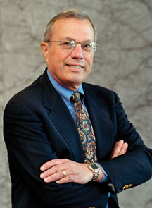
Brad Parkinson The Marconi Society has awarded its 2016 Marconi Prize to Bradford Parkinson. The $100,000 prize, given annually, recognizes major advances in the field of information and communication science which benefit humanity.
Parkinson’s contributions to the development of GPS helped create the vast global utility that provides positioning, navigation, and timing (PNT) information to the world and is a vital part of today’s global information infrastructure. The early stages of GPS were very nearly derailed and the U.S. Air Force might have abandoned its development had it not been forced to fund it. In a historic decision, the Air Force selected a project leader uniquely qualified to make it a success.
A Bit of History. Lt. General Kenneth Schultz, Space and Missile System Office (SAMSO) Commander, called Colonel Parkinson to his office in November, 1972. The General’s purpose was to discuss a floundering USAF program called 621B, which was attempting to create a global navigation service using satellites. Parkinson wasn’t interested. “I already had a super job with a hundred million dollars of play money every year that I could spend on anything related to ballistic missile re-entry,” he recalls. Meanwhile, the incipient GPS program was mired in technical challenges and in competition with other ideas within the Dept. of Defense.
The General insisted. Parkinson, a rising star and perhaps the top military expert on inertial navigation, had one question. If he accepted the assignment, would he be in charge of it? When the General said, “I can’t promise that,” Parkinson said, “Then I don’t volunteer.”
Fortunately, Schultz went ahead anyway. By the time Parkinson was ten feet out the door, the General had called personnel and initiated his transfer — in the process giving the young colonel the authority he had requested. With sinking heart, Parkinson realized he had inherited a lot of good underlying thinking, but so much infighting that the program had ground to a halt.
Parkinson’s career had prepared him for this project, from his study of navigation at the U.S. Naval Academy to his Master of Science study at MIT, at a time when Charles Draper was making his mark on inertial navigation, to his subsequent PhD research at Stanford University. Parkinson had taught future astronauts about satellite design and operations, and he understood navigation from the inside, as a mission commander flying combat sorties in Southeast Asia.
An Amazing Coincidence. In what Parkinson calls “an amazing coincidence,” Dr. Mal Currie, the senior person in the Dept. of Defense for development, had just been appointed and was moving to Washington from Los Angeles. However, he needed to travel back and forth to Los Angeles for several weekends to organize his family’s move. To make it official, he would stop by the Space and Missile Systems Office for a briefing each weekend. General Schultz soon ran out of top-level discussion topics, so someone had the bright idea to send Dr. Currie down to discuss 621B with Parkinson.
“Here I am, a brand new colonel, given uninterrupted time with the senior-most development leader in the whole Defense Department, about five levels above me, and I have all afternoon. He is brilliant; he is a nuclear physicist. We soon got down to technical stuff. I brought out this big stack of charts and a small projector, using the wall as a screen,” Parkinson remembers. By the end of the afternoon, Parkinson had convinced Currie that GPS was a great idea. It just needed tweaking.
With Currie’s support, Parkinson kept plugging. He requested — and got — some of the brightest minds in the Air Force to help him. He encountered opposition everywhere, even veiled threats. Finally, in August of 1973 he stood before a sea of DoD General officers and officials in Washington. He presented GPS as it then stood, for a thumbs up or down vote. It was thumbs down. The Air Force preferred to build more planes.
Currie, who had chaired the meeting, immediately called Parkinson to his office. “You and I know you inherited this program, but there are some improvements you can make. I’d like you to make those improvements and come right back to another decision meeting,” Currie said.
Lonely Halls Meeting. Parkinson gathered a small group of his brightest team members. They met not in Los Angeles, where the group was based, but in the deserted Pentagon, over Labor Day weekend. The only occupants of the largest office building in the world were Parkinson’s band in a 5th floor conference room.
They worked nonstop to change the proposal. The 621B fundamentals were sound, but several technical details had to be modulated to make it the GPS we know today. The team confirmed the use of the then-unique digital signal structure called code-division multiple-access (CDMA) that had been tested by 621B. This allowed the signals used by all the satellites to broadcast on the same frequency and insured that location precision (eventually to millimeters) could be achieved. Equally important, they decided every satellite had to carry redundant atomic clocks, so that signal timing was accurate even when on the other side of the world. Use of such clocks had been advocated by both 621B and the Navy.
They also confirmed the over-all GPS system concept from 621B: the user would measure the range to four satellites, with knowledge of the exact time they broadcast their signal and their location, then the user could triangulate the receiver’s position as well as determine time to nanoseconds. GPS was built on this premise.
Parkinson went back to Currie with his revised proposal in December 1973, and this time received thumbs up. Just 44 months after contract award the Air Force launched the first GPS satellite — probably a record for any military program. Today, 30 operational GPS satellites circle the planet.
For Parkinson’s own account of these events, see The Origins of GPS, and the Pioneers Who Launched the System (Part 1), and The Origins of GPS, Fighting to Survive (Part 2).
After retiring from military service as an Air Force colonel, Parkinson inspired a new generation of GPS scientists at Stanford, where he is a now a professor of aeronautics and astronautics, and other leading engineering schools, helping push hundreds of enhancements and new applications. At his Research Center, he and his allied faculty and students developed the concept and first demonstration of the FAA’s now-operational GPS integrity system, called WAAS. With his students (and sponsored by John Deere) they demonstrated the first GPS auto-guided farm tractor, now an $800 million world-wide GPS farming business. In 1992 they demonstrated the first completely blind landing of a commercial airline (and repeated it for 110 landings!).
“Today, there are billions of GPS receivers in the world,” says Marconi Society Vice Chairman Vint Cerf, “GPS is one of the most under-rated advances in the history of information science. It’s taken for granted, but Parkinson was on the ground floor of enabling air, space and terrestrial guidance and navigation with GPS. His vision for the use of timing signals resulted in cellular telephone improvements, better Internet traffic control, power grid management and a myriad of important financial applications. Dr. Parkinson’s achievements have been game-changing.”
“With immense dedication, Dr. Parkinson overcame technical and bureaucratic obstacles in order to champion the early development, and later enhancement through modernization, of GPS,” said Dr. Charles Elachi, director of the Jet Propulsion Laboratory. “We now take for granted GPS technology, whether our phone is providing turn-by-turn directions or enjoying GPS-time-synchronized communications. However, the concept of using an orbiting spacecraft’s transmitting radio signals as a solution for all-weather global navigation (positioning and timing) faced enormous obstacles during its development phase in the 1970s. As the program director for the Air Force, Dr. Parkinson and his fellow engineers were pushing the state of the art.”
Parkinson will receive the Marconi Prize at a private ceremony at the Computer History Museum in Mountain View, CA, on November 2, 2016. He joins a select group of scientists whose work in communications and information technology has led to major advances and provided social, economic and cultural benefits for humanity. Past winners of the prize, established in 1975 by Gioia Marconi Braga, daughter of Guglielmo Marconi, have included Internet pioneers Vint Cerf, Bob Kahn and Len Kleinrock, digital trailblazers Irwin Jacobs and Henry Samueli, encryption pioneers Ron Rivest, Marty Hellman and Whit Diffie, MIMO inventor A. J. Paulraj and cell phone pioneer Marty Cooper, among others.
GPS World is indebted to Ken Pesyna, a 2015 recipient of the Marconi Society’s Young Scholar award, for bringing this story to our attention. Pesyna co-authored the February 2015 cover story, “Accuracy in the Palm of Your Hand” and is currently CTO and co-founder at Radiosense.
The Marconi Society was established in 1974 through an endowment set up by Gioia Marconi Braga, daughter of Guglielmo Marconi, the Nobel laureate who invented radio (wireless telegraphy). It is best known for the Marconi Prize, awarded annually to an outstanding individual/s whose scope of work and influence emulate the principle of “creativity in service to humanity” that inspired Marconi. Through symposia, conferences, forums and publications, the Marconi Society promotes awareness of major innovations in communication theory, technology and applications with particular attention to understanding how they change and benefit society.
