Category: GNSS

  • Lockheed Martin submits proposal for U.S. Air Force GPS IIIF program

    Lockheed Martin has submitted a competitive and fully compliant proposal for the U.S. Air Force’s GPS III Follow On (GPS IIIF) program, which will add enhanced capabilities to the most advanced GPS satellites ever designed. The GPS IIIF program intends to produce up to 22 next-generation satellites.

    The U.S. Air Force’s first 10 GPS III satellites, now in full production at Lockheed Martin, are already the most powerful GPS satellites ever designed. GPS III will have three times better accuracy and up to eight times improved anti-jamming capabilities. Spacecraft life will extend to 15 years, 25 percent longer than the newest GPS satellites on-orbit today. GPS III’s new L1C civil signal also will make it the first GPS satellite to be interoperable with other international global navigation satellite systems, like Galileo.

    Lockheed Martin’s proposal for the GPS IIIF program adds further power, resiliency and capabilities to GPS III.

    The biggest feature of GPS IIIF will be a regional military protection capability, which will increase anti-jam support in theater to ensure U.S. and allied forces cannot be denied access to GPS in hostile environments.

    Lockheed Martin’s GPS IIIF will feature a fully-digital navigation payload. The payload on the first 10 GPS III satellites is already 70 percent digital.

    Each GPS IIIF satellite will include a laser retro-reflector array, which allows the positioning of on-orbit satellites to be refined with ground-based, laser precision. The precise positioning of each satellite ultimately enhances the positioning signals they generate.

    Additionally, the U.S. government will provide each GPS IIIF with a new search-and-rescue payload. These hosted payloads, spread around the globe on GPS IIIF satellites, will make it easier for first responders to detect and respond to emergency signals.

    “When we developed our design for the first 10 GPS III, we used a flexible, modular architecture that would allow for the insertion of modern technologies and new Air Force requirements in a low-risk manner,” said Johnathon Caldwell, program manager for Lockheed Martin’s navigation systems mission area. “In addition, our GPS IIIF solution is based off a design already proven compatible with both the Air Force’s next generation Operational Control System (OCX) and the existing GPS constellation.”

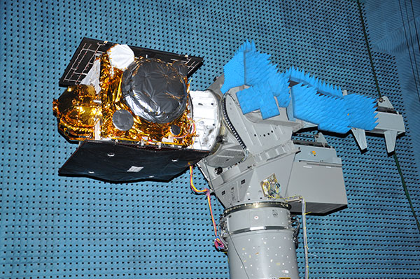
    The first 10 GPS III satellites are in full production at Lockheed Martin’s GPS III Processing Facility, a $128 million cleanroom factory designed in a virtual reality environment to drive efficiency and reduce costs in satellite production.

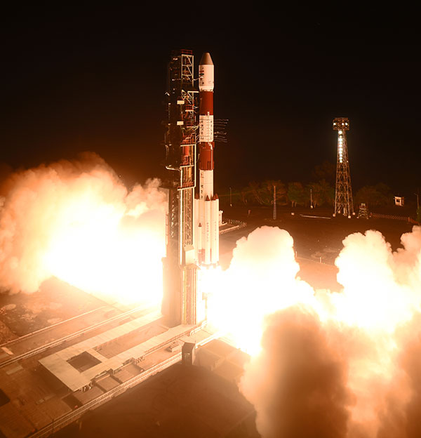
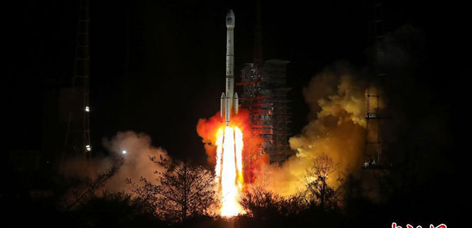
    In September 2017, the Air Force declared Lockheed Martin’s first GPS III satellite “Available for Launch” (AFL). GPS III Space Vehicle 01 (GPS III SV01) is in storage waiting for the Air Force to call in up for launch.

    GPS III SV02 completed rigorous Thermal Vacuum (TVAC) testing in December 2017, is in final environmental testing, and is expected to be declared AFL in summer 2018. GPS III SV03 was fully integrated in fall 2017 and recently began TVAC, and SV04 was recently integrated in anticipation of environmental testing later this summer. GPS III SV05 has now received its navigation payload and is in final vehicle build up. Not far behind, GPS III SV06 has begun its initial build with GPS III SV07 also planned to begin production this spring.

    To date, more than 90 percent of parts and materials for all 10 satellites have been received, from more than 250 aerospace companies from 29 states, to help ensure GPS III maintains the gold standard in position, navigation and timing.

  • India successfully launches IRNSS-1I navigation satellite

    India successfully launches IRNSS-1I navigation satellite

    A replacement satellite for NavIC, India’s navigation constellation, was successfully launched April 11 from Satish Dhawan Space Centre SHAR, Sriharikota.

    In its 43rd flight, the India Space Research Organization’s (ISRO’s) Polar Satellite Launch Vehicle PSLV-C41 propelled the 1,425-kilogram IRNSS-1I Navigation Satellite into orbit.

    All three rubidium atomic clocks on IRNSS-1A have failed. A replacement satellite, IRNSS-1H, was launched on Aug. 31, 2017, but was not successfully deployed. This satellite, IRNSS-1I, is also a replacement satellite for IRNSS-1A.

    PSLV-C41 lifted off at 0404 hrs (4:04 a.m.) IST, as planned, from the spaceport’s First Launch Pad. After a flight lasting about 19 minutes, the vehicle achieved a sub-geosynchronous transfer orbit with a perigee (nearest point to Earth) of 281.5 km and an apogee of 20,730 km inclined at an angle of 19.2 degrees to the equator, following which IRNSS-1I separated from PSLV.

    After separation, the solar panels of IRNSS-1I were deployed automatically. ISRO’s Master Control Facility (MCF) at Hassan, Karnataka, took over the control of the satellite. In the coming days, orbit maneuvers will be performed from MCF to position the satellite at 55 degrees East longitude in the planned geosynchronous orbit with an inclination of 29 degrees to the equator.

    IRNSS-1I is the latest member of the Navigation with Indian Constellation (NavIC) system. NavIC, also known as Indian Regional Navigation Satellite System (IRNSS), is an independent regional navigation satellite system designed to provide position information in the Indian region and 1500 kilometers around the Indian mainland.

    A number of ground facilities responsible for IRNSS satellite ranging and monitoring, generation and transmission of navigation parameters, satellite control and network timing have been established in many locations across the country as part of NavIC.

  • GSA, Joint Research Centre test automotive eCall with Spirent

    Spirent Communications plc is working with the European Commission’s Joint Research Centre (JRC) to help implement the eCall system, which is required in new cars sold in Europe starting in April.

    Experts from the JRC have been working with Spirent GNSS test equipment during the European GNSS Agency (GSA) eCall test campaign. The campaign aims to pre-test eCall in-vehicle modules and evaluate their compatibility with the positioning services provided by Galileo and the European Geostationary Navigation Overlay Service (EGNOS) in accordance with the test procedures established by the regulation.

    As the eCall initiative goes live this month, the GSA launched a test initiative to support eCall device manufacturers in their preparation for type approval. In safety-critical situations, eCall must be as accurate as possible, so defining and conducting proper test procedures is imperative.

    Spirent is cooperating with the JRC to develop its own eCall test solution. “Working with JRC enabled us to develop better tests to verify that eCall devices are working properly,” said Steve Hickling, product director for Spirent’s positioning business.

    When a collision occurs, an eCall-equipped car automatically calls the nearest emergency centre. Even if no passenger is able to speak – such as because of injuries — a “minimum set of data” is sent, which includes the exact location of the crash site. eCall is expected to significantly reduce emergency service response times, leading to lives saved and injuries reduced.

    The JRC used a Spirent GSS9000 simulator to assess eCall devices’s capability to support the reception and processing of the Galileo and EGNOS signals. Using feedback from the JRC, Spirent has developed an eCall Test Suite for its automation solution, PT TestBench.

    Tested with various eCall devices, the eCall Test Suite is available for eCall device manufacturers and include, among others, positioning accuracy, time to first fix, GNSS receiver sensitivity and reacquisition performance.

    For more information on Spirent’s GNSS testing solutions, visit the website or download the company’s white paper Detecting and Protecting Against GPS Cyberthreats.

  • BeiDou inaugurates first overseas center in Tunisia

    BeiDou inaugurates first overseas center in Tunisia

    The first overseas center for China’s BeiDou Navigation Satellite System (BDS) was inaugurated in Tunis, Tunisia, on April 10, according to the Xinhua News Agency.

    The China-Arab States BDS/GNSS Center was established as a pilot project between China and the Tunisia-based Arab Information and Communication Technology Organization (AICTO), an Arab governmental organization under the Arab League, to promote the global application of BeiDou, said Ran Chengqi, director of the China Satellite Navigation Office.

    “The center could serve as both a window to showcase the BDS, and a platform for promoting international exchanges and cooperation,” Ran said.

    Mohamed Ben Amor, secretary general of AICTO, hailed the center as a unique technology project for the Arab region and the entire world. AICTO will “intensify its cooperation with China in the field of satellite navigation to boost technological advance and economic development in the region,” Amor said.

    The BeiDou pilot project will help train satellite navigation scientists and develop digital economy in Arab countries, according to Khalil Amiri, Tunisia’s secretary of state for scientific research. “We are working closely with China to effectively access and develop win-win database services via BeiDou and other satellites for various uses,” Amiri said.

    Ran (left front) and Amor shake hands during the inauguration ceremony of the China-Arab States BDS/GNSS Center in Tunis. (Photo: Xinhua)
  • India preps for navigation satellite launch

    India preps for navigation satellite launch

    Another navigation satellite is scheduled to join India’s NavIC constellation this week. IRNSS-1I is on the launchpad, with launch set for Thursday, April 12, at 04:04 (IST), according to the India Space Research Organization (ISRO).

    The 32-hour countdown activity began at 20:04 IST on Tuesday. Follow the launch here.

    All three rubidium atomic clocks on IRNSS-1A have failed. A replacement satellite, IRNSS-1H, was launched on Aug. 31, 2017, but was not successfully deployed. This satellite, IRNSS-1I, is also a replacement satellite for IRNSS-1A.

    Satellite IRNSS-1I will be the eighth satellite to join the NavIC constellation (formerly IRNSS). The satellite will be launched from First Launch Pad (FLP) of SDSC SHAR, Sriharikota, using India’s Polar Satellite Launch Vehicle (PSLV), in its 43rd flight (PSLV-C41) in XL configuration. The XL configuration is being used for the 20th time.

    IRNSS-1I undergoes testing at the Compact Antenna Test Facility. (Photo: ISRO)

    IRNSS-1I’s predecessors — IRNSS-1A, 1B, 1C, 1D, 1E, 1F and 1G — were launched by PSLV-C22, PSLV-C24, PSLV-C26, PSLV-C27, PSLV-C31, PSLV-C32 and PSLV-C33 in July 2013, April 2014, October 2014, March 2015, January 2016, March 2016 and April 2016 respectively. See the GPS World Almanac for details on the constellation.

    Like all other IRNSS satellites, IRNSS-1I also has a lift-off mass of 1425 kilograms. The configuration of IRNSS-1I is similar to IRNSS-1A, 1B, 1C, 1D, 1E, 1F and 1G.

    Like its IRNSS predecessors, IRNSS-1I also carries two types of payloads — navigation and ranging. The navigation payload of IRNSS-1I transmits signals for the determination of position, velocity and time. This payload is operating in L5-band and S-band. Rubidium atomic clocks are part of the navigation payload of the satellite.

    The ranging payload of IRNSS-1I consists of a C-band transponder, which facilitates accurate determination of the range of the satellite. It also carries Corner Cube Retro Reflectors for LASER Ranging.

  • Homeland Security provides info about 2019 GPS rollover event

    The U.S. Department of Homeland Security (DHS) has released a memorandum about a GPS rollover event coming in April 2019.

    The memorandum, U.S. Owners and Operators Using GPS to Obtain Time, is intended to provide an understanding of the possible effects of the April 6, 2019, GPS Week Number Rollover on Coordinated Universal Time (UTC) derived from GPS devices.

    DHS recommends that critical infrastructure and other owners and operators prepare for the rollover. They should:

    • investigate and understand their possible dependencies on GPS for obtaining UTC;
    • contact the GPS manufacturers of devices they use to obtain UTC;
    • understand the manufacturers’ preparedness for the ollover;
    • understand actions required by CI and other owners and operators to ensure proper operation through the ollover, and
    • ensure that the firmware of such devices is up to date.

    The memorandum is sponsored by the Department of Homeland Security’s National Cybersecurity and Communications Integration Center in coordination with the Department of Homeland Security’s Science and Technology Directorate, the Department of Homeland Security’s National Protection and Programs Directorate Office of Infrastructure Protection and the National Coordination Office for Space-Based Positioning, Navigation and Timing.

    GPS World discussed in-depth the previous rollover event in an Innovation column.

  • Dubious claim about GLONASS-BeiDou ‘merger’

    Dubious claim about GLONASS-BeiDou ‘merger’

    On April 1 — there’s a telling date for you — the Russian news outlet RT published a story headlined, “Russia and China to merge satellite tracking systems into one global navigation giant.”

    “If successful,” the story elaborated, “the project will divide the entire world into two zones of influence by two united systems: GLONASS-BeiDou and GPS-Galileo, operated by the U.S. and the European Union.”

    Intriguing. Mind-boggling. With some initial smattering of verisimilitude.

    I don’t want to say, “Yet in the end, spurious.” Because we haven’t yet reached the end. But indicators point in that direction.

    What. The story claimed that “The countries will reportedly negotiate the merger in May at the International Conference on Advanced Technologies in Manufacturing and Materials Engineering in the Chinese city of Harbin, Izvestia daily reports.”

    The primary reason for all GNSS and for GPS itself in the very beginning is military advantage. For these two superpowers in particular to share one military resource is unthinkable; for either to disclose aspects of its security and weapons guidance operations to the other, untenable.

    Whence. Who is RT? According to Wikipedia, the outfit formerly known as Russia Today is an international television network funded by the Russian government, operating cable and satellite television channels and internet content directed to audiences outside of Russia. Based in Moscow, it presents around-the-clock news providing “a Russian viewpoint on major global events.” In 2008, Prime Minister Vladimir Putin included RT’s parent organization on a list of core organizations of strategic importance to Russia.

    RT has been frequently described as a propaganda outlet for the Russian government and its foreign policy, and has been accused of spreading disinformation, broadcasting “materially misleading” content. In 2017, during the French presidential election, a spokesperson for successful candidate Emmanuel Macron said that both RT and the Sputnik news agency showed a “systematic desire to issue fake news and false information,” and banned them from campaign events.

    Why. No one to whom I reached out in either Russian or Chinese government or satnav operations agency has returned any comment. Silence on all fronts.

    We can only guess at the underlying reasons for this floated, unsubstantiated story. To stir things up, as has been done in other arenas by these same “news” actors. It’s just a bit stinging, and a bit scary, to find it in our own world of science and technology.

    There is no evidence that any GLONASS officials have been in any way involved — there’s no evidence of anything at all, when you come right down to it.  The development does not reflect favorably on the Russian news system, and it may be as well to take everything from Moscow with a barrel of salt until something more tangible emerges.

    A GLONASS-M satellite is prepped for launched in February 2016. (Photo: Russian Ministry of Defense)
    A GLONASS-M satellite is prepped for launched in February 2016. (Photo: Russian Ministry of Defense)
  • GNSS Summer School slated for July

    The annual ESA/JRC International Summer School on GNSS will take place July 16-27 in Loipersdorf, Austria. The early registration discount ends May 15.

    The 10-day school will cover all aspects of satellite navigation, up to and including the creation of a satnav-based business. It is open to graduate students, Ph.D.s and postdoctoral researchers, as well as young engineers and academics working within industry or agencies, aged 35 or younger.

    The number of participants is limited to 50, on a first-come, first-served basis.

    Internationally renowned scientists and specialists will be giving lectures as well as overseeing practical exercises and lab work.

    Participants will receive a full-spectrum overview of satellite navigation, starting from the theoretical basis of Global Navigation Satellite Systems, their signals, the processing performed by signal receivers and how the position-navigation-time solution is worked out.

    Also discussed will be threats to the satnav systems, such as spoofing or jamming, and countermeasures available against them, along with back-up navigation solutions for a GNSS-denied environment.

    Practical exercises will include receiving the various satnav constellations now in orbit — including Europe’s Galileo — to give course members direct, hands-on experience.

    In addition, lectures will cover business aspects, including patents and intellectual property rights.

    The main emphasis of the course will be the development of a group business project, building on an innovative idea to take in the planning of the product or service, its technical realisation and finally its marketing to customers.

    Image: Summer School
    Image: Summer School

    The school takes place in cooperation with Stanford University in the United States, the Institut Supérieur de l’Aeronautique et de l’Espace ISAE-SUPAERO in Toulouse, France, Graz University of Technology in Austria, and the University FAF Munich in Germany.

    Austria is this year’s host nation, and the summer school is supported by Graz University of Technology and the Austrian Institute of Navigation.

    For more information and to register, visit the summer school website.

  • Two more BeiDou-3 satellites launched for global coverage by 2020

    Two more BeiDou-3 satellites launched for global coverage by 2020

    China launched two more Beidou-3 satellites March 30, the seventh and eighth of the third phase of the Beidou system.

    Launch via Long March 3B rocket took place at 01:56 Beijing time Friday (17:56 UTC Thursday) from the Xichang Satellite Launch Centre, reports gbtimes.com.

    The satellites join six others orbiting at 21,000 kilometers above the Earth. BeiDou-3 is designed to expand Beidou navigation, positioning and timing services from regional to global coverage by 2020.

    The satellites were inserted into medium Earth orbits by a Yuanzheng-1 upper stage more than three hours after launch, with CASC, China’s main aerospace contractor, then confirming success.

    The satellites were developed by the Innovation Academy for Microsatellites at the Chinese Academy of Sciences (CAS), while the China Academy of Launch Vehicle Technology (CALT) under CASC provided the Long March 3B launch vehicle.

    A Long March rocket carries a pair of BeiDou-3 satellites to medium Earth orbit on March 30, 2018. (Photo: Liang Keyan/Xinhua)
  • Galileo ground segment keeps constellation on track

    Galileo ground segment keeps constellation on track

    News from the European Space Agency

    Galileo’s initial services have been running for more than 15 months now, and signals from the satellites in space are routinely serving users all across the world. The functioning of Galileo is dependent on a global network of ground stations, its current extent shown in the map here.

    The constellation in orbit is only one element of the overall satellite navigation system – the tip of the Galileo iceberg. At the same time as satellites were being built, tested and launched, a global ground segment has been put in place, extending to some of the world’s loneliest places, from Svalbard in the High Arctic to storm-engulfed Jan Mayen Island, Ascension Island in the Mid Atlantic to Noumea in the South Pacific, Kerguelen in the southern Indian Ocean to Troll base in the Antarctic interior.

    Galileo’s global ground segment. (Image: ESA)

    Among the latest developments are updated control and mission software for the two Galileo control centres that sit at the heart of this global web: Fucino in Italy generates the accurate navigation messages that are then broadcast through the navigation payloads, and Oberpfaffenhofen in Germany controls the constellation of satellites. A new telemetry, tracking and command station last year arose in Papeete on Tahiti, in the South Pacific.

    Establishing Galileo’s ground segment was among the most complex developments ever undertaken by ESA, having to fulfill strict levels of performance, security and safety. Formal responsibility for the operations of this Galileo ground segment was last year passed to ESA’s partner organization, the European Global Navigation Satellite System Agency, or GSA, but ESA continues to be in charge of its maintenance and growth.

    Galileo’s Nouméa ground station’s Sensor Station and Uplink Station. (Photo: ESA)

    Users don’t have to worry about this ground segment, but it is essential to keeping Galileo services running reliably. The atomic clocks aboard the satellites are accurate to a few nanoseconds, delivering metre-scale positioning precision, but they are prone to drift over time.

    Similarly, the orbits of the satellites can be slightly nudged by the gravitational tug of Earth’s slight equatorial bulge and by the Moon and Sun. Even the slight but continuous push of sunlight itself can affect satellites in their orbital paths. The quality of signals received on the ground can be affected by their transit through the ever-changing ionosphere, the electrically active outer layer of Earth’s atmosphere.

    Galileo sensor stations, with small omnidirectional receiving antennas around just 50 cm high, are on place around the globe to check the accuracy and signal quality of individual satellites in real time, and work together to pinpoint the current satellite orbits.

    These measurements are transmitted via secure satellite communications to Fucino, where they serve as the basis of a set of corrections — accounting for timing or orbital slips — to be uplinked to the satellites via a network of 3-metre-diameter uplink stations for rebroadcast within navigation messages to users, currently updated every 50 minutes.

    Considering Galileo is Europe’s largest satellite constellation, timely control of the satellites is essential, enabled by 13 m-diameter telemetry, tracking and command stations in Kiruna, Sweden and Redu, Belgium as well as the equator-hugging Kourou, French Guiana, Reunion, Noumea in New Caledonia and now Papeete sites.

    Galileo Station on Gran Canaria. (Photo: ESA)

    The ground segment also comprises a set of four Medium-Earth Orbit Local User Terminals serving Galileo’s search and rescue service, at the corners of Europe and facilities for testing Galileo service quality and security — the Timing and Geodetic Validation Facility and two Galileo Security Monitoring Centres.

    The Launch and Early Operations Control Centres have the task of bringing new satellites to life, to be handed over to the main Satellite Control Centre in Oberpfaffenhofen within typically a week after launch. Redu in Belgium, set up as Galileo’s In-Orbit Test Centre, then puts these satellites through a complex set of testing and checkouts ahead of them joining the working constellation.

  • National PNT Engineering Forum rejects Ligado test results

    An independent technical review published earlier this month found sufficient data in three government-conducted tests to assess the risk of using frequencies near the GPS band for a ground-based communications network — specifically, the one proposed by Ligado Networks. The panel rejected two tests sponsored by Ligado Networks, saying they did not meet minimum criteria for inclusion or use.

    The testing and various hearings before the Federal Communications Commission (FCC) come in response to increasing demand for commercial spectrum to support broadband wireless communications. The FCC and other branches of U.S. government are giving serious consideration to repurposing various radio frequencies, including the satellite communications bands next to GPS, to accommodate this.

    Ligado Networks has petitioned the FCC to repurpose satellite frequencies near GPS to also support terrestrial telecom services, effectively transferring its license for space-based broadcasting to powerful terrestrially-based broadcast towers. Ligado’s custom networks would provide services for industrial operations such as power grids and connectivity for drones and driverless cars, in addition to consumer broadband services.

    The National Executive Committee of the government’s National Coordination Office for Space-Based Positioning, Navigation, and Timing released the assessment by its National Space-Based PNT Systems Engineering Forum (NPEF) of testing methodologies used to analyze the impacts of adjacent band interference on GPS receivers. The assessment is also known as the “gap analysis.”

    The NPEF evaluated five tests performed by the following organizations, the first three of them government organizations and the last two private tests sponsored  by Ligado with little or no public or government input:

    • Federal Communication Commission (FCC)-mandated Technical Working Group (TWG) — done in 2011.
    • National Space-Based PNT Systems Engineering Forum (NPEF) — done in 2011.
    • Department of Transportation (DOT) Adjacent Band Compatibility (ABC) — done in 2017 but not previously released.
    • Roberson and Associates (RAA)
    • National Advanced Spectrum and Communications Test Network (NASCTN).

    The gap analysis concluded that the results from the first three tests are sufficient and appropriate to inform spectrum policy makers on the major impacts of a proposed LTE network on GPS receivers. The DOT test results revealed the power levels that GPS and GNSS receivers can tolerate from interference sources in the adjacent band in an effort to inform the enforcement of a GPS interference protection criterion.

    PNT Advisory Board's set of minimum criteria. The two Ligado-sponsored tests are the RAA and the NASCTN. (Image: PNTAB)
    PNT Advisory Board’s set of minimum criteria. The two Ligado-sponsored tests are the RAA and the NASCTN. (Image: PNTAB)

    The NPEF team found the scope and framework of the last two tests, sponsored by Ligado, to be insufficient when evaluated against the PNT Advisory Board’s set of minimum criteria. Key among these criteria is one that specifies use of the internationally accepted 1 dB degradation Interference Protection Criterion (IPC):  a one-decibel (1 dB) degradation in C/N0, the carrier-to-noise power density ratio. Ligado has tried to redefine the standard measurement of interference to one more in its favor: a change in positioning and timing accuracy.

    For further background on this and other aspects of the gap analysis, see the January 2018 GPS World article by Brad Parkinson, “A Grave Threat to GPS and GNSS.”

    The NPEF strongly recommended that decisions impacting the GPS radio frequency environment be informed by data from tests that align with the PNTAB’s set of minimum criteria and with full consideration of the potential operational, scientific, and economic impacts.

    The full gap analysis study can be downloaded here.

    The NPEF is co-chaired by the Departments of Defense and Transportation and consists of representatives from at least 14 federal agencies.

  • Challenges in Arctic navigation the focus of new conference

    The first Pan-Arctic Workshop: Challenges in Arctic Navigation will be held April 16-18 in Olos, Lapland, Finland.

    The workshop is part of the official Arctic Council calendar (Finland is the chairman for 2017-2019). It will gather academia, industry and authorities to discuss navigation challenges on land, air and sea in the Arctic.

    The experts will be looking for solutions and the next steps forward. One challenge is solving the problem  of suboptimal satellite navigation augmentation constellations in the Arctic, as well as scintillation affecting satellite navigation.

    The workshop is funded by the Finnish Ministry of Foreign Affairs and organized by the Finnish Ministry of Transport and Communications, but they have delegated the arrangements to FGI/Department of Navigation and Positioning.

    Speakers and participants from all Arctic Council states will take part, with participation expected to be around 100-150.

    The event is free of charge, but participants will have to cover their own travel and accommodation expenses.

    Olos is close to the snowtonomous ITS testing grounds Aurora Snowbox, and participants will also be given information and a demonstration about the site during the workshop.