It is a beautiful, crisp afternoon, the last of the summer, as I write and as we prepare for next week’s ION GNSS+ conference, where GPS World and sponsors Harris Corporation, Rockwell Collins and Spirent Federal Systems will host the 2017 Leadership Dinner and confer this year’s Leadership Awards in Satellites, Signals, Services and Products.
The engraved glass awards nestle snug in their boxes beside me, the names upon them known only by a few.
However, as you read this, it is early October — and hopefully another beautiful crisp afternoon among autumn’s best — and those glass awards are safe at home with their new owners. Their names are known by all 125 Leadership Dinner attendees, and now by you as well. We will publish their spoken remarks in the December issue. Here now are the basic details.
The voting ballot for the awards was assembled by polling a group of roughly 25 industry VIPs for their nominations, and that same group plus another 40 voted for the final recipients.
The 2017 Leadership Award for Satellites went to Wolfgang Paetsch, director of Navigation for OHB, primarily responsible for the space projects that the company executes for the European Space Agency (ESA) and the European Union. He was nominated for his leadership in setting up the routine production of the Galileo satellites leading to Galileo constellation deployment, including the quadruple Ariane 5 launch in November 2016. As one voter remarked as he cast his ballot, “The quadruple launch capability is a key enabler for the future.”
The Leadership Award for Signals was conferred upon Christopher Hegarty, director for Communications, Navigation and Surveillance Engineering and Spectrum at The MITRE Corporation, for contributions to the Department of Transportation’s GPS Adjacent Band Compatibility Assessment. Said Compatibility Assessment has been a long and winding road, and has required several sure hands, Chris’ among them, to guide it. We hope to publish something on its outcomes soon.
The Leadership Award for Services was given to Patricia Doherty, director and senior scientist at the Institute for Scientific Research at Boston College, for initiating and leading the Africa GNSS Outreach program since 2009. The program’s mission is to help developing countries derive social and economic benefits from satellite-based positioning, navigation and timing. Each year, around 50 graduate students and faculty from African and other countries attend these GNSS workshops. The faculty reads like a Who’s Who of satnav scientists and teachers, testifying to both Doherty’s formidable recruiting talents and the dedication of this community to knowledge-sharing around the world.
2017 GPS World Leadership Awards.
The Leadership Award for Products was a tri-partite affair, going to colleagues Charles Abraham and Andreas Warloe, vice president of Engineering and senior director of GPS Engineering, respectively, at Broadcom. As the chief designer and the architect of the first dual-frequency L1/L5 E1/E5 GNSS chip for smartphones, they are helping to usher in a new era of high-precision GNSS in mass-market products. See this article for more details on the just-launched product.
The two shared the award with Javier de Salas, director of Software Engineering at Broadcom, for leadership in establishing Galileo-ready receiver products.
A good time was had by all at the Leadership Dinner, which also included the PNT Powerplay Puzzle and Pig-in-a-Poke Live Auction. Details in December!
Using live data from USGS and Waze, a new Esri interactive map visualizes active wildfire locations and traffic alerts for Northern California.
The map incorporates a new mapping technique to group traffic alerts at locations where there is a high density of alerts. This method enables faster and more effective visual analysis in areas where there are many alerts that would normally overlap. Zoom in on the map to reveal the latest individual traffic alerts.
Active fire data displays the locations of large fire incidents in Northern California. Data is provided by the U.S. Department of Agriculture Forest Service and The Geospatial Multi-Agency Coordination Group, and is intended to give near real-time understanding of the situation on the ground.
Location and status of active fires is updated throughout the day as new information is gathered by first responders.
Data from Waze is reported by users of Waze and updated every 2 minutes. This data, provided by Waze through the Connected Citizens Program, contains filtered data for affected area including system-generated traffic jams and user-reported traffic incidents (including jams, accidents, hazards, construction, potholes, roadkill, stopped vehicles, objects on road, and missing signs).
Old Faithful is Yellowstone National Park’s most famous landmark. Millions of visitors come to the park every year to see the geyser erupt every 44 to 125 minutes. But despite Old Faithful’s fame, relatively little was known about the geologic anatomy of the structure and the fluid pathways that fuel the geyser below the surface. Until now.
University of Utah scientists have mapped the near-surface geology around Old Faithful, revealing the reservoir of heated water that feeds the geyser’s surface vent and how the ground shaking behaves in between eruptions. The map was made possible by a dense network of portable seismographs and by new seismic analysis techniques. The results are published in Geophysical Research Letters. Doctoral student Sin-Mei Wu is the first author.
For Robert Smith, a long-time Yellowstone researcher and distinguished research professor of geology and geophysics, the study is the culmination of more than a decade of planning and comes as he celebrates his 60th year working in America’s first national park.
“Here’s the iconic geyser of Yellowstone,” Smith says. “It’s known around the world, but the complete geologic plumbing of Yellowstone’s Upper Geyser Basin has not been mapped nor have we studied how the timing of eruptions is related to precursor ground tremors before eruptions.”
A portable seismometer used to map the geology beneath Old Faithful. (Photo: Paul Gabrielsen)
Small seismometers
Old Faithful is an iconic example of a hydrothermal feature, and particularly of the features in Yellowstone National Park, which is underlain by two active magma reservoirs at depths of 5 to 40 km depth that provide heat to the overlying near-surface groundwater. In some places within Yellowstone, the hot water manifests itself in pools and springs. In others, it takes the form of explosive geysers.
Dozens of structures surround Old Faithful, including hotels, a gift shop and a visitor’s center. Some of these buildings, the Park Service has found, are built over thermal features that result in excessive heat beneath the built environment. As part of their plan to manage the Old Faithful area, the Park Service asked University of Utah scientists to conduct a geologic survey of the area around the geyser.
For years, study co-authors Jamie Farrell and Fan-Chi Lin, along with Smith, have worked to characterize the magma reservoirs deep beneath Yellowstone. Although geologists can use seismic data from large earthquakes to see features deep in the earth, the shallow subsurface geology of the park has remained a mystery, because mapping it out would require capturing everyday miniature ground movement and seismic energy on a much smaller scale. “We try to use continuous ground shaking produced by humans, cars, wind, water and Yellowstone’s hydrothermal boilings and convert it into our signal,” Lin says. “We can extract a useful signal from the ambient background ground vibration.”
To date, the University of Utah has placed 30 permanent seismometers around the park to record ground shaking and monitor for earthquakes and volcanic events. The cost of these seismometers, however, can easily exceed $10,000. Small seismometers, developed by FairfieldNodal for the oil and gas industry, reduce the cost to less than $2,000 per unit. They’re small white canisters about six inches high and are totally autonomous and self-contained. “You just take it out and stick it in the ground,” Smith says.
In 2015, with the new instruments, the Utah team deployed 133 seismometers in the Old Faithful and Geyser Hill areas for a two-week campaign.
The sensors picked up bursts of intense seismic tremors around Old Faithful, about 60 minutes long, separated by about 30 minutes of quiet. When Farrell presents these patterns, he often asks audiences at what point they think the eruption of Old Faithful takes place. Surprisingly, it’s not at the peak of shaking. It’s at the end, just before everything goes quiet again.
After an eruption, the geyser’s reservoir fills again with hot water, Farrell explains. “As that cavity fills up, you have a lot of hot pressurized bubbles,” he says. “When they come up, they cool off really rapidly and they collapse and implode.” The energy released by those implosions causes the tremors leading up to an eruption.
One scientist’s noise is another scientist’s signal
Typically, researchers create a seismic signal using an active source, such as swinging a hammer onto a metal plate on the ground or setting off an explosion. Lin and Wu developed the data analysis method that would help find useful signals among the seismic noise without disturbing the sensitive environment in the Upper Geyser Basin. Wu says she was able to use the hydrothermal features themselves as a seismic source, to study how seismic energy propagates by correlating signals recorded at the sensor close to a persistent source to other sensors. “It’s amazing that you can use the hydrothermal source to image the structure here,” she says.
The model of Old Faithful’s hydrogeological system suggested by the study’s results. (Image: Sin-Mei Wu)
When analyzing data from the seismic sensors, the researchers noticed that tremor signals from Old Faithful were not reaching the western boardwalk. Seismic waves extracted from another hydrothermal feature in the north slowed down and scattered significantly in nearly the same area suggesting somewhere west of Old Faithful was an underground feature that affects the seismic waves in an anomalous way. With a dense network of seismometers, the team could determine the shape, size, and location of the feature, which they believe is Old Faithful’s hydrothermal reservoir.
Wu estimates that the reservoir, a network of cracks and fractures through which water flows, has a diameter of around 200 meters, a little larger than the University of Utah’s Rice-Eccles Stadium, and can hold approximately 300,000 cubic meters of water, or more than 79 million gallons. By comparison, each eruption of Old Faithful releases around 30 m3 of water, or nearly 8,000 gallons. “Although it’s a rough estimation, we were surprised that it was so large,” Wu says.
Further work
The team is far from done answering questions about Yellowstone. They returned for another seismic survey in November 2016 and are planning their 2017 deployment, to begin after the park roads close for the winter. Wu is looking at how subsurface structure and hence the propagation of seismic waves can change with time. Farrell is using the team’s seismic data to produce even higher resolution subsurface images and predict how earthquake waves might reverberate through the region.
Smith is looking forward to conducting similar analysis in Norris Geyser Basin, the hottest geothermal area of the park. Lin says that the University of Utah’s research program in Yellowstone owes much to Smith’s decades-long relationship with the park, enabling new discoveries. “You need new techniques,” Lin says, “but also those long-term relationships.”
The full study can be found here. The research was funded by the National Science Foundation and by King Abdullah University of Science and Technology, the Brinson Foundation and the Carrico Fund. Fan-Chi Lin is the Principal Investigator.
Paul Gabrielsen is a science writer at University of Utah Communications.
The U.S. Air Force has declared the first Lockheed Martin-built GPS III satellite “available for launch,” (AFL) ushering in a new era of advanced GPS technology.
The Air Force’s “AFL” declaration is the final acceptance of Lockheed Martin’s first GPS III Space Vehicle (GPS III SV01) before its expected 2018 launch. GPS III SV01 will bring new capabilities to U.S. and allied military forces, and a new civil signal that will improve future connectivity worldwide for commercial and civilian users.
GPS III SV01 now awaits a call up to begin pre-launch preparations. In the meantime, the advanced satellite is stored in an environmentally controlled clean room, where engineers can perform maintenance and continue to service the satellite.
New GPS Capabilities
The U.S. Air Force declared the first Lockheed Martin-built, next-generation GPS III satellite “Available for Launch” in 2018. (Photo: Lockheed Martin)
GPS III SV01 is the first space vehicle of an entirely new satellite design. GPS III is a next generation technology and capability leap over any of the 31 GPS Block II satellites that currently populate today’s operational GPS constellation.
Better accuracy. For military forces, precision is essential. GPS III signals will provide them three times more accuracy than any current GPS satellites. How accurate is that? We cannot get specific, but stretch your arms out, we are within that range now.
Improved anti-jam. It is no secret that future adversaries will try to nullify tools like GPS that give our military an edge in conflicts. GPS III’s powerful new signals have eight times improved anti-jamming capability, and the satellites’ nearly 70 percent digital payload will provide the Air Force with greater operational flexibility.
Stronger design. Space is a tough neighborhood and GPS III is built tough. GPS III comes with a more resilient design and a design life which can expand its operational life to 15 years. That’s 25 percent longer than the newest GPS satellites on-orbit today.
New civil signal. GPS III will be the first GPS satellite broadcasting L1C, a new, common signal being adopted by other international Global Navigation Satellite Systems (GNSS), like Europe’s Galileo. In the future, users of civilian GPS receivers will be able to connect to L1C from multiple GNSS constellations, allowing for greater connectivity.
Designed for the Future
One of the keys to Lockheed Martin’s GPS III is it was designed for today’s mission with an eye on tomorrow’s needs.
“As we designed GPS III, we knew that mission needs would change in the future and that new technology will become available,” said Mark Stewart, vice president of Lockheed Martin’s Navigation Systems mission area. “We wanted the satellite to be flexible to adapt to those changes. To do that, we intentionally developed GPS III with a modular design. This allows us to easily insert new technology into our production line.”
Future satellites — already with a robust, production-ready design — also would benefit from the inherent risk-reductions already proven out in GPS III, like compatibility with OCX and the existing GPS constellation. Significant work has already been completed on future requirements like an accuracy-improving Laser Retro-reflector Array and a Search and Rescue payload.
For Lockheed Martin, the completion of GPS III SV01 is a major milestone on a challenging development program to design and build the most powerful GPS satellites ever envisioned. With all major development risks behind them, the company is now in full production on ten GPS III satellites at its GPS III Processing Facility near Denver.
“Lockheed Martin’s GPS III team owes much of its success to the Air Force’s Back to Basics program,” Stewart added. “We are proud to partner with the Air Force on this important program and look forward to launching the first GPS III satellite in 2018.”
The GPS III team is led by the Global Positioning Systems Directorate at the U.S. Air Force Space and Missile Systems Center. Air Force Space Command’s 2nd Space Operations Squadron (2SOPS), based at Schriever Air Force Base, Colorado, manages and operates the GPS constellation for both civil and military users.
The Military Code (M-Code) Early Use (MCEU) contract will accelerate deployment of command and control of M-code capability to GPS IIR-M and GPS IIF satellites currently on orbit, as well as future GPS III satellites (like GPS III SV02 above). (Photo: Lockheed Martin)
The U.S. Air Force has awarded Lockheed Martin a $45.5 million contract to provide military code (M-code) early use (MCEU) capability to GPS.
MCEU will provide command and control of M-code capability to eight GPS IIR-M and 12 GPS IIF satellites on orbit, as well as future GPS III satellites, which the Air Force expects will begin launching in 2018.
MCEU is envisioned as a way to accelerate M-code’s deployment to support testing and fielding of modernized user equipment in support of the warfighter.
The U.S. Air Force’s MCEU contract directs Lockheed Martin to upgrade the existing Architecture Evolution Plan (AEP) Operational Control System (OCS), allowing it to task, upload and monitor M-code within the GPS constellation. The contract includes new software and hardware development that will be deployed in 2019 to worldwide ground facilities that support the Air Force’s GPS.
The AEP OCS — maintained by Lockheed Martin under the GPS Control Segment (GCS) Sustainment Contract — controls the 12 GPS IIR, 8 IIR-M and 12 IIF satellites in orbit today. The company has successfully implemented several recent projects to modernize and sustain the system for the Air Force.
U.S. Department of Defense units and university researchers gathered at Edwards Air Force Base, in California, to evaluate various aerial platforms in a degraded GPS environment. The week-long test event called Developmental Test Navigation Festival (DT NAVFEST) was the first large-scale program of its kind, according to James Cook, KC-46A project manager with the 418th Flight Test Squadron.
“DT NAVFEST was established to provide a locally more realistic GPS jamming environment in which aircraft platforms and unmanned aerial vehicles could evaluate their performance under a degraded GPS signal,” Cook said. “Other locations around the U.S. provide such environments, but having it locally allowed for direct program input and cost savings to customers by not having to deal with the logistics costs of deploying to those locations.”
Units that tested assets at Edwards included the Emerging Technologies Combined Test Force, the 411th, 416th, 419th and 461st Flight Test Squadrons, Stanford University, the University of Illinois, and the U.S. Army’s Special Operations Command. The GPS jammers and support came from the 746th Test Squadron at Holloman Air Force Base, New Mexico.
“Live GPS jamming data is extremely difficult for academic labs to obtain due to the complexity of working with the Federal Aviation Administration and regional first responders,” said Wei Lee, test safety engineer with the 412th Test Wing. “It is crucial that the Department of Defense support basic research and development that is ongoing in our nation’s top academic institutions. Many of the low-technology readiness-level projects will eventually migrate from academic labs to defense industry and military applications. Allowing the labs to participate on a non-interference basis is a win-win situation.”
The GPS jammers employed had a vertical reach of upwards of 30,000 feet.
The 746th Test Squadron from Holloman Air Force Base, New Mexico, provided an array of GPS jamming equipment and support for DT NAVFEST at Edwards Air Force Base. The jammers provided a degraded GPS environment for testing multiple aerial platforms throughout the week. Testing was done from 1 to 6 a.m. each day to minimize impact on the community and civilian air traffic. (Photo: U.S. Air Force/Cole Johnson)
IRNSS launch unsuccessful
A launch of a new Indian Regional Navigation Satellite System (IRNSS) satellite failed when the protective fairing did not separate. The 1425-kg satellite was expected to expand the existing seven satellites of the NavIC constellation. The launch vehicle PSLV-C39 lifted the satellite on Aug. 31.
The three phases of the launch went smoothly, but the heat shield that was supposed to be separated in the fourth stage could not be detached. IRNSS-1H was planned as a replacement satellite for IRNSS-1A.
Europe’s next two Galileo navigation satellites have touched down in Europe’s Spaceport in French Guiana ahead of the launch of a quartet by Ariane 5 at the end of this year (scheduled for Dec. 12).
Galileos 19 and 20 left Luxembourg Airport on a Boeing 747 cargo jet on the morning of Sept. 18, arriving at Cayenne — Félix Eboué Airport in French Guiana that evening.
Safely cocooned within protective air-conditioned containers, the pair were offloaded and driven to the cleanroom environment of the preparation building within the space centre.
A Galileo satellite in its protective container is unloaded from its cargo plane after landing in French Guiana Sept. 18. (Photo: ESA)
This building will remain their home as preparations for their launch proceeds, with the next two Galileos due to join them later this month.
The satellites join the first elements of their customised Ariane 5 at the centre — including its cryogenic main stage and half-shell payload fairing — which were delivered by ship the week before.
Galileo is Europe’s own satellite navigation system, providing an array of positioning, navigation and timing services to Europe and the world.
A further eight Galileo “Batch 3” satellites were ordered last June, to supplement the 26 built so far.
A Galileo satellite is driven to the Guiana Space Centre following its arrival on Sept. 18. (Photo: ESA)
With 18 satellites now in orbit, Galileo began initial services on Dec. 15, 2016, the first step towards full operations.
Further launches will continue to build the constellation, which will gradually improve performance and availability worldwide.
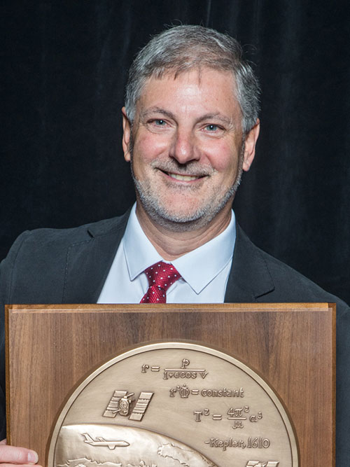
The Institute of Navigation’s (ION) Satellite Division presented Professor Terry Moore with its Johannes Kepler Award for his outstanding contributions to the development of satellite navigation through a sustained and distinguished professional career devoted to research and teaching.
Moore received the award Sept. 29 at the ION GNSS+ Conference in Portland, Ore. Moore is a member of the GPS World Editorial Advisory Board.
Terry Moore has more than 30 years of research experience in surveying, positioning and navigation technologies, and is a consultant and advisor to European and U.K. government organizations and industry.
He has taken a leading role in national and European initiatives aimed at integrating academic research and teaching activities in GNSS and interacting closely with industry.
Moore is credited with extensive work on the introduction and implementation of WGS 84 as the standard reference systems for air and marine navigation, as well as the development of standard software tools for coordinate transformations and map projections used extensively through the aviation industry.
Additionally, he is known for the development of GRINGO software that pioneered the use of raw GPS code and carrier phase data from low cost Garmin receivers. His work has also includes the pioneering of novel methods and algorithms for GPS orbit relaxation; which led to reduced dynamic GPS-based orbit determination for LEO spacecraft, with a real-time implementation.
Moore is the Director of the Nottingham Geospatial Institute (NGI) at the University of Nottingham where he has responsibility for all of NGI’s research and teaching. He is also the founding Director of GRACE, the GNSS Research and Applications Centre of Excellence, which was jointly funded by the University of Nottingham and East Midlands Development Agency, and targets knowledge transfer between the NGI and business. Additionally, he leads the university-wide Aerospace and Transport Technology Research Priority Area.
Moore has supervised numerous research projects funded by industry, research councils, the European Space Agency and the European Commission, and has supervised more than 30 Ph.D. students.
Moore is involved in the volunteer activities of numerous international professional and scientific bodies. He is currently a Royal Institute of Navigation (RIN) Vice-President (now also President Elect) and a member of their Technical Committee, while simultaneously serving on the ION Council as a Technical Representative and as a co-chair of the ION’s Satellite Division’s Technical Peer Review Committee.
He has served on the ION’s Satellite Division Executive Committee on numerous occasions and is a past ION GNSS+ program and general chair.
Moore is a Fellow of both the Institute of Navigation and the Royal Institute of Navigation (RIN). He is also a Fellow of the Chartered Institution of Civil Engineering Surveyors, a Fellow of the Royal Astronomical Society and an Associate Fellow of the Remote Sensing and Photogrammetry Society. In 1999 and 2008 he was awarded the RIN Richey Medal (best paper in the RIN Journal of Navigation), in 2013 was awarded the RIN Harold Spencer-Jones Gold Medal (outstanding contributions to navigation), and in 2016 the RIN J.E.D. Williams Medal (contributions to the RIN).
He holds a BSc degree in Civil Engineering and Ph.D. degree in Space Geodesy, both from the University of Nottingham, where he was promoted to the U.K.’s first Chair of Satellite Navigation in 2001.
The Johannes Kepler Award recognizes and honors an individual for sustained and significant contributions to the development of satellite navigation. It is the highest honor bestowed by the ION’s Satellite Division.
By Carmela Ruta, Francesco Paggi and Monica Gotta, Thales Alenia Space-Italia; D. Oskam, Airbus Defence and Space; and Rafael Lucas Rodriguez and Igor Stojkovic; European Space Agency / Presented at the European Navigation Conference, Switzerland, May 2017
The European Space Agency, Thales Alenia Space-Italy and Airbus Defence and Space contributed to the Search and Rescue/Galileo Forward Link system deployment and performance evaluation with a full-scale System Performance Validation test campaign, aimed at evaluating the performances of the SAR/Galileo system, in terms of distress detection rate, localization probability and localization accuracy.
Forward Link Message Detection probability in 10 minutes.
The paper describes SAR/Galileo principles and the COSPAS-SARSAT MEOSAR concept (detection and localisation of distress events based on MEO satellites). It presents the space and ground segments of the Galileo infrastructure that enables the SAR/Galileo Forward Link Service provision and the main inherent performances of the system. The SPV test campaign is described in terms of objectives and organization; the main results are presented, and the foreseen milestones for SAR/Galileo deployment are summarized.
Global availability of 5 km beacon localisation accuracy (95%) in 10 minutes.
In-car navigation before GPS satellites — that’s just one of the legacies of Stan Honey, who discussed his life and career during his keynote speech at the ION GNSS+ 2017 plenary.
The ION GNSS+ trade show and conference is being held Sept. 26-29 in Portland, Oregon.
The Etak company was founded in 1983 (and eventually acquired by TomTom.) The Etak navigation system debuted in 1985. Honey described how he was working at SRI International when he went yacht-sailing with Nolan Bushnell (Honey isn’t just an engineer — he uses practical navigation skills in world-class yacht races.) Bushnell founded the Atari company, and created the game Pong (which this writer remembers playing almost as much as Tank.)
Honey explained that Bushnell was impressed by his yacht navigating and his electronics know-how, and wondered if he had other ideas. Bushnell ended up providing seed money for a new firm named after a Polynesian term for navigation: Etak.
The Etak navigation device used dead-reckoning sensors and digital mapping databases stored on tapes to create a device that provided 50-meter accuracy and displayed position as a vector image. Its development resulted in more than one patent, including one for map-matching.
Honey sold Etak to News Corp, and began working for them as a chief technical officer. He create his own R&D department within News Corp, which in 1994 developed a way to track hockey pucks visually for National Hockey League (NHL) games. Long-time fans hated it, but those new to hockey, or casual viewers, appreciated being able to see the tiny puck on pre-high-definition TVs. The puck itself had a tracker inside. Honey was concerned that it might come apart at some point, with only half of it going into the net and causing a scoring controversy. It never happened.
More popular than the NHL puck tracker was the yellow line for the National Football League (NFL). The yellow line indicating first down was the first product of Sportvision, a company Honey founded in 1998. The 1st & Ten computer system has since become standard in college and professional football broadcasts.
The 1st and Ten line displays the yard line needed for a first down during an ESPN Sunday Night Football broadcast.
While it might look straightforward to add a yellow line to a broadcast, it took creating digital elevation models of the fields, which aren’t flat, but gently curved to provide drainage. That means the white yard lines aren’t straight, so the yellow line has to conform to them. A chromakey keeps the line from overlapping players. the cameras broadcasting the games are attached to bleachers, which vibrate when fans get rowdy, so each camera now compensates with a fiber-optic gyro on a tripod, calibrated by Sportvision.
Major League Baseball came next. Baseball officials wanted no part of the K Zone technology, which tracks the baseball — until they discovered it was verifying their calls. In three weeks, the umps became the system’s biggest advocates, insisting it be installed in all ball parks.
Another popular Sportvision product appears in broadcasts of NASCAR races. RACEf/x creates virtual flags above the cars to make them easier to follow. Beginnng in 2001, a Sportvision-developed electronics package has been installed in every race car. A NovAtel RTK receiver and Honeywell sensors tell viewers which car is which. As Honey said, the system “takes something hard to see and makes it easy to see.”
For the Olympics, the company provided a new yellow line, this one marking the record-winning speed or finish. It also dressed things up, such as placing national flags in the lanes of speed skaters. The flags look like they’re under the ice.
Sportvision has won several Emmy Awards for its innovations in sports broadcasts.
Meanwhile, Honey also pursued his yachting ambitions, winning the Jules Verne Trophy in 2010 for the fastest circumnavigation of the world with a yacht. The 2010 America’s Cup winner, Larry Ellison of Oracle, encouraged the creation of LiveLine, a graphics system for yacht racing. A grid of 100-meter lines makes the previously indecipherable course look like a football field, making it much clearer which craft is nearing the finish line.
The LiveLine System overlays geo-positioned lines and data streams at an accuracy of within an inch on live racecourse video shots taken from helicopter and water-based craft. (Image: Sportvision)
LiveLine was first used for the 34th America’s Cup in San Francisco Bay in 2013. It uses a NovAtel SPAN-CPT GNSS/INS receiver and a KVH CNS 5000 inertial navigation system.
Honey will be attending the conference, and invites anyone with questions to talk to him.
At Intergeo 2017, Septentrio debuted the Altus NR3: a multi-frequency, quad-constellation (GPS, GLONASS, BeiDou and Galileo) RTK receiver for survey and GIS applications.
The Altus NR3 features Septentrio’s AIM+ interference mitigation and monitoring system, allowing continued operation in the presence of both intentional and non-intentional interference. According to the company, it combines advanced GNSS features with a robust communications suite in a compact, low-power and easy-to-use unit.
The Altus NR3 is configurable as either a rover or a base station. It offers one-touch logging and Septentrio’s on-board web interface so users can monitor and configure the unit as well as collect data using any Wi-Fi-capable device.
Data collection is done using either SurvCE or Septentrio’s PinPoint Data Collector with data updating to the cloud. Septentrio’s open interface and fully documented data formats are widely supported, making the Altus NR3 easy to integrate into any existing workflow, the company said.
“We’ve built on the flexibility, reliability and ease-of-use that our Altus line is famous for, and we’ve added all-in-view RTK and the most the most advanced interference mitigation system on the market today,” said Gustavo Lopez, product manager at Septentrio. “Locations with bad visibility or at risk of interference that were previously off limits can now benefit from high-precision GNSS positioning, saving both time and cost.”
The GPS World staff is reporting from Intergeo Sept. 26-28 in Berlin, Germany. The massive trade show, dubbed the “global hub of the geospatial community,” brings together more than 17,000 visitors from more than 107 countries and features approximately 525 exhibitors. Check out some of the latest industry news, as well as photos and videos from the event.
The launch of a GLONASS-M navigation satellite took place on Sept. 22, reports the ISS Reshetnev website.
The launch of GLONASS-M spacecraft No. 52 was carried out from the Plesetsk launch site by a Soyuz-2 carrier rocket and a Fregat upper stage.
The satellite was built by the Information Satellite Systems company.
By now, the satellite has oriented to the Sun and Earth. Specialists of the Main Test Center in Krasnoznamensk, together with workers from ISS Reshetnev, began to check the working of the service systems of the satellite.
Upon completion of the checks, GLONASS-M No. 52 will be introduced into the GLONASS constellation. In orbit, the new satellite will replace another spacecraft now working beyond its design life.