A couple of years ago, wearing a different hat, I found myself on a guided tour of a key military C2 (Command and Control center) that was about as big as a football field and was to be deployed somewhere in Southwest Asia. My colleagues and I, who are all GPS SMEs (Global Positioning System Subject Matter Experts), asked the same question of almost everyone we saw that day. Near the end of the day and the tour, we had yet to receive an adequate answer. The typical response was, “Please save that question for our senior communications officer.”
Finally, at the end of the tour and demonstration, we met the communications chief, and we once again asked our persistent and, for some of us paramount, question: “What would happen if we walked into this facility in the middle of a major military operation and activated a Coke-can-size GPS jammer that we were surreptitiously carrying in a backpack? In other words, what would happen if we disrupted your GPS signal reception?”
The communications expert thought awhile and then answered. Unfortunately, the answer was a bit perplexing and yet all too common, inside the military and out. The communications officer hesitantly replied, “Well, this is a C2 center, and we are all about computers, networks and communications, and although I have to admit I don’t know much about GPS, other than we use it to navigate our military and civilian vehicles, I guess I would have to say it would not make any difference. In fact I am not even sure we would notice.”
Quick as lightning, before I even had a chance to challenge the response or thought process, a grizzled old E9, who proved his operational savvy that day, interjected, “Beg your pardon, but all of our radios, computers, networks and communications gear are referenced and synchronized to GPS time. A GPS jammer would take us out of business until we brought up our backup atomic reference system. So, initially a Coke-can jammer activated in our facility would be catastrophic, but we would soon be back in business because we have backup atomic reference systems.”
Fast-forward, and today that transition between GPS and atomic reference system is seamless. There is no down time, and yet the systems still run on GPS time. But during that initial visit, I could tell by the looks on the junior communications officers faces that surrounded us that, while they appreciated the save by the old chief, they were also still wondering, just how pervasive is the actual impact of GPS time for computers, networks and communications?
The answer is simple. The world as we know it today runs on GPS time.
GPS — Time and Frequency
This is unfortunately a scenario my colleagues and I encounter all too often. While it is not my intention to launch into GPS 101, it bears repeating that of the approximately 3.5-billion-plus users of GPS and PNT (Position, Navigation and Timing) systems in the world today, 90% use the signals for incredibly accurate time-keeping and frequency stability, not just for positioning and navigation.
Indeed, GPS SVs (space or satellite vehicles) today typically contain either three or four atomic reference systems (atomic clocks), primarily long-term, stable Rubidium systems with shorter term stable Cesium clocks as a Primary Reference Source, that continually broadcast Stratum-1 timing signals with stability on the order of 1×10-E13 or a pico second (a trillionth of a second) or greater.
For the mathematically challenged, that means the stability of the atomic clocks are such that if the GPS atomic reference system could be maintained in a perfect environment for the lifetime of the clock, nominally 20-30 years for Rubidium systems, it would never lose a second of time. To put this number in perspective, consider that the navigation revolution (easily the biggest change in navigation since the sextant was invented) brought about by Harrison’s chronometer, perfected in 1759, allowed accurate navigation by Longitude and Latitude, by keeping and transferring time aboard ships with accuracies in the 10-second range over periods of weeks. And even though at the time it was hailed as a chronometer, its lack of accuracy is such that most navigators today could not tolerate the inaccurate time or lack of stability, not when they can measure time to the trillionth of a second or better simply by receiving a free GPS timing and frequency signal available globally.
Interestingly, the clocks on the Boeing IIF GPS satellites (currently four SVs on orbit), which certainly have other issues, are proving to be the most stable Rubidium atomic reference systems ever flown in space to date, as they are currently displaying an unexpectedly high degree of frequency stability. Hopes are that future spaceborne atomic reference systems (such as in the GPS III LMCO SVs) may achieve two orders of magnitude greater stability at 1×10-E15. Compared to Harrison’s chronometer, that is an improvement on the order of 17 orders of magnitude!
Now, if you are still wondering what all this clock stability means to you, consider that one nanosecond, or merely one billionth of a second, equates to a foot of positioning accuracy on the Earth, but even more importantly, for 90% of GPS users globally, time and frequency stability equates to an incredible, dependable, stable, ubiquitous timing source for the initiation and synchronization of networks and communications systems worldwide.
When you consider that almost everything we do today involves timing, networks, computers and communications in some form, it also means that when we consider our (United States) Critical National Infrastructure (there are 16 critical infrastructure sectors defined today), all 16 depend in some form or function on GPS time and frequency stability. That is a sobering thought, and is exactly why we often use the words “ubiquitous” and “utility” when referring to the Global Positioning System. Make no mistake about it: almost every major country you can name today has the same dependency on time and frequency stability for their Critical National Infrastructures, and the majority use GPS as their primary timing, frequency and/or reference source.
Dependence
Some of you — and you don’t necessarily have to be a conspiracy theorist to think this way — will immediately see this dependence on one space constellation or system as a vulnerability. You would be correct, if there were no backup systems, augmentations or alternatives. Fortunately, just like the military C2 center, the majority of our Critical National Infrastructure sectors today have interim or temporary backups. While you should view that as a fortunate circumstance, it is also the limiting factor, or LIMFAC, in our infrastructure; the majority of the backups are terrestrial, oftentimes temporary in nature, and they rarely have the same degree of coverage, reliability or stability of GPS.
Many of you may still be saying to yourself, so what? Here’s the so what: without GPS timing and frequency stability, we as a nation may be able to generate electricity, but we would not be able to distribute it. We may be able to drill for oil and produce products such as gasoline and diesel, but we could not distribute them, and you would not be able to dispense or purchase them at the pump. You could earn money, but you would not be able to access your bank account or bank records online or at an ATM. All of these systems depend on computers, networks and communications, and they all depend on GPS time and frequency for synchronization. Get the point!?
Knee-Jerk Reactions
Unfortunately, this realization has led many of our senior leaders in the services and the federal government, who should know better, to make broad and blanket knee-jerk statements concerning the need to replace GPS that are entirely unwarranted. As I said earlier, if you think of GPS as a global utility, that is exactly what it is. Then you must treat it just like you would electricity, for example. Certainly much of the world runs on electricity, and as you have seen, much of the world also runs on or certainly depends on GPS timing and frequency signals.
However, as much as we depend on electricity, we don’t scream “find another energy source” every time the lights go out due to a storm, or power cables are cut by an accident or a farmer’s plow. Instead, prudence dictates that we plan for these occurrences, and we utilize other temporary or alternative methods of generating electricity such as backup generators. Indeed, we routinely use solar power, wind power, and batteries to hold us over until the main power is restored.
We should think of GPS in the same way. When the GPS signal is interrupted, we should not immediately call it unreliable. Rather, we should use atomic clocks, inertial systems, and other PNT systems until the gold standard GPS signals are once again available. The solution is all in how you parse the problem.
eLORAN
If there were only a persistent, wide-area, wireless solution to our problem. Fortunately, there is, and as a nation we are well acquainted with one answer and one solution, which in my opinion is the answer and a time-proven solution. For more than 70 years, since before WWII until 2010, we as a nation had the answer. The near-perfect backup and/or augmentation system for GPS was already in place; it was a coterminous system originally designated LORAN-A (long range navigation). The legacy system (LORAN-C) was in the process (90% complete) of being updated to eLORAN, a modern digital system, when inexplicably the current administration decided the entire project was a waste of money; it’s a well known government condition or disease better known as myopia or shortsightedness. Now that same administration is spending more money every year ($50M) to tear down the LORAN-C and existing e-LORAN infrastructure and remediating land at the 28 transmission sites. The annual cost of operating the e-LORAN system for one year ($16M) means these same funds could operate the eLORAN system for more than three years.
The sad part is that while our government is wasting taxpayer dollars in a severely constrained, sequestered budget environment, destroying badly needed LORAN-C and eLoran infrastructure, the rest of the world is busy building modern eLORAN systems (there are currently ~75 LORAN towers in the world today) as a backup and augmentation to GPS — countries such as Great Britain, Japan, South Korea, and Russia with their CHAYKA system, just to name a few.
A recent RNTF (Resilient Navigation and Timing Foundation) white paper (more on this new organization later) on GPS and LORAN points out that an independent think tank known as IDA (the Institute for Defense Analyses), an organization of which I am proud to be a member and which includes Dr. Bradford Parkinson, who many call the father of GPS, recently conducted a study on GPS and LORAN and recommended that, “an existing and outdated nationwide navigation system called ‘Loran-C’ be greatly updated and modernized to ‘eLoran’.’’ Such a system would provide a navigation and timing signal comparable with and complementary to GPS. The IDA study concluded that: “eLoran is the only cost-effective backup for national needs; it is completely interoperable with and independent of GPS, with different propagation and failure mechanisms, plus significantly superior robustness to radio frequency interference and jamming. It is a seamless backup, and its use will deter threats to U.S. national and economic security by disrupting (jamming) of GPS reception.”
The story of how the United States, which pioneered LORAN, wound up without an eLORAN system today, would be comical if it were not so sad. It is a long and sometimes incredulous tale, as Shakespeare once said, “full of sound and fury,” that I will not take the time to relate; however, I will say that it is not too late. Indeed, if we were to merely admit our mistakes and take the money budgeted for one year of LORAN-C and eLORAN destruction, we could not only build an entirely modern eLORAN system (for ~$40M) but we could operate it for the better part of a year while we figured out ways to make it pay for itself, and believe me when I say there are numerous viable courses of action that make this a real possibility. Then we, as a nation, would not only have a 4,000 KW terrestrial backup and augmentation to GPS, but we would have a backup and augmentation for timing and frequency stability for all of our Critical National Infrastructure sectors that would be nearly impossible to jam or spoof. Consequently, if you can’t jam or spoof the backup, then why bother trying to jam or spoof the primary system, GPS? In this instance, a modern e-LORAN system becomes a security blanket for GPS as well. It is indeed a win/win proposition.
NSPD-39 and RNTF
Lest you think I am a lone voice crying in the wilderness, in 2004 President Bush issued a National Space Policy (NSPD-39) that addressed the problem of GPS dependence. The space policy directed DOT and DHS (Departments of Transportation and Homeland Security) to find a suitable backup and augmentation for GPS. Six years later, a new administration unabashedly began destroying the only viable system that currently meets the parameters spelled out in NSPD-39. Fortunately, there are many today in and out of government that think as I do, and fortuitously they are doing something about it.
Several months ago, I wrote about Charles (Chuck) Schue and his new digital e-LORAN system at UrsaNav being tested and supported by a CRADA or Cooperative Research and Development Agreement with the U.S. Government, and I promise you an update on that endeavor soon.
Now there is an independent non-governmental foundation, the Resilient Navigation and Timing Foundation (RNTF), that supports a P3, or Private-Public-Partnership, to help develop and fund eLORAN as a private/public leased service to the government, and any other interested parties for that matter. In other words, the foundation proposes, among other ideas, to build and operate a modern digital eLORAN system for the United States, for all the reasons mentioned earlier, and lease that service to the U.S. government among others. Using P3 means that in this sequestered budget environment there are no upfront development or deployment costs to the government, and yet the system that augments and backs up GPS and critical timing for our Critical National Infrastructure is in place and operating as a private entity, employing people, paying taxes and providing a critical service. As I said, a winning proposition for all concerned.
If that were not enough, just this week the GAO came out with a report entitled GPS Disruptions: Efforts to Assess Risks to Critical Infrastructure and Coordinate Agency Actions Should Be Enhanced. You can find the highlights for the report at the following link: http://www.gao.gov/products/GAO-14-15. Once there, you can click on the PDF link for the report, which is about 58 pages. So, it is a hot topic, and one that can be easily solved once common sense again reigns in our government.
What Is Don Reading?
This month, I am going to recommend two edited books that are worlds apart in concept but are both highly related to the use of GPS, one theoretically and the other physically and fundamentally.
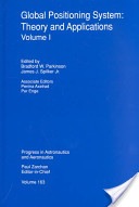
The Global Positioning System: Theory and Applications,
by Dr. Bradford Parkinson and Dr. James Spilker
1996, American Institute of Aeronautics and Astronautics
ISBN 978-1-56347-106-3
This exhaustive two-volume compendium of GPS knowledge is my daily bible for almost any GPS technical query you can muster. The two volumes total 781 pages and, truth be told, they are certainly doorstops, and while they are essential to your encyclopedic knowledge of GPS, they are certainly not to be carried around as textbooks. They are reference books, and the kind that should remain in your library at home. I treat my copies very gingerly, since they are about to fall apart from constant use. Plus, both volumes are signed by both editors, since they are both close friends and colleagues — but that is not why I recommend them. If Dr. Bradford Parkinson is the father of GPS, then Dr. James Spilker is the father of the GPS frequency and signal structure. Both Brad and Jim are currently Professors Emeritus at Stanford University and we visit on a regular basis, but again, friendship does not enter into my recommending these volumes.
I recommend them because they are simply the best compiled and edited volumes on GPS that exist today. They are authoritative and technical to a fault. As I said before, the word exhaustive comes to mind, and frankly, I don’t know how any GPS aficionado or SME could make it through the day without these incredible reference tools. I know from first-hand knowledge that both Brad and Jim have been approached about an updated edition, but I don’t know how they would find the time. They are both in great demand and are constantly writing and speaking about GPS in venues around the globe. But it would be wonderful if they could fit it in. Now a digital, searchable version — that would be something.

Guide to Super Snipers, Soldier of Fortune Magazine,
edited by Lt. Col. Robert K. Brown and Vann Spencer
2013, Skyhorse Publishing
ISBN 978-1-62636-067-9
This book is an edited history of snipers and their equipment that in the last 15 years has included GPS and other PNT systems on a consistent basis. Soldier of Fortune magazine and the editors interviewed literally hundreds of snipers around the world, and this is their story. Some of the snipers made headlines, like Audi Murphy, and were popular American heroes. Others you will have never heard of, but that does not make them any less meaningful or important in the roles they have played keeping their country safe.
This book includes great details about legacy and current sniper rifles and the expert marksmen behind the scopes and sights. It may be more than you ever wanted to know about the art and science of snipers, but it is an inspiring and patriotic book that many will thoroughly enjoy. Be aware there are numerous typographical and grammatical errors — try not to let that impair your enjoyment of this one-of-a-kind book.
Until next time, visit the RNTF site, support eLORAN, read a good book, and I wish you happy navigating.