Category: Opinions

  • Expert Advice: Looking Back to the Early Days of GPS

    Len Jacobson
    Len Jacobson

    By Len Jacobson

    Besides my family and friends, two major influences have guided my life. One is GPS, and the other is flying, although I’m not a pilot. Most of the flying was on business trips for GPS. I’ve been writing a book about my experiences and how I helped in a small way to bring GPS to the world. I estimate I’ve spent about eight months aboard airplanes, logging almost 2.5 million miles. During that time, I visited many places throughout the world, acting as a catalyst to promote the use of GPS and to obtain GPS business for my employers and for myself. I kept an extensive log of my travels and it enabled me to recreate much of what happened, and my impressions of why events occurred.

    In 1968, after two engineering degrees and five years working in communications systems, I met a business development director from Magnavox, which had teamed with Hughes Aircraft, where I worked, on a study contract. We both attended a briefing on the contract status; that day was my first encounter with what would become known as GPS.

    I attended one more meeting about the 621B satellite program. The U.S. Air Force had no funding for a full-up 621B, so instead it focused on proving that the technology was viable. We were asked to bid on supplying a receiver that would precisely measure a half-mile of cable using a spread-spectrum signal. I vividly recall a Hughes VP stating that 621B would never go anywhere, and besides, Hughes was only interested in building synchronous satellites. Our 621B competitor, TRW, agreed take the follow-on contract. TRW was acquired by Northrop Grumman in 2002. The Air Force felt it needed two competitors in case one failed, so it offered a second contract to Magnavox. The company took the contract, which became its first hardware entry in the world of GPS.

    Before long, I received an offer from Magnavox to join the world’s leading experts on implementing anti-jam communications systems using then-classified, direct-sequence spread-spectrum technology. Magnavox had been working in the field since it was formed in the early 1960s, building the first anti-jam modems for the Initial Defense Communications Satellite Program (IDCSP) and now pursuing a follow-on program. Its main business areas were satcom, tactical communications, and positioning programs such as the 621B receiver. There also was a group building Transit satellite receivers for the Navy. Transit was really the first navigation satellite, growing out of experiments at Johns Hopkins University Applied Physics Lab, using Sputnik signals to determine one’s position on Earth by tracking the Doppler signal of a satellite in a known orbit. Besides the Naval Research Lab, Magnavox built the only Timation receivers, an early competitor to GPS for solving military positioning needs using a satellite system.

    While I was still working at Magnavox on satcom, the 621B receiver was completed and we proved you could use a spread-spectrum signal to accurately measure distance. Once again, the Air Force did not have funds to launch navigation satellites so it proceeded with a new effort called “621B User Equipment Definition and Experiments Program.” The prime contractor was Grumman Aircraft. The idea was to put four transmitters on the ground and have an aircraft with a receiver fly over them and try to determine the aircraft’s position. The signals were to look as if they came from four satellites and were received by an antenna on the bottom of the plane. Grumman decided to use a receiver built by Hazeltine, which had some experience in spread spectrum but nowhere near as much as Magnavox. For this reason, the Air Force leased another receiver from us, asking how much? We came up with the number $450,000, our development and build cost. They agreed, and we called the receiver the MX450. It flew beside the Hazeltine receiver on the NC-135 aircraft at the White Sands Missile Range. Most of the usable test data came from the MX450, showing residual errors between the aircraft solution and the range tracking system to be less than five feet. This data was crucial in getting DoD approval in 1973 to proceed with Phase 1 of GPS. But we should have called it the MX495 because we overran the cost by $45,000.

    A Tale of Two Contracts

    The procurement for Phase 1 GPS came together as two major contracts. There would be a small number of satellites that Rockwell would win competitively and would lead to many years and billions of dollars in future GPS satellites, as it became part of Boeing Corp. ITT would build its own payload and go on to be the major supplier of GPS payloads to this day. The other contract, a study contract, was awarded to three companies: General Dynamics Electronics (GDE), Philco-Ford, and Grumman. Two of the contractors performing that study, which ended in proposals for the design of the ground network and several types of user equipment (GPS receivers), would be chosen to create the designs. Then one of the two would be selected to actually implement Phase 1 of GPS.

    After the first round down-select, we were now playing in the big leagues, GDE/Magnavox against Philco/TRW. The Philco leader, Jim Spilker, and our guru, Charlie Cahn, had to work together along with Rockwell engineers to define a common signal for GPS. The product of their work is still in use as it was defined then, at least for the civil C/A GPS signal. There were tradeoffs and compromises. The length of the short code was a contentious issue. TRW had built a 512-bit correlator, and Philco pushed that for the C/A-code. Cahn wanted 2048 bits to minimize inter-satellite signal interference. They compromised on 1024 bits. Charlie wanted a serially transmitted short code/long code for the military signal to enable long-code acquisition, a technique we had used in all our modems. But Spilker pushed for the codes to be transmitted in phase quadrature, a more elegant solution that prevailed. The need for a short code arose because the receiver could not acquire the long military signal unless it knew time to microseconds accuracy. The military code was very, very long. By first acquiring the short, repetitive C/A signal, the receiver could read its data and determine time close enough to make a long-code acquisition search practical.

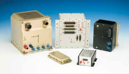
    The GDE/Magnavox team won the Phase 1 contract, and we were developing the first military and civil GPS user equipment (UE). Our Phase 1 UE contract included quantities of a 4-channel, high dynamics set for the F-4 fighter aircraft; a 2-channel aircraft set for the bigger and slower C-141 and helicopters; a manpack; and a civil aircraft set that looked like a TACAN and used only the C/A GPS signal. The three aircraft sets were called the X-set, Y-set and Z-set, respectively. Before long, Col. Brad Parkinson, director of the Joint Program Office, decided that there should also be a competitive high-dynamics set and another manpack, and awarded a contract to Texas Instruments. The USAF avionics laboratory wanted a piece of the GPS action so it awarded a what it called a “high technology” GPS UE contract to Rockwell Collins.

    For various reasons, many not of its own making, Collins eventually became the number-one supplier of military GPS UE, long after Magnavox faded from the scene. (Hughes and then Raytheon eventually acquired the Magnavox GPS crew, where some of my former colleagues still work today.) The Collins unit flew in the C-141. Our X-set flew in a pod under the F-4. The complement of equipment, GPS receiver, navigation computer, power supply, and so on, was too big to be installed into the aircraft, so it was housed in the pod.

    Building the Crew

    To staff the contract required hiring many new engineers. We scoured our competitors and prior employers that had people experienced in the needed hardware and software disciplines, and were able to create a crew that went on to become major contributors to GPS developments for decades. Some started their own GPS companies, like Min Kao who, with Garry Burrel of King radio, later became the MIN and GAR in GARMIN. Another GPS company started by Magnavox people is CAST Navigation, a GPS simulator manufacturer.

    The Magnavox Marine Division developed commercial Transit receiver and integrated shipboard navigation systems and survey systems. Later on, it pioneered GPS-based marine navigation systems and eventually split off into another company called Navcom, formed by Jim Litton, which later became part of John Deere. Several notable GPS experts from that Magnavox cadre like Tom Stansell, Ron Hatch (still with Navcom), and Jerry Knight are actively consulting today. So with all modesty, I have to say that I too was part of that original group who can claim some degree of fatherhood for GPS user equipment and receivers.

    Over the next several years, I became an ambassador for GPS, traveling the world, particularly to visit potential military GPS users in NATO and at other allies. In the late 1970s, Magnavox and Collins were awarded the Phase 2 user-equipment developments. About a year before the production contract was awarded to Collins, I had left Magnavox to join Interstate Electronics (IEC), now a major part of L-3 Communications, to lead its efforts to become a military GPS user-equipment supplier. IEC had a unique technology for tracking submarine-launched ballistic missiles using a GPS translator tracking system. We succeeded in applying it to the DOD test ranges and for Trident missile tracking and submarine navigation. In my later years there, we eventually miniaturized the GPS receiver to the point where it could be applied to guiding missiles and projectiles.

    After nine years at IEC, I decided to go out on my own as a consultant and formed Global Systems and Marketing, Inc. For the next 20 years I worked on various assignments from most of the major GPS companies and several small businesses that were trying to find a position in the GPS market. I also participated as an expert witness in many legal cases involving GPS, from patent disputes to accident reconstruction to parolee tracking.

    Looking back now from the beginning of my retirement, I can obviously say I’ve learned a lot. Two things stick out in my mind:

    • Never believe the schedule and budget anyone offers up, because new developments will likely take longer and cost more than originally estimated;
    • When you stop being better, you stop being good.

    I know the future holds more miraculous applications of GNSS technology because of all the brilliant, innovative people working in the field that I have met, and those that I haven’t met but have read about in places like GPS World. You are all very fortunate to be part of what I call the most important dual-use system (after the Internet) ever invented.


    Len Jacobson is a retired GPS consultant, having worked in the field since 1968. He is still active in the Institute of Navigation, having been Western regional vice president twice and held leadership roles in several of its conferences. He lives in Long Beach, California. Visit his site at www.lenjacobson.com.

  • Out in Front: Geospatial on Everything

    Alan Cameron, GPS World and GSS publisher.
    Alan Cameron, GPS World and GSS publisher.
    GPS World Publisher Learns about GIS

    By Alan Cameron

    Everything has a geospatial aspect. Everything. Past, present, future.

    Over grits, coffee, and the airborne delicacy purveyed at the Flying Biscuit Cafe (right out of the oven, right into your mouth) in Sandy Springs, Georgia, I absorbed this high-tech homily.

    You’ve heard of the European financial crisis. Trace it back to geospatial, from the Greek banking collapse, which in turn had roots in the implosion of the Greek tax system, due to a plethora of gaps, inconsistencies, and exceptions filed in a largely uncontrolled property cadastre — the register of real property, including details of ownership, precise location (by GPS coordinates), and value of land parcels.

    Lose control of your cadastre (your GIS), lose the country. With global interconnections, soon the continent, if not perhaps the world economy.

    For want of a nail, the battle was lost.

    Jump forward, technologically, to flash lidar. Ball Aerospace created this ability to capture continuous rapid multiple laser interferometry detection and ranging (LiDAR) images/point clouds, merged with continuous high-resolution optical images, to create full-color 3D models in real time. Stitched together with GPS, this produces real-time full-motion video: interactive geo-referenced metric 3D models.

    In field application, this can yield time-critical 3D mapping for urgent missions, enhanced situational awareness, battlefield characterization, and tactical mission planning. It can help with disaster-response planning and event forensics. Real-time models could be communicated with the public through easily comprehended moving images via television or the Internet. of the actual progress of a fire or flood, together with evacuation routes.

    Jump again to fabfi. What’s a fabfi?

    FabFi is an open-source, lab-grown system out of MIT using common building materials and off-the-shelf electronics to transmit wireless Ethernet signals across distances up to several miles. Communities can build their own networks for high-speed Internet connectivity, and access to online educational, medical, and other resources.

    Simple, low-cost, and feasible in unstable environments: Afghanistan, Kenya, and any number of countries that leapfrogged telephone landlines to come quickly into the cellular era; now they can leapfrog Ethernet cable networks and even Wi-Fi for virtual connectivity. Implement with locally available materials. Print out a 2D design file and create the pieces out of wood, metal, acrylic, clay, stone, or ice, as long as you can attach a metallic RF reflective surface to the front.

    If you haven’t guessed the geospatial aspect of this, I assure you it’s there, but I’ve run out of room here.

    For these geospatial glimpses, I am indebted to contributing editor Art Kalinski. Read his monthly columns here.


    Alan Cameron is editor-in-chief and publisher of GPS World magazine, where he has worked since 2000. He also writes the monthly GNSS System Design e-mail newsletter and the Wide Awake blog.

  • Geospatial on Everything

    By Alan Cameron

    Everything has a geospatial aspect. Everything.

    Over grits, coffee, and the airborne delicacy purveyed at the Flying Biscuit Cafe (right out of the oven, right into your mouth) in Sandy Springs, Georgia, I absorbed this high-tech homily.

    You’ve heard of the European financial crisis. Trace it back to geospatial, from the Greek banking collapse, which in turn had roots in the implosion of the Greek tax system, due to a plethora of gaps, inconsistencies, and exceptions filed in a largely uncontrolled property cadastre — the register of real property, including details of ownership, precise location (by GPS coordinates), and value of land parcels.

    Lose control of your cadastre (your GIS), lose the country. With global interconnections, soon the continent, if not perhaps the world economy.

    For want of a nail, the battle was lost.

    Jump forward, technologically, to flash lidar. Ball Aerospace created this ability to capture continuous rapid multiple laser interferometry detection and ranging (LiDAR) images/point clouds, merged with continuous high-resolution optical images, to create full-color 3D models in real time. Stitched together with GPS, this produces real-time full-motion video: interactive geo-referenced metric 3D models.

    In field application, this can yield time-critical 3D mapping for urgent missions, enhanced situational awareness, battlefield characterization, and tactical mission planning. It can help with disaster-response planning and event forensics. Real-time models could be communicated with the public through easily comprehended moving images via television or the Internet. of the actual progress of a fire or flood, together with evacuation routes.

    Jump again to fabfi. What’s a fabfi?

    FabFi is an open-source, lab-grown system out of MIT using common building materials and off-the-shelf electronics to transmit wireless Ethernet signals across distances up to several miles. Communities can build their own networks for high-speed Internet connectivity, and access to online educational, medical, and other resources.

    Simple, low-cost, and feasible in unstable environments: Afghanistan, Kenya, and any number of countries that leapfrogged telephone landlines to come quickly into the cellular era; now they can leapfrog Ethernet cable networks and even WiFi for virtual connectivity. Implement with locally available materials. Print out a 2D design file and create the pieces out of wood, metal, acrylic, clay, stone, or ice, as long as you can attach a metallic RF reflective surface to the front.

    If you haven’t guessed the geospatial aspect of this, I assure you it’s there, but I’ve run out of room here.

    For these geospatial glimpses, I am indebted to contributing editor Art Kalinski. Read his monthly columns here.


    Alan Cameron is editor-in-chief and publisher of GPS World magazine, where he has worked since 2000. He also writes the monthly GNSS System Design e-mail newsletter and the Wide Awake blog.

  • Looking High in the Sky from Down Under

    A few months ago I wrote in the magazine’s Out in Front column about the surprising abundance of BeiDou-centric papers to be presented at the upcoming ION GNSS+ conference, to which I very much look forward — both the abundance and the conference as a whole. With GLONASS encountering stormy weather of late, and Galileo plugging steadily along but not quite making up time, it seems increasingly possibly that the first GNSS of choice may constitute GPS+BeiDou, if certain spectrum questions can be worked out. News of an advance in Australia further heralds this likelihood.

    Researchers at Curtin University in Perth, Western Australia, have put forth a method integrating GPS and BeiDou signals, in an effort particularly aimed at urban canyons. In Australia at least, the visibility of BeiDou’s five geostationary and five inclined geosynchronous orbit satellites hovering above the Asia-Pacific region can bring added punch to any receiver experiencing skyviews obscured by skyscrapers. The same problem occurs in open-pit mines, said Curtin University professor Peter Teunissen. Open-pit mines are a very big thing in Australia.

    For those surprised to find this flying Dutchman, the inventor of the LAMBDA method for GNSS carrier phase ambiguity resolution, popping up in Australia, it appears he has a secondary appointment at Curtin University.  He remains based, as he has for 20 years, at the Delft University of Technology in the Netherlands, where he is head of the Department of Earth Observation and Space Systems.

    I wish I had a secondary appointment somewhere.

    “By combining GPS with Beidou,” announced Teunissen and colleagues at the Cooperative Research Centre for Spatial Information, “we are making use of Beidou’s 14 new satellites that cross our sky at a high angle, increasing satellite availability, improving positioning capability and ultimately creating a system that is perfect for both urban and mining environments.”

    Beidou of course has a ways to go to achieve its fullness at 35, perhaps as soon as 2020. Combining all and sundry GNSS, more than 100 GNSS satellites are expected to be operational by 2016, so algorithms making use of multiple signals and systems have moved to the fore. As we well know.

    “The emergence of new GNSSs, together with the linking of different systems, has enormous potential for improving the accuracy, integrity and efficiency of positioning worldwide, enabling much more reliable data,” Teunissen added.

    Precise positioning services could boost Australia’s gross domestic product by $13.7 billion by 2020, according to a recent report by a consultant for the Department of Industry, Innovation, Climate Change, Science, Research and Tertiary Education. (Maybe that’s where I should seek my secondary appointment; they’ve got a lot on their plate.)

    In January of this year, Teunissen’s Curtin University group and Dr Dennis Odijk, from the Western Australian School of Mines (WASM), also announced a methodology integrating GPS with Galileo signals. Both projects were funded by the Australian Space Research Program.


  • Mobile Resource Market Shows Largest Growth in Location Industry

    Mobile resource management has never been a sexy market full of buzz and excitement — we are talking tracking trailers and containers. However, it is on pace to see double-digit growth through 2020. Led by a handful of companies in local fleet, long haul, cellular and trailer tracking, MRM has never faced ups and downs like other location market segments. In fact, acquisitions and growth appear to be in the future for this market segment.

    With more than 5.7 million tracking units nationwide, and 9 million more expected to be sold by 2015, the mobile resource management market continues to be one of the steadiest, and profitable, location businesses.

    In one of the bigger MRM deals earlier this month, Danaher Corp. purchased Garden City, California-based Teletrac, which was owned by Vector Capital. Teletrac, which offers a cloud-based software as a service (SaaS), has units installed in more than 200,000 vehicles in 87 countries.

    In terms of segments within MRM, the local fleet market continues to be the largest, according to Clem Driscoll, president of CJ Driscoll and Associates, who is completing a multi-client study of U.S. fleet operators that is sponsored by two major wireless carriers.  Local fleet operators had more than 3 million units installed in 2012. In 2000, local fleet companies had about 250,000 units installed, according to Driscoll.

    Another growing MRM market segment include cell-phone-based systems with 1 million units.  Long-haul trucking and trailer tracking both have less than 1 million units installed in 2012. The major players in long-haul trucking markets have included Qualcomm, PeopleNet and XRS (Xata), but Qualcomm just announced that it is selling its fleet management and tracking business Omnitracs to Vista Equity Partners for $800 million in cash.

    Driscoll says the largest GPS fleet management company is Fleetmatics, which recently went public, raising $94.3 million. The company has 331,000 units installed worldwide, and had $127.5 million in revenue last year.

    Driscoll has identified several MRM trends: hardware prices are declining, MRM service providers are bundling the hardware; leveling off of equipment purchases for local fleet markets as suppliers transition to third-generation devices; increased integration with Android; smartphones and tablets; and more acquisitions.

    Speaking of acquisitions, the past year was a busy one for MRM. Telogis bought Maptuit and NavTrak. CalAmp bought Wireless Matrix, which is a GPS-cellular tracking company.

    For long-haul trucking acquisitions, the biggest deals came from Trimble, which purchased TMW Systems, ALK Technologies and GEOTrac, an oil and gas monitoring company.

    In Europe, the United Kingdom and France could see growth, but Spain has economic problems. Germany still is a strong long haul market, Driscoll says. In Asia, there should be 9 million potential units sold in the next few years, with China being the dominant player. Korea and Japan are maturing markets.

    Overall, by 2020, MRM could achieve the same level of penetration as the smartphone market.  Today’s smartphone may be the ultimate telematics equipment, and future MRM equipment of choice, as the automotive OEMs have found out by listening to their consumers, Driscoll said.

    Google Maps Already Using Waze 

    In other location industry news, Google Maps this week is using Waze real-time traffic reports on its app for Apple iOS and Android, according to a blog post from Google. The announcement constitutes the first significant use of the Waze app since Google purchased the Israeli startup for $1 billion in June.

    While Google Maps users will be able to use reports about accidents, construction and road closures, Waze consumers will be able to get access to Google search and Street View. According to published reports, more than 15,000 new map editors joined the Waze editing community this month, which is a 43 percent month-over-month increase.

    Intel Shuts Down Telmap

    Late last month, after our LBS Insider deadline, Intel announced it was shutting down Telmap, an Israel-based company it acquired in 2011 for a reported $120 million. The move signals the end of Intel’s navigation business, which had hoped to offer end-user tools and white label technology for developers.

    Telmap employed 150 people at its development center in Herzliya, Israel, and had dozens of other employees at various Intel branches throughout Europe and the United States. Telmap rolled out a free navigation app called M8, which was launched earlier this year. The app drew revenue from advertising and was marketed to wireless carriers for rebranding.

    In Israel, Orange, Cellcom and Pelephone, the country’s largest wireless carriers, all use Telmap’s white-labeled product, according to published reports.

    According to published reports, some of the Telmap employees will be placed in other positions within Intel Israel. The reports said that Intel was too late with its free app and was way behind crowdsourced traffic providers such as Waze.

    Telmap, founded in 2000, was viewed as an up-and-coming player in the location industry. It supported wireless carriers mainly outside of the United States such as Orange FT Group, SingTel, MTS, Vodafone, Vodacom, SFR, Telefonica-02 and others. Its U.S. partners included Nokia (Navteq), MapQuest and Inrix.

    Is the Location Industry Conference Dead?

    After working overseas for nearly a year, I have noticed that there are not a lot of industry events to cover, particularly pure location conferences. There may be a connected vehicle panel at the Consumer Electronics Show or a CTIA trade show.

    However, the location-centric conference appears to have died in the wake of industry consolidation (and Google’s giving navigation away for free). Replacing these conferences are connected vehicle and insurance telematics conferences that feature an occasional wireless, or LBS, panel.

  • A Space Pioneer Remembered

    Colonel Francis Xavier Kane
    Painting of Colonel Francis Xavier Kane (courtesy of the USAF Space and Missile Pioneers).

    Plus: The First Installment of ‘What Is Don Reading?’

    This month I planned to catch up on all those important topics that need to be written about but don’t make the cut, mainly due to space limitations — and then came the sad news of the passing of a good friend, mentor, and great Space and Missile Pioneer, Colonel Francis Xavier Kane, Ph.D., USAF Retired, born on December 12, 1918, in Philadelphia, Pennsylvania. To put this date in perspective, consider that the first successful Wright Brothers flight at Kitty Hawk occurred in 1903.

    Known simply as “Duke” to his friends and colleagues, he went to be with the Lord on July 18, 2013. He was 94 years old, and the majority of those years were filled with futuristic thoughts and writings about what we could achieve in the heavens above us, and accomplishments that support the Space Age we all live in today.

    I first met Colonel Kane in 1973, a full three years after he retired with 27 years of active duty in the USAF. Duke graduated from the U.S. Military Academy at West Point in 1943 in the middle of WWII. In those days, there was not an U.S. Air Force Academy. What would become the U.S. Air Force was then known as the Army Air Corp. The USAF did not become a separate military service until September 18, 1947, with the implementation of the eponymous National Security Act. Still, Duke found himself in an Air Force uniform, flying airplanes and instructing others how to fly. He loved flying, but as you will soon discover, he was an engineer and professor at heart. He played to his strengths.

    I never knew Duke while he was in uniform. Despite my best efforts to refer to him with proper military courtesy as Colonel Kane, he quickly remonstrated me and informed me that to his friends and colleagues he was known simply as Duke, and so “simply Duke” it has been for the last 40 years. At the end of our conversation about appropriate appellations, he added, “And no one calls me Francis-Xavier except my wife Virginia, and then I know I’m in the dog house!” (Ed: Duke and Virginia were married for 67 years).

    Duke Kane was the first to send me a wonderful handwritten letter of congratulations via snail mail back in 2007, when I penned my first column as the Defense Editor for GPS World magazine. The letter was extremely complimentary, with high praise I had certainly not yet earned, but then that was Duke — always supportive. Comments in his letter I will always treasure are “Finally, we have someone writing regularly about GPS that actually knows what he is writing about…and don’t forget, Don, I have declassified history files dating back to the early days of the 621B program and they are always at your disposal.”

    I heard regularly from Duke, several times a year at least, and it was always a note of encouragement or praise; what every journalist needs. It meant a lot to me personally that it came from Duke because, you see, Duke was a very prolific writer and thinker himself, and perhaps at times even a frustrated journalist. Some of his wonderful and insightful writing on the possible uses of the “Space Domain” as a medium for our future infrastructure are seminal and even legendary today — such as the one he wrote on terrestrial navigation using space assets, which helped spawn the aforementioned 621B program that led to the Global Positioning System. More on that later.

    Duke was a prolific writer, but rarely took credit for his futuristic ideas. While serving as an Air Force planner, Duke penned papers concerning the initial development and importance of systems analysis and applications of early computers for both terrestrial and space applications. Early on, Duke saw the need to develop a coherent planning and policy environment in the DoD (Department of Defense) to enhance the evolution of and to formally inculcate the U.S. space program, to include systems and technology planning.

    In the early 1960s, Duke wrote profusely concerning space-based missile warning, known today as the DSP or Defense Support Program and more recently as the SBIRS or Space-Based Infrared System. He wrote about manned space maneuvering vehicles, now known as the Space Shuttle, which came and went during his lifetime, as well as the detection and tracking of mobile missiles and the possibility of shooting them down with lasers. He also wrote about lasers as “blindingly effective” anti-satellite weapons, a capability and problem that modern planners and operators are still worrying about and dealing with today. He wrote about advanced ballistic missiles, which we know today as the MX or the Peacekeeper program.

    He was always ahead of his time. He wrote knowledgeably about space-based missile defense, a theme he would later revive as a member of the GPS Independent Review Team (GPS-IRT), which several of us invited him to join because in the 1960s he penned significant white papers concerning the possibility and credibility of navigation satellites, which of course we know today as the Global Positioning System. He was, in many respects, a visionary.

    Before his retirement in 1970, Duke managed to find the time to complete a master’s degree in political science and a doctorate from Georgetown University. He went on to teach courses at UCLA, the University of California at Los Angeles, the Catholic University of America, and Pepperdine College.

    Duke loved to think and write about the future. One of his favorite topics was the Global Positioning System, which in many respects sprang from the classified 621B program he supported toward the end of his Air Force career.

    Aerospace Corporation Historian Steven R. Strom, in his insightful writings and interviews with luminaries of the early U.S. space programs, with an emphasis on the history of GPS, wrote that in 1963 the Air Force Space Systems Division funded Colonel Kane to lead a classified project known as 621B. Phase one of 621B featured the engineering concept for a “space-based navigation system,” later to become known as the Global Positioning System or more formally as the GPS/NAVSTAR. According to Colonel Bradford Parkinson, Ph.D. USAF, retired — and the first GPS Program Manager/Director at what is now SMC — Project 621B had “many of the attributes that you now see in GPS. It has probably never been given its due credit.”

    Duke never forgot those early days or got over his involvement and fascination with GPS. In 1993, 23 years after his retirement from active duty, Duke founded the GPS International Association. He served on the U.S. Department of Transportation Civil GPS Service Interface Committee and authored more than 20 significant articles on GPS and other critical space-based systems.

    Finally, in 2010 Duke was inducted as an Air Force Space and Missile Pioneer — his picture and a short biography hang in the entryway of AFSPC (Air Force Space Command) Headquarters (the Hartinger building) on Peterson Air Force Base in Colorado Springs, Colorado — a well-deserved honor of which Duke was extremely but humbly proud.

    Colonel Francis Xavier “Duke” Kane — fighter pilot, flight instructor, engineer, professor, visionary and, for many, a friend and mentor who will be sorely missed.

    Now on to the Catch-up Topics…

    As my regular readers are aware, I generally take a long time to evaluate PNT and PNT-related equipment sent for me to review, and I only review about one in twenty items. For years I have reviewed and recommended OtterBox equipment for keeping iPads, iPhones and assorted PNT handhelds safe from the environment. They are indeed some of the best add-on “ruggedizers” I have ever encountered. However, a few weeks ago I called the wonderful folks at OtterBox to enquire about a rugged mounting system for PNT equipment and discovered to my dismay that they just don’t do that. Not an area of expertise for them. Fair enough, and I certainly appreciated their honesty. Then, out of the blue, I received an email from Francesca Marino at Blast Media on behalf of Rokform, a relatively new U.S. company that builds rugged mounting systems that she said were perfect for our warfighters. She even included the following advertisement/vignette:

    Made in the USA, all Rokform products are designed and engineered of CNC aircraft grade aluminum. Each accessory allows soldiers to mount their phone magnetically, or by Remote Mounting System (RMS), to dashboards of any vehicle. A member of the Navy inland search and rescue team accounts his experience with Rokform’s RokBed v3 case while on duty for helicopter rappel operations:

    “I’m active duty military, and one of our engineers bought the magnet for his [Rokform] case as I had. While standing on the quarterdeck, he accidentally dropped his phone and tried to kick it back onboard before it went in the drink. He only succeeded in kicking it overboard…only to have it catch itself on the side of the ship! Several others saw what happened and were surprised when he was able to retrieve his phone from its watery grave! I had to share that story as you had to be there to believe it.”

    Francesca asked if I would be interested in receiving a sample of a Rokform rugged smartphone or iPad case for testing.

    I took Francesca up on her offer, and frankly, I am impressed with the earth-magnet mounting system on the Rokform equipment cases, and especially with the v3 mounting system (see picture). I have used the v3 for a couple of months in numerous rental cars and with both my iPhone and my iPad — it works flawlessly. It has never released involuntarily even on hot and cold surfaces, and it has never dropped my iPhone or iPad on the dash. Not something I can honestly say about any other device of this type I have tested. I also use the v3 at home on a granite counter top Sometimes just getting it unstuck is a chore, but a happy one. It simply works as advertised; it holds whatever you attach securely and effectively, and has the flexibility and maneuverability to do so in all kinds of environments. It is truly rugged, versatile and very useful. It stays where you mount it, and it is made in the USA. I highly recommend it.

    The Rokoform v3 mounting system.
    The Rokform v3 mounting system.

    Specifications:

    There are numerous hands-free options for the v3 Suction Mount. Attach the mount to any smooth, flat, non-porous surface, and adjust to your ideal viewing angle. A few of the locations I tested include a conference table, desk, car window, windscreen, mirror, and sunroof.

    Features

    • Polycarbonate and die cast zinc construction
    • 360-degree turn and rotation
    • 210-degree tilt for ideal viewing angles
    • Powerful suction pad measures 3.4 inches (86.4 mm) in diameter

    The v3 is compatible with all v3 mountable phone cases, which pretty much covers the waterfront on phone cases, and so they should have one that fits your needs.

    There is a separate attachment for your mobile devices that uses adhesive if you just don’t want to use the suction cup model — just beware that once you attach the separate small earth-magnet device, to a case or your automobile, it is not coming off. Be sure you want it there permanently. I view this as a good thing: no falling iPhone or iPads. But it is just something you need to contemplate. Of course, the v3 works with a tenacious suction cup, so there is not a permanence issue with that device. Try it.

    What Is Don Reading?

    Ever since I started penning this column and mentioning books I have read or am reading and frequently quoting from them, I have received a steady array of requests to discuss the books and recommend or review them, even if they are not primarily about GPS or PNT.

    Certainly, locating books to review is not an issue. My wife calls me a parallel reader, in that I am generally reading two, three, even four books at a time. The question is will any of them be of interest to you? Let’s find out. While we are not sure this feature will appeal to all of you, or if we can make this a regular feature due to time and space limitations, we will give it a trial run this month. Please let us know what you think and what you are reading that may be of interest to our readers, at [email protected].

    I recently had the pleasure of reading two books about wartime that cover two distinct periods of time and are actually in different genres. However both books are fascinating for very different reasons.

    ViperPilot-coverViper Pilot:  A Memoir of Air Combat, by Dan Hampton (USAF, Ret).

    This book is a “must-read” for air combat aficionados in that it is a seat-of-the-pants warfighter, fighter-pilot view of the air wars in Iraq, Afghanistan, and Kosovo. It is also a very candid fighter pilot’s view of how those wars were managed or not managed, as the case may be. Dan certainly pulls no punches, and if you have any romantic visions of aerial combat and how it comes about — as portrayed in movies like Twelve O’Clock High — then this book may prove to be an eye-opener.

    Be warned, it takes a chapter or two for Dan to set the hook, but if you are still engaged by chapter three, you should be good and firmly on the line. The first two chapters are more of what those of us in-the-business refer to as standard fighter-pilot rhetoric, as in “I am god’s gift to the world and am without a doubt the world’s best fighter pilot.” Indeed, the first two chapters do a good job of substantiating the old barb, “You can always tell a fighter pilot, but you can’t tell him much.” Today, to be politically correct, I guess that would have to be him or her much.

    However, in retrospect, who would want to read a book by a warfighter, especially an F16C Wild Weasel fighter pilot, who was not absolutely sure of his or her superiority? Not me. Indeed, another old barb that applies here, “There are bold pilots and old pilots but very few old bold pilots.” After you read Viper Pilot, I think you will agree than Dan Hampton, who by his own humble admission is one of the most decorated F-16 pilots in American history, is certainly the exception to the rule.

    Most importantly, Dan Hampton gets it right, technically and operationally. His frustration with incompetent ground-pounders and support personnel notwithstanding, he tells it like it is, and you quickly detect that his frustrations are probably justified and his feelings, which he freely shares without compunction, are certainly justified, at least in his view of the world.

    As far as I can decipher, and I was in that business for almost thirty years, there are no glaring errors or even small mistakes about procedure, process, or organizational charts. He tells it like it is and lets the pieces, whether blame or commendation, fall where they may. It is a great read, and one that all history, war, airplane and aerial-combat buffs will find a must read. And yes, there are numerous references to GPS and GPS-guided weapons and effects. I thoroughly enjoyed it — even though the language can at times be a bit over the top and is totally unnecessary to the storyline, but then, when you are God’s gift to fighter pilots, what do you expect?

    By the way, rumor has it Dan is in the process of writing another book. I, for one, can’t wait.

    Ledger-coverThe Ledger, by Lloyd Holm

    This wartime romantic novel by Lloyd Holm is certainly a departure from Viper Pilot. This book is romantic in nature, but in a good way, and yet is also a very true and authentic synopsis of what it was like during both WWI and WWII, which was globally known as the “War to end all Wars.”

    Lloyd Holm does a great job of setting the hook immediately. No waiting. I read it in one sitting and was disappointed only because it was over. I wanted the story to go on and on. Hint to Mr. Holm: There is certainly a sequel here if you have it in you.

    This fast paced riveting story concerns two families and their involvement with each other during both world wars. The story more or less begins with a very authentic and well-documented event, the 1914 lull in fighting due to the spontaneous and unofficial 24th of December Christmas Truce during WWI. Both Allied and German soldiers meet in “No Man’s Land” between the trenches to exchange food, stories and camaraderie. During this incredible event, the lives of two families, German and Jew, become irrevocably intertwined — the rest, as we say, is history and the storyline of The Ledger.

    This wonderful book is authentic and detail oriented. I could find no fault with the well-documented history, the unit designations, or the language, as English, French, and German words are used liberally and in the correct context.

    Whether you read this book as an historian, a romantic, or a war buff, you will find it satisfying on all accounts, and I dare you to put it down once you start. Sequel?

    Until next time, read a good book and happy navigating.


  • Real-Time 3D Models

    The Penultimate Visualization System?

    By Art Kalinski, GISP

    Last month we looked at old and new providers of oblique imagery.  I mentioned what a strong proponent I am of oblique imagery because it’s such a powerful visualization tool, easily comprehended by non-GIS users. My experience with police, firefighters and the Atlanta Regional Commission demonstrate that many first responders and politicians have difficulty reading blueprints, technical drawings or maps, but can visualize an area of interest much faster with oblique imagery.

    Jack Maguire, a colleague and GIS Manager for Lexington County South Carolina, coined a very descriptive phrase. He said that most non-GIS people have “map blindness,” in that they have difficulty comprehending maps even if merged with ortho imagery. However, those same users will have no difficulty getting oriented viewing an oblique image. (See my July article for a more detailed explanation). That’s why both Google Earth and MS Bing now include oblique views and even some interactive 3D models for a growing number of urban areas.

    Most oblique imagery data sets are generally limited to four cardinal directions along with an ortho view. That’s why I believe 3D models are a notch above, because they offer infinitely adjustable oblique views for even better visualization. It’s the oblique views that are the key attraction of 3D models. If you observe someone using an interactive 3D model, they almost always look at multiple oblique views. I’ve never seen a 3D model user navigate to the ortho view and stay there as they navigate around a city.

    PLW Modelworks

    There are many ways to create 3D models, ranging from manually produced models using CAD/CAM/BIM/GIS programs to fast simple 3D modeling tools such as Google Sketch Up. Over the years there have been many vendors in the business of building 3D models, some extremely detailed and sophisticated. In my opinion the best 3D models being produced are from PLW Modelworks.  Their models are very detailed, photo realistic and photo accurate. There is a precision and “correctness” to their models that is missing from many other models I’ve seen.

    Most of their models are built from measurements taken directly from Pictometry metric oblique imagery. The same oblique imagery is then “draped” on each building face resulting in 3D models that are true to life and fully measurable, including length, width, height and even angular measurements from one building roof to another. This YouTube video will give you an appreciation for their models.

    One aspect of PLW models important to first responders and military operators is that no part of any building in their models is cloned, textured or faked. The buildings are draped with the actual building image. If all or part of a building is occluded, then the PLW people indicate that as a black “no-data” area that looks like a black shadow. That way operators know that any window or door that is visible on a building is actually there and measurable.

    Street Factory

    A recent addition to 3D modeling is Street Factory by Astrium Services, which does automated 3D models as complex TINs built from existing oblique imagery. The process is advertised as photogrammetrically corrected for high accuracy with a quick turn-around in the range of several hours. Unlike PLW models where each building is a separate object in the database, Street Factory models are one continuous surface requiring extra processing tools to extract individual buildings/features and link to attributes. See the brochure for additional information. I hope to personally see their system and products soon and will let you know what I learn and observe.

    Although PLW and Street Factory models are the state of the art, there are some limitations. It does take time to build the models ranging from hours to weeks if the area is large and complex. If new imagery has to be captured, the aerial flights can add significantly more time to the entire process. So, for my GIS budget, the ultimate “holy grail” of visualization would be accurate, high resolution, full color, interactive and measurable 3D models that are easy to produce and close to real time.

    Well, hang on to your surveyor’s helmet; that time has arrived.

    Ball Aerospace FLASH LiDAR

    For several years, I’ve observed refinements of a technology developed by Ball Aerospace called FLASH LiDAR. Simply put, Ball Aerospace created the ability to capture continuous rapid multiple LiDAR images/point clouds merged with continuous high-resolution optical images to create full-color 3D models in real time. Yes, real-time full motion video resulting in interactive geo-referenced metric 3D models.

    Shown here are screen shots of the system software showing the LiDAR data colored by height, the optical image captured at the same time, and the resultant full-color 3D model of the merged data in real time.

    The first time I saw the system was at GEOINT 2010 where the Ball engineers had their FLASH LiDAR running in sync with a video camera creating continuous 3D fused images. That first demonstration was somewhat crude but I could see the significant potential. They’ve continued to refine the system to a point where the models now look extremely good. This is one technology that needs to be viewed as video clips which you can access through the Ball Aerospace website.

    Since the capture process is fully automated, complexity is not an issue as both simple buildings and complex trees are modeled at the same speed. Since the resultant 3D model is assembled from multiple views, trees look like trees and not like bushes. Additionally, since the very accurate LiDAR point cloud is an intrinsic part of the capture process, relative and real positional accuracy suitable for targeting is continuously maintained. Another benefit of the integrated system design is that mounting the camera pod is not complex nor does the aircraft have to be modified. Installation is quick and easy on large or small fixed-wing aircraft and helicopters.

    The optical sensor can be a RGB, IR, low light, night vision or multi-spectral cameras. The resultant models can be down-linked to ground computers or hand held devices for real-time viewing and analysis.

    According to Roy Nelson, Ball’s Senior Advanced Systems manager, FLASH LiDAR is tailor made for time critical 3D mapping for critical missions, enhanced situational awareness, battlefield characterization, tactical mission planning and improved targeting. For emergency responders it can help with disaster response planning and event forensics. Roy also cited a discussion he had with an EOC manager who indicated that the real-time models could be a valuable tool to communicate with the public via television, kiosks or the Internet. Since the real time 3D/oblique images are easily comprehended by the public, he could show the actual progress of a fire or flood and communicate to the public evacuation needs and routes.

    The Future

    So, what will be the ultimate word in visualization? I saw two possibilities at recent GEOINT conferences. First, immersive virtual reality and augmented reality keep improving and are making deep inroads in many different applications. Second, Zebra Imaging, producers of compelling 3D holograms, may eventually have the real “killer” visualization product. Their ZScape holographic motion displays are full motion holographic 3D video displays that are still in the early stages of development. I can easily imagine where this Star Wars technology will be in five years when combined with real-time full motion 3D models.

  • Esri Survey Summit, User Conference, and GIS Lessons from Will.I.Am

    Esri Survey Summit, User Conference, and GIS Lessons from Will.I.Am

    The Esri Survey Summit and Esri International User Conference (UC) were held in July in San Diego, California (they’re held San Diego every year). As always, these events are a whirlwind of spatial data technology, covering surveying software to handhelds/tablets, GNSS/GPS units, UAVs, handhelds/tablets, and plotters. There are only two conferences in the world where you will experience such a breadth and depth of hardware/software spatial technology: the Esri International User Conference (UC) and Intergeo.

    The Esri UC, which is preceded by the Esri Survey Summit, is a vendor-specific conference, so you won’t see any Esri competitors there (such as Autodesk, Intergraph, MapInfo, Bentley, and Smallworld). Intergeo, set for October 8-10, is vendor-independent, so anyone can attend if you pay the fee, but it’s always located in Germany, which puts it out of reach for many North and South Americans. It’s also much more focused on business and a trade show than the UC. Finally, the Esri UC offers many more technical sessions than Intergeo. In my opinion, one of the greatest values of the Esri UC is the diverse, GIS-centric technical sessions available for about any vertical market you can imagine, from utility infrastructure to municipal engineering and wetland science. If you’re interested in browsing the technical sessions from last month’s Esri UC, you can do so here.

    Survey Summit

    The bulk of the Survey Summit was held the weekend before the Esri UC. This is an event where surveyors and GIS professionals (sometimes the same person) interact. The concept is solid, as surveying and GIS technologies are converging. However, this year’s Survey Summit suffered from a lack of attention from the organizers and, consequently, attendance took a hit. Only about 150 people attended, when the conference really should attract 750-1,000 people. Yes, tight travel budgets can be attributed to the decline in attendance, but there wasn’t buzz created leading up to the conference, and the content was marginal. For the first time since I can remember, there was no exhibition area for vendors. Note to Survey Summit organizers: I get that you’re busy on other projects, but if you want this to be a serious conference, you’ve got to put more energy into it.

    Who's in the Room. Survey Summit + UC.
    Who’s in the Room. Survey Summit + UC.

    Who’s in the Room. Survey Summit + UC.

    Most interesting take-aways from the Survey Summit:

    • Esri programmers responsible for the geographic datum transformations in ArcGIS were at the Survey Summit and engaged. Esri needs to do a lot of work in this area to accommodate high-precision GIS and surveying, and it seems the company is taking it seriously, but it can’t come soon enough.

    • National Geodetic Survey (NGS) usually sends a pack of people to the conference. This year, it all fell on Michael Dennis, who delivered a record number of presentations. The NGS is getting smaller. It employs about one third of the people it used to. People with a tremendous amount of knowledge and outreach throughout the years such as Dave Doyle and Bill Henning have retired recently, and there’s a hiring freeze at NGS. While geodesy for GIS is becoming more important, we are losing geodesy expertise at the federal level.

    Photo: Esri Survey Summit

    Most interesting quotes from the Survey Summit:

    • “GIS isn’t an acronym for Get It Surveyed; it’s an acronym for Get Involved Seriously.” — Curt Sumner, National Society of Professional Surveyors

    • “Think about what’s not going to change in the next 10 years, that’s the more important question.” — Brian Matsubara, Amazon Web Services

    Esri International User Conference Keynote

    Photo: Esri Survey Summit

    The challenge is that Esri President Jack Dangermond sets the bar so high every year that there’s an expectation that he will “wow” us again. That didn’t happen this year. Mind you, I’m a huge fan of Mr. Dangermond. I love it that he’s kept Esri a privately held company (no public shareholders) and the way he dismisses investor community analysts. I love it that he has a vision, sticks to it, and yet doesn’t hesitate to make significant changes as he sees fit. He told Investor’s Business Daily, “We’ve never borrowed money,” conceding that this meant the company grew more slowly than it might have. “We had to be very, very, very conservative with money. …It drove careful decision making. We were never at the (beck) of outside shareholders or banks. What that means is we could focus on our users and employees.”

    Think about a guy who, at 67 years of age, struck up a relationship with pop musician Will.I.Am, who ended up speaking in front of thousands of attendees at the Esri UC this year. You can view a video of Will.I.Am’s and other keynote conversations here. By the way, Will.I.Am says he’s going to attend the Massachusetts Institute of Technology (MIT) this fall, studying computer science. I’m impressed.

    Esri International User Conference

    Attendance at this year’s conference was probably down from last year, likely from reduced government travel budgets. On the conference opening day, Jack reported that 12,000 people were in attendance from 130 countries, making it the largest gathering of geospatial users in North America.

    During the plenary session, four technologies were emphasized. None of them are new or earth-shattering, but each are pushing forward:

    Cloud-based GIS: Esri is pushing cloud-based GIS hard. It’s a significant transformation, and there’s no turning back. During the plenary session, Jack announced that starting with ArcGIS 10.2, each license will also include a subscription to ArcGIS online. The cloud is a natural segue into Big Data.

    Photo: Esri Survey Summit

    More Data: If GIS software is the engine, then data is the fuel. More data usually translates into more apps. More granular data usually translates into better decision-making capability.

    Esri reported that 100 million square miles of imagery was added or updated to ArcGIS online. DigitalGlobe announced that ArcGIS Online users will now have access to DigitalGlobe’s Global Basemap, FirstLook, and Multispectral Premium Services.

    Photo: Esri Survey Summit

    More Apps: Taking a lesson from Apple, Jack reported that “in a couple of months Esri will introduce an itunes-like appstore for GIS apps.” Seeing how GIS apps are largely customized, it will be interesting to see what this offers to the user community. It’s a super-smart idea from an Esri strategy perspective, allowing users to derive greater value from their Esri investments.

    3D: Esri is spending time promoting 3D online. Jack said, “Once you get there, it’s hard to leave. 3D is a major footprint for us.” Ten years ago, I was involved with 3D visualization in landscape architecture and accident reconstruction. Generating 3D models was a painfully slow process. Jack is correct. If you can generate 3D visualizations relatively easily and inexpensively, why would you stay in 2D? This is the future. Check out Autodesks’s free Recap software for easily generating 3D visualizations from scan data and photos (even from your smartphone).

    Photo: Esri Survey Summit

    The most interesting take-aways from the Esri International User Conference:

    • Esri’s app store coming in the next few months.

    • More and better imagery.

    • Greater selection and cheaper mobile devices.

    Photo: Esri Survey Summit


    Photo: Esri Survey Summit


    Photo: Esri Survey Summit

    • Esri Mobile GIS strategy is moving away from ArcGIS Mobile and ArcPad, towards Collector for ArcGIS, but Collector isn’t ready for prime-time.

    Esri Mobile Platform Landscape
    Esri Mobile Platform Landscape.

    Most interesting quotes from the Esri International User Conference:

    • “One quarter of all Esri licenses are used by NGO’s or non-profits at little or no cost.” — Jack Dangermond, Esri

    •”The poorest of the poor must obtain the best education possible. Information will be the fourth pillar of democracy in 21st century.” — Dawn Wright, Esri

    • “In the past year, ArcGIS online has transformed from a web mapping tool to a true GIS.” — Jack Dangermond, Esri

    • “Gangs are a business too, and they recruit (kids) earlier than companies do. To get a job, you have to graduate from college. What do you want these kids to be? If you’re not going to tell (them) what to do, (they’re) just going to go over here (to the gangs). Our system is broke.” — Will.I.Am


    If you missed it, I along with Michael Dennis (Geodesist, NGS) were guests on the NSPS Radio Hour <ACSMJuly22_2013>. We talked about geodesy, LightSquared, and a few other subjects. It’s anMP3 file so you can download it onto your smartphone, i device or computer to listen at your convenience.

    Thanks for reading, and see you next month.

    Follow me on Twitter at https://twitter.com/GPSGIS_Eric

  • Out in Front: A Star Is Born

    Welcome to the club, India, and happy Birth Day. With the July 1 launch of IRNSS-1A, India and the Indian Regional Navigation Satellite System have officially joined the GNSSS (Global Navigation Satellite Systems Society).

    With full membership, however, come some society duties and responsibilities. Chief and first among these is to provide all other society members and interested parties with an interface control document (ICD) defining the characteristics of the signal transmitted from one’s satellites to navigation receivers on the specified radio frequency(ies).

    IRNSS signal transmitters will operate in L5 band (1176.45 MHz) and S band (2492.028 MHz). The system targets provision of an absolute position accuracy of better than 10 meters throughout the Indian landmass and better than 20 meters in the Indian Ocean, as well as a region extending approximately 1,500 kilometers around India.

    Who needs an ICD now, you ask? Who wants to navigate the Straits of Hormuz or New Delhi’s traffic jams using one satellite? No one, of course.

    But nearly every GNSS product developer, designer, and manufacturer has a vested interest in quickly getting their hands on such a document, if they want to sell goods in India, a market of very significant size. Development, design, and manufacture cycles are long, especially when you begin with new and unknown quantities such as a new signal in space. IRNSS once posted a very aggressive schedule: beginning in 2011, it planned to launch two satellites per year, to achieve a full constellation of seven by the end of 2014. Of course, it has fallen a bit behind that curve with first launch in 2013. This would push its operational date to end of 2016. Not all that far out.

    As our OEM editor Tony Murfin wrote last year in a BeiDou context, developers are building digital signal processing application-specific integrated circuits with so-called generic reconfigurable channels to accommodate future add-ons — but RF front-end hardware and signal processing software still require lengthy research and development. Generic DSP channels and associated software decoding algorithms may not be generic enough for all the things that  might await in new modulation schemes yet to come online.

    So it’s not just rabid intellectuals like the Noble New Brunswegian, my friend, colleague, and GNSS mentor and our intrepid Innovation columnist, who prodded me up on this bully pulpit  to ask: O India, where is thy ICD?

    The world’s breadth and depth of GNSS wants to know.

  • Expert Advice: The Chip-Scale Combinatorial Atomic Navigator

    Expert Advice: The Chip-Scale Combinatorial Atomic Navigator

    Andrei Shkel, Defense Advanced Research Projects Agency (DARPA)
    Andrei Shkel, Defense Advanced Research Projects Agency (DARPA) Photo: Andrei Shkel, Defense Advanced Research Projects Agency (DARPA)

    By Andrei Shkel, Defense Advanced Research Projects Agency (DARPA)

    Future breakthroughs in microtechnology for positioning, navigation, and timing (PNT) will likely rely on yet-to-be-exploited physics, new materials, highly specialized fabrication technologies, batch assembly techniques, selective wafer-level trimming and polishing, a combination of passive and active calibration techniques strategically implemented right on-chip, and introduction of innovative test technologies.

    Such microtechnology advances for PNT are sought because reliance on satellite-based GPS for precision PNT information, which is critical to the conduct of many types of military operations and the performance of a wide range of military weapon systems, can mean dependence on a resource that may become inaccessible, whether as a result of some type of component or overall system malfunction or as a consequence of deliberate enemy action. The goal of the DARPA micro-PNT portfolio of programs is to develop micro-technology for self-contained, chip-scale inertial navigation and precision guidance that would effectively eliminate the dependence on GPS while enabling uncompromised navigation and guidance capabilities for advanced munitions and various military platforms, under a wide range of operation conditions.

    In 2012, under the project name C-SCAN, DARPA solicited innovative research proposals in the area of co-integration of inertial sensors with dissimilar physics of operation in a single micro-scale inertial measurement unit (IMU). This solicitation is an integral part of DARPA’s microtechnology for positioning, navigation, and timing (micro-PNT) portfolio of programs. The overarching objective of the micro-PNT portfolio is to develop technologies for self-contained chip-scale inertial navigation and precision guidance that could effectively eliminate the dependence on GPS or any other external signals and enable uncompromised navigation and guidance capabilities for advanced munitions, mid- and long-range missiles, and various military platforms under a wide range of operating conditions. The micro-PNT program includes a number of important specific efforts that focus on development of precision timing devices, inertial sensors, and microsystems. C-SCAN leverages the results of these efforts and expands the scope of the micro-PNT program.

    In this context, the program sought to address challenges associated with the long-term drift, dynamic range, and start-up time of chip-scale components for positioning, targeting, navigation, and guidance tasks. Specific interest lies in the development of a Chip-Scale Combinatorial Atomic Navigator (C-SCAN) that combines inertial sensors with dissimilar, but complementary, physics of operation into a single microsystem. The main objectives of the C-SCAN program are to:

    • explore miniaturization and co-fabrication of atomic sensors with high-performance solid-state inertial sensors, and
    • develop combinatorial algorithms and architectures that seamlessly co-integrate components with dissimilar physics in a single ensemble.

    The deliverable is a miniature IMU that co-integrates atomic and solid-state inertial sensors in a single microsystem with a volume of no more than 20 cubic centimeters (20 cc) and power consumption of no more than 1 Watt (1 W). The performance of C-SCAN is expected to be above and beyond what is currently available, combining a high resolution of motion detection (10-4 deg/hour for rotation and 10-6 g for linear acceleration), exceptional long-term bias and scale-factor stability (1 ppm with respect to the full-scale of operation), and start-up time performance orders of magnitude better than available today (less than 10 seconds from cold start).

    To meet these objectives, the C-SCAN program expects to develop a complete IMU comprised of combinatorial gyroscopes and accelerometers with the following characteristics: 10-4 deg/hour and 10-6 g bias stability, 5·10-4 deg/√hour angle random walk (ARW) and 5·10-4 m/sec/√hour Velocity Random Walk (VRW), 1 ppm bias and scale-factor drift characteristics of 40 Hz (or ~15,000 deg/sec), and 1,000 g range of operation, respectively.

    Figure 1. C-SCAN conceptual implementation.
    Figure 1. C-SCAN conceptual implementation. Photo: Andrei Shkel, Defense Advanced Research Projects Agency (DARPA)

    The C-SCAN module will have three axes of rotation, as well as three axes of acceleration sensitivity. The misalignment between the axes of sensitivity in C-SCAN is not to exceed 10-4 radians when operating in a harsh military environment. The operational environments of interest are:

    • in-operation exposure to temperatures varying from -55ºC to +85ºC,
    • in-operation exposure to mechanical vibrations from 5 Hz to 5 kHz with an average amplitude 5 g, and
    • device survivability and subsequent normal operation after exposure to
      • 15,000 g shock exerted in less than 1 second,
      • a peak acceleration amplitude on the level of 20 g through the frequency range for random vibrations from 5 Hz to 5 kHz, and
      • a 100º C temperature difference thermal shock with transfer time not exceeding 10 seconds.

    Current state-of-the-art microscale inertial instruments can provide the required level of precision for missions of only 30 seconds or less in duration. The micro-PNT program is developing chip-scale, small SWaP+C (Size, Weight and Power, plus Cost) inertial sensors for a variety of operational scenarios, missions ranging from minutes to hours, and for reliable operation under environmental conditions varying from moderate to severe. Ongoing work includes development of a broad range of chip-scale precision timing devices and inertial sensors, including chip-scale atomic clocks, chip-scale primary atomic clocks, solid-state oscillators, silicon accelerometers, and various gyroscopes: vibratory rate, rate-integrating, electrostatically levitated spinning-mass, micro-nuclear magnetic resonance, and cold-atom interferometric.

    While recent results in the micro-PNT program have shown considerable progress toward development of small-scale inertial instruments approaching navigation-grade performance, the overall challenge remains: how to simultaneously meet all the stringent PNT requirements imposed by U.S. Department of Defense missions in a small SWaP+C package. Specific requirements include, but are not limited to, accuracy, resolution, scale-factor, bias stability (both in-run and long-term), extended dynamic range, fast warm-up time, and short integration time. These challenges are significant, and it is unlikely that all the requirements can be achieved in a single type of device.

    Overall, more than 98 percent of the missiles currently in the U.S. arsenal have mission durations of less than 20 minutes, and today, almost all of these missions are critically dependent on GPS for achieving the required level of delivery accuracy. A preferable solution is to completely eliminate dependence on GPS or any other external signals during the mission and rely solely on self-contained solutions such as inertial navigation, which is immune to jamming, spoofing, and other intentional or unintentional modification of position, orientation, and time information. Achieving 20 minutes of free inertial guidance is a major technological challenge faced by small SWaP+C inertial instruments. Solving this problem is of great strategic importance.

    Several recent developments in micro-technology, inertial instruments, and atomic devices may present an opportunity for solving the problem of extended inertial guidance and navigation, potentially offering a new breed of chip-scale navigators exhibiting favorable characteristics when combined in a single hybrid micro-system ensemble.


    Andrei M. Shkel received a Ph.D. in mechanical engineering from the University of Wisconsin-Madison and is a program manager in the Microsystems Technology Office at the Defense Advanced Research Project Agency (DARPA).


    This column builds on material presented in a September 2011 GPS World article, “Microtechnology Comes of Age.”

    That article, also by Andrei Shkel, described:

    • two then-current efforts involving the development of clocks: Chip-Scale Atomic Clock (CSAC) and Integrated Micro Primary Atomic Clock Technology (IMPACT), and
    • three efforts involving the development of inertial sensors and systems: Navigation-Grade Integrated Micro Gyroscopes (NGIMG), Micro Inertial Navigation Technology (MINT), and Information Tethered Micro Automated Rotary Stages (IT-MARS).

    The 2011 article continued to explore four complementary new developments:

    • Microscale Rate Integrating Gyroscopes (MRIG),
    • Chip-Scale Timing and Inertial Measurement Unit (TIMU),
    • Primary and Secondary Calibration on Active  Layer (PASCAL),
    • Platform for Acquisition, Logging, and Analysis of Devices for Inertial Navigation & Timing (PALADIN&T).

    This column goes yet further, announcing the start of development of the Chip-Scale Combinatorial Atomic Navigator (C-SCAN) — the subject of a 2012  Broad Agency Announcement and request for proposals.

  • Google Disappoints with Mobile Ad Revenue, Apple Shines

    Janice Partyka
    Janice Partyka

    It has been a busy month. Apple is getting help turning around its embarrassing mapping debacle with an acquisition of HopStop and Locationary. Latitude, which enables location sharing and check-ins, is being sunsetted by Google, as it adds that functionality to Google Plus. Twitter acquired Spindle to enable real-time location recommendations. Nokia, leading the charge in augmented reality, added LiveSight sight recognition into apps. And mobile advertising, the life blood of many location apps, is exceeding expectations for social media, but is disappointing with mobile search.

    In a week when Facebook’ mobile advertising revenue far exceeded analyst expectations and garnered 41 percent of the company’s revenue, Google’s advertising woes are particularly interesting. Second-quarter revenue results from Google indicate that mobile devices are depressing its online advertising prices at a rate greater than expected. Search-ad prices have been declining since late 2011, but Google’s numbers are still surprising low. The average cost-per-click rate, the price Google gets paid by advertisers, is down 6 percent from a year ago. This was double the drop expected by analysts. The decline is due in part from the lower cost-per-click on sites that are accessed from mobile devices than those seen from PCs.

    Earlier this year, I wrote about Google’s move to accelerate advertisers’ shift to mobile. The company overhauled its AdWords platform in February in an attempt to reach consumers across all device screens. This required advertisers to pay for mobile ads, even if they only wish to reach consumers via the desktop. Google saw this as a way to more revenue and insisted that an integrated platform would also benefit advertisers. The results have been disappointing and the switch to a mobile world may not be entirely good for Google.

    Whatever it Takes. Apple is hard at work overhauling its mapping. Apple has confirmed its acquisition of Locationary and HopStop. Locationary solves the problem of out-of-date points of interest and business data with a platform that collects and verifies crowd-sourced and other data. It also checks the actual physical location of businesses and other places. HopStop offers a door-to-door navigation app that includes transit, walking, biking, and taxi directions in more than 500 cities worldwide.

    Tweeting Spindle. Twitter has acquired Spindle, whose mobile search application leverages the social graph to deliver real-time local recommendations. The app harvests social media activity, including location and time of day, and identifies nearby restaurants, retail and other places in the vicinity. In March, Spindle added push notifications based on user preferences. Twitter has closed down the Spindle offering and is certain to repurpose it.

    Airport Trip Timing. Traffic is only one of the delays that can be encountered on a trip. Not knowing the expected wait time at airport security frustrates travelers. TripAdvisor has acquired GateGuru to provide security-time estimates, gate locations, and real-time flight status. The company collects information from a mix of user-generated content and data from airports. The offering also includes weather forecasts, detailed maps, and information on terminal amenities.

    Augmented Reality at Nokia. Augmented reality (AR) is a leap forward for mapping and is beginning to leave the realm of emerging technology and entering mainstream. Adding AR to maps creates an innate experience in which one can “see” a place with text or a superimposed image. Nokia, a leader in augmented reality, has added LiveSight, an integrated sight recognition technology into the Here suite of apps for some Window phones. Users can enter LiveSight mode, which will scan the surrounding area and pull up relevant information about nearby locations, like addresses, phone numbers, and ratings.Virtual signs are attached to buildings as viewed through the camera display. This can all be accessed off-line.

    Augmented Job Searching. One novel app is Nokia’s JobLens, which adds augmented reality to job hunting. Users can visually see jobs around them through the phone’s camera lens. A number of search filters help narrow down jobs, including filtering jobs that have a connection with one’s social networks. JobLens is integrated with LinkedIn, Facebook, Twitter, and Windows Live. Data is provided by partners that include LinkedIn, Indeed, Salary.com and Zillow. When a user finds a job that she wants to apply for, the application will then walk her through the application process and keep track of her progress. Will the job pay in fictitious currency?