Category: Opinions

  • Out in Front: The Semi-Private Life of Waldorf Twitty

    We’re going through!” The Captain’s voice was like thin slate breaking. He wore combat fatigues with a dusty beret.

    “We can’t make it, sir. They’re laying down fire too heavy, if you ask me.”

    “I’m not asking you, lieutenant,” said the Captain. “Go to overdrive!”

    The throb of the diesel Stryker increased: cha-rugga-rugga-rugga. He surveyed the rocky defile ahead. “Throw back the shield!” he shouted. “Swing out the M240!”

    The crew, bending to tasks in the rocking transport, grinned. “The Old Man’ll bring us through,” they said. “The Old Man ain’t afraid of hell!” . . .

    “Get a free muffin with your next mocha latte!” Waldorf Twitty’s phone on the passenger seat squawked.

    “Hmm?” said Twitty. He regarded the smartphone in mild astonishment. “You’re within 15 meters of Studbricks. Bring your e-coupon now!” Waldorf Twitty drove on in silence, the fire of the worst ambush in years of guerilla warfare fading in the airways of his mind. “Recalculating!” yapped the phone urgently. “Head for Studbricks!”

    Waldorf Twitty proceeded to a parking lot at town’s edge. He hefted his laptop, pocketed his phone, and crossed the green expanse of industrial campus toward a distant office block, passing a clinic that ministered to employees.

    . . . “It’s the billionaire investor, Boren Wellfleet,” said the pretty nurse.

    Waldorf Twitty put down his external hard drive, repository of his own medical research. “Who has the case?”

    “Dr. Debakow, and a specialist, Dr. Farnyard, has flown in.”

    A door opened and Farnyard emerged, distraught. “It looks bad for Wellfleet. Obstreosis of the ductal tract. Tertiary. Wish you’d take a look.”

    “Glad to,” said Twitty.

    In the operating room Dr. Debakow whispered, “I’ve read your blog on streptothricosis — brilliant.” At this moment a machine with many displays began to go rugga-rugga-rugga.

    “The new anaesthetizer is giving way!” cried an intern. “No one knows how to fix it!”

    Twitty glided to the machine, now going rugga-rugga-queep-rugga-rugga-queep. “Give me a USB drive!” he snapped. He inserted the device in his own hard drive, then into a port on the trembling, moaning anaesthetizer. “That will hold for ten minutes,” he said. “Get on with the operation.”

    “Coreopsis has set in,” said Farnyard nervously. “Would you take over, Twitty?”

    “If you wish.” . . .

    “I see you! You’re in the geofence!” his boss’s voice barked. Waldorf Twitty halted and looked around; people passed tranquilly to and fro. “I’m tracking your phone now — why aren’t you here yet? Where’s the Veeblefreetzer design!?! Why weren’t you in at 6 this morning?”

    Twitty groaned. He had never figured out how to disable the location transmit function on his phone. Every app he downloaded — and he had many — claimed location-sharing could be turned off, but they buried the settings so deep. He turned back to the parking lot. He would call in sick. Or something.

    . . .The dark-haired beauty took his hand. “You’ll lead us out of here?” she quavered. He nodded grimly. . .

    “Say, bud, looks like you’re under-insured!” a friendly voice boomed from his pocket. “Bill Lacky with Consolidated Coverage, friend of your friend’s friend on Facebook, and a 3rd removed on LinkedIn. I’m just a few blocks away. I bet I can get an introduction from someone by the time I’m there. Heading your way!”

    At a corner he leaned against a wall in the shade. “This is the police, Mr. Twitty. We are authorized to make an employer’s arrest. Hold your phone and stand perfectly still. An officer has your coordinates and will arrive shortly.”

    . . . He put his shoulders back and his heels together. “To hell with the blindfold,” said Waldorf Twitty. Then, with that faint, fleeting smile on his lips, he faced the firing squad: erect, motionless, proud and disdainful. Waldorf Twitty, inscrutable to the last.


    [with apologies to James Thurber.]

  • BYO What?

    Every time I see a headline or read an article concerning BYOD (Bring Your Own Device) from a government source, where that source details only the risk associated with BYOD, especially where GPS/PNT (position, navigation and timing) is concerned, I am incredulous. Consider these recent BYOD headlines:

    • BYOD – Disaster Waiting for Government Networks
    • BYOD – Bring Your Own Disaster to the Government Enterprise
    • BYOD – Are the Military Networks Ready?
    • BYOD – Bring Your Own Destruction
    • BYOD – A Huge Security Risk?
    • BYOD – A Smart Choice or a Cyber Disaster?

    Historical Perspective

    The naiveté of the authors that penned these stories astounds me, as frankly they are out of step with the times by about 2,000 years. BYOD and the military go hand in hand. During Roman times, except for conscripts or slaves, Roman soldiers were expected to furnish their own supplies, their own weapons, their own horses and their own support. Often they brought their own slaves/servants to care for them in camp. In our (U.S.) Revolutionary War, many of the ragtag regiments were formed from state volunteers and local militias who were commanded by officers who, having paid for their commissions, supported the soldiers they brought to the fight, with food and uniforms; many were even expected to bring their own weapons and ammunition. The same applies to our (U.S.) Civil War, the War Between the States or the War of Northern Aggression, as my Southern colleagues are wont to constantly remind me.

    Since warfare began, warfighters have supplied their own equipment (BYOD), and today’s warfighters are no different, especially when it comes to personal electronic equipment, even though antiquated DoD (Department of Defense) regulations frown on such behavior. Hopefully you can see where I am going with this, especially as it relates to GPS/PNT user equipment. Unfortunately, DoD regulations also specify our warfighters in all services must utilize the government-supplied GPS equipment known as MUE (Military User Equipment), and even specifies the consequences of not adhering to that inane policy. Consequently, warfighters generally have the GPS MUE readily available if it is embedded, thereby avoiding the horrendous user interface, but they invariably also have their own personal GPS/PNT devices close at hand.

    These BYO-GPS-D are, without a doubt, more useful, certainly more user friendly, and actually provide a modicum of situational awareness, with such incredible features as actual moving color maps, annotated roads and rivers, up-to-date geographical features and even voice guided navigation — all features not available on the GPS MUE as a stand-alone unit today. Some PNT devices answer verbal inquiries from their users. Can you say, “Hi Siri, where am I?”

    Fast Forward: First Gulf War

    Consider the first Gulf War in 1990, which in GPS lore is touted in military aviation circles as the turning point for GPS transitioning from just another en route navigation system to a weapons systems multiplier and situational awareness tool that made believers of even the most jaded fighter pilots and land warriors. Suddenly fighter pilots and weapons systems operators were scoring “shacks” or direct hits on targets, on every sortie. Instead of using four bombs to hit one target, four bombs now equaled a direct hit on four targets — a phenomenal increase in accuracy, with minimal collateral damage, all due to the Global Positioning System.

    For land warriors, the famous “left hook” strategy, employed during the midst of a major, once-a-decade sandstorm that placed American warriors behind the Iraqi forces occupying Kuwait, was widely credited with bringing the ground war to a close in just four days, and it could never have been accomplished without GPS. However, the part of this story that often gets misinterpreted is the sudden appearance of BYOD GPS devices during that extremely short duration conflict (August 2, 1990, until February 28, 1991).

    Newspapers and military magazines carried numerous pictures of commercial/civil GPS devices taped to military vehicle windshields, windows on ships bridges, in fighter cockpits, inside tanks and fighting vehicles — and of course carried by individual warfighters, despite regulations to the contrary.

    I Don’t Know Where It Came From Sir…It Just Magically Appeared!

    What we tend to overlook is that these BYOD or personal PNT devices, despite warfighter protestations to the contrary (“Methinks thou dost protest too much…”) did not just appear overnight. Warfighters carried them in flight-suit pockets and briefcases for years. They saw minimal use, and then the U.S. decided to fight a war on and over a featureless desert. And I can confirm first-hand that navigating over a featureless desert without any external navigation aids is particularly troublesome. No landmarks, no ground-based navigation aids, no radar returns, and frequent sandstorms that obscure everything in sight and radically change the landscape make life a real challenge for warfighters prosecuting a war. Navigation in this environment is challenging at the best of times; add the fog of war and it becomes a nightmare. General William Tecumseh Sherman said “War is hell!” and while it can certainly never be a walk in the park, add GPS and precise navigation along with precision targeting/bombing becomes infinitely doable.

    Personal Experience

    I sat in my first aircraft cockpit and took my first flight more than 50 years ago. Contrary to popular belief, neither Orville or Wilbur Wright were my first flight instructors, just close friends, but I did learn a great deal from Charles Lindberg. Seriously, I can tell you that in the “good ol’ days” an inordinate amount of airborne time was spent determining your position/location, airspeed, altitude and heading to your destination or next waypoint, often with wildly varying degrees of accuracy. Ask any aviator hailing from that era and they will tell you we really had to work at it. It was a constant struggle where IFR (Instrument Flight Rules) frequently equated to “I Fly Roads.” Certainly it was gratifying when it all worked out, but also extremely frustrating when it did not, and there was no alternative.

    Nature of the Beast

    Fighter pilots by nature tend to be vain and querulous creatures that by definition are the best at what they do. Did you ever meet one who wasn’t? Just ask them and they will be quick to tell you they are the best fighter pilot in the world, every one of them. And they hate to ask for directions or admit they are lost, male and female alike, hence the old adage, “You can always tell a fighter pilot, but you can’t tell them much.” Indeed, just ask any fighter pilot worth their wings and they will invoke the Daniel Boone response when asked about being lost. When asked if he had ever been lost, that great woodsman, statesman and explorer replied, “Lost? No I can truly say that I have never been lost… I was mighty bewildered once for about four days, but never lost.”

    Unfortunately pilots and/or navigators don’t have the luxury of pulling over and checking for moss on the south side of trees. But one glance at a GPS device in flight (it does not have to be an aviation-grade receiver) will tell you your current heading, time and desired heading to your next waypoint and final destination, speed along the ground, altitude, and of course current position down to a meter or better. This wonderful device leaves the intrepid aviator with time to concentrate on putting weapons on target, which, if they are also GPS guided, is almost a cinch.

    Now you understand why aviators were among the first warfighters to embrace BYO-GPS, and why they seemed to just “pop-up” during the first Gulf war. Today’s ultra modern jets, such as the F-22 and F-35, have built-in GPS/PNT systems with redundant inertial systems, Doppler systems, and of course radars that are all tightly integrated. Some smart weapons even have their own GPS and laser systems on board. But you can bet your next paycheck there is a backup civil/commercial battery-operated BYO-GPS in a flight-suit pocket or helmet bag, just in case, as fighter pilots also have a great sense of self-preservation.

    Warfighter GPS Equipment Database

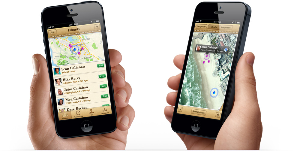
    I have personally compiled a “Warfighter GPS Equipment Database” over the last 10 years, since we have been at war in Iraq and Afghanistan. The database is comprised of more than 8000 entries from warfighters from all services, U.S. and allies alike. Only 1 in 40 warfighters utilize issued GPS MUE as a stand-alone handheld device, but every single warfighter (that’s 100 percent, a rare event in statistics) in the database proudly possessed and freely spoke about their own personal BYO-GPS device, with the majority of them being various iterations of a Garmin device, with Trimble devices and iPhones coming in a close second and third; although the iPhone and other smartphones are rapidly gaining ground on all the PNT devices in theater. So the bottom line is when it comes to BYOD, GPS is alive and well and has been for the last 23+ years with no end in sight.

    BYOD Here to Stay

    While thousands of warfighters have written me to say, “I love my Garmin, Trimble, iPhone, etc.” I do not have a single letter or email saying I love my PLGR or DAGR (precision lightweight and defense advanced GPS receivers or MUE). However, I will and must caveat my BYOD position by stating, as I always do, that while the PLGR and DAGR are, in my opinion, woefully inadequate as handheld PNT devices, they are extremely functional and sometimes the best/only option warfighters currently have as an embedded device, especially in a GPS-denied environment. Anything that improves on the display, battery life and user interface of the current GPS MUE is to be applauded.

    So to be clear, I would never advise a warfighter not to utilize the GPS MUE issued to them, but would certainly encourage them to have a backup or two. Fortunately that encouragement is totally superfluous as I have yet to meet a warfighter who did not have at least one civil/commercial PNT receiver as a backup, even in the cockpit. During a recent visit to a local firefighting C-130 squadron, the navigator utilized the on-board, original equipment MAGR GPS unit, a Trimble unit, Velcroed to the navigation console, and two laptops with different independent GPS capabilities, such as color real-time moving map displays, and the navigator had a BYOD Garmin in his flight suit pocket. QED!

    BYOD is here to stay!

    Let’s embrace the technology of the 21st century, stop asking if our warfighters, government employees and government contractors should be allowed to use their own PNT, computer and communication devices, and begin incorporating the smartest and best devices in the world into our networks and enterprise infrastructures. For all the hype to the contrary, there really is no alternative.

    Until next time, don’t forget to BYOD and happy navigating!


  • New Organization Advocates for GPS Industry

    A new group, the GPS Innovation Alliance, has formed and announced itself as the voice of the U.S. GPS industry and community of users, to “support the ever-increasing importance of GPS” in the U.S. capital, Washington, D.C.  The organization subsumes and replaces both the U.S. GPS Industry Council, an entity of longstanding, and the Coalition to Save Our GPS, which arose in March 2011 in response to a Federal Communications Commission (FCC) conditional waiver granted to LightSquared.

    The alliance appears to reflect a desire on the part of some industry members to take a more aggressive approach inside the Washington Beltway, a sign, it would seem, of the political times. Some of those involved spoke informally of a desire to take advantage of contacts made on Capitol Hill and in the media during the highly visible LightSquared combat, fought in the glare of media attention heretofore unknown in industry circles.

    Members of the Alliance are drawn from a variety of fields and businesses reliant on GPS, as well as leading manufacturers of GPS equipment. The former group includes, aviation, agriculture, construction, transportation, first responders, and surveying and mapping, and consumer organizations representing users of GPS for boating and other outdoor activities, and in automobiles, smartphones, and tablets.

    Joining John Deere, Garmin, and Trimble — three lead drivers of the Coalition effort at the FCC — are NovAtel Inc. and Topcon Positioning Systems. All five were previously long-time members of the USGIC, and they appear as founding members of the alliance at www.gpsalliance.org.

    Affiliate members listed on the website include the Association of Equipment Manufacturers, General Aviation Manufacturers Association, National Association of Manufacturers, Association for Unmanned Aerial Vehicles International, and Boat Owners Association of the United States.

    The alliance plans to build on “the proud heritage and extensive expertise of the United States GPS Industry Council (USGIC), which was formed in 1991 to promote broader commercial applications of GPS and to expand global markets while assisting in safeguarding the technology’s military advantages. The council has a long history of highly effective advocacy on behalf of the GPS industry, as well as serving as a trusted source of objective information for policy makers, the media and the public both in the U.S. and around the world.” The alliance website gives a longer statement about the history and record of the USGIC, highlighting its role in international negotiations.

    Michael Swiek, executive director of the USGIC, has transitioned to become the executive director, executive branch and international, of the Innovation Alliance. In addition to working closely with leading offices of executive branch departments of the U.S. government, he will continue well-established dialogs with governmental, private sector and academic entities in areas critical to GPS and satellite navigation among key players in Europe, Japan, Russia, Korea, China, and elsewhere.

    Heather Hennessey, a principal of Innovative Federal Strategies LLC, a “comprehensive government relations firm,” has taken the position of executive director, legislative, at the alliance. Hennessey has seven years of service in the House of Representatives, including two years as chief of staff for Congressman Jack Kingston of Georgia.

    An active voice in alliance representations on Capitol Hill will presumably be that of Jim Kirkland, vice president and general counsel for Trimble. Kirkland was the most prominent spokesperson for the coalition during the LightSquared battle, which appears to be either over or nearly so. “The alliance is committed to ensuring constructive, robust dialog between GPS users, manufacturers and policy makers on critical policy issues affecting GPS,” Kirkland said, “a commitment Trimble is pleased to be a part of as the industry continues to innovate and modernize.”

    The alliance mission statement cites the importance of GPS to global economy and infrastructure; vows to aid further GPS innovation, creativity and entrepreneurship; and to protect, promote and enhance the use of GPS.

    The GPS Innovation Alliance officially launched on February 13 with a reception on Capitol Hill, a traditional lobbying tactic that previous efforts had perhaps not envisioned.  The organization has also hired a public relations firm, Prism Public Affairs, and commissioned a logo.

  • Smartphone vs. Tablet vs. Desktop? It No Longer Matters

    Janice Partyka
    Janice Partyka

    The biggest mobile show, the Mobile World Congress, starts next week in Barcelona, Spain. It comes at an interesting time. Attendees will find it no longer makes sense to think about which device, or screen, is of primary importance to users. Google reports findings that 90 percent of users move sequentially between several screens (TV, phone, desktop computer and tablet) to accomplish tasks.

    Google, wanting to more fully exploit ad opportunities on all devices, has revamped AdWords to require that all ad campaigns include mobile. The GPS-based fitness watch market looks like it is on a steep curve upward, and feasible smartphone GPS watches are available. Rumor says Facebook is going to start tracking users’ locations at all times to be able to cull more ad revenue from individual’s preferences and geo life.

    Analytics firm Flurry tracked mobile app usage during the Super Bowl and found that overall app usage declined by less than 5 percent during the Super Bowl, compared to same time period on the prior Sunday. A large amount of consumers’ attention was spent in apps, even as they sat in front of their TVs on the biggest football day of the year. Surprisingly, app usage did not greatly differ between commercials and game play. Mobile app usage peaked during the game’s power outage and declined during Beyonce’s apparently riveting half-time show.

    Google Requires Mobile Advertising. Citing concerns that the shift from desktop to smartphones and tablets is damaging its bottom line, Google is revamping its AdWords advertising platform to integrate ad campaigns across all device screens. In fact, Google indicated that it will require all advertisers to pay for mobile ads even if they only wish to reach consumers on desktops. The revamp will allow customers to use contextual factors like location, time of day and device type to control integrated campaigns.

    Google provides an example of how a user’s location and device type could change the advertising message. “For example, a pizza restaurant probably wants to show one ad to someone searching for ‘pizza’ at 1 p.m. on their PC at work (perhaps a link to an online order form or menu), and a different ad to someone searching for ‘pizza’ at 8 p.m. on a smartphone a half-mile from the restaurant (perhaps a click-to-call phone number and restaurant locator),” reads Google’s blog.

    Will Apple Take Control of Your Wrist? Rumors continue that Apple will release a GPS-based fitness watch in 2013. Whether Apple enters the market or not, the GPS fitness market is huge and growing. The GPS fitness watch market is set to reach $1.07 billion in 2013, predicts ABI Research. Cellular connected GPS fitness watches like the I’m Watch may further speed this market. “There have already been unfounded rumors around Apple in 2013, so let’s wait and see. If an Apple watch did feature integrated GPS, it would no doubt significantly boost shipment forecasts in 2013,” asserts Dominique Bonte of ABI. Some start-ups in the GPS watch category have joined the action including Leikr, Pebble, Basis and others.

    Facebook Is Watching. Is it possible that the relationship between Facebook and Google can get even more tense? According to a Bloomberg article, Facebook is developing a smartphone application that will track the location of its users. The app is said to be scheduled for release by mid-March, and would run on handsets in the background even when the Facebook app or the phone isn’t open or in use. The location data would help Facebook capture more advertising revenue as ads can be more targeted with information about a user’s location and habits. The project is said to be headed by an ex-Googler and talent from Glancee and Gowalla, both of whom were purchased by Google.

    Privacy concerns with Facebook location tracking will undoubtedly be raised. Currently, Facebook records the GPS coordinates of users when they post status updates or photos from their phones, or check into a venue. Tracking users 24/7 is another thing. Facebook’s current location-sharing policy seems to cover them carte blanche. It allows the use of data “to serve you ads that might be more relevant,” and “to tell you and your friends about people or events nearby, or offer deals to you that you might be interested in.”

    Blackberry10-T_150x94Will Windows and BlackBerry Smartphones Succeed? Will there be a crack, even a tiny one, in the duopoly of iOS and Android? The biggest worry for Microsoft and BlackBerry is if initial sales of their smartphones are too small to excite developer interest. Without abundant applications, consumers won’t continue to buy these phones. ABI Research is predicting that the demand will be strong enough, and is forecasting a BlackBerry installed base of 20 million and Windows smartphone base of 45 million by year-end.

    Open Geospatial Consortium Location Standards for Next-Generation LBS.  The Open Geospatial Consortium (OGC) is having a free session and reception at the Mobile World Congress for mobile developers, location data providers, network operators and LBS service users. Attendees will learn the latest in open standards development. The event is being held on February 27, 2013 in Barcelona. Register for free.


  • Facebook to Roll out Location App

    Facebook to Roll out Location App

    Kevin Dennehy
    Kevin Dennehy

    There always is a lull in news between the Consumer Electronics Show and the Mobile World Congress, which is later this month in Barcelona. However, published reports that Facebook plans to launch a location application is big news. The social network giant, with more than 1 billion mobile users worldwide, could conceivably generate huge advertising revenue through the location-based friend-finder app. Facebook has a number of competitors, but with the sheer number of worldwide users, it has to make the industry take strong notice.

    Facebook to Roll Out Location Application for Mobile Users

    Facebook is attempting to grab a big piece of the mobile location market with a new app that will track users to perhaps boost mobile advertising sales.  The news, first reported by Bloomberg, indicates that Facebook is adding location features to perhaps take a chunk of profit from 1 billion mobile users who use the social network.

    The new feature, expected to be launched in March, will work with smartphones, even when the user is not using the application, according to the Bloomberg article.  This may raise some privacy hackles, as competing services have opt-in functions. In addition, some handset manufacturers and carriers require user opt-in as part of privacy agreements.

    Facebook already purchased two location companies in Glancee and Gowalla. Glancee is a location-tracking startup Facebook bought in May 2012. Gowalla, a location-based social network, was purchased in December 2011.

    Facebook Has Competitors in Location Market

    The new Facebook location app will be an answer to Google Latitude, which was launched in early 2009. Latitude, a feature for Google Maps, is an opt-in mobile app that allows users to see the location of friends and family, who also allow the service to track them. Google’s premise, four years ago when it launched Latitude, was that many users wonder where their friends and family are — and what they are doing.

    Because it is an opt-in service, Google said users could find out where a spouse was stuck in traffic on the way home from work, knowing when a loved one’s flight landed safely, or if a buddy was in town. Although it has been around for more than four years, Latitude was innovative with the concept that not only can you see friends on a map, but you can get in touch with them via SMS, Google Talk, gmail and  updating a status message.

    “While Google quietly improved its databases, tools and location services, most other players in the location industry were slipping further behind, apparently involved in a frenzy of disorganization prompted by a lack of skills in strategic planning,” said Mike Dobson, Telemapics president, in a recent interview.

    Another similar service, Find My Friends from Apple, runs on the iOS 5 operating system.  It is another location share service that attempts to allow users to find friends in real time, according to published reports.

    Apple needs to hit a home run in the location and mapping market. Last year, the controversy surrounding Apple Maps caused a shake up at the company and industry because of faulty map data. The incident made manufacturers realize that digital maps are a very important feature for smartphones. It also made many of these giant companies, who believe that location isn’t that big of a deal, sober up to the fact it is hard to make quality maps.

    A number of other companies are offering friend and family finder apps, namely Location Labs, Life360 and Loopt.

    Still, while such companies as Facebook, Apple and Google give away maps and navigation for free, which destroyed smaller companies and caused a huge consolidation of the industry starting in 2008, some believe that maps are too hard to produce for free. Some analysts, Dobson included, think that “free” maps and navigation services may not stay that way as consumers and enterprise customers demand better accuracy.

    Tablet Owners Spend More than Smartphone Buyers

    In advance of the Consumer Electronics Show, analysts were saying not only that flatscreen TVs sales were dropping, but the champion of the previous shows, the tablet, also was to see a downward trend. Not so, says ABI Research, which estimates nearly 200 million tablets shipped worldwide since 2009, with an additional 1 billion tablets forecast to ship over the next 5 years.

    What’s interesting, or not, depending on your location company’s strategy, is that ABI says 22 percent of users spend $50 or more per month and 9 percent spend $100 or more on purchases ordered from their tablets. That’s higher amounts than from even smartphones, the company says.

    As we reported last fall, the next edition of Amazon’s Kindle Fire tablet introduced mapping services in partnership with Nokia, which snubbed technology from Google, which is funny because its mobile operating system powers the platform. But it was an indicator of how much promise companies are still seeing in adding location-based services capability to tablets.

    In other LBS news:

    • Sense Networks released the results of a location-based mobile advertising campaign for Denver-based fast food chain Quiznos. The campaign, conducted in Portland, Oregon, placed ads on mobile devices of people 18-34, who eat at competing, and similar, restaurants such as Subway. The company said Quiznos had a 20 percent gain in coupon redemptions.
    • TeleCommunication Systems, Inc. (TCS) is providing map, local search, location services and navigation applications for the new BlackBerry 10 smartphone. The TCS-based mapping application will ship with the new smartphones, which are scheduled to roll out in mid-March. TCS’ APIs are also available for Blackberry 10 developers. This leads many in the industry to believe that if this smartphone is a much-needed home run for Research in Motion, the TCS partnership could be a big deal.
    • Locaid plans to provide GTECH with secure mobile location, IP location and other LBS to include geofencing and location authentication. What’s cool about this deal is GTECH designs and sells lottery technology. Its service includes a geo-complaince engine that ensures a mobile or Internet-connected device is within state lines.

    If you have news, or tips, or gossip, please contact me at [email protected].  The Mobile World Congress in Barcelona is coming up this month, so get me your story ideas and product news.


  • Why the Price of Precision Receivers Will Drop

    Why the Price of Precision Receivers Will Drop

    Eric Gakstatter
    Eric Gakstatter

    For quite some time, I’ve been writing in GPS World magazine and speaking at conferences about the declining prices of high-precision GNSS receivers and how the cost of high-precision data (especially vertical) is going to decline substantially. For my colleagues in Asia, Africa, Europe, and South America, you’ve already seen this. Dual-frequency, multi-constellation GNSS receiver prices in those areas are significantly lower than in the United States and Canada.

    Previously, I’ve presented to you that I think dual-frequency (L1/L5), dual-constellation (GPS/Galileo) GNSS receivers will be  inexpensive in the future. My reasoning, simply, is that L5 is an open signal (legacy L2 is not) and supported by both GPS and Galileo. Furthermore, both GPS and Galileo use a CDMA radio technology, so designing a GPS/Galileo receiver is a heck of a lot easier than a GPS/GLONASS receiver. Therefore, unlike today’s GNSS receiver competitive landscape of only a dozen or so manufacturers of high-precision GNSS receivers, there will be dozensssss (emphasis on s) and maybe hundreds of high-precision GNSS receiver manufacturers, based on oodles of L1/L5 GNSS chipsets that are sure to come.

    Will all GNSS chipset designers decide to expend the extra energy it takes to optimize their chipset for RTK FIX or Float solution? No, but certainly there will be “boutique” GNSS chip designers that will specialize in high-precision designs. It likely won’t be the companies selling a $3 GNSS chip to Apple or Samsung  today. Those companies rely on selling tens (or hundreds) of millions of GNSS chips per year. I’m talking about companies that can survive on selling hundreds of thousands of high-precision GNSS chipsets for $50-100 each.

    However, Galileo is still at least two years from a minimal usable constellation and the GPS operator, the U.S. Air Force, is in no hurry to launch GPS satellites with new capabilities (for example, L5) — so low-cost, high-precision GNSS chipsets are still a couple of years away. If this is the case, then why are high-precision GNSS receiver prices declining in some areas today?

    As I mentioned before, our colleagues in Asia, Africa, Europe, and South America are already seeing lower-cost high-precision GNSS receivers. There are brands offered in those geographic regions that aren’t known (or are very little known) in the U.S. and Canada. Brands like Stonex, FOIF, BHCNav, CHCNav, and others market themselves outside of the U.S. and Canadian markets, but not much in the United States or Canada. The increased competition in those foreign markets has driven high-precision GNSS prices down.

    Intergeo2012_eric1
    The CHC booth at Intergeo 2012.

    The reason high-precision GNSS prices are still high in the U.S. and Canadian markets are because it’s still primarily a Trimble, Leica, Topcon game. Yes, there are other brands like Ashtech/Spectra-Precision, SXBlue, Javad, Sokkia, Hemisphere, Altus, and Navcom, that may offer entry-level entry points, but the Big Three still dominate the U.S. and Canadian markets, partly because of their broader product lines and mostly because they have the best network of dealers. Differing from the others in this mix is Navcom, a subsidiary of John Deere & Co. Navcom’s GNSS technology is distributed by Deere & Co, and is focused almost exclusively on the agriculture market.

    In the United States and Canada, high-precision GNSS receiver users are still willing to pay a premium for leading brand-name products and their dealer networks. You might think that there’s a lot of price pressure from the other brands. There is some, but some of the other brands are owned by the big boys. Trimble owns Spectra-Precision and Ashtech. Topcon owns Sokkia.

    Intergeo2012_eric3
    Spectra Precision (here at Intergeo 2012) is owned by Trimble.

    For there to be serious price movement in the United States and Canada as there has been in other areas of the world requires more competition. I think we’re going to start to see more of that.

    I know you don’t want to hear this, but the competition for high-precision GNSS receivers is coming from China — and it’s serious competition. Chinese GNSS receiver manufacturers are already well-established in Africa, Europe, and Asia (of course). Their high-precision GNSS gear is coming soon to a place near you.

    CHCX91What exactly is a Chinese-made GNSS receiver? Mostly, they are receivers made using the guts (GNSS receiver boards) from mainstream GNSS receiver designers like Trimble, Topcon, NovAtel, and Hemisphere. The Chinese companies buy these receiver boards and design their own cases, battery packs, and other supporting systems around the GNSS receiver board. The finished products, like the CHCNav X91, look much like what you see from Trimble/Topcon/Leica today, and it sports a Trimble or Novatel GNSS receiver inside, for fraction of the price you’ll pay for the equivalent Trimble GNSS receiver.

    Of course, you wouldn’t benefit from Trimble (or whomever) dealer network support, and you would be risking that the manufacturer has designed a reliable system around the GNSS receiver board. What happens if the receiver needs service? Where’s the nearest support center? Who do you call? These are all very valid questions that any prudent businessperson would ask themself before making a significant equipment purchase.

    Some of the Chinese manufacturers rely on low price to attract your attention and then offer minimal customer support. Others, like CHCNav, are addressing this by setting up regional centers around the globe for support and repair. Can they produce high-quality GNSS products that will meet the expectations of U.S. and Canadian buyers? The reputation of Chinese manufactured products in the surveying market is not very good. Will they have the staying power to hang on for a few years, long enough to gain the confidence of U.S. and Canadian users?

    In their favor is their home market. China is the largest consumer of high-precision GNSS receivers in the world. In fact, it’s been said that more high-precision receivers are sold in China than in the rest of the world combined. Even if that’s not an accurate statement, it’s not incorrect by very much. That tells you something about the size of the Chinese market for high-precision receivers. With a market that size, I think it’s safe to say that Chinese receiver manufacturers are gaining a lot of experience in designing and manufacturing GNSS receivers, and one can assume that the next-generation receiver design is better than the previous one.

    While they haven’t quite ventured into offering their own GNSS receiver designs (still buying GNSS receiver “guts” from established manufacturers), last week one Chinese manufacturer took a step closer to doing so. On January 31, Hemisphere GPS announced that Beijing UniStrong Science & Technology Co Ltd. is acquiring Hemisphere’s core GPS design/manufacturing business. Hemisphere has chosen to divest itself of all non-agriculture related businesses and rename the company AgJunction, the same name as a software company it acquired recently. Of course, GNSS technology is highly related to agriculture, and there’s no doubt that AgJunction will continue to use GNSS technology, but clearly the AgJunction management team doesn’t think it’s an important enough technology to have to own it.

    UniStrong is no stranger to the GPS/GNSS business and is no small fry. It’s been in business since the mid-1990s and boasts more than 1,000 employees, offering a wide variety of high-precision GPS/GNSS receiver solutions from handheld GIS receivers to full-blown RTK GNSS receivers. With this acquisition (US $15 million), it becomes the first Chinese-owned GNSS receiver design/manufacturing group in North America.

    Thanks, and see you next time.
    Follow me on Twitter.

    Intergeo2012_eric2
    Navcom, a subsidiary of John Deere, focuses on the ag market.
  • Expert Advice: BeiDou, How Things Have Changed

    John Lavrakas
    John Lavrakas
    Economically, the System Differs Significantly from Its GNSS Cousins

    John W. Lavrakas

    In May 2007, I authored an article in GPS World looking ten years into the future and envisioning how the GNSS field would operate at that then-distant time. Reviewing my assessments, I see that I was both accurate and wide of the mark with my predictions.

    The prediction that has proved accurate was that the GNSS world would be hybrid, with no one system as the sole provider of satellite-based positioning and timing services. This was hardly a risky prediction. Most in the GNSS community would have come to the same assessment.

    But what I did not see coming were the advances China would take with its BeiDou program. My original assessment was based on three GNSSs only: GPS, GLONASS, and Galileo, and did not include BeiDou.

    When I did my analysis in 2006, China was pretty quiet on BeiDou: no technical descriptions, no interface control document (ICD); no presentations at conferences of the Institute of Navigation. What little we knew about BeiDou was that it was a limited system, offering at best a regional solution. The original design was an active system using geosynchronous satellites, requiring each remote unit to request position from the satellite, which was calculated and sent back to the remote station.

    How things have changed.

    Since 2007, China has reshaped the BeiDou concept into a full-fledged modern GNSS, offering CDMA codes, navigation messages, and data rates comparable to GPS and Galileo — and lots of satellites. The ICD states in section 3.1, “When fully deployed, the space constellation of BDS consists of five geostationary Earth-orbit (GEO) satellites, twenty-seven medium Earth-orbit (MEO) satellites, and three inclined geosynchronous satellite orbit (IGSO) satellites.” No dates are provided, however, regarding attaining these numbers. So the BeiDou system promises to be on par with the other GNSSs.

    Why does this matter?

    While technically the BeiDou system resembles its cousins, economically it presents quite a different animal. Unlike other nations offering GNSS, China has a huge capacity for manufacturing at low cost. Considering this situation from a business perspective, a possible scenario could be that China offers GNSS chipsets that operate with BeiDou (either solely or as a hybrid with another GNSS)at extremely low prices. In doing so, China could corner the market for general purpose LBS applications (setting aside specialty receivers, such as for surveying and aviation applications). The price point would be so attractive that LBS services would employ Chinese devices in preference to the GPS ones, much like consumers purchase television sets: most come from China, and none are made in the United States any more.

    China offers something, then, in this scenario that neither Russia, Europe, nor the United States can currently match. This may not be the scenario that eventually occurs, but it is possible. Other factors such as local terrestrial PNT solutions and dual-frequency improvements will come into play, but what I have described is one possible scenario. While the signal is free, the equipment is not, and when we are talking about a billion or more installations, cost is going to be a big driver.

    Am I going out on a limb and saying that BeiDou will be the system of choice in another ten years or so? No, I would not go this far.

    But I do say that serious competition for GNSS users (read “market share”) is now in play. Further, it is important for each GNSS operator to recognize this as they consider the services and features they choose to offer, and the impact these have in capturing their share of the market. GNSS providers now must factor the business aspect of their services as much as the technical, scientific, or safety of life. The U.S. government, for one, has gotten a bit complacent in upgrading GPS services to meet user needs, operating from a basis that it is the only GNSS on the block. It could wake up one day and find this no longer to be the case.


    John Lavrakas is president of Advanced Research Corporation, where he provides consulting services on satellite navigation and fishery information systems. He has spent 32 years in GPS, supporting development of the GPS Control Segment, GPS user equipment, GPS performance analysis capabilities, and developing and marketing location-based systems. He is past president of the Institute of Navigation and an ION Fellow.

  • Out in Front: Stand By to Capsize

    We have reached our tipping point, say the seven U.S. military Joint Chiefs of Staff in a January 14 letter to Senator Carl Levin, chairman of the U.S. Senate Committee on Armed Services.

    “We are on the brink of creating a hollow force,” they continue. By this they mean that the military of the size that they are required to maintain may be incapable of performing the duties for which it is relied upon.

    This sounds a great deal like the scenario forecast in Don Jewell’s “2C or Not 2C” column in this magazine. Five GPS satellites currently on orbit have the capability of broadcasting new signals essential to security and economic growth. But that capability is hollow because of a lack of — what? money? resolve? back-up? — to turn it on and use it. Those satellites could actually die in a couple of decades without ever performing the function for which they were designed.

    The hollow-force concept as applied to the GPS constellation reverberates eerily through John Lavrakas’ “BeiDou, How Things Have Changed” piece in this issue. If GNSS matters continue developing along the same paths they follow now, the hierarchy of satnav systems, by user numbers, market share, health, robustness, economic viability, yea even unto military prowess, may well shift.

    The uncertain fiscal year 2013 funding caused by the combined effects of a possible year-long Continuing Resolution in the U.S. Congress and radical budget surgery known as sequestration currently has military chiefs directing severe reductions to operation and maintenance spending.
    Operations and maintenance keep satellites flying.

    “Our proposed near-term actions,” write the civilian Secretary of the Air Force and the U.S.A.F. General Chief of Staff, “include . . . defer[ring] non-emergency Facilities Sustainment, Restoration, and Modernization  (FSRM) projects, resulting in a reduction of roughly 50 percent in FSRM spending; where practical, de-obligat[ing]/incrementally fund[ing] contracts to encompass only FY13.”

    Modernization will (or would) keep GPS apace with user requirements, growing security needs, and an increasingly digital world. Incremental funding has delayed new signals and new capabilities time and again; sounds like it’s set to do more.

    “For now, and to the extent possible, any actions taken must be reversible at a later date in the event that Congress acts to remove the risks I have described,” writes Ashton Carter, Deputy Secretary of Defense, to nearly every one under the sun connected with the military and money.

    When is decay reversible? The notion of a tipping point is that, once passed, it cannot be re-crossed again in the opposite direction. Neither the status quo nor stability can be restored.

    Many of us in the private sector have gone through successive rounds of cutbacks and lay-offs. Such measures first trim away the fat. This can be healthy, to some extent, although fat stores energy for later use. Then they start slicing into muscle. This reduces the ability to function. Finally, in many cases, they take a hacksaw to the bones. This not only cripples the organism, it effectively destroys it.

  • Report from ION ITM: Faster, Smaller, Cheaper

    And more of them!

    That’s been one of the mantras — a controversial one, granted — of technological advance in the late 20th and early 21st centuries. It has succeeded in penetrating the global positioning, navigation, and timing vanguard, as evidenced by a handful of key presentations on the first day of the Institute of Navigation (ION) International Technical Meeting in San Diego on Monday.

    Skybox Imaging, a company that is “passionate about bringing Moore’s Law to space via disruptive microsatellite technology, rapid development cycles, and a scalable web-based delivery platform,” spoke to the ION ITM plenary session in the person of Ronny Votel, an engineer leading the company’s guidance, navigation and control division. Skybox’s goal is to provide “easy access to reliable and frequent high-resolution images . . . through a “constellation of imaging microsatellites delivering high-resolution imagery of any spot on Earth multiple times per day.”

    To achieve that goal, Skybox is developing a low-cost imaging satellite system:

    • design life of the satellites, 3 years;
    • size of the satellites, a mini-fridge;
    • size of the constellation, in the tens.

    Skybox will pair that flying system with web-accessible big data processing platform to capture video or images of any location on Earth within a couple of days — an unheard of delivery turnaround in the current global imaging industry, unless you happen to be a government (as in central, high, federal, perhaps military) customer.

    The low-cost nature of the satellite opens the possibility of deploying tens of satellites which, when integrated together, have the potential to image any spot on Earth within an hour. Votel several times made the analogy in his talk of using an iPhone camera to capture desired imagery, and indeed that could be a next logical step in FBC development: just throw a bunch of camera phones up into orbit.

    Skybox expects to launch its first two satellites later this year.

    In April of last year, Wired published a fascinating history and analysis: “Smaller, Quicker, Secret, Robotic: Inside America’s New Space Force.” Between Between 1992 and 1999, the U.S. National Aeronautics and Space Administration (NASA) launched 16 faster, smaller, cheaper missions, including Mars probes and space telescopes. Ten missions succeeded; six failed. Analysts declared the initiative a failure, and to a large extent it has been forsaken. Recent public writings, though, show second thinking. “I would like to respectfully suggest that success-per-dollar is a more meaningful measurement of achievement than success per-attempt,” stated one Air Force lieutenant colonel in a treatise on program management lessons from NASA.

    Could such an approach work for GNSS satellites, some of which are burdened with extraneous non-PNT payloads that make them far from FSC? Time will tell the wiser.

    Microtechnology

    In that FSC vein, at one of the afternoon’s technical sessions, Andrei Shkel of UC-Irvine had been scheduled to deliver a paper on “Precision Navigation and Timing Enabled by Microtechnology,” but apparently something came up and he was not able to appear. I had looked forward very much to what I anticipated would be an update to his September 2011 article in GPS World, “Microtechnology Comes of Age,” which was itself an update to a plenary talk he gave at ION ITM back in 2011. For now, that article will have satisfy us.

    Other presentations in the same MEMS, atomic clock, and MicroPNT session:

    Michael Bulatowicz of Northrop Grumman talked about a DARPA-backed project, the nuclear magnetic resonance (NMR) gyroscope. Northrop’s development and research has shown a viable solution to producing a small (size of a U.S. quarter coin) low-power navigation grade gyro using non-vibratory technology. The company has produced two prototypes and is at work on two more. Feed the NMR gyro into Shkel’s work and who knows what you’ll get in terms of FBC PNT? Well, maybe not cheaper in the immediate future. Bulatowicz said that as an assembled device he expected its cost, at least initially, to be substantially higher than MEMS technology.

    Richard Waters of Lumedyne Technologies spoke on next-generation MEMS inertial sensors with white-noise characteristics, a new paradigm based on time-domain switching for how MEMS sensors might work. TDS inertial sensors provide some key benefits: a purely digital approach, recalibration due to bias drift is not required, output is independent of oscillator conditions. Power is low, less than 1 millwatt. The device demonstrated switch stability under static conditions to –170 db. The same TDS concept can also be applied to a mechanical gyro.

    QZSS

    In other ION ITM first-day news, H. Tokura of the Tokyo University of Marine Science and Technology talked about “The Possibility of Precise Automobile Navigatin using GPS/QZS and Galileo E5 Pseudoranges.” Currently, research and prototype automobile high-precision PNT is done with real-time kinematic (RTK) networks, but this has some disadvantages, as discussed in an article by authors from the University of Nottingham, UK, in the February issue of GPS World.

    Japan’s QZSS now broadcasts L5 signals. Japan has essentially leapfrogged the United States, since the L5 signals with full CNAV message is already broadcast by satellite QZSS-1. Currently, three U.S. GPS satellites are L5 CNAV-capable, but none are broadcasting such a signal.

    Tokura showed results demonstrating that pseudorange observables from L5 are basically robust enough for this task. Further investigation for L5 is required because manufacturers are still developing the tracing technique for the new L5 signal. A software-defined receiver is indicated for usage.

    Hideki Yamada of Japan’s Electronic Navigation Research Institute spoke about the possibility of using only the QZSS constellation, “in case of GPS failure,” for RTK positioning in precision ag and machine control, with 4 to 7 QZSS satellites that could be launched in a future version of the constellation. QZSS has been shown to provide 10-meter accuracy in absence of GPS; now the research looks at an RTK method.

    With only one satellite in orbit, RTK-QZSS cannot be tested in the field. The researchers simulated a fuller constellation by using QZS-1, Multifunctional Transport Satellites (MTSAT), a set of geostationary weather and aviation control satellites, and GPS signals. Using a JAVAD Alpha receiver, Trimble and NovAtel antennas, they obtained results with low multipath error (about 30 centimeters) in a Tokyo environment. Multi-epoch processing is necessary for RTK-QZSS. This solution can work well as a minimum backup system of high-precision position under relatively moderate DOP condition.

    __________________

    Living may be easy, dying may be hard. But I’m wide awake, staying up late, sending my regards.

  • GIS and the World 2013: No Worries, or Is the Sky Falling?

    Art Kalinski
    Art Kalinski

    Talking to GIS managers over the past several months, I’ve heard a lot of hand wringing from many regarding the future and I share much of the concern. We seem to be at loggerheads on the budget or lack thereof, taxes, energy, gun control and many other issues that make optimism difficult to maintain. For those of you that haven’t faced lean budgets, the next few years may get difficult. GIS operations are especially vulnerable since many politicians don’t really understand “that technical stuff” like GIS, and that GIS doesn’t cost money — it saves money, and even more important, it saves lives.

    There is a general misconception among non-GIS people and politicians that we don’t need our own geospatial operation, we can just use Google. In some cases, like planning a trip, that may be true, but for many of your organizations that may not be enough. One example that struck close to home when I was the GIS manager for the Atlanta Regional Commission (ARC) was a failed drug raid in one of our counties. The drug dealers were clever enough to switch house numbers with the house next door. When the SWAT team raided the wrong house, based only on Google Maps and the house number, the resulting lawsuit of the innocent family cost the county thousands even though no one was hurt.

    People have to be educated that Google’s key purpose is to drive traffic to its website and sell advertising. Google is not intended to be an authoritative source, and reading the terms of use, one finds special Federal Use Restrictions and “FAR and DFARS provisions.” Google is intended for “planning purposes only” and “makes no representations or warranties regarding the accuracy or completeness of any content.”

    Many of you are involved in creating the content that others, including Google, use. Google uses data from more than 12 federal agencies and augments them with commercial data. However, only your staff can determine your exposure to inappropriate use or incomplete data. At ARC, we spent considerable effort constantly updating our street base so planners and 911 call centers had the latest data. Many of those updates took over a year to make to Google Maps.

    I learned through countless budget and reorganization battles that you have to be prepared with hard numbers, data and documentation to back up your position. There is nothing more gratifying than to pull out a stack of documents that completely shuts down your opponent’s unsubstantiated “opinion” during one of these battles. But this takes forethought and preparation. GIS professionals must constantly work to build data that shows a “return on investment (ROI).” ROI may be a common concept in the business world, but it’s not used as frequently in government service. We need to be ready at all times to show in real terms how GIS impacts our organization and how it helps improve efficiency. The easiest way is to accumulate and remember needed documentation, to collect it as you operate day to day by placing emails or other information into a physical or electronic drawer. That way you can pull out needed documentation on short notice and not miss key points.

    As depressing as this potential damage control may sound, I’m very optimistic long term for the country, the planet and GIS. The real numbers seem to fly in the face of the “doom and gloom media” who only sell content covering plane crashes rather than successful landings. Recently John Stossel had a program in which he featured the noted author Matt Ridley who introduced his newest book, The Rational Optimist. Reading his book I was very encouraged by his research. Put in a nutshell, he cites that despite the depressing picture painted by the media, life is better for more people than it has ever been in history. Inflation-adjusted prices for goods and services are lower in all categories with the exception of health care and education. In his analysis he uses labor as cost measure. In the 1900s, an average person spent 76 percent of his income on food, clothing and shelter. In 2012 that number is down to 37 percent. That means more disposable income for fun stuff.

    The environment is generally cleaner and life expectancies continue to rise. The chance of a world citizen dying in a war, disease or famine continues to fall. As a senior citizen I can confirm many of his points through personal experience and observations. Take transportation: In 1960, gas was 32 cents a gallon and my dad bought a brand new fully loaded Chevy Impala for a whopping price of $3,000. Today, both are 10 times higher but so are salaries. With regard to the environment, in 1950 I remember my mother having to scrub my dad’s white shirt collars and cuffs after only a few hours of wear in a coal-dust and soot-infused Chicago atmosphere. I know of no U.S. city that dirty today. When I was Naval Officer on a destroyer going through a 1974 overhaul in Brooklyn, New York, my sailors would have daily wagers as to the number, type and size of sewage objects that would float past the ship as they worked. Two years ago when I was in New York near the East River, I was surprised at the clarity to a depth of several feet of that same water.

    Note this dramatic photo from the New York City Municipal Archive of Grand Central Station taken in 1930. It’s a beautiful photo, but it also shows the heavy particulates in the 1930 air reflecting the sunlight.

    We in the GIS community can point with pride to the work we’ve done to make life better for everyone. When I was building street center-line files in the early 90s, I never dreamed that those simple files combined with GPS and cell-phone technology would be providing me with surprisingly accurate maps and imagery, including street level photos and turn-by-turn voice navigation, all delivered to my small cell phone. I no longer struggle with phone books and maps trying to find businesses. I just talk into my smartphone to get phone numbers and least cost routing, including traffic jam avoidance to businesses. It would be interesting to calculate how much fuel the GIS community has saved FedEx, UPS or public schools running a fleet of buses with optimal routing.

    Google Earth has become a universal tool to find what you need along with directions, user opinions and alternate choices. I no longer go anywhere without reviewing the route, business hours and imagery. Today, buying a home and learning about neighborhoods, prices, schools, transportation is a breeze compared to 20 years ago. Regional planning including environment, agriculture and providing county services has been significantly helped with GIS. Just consider the effectiveness of police and fire responding to 911 calls.

    The intelligence community has moved from analysis of static low-resolution ortho imagery to integration of multiple imagery, full motion video and incorporation of “big data” / social media to create pattern-of-life analysis. We can only speculate how many lives have been saved with this advanced intelligence and how the technology will evolve and improve over the next 10 years.

    And that was the key point of Ridley’s book. That it takes a collective human intelligence and division of labor to raise the standard of living for all citizens. He used as an example a simple computer mouse. That small device that you are probably holding in your hand is the result of the intelligence and work of thousands of people ranging from the oil rig workers getting the oil to make the plastic, to mathematicians, engineers and chemist to design the parts and create the IC chips, to assembly-line workers putting the parts together, to a ship’s crew, truckers and retailer that got it to you and all that at a price of only a few dollars. Imagine building one from scratch with no outside assistance.

    Even more amazing is how fast the learning curve has become. In just a few decades we’ve made more progress than the previous 50,000 years and the curve seems to be increasing. GIS has been part of that process and I look forward to an even better decade ahead.

    I’m going to attend the ESRI Federal User’s Conference Feb 25-27.  Please introduce yourself if you see me (my bald head is easy to spot) and let me know how we can improve our publications.

  • From LightSquared to Narrowbanding: What’s Coming in 2013

    After a four-month sabbatical and the GPS World servers back in order, I’m back writing on a regular basis. I’ve been super busy on different GPS/GNSS-related products, conferences and various GPS/GNSS applications.

    Let’s take a look at some of the technologies and events that were significant in 2012 and some that will be significant in 2013 for high-precision GNSS users.

    LightSquared

    House Representative Anna Eshoo, ranking member on the House Subcommittee on Communications and Technology, who in September 2011 wrote to the NTIA’s Larry Strickland asking Strickland to find a way for LightSquared and GPS to coexist, said it best a year later (November 2012):

    “What happened to LightSquared is disappointing, but unfortunately that ship has sailed.”

    Now all that’s left are negotiations regarding GNSS receiver standards and/or a frequency guard band around GPS L1, both of which are moving at a snail’s pace. Regardless, you can bet that GNSS receiver designers are taking this experience to heart and tightening up their filtering as much as possible. The more difficult problem to solve is the augmentation services offered in the MSS band (such as Trimble’s OmniSTAR, Deere’s Starfire and just-introduced Terrastar), all of which broadcast their correction signals in the MSS band at low-power satcom power levels (as opposed to high-power terrestrial power levels).

    You can pretty much dismiss the LightSquared-proposed spectrum sharing proposal from last fall. It’s just another desperate move from a desperate company. If you have a few minutes, you can listen to the NSPS (formerly ASCM) Radio Hour show I participated in on October 8, 2012, where we discuss this issue.

    FCC UHF/VHF Narrowbanding Rule

    Hidden behind the LightSquared issue over the past two years has been the FCC narrow-banding ruling that took effect on January 1, 2013. Initially adopted in 1995, the narrowbanding ruling has been around for a number of years. In fact, equipment suppliers have been required to offer narrowbanded (12.5kHz vs. 25kHz spacing) radios since 1997. In 2004, the FCC set the January 1, 2013 deadline for users to comply.

    The FCC’s webpage on the narrowbanding ruling shed some light on the rationale behind it, but narrowbanding doesn’t specifically target RTK users so there’s not any RTK-specific information contained in the FCC documents. The bottom line is that the FCC is trying to allow more users in the same spectrum, similar to trying to fit more cars on a highway by splitting lanes in two. The problem with this, from a user standpoint, is that some vehicles won’t fit in the new, narrower lanes and therefore aren’t legal to use any longer. That’s the case with most UHF/VHF RTK base stations.

    To be clear, the narrowbanding ruling doesn’t affect UHF/VHF radios on your rover (receiving radio) GPS/GNSS receiver. I’m talking about the base station UHF/VHF radio. The ruling states that your UHF/VHF base station radio must be able to broadcast at 12.5kHz vs. 25kHz, essentially utilizing half the spectrum. Your UHF/VHF base radio can still broadcast at 25kHz if it broadcasts at 19,200 baud. Since January 1, 2013, it is illegal to broadcast at 4,800 or 9,600 using 25kHz spacing. The reality is that it becomes complicated when trying to broadcast at 19,200 baud at 25kHz spacing. Radio range is reduced and communication protocols (compatibility) become an issue. The reality is that you’ll likely need to replace your UHF/VHF base radio in order to stay compliant with the FCC rules.

    Just a few weeks ago (January 7, 2013), I was a guest on the NSPS Radio Hour to discuss the FCC narrowbanding rule. I invited Charlie Branch from Pacific Crest Corporation, a major supplier of VHF/UHF radios for RTK users, and Mark Silver from IGAGE Corp, a Pacific Crest dealer, to discuss their thoughts on the FCC narrowbanding rule and their experience with equipment compatibility. It is a great discussion on the subject and well worth listening to if you’re interested in learning more about the narrowbanding rule and how it affects RTK users.

    Lastly, you might also be interested in this presentation from Charlie Branch on the FCC narrowbanding rule.

    S-20203-P-Navigating-the-FCC's-Narrowbanding-Requirement-1-W

    Low-Cost RTK Receivers

    At the GPS World dinner during the Institute of Navigation GNSS conference last September, Dr. Todd Humphreys predicted that RTK GNSS would be available in mobile phones by the year 2020. As I’ve written before, the challenge with this is not really the quality of the GPS receiver used in mobile phones (some of the key engineers at Broadcomm, who supply the GNSS chip to Apple, used to design RTK receivers at Ashtech), but rather the poor quality antennas that mobile phone designers choose to use. Instead of RTK inside the mobile phone, I think small RTK “pucks,” a few inches in diameter, are more practical and realistic and will become common and easily interfaced to mobile phones (or other mobile devices) via Bluetooth. I think you will start seeing these within the next three years.

    Galileo

    With four Galileo IOV (in-orbit validation) test satellites in orbit that will be converted to operational satellites, Europe’s Galileo is on its way to becoming a viable satellite navigation system for high-precision apps. Launch of production satellites is scheduled to begin later this year and scheduled to occur every three months, launching in pairs. With an aggressive launch schedule, 18 satellites are predicted to be in orbit by the end of 2015, a little more than two years from now.

    I’m very bullish on Galileo because, like GPS, it supports the new L5 signal, which will lead to less expensive dual-frequency, dual-constellation receivers. It’s clear that the European Union is committed to Galileo, and it would be difficult for them to shut down the project after advancing as far as they have.

    GPS Modernization

    Modernizing GPS, on the other hand, is moving very slowly. Galileo already has more L5-capable satellites in orbit than GPS. My 2010 prediction that 18 Galileo satellites and 12 GPS satellites would provide the high-precision user community with a full 30-satellite constellation broadcasting L1/L5 signals by 2015 may not materialize. However, the weak link might end up being delays with the GPS program rather than a lack of commitment from the European Union with its Galileo program.

    Last August at a CGSIC (Civil GPS Service Interface Committee) meeting, I heard rumblings of three GPS launches this year (2013). Sadly, I don’t think this is going to materialize. I think we’re on pace for a single launch this year, again. Budget, launch pad scheduling and a healthy GPS constellation continue to be the culprits.

    There’s also a bit of second-guessing happening with respect to GPS signals. Earlier this month, Don Jewell wrote a piece entitled “2C or not 2C: An Important Signal Question.” While the delay in launching next-generation GPS satellites may have saved the U.S. government some money, I think it has put the L2C signal in peril. There were high hopes for L2C, as the second civil GPS signal, when it was conceived in the 1990s. But it’s been seven long years since the signal was deployed on the first GPS II-RM satellite in 2005, and there are only a total of 10 GPS satellites broadcasting L2C today. That’s not enough, and it’s hard for receiver manufacturers and the civilian user community to take L2C seriously when it appears the U.S. government is not taking it seriously.

    Some sort of positive traction with L2C must happen soon, or it will risk being ignored as it is overtaken by the new L5 signal that is supported by up-and-coming GNSS like Galileo and Compass/BeiDou.

    UAVs (Unmanned Aerial Vehicles)

    The United States is the last major geographic region (that I’m aware of) where UAVs are illegal to use by commercial entities. Service companies in other countries are going crazy with UAVs in offering mapping services (for instance, in mining and agriculture). The Federal Aviation Administration (FAA) is working on establishing rules by 2015 that will allow commercial entities to utilize UAVs in the U.S. This will turn the market for digital mapping imagery upside down. It will become very easy and inexpensive for people to obtain quick-n-dirty imagery for mapping purposes with a very quick turnaround.

    Thanks, and see you next month.

    Follow me on Twitter at https://twitter.com/GPSGIS_Eric