Category: Receivers

  • Quantum Spatial lidar surveys provide volcano eruption insights

    Looking southwest towards Leilani Estates with Fissure 8 erupting in the background. (Image: Ron Chapple/GEO 1)
    Looking southwest towards Leilani Estates with Fissure 8 erupting in the background. (Image: Ron Chapple/GEO 1)

    High-resolution lidar surveys help first responders, scientists and government agencies monitor Kilauea conditions and predict future lava flows.

    Independent geospatial data firm Quantum Spatial Inc. (QSI) has conducted high-resolution lidar surveys of areas surrounding the Kilauea volcano eruption in Hawaii.

    The emergency response effort was part of the U.S. Geological Survey’s (USGS) Rapid Response Imagery Products (RRIP) in support of the Kilauea’s 2018 East Rift Zone – Remote Sensing Acquisition Requirement.

    The USGS Hawaiian Volcano Observatory (HVO), along with emergency responders, government agencies and academics, will use the data to better understand the conditions and characteristics of the Kilauea volcano, which has been continually erupting since May 3.

    Data also will assist planners in modeling potential lava flows, which may better predict and respond to future flows and enhance safety of residents.

    The USGS National Geospatial Program (NGP) selected QSI to perform the first of two planned surveys over the active volcanic area. The QSI team, which included GEO1 and Windward Aviation, deployed within days to acquire high-resolution lidar at point densities averaging from 40 to 80 ppsm, with up to 150 ppsm in select areas and 100-mp digital imagery using a Riegl dual VUX-1 LR sensor pod equipped with ABGPS/IMU mounted on a Hughes 500D helicopter.

    Five distinct locations, covering an area of 57 square miles, were targeted:

    • Kīlauea Summit Caldera
    • Pu’u O’o Crater and flow
    • Chain of Craters Road / Kaoe
    • Puna Geothermal Venture (PGV)
    • Western Leilani Estates lava field.

    The project required 11 missions over the course of six days, operating at times as low as 500 feet above the ground and above active flows and nearby erupting calderas. With a need for a quick turn around, QSI deployed an analyst with the flight crew to post process each mission within hours of collection.

    The data was uploaded to the Geospatial Repository and Data Management System (GRiD) interface, developed by the U.S. Army Corps of Engineers (USACE), where additional data products have been developed and provided to the response team that includes FEMA, Hawaii’s Emergency Operations Center (EOC) and the Hawaii County Civil Defense.

    After data collection, QSI measured topographic shifts during the processing by comparing new data with a 2011 lidar collection from the same area. Survey specialists and USGS experts confirmed within hours of processing QSI’s lidar data that areas within the site had shifted up to 1.5 meters east, 2 meters to the north and 1 meter in elevation.

    USGS scientists will continue to examine the new topographic data to better understand the nature of these shifts, and integrate it into lava flow models for more accurate predictive modeling.

    “Airborne lidar and imagery remote sensing surveys are invaluable tools for understanding the effects of active volcanic eruptions, which change the topography as fissures emerge and lava flows extend to the ocean,” said Michael Shillenn, vice president at QSI. “We were honored to work with the USGS and others on this critical project. We believe that data and analysis provided by the QSI team will provide insights into future scenarios, enabling emergency responders to protect the surrounding community.”

  • Tallysman GNSS antenna designed for precision positioning

    Tallysman GNSS antenna designed for precision positioning

    The TW7875 GNSS antenna. (Photo: Tallysman)
    The TW7875 GNSS antenna. (Photo: Tallysman)

    GNSS antenna maker Tallysman has introduced the TW7875 magnetic mount GNSS antenna, which is designed for precision dual-frequency positioning. It is capable of receiving GPS L1/L5, GLONASS G1, BeiDou B1, Galileo E1/E5a and NavIC L5.

    The TW7875 employs Tallysman’s Accutenna technology, which provides superior multipath signal rejection due to its low axial ratio across the full bandwidth, the company said.

    The antenna also provides a linear phase response and tight phase center variation at a new economical price point, according to the company, which said it provides performance comparable to  higher priced dual-band GNSS antenna.

    It is designed for precision agriculture, autonomous vehicles and other applications where precision matters.

    The TW7875 is housed in a magnetic mount IP67 rated housing. It can also be ordered without the magnet since it can also be mounted by screws or double-sided adhesive tape.

    Model TW3875 is the embedded antenna version of the TW7875. It is available with a wide selection of connectors and custom cable lengths, and can be custom tuned by Tallysman to ensure optimum performance within the customer’s enclosure.

  • Persistent Systems provides drone tracking for battlefields

    Persistent Systems LLC has introduced the Auto-Tracking Antenna System, a new portable ground-to-air antenna that operates on the Wave Relay mobile ad hoc network (MANET).

    Designed to incorporate aircraft into the MANET, the Auto-Tracking Antenna System is a complete portable ground-to-air system for tracking aircraft, including drones. Army, Navy and foreign customers can use it for better airborne communications relay and full-motion video camera/sensor data transmission, Persistent said.

    Photo: Persistent Systems
    Photo: Persistent Systems

    “The Auto-Tracking Antenna System represents a major step towards achieving the vision of a truly networked battlefield,” said Herb Rubens, CEO of Persistent Systems. “The tracking antenna rotates to follow air assets, keeping them connected to the MANET. “The air platforms orbit over our users on the ground, extending the MANET bubble and keeping soldiers connected to the enterprise. High throughput, low latency connectivity empowers the warfighter and decreases the dependence on SATCOM, which both reduces cost and increases network availability.”

    Designed for ease-of-use, quick assembly and portability, the Auto-Tracking Antenna System can be assembled and deployed in less than 15 minutes, the company added.

    The portable and lightweight design is completely collapsible, with the main five-foot parabolic dish breaking down into eight individual petals.

    The entire system fits into most standard-sized SUVs for easy transport and compact storage.

    Photo: Persistent Systems

    Mimicking the MPU5’s modular RF structure, the Auto-Tracking Antenna System has interchangeable S-band, L-band and C-band MIMO feeds that allow it to cover all frequencies where Persistent’s five radio modules operate.

    The antenna feeds twist-lock into place for quick and simple installation. An Automatic Heading System enables the tracking antenna to self-calibrate prior to operation for greater precision and less than one-degree pointing accuracy.

    “Our customers require a system that is simple to put together, turn on, and works,” said Louis Sutherland, vice president of business development at Persistent Systems. “They want to extend the Wave Relay MANET out to aircraft and achieve high data-rates and reliable HD video transmission. The Auto-Tracking Antenna System truly delivers.”

    The large parabolic dish enables video streaming out to distances of 130 miles (over 200 kilometers) while maintaining high throughput and strong signal strength.

    Photo: Persistent Systems
    Photo: Persistent Systems

    Combining the precisely aimed tracking system with the MPU5 radio and Wave Relay MANET achieves optimal connectivity and reliable communications for manned and unmanned aircraft to communicate further than ever before.

    The antenna is IP67 rated and built to endure harsh environments and weather, so it can be setup and left out for as long as the mission requires.

  • STMicroelectronics offers automotive-grade inertial sensor

    STMicroelectronics has introduced the automotive-grade ASM330LHH six-axis inertial sensor for super-high-resolution motion tracking in advanced vehicle navigation and telematics applications.

    Photo: STMicroelectronics
    Photo: STMicroelectronics

    Serving demands for continuous, accurate vehicle location to support automated services, the ASM330LHH lets advanced dead-reckoning algorithms calculate precise position from sensor data if satellite signals are blocked, such as in urban canyons, tunnels, covered roadways, parking garages or dense forests.

    Its advanced, low-noise, temperature-stable design enables dependable telematics services such as e-tolling, tele-diagnostics and e-Call assistance. Precision inertial data in six axes also meets the needs of advanced automated-driving systems, the company said.

    Automotive component manufacturer Magneti Marelli has selected the ASM330LHH for advanced telematics systems, to be fitted as original equipment by global automotive groups in upcoming vehicle ranges.

    For the ASM330LHH, as with all its MEMS sensors, STMicroelectronics owns the entire manufacturing process, from designing the sensors, through wafer fabrication, packaging, test, calibration and supply. Full end-to-end control enables STMicroelectronics to create high-performing sensors and assure customers of a robust and responsive supply chain, with rigorous end-of-line quality screening, the company said.

    “STMicroelectronics is the largest supplier of MEMS sensors for automotive non-safety applications, such as navigation and telematics,” said Andrea Onetti, Analog, MEMS and Sensors Group vice president at STMicroelectronics. “Our latest-generation inertial sensor, the automotive-grade ASM330LHH, enables precise positioning for safer, smarter driving.”

    Engineering samples will be available for evaluation by the third quarter of 2018, and volume production will begin the following quarter.

    Further technical information on the ASM330LHH

    • Temperature range up 105 degrees Celsius giving designers extra freedom to locate electronic controls in hot areas such as in smart antennas on the vehicle roof, or near the engine compartment.
    • Ultra low noise allows greater measurement resolution by minimizing integration errors when positioning is reliant on sensors only.
    • High linearity and built-in temperature compensation eliminate any need for external compensation algorithms over its operating range.
    • Lowest power consumption in class, with features for optimizing power management if battery usage becomes crucial.
    • Qualified according to AEC-Q100 automotive-grade robustness standard.
    • Built on STMicroelectronics’ proven, proprietary ThELMA MEMS process technology, which enables integration of both the three-axis accelerometer and three-axis angular-rate sensor (gyroscope) on the same silicon for optimum yield, quality, and reliability.
    • The electronic interface integrates the signal chain for both sensors on a single die using STMicroelectronics’ 130nm HCMOS9A technology.
    • Reference designs, as well as STMicroelectronics’ Teseo satellite-positioning modules and related software are available. The dead-reckoning algorithm included with the Teseo III GNSS-receiver chipset already supports the ASM330LHH to generate a high-accuracy output suitable for autonomous navigation.
    • Tiny, low-profile 3mm x 2.5mm x 0.83mm device for minimal impact on the size of any on-board module.
    • Packaged as a leadless Land Grid Array (LGA) device.
  • Dewberry to update lidar for Puerto Rico and US Virgin Islands after hurricane

    The U.S. Geological Survey (USGS) has selected Dewberry, a privately held professional services firm, to collect and process Quality Level 1 topographic lidar data of Puerto Rico, including the islands of Culebra, Vieques and Isla de Mona; and the U.S. Virgin Islands of St. Croix, St. John and St. Thomas.

    The new data will be used to identify the impact of Category 5 Hurricane Maria, which struck the territories in September 2017.

    Digital elevation model of El Yunque National Forest produced from 2016 topographic lidar data. (Image: Dewberry)

    The project will be completed under Dewberry’s Geospatial Product and Services Contract with USGS to support the agency’s 3D Elevation Program.

    Dewberry has been performing mapping, mitigation planning and sea-level rise studies in Puerto Rico for more than 10 years, primarily serving the Federal Emergency Management Agency (FEMA).

    In a similar effort, the firm recently collected and processed more than 3,400 square miles of topographic and bathymetric lidar data for USGS, the National Oceanic and Atmospheric Administration and the Commonwealth of Puerto Rico.

    For that project, the data were collected prior to Hurricane Maria’s landfall, and the new data will be assessed in comparison to that dataset to evaluate the storm’s impact. Lidar data have not been collected for the U.S. Virgin Islands in more than 10 years.

    Digital Elevation Model of the Guajataca Lake Dam produced from 2016 topographic lidar data. (Image: Dewberry)

    The new lidar data will be collected, processed and delivered by the spring of 2019. Dewberry will perform all ground surveys and its geospatial team will complete the processing and creation of digital elevation models and other ancillary products. The firm’s subconsultant, Leading Edge Geomatics, will perform the data acquisition using two Riegl VQ1560i sensors.

    “The pre-storm data we had collected and processed under our prior task order was instrumental in assisting FEMA, its partners and the local Puerto Rican government in planning and conducting its post-Maria disaster recovery work,” said Amar Nayegandhi, CP, CMS, GISP, vice president of geospatial and technology services for Dewberry. “The new data are being collected at a higher density to also support the infrastructure community and will show how the storm has altered the terrain.”

  • The evolution of remote sensing platforms

    Drones and robots complement traditional platforms, delivering insights in unique use cases.

    Guest column by Mike Fuller

    Geographic surveys have changed in the last 150 years. What started with early film cameras strapped to hot air balloons, kites and homing pigeons has advanced — both in terms of sensors and the platforms on which they’re deployed. These innovations — which include drones and robots — are changing the way we can collect data, enabling us to gather greater detail and providing richer insights about the world around us.

    These nascent platforms are set to explode in popularity. The global market for remote sensing platforms will more than double in the next four years. It’s projected to reach more than $21 billion by 2022, driven in large part by use of drones, according to an October 2017 report from MarketsandMarkets.

    Despite the anticipated growth in drone and robot usage, they will not replace traditional remote sensing platforms such as airplanes, satellites and vehicles. The new technologies bring with them some limitations with regard to the number, size and weight of sensors they can carry, capture rates, area covered and and line-of-site restrictions.

    As a result, drones and robots will offer new capabilities that complement the traditional platforms and provide greater geographic detail, as well as the ability to be quickly deployed and constantly monitor areas where humans cannot routinely go.

    How far we’ve come

    To understand how far geographic information system (GIS) mapping and remote sensing technology has come, it’s important to consider how it started. Inventors in the 1800s relied on early film cameras and somewhat unreliable, imprecise airborne platforms — such as hot air balloons, pigeons and kites — to conduct land surveys and do surveillance.

    The introduction of a new kind of “bird” — the airplane — opened up new opportunities in the 1900s, supporting the use of more accurate aerial photography for reconnaissance and mapping.

    Satellite technology launched remote sensing into space in the 1970s, supporting the collection of detailed multispectral data that led to improved understanding of minerals, soils, urban growth, agriculture and other geographic features.

    Even though the technology has become more sophisticated, GIS professionals still leverage data from many of these historical platforms:

    • Manned aircraft – planes and helicopters
    • Satellites – high-resolution satellites and cubesats
    • Terrestrial – survey vehicles and handheld devices

    But — much like the impact of airplanes and satellites — we’re on the precipice of another significant milestone for remote sensing. Marked by use of burgeoning drone and robotic technology, this new technology will complement traditional platforms and deliver more insights than ever before possible.

    Rise of drones and robots

    Drones and robots are the newest remote sensing platforms catching the eye of the GIS community. Not only are they cool and cutting-edge, they open up a new class of use cases that were previously not possible with traditional aerial survey methods. They offer new opportunities to monitor remote areas, and their form factors and cost enables a higher frequency of data collection compared to aerial survey.

    Because of their unique features, users are envisioning how these platforms can be implemented for remote sensing in many fields, such as energy, oil and gas, aviation, forestry, transportation, emergency management, and natural resource preservation and restoration.

    When the frequency of data from these platforms is coupled with analytics and cloud infrastructure, it is possible to acquire, analyze and act in ways that were not possible before.

    Keep in mind, though, that each technology comes with trade-offs. Users should assess their goals, and weigh these factors, to determine if drones or robots will deliver the results they wish to achieve. Let’s take a closer look:

    Drones

    QuantumSpatial_sensor-uav-W
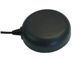
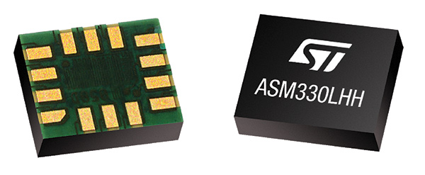
Drones are capable of delivering ultra-high-resolution data, with ground sample distances (GSD) of 1 cm and accuracy of under 5 cm. However, accuracy is highly variable; it can vary based on the drone model, terrain and software used to process the collected data.

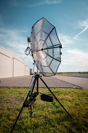
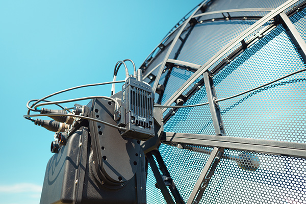
    The form factor of many drones also limits the ability to do multi-sensor flights. A drone typically can cover no more than a few square miles per day with a visible or multispectral camera, compared to manned aircraft that span hundred of thousands of acres a day carrying hyperspectral, lidar and orthophotography devices simultaneously.

    Because they can be deployed quickly, and on a daily basis, drones offer a cost-effective, practical approach for covering small areas compared to other aerial survey methods. But drone usage currently faces a significant impediment.

    Current regulations require operators to maintain sight of the devices during all flights. These line-of-site restrictions limit the distance a drone can go on each flight, and require operators to change locations multiple times for a single survey. As a result, frequent revisits can be labor intensive.

    Battery life also plays a role in the usability of drones. Most commercial drones can fly for only about 45 minutes, despite continued improvements in battery technology. Combined with the line-of-site restrictions, battery life impacts the amount of territory drones can cover. Most can handle only a few square or linear miles during each flight, making helicopters or airplanes better suited for projects that span hundred of miles or more.

    Despite some of the drawbacks, drones are proving ideal in many use cases — from damage assessment and power restoration after hurricanes to data collection for hydraulic modeling, stream restoration design and aquatic habitat assessment.

    For example, drones equipped with bathymetric and terrestrial laser scanning sensors are ideal for supporting riverine mapping applications. In these cases, drones offer an effective alternative when the waterway cannot be accessed, or it is too dangerous to use ground- or water-based survey methods for collecting channel geometry.

    Robots

    QuantumSpatial_sensor-lidar-robot-WRobotic platforms are flexible, enabling users to attach a variety of sensors, including thermal cameras, lidar and sniffers for natural gas or other hazardous material. They are rarely hampered by payload restrictions, like drones.

    And, with programming, robots can return to their chargers when their batteries dip below a certain threshold.

    Like drones, there are many potential applications for terrestrial remote sensing robots. One use is for precision agriculture to test soil, water and plant health.

    Many utilities are expressing serious interest, too, for robots. These robots can include onboard spectral, thermal and lidar sensors, precision navigation and hazard cameras to perform fine-scale spatial mapping and can acquire a wide array of data from electrical substations.

    In this scenario, the robotic platform could detect physical and spectral changes, identify objects, monitor corrosion, detect liquid and gas leaks, and conduct thermal monitoring. Using this model, utilities could track substation environments remotely, saving time associated with physical inspections and enabling earlier detection of potential problems.

    Systemwide approach required

    Traditional remote sensing platforms — airplanes, satellites and vehicles — will continue to play an important role in GIS mapping. Drones and robots give us new tools that will have a dramatic impact on the amount of detailed geographic information collected.

    For these new platforms to be used effectively as complements to traditional platforms, the industry must adopt a systems approach that takes into consideration a number of factors:

    • The end application
    • The sensors and acquisition protocol that will collect data at the precision required by the end application
    • The actionable analytics that need to be extracted from the data
    • How the data and insights integrate with the business processes used for decision making.

    By taking this approach, those who work in a variety of fields can gather the insights they need to do their jobs more effectively and efficiently, while leveraging the unique strengths offered by these emerging platforms.

  • 2018 Connected Car Buyers Guide

    Globarstar Automotive

    Globalstar has launched an automotive division to support connectivity solutions for the next generation of connected and autonomous vehicles and intelligent transport. With Globalstar’s two-way global and broadcast-capable network, automakers will be able to comply with the newest safety regulations, deliver over-the-air (OTA) software updates, increase location accuracy, and improve the reliability for autonomous vehicle operation.

    Globalstar’s next-generation global, hybrid network service is designed to leverage both satellite and terrestrial technologies to connect cars. The highly scalable broadcast/multi-cast network delivers common content to multiple users with virtually unlimited scalability.

    The network has enhanced GNSS accuracy and integrity with protection levels to increase the safety and reliability of autonomous driving systems.

    It is an efficient and secure broadcast service for critical security patches and OTA updates to software and firmware in Telematics Control Units (TCUs), Electronics Control Units (ECUs), and Head Units (HUs), as well as map tile and map layer data. It also provides datacasting of traffic, weather, hazards, and other alerts.

    Global connectivity provides optimized routing of content and services.

    • Telematics. Increased coverage and reliability for ACN/eCall, roadside assistance, vehicle tracking and telemetry. Data can be pulled from vehicles for remote diagnostics, condition-based maintenance, and preventative analytics.
    • Managed Security. Secure link for global certifcate and key management, audits and compliance monitoring, that aslo enables service to patch vulnerabilities, and update firewalls and intrusion detection systems (IDS).

    www.globalstar.com
    phone: 877-452-5782


    Cohda Wireless

    The vehicle-based system V2X-Locate can identify vehicle position to sub-meter accuracy in environments that degrade GPS accuracy, such as tunnels and underground carparks, and between high-rise buildings.

    As well as enhancing current connected vehicles, V2X-Locate delivers a critical component for connected autonomous vehicles (CAV), which will require uninterrupted positioning data to safely navigate on roads. V2X-Locate enables equipped vehicles to identify their location using existing Smart City V2X (vehicle-to-everything) roadside infrastructure from any standards-based manufacturer.

    V2X-Locate positions the vehicle with sub-meter accuracy by using existing communications signals produced by V2X Smart City infrastructure deployments. The result is that V2X-Locate can eliminate positioning black spots in city centers.

    www.cohdawireless.com


    Telenav

    The In-Car Advertising Platform enables automotive OEMs to generate revenue by delivering ads to cars in a safe, user-friendly and contextually relevant way. The end-to-end offering for OEM partners is powered by Telenav’s In-Car Ads SDK (software development kit) and cloud-based intelligent targeting platform.

    To ensure driver safety, ads only appear when the vehicle is stopped, such as at car startup, traffic lights and upon arrival. The ads automatically disappear whenever the car is in motion or when users interact with other in-dash functions such as music or phone calls.

    Relevant ads such as coupons and recommendations are delivered to customers based on information from the vehicle, including frequently traveled routes, destinations and time of the day. For instance, when the vehicle is low on gas, the platform points out nearby stations along the driver’s route, potentially with discount offers.

    www.telenav.com


    Danlaw

    The Through Glass Integrated V2X Antenna is designed for vehicle-to-vehicle and vehicle-to-everything (V2X) communications. The design incorporates an integrated GNSS antenna on the interior coupler. The antenna pairs with dedicated short-range communications (DSRC) devices.

    The dual-radio, glass-mounted antenna eliminates the risk of damaging the vehicle by using a coupling pair to pass DSRC signals between the vehicle’s interior and exterior, eliminating the need to pass RF cables through the roof or window opening. It antenna can be mounted on the rear, front or side windows using automotive-grade glass adhesive. Flexible installation allows the shortest cable route to the V2X device, reducing signal losses due to cable length.

    www.danlawinc.com

  • NovAtel introduces positioning solutions for space-constrained systems

    NovAtel introduces positioning solutions for space-constrained systems

    NovAtel has introduced several new precision positioning solutions for space-constrained applications. With enhanced positioning accuracy in a compact form, the PwrPak7D, PwrPak7DE1 and OEM7600 are suitable for automotive, airborne and other smaller unmanned systems.

    PwrPak7D and PwrPak7D-E1 are dual-antenna, multi-frequency enclosures, and the OEM7600 receiver board, plus NovAtel’s new Waypoint Inertial Explorer Express post-processing software are being showcased this week at AUVSI Xponential 2018.

    Dual-Antenna, Multi-Frequency Enclosures

    The new PwrPak7D enclosure. (Photo: NovAtel)
    The new PwrPak7D enclosure. (Photo: NovAtel)

    NovAtel’s new PwrPak7D and PwrPak7D-E1 enclosures provide space efficiency without sacrificing position accuracy and heading stability, even in stationary, slow-moving or hovering dynamics.

    The PwrPak7D-E1 enclosure integrates an inertial measurement unit (IMU) with NovAtel’s OEM7720 dual-antenna receiver board to deliver GNSS and inertial navigation system (INS) capabilities.

    When combined with NovAtel’s SPAN technology, positioning and attitude performance is optimized during extended GNSS outages.

    Both the PwrPak7D and PwrPak7D-E1 include NovAtel’s Interference Toolkit with advanced interference detection
    and mitigation features applicable to all stages of integration. A web user interface, accessible through Ethernet or
    Wi-Fi, allows for quick and easy system configuration and control.

    OEM7600 Receiver Board for Smaller Autonomous Systems

    The OEM7600 receiver board. (Photo: NovAtel)
    The OEM7600 receiver board. (Photo: NovAtel)

    The OEM7600 receiver board features NovAtel’s high-performance positioning solutions in an extremely small form factor, wrapped with protective shielding to isolate emissions from surrounding electronics in confined spaces.

    This new receiver integrates easily with NovAtel’s SPAN technology to optimize performance during extended GNSS outages.

    The new OEM7600 will be commercially available this summer.

    New Post-Processing Software for UAVs and Small Project Areas

    Inertial Explorer Xpress centroid circle. (Image: NovAtel)
    Inertial Explorer Xpress centroid circle. (Image: NovAtel)

    Also at Xponential 2018, NovAtel is introducing Inertial Explorer Xpress (IEX), a cost-effective, post-processing software for GNSS+INS datasets.

    Inertial Explorer Express provides the same core processing and utilities as the
    Waypoint Inertial Explorer software for applications including unmanned aerial vehicles (UAVs) and smaller projects.

    Inertial Explorer Express will produce centimeter-level position and attitude solutions compatible for lidar, camera and other sensor data with faster processing times and reduced complexity

    “We are very excited to be introducing our new OEM7-based and Inertial Explorer solutions at Xponential 2018,” said Neil Gerein, director of product management at NovAtel. “These systems provide robust positioning and accuracy in a compact footprint for UAVs and smaller autonomous projects. An advanced range of software options, including NovAtel’s tightly coupled GNSS+Inertial SPAN technology and Interference Toolkit, provide assured positioning anywhere.”

  • NavVis launches 6D SLAM indoor mapper

    NavVis-M6-indoor-mapper-WMapping company NavVis has launched the M6, a next-generation indoor mobile-mapping system that the company says can overcome the scalability and data quality constraints of reality capture technology.

    Surveyors and architecture, engineering and construction (AEC) professionals can now use reality-capture technology for large-scale indoor mapping projects. The M6 can be used for factory planning and creating and updating as-built BIM (building information modeling) models and construction monitoring.

    The NavVis M6 is an all-in-one system that captures 360-degree immersive imagery, photorealistic point clouds, Bluetooth beacons, Wi-Fi signals and magnetic field data.

    The NavVis M6 features a mobile lidar system that lets it scan up to 30 times faster than stationary devices, letting users capture up to 30,000 square meters in a day.

    Cutting-edge 6D simultaneous localization and mapping (SLAM) technology significantly improves the quality of data captured. Thanks to 6D SLAM, M6 continuously scans even complex indoor environments, including uneven surfaces or changing elevations such as ramps, open spaces or long corridors without compromising the quality of the data.

    M6’s innovative software is complemented by hardware features designed to improve the quality of data and ease of capture: four laser scanners with a range of up to 100 meters are arranged to maximize scan coverage, while six cameras automatically take high-resolution images during mapping. The innovative design of the M6 includes camera placement that keeps the operator in a blind spot.

    NavVis IndoorViewer software gives stakeholders access to the scanned environment through an interactive virtual building in their browser.

    “The NavVis M6 marks a quantum leap in indoor mobile mapping,” Felix Reinshagen, CEO of NavVis. “Anyone who needs to scan large properties, run repeated scans or would like to move into the field of reality capture will profit from the groundbreaking data quality.

    “With M6, users can now quickly capture large, complex indoor environments for typical tasks such as updating floorplans, documenting construction progress or creating as-built BIM models. At the same time, M6 captures the data needed to provide customers with additional deliverables such as browser-based immersive walkthroughs and indoor navigation,” Reinshagen said.

  • Expert Opinions: How simulation can aid in anti-spoofing developments

    Q: How can simulation aid in the development of anti-spoofing measures or product features?

    Lou, Pelosi, VP, Cast Navigation

    A: Anti-spoofing is a receiver function. It is the ability of a GNSS receiver to distinguish between actual navigation signals and false signals. Simulators allow a receiver developer to play “what if” games with their receiver. A simulator user controls every variable that a receiver processes. Time, satellite information and almanac are all specifiable.


    Mark Wilson, Vice President of Sales, IFEN

    A: With a simulator, a user may include spoofing signals in a variety of test scenarios. The results from the receiver under test may then be compared to the “truth” data available from the simulator, in order to demonstrate any susceptibility to spoofing. As anti-spoofing measures or product features are developed and applied, the same tests may be repeated, in order to evaluate the effectiveness of the countermeasures.


    Said Jackson, President, Jackson Labs Technologies

    A: Since live-air spoofing is illegal, simulators provide a fully controlled and repeatable environment for evaluating spoofing resilience of algorithms and products. Newly available low-cost simulators may also reduce the overall cost and time, and increase the confidence level as well as reduce the environmental impact compared to having to go to a military test-range for live testing. Simulators also provide the ability to test spoofing scenarios that may not yet be possible with today’s technology, such as multi-GNSS spoofing.


    Mark Sampson
    LabSat Product Manager, Racelogic

    A: Simulation is of great benefit when developing product features due to its repeatability. By replaying a consistent scenario, new products can have GNSS capabilities edge-tested for criteria such as receiver sensitivity, programming robustness and latency. Additionally, by replaying two scenarios created with signal-generator software on a multi-constellation simulator, starting at the same position and time and using the same constellation(s) but with one that diverges in position, spoofing vulnerabilities can be assessed.


    Iurie Ilie, CTO & Co-Founder, Skydel

    A: One of the most effective methods for mitigating GNSS spoofing is spatial discrimination. This supposes two or more receiving antennas are used. To test such systems and help designers to tune their algorithms in a controlled environment, the spoofing and truth GNSS signals must be simulated by a wavefront approach. This ensures that the signals’ code and carrier-phase offsets at the antennas’ phase center will be a function of the relative receiver/transmitter geometry.


    Phil Bonilla, Systems Engineer, Spirent Federal

    A: A flexible, high-quality RF constellation simulator provides the capability to model a multitude of scenarios in realistic environments. Users can configure signals and data to perform spoofing attacks, echoing both those observed and those purely theoretical today. Performing these tests via RF simulation provides highly controlled, repeatable system tests while providing flexibility to evaluate performance thresholds. The ability to assess risk and evaluate system robustness using simulation is vital in the evolving GNSS threat environment.


    Joel Korsakissok, President, Syntony GNSS

    A: A spoofer is a simulator that has been modified to be a slave of a master system, which defines the signal and trajectory to be emitted. To test an anti-spoofing system, it is necessary to have two simulators: the first will emit the real GPS constellation and the second will emit the spoofing signal, which will be probably synchronized in time and position at the beginning, but with divergent evolution in time.


    Tim Erbes, Chief Technology Officer, Talen-X

    A: Simulation is currently the best method to develop and test anti-spoofing algorithms. To ensure realism, it is often necessary to simulate both the true and spoofed signals from separate simulators. This provides flexibility for the threat to be modeled differently than the real satellites, a critical nuance that is often overlooked. Without the repeatability and control that such simulation provides, it would be impossible to adequately test the anti-spoofing capabilities of a GNSS receiver.

  • PNT Roundup: Positioning integral to system design of 5G cellular networks

    PNT Roundup: Positioning integral to system design of 5G cellular networks

    The cellular 5G standard targets latencies under 1 millisecond, data rates of up to 10 gigabits per second, extremely high network reliability and better accuracy in positioning. With location awareness becoming an essential feature in many new markets, positioning is considered as an integral part of the system design of upcoming 5G mobile networks.

    The cellular industry is currently implementing Long-Term Evolution (LTE)-Advanced, which might be called “4G” mobile broadband. Simultaneously, the industry is preparing the next step, a fifth-generation (5G) system. It will process communication 10 times faster than 4G, according to experts. 5G rollout will be complete in many international metropolitan areas by 2020.

    Positioning Performance for 5G NR and other technologies in different environments. (Image: Fraunhofer IIS)
    Positioning Performance for 5G NR and other technologies in different environments. (Image: Fraunhofer IIS)

    Adaptive array antennas

    In addition to the precise positioning it will afford, 5G shares another characteristic with GPS/GNSS: adaptive array antennas for digital beamforming (DBF). Adaptive arrays have many advantages for PNT, primarily in mitigation for multipath, jamming and spoofing.

    Adaptive antenna arrays with DBF are becoming increasingly important for PNT in challenging signal environments. DBF combines multiple antenna inputs to generate gain in arrival direction of the desired satellite signal and to create spatial nulls in the direction of jamming. (See the January 2017 Innovation column “Correlator beamforming for low-cost multipath mitigation” and the February follow-up, “Mitigating interference with a dual-polarized antenna array in a real environment.”)

    Picocells

    Emerging applications of DBF in 5G involve dense networks of picocells, small cellular base stations that typically cover a small indoor area. Picocells extend coverage where outdoor signals do not reach well, and add network capacity in areas with very dense phone usage. 5G architectures will use adaptive array technology to achieve high data rates, spectrum reuse and communications robustness.

    The implications for PNT are that 5G will require improved (relative) PNT to operate effectively, and picocells will be a source of PNT information in constrained environments.

    5G involves massive directional communications via multiple-input, multiple-output (MIMO), enabling high-bandwidth communications in fading (multipath) channels by using multiple antenna inputs to adapt to channels. It can do this without knowledge of user location, but it adds to the processing complexity. The directional capability can enable multiple users to be serviced in a picocell at different frequencies, while permitting spectrum re-use by nearby picocells through narrow beamwidth and the limited range of millimeter-wave (mmWave) frequencies.

    The PNT implications of 5G architectures, according to Gary McGraw of Rockwell Collins, are that 5G picocells will be synergistic with PNT in challenged environments — naturally, indoor and dense urban. They will necessitate development of distributed, networked PNT processing and infrastructure.

    Fraunhofer

    The 5G positioning framework will integrate a multitude of sensors into a hybrid positioning scheme, according to the Fraunhofer Institute for Integrated Circuits (IIS) in Germany. Fraunhofer IIS is currently prototyping low-latency and high-precision positioning systems for legacy LTE and future 5G New Radio (5G NR).

    5G NR enables positioning by providing high bandwidths for precise timing, new frequency bands at mmWave, massive MIMO for accurate angle-of-arrival estimation and new architectural options that support positioning. Improved accuracy, robustness and latency can be achieved, according to the institute.
    5G provides fast and reliable access to moving objects to achieve time-critical process control and optimization in industrial environments. Increased contextual awareness of goods, parts, machines and workers will enable new interaction and collaboration, the institute said.

  • Lidar and UAV reveal Mayan "megalopolis" below Guatemalan jungle

    Lidar and UAV technology has revealed hundreds of previously unknown Mayan ruins in the Guatemalan rainforest.

    The Optech Titan stripped away overlying vegetation to reveal extensive Mayan ruins in Guatemala’s rainforest. (Image:
    Teledyne Optech)

    In what is considered biggest aerial lidar survey in the history of archaeology, a vast and complex civilization has been discovered.

    The University of Houston’s National Center for Airborne Laser Mapping (NCALM) used Teledyne Optech’s Titan sensor to identify raised highways, and complex irrigation and terracing systems.

    The jungle of Central America is one of the last great frontiers of archaeology, according to National Geographic, which covered the new finds in a recent documentary, Lost Treasures of The Maya Snake Kings.

    After the collapse of the Mayan civilization, its cities and monuments were quickly covered by thick rainforest, hiding it from airborne observation and making it very difficult to survey on foot. Over decades of work, the ancient civilization has gradually been revealed. But now technology is set to change everything.

    Lidar digitally removes the forest canopy to reveal ancient ruins below, showing that Maya cities such as Tikal were much larger than ground-based research had suggested. (Photo: National Geographic)

    Flying high above the rainforest, the Titan’s lasers penetrated the canopy to collect almost a million data points per second from the forest floor, giving archaeologists a “bare earth” view of the structures underneath.

    Having covered 2,100 square kilometers, the Titan’s data revealed massive amounts of ruins hidden below the forest, showing that their urban centers were significantly larger than archaeologists had previously thought.

    “Lidar is revolutionising archaeology the way the Hubble Space Telescope revolutionised astronomy,” Francisco Estrada-Belli, a Tulane University archaeologist, told National Geographic. “We’ll need 100 years to go through all [the data] and really understand what we’re seeing.”

    (Image:
    Teledyne Optech)

    “We are incredibly proud and excited that our award winning Titan multispectral lidar sensor has contributed to this spectacular discovery,” said Michel Stanier, EVP and general manager of Teledyne Optech. “The Titan’s ability to strip away overlying vegetation and map wide areas very quickly and accurately makes it an important tool for archaeologists, and we expect to see many more discoveries coming from it and our other airborne laser terrain mappers.”

    The Optech Titan multi-spectral lidar sensor incorporates three independent laser wavelengths into a single sensor design, with beams at 532, 1064 and 1550 nanometers (0.5/1.0/1.5 microns) and a ground sampling rate of 300 kHz per beam.

    Because Titan uses both green and infrared channels, it is capable of simultaneous water-depth mapping and high-precision 900-kHz topography.

    Titan can also be used for purposes such as vegetative and forestry applications, which require multiple wavelengths for improved classification accuracy and carbon credit counting initiatives.