By Stephen Mackey, Hadi Wassaf, Karen Van Dyke, Christopher Hegarty, Karl Shallberg, John Flake and Terence Johnson.
OOBE Levels associated with LTE signal power used in testing. Source: Stephen Mackey, Hadi Wassaf, Karen Van Dyke, Christopher Hegarty, Karl Shallberg, John Flake and Terence Johnson.
The Adjacent Band Compatibility Assessment evaluated the adjacent radiofrequency band power levels that can be tolerated by GPS and GNSS receivers, to advance the U.S. Department of Transportation’s understanding of the extent to which such power levels impact devices used for transportation safety purposes, among other applications. The paper describes the testing approach and data analysis used to develop interference tolerance masks (ITMs) based on a 1-dB carrier-to-noise-ratio (CNR) degradation. DOT and other participants tested 80 GPS/GNSS receivers in an anechoic chamber. Four types of testing were conducted which involved a linearity test, 1-MHz Bandpass Noise, 10-MHz Long Term Evolution (LTE), and effects of third order intermodulation.
This paper also presents the resulting ITMs and puts forward a recommendation for the bounding ITM for each GPS/GNSS receiver category. Given a particular use case scenario, the significance of these bounding ITMs is that they provide information that is necessary for the downstream analysis to determine the maximum Effective Isotropic Radiated Power (EIRP) that can be tolerated in the adjacent radiofrequency bands on a per category basis. The paper discusses acquisition results as they relate to the 1-dB CNR degradation limit, and a cross comparison for some of the receiver results between radiated and conducted tests incorporating the appropriate antenna characterization data.
CAD model of the antenna system: The antennas will be arranged so that the center of mass is at the center of the tube. Each antenna will be counterbalanced. (NASA)
Researchers at NASA’s Armstrong Flight Research Center have designed an antenna-mounting platform to provide users satellite-based tracking functions for unmanned aerial vehicles. The platform integrates multiple capabilities onto one low-cost platform.
In August 2016, NASA signed a license agreement with Mobile Antenna Platform Systems Inc. to commercialize the portable antenna platform.
The platform is built to rotate 60 pounds of antennas, transmitters and receivers and eliminate the need for additional load-balancing hardware. A smaller version can be flown on a plane, greatly extending the telemetry link range without requiring more power from the aircraft.
Auto tracking software uses the target’s GPS location to coordinate and maintain a line-of-sight link as great as what the telemetry system can support.
NASA researchers originally developed the technology for use with research UAVs, which often involve multiple transmitters and receivers on the aircraft and on the ground, with multiple antennas that must be pointed at a single UAV.
The platform is a middle ground between the low-end tracking platforms that support only one antenna and expensive, high-end options designed for military use.
Besides research, the platform could be used in marine communications, satellite tracking in multiple frequencies and weather balloon tracking, NASA said.
Powered by 120 VAC, the platform moves all of the antennas simultaneously in continuous rotation in azimuth and vertical ±180°, effectively tracking a line-of-sight object up to 20 miles away or further, limited by transmit power and antenna configuration.
It is designed for use with any moving system needing to transmit large quantities of data over one or more RF links. RF signals can include video, command and control, and signals to and from the UAV as well as the research data of interest.
The platform design includes:
a horizontal bar with antenna mounts
a platform head containing the motors and gears
an antenna stand containing electrical slip rings and cables to connect to the radios, motors and external computer
a microcontroller interface to drive the motors and receive antenna commands from the software
Its user interface runs on Microsoft Windows and enables the tracking antenna to be interfaced to any ground station that can provide the GPS coordinates of the target being tracked in real time and the GPS coordinates of the tracking antenna.
Platform benefits
According to NASA, the antenna platform offers these benefits:
Portability. Lightweight components and a small profile allow the platform to be carried by a single person.
Simplicity. Its unique design eliminates the need for additional load-balancing hardware, simplifying setup.
Versatility. Up to 58 pounds (26 kg) of multiple antennas from various manufacturers in any combination (including Yagi-Uda, dish/parabolic, omnidirectional, patch/microstrip) under 10 W can be accommodated
Low Power Use: Using a smaller motor that is faster than those on other platforms requires less power to achieve continuous rotation.
Low Cost: The overall system is estimated to cost less than $5,000.
A researcher prepares to use lidar to scan snow depth at Arapahoe Basin in Colorado. (Photo: Riegl)
In 2014, an avalanche injured two Colorado avalanche control workers. They had been using an “avalauncher” compressed gas cannon to shoot charges into slopes that posed a serious avalanche risk to motorists below, but the charge exploded too early, in the barrel of the launcher.
The accident prompted a re-evaluation of the Colorado Department of Transportation’s avalanche control techniques.
Now, transportation officials have brought in researchers who are applying lidar to safely map snow depth in steep terrain, making avalanche control safer and more efficient for safety teams.
Jeffrey Deems, a researcher with the National Snow and Ice Data Center at the University of Colorado Boulder, and his colleagues developed the new application for lidar systems that map snow depth at high resolution. The researchers craft detailed maps of the slopes in summer, without snow, and then compare them to snow-covered slopes months later.
The researchers have been testing the technique at Colorado’s Arapahoe Basin Ski Area, where they help snow safety teams target explosives placements. The snow-depth change maps help the safety teams look for old and new snow accumulation patterns.
The data help the safety team refine their explosives targeting plans and guide them when they need to decide whether to shoot explosives into certain areas.
Also, explosives delivery tram lines for a ski area expansion are being planned and refined with the aid of the lidar-derived snow depth maps, allowing more efficient and effective tram network design. The lidar snow depth maps revealed less-obvious accumulation spots and supported a redesign of the planned tram line network.
SBG Systems has released a new version of the Ellipse Series, its product line of miniature inertial sensors. The Ellipse has been greatly improved, showing higher performance in attitude measurement while adding the Galileo constellation to its GNSS receiver.
Photo: SBG Systems
After thousands of Ellipse miniature inertial sensors operational on the field, SBG Systems has made major improvements to its Ellipse line of miniature inertial sensors while keeping the same form factor and price level.
Attitude Accuracy Improved by a Factor of Two. With low-noise gyroscopes and new high performance accelerometers providing superior noise level, the accuracy of every Ellipse model has now improved from 0.2° to 0.1° in roll and pitch. In addition, the new accelerometers tolerate very high vibration environments (up to 8 g).
The Ellipse-N model is an all-in-one inertial sensor that embeds a L1 GNSS receiver. Ellipse-N is already compatible with GPS, GLONASS and BeiDou constellations. With the addition of Galileo tracking, Ellipse-N benefits from more satellites, improving the signal robustness in harsh environments.
Ellipse embeds high-quality sensors with a greatly improved long-term stability. Sensors are totally integrated in an IP68 enclosure, resistant to dust and water.
Every Ellipse sensor is tested and calibrated in temperature and dynamics, to ensure constant behavior in every condition. Highly robust, Ellipse are guaranteed for two years. This warranty can be now extended up to five years.
Entry-level Solution for Surveying. The Ellipse Series is extremely powerful for its size. It is an affordable all-in-one solution providing accurate attitude and position for surveying applications, whether they are terrestrial, aerial, or marine.
With its fully backward compatibility design, the new Ellipse series can be used as a drop-in replacement of the previous Ellipse. No specific action is required in terms of mechanical, electrical or software integration. The new Ellipse sensors are available for ordering now.
Two new topic areas and presentations have been added to this Thursday’s free webinar on Signal Interference: Detection and Mitigation.
The speakers will explore anti-jamming protection with controlled radiation pattern antennas (CRPAs) and with dual-polarized antennas. The latter topic is also the cover story for the February issue, which demonstrated a significant improvement in positioning accuracy and robustness against interference with a dual-polarization approach: a gain in terms of C/N0, particularly for low-elevation angle satellites and valuable in urban environments.
Headshot: Kirk Burnell
Kirk Burnell from NovAtel joins the Feb. 2 panel to present “How to deliver assured positioning, navigation and timing in GNSS-compromised environments.”
He will look at applications that stress the importance of high-reliability PNT. Compromised GNSS signals due to unintentional interference is of great concern, but intentional interference due to jamming is much more insidious. Anti-jamming protection via controlled reception pattern antenna (CRPA) technology is now available to a wide range of users. A brief explanation of the technology will be followed by a few use-cases where CRPAs have been deployed in a variety of applications.
Burnell, Core Cards Product Manager for NovAtel, has worked at the company since 2015. With an education in survey engineering, Kirk has been working with precision GNSS system designers and integrators in both support and product management capacities for more than 20 years.
Headshot: Matteo Sgammini
Matteo Sgammini of the German Aerospace Center (DLR) will talk about work with dual-polarized antennas: the principles of operation of such an antenna array and how one performed in real-world jamming and non-jamming scenarios. This ION GNSS+ 2016 presentation became the cover story for GPS World’s February issue.
Innovation editor Richard Langley writes in his introduction to the February column, “All GNSS satellites transmit RHCP [right-hand circularly polarized] signals and therefore most GNSS receiving antennas are designed for such signals. However, a funny thing can happen to a satellite signal on the way to a receiving antenna. If the signal bounces off a nearby structure or the ground or the sea surface, its polarization is modified and it will become LHCP [left-hand circularly polarized] or a combination of the two polarizations.
“A primarily LHCP antenna can capture a significant portion of the energy in such a RHCP signal and could provide a strong response to a reflected signal when the line-of-sight signal is missing or very weak. So, there could be a benefit in having a dual-polarized antenna to improve positioning capability in marginal situations. Furthermore, jamming signals can be of arbitrary polarization and a dual-polarized antenna array with beamforming capability could better separate and mitigate such interference.”
February cover story. Photo: GNSS
Researchers at the DLR equipped a GNSS receiver with a diversely polarized antenna array to combine signal processing in the spatial and in the polarization domain. Tests show a significant improvement in receiver robustness against interference compared with the general single-polarization case.
The carrier-to-noise-density ratios of the line-of-sight components are improved since the receiver can use the power present on the left-hand circularly polarized channels, particularly for satellites with low elevation. Interference mitigation improves due to the possibility of filtering in the polarization domain and the additional number of available degrees of freedom.
Sgammini received a Masters degree in electrical engineering from the University of Perugia, Italy and now works at the Institute of Communications and Navigation, DLR. He is currently pursuing a Ph.D. in electrical engineering with research interests in interference mitigation techniques for GNSS. His research activity includes adaptive filtering, array signal processing and estimation theory for GNSS.
As the number of GNSS signals being tracked increases, so does the potential for interference to dismiss the performance gains of using those additional signals.
To maximize performance and efficiency, prepared PNT users need their equipment to be able to detect when interference is present and mitigate it.
Developers, integrators and users need mitigation tools to protect and preserve GNSS measurement quality, maintaining high-quality multi-frequency multi-constellation positioning performance, even in challenging RF environments. This is essential particularly on the integration journey, especially during prototyping and when encountering unforeseen interference events in field testing, in order to produce fully successful integrated products.
The one-hour webinar also will include a follow-up Q&A session with the speakers. Burnell and Sgammini join Patrick Casiano of NovAtel and Rick Hamilton of CGSIC on the speaker panel. Casiano will present an Interference Toolkit that measures RF spectrum levels and allows the user to apply mitigation tools to protect and preserve GNSS measurement quality. Hamilton will explain the proliferation of jammers, aspects of illegal use, coordinated government response to interference events, and regulations to prohibit manufacture, import, export, sale and use of jammers.
Caltrans — the California state agency responsible for highway, bridge and rail transportation planning, construction and maintenance — has taken delivery of the new Riegl VMX-1HA mobile mapping system.
The Riegl VMX-1HA dual-scanner mobile mapping system.
The Riegl VMX-1HA is a high-speed, high-performance dual-scanner mobile mapping system. It provides high performance and dense, accurate and feature-rich data at highway speeds.
With two million measurements and five hundred scan lines per second, the turnkey solution is suited for survey-grade mobile mapping applications to meet the standards of departments of transportation nationwide, Riegl said.
The technology of the system comprises two Riegl VUX-1HA high-accuracy waveform lidar sensors and a high-performance INS/GNSS unit, housed in an aerodynamically shaped protective cover. Four 9-megapixel cameras, along with a LadyBug 5 camera, complement the waveform lidar data with precisely georeferenced images.
The Riegl software suite provides seamless workflows for mobile data acquisition, processing, adjustments and deliverables.
Riegl USA was awarded the contract of the Request For Quote (RFQ) on the open market.
Q: Why do we need to take integrity seriously in the vehicle environment?
Chris Rizos, Professor, Geodesy and Navigation, University of New South Wales
A: Since the 1980s, surveyors and geodesists have used GPS for high-accuracy positioning. We take for granted centimeter- and even millimeter-level accuracy positioning capability that is faster, more reliable, at a lower cost and with fewer constraints than ever before. However, the demand for “trustworthy positioning” dismisses such achievements, and the mantra is more “availability” and greater “integrity” to support highly automated driving. Our positioning and navigation community must rise to this challenge.
Rod Bryant, Senior Director, Technology, Positioning, u-blox
A: In autonomous vehicles, a GNSS/inertial module will be just one of several sensors used for location. The risk of contributing to accidents and serious injury will be decomposed and allocated between subsystems by the OEM or system designer. Taking aviation as a model, the allocation to GNSS may be in the form of an alarm limit of a few meters with integrity risk less than 10-6/hour. However, multipath and obstructed sky make automotive risk far more difficult than aviation. Carrier-phase techniques will come into play and new approaches to protection limit estimation will be needed.
Sam Pullen, Senior Research Engineer, Stanford University; Consultant, Sam Pullen Consulting
A: Advanced sensor fusion techniques now make it possible to achieve very accurate PVT results by combining multiple dissimilar sensors. Once we rely on these capabilities for autonomous driving, the primary threat to safety will come from confluences of rare events that were not observed or foreseen during system development. Design for integrity focuses attention on the identification and mitigation of potentially hazardous anomalies before they happen, not afterward.
We have a finite number of pages to bring you each month, one might say a tightly controlled number. That number has never easily accommodated the quantity of fresh, relevant GNSS and PNT news and technical material that emerges each month. The pace of your developments is too fast with which to keep up!
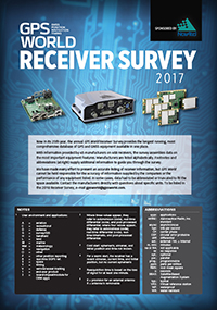
2017 GPS World Receiver Survey (PDF).
This month, a case in point. Most importantly, driving the whole issue is the latest, greatest version of that long-running industry resource and guide, the GNSS Receiver Survey: 24 data-packed pages of it!
There is a major GNSS milestone to report, one which I have personally awaited since the year 2000 — and I know many others have also. When I signed on at this publication, my first assignment was getting its little sister magazine out the door: the summer 2000 issue of Galileo’s World. For four years we published that optimistic quarterly. There was plenty of content for it, but the constellation itself, and the market to support it, were slower in developing. No longer. With the Declaration of Initial Services, reported in the System of Systems section, Galileo is truly and fully open for business.
This month, we also report a momentous satnav development that is not GNSS in the traditional sense, but does come from a globally orbiting constellation. Adding signals from ranging satellites in low-Earth orbit to those from GNSS satellites in medium-Earth orbit provides just the kind of augmentation and backup that many applications critically need. The advantages come primarily in the timing realm, but there is potential for significant positioning benefits, especially once you many innovators out there get your hands on it and combine it with inertial. A true PNT powerhouse.
I haven’t even gotten to this month’s cover story yet: a technical advance in multipath mitigation that has the potential to amp the power, so to speak, of GNSS receivers in many applications. Correlator beamforming is an intriguing new development. Scientists at the Air Force Institute of Technology put it through its paces, and report good results.
At the risk of giving short shrift to any of these essential stories, not to mention the multiple new products, partnerships, application advances and technology updates that appear in smaller bites, we have opted not to omit any, but to cram them all into the one knowledge-laden issue.
We may not be the New York Times, nor can we approach that venerable publication’s mission, reproduced here. But we have our own — All the News That Fits!
Letter to the Editor
My November column began with Jimi Hendrix, drifted into GPS jamming, touched on a mock presidential plebiscite conducted during ION GNSS+, and concluded by reverting to Hendrix’s Purple Haze: “The real [election] results may already be known by the time you read this … Is it tomorrow, or just the end of time?”
Brian in Oklahoma sent me a four-word email in response. “The end of time,” he wrote.
The organizers of International LiDAR Mapping Forum (ILMF) has announced the 2017 keynote lineup. The event takes place Feb. 13-15 in Denver, Colorado.
ILMF is a technical conference and exposition covering the newest airborne, terrestrial and underwater lidar as well as emerging remote-sensing and data-collection tools and technologies,
The keynote speakers are:
Larry Mayer, professor and director, School of Marine Science and Ocean Engineering, Center for Coastal and Ocean Mapping, University of New Hampshire Keynote: “Challenges of Mapping the Deep Ocean: If Only Airborne Lidar Bathymetry Worked in 10,000m of Water”
Timothy Trainor, co-chair, United Nations Committee of Experts on Global Geospatial Information Management; chief of Geography Division, U.S. Census Bureau Keynote: “Role of Technology and Geospatial Information Toward Achieving UN Sustainable Development Goals”
Roy E. Wright, deputy associate administrator for Insurance and Mitigation, FEMA Keynote: “What FEMA Seeks from Geospatial Information: Risk Management, Risk Reduction”
Eric E. Poehler, associate professor of Classics and co-director, Digital Humanities Initiative; University of Massachusetts – Amherst Keynote: “Mapping Pompeii: New Discoveries with New Technologies”
“We’re honored to have such a stellar lineup to kick off the ILMF conference,” said Lisa Murray, event director. “These keynotes demonstrate the incredible breadth of uses for lidar technology — from mapping the ocean floor to mapping the ancient city of Pompeii, to using lidar for global sustainable development and for risk management and reduction.”
These leaders are among 60 aerial mapping experts at ILMF 2017 who will share their knowledge at ILMF. Other sessions will cover topics including:
Analyzing Lidar for Decision-Making
Bathymetry Lidar and Topobathy
Coastal Monitoring
Forestry
Geiger-Mode Lidar (GML) and Single-Photon Lidar (SPL): What’s the difference and why does it matter?
Landslide Detection and Mapping
Multi-Sensor and Data Fusion
New Developments In Mobile Mapping
New Technologies
Point Clouds: From Processing & Feature Extraction To Analysis & Management
Running alongside the conference is an exhibition featuring the world’s top providers of lidar and new and complementary solutions. See the exhibitor list here.
“ILMF is the best opportunity of the year for mapping professionals to learn about the newest lidar solutions, raise their technical competence, network with other practitioners, and see the latest technology,” said Ms. Murray.
The U.S. Defense Advanced Research Projects Agency (DARPA) has awarded HRL Laboratories LLC $4.3 million to develop vibration- and shock-tolerant inertial sensor technology that enables future system accuracy needs without using GPS.
Positioning, navigation and timing are key to ensuring the location accuracy critical to the success of modern military missions. Today’s military systems typically rely on GPS to ensure position accuracy. While GPS provides sub-meter accuracy in optimal conditions, the signal is often lost or degraded due to natural interference or malicious jamming.
“The ATLAS project will deliver a comprehensive approach to breaking performance and cost, size, weight and power barriers in inertial sensor technology that prevent robust, GPS-independent, military positioning, navigation and guidance,” said Logan Sorenson, principal investigator and research staff member in HRL’s Sensors and Materials Laboratory.
ATLAS will combine intimate locking of a micro-electro-mechanical systems (MEMS) Coriolis Vibratory Gyroscope (CVG) sensor with an atomically stable frequency reference in order to exploit the intrinsic accuracy of the atomic hyperfine transition frequency.
“The engineering challenge lies in developing a system architecture to transfer the stability from the atomic reference to the CVG sensor without introducing unintended noise,” Sorenson said. “We are very excited to explore this novel approach to addressing long-standing precision navigation need faced by the U.S. military.”
HRL Laboratories is located in Malibu, California. It is a corporate research-and-development laboratory owned by The Boeing Company and General Motors specializing in research into sensors and materials, information and systems sciences, applied electromagnetics, and microelectronics. HRL provides custom research and development and performs additional R&D contract services for its LLC member companies, the U.S. government, and other commercial companies.
LizardTech, a provider of software solutions for managing and distributing geospatial content, has unveiled lossless compression of Harris Geiger-Mode lidar data in the newest release of its GeoExpress software.
Users of GeoExpress 9.5.3 can now convert massive Geiger-Mode point clouds directly from their native binary point file (BPF) format to industry-standard MrSID files without losing data.
“Direct conversion from BPF enables GeoExpress clients to fully leverage the rich information content of Geiger-Mode lidar data sets,” said Terry Ryan, LizardTech federal government sales manager. “In addition, the compressed files are easier to process, archive and share.”
Harris has provided airborne Geiger-Mode lidar data to the U.S. government for two decades and recently rolled the technology out to the commercial sector for a variety of large-area mapping applications. Geiger-Mode employs a multi-angle illumination method to capture extremely dense point clouds of the Earth’s surface. Compared to traditional LiDAR, Geiger Mode offers higher resolution and greater information content, but in much larger data sets.
BPF is the native format used for raw Geiger-Mode data because it readily accommodates enormous files with multiple metadata and attribute fields. However, the BPF format is not supported by most commercial lidar processing software packages.
As a result, Geiger-Mode customers had to convert BPF to the more common LAS format for generation of surface models, digital elevation models and other map products. This BPF-to-LAS conversion was time consuming and lost data in the process.
GeoExpress 9.5.3 eliminates the intermediary step of converting to LAS and compresses directly to MrSID files, which can be easily processed by all commercial LiDAR software packages.
“The full information content of the Geiger-Mode LiDAR data is retained, and processing time is reduced with GeoExpress 9.5.3,” Ryan said.
GeoExpress is LizardTech’s flagship software product, enabling geospatial professionals to manipulate digital image and LiDAR data sets and compress them to MrSID or JPEG2000 files for cost-effective processing, storage and transmission. In addition to the new Geiger-Mode handling capabilities, GeoExpress 9.5.3 offers other enhancements, including advanced color balancing, default RGB transformation and easier licensing.