Category: Uncategorized

  • WGIC and university partners announce professional doctorate in geospatial leadership

    WGIC and university partners announce professional doctorate in geospatial leadership

    The World Geospatial Industry Council (WGIC) is supporting the launch of a professional doctorate in geospatial leadership — the Executive Doctor of Geospatial Leadership (DGEO) — offered by Clark University and the University of Southern California (USC). The announcement was made at WGIC’s flagship annual event, Horizons 2026, in London.

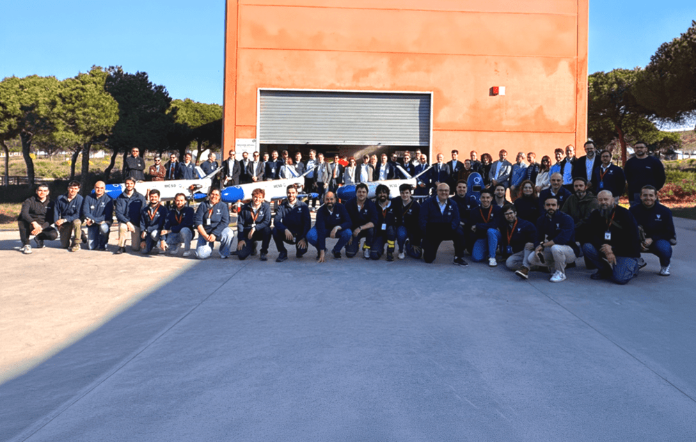
    Designed in collaboration with WGIC and its 50+ member organizations, including companies such as Esri, Oracle, Amazon Web Services, TomTom, Trimble and Hexagon, the low-residency, cohort-based doctorate for mid-career professionals is set to begin in Summer 2027 at both Clark University and USC.

    These strategic partnerships aim to address the significant workforce gap in the industry and to build a much-needed pipeline of geospatial leaders. DGEO graduates will possess the precise technical and executive skills required to lead organizations that deploy geospatial technology – a critical infrastructure cutting across numerous sectors of the economy, from insurance and logistics to urban planning, agriculture, and environmental monitoring.
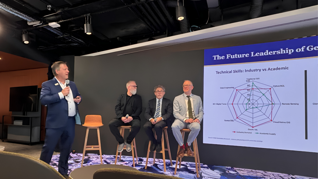
    The initiative reflects WGIC’s ongoing commitment to geospatial workforce development. Accordingly, WGIC invites its member organizations to help establish the DGEO programs, participate in the doctoral capstone and classroom experience to bring real-world practices to the curriculum, and drive recognition and demand for the degree worldwide.

    “Leaders emerging from this first-of-its-kind program will be equipped and empowered to approach problems with heightened understanding, an expansive set of skills, and the ability to find meaningful solutions,” said Aaron Addison, executive director of WGIC. “We are living in a time of incredible climate and societal disruption, when the demand for leaders in this space is acute — and the DGEO program will be critical in meeting that demand.”

    “We are at the point where the scale and impact of the geospatial industry has expanded greatly, moving beyond traditional GIS and remote sensing to integrate AI, machine learning, and data engineering,” said Lou Leonard, the D.J.A. Spencer Dean of the School of Climate, Environment, and Society at Clark University. “However, with this growth have come workforce gaps for the industry, particularly at management levels, where integrating technological competence, particularly GeoAI, with executive skills is vital to leading organizations in a changing future.”

    “The DGEO program will offer working professionals the opportunity to strengthen their communication, financial, and management skills as they step into leadership roles across the geospatial sector,” said John Wilson, professor and founding director of the Spatial Sciences Institute at the University of Southern California.

    The DGEO Program delivers

    Offered primarily online and built around a cohort model, the DGEO coursework spans strategic leadership, organizational management, finance, sales and marketing, and product management, governance, and policy, equipping graduates to lead a GeoAI-first enterprise and to remain fluent in geospatial technology from sensors and data to cloud-native workflows and analytics. The programs target mid-career managers, industry-sponsored candidates, and technical leaders bridging into business.

    Two Pathways to the Degree

    Executive Doctor of Geospatial Leadership, Clark University

    Program Length: 6 semesters (2 years)

    Units/Courses: 12 courses (48 credits) – 2 courses per semester

    Delivery Model: Online/asynchronous + 2 annual 1-week in-person intensive sessions

    Doctoral Capstone: Individual project/white paper/business model

    Executive Doctor of Geospatial Leadership, University of Southern California

    Program length: 10 semesters (3+ years)

    Units/Courses: 10 courses (40 units) – 1 course per semester

    Delivery Model: Online/asynchronous + three 4-day in-person intensive experiences

    Doctoral Capstone: Thought leadership, business models, innovation, and new opportunities

    Both programs start in Summer 2027.

    For more information, visit www.wgicouncil.org.

  • SPH Engineering launches marketplace to for specialized drone surveying equipment

    SPH Engineering’s new Marketplace acts as a specialized network connecting enterprises, research institutions, and engineers with a vetted network of drone equipment rental services providers. At launch, the network includes more than 30 partners spanning 38 countries.

    Heavy industry and research companies increasingly rely on drone-based data, but finding the right local team or renting a highly specific sensor is often a fragmented, slow, and expensive process. The new Marketplace is designed to help address this practical bottleneck. For project teams in oil & gas, mining, construction, hydrology and academia, the platform helps reduce the operational burden of building internal drone programs.

    Whether a university needs water depth-mapping for an environmental study or an energy firm requires airborne GPR for underground utility mapping, they can instantly source a verified team with the right equipment. This makes it easier to access professional data collection capabilities without investing in pilot training or hardware maintenance.

    Users submit a single project request through the SPH Engineering platform, which is then routed to relevant partners. The Marketplace launches with an initial partner base covering Europe, North America, Latin America, the Asia-Pacific, and Africa, with the network expected to expand.

    To ensure quality and reliability, partners are reviewed based on their technical capabilities, equipment availability, relevant project experience, and ability to support incoming customer inquiries.

    Beyond empowering enterprise end-users, the platform serves two additional groups within the ecosystem:

    • Engineers: For technical professionals who already have UAV capabilities but lack specific sensors, the Marketplace offers a robust rental network. Users can directly rent high-value, specialized payloads — such as drone-mounted lidar systems, ground penetrating radar, magnetometers, and echo sounders — for specific project windows. This approach allows engineers to validate a drone workflow or sensor capability before committing to a major purchase.
    • Drone partners and service providers: The Marketplace provides a channel for commercial drone service companies and hardware partners for hard-industry and environmental clients. By joining the network, partners gain visibility among a highly targeted audience of enterprise clients requiring specialized geophysical and hydrographic data. SPH Engineering facilitates the routing of incoming project inquiries to relevant partners, connecting local operators with complex, relevant enterprise opportunities and allowing them to maximize the utilization of their specialized equipment.

    To find a drone service provider with specialized equipment, or join the network, visit the Marketplace.

  • Iridium to acquire Aireon to lead aviation safety

    Iridium to acquire Aireon to lead aviation safety

    Iridium Communications Inc., a provider of global voice, data and positioning, navigation and timing (PNT) satellite services, has entered into a definitive agreement to acquire Aireon LLC.

    Aireon is operator of the space-based Automatic Dependent Surveillance-Broadcast (ADS-B) air traffic surveillance system. The acquisition of Aireon is a defining step in Iridium’s strategy to provide the foundational architecture for global aviation safety, bringing space-based surveillance, safety communications, PNT and operational data together on a single network.

    “Aireon has always been part of Iridium’s aviation safety strategy. We founded it in partnership with the world’s leading Air Navigation Service Providers (ANSPs), because we believed space-based aviation safety was a generational opportunity,” said Matt Desch, CEO, Iridium. “The aviation industry is now entering an era of growing air traffic, denser airspace, autonomous aircraft, and greater expectations for safety and resiliency. Bringing Aireon fully inside Iridium better positions us to build what’s needed to support the future of aviation, including more innovations like the future introduction of space-based VHF communications.”

    Platform for Aviation Safety
    The acquisition unites Aireon’s surveillance and data services, including GPS jamming and spoofing detection, with Iridium’s global satcom network and PNT services that help keep GPS-dependent systems working in contested environments. This combination creates one company providing four critical aviation industry capabilities: knowing where every aircraft is, communicating with the pilots flying them, providing the navigation and timing integrity those aircraft rely on, and translating that information into operational insights that make airspace safer and more efficient. No other satellite operator delivers this combination of capabilities on a global scale.

    The Aireon system, which is certified by theEuropean Union Aviation Safety Agency (EASA), flies as a payload on the Iridium satellite constellation and tracks an average of 190,000 flights per day. Commercial aircraft broadcast information such as an aircraft’s identity, location, altitude, speed, and heading. Aireon’s space-based ADS-B payload captures this information in real time, with 100% global coverage. ANSPs covering more than 50% of the global airspace rely on Aireon data to create safer and more efficient airspace.

    The world’s leading ANSPs and investors in Aireon, including NAV CANADA and NATS (United Kingdom), AirNav Ireland, ENAV(Italy), and Naviair (Denmark), each played a vital role in launching the Aireon service, proving its reliability, and establishing it as a critical part of the global air traffic control infrastructure. NAV CANADA and NATS, which together manage the most heavily trafficked oceanic airspace in the world — the North Atlantic Tracks between Europe and North America, were the first to go live with the service. In connection with the acquisition, both ANSPs will sign extended data services agreements through 2035 and beyond, with provisions for continued cooperative development of space-based VHF communications and other new capabilities.

    “Aireon and Iridium have been partners since day one, and that partnership is the reason we have been able to build the world’s only space-based air traffic surveillance system and a fast-growing aviation data services business alongside it,” said Don Thoma, CEO of Aireon. “Becoming part of Iridium is a natural next step for our team, our customers, and our roadmap, particularly as our data products expand into new areas like turbulence detection and aviation data analytics. Together, we are building the foundation for the future of global aviation.”

    “NAV CANADA is proud of our foundational role in establishing Aireon’s world-first technology,” said Mark Cooper, President and CEO, NAV CANADA. “This sale sharpens our focus on our core expertise: keeping Canada’s skies safe. As a fellow founding partner, Iridium is the ideal owner to guide Aireon’s continued commercial growth. We wish the entire team continued success and look forward to our ongoing relationship as a customer.”

    “We have been proud to be a part of Aireon’s successes, most notably making real-time aircraft surveillance over the Atlantic a reality for the first time in history, enabling even safer operations across the North Atlantic,” said Martin Rolfe, CEO, NATS. “As a shareholder for the past eight years, it is now the right time for us to divest. We are confident Aireon is well positioned for the future and wish the team every success in the next stage of its development.”

    The Next Transition: Space-Based VHF
    Space-based VHF communications represent a major opportunity in air traffic management, extending pilot-to-controller VHF services into oceanic and remote airspace where ground infrastructure cannot reach, without the need for additional aircraft equipment. The model is similar to how aircraft already carry ADS-B transceivers, which enables Aireon to deliver space-based ADS-B surveillance without requiring fleet retrofits.

    Aireon’s Growing Data Services Business
    Beyond surveillance for ANSPs, Aireon operates a fast-expanding aviation data services business that sells real-time and historical aviation data to airlines, airports, OEMs, governments, and aerospace operators. Product lines already available or launching this year include turbulence detection, GPS jamming and spoofing detection, and safety and efficiency analytics. Additional applications are also in development to support the rapidly evolving airspace environment.

    Aireon’s data business is one of its highest-growth areas today and is expected to be a meaningful contributor to the combined company’s aviation growth.

    Terms of the Transaction
    Iridium is an existing owner of Aireon and will acquire the remaining 61% of equity interests of Aireon in the transaction for a purchase price of approximately $366.7 million from the other owners, NAV CANADA, AirNav Ireland, ENAV, NATS and Naviair. The purchase price will be paid 50% at closing and 50% on the one-year anniversary. Iridium will also assume Aireon’s outstanding debt, expected to be approximately $155 million at closing.

    The acquisition of Aireon is accretive to Iridium’s growth outlook; over the past three years, Aireon’s total revenue has grown at a compound annual growth rate (CAGR) of 10%. Iridium expects the acquisition will result in at least an additional consolidated $100 million of service revenue and $30 million of OEBITDA on an annualized basis.

    Iridium expects to pay the purchase price with current liquidity, including borrowings under its revolving credit facility, and future cash from operations. After closing the transaction, Iridium expects net leverage to increase to approximately 4.0 times OEBITDA during Q3 2026, with net leverage planned to return to the current levels over the subsequent twelve months. Iridium’s long-term net leverage guide of 2.0 times OEBITDA by the end of the decade remains unchanged and assumes no change in its paused share buyback program.

    Aireon will continue business-as-usual operations in the near term, with no planned changes to business strategy. The transaction is targeted to close in early July.

    Evercore served as financial advisor and Cooley and Milbank served as legal counsel to Iridium. PJT Partners served as financial advisor and Hogan Lovells served as legal counsel to Aireon.

  • SATNUS completes NGWS flight demonstration, validating combat air system development

    SATNUS completes NGWS flight demonstration, validating combat air system development

    The UAV Navigation–Grupo Oesía flight control system, as a subcontractor to SATNUS, proved key to the success of the demonstration.

    In March, the Spanish consortium SATNUS successfully completed the fourth flight demonstration campaign under Pillar 3 of the Next Generation Weapon System / Future Combat Air System (NGWS/FCAS) program, held at the INTA‑CEDEA facilities. The campaign comprised a total of nine flights aimed at verifying the flight control software dedicated to collaborative manned‑unmanned teaming (MUT) operations, led by SATNUS and developed in cooperation with international partners Airbus GmbH and MBDA, and integrated into the Next Generation Autonomy Computer (NGAC). During these tests, the remote carriers were represented by both real and simulated platforms of the manned‑unmanned teaming & common systems demonstrator (MCSD).

    During the campaign, key MUT functionalities were demonstrated, including formation flight, evasive maneuvers, collaborative navigation, mission replanning and formation breakup, among other capabilities. Flights involved up to three real Remote Carriers operating simultaneously, supported by UAV Navigation–Grupo Oesía’s technological contribution in guidance, navigation and control (GNC) systems, which acted as a key enabler for the safe execution of the flight maneuvers carried out within the objectives defined by SATNUS under Pillar 3 of the NGWS/FCAS program.

    The campaign concluded with the execution of flights 29, 30, and 31, in the presence of the Combined Project Team (CPT) and representatives from the National Program Offices of the three participating nations: Spain, France and Germany.

    Engineering teams from all SATNUS partner companies, including members from UAV Navigation–Grupo Oesía, carried out highly specialized work to achieve this milestone, successfully meeting all established objectives. In this context, UAV Navigation–Grupo Oesía’s contribution supported the proper execution of operations and helped validate the capabilities demonstrated throughout the campaign.

    SATNUS has expressed its appreciation for the support and trust of the Spanish Armed Forces and the Spanish Ministry of Defence throughout the entire process and will continue advancing the development of capabilities within other NGWS/FCAS-related programs.

  • Team Elaris wins £6M eLoran contract

    Team Elaris wins £6M eLoran contract

    QinetiQ-led Team Elaris has been awarded a £6 million contract with the UK Ministry of Defence (MOD) to develop a deployable solution concept for enhanced long-range navigation (eLoran).

    Work completed under the two-year Urgent Compass program will be used to inform future demonstration, production and deployment packages of work.

    The UK and its allies rely heavily on position, navigation and timing (PNT) for effective military operations. PNT solutions traditionally use GNSS signals, but these can be jammed or spoofed by adversaries in battlefield environments. A jammed or spoofed satellite navigation signal, if undetected or uncorrected, can result in misdirected troop movements or incorrectly guided missile trajectories, leading to mission failure in the battlefield arena.

    Militaries are increasingly looking for alternative, more resilient PNT solutions to enhance and complement traditional GNSS, such as eLoran which is a terrestrially based alternative and can operate when access to satellite PNT is denied. This program extends QinetiQ’s engagement with MOD on assured PNT solutions, which includes the Robust Global Navigation System (RGNS) program — another key component in UK MOD’s approach to resilient PNT.

    Urgent Compass will explore eLoran based solutions that can be quickly deployed into contested locations worldwide.

    Team Elaris is made up of QinetiQ, UrsaNav, Roke and GMV. Each organization brings technical knowledge and domain expertise in PNT technologies to the partnership, which is exploring both deployable and fixed eLoran solutions.

  • U-blox expands ZED-X20P platform for high-precision positioning anywhere

    U-blox expands ZED-X20P platform for high-precision positioning anywhere

    ZED-X20P-01B adds Galileo High Accuracy Service (HAS), Moving Base, and stronger resilience against jamming and spoofing, enabling scalable high-precision positioning for global OEM deployments.

    U-blox has launched and availability of its new all-band GNSS module variant, the ZED-X20P-01B.

    Building on the proven capabilities of the ZED-X20P platform, the new module expands access to high-precision positioning by bringing global precise point positioning (PPP) to a broader range of use cases. With support for Galileo High Accuracy Service (HAS) the ZED-X20P-01B enables OEMs to launch products with reliable, decimeter-level positioning across markets worldwide, without tying product availability to local correction infrastructure.

    The ZED-X20P-01B extends u-blox expertise in GNSS by addressing a growing market need: making high-precision positioning more practical to deploy at global scale. By integrating enhanced PPP capabilities, including Galileo HAS functionality, and improving resilience against jamming and spoofing (verified at Jammertest 2025), the module gives developers a dependable positioning that can serve both as a primary global solution and as a fallback where local RTK correction services are limited, unavailable, or impractical. This flexible approach opens new opportunities for global OEMs to design and ship products with reliable decimeter-level accuracy out of the box across regions, applications, and operating conditions.

    The ZED-X20P-01B. (Credit: U-blox)

    Built for global OEM deployment

    The ZED-X20P-01B is especially valuable for products shipped across regions with inconsistent access to RTK networks, SBAS coverage, or reliable communications. This gives manufacturers a more flexible path to delivering high-precision positioning worldwide, while also opening new opportunities in remote, rural, and infrastructure-limited environments.

    Representative applications include:

    • UAVs without reliance on continuous connectivity for mapping and navigation:
      • Marine applications such as dredging, near-shore navigation, and seabed mapping without complex RTK setup
      • Precision agriculture, construction and mining in remote locations, including geofencing and equipment tracking
    • Environmental and utility mapping in infrastructure-limited regions
    • Robotics and autonomous platforms requiring reliable relative positioning through Moving Base functionality.

    Enhanced performance and robustness

    The ZED-X20P-01B builds on the core strengths of the ZED-X20P while introducing key enhancements:

    • Native support for Galileo HAS for globally accessible PPP corrections
    • Moving Base functionality for applications requiring precise relative positioning
    • Improved jamming and spoofing detection and mitigation for mission-critical applications
    • Continued compatibility with u-blox PointPerfect services for scalable correction options.

    Together, these enhancements help OEMs deliver reliable high-precision positioning across wider geographies and more demanding RF environments, while keeping system design streamlined. Most importantly, they make decimeter-level accuracy out of the box a practical option for products deployed globally.

    Ease of integration and scalability

    Maintaining the established ZED form factor, the ZED-X20P-01B offers a seamless upgrade path for existing customers. With its compact design it reduces the need for additional hardware or complex host-side computation.

    This helps developers accelerate time to market and scale from pilot projects to global commercial rollouts without redesigning their systems for each target region. For OEMs building products for international shipment, the ZED-X20P-01B offers a practical way to standardize around one high-precision platform while expanding coverage, improving resilience, and simplifying deployment.

    “ZED-X20P-01B reflects our commitment to making high-precision positioning more scalable, resilient, and easier to deploy globally,” said Andreas Thiel, CEO of u-blox, said. “With Galileo HAS support, Moving Base, stronger protection against jamming and spoofing, and a seamless path for existing ZED-X20P customers, we are enabling OEMs to bring reliable decimeter-level positioning to more products, in more markets, with fewer deployment constraints.”

    Experience ZED-X20P-01B live

    U-blox will showcase the ZED-X20P-01B at XPONENTIAL 2026 in Detroit, where visitors can experience the module live at booth 23023.

    Availability

    Samples and evaluation kits for the ZED-X20P-01B will be available in June.

  • TU Graz develops navigation system for underground rescue teams

    TU Graz develops navigation system for underground rescue teams

    Using a wide range of sensors and an ultra-broadband network created by team members, emergency services can orientate themselves and coordinate effectively even without GNSS, light or external communication.

    In the NIKE MATE project, the focus is on navigating tunnels in difficult circumstances — collapse of infrastructure, GNSS outages, presence of smoke and debris, all of which make orientation challenging.

    NIKE MATE is funded by the Austrian Research Promotion Agency (FFG), a research team consisting of Graz University of Technology (TU Graz), the University of Leoben, the Federal Ministry of Defence, OHB Austria and the Laabmayr Engineering Office.

    The NIKE MATE team has developed a system for tough tunnel missions that combines sensor data from robots and rescue teams with a self-built UWB (ultra-wideband) network. The result is a dynamic map of the environment in which the team can locate and coordinate itself.

    A human/robot team

    The central innovation of the project is “teaming”. A robot with highly developed sensor technology first explores the surroundings and creates the dynamic map. The position information obtained is exchanged via a UWB transmitter with emergency personnel following behind or working in parallel, who are themselves equipped with UWB tags and who place UWB anchors along their route.

    In addition to stable data transmission, the anchors also enable distance measurements between all participants even without a direct line of sight. This creates a network of distance measurements in which the positions of robots and people can be determined with an accuracy of closer than one meter.

    “This precise localization is a decisive safety factor, for example if there is an open lift door or a precipice in front of a person,” said project manager Philipp Berglez, Institute of Geodesy, TU Graz.

    Sensor technology plays an important role in localization. The robot uses a laser scanner, a camera, and wheel sensors to create a map of its surroundings. This means emergency services do not have to rely on plans that may be outdated or no longer correct due to damage.

    The rescue workers who follow have inertial sensors (accelerometers and angular rate sensors) on their shoes. Using AI-based analysis, the system recognizes various movement patterns such as walking, crawling on all fours, or belly crawling. 

    Drone data to be included

    To ensure that the position calculations are not only accurate but also reliable, the project team uses factor graph optimization methods. These originate from robotics and make it possible to take past measurements into account again, and thus better determine the current position. If robots or people pass the same place at different times, their data can be linked and the map continuously improved.

    “The prototype we developed proved its suitability for use during our tests at Zentrum am Berg at the University of Leoben,” Berglez said. “For real-life use, we now need to make the individual components even more robust so that they can withstand real-life conditions and function reliably.

    “We would also like to expand the system to include mini-drones in order to obtain additional data from a slightly higher position in the event of an emergency, which could significantly help emergency services in their work.”

  • Thank you for registering

    Thank you for registering for the upcoming webinar, An Inflection Point in EO/IR Stabilization sponsored by EPSON.

    A link to the live event will be sent to you two hours before the event. Your personalized event URL will be automatically generated by the ON24 system. To ensure receipt of the email, please whitelist this email address by adding it to your contacts: [email protected].

    This presentation will begin at 2 p.m. EDT on Tuesday, May 5. A recording will also be sent to you the following day so you can watch it on-demand.

    Audience members may arrive 15 minutes prior to live time. If you have any questions, please contact event producer Alicia LoPresti  at [email protected].

  • Unifly & Nexova complete NAVISP phase to advance cyber-resilient U-space operations

    Unifly & Nexova complete NAVISP phase to advance cyber-resilient U-space operations

    Unifly, in cooperation with Nexova, have successfully completed the SecureUTM 2 Phase I under the European Space Agency’s (ESA) NAVISP program, with emphasis on mitigating GNSS jamming and spoofing.

    The project establishes a certification-aligned, risk-driven cybersecurity foundation for secure, resilient and scalable unmanned traffic management (UTM) and U-space services across Europe. 

    As drone operations grow in complexity and cross-border interoperability, cybersecurity is becoming essential for operational continuity and public trust. SecureUTM 2 embeds cybersecurity engineering into the core architecture of UTM systems, aligning with European U-space regulations, Common Criteria methodology and ENISA risk frameworks. Security is treated as a foundational design principle rather than a late-stage compliance requirement. 

    Building on SecureUTM 1, SecureUTM 2 Phase I significantly expanded the cybersecurity baseline for UTM systems. Key outcomes include: 

    • Refinement of a harmonized Protection Profile (PP) for UTM 
    • Development of an updated Security Target (ST) for the Unifly platform 
    • Structured risk assessment and certification-aligned gap analysis 
    • Definition of a secure architectural baseline addressing real-world U-space complexity 
    • Setup of a PoC Testbed 

    Risk-based engineering roadmap

    A control-by-control gap assessment translated cybersecurity requirements into a prioritised implementation roadmap. Focus areas include: 

    • PNT source authentication and plausibility checks 
    • Enhanced session integrity and transport protection 
    • Denial-of-Service resilience 
    • Device-level authentication and auditing 
    • Secure storage and encryption 

    This structured approach supports operational deployment and future EU cybersecurity certification readiness. 

    Validated mitigations for GNSS and PNT threats

    SecureUTM 2 phase I placed strong emphasis on GNSS jamming and spoofing risks increasingly observed in drone operations. Practical, layered mitigations were validated through a dedicated U-space proof-of-concept testbed with Hardware-in-the-Loop UAV simulations. 

    Validated measures include: 

    • On-board GNSS jamming detection 
    • Fleet-level interference inference 
    • Trajectory plausibility and conformance monitoring 
    • OSNMA-based message verification 
    • Structured anomaly logging and alerting 

    The testbed enables repeatable attack simulation, KPI-based evaluation and regulator-ready evidence generation. 

    Foundation for Phase II and European deployment

    Phase I also delivered a structured U-space testbed blueprint, verification methodologies and digital twin foundations to support continued validation, operator training and continuous cybersecurity testing. 

    SecureUTM 2 directly supports Belgium’s U-space deployment strategy and strengthens its position in secure drone integration. 

    Phase II will focus on implementing prioritised controls, expanding validation capabilities and further aligning with EU certification frameworks. 

  • Galileo’s LuGRE proven for Moon navigation

    Galileo’s LuGRE proven for Moon navigation

    With the first manned Artemis mission to the Moon underway, the European Space Agency reminds us it has already accomplished testing of a GNSS receiver for Moon missions.

    News from the European Space Agency

    In 2025, history was made as a navigation receiver on the Moon determined its position in real time using signals from approximately 410,000 km away. The receiver, called the Lunar GNSS Receiver Experiment (LuGRE), acquired signals from four navigation satellites orbiting Earth: two Galileo satellites and two GPS satellites.

    The mission also tested Galileo’s Emergency Warning Satellite Service (EWSS) on the Moon, demonstrating the robustness and reach of the planned service.

    With an increasing number of lunar missions planned by space agencies and private companies in the coming decades, accurate lunar navigation will be a key component of sustainable lunar exploration and the development of a lunar economy.

    LuGRE, the joint Italian Space Agency (ASI) and NASA mission, showed that existing terrestrial satellite navigation systems can be used for positioning, navigation and timing on the Moon. Transported to the Moon by Firefly’s Blue Ghost, LuGRE was the first navigation receiver to operate beyond low Earth orbit.

    After arriving at the Moon on March 2, 2025, LuGRE maintained connections with Galileo and GPS satellites, in double frequency, for a lunar day (14 Earth days) before powering down. The success of LuGRE laid a foundation for future navigation systems on the Moon by demonstrating the feasibility of using navigation satellites orbiting Earth to determine positions on the Moon.

    Emergency warning on the Moon

    In early March 2025, Qascom, the company that developed LuGRE for ASI, proposed an additional joint demonstration to test the Galileo EWSS on the Moon during the LuGRE mission. This demonstration involved ESA, the European Commission (EC), the European Union Agency for the Space Program (EUSPA) and the Centre National d’Etudes Spatiales SAR Galileo Data Service Provider (CNES/SGDSP).

    With less than two weeks from proposal to execution, the partners swiftly coordinated their efforts to make the demonstration possible. 

    On March 13, 2025, a simulated emergency warning message alerting astronauts to seek shelter due to high radiation exposure was disseminated via select Galileo satellites and received by LuGRE’s receiver on the Moon as part of the data collected and downloaded to Earth.

    LuGRE was the idea candidate for this off-world test because it was designed to receive navigation signals. The emergency warning message of the EWSS is sent via the same signal frequency as satellite navigation signals, so LuGRE was also able to pick up and process the EWSS test signal.

    The success of this demonstration on the Moon showcases the robustness and reach of the Galileo EWSS, which will enter service later this year. It also highlights the collaboration between European institutional and industrial partners, a strong example of cross-agency collaboration enabling innovation in global navigation services.

    Stepping towards lunar navigation

    With lunar exploration expected to increase in the coming years, ESA’s Moonlight program is developing navigation and telecommunications services for use on the Moon. By providing a unified lunar navigation and communication system, Moonlight will allow missions to focus on core activities, facilitating a long-term presence on the Moon and exploration of the Moon and beyond. Due to its compatibility with other planned lunar navigation systems, Moonlight will increase the future lunar service provision for many institutional and private users.

    Newly approved at ESA’s Ministerial Council in 2025, NovaMoon will develop the first station on the Moon for high accuracy navigation. It will enhance the navigation services of Moonlight by providing an advanced geodetic and timing station on the Moon.

  • Mikroe offers XSens MTi-8 Click board for RTK GNSS and INS

    Mikroe offers XSens MTi-8 Click board for RTK GNSS and INS

    XSens MTi-8 Click is a new compact add-on board designed for RTK-supported high-accuracy positioning and orientation tracking in demanding outdoor embedded applications. It is based on the MTI-8-5A, an RTK-enhanced GNSS/INS module from Xsens that combines GNSS positioning with advanced inertial sensing and real-time sensor fusion.

    The compact Click add-on boards enable developers to rapidly provide proof-of-concept, then prototype and code new embedded projects. 

    Key Features

    • Centimeter-level precision: Features real-time kinematic (RTK) support, delivering position accuracy down to 1 cm + 1 ppm CEP
    • High-speed sensor fusion: Runs the Xsens’ sensor fusion algorithm with output data rates up to 100 Hz, providing high-speed dead-reckoning and orientation data even during rapid movements
    • Advanced inertial sensing: Integrates a high-range gyroscope, accelerometer, and magnetometer, offering roll/pitch accuracy of 0.5° RMS and yaw accuracy of 1° RMS (with GNSS aiding)
    • Interface options: Offers flexible system integration through UART, SPI, or I2C interfaces, along with a USB Type-C port for easy configuration and testing.

    Suitable applications

    • Self-driving platforms and delivery robots that require centimeter-level navigation in outdoor environments
    • Autonomous tractors and crop-monitoring drones where precise path-following is essential
    • High-end drones and robotic systems that depend on accurate roll, pitch, and yaw data for stability
    • Mobile mapping systems and surveying equipment that demand high-reliability motion tracking and positioning.

    The board is now available from Mikroe.

  • EUSPA and EIOPA harness Copernicus data to guide disaster response

    EUSPA and EIOPA harness Copernicus data to guide disaster response

    Using data from satellites to predict and resond to climate-related disasters is considered in a new white paper.

    The EU Agency for the Space Programme (EUSPA) and the European Insurance and Occupational Pensions Authority (EIOPA) published the joint white paper

    It explores how Earth observation (EO) data could be harnessed to enhance the supervision of natural catastrophes and assess the impact of extreme weather events on Europe’s insurance sector.

    As Europe faces escalating climate-related disasters and rising economic losses related to them, the need for more effective risk management and greater resilience against natural catastrophes is paramount — not least through the deployment of innovative solutions.

    The white paper is the result of a joint pilot project between EIOPA and EUSPA — highlights the benefits of using open-access Earth observation data from Copernicus to improve the tracking and management of natural hazards.

    The project demonstrates that satellite-based EO data offers independent, objective and near real-time geospatial insights that can meaningfully improve risk assessment and risk management practices for insurers, communities and supervisors.

    Earth observation technology — especially the open, traceable data that Copernicus provides — can sharpen risk identification, reinforce scenario design and accelerate loss estimates in the aftermath of shocks. Financial supervisors can leverage the technology to:

    • rapidly identify affected areas and exposed insurance undertakings: Satellite imagery makes it possible to map disaster-affected areas (for example, the extent and trajectory of floods) as events unfold. This granular geospatial data can be matched with Solvency II regulatory reporting to estimate the potential impact of natural catastrophe events on individual insurers (micro-prudential perspective);
    • estimate overall loss-magnitudes early on by scaling up the micro-level analysis to the sector as a whole (macro-level perspective); and
    • improve benchmarking, model validation and scenario and stress test design by providing objective, data-driven reference points against which model outputs and reported or calculated losses can be compared.

    The collaboration between EIOPA and EUSPA showcases the value of innovation in addressing the challenges posed by climate-related disasters: when used effectively, Earth observation data can contribute to a more resilient and sustainable insurance sector — one that better protects European citizens and businesses from the damaging effects of a warming climate.