Category: Uncategorized

  • AUVSI report: Demand growing for expanded drone operations

    AUVSI report: Demand growing for expanded drone operations

    Image: 4X-image iStock / Getty Images Plus / Getty Images
    Image: 4X-image iStock / Getty Images Plus / Getty Images

    Nearly 4,000 waivers granted under Part 107; about 20 percent of waivers granted to organizations received by first responders

    Almost four years after the Federal Aviation Administration (FAA) established rules for the commercial operation of small unmanned aircraft systems (UAS), a new report by the Association for Unmanned Vehicle Systems International (AUVSI) found that nearly 4,000 operators across all 50 states have been granted waivers to go beyond current regulations.

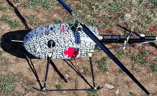
    First responders across the country received about 20 percent of all waivers granted to organizations (398), which demonstrates growing interest and need for public safety applications enabled by UAS, including search and rescue and firefighting at night.

    Effective Aug. 29, 2016, the small UAS rule, also known as Part 107, created a uniform regulatory framework for UAS. Among the rule’s requirements, UAS must fly below 400 feet above ground level (AGL), within visual line of sight and during daylight hours.

    Recognizing the need for the rule to be flexible to foster innovation, the FAA created a waiver process that allows for expanded types of operations, such as nighttime or beyond line of sight operations, with the approval of the agency.

    AUVSI analyzed 3,946 of these waiver documents granted by the FAA since Part 107 went into effect. While the vast majority of waivers (3,636 or 92 percent) were granted to waive the requirement for flying only during the daytime to enable nighttime operations, the FAA has also granted waivers from other sections of the regulations to permit advanced operations, including:

    • Flights over people (112 waivers);
    • Operation in certain airspace (97 waivers);
    • Operating multiple UAS at the same time (55 waivers);
    • Visual line of sight operations (to enable beyond line of sight operations) (51 waivers).

    Operators in all 50 states, as well as the District of Columbia and Puerto Rico, have received waivers. California leads the way with 451 waivers granted, followed by Texas (334), Florida (272) and New York (159). About 87 percent of all waivers were granted to small businesses with fewer than 10 employees and annual revenues of less than $1 million.

    “Across the country, operators have demonstrated they are eager to harness the tremendous potential of expanded UAS operations,” said Brian Wynne, president and CEO of AUVSI. “Small businesses have been able to save time and money, and first responders and public safety agencies have used UAS technology to increasingly contribute to the greater good worldwide, supporting missions from disaster relief to humanitarian aid.”

    Last month, AUVSI submitted its comments on the FAA’s Notice of Proposed Rulemaking (NPRM) for Remote Identification of UAS. In the comments, AUVSI urged the FAA to proceed concurrently with rulemaking that would allow for expanded operations rather than wait for a fully implemented remote ID rule to avoid unnecessary delays. The FAA says it hopes to issue a final rule before the end of the year.

    In the interim, the FAA recently announced several initiatives to improve the waiver application process in response to a review last year of the waiver framework by a task group of the Drone Advisory Committee that was chaired by Wynne.

    The FAA’s plans include expediting the waiver renewal application process, particularly in instances where there hasn’t been many changes since the original application; enabling quick administrative changes to previously granted waivers; providing more responsive feedback to applications that were not approved; streamlining the applications; implementing new regulations to obviate the need for waivers; and increasing transparency and accountability to provide support for waiver applications, disapprovals, and general UAS questions.

    “The waivers that have been granted so far demonstrate that operators are safely able to conduct expanded operations, such as flights over people and beyond visual line of sight,” said Wynne. “While improvements to the waiver process are needed and welcomed, we urge the FAA to move forward rapidly with rulemakings that would enable these operations widely and provide the economic and societal benefits they offer.”

    To view the full interactive report, click here.

  • Plans to reopen after COVID-19 vary widely

    Plans to reopen after COVID-19 vary widely

    Around the world, countries are cautiously beginning to reopen businesses and activities they had shut down to limit the spread of the coronavirus.

    Countries

    Austria will reopen some smaller shops, hardware and garden stores but people will have to wear masks to supermarkets and on public transport. From May 1, all stores, shopping centers and hairdressers will open; restaurants and hotels will open from mid-May at the earliest.

    China has largely removed restrictions on mobility while tightening policy to contain the virus transmission of asymptomatic cases.

    The Czech Republic on April 6 allowed shops such as hardware and bicycle stores to re-open. Outdoor sports facilities have also reopened. Starting on April 20, students will begin a phased return to colleges and schools, but high schools are not expected to fully open until September 1. From June 8, all retail stores, including those in shopping centers, all restaurants, hotels and other accommodation will be allowed to reopen.

    Denmark will reopen daycares, kindergartens and schools (up to 5th grade) on April 22, while other bans, such as on gatherings of more than 10 people, will remain in place until May 10. Churches, cinemas and shopping centers will remain closed. All festivals and large gatherings are banned until August.

    Germany will allow stores with a sales area of less than 800m2 to reopen on April 20 if they maintain hygiene and prevent lines from forming. Schools with hygiene plans in place will gradually reopen from May 4, with priority given to primary and secondary pupils in final years, while daycare centers will remain shut. Other social distancing measures, along with bans on large public events, will remain in place.

    India has extended what is currently the world’s biggest lockdown through May 3.

    Italy allowed bookstores, laundries, stationery stores and children’s clothing stores to reopen on April 14. “Phase 2” of the three-phase reopening plan will start sometime after May 3. Businesses that reopen will be required to make hand sanitizer available, enforce the use of masks in enclosed spaces, and use disposable gloves to handle food and drink.

    Japan has tightened its approach, declaring a state of emergency in Tokyo, Yokohama and Osaka, the country’s three biggest cities.

    Norway is prioritizing reopening schools and will begin to scale back its lockdown measures from April 20, when kindergartens will start to reopen. A week later, schools will reopen for pupils in grades one to four.

    Spain allowed many non-essential employees to return to work after the Easter weekend. Construction and other industries have been allowed to restart, but non-essential stores, bars, and restaurants remain closed. Spanish police are distributing more than 10 million masks to commuters at metro, bus, and train stations.

    Switzerland has extended social distancing restrictions to April 26, but might relax other measures later this month, including border controls, school closures and bans on gatherings, if the virus’ spread is kept in check.

    United States reopenings vary by state

    If you cannot resist the urge to eat at a restaurant or have a drink at a bar during this pandemic without leaving the United States, head for South Dakota, the only state that has not banned these activities except for take-out.

    However, unless you live in neighboring Iowa, Nebraska, or North Dakota, you will be most likely breaking the law of one of the 39 states that have banned travel that is not deemed essential or to get to work (five of them with exceptions or limitations). South Dakota and Arkansas have no travel bans and the remaining six states have a variety of advisories and bans targeted at various classes of people, such as those over 70 years old.

    As for gatherings, 27 states restrict them to ten people or fewer, four states to nine people or fewer, and five states allow no gatherings at all. Only two states, North Dakota and Minnesota, have not banned any gatherings.

    Twenty-five states have limited all nonessential businesses to minimum operations or remote work, three have closed all nonessential businesses, and only two states — again, Nebraska and South Dakota — have not restricted any business activity.

    Finally, while 27 states have no state-wide quarantines, the remaining 23 have a bewildering array of quarantine rules for travelers depending on where they have been. However, the duration of the quarantine is always 14 days.

    Photo: Kameleon007 / iStock / Getty Images Plus
    Photo: Kameleon007 /iStock / Getty Images Plus/Getty Images

    Sources

    *Laura Smith-Spark and Emma Reynolds, “These countries are reopening after coronavirus — here’s how they’re doing it,” CNN, 2020.04.16

    Patrick Kingsley, “Some European Nations Ease Pandemic Rules, but Move Warily: The lifting of restrictions is an early test of whether democracies can restart their economies and restore basic freedoms without refueling the spread of the coronavirus.” The New York Times, 2020.04.14

    International Monetary Fund, POLICY RESPONSES TO COVID-19, last updated on 2020.04.10

    Ryan Heath, “How does the world end the coronavirus lockdown? Countries can’t agree on exit strategy. There are no global benchmarks and little coordination when it comes to opening up national economies.Politico, 2020.04.15.

  • 3 more conferences postponed due to COVID-19

    3 more conferences postponed due to COVID-19

    Three more conferences, including AIxSPACE, the European Navigation Conference and the Connected & Autonomous Vehicles Conference, have been rescheduled for the fall due to the coronavirus pandemic.

    AIxSPACE, originally scheduled for June 1, has been rescheduled to take place Nov. 2. The conference, formed by Euroconsult and Innovitech, will bring together stakeholders in space and artificial intelligence industries to allow everyone to obtain concrete information on these markets and connect with potential business partners. It will still be taking place in Montreal, Québec, Canada.

    The European Navigation Conference has been rescheduled for Nov. 22-25. According to show organizers, the conference will bring together scientists, engineers and international experts to discuss new ideas, latest research results, future developments and new applications. The European Navigation Conference event will still be taking place in Dresden, Germany.

    Finally, the Connected & Autonomous Vehicles Conference will now be taking place Aug. 10-13 at the San Jose Convention Center in San Jose, California. This conference will explore the latest industry developments. In addition, attendees will hear thought-provoking case study presentations from top automakers.

    Check out more show updates as a result of the coronavirus pandemic here.

  • NSGIC issues joint statement on value of GIS for COVID-19 pandemic

    Image: Kat72/ iStock / Getty Images Plus/Getty Images
    Image: Kat72/iStock / Getty Images Plus/Getty Images

    The National States Geographic Information Council (NSGIC) has released a joint statement on the value of GIS in the pandemic, alongside its partners the MidAmerica GIS Consortium (MAGIC), Open Geospatial Consortium (OGC), Urban and Regional Information Systems Association (URISA), and American Association of Geographers (AAG).


    Joint Statement on the Value of GIS in the Pandemic

    The spread and effects of COVID-19 can be best understood considering space and time.

    As governments are responding to COVID-19, more leaders are recognizing the value of “knowing the where.” The importance of knowing where the outbreak is growing, where high risk populations are, where the hospital beds and important medical resources are, and where to deploy resources is essential. “Knowing the where” informs better decision-making.

    In an effort to better understand the where, governments are recognizing the value of geospatial information and technologies and are engaging geospatial professionals to help them better understand the where to help them in their decision-making and response.

    Geospatial professionals bring unique analytical and visualization skills to the table that help responders and decision-makers visualize where the pandemic is spreading more quickly and can make the important decisions regarding where response and resource needs need to be focused. The value of telling the story through a map coupled with a geospatial dashboard provides a view of the event not readily seen in a table such as a spreadsheet.

    Beyond visualizing existing data, we can connect data from a location perspective, which enhances the value of the data sources being integrated. Equally important in this event is data on COVID-19 cases and testing packaged and shared in a way useful to scientists.

    GIS (geographic information systems) is experiencing an unprecedented level of use. Historically, GIS was deployed following a disaster to help respond and recover. Today, GIS is used as a disaster is unfolding. The COVID-19 event is an outstanding example of how effective GIS is when robust data is available. Governments are realizing the value of investing in these systems and the people who run them.

    The information necessary to empower all partners already exists.

    Current nationwide models and response efforts may not benefit from the details of local geographic parameters. Local or statewide models and response efforts may not fully take advantage of the data from other areas of the country. Hospitals are surveyed by both federal and state agencies, and the results of those surveys are not readily available to the hospitals working together to care for patients. Nationwide geospatial data will empower a coalition of participants with a better understanding of the spread and impacts of COVID-19 and improve mitigation actions.

    The same data can be made available in different forms to empower people playing different roles in the response. Researchers — epidemiologists — will benefit from nationwide COVID-19 testing data and data describing factors impacting the spread. This data needs to be as disaggregated as permissible under HIPAA and in a form readily digestible in models.

    The case data could be aggregated to the same units of geography as a wealth of existing demographic data (Census tracts), which could explain and quantify local variances in the spread. Policy makers and those in emergency management can benefit from map and tabular dashboards, harnessing the power of the where by integrating data for analytics.

    The emergency response, public health and geospatial communities must come together to understand COVID-19 in the U.S. and mitigate its spread and overall impact.

    By geo-enabling public health and emergency response data, we can better:

    • understand the spread — with COVID case data, movements of people, and symptoms
    • understand the impact on individuals — with data including age, disease, obesity, and medical treatments
    • understand how to tailor outreach — by age, language, engagement with government, and lifestyle choices
    • understand the needs of the healthcare industry — by facility, day, bed capacity, type of care, ventilators, and PPE
    • understand the impact on the local economy — by county, day, unemployment, and bankruptcies
    • understand the societal impacts — by census tract, domestic violence, alcohol consumption, child abuse, animal abuse, elder abuse, mental health crises, 3-1-1 calls and firearm sales

    We are committed to beginning the national conversation about leveraging the best available data to better understand the spread and impacts of COVID-19.

    To receive more information and be part of the discussion, please share your email address with us.

    National States Geographic Information Council (NSGIC)

    MidAmerica GIS Consortium (MAGIC)

    Open Geospatial Consortium (OGC)

    Urban and Regional Information Systems Association (URISA)

    American Association of Geographers (AAG)

  • 2 SOPS disposes last GPS IIA satellite after 26 years

    2 SOPS disposes last GPS IIA satellite after 26 years

    News by Airman 1st Class Jonathan Whitely
    50th Space Wing Public Affairs Schriever Air Force Base

    The 2nd Space Operations Squadron at Schriever Air Force Base, Colorado, initiated the disposal of the last operational GPS IIA satellite, satellite vehicle number 34, April 13-20.

    The GPS satellite program currently uses 31 satellite vehicles to transmit precise position, navigation and timing signals to more than 6 billion users around the world. To support the Air Force’s GPS III modernization efforts, 2nd SOPS operators phase out older models to make room for the new GPS III satellites.

    The disposal of SVN-34 marks the end of a 26.5-year era in which the satellite outlived its 7.5-year design life by 19 years.

    “As we continue to manage the influx of GPS III (the newest iteration of GPS satellites) and maintaining other vehicles in a residual status, we have to be cognizant of effective risk management,” said Capt. Angela Tomasek, 2nd SOPS GPS mission engineering and analysis flight commander. “As SVN-34 continued to age, we had to manage its aging components and likelihood of having a critical malfunction. We are at a stage where we are confident in the robustness of the overall GPS constellation to remove the last remaining IIA vehicle.”

    Disposal process. Units conduct satellite disposals when a satellite reaches the end of its operational life and no longer requires daily caretaking and maintenance.

    “We push the satellite vehicle to a higher, less congested, ‘disposal orbit’ to eliminate the probability of collision with other active satellites,” Tomasek said. “[Then,] the vehicle is put into a safe configuration by depleting the leftover fuel and battery life and shutting off the satellite vehicle transmitters so no one else can access the satellite in the future.”

    Once SVN-34 is in its final orbit, 2 SOPS will on April 20 hand over full tracking responsibility to the 18th Space Control Squadron at Vandenberg Air Force Base, California, where it will be treated and cataloged like every other space object.

    “This disposal marks the end of an era in GPS history,” said Lt. Col. Stephen Toth, 2nd SOPS commander. “There are senior leaders and long-time contractors [who] launched and operated the IIA satellites at the beginning of their careers [who] are nowhere to see it end. It is an opportunity to reflect on the legacy and heritage of 2 SOPS and GPS to see how far we have come.”


    Feature image: Artist’s depiction of a GPS IIA satellite in orbit. (Image: USAF)

  • Quectel offers 5G sub-6GHz module for mass deployment

    Quectel offers 5G sub-6GHz module for mass deployment

    Photo: Quectel
    Photo: Quectel

    Quectel Wireless Solutions‘ RG500Q-EA 5G NR module has achieved commercial readiness and is now available to support global customers with mass deployment.

    The module features the Qualcomm Snapdragon X55 5G modem. It is designed for a variety of industrial and consumer internet of things (IoT) applications, including business routers, home gateways, customer premises equipment (CPE), MiFi, industrial IoT (IIoT), industrial laptops, PDAs, video surveillance, digital signage, 4K/8K live streaming and many other bandwidth-intensive use cases.

    The Quectel RG500Q-EA supports major sub-6GHz frequency bands as well as worldwide LTE-A and WCDMA network coverage, allowing customers to deploy their IoT solutions flexibly in Asia-Pacific, Europe and the Middle East.

    Quectel RG500Q is a series of 5G Sub-6GHz modules optimized specially for IoT and M2M applications. Adopting the 3GPP Rel. 15 technology, it supports both 5G NSA and SA modes.

    The RG500Q is provided in two variants: RG500Q-EA and RG500Q-NA. The module supports Qualcomm IZat location technology Gen9C Lite (GPS, GLONASS, BeiDou/Compass, Galileo and QZSS). The integrated GNSS receiver greatly simplifies product design and provides quicker, more accurate and more dependable positioning capability.

  • Tallysman releases HC977 triple-band GNSS antenna

    Tallysman releases HC977 triple-band GNSS antenna

    Tallysman Wireless Inc. has added the HC977 triple-band GNSS antenna to its helical antenna family.

    HC977 GNSS antenna. (Photo: Tallysman)
    HC977 GNSS antenna. (Photo: Tallysman)

    The HC977 includes all signals covered by the HC975: GPS/QZSS-L1/L2/L5, GLONASS-G1/G3, Galileo-E1/E5a/E5b, BeiDou-B1/B2/B2a, IRNSS-L5 and L-Band correction services, and also provides reception of GLONASS-G2.

    Tallysman helical antennas are designed for high-accuracy applications where precision and light weight matter, such as unmanned aerial vehicles (UAVs). The antennas are available in either a robust IP67 enclosure or an embedded format.

    HC977E GNSS antenna. (Photo: Tallysman)
    HC977E GNSS antenna. (Photo: Tallysman)

    The HC977 features a low current, low noise amplifier (LNA) that includes an integrated low-loss pre-filter to protect against harmonic interference from high amplitude interfering signals, such as 700-MHz band LTE and other near in-band cellular signals.

    The antenna is protected by a robust, military-grade plastic enclosure with an integrated SMA connector for screw-on mounting that securely seals the unit with an O-ring, complying with IP67 standards. The enclosure also provides three threaded holes in the base for secure attachment of the unit.

    For the embedded version, HC977, Tallysman provides an embedded helical antenna mounting ring that traps the outer edge of the circuit board to another circuit board or to any flat surface. To facilitate a successful installation and optimum antenna performance, Tallysman also provides an Embedded Helical Antenna Installation Guide.

  • Airbus to produce 3D-printed visors in fight against COVID-19

    Airbus to produce 3D-printed visors in fight against COVID-19

    Photo: Nenad Stojnev/E+/Getty Images
    Photo: Nenad Stojnev/E+/Getty Images

    Survey Copter, the tactical drones division of Airbus, will be starting production of medical protection visors using the 3D printers normally used to build drones.

    The parts produced with a 3D printer, using fused deposition modeling on an ABS type plastic base, account for up to 15% of the components of a drone built by Survey Copter, the company said. More than 20 printers are being used to produce the visors.

    The Survey Copter 3D printers take about 45 minutes to produce a visor. According to the company, they’re not certified from the outset as medical equipment but they nonetheless offer the required protection and, given the urgency, are being officially approved by the Montélimar Hospital in France.

    The challenge is to be able to produce a visor capable of withstanding the disinfection procedures used in a hospital environment at temperatures of up to 110 degrees Celsius, without deformation or opacity, the company added.

    “Providing our urgent assistance to the medical sector, faced as it is with the COVID-19 epidemic, is one of our priorities, both locally and internationally, and the reactivity of Nicolas Askamp and his teams at Survey Copter is a perfect illustration of this,” said Dirk Erat, head of communications at Airbus Defence and Space.

    In addition, Airbus in Germany joined the project. The Airbus Protospace Germany and the Airbus Composite Technology Centre in Stade, together with the 3D-printing network named “Mobility goes Additive,” are now supporting this project in Spain, also coordinating the collection and transport of visors to the Madrid region.

  • Thank you for registering.

    Thank you for registering for the upcoming webinar, “Smarter Decisions from Above: How to Optimize Aerial & Drone Survey Programs” sponsored by Nearmap Inc..

    A link to the live event will be sent to you two hours before the event. Your personalized event URL will be automatically generated by the ON24 system. To ensure receipt of the email, please whitelist this email address by adding it to your contacts: [email protected].

    This presentation will begin at 1 p.m. Eastern / 10 a.m. Pacific on Thursday, April 30th. A recording will also be sent to you the following day so you can watch it on-demand.

    Audience members may arrive 15 minutes prior to live time. If you have any questions, please contact event producer Grace Rybak at [email protected]

  • UAVOS completes tests for drone delivery of humanitarian relief

    UAVOS completes tests for drone delivery of humanitarian relief

    UAVOS has successfully tested its cargo delivery UVH-170 unmanned helicopter. The trial aimed to validate a highly automated delivery flight from a vendor to a destination and back, across precisely pre-selected pathways.

    The flight took 1.7 hours and covered a standoff distance of 62 miles (100 kilometers). Critical humanitarian aid weighing 17.6 lbs (8 kg) was delivered with neither the need to land nor the need for a ground-control station on the receiving side.

    UAVOS’s UAS is equipped with line-of-sight data link (LOS) and satellite communication data link, which supports beyond visual line of sight (BVLOS) flights. Watch the cargo delivery UVH-170 UAV in action.

    UVH-170 unmanned helicopter is designed for commercial operations and immediate air response, emergency relief under demanding conditions and tight timescales. The aircraft’s high standoff distance makes it well-suited to humanitarian and disaster relief applications.

    The capabilities of the UVH-170 unmanned helicopter address many social (medical, pharmaceutical, remote communities, humanitarian aid, etc.) and economic (mining, oil and gas, courier, etc.) use-cases being requested by customers.

    The solution is based on the gasoline engine UVH-170 unmanned helicopter. With a maximum take off weight of 99 lb (45 kg), and a payload of up to 22 lb (10 kg), the UVH-170 flies at an altitude of less than 8,200 ft (2,500 m) at maximum speed of 74 mph (120 kph).

    “As we have seen during the trials, the customers can derive significant benefits from the use of the UVH-170 UAV,” said Aliaksei Stratsilatau, CEO and Lead Developer of UAVOS. “As a robust VTOL platform, the UVH-170 does not require any additional take off or recovery equipment, which makes it perfect for delivery to remote areas. Besides, the unmanned helicopter has demonstrated capability to operate in windy conditions with gusts more than 14 mps.”

    UAVOS has offices in Hong Kong, the United States and Europe. Among UAVOS’ unmanned technologies is the high-altitude pseudo-satellite (HAPS) ApusDuo, multi-platform autopilot solution for converting manned vehicles of all types into unmanned, and unmanned aerial vehicles aimed to counteract systems of electronic warfare.


    Feature photo: UVH-170 unmanned helicopter is designed for immediate deliveries. (Photo: UAVOS)

  • ION GNSS+ 2020 advanced conference program available online

    ION GNSS+ 2020 advanced conference program available online

    Illustration: ION

    The Institute of Navigation’s (ION) ION GNSS+ 2020 advance conference program is now available online.

    The show, which is the the 33rd International Technical Meeting of the Satellite Division of the Institute of Navigation, is slated to take place Sept. 21-25 in St. Louis.

    According to ION, the show will feature Commercial and Policy tracks and Research tracks with more than 36 technical sessions Sept. 23-25, in addition to a commercial exhibit.

    ION GNSS+ 2020 will offer short courses on pre-conference tutorials to provide in-depth learning of specific GNSS-related disciplines and will again facilitate the CGSIC meeting. These will take place Sept. 21-22. ION’s Satellite Division will also bring back complimentary short courses, taught by internationally recognized PNT experts and educators on Sept. 21.

    This year’s ION GNSS+ 2020 Plenary Session will feature two dynamic keynote addresses from Dr. Christine Darden, retired NASA program manager and one of the key researchers featured in the book Hidden Figures, and Dr. Bradford Parkinson, who will be presenting “Radio Navigation from Marconi to GNSS.”

    Finally, nominations are currently being accepted for ION’s Johannes Kepler Award, which honors an individual during their lifetime for sustained and significant contributions to the development of satellite navigation, as well as the Bradford W. Parkinson Award, which recognizes an outstanding graduate student in the field of GNSS. Nominations, along with required reference letters, are due June 30.


    Check out ION GNSS+ 2019 show coverage here.

  • Robotic Research innovates to help fight COVID-19

    Robotic Research innovates to help fight COVID-19

    D.C.-area engineering firm produces reusable face shields for region’s hospitals, offers sterile 3D printer patent for COVID applications globally

    The team of engineers at Robotic Research LLC, based in Clarksburg, Maryland, is applying its innovative engineering expertise to create new solutions for healthcare workers to help fight the COVID-19 crisis in the Washington area and around the world.

    Robotic Research is a provider of autonomy and robotic technologies for government and commercial customers.

    The company has created a unique design for reusable face shields and is providing the shields to healthcare teams in hospitals around the Greater Washington Metro area. The company also just opened up its patented design of its sterile 3D printer by waiving licensing fees globally for any application of the printers related to fighting the current public health pandemic.

    Face shields

    Face shield printed for health-care workers to help fight COVID-19. (Photo: Robotic Research)
    Face shield printed for health-care workers to help fight COVID-19. (Photo: Robotic Research)

    The face shields, which Robotic Research is printing on standard industrial 3D printers at its robotics engineering facility in Clarksburg, are being delivered to support teams at hospitals in the Montgomery County area.

    The face shield design provides comfort and protection, and features an improved disinfection process capability using materials compatible with hospital cleaning methods. The design has been approved for use in select departments, with broader uses under evaluation.

    “Our team wanted to help out in any way we could to support the local frontline health-care providers who are working around the clock to assist those impacted by the COVID-19 public health crisis,” said Alberto Lacaze, president of Robotic Research. “We are producing a face shield that modifies a design based off the blueprint provided by the National Institutes of Health. The design includes some enhancements to further protect from aerosol in the temple area and allow the masks to be cleaned and therefore reusable, as well as comfortable to wear over prolonged use.”

    Robotic Research has sourced materials from across the country to support the production of approximately 2,000 face shields. The company is seeking a grant through Montgomery County and the state of Maryland to boost production to approximately 500 shields a day. The company normally uses its standard 3D printers to support many of its robotic products and solutions.

    Sterile 3D printer

    A batch of face shields prepared fo delivered to a Maryland hospital. (Photo: Robotic Research)
    A batch of face shields prepared fo delivered to a Maryland hospital. (Photo: Robotic Research)

    Materials used for polymer 3D printing are often damaged by the high temperatures, chemicals or radiation used in standard sterilization processes. Robotic Research’s patented process overcomes this challenge by using a sterile chamber around a 3D printer where unsterilized plastic is brought into the chamber.

    The possibly contaminated plastic is sterilized by the printing process and packaged maintaining the sterile field.

    This system was initially designed for a U.S. government agency to allow sterile medical materials to be printed at locations where commonly used sterilization methods might not be possible.

    “Because this printer can create sterile materials, which are sterile from the inside out once produced, we are eliminating the need for hospitals to re-sterilize equipment before use,” Lacaze said. “At a time when efficiency and supplies are critical, we hope this technology will be able to help alleviate some of the immense pressure hospitals and medical facilities are currently facing. It is our hope that providing the use of this process at no cost may help bring solutions to the health care teams working to save lives during this crisis.”

    The unique printer process enables the manufacturing of sterile medical equipment and implantable device components, such as intubation tubes and other materials required during invasive procedures, in a manner that eliminates the need for additional sterilization.

    Robotic Research’s patented sterile 3D printing process (USPTO 10,406,758) will be available royalty-free for a minimum of one year for any COVID-19 applications across the globe.

    The company is committed to continuing to use its resources and facilities to develop solutions for the ongoing challenges of the COVID-19 pandemic.