Category: Uncategorized

  • Conducting integrated drone surveys at a congested airport

    Conducting integrated drone surveys at a congested airport

    Photo: Joel Papalini/iStock / Getty Images Plus/Getty Images
    Photo: Joel Papalini/iStock / Getty Images Plus/Getty Images

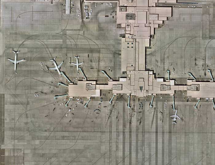
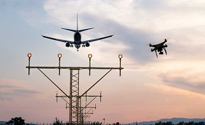
    Airports are extremely congested spaces, both on land and in the air, making it difficult to conduct surveys that provide insights into their continued monitoring and maintenance.

    UAVs create the opportunity to survey such sites safer and faster, reducing disturbances to everyday operations while collecting a level of detail unparalleled by conventional surveying techniques to locate and accurately capture areas in need of maintenance and management on airport runways.

    Following several drainage and grading issues throughout a 650-acre airport, Texas-based civil engineering company Gessner Engineering was contracted to provide surveying services to identify the most problematic regions.

    The team had to conduct the survey with minimal impact on runway operations. By coordinating with the airport’s air traffic controllers, the team planned a 6–8-hour flight window, with just a few pauses for ongoing traffic, while the airport operated as usual.

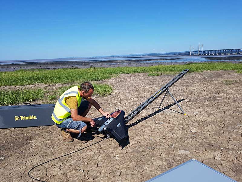
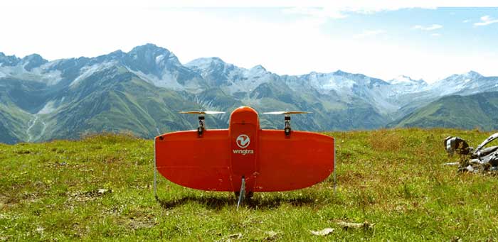
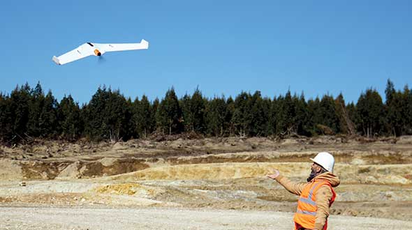
    Before the flight, the surveyors used senseFly eMotion flight-planning software to carry out pre-flight risk assessments and plan flights. During the survey, four 20-minute flights were completed with the senseFly eBee fixed-wing drone. With its fully autonomous and easy-to-use aerial mapping capabilities, the eBee was able to capture the high-resolution aerial photos needed to map the entire airport. The data was processed using Pix4D Mapper to generate a topographic model including a point cloud with a ground sample distance of 1.5 inches.

    The point cloud was so comprehensive, it brought attention to four more areas with drainage issues, providing a level of detail that would not have been possible using only a ground GNSS base station. The UAV survey took one day, compared to four weeks for traditional surveying. This cut the project time in half and significantly reduced disturbances to airport operations.

    “The savings in manpower with the shorter surveying time, accurate data retrieved, and the additional drainage issues identified demonstrate the value of drones, as an enabler of solving complex challenges in congested airspaces, especially where time is limited,” said Troy Hittle, general manager, North America, SenseFly. “The success of this project by using UAV equipment has offered new possibilities to both Gessner Engineering and the future of aviation maintenance.”

  • AG Surveys collects topographic beach surveys throughout England

    AG Surveys collects topographic beach surveys throughout England

    Prepping for flight: Andreas Garbe, AgSurvey, sets up the UX5 HP for a topographic survey at Severn Beach, a village in South Gloucestershire. (Photo: Trimble)
    Prepping for flight: Andreas Garbe, AgSurvey, sets up the UX5 HP for a topographic survey at Severn Beach, a village in South Gloucestershire. (Photo: Trimble)

    Based in Bristol, AG Surveys has been collecting topographic beach surveys around the country as part of England’s Environment Agency’s coastal monitoring campaign.

    In the first integrated approach of its kind in the program, AG Surveys uses the Trimble UX5 unmanned aerial system (UAS) equipped with a Trimble/Applanix GNSS receiver along with photogrammetry software. The UAS-based system has not only confirmed its viability for coastal monitoring, it has been bringing new business opportunities ashore since 2017.

    For each beach, AG Surveys must provide one baseline survey based on a 5-meter grid with a height accuracy of 3 centimeters. Also required is a series of profile line surveys. Profile surveys follow pre-defined lines set every 50 meters from the back of the beach to the low tide line, with GNSS measurements taken within 10 centimeters of each side of the line.

    Crews typically cover 3 square kilometers a day, flying four to five Delair drone flights at an altitude between 100–120 meters, at speeds of 80 kph and a lateral overlap of 80%. To ensure the reliability and accuracy of the UAS data, they use a minimum of 10 ground control points (GCPs) for each flight block and measure each target’s position with a GNSS receiver.

    Once flights are complete, the team imports into Trimble Business Center (TBC) the flight and GNSS data and the base station survey data. Using both on-board GNSS positioning data and the ground control data, they process precise, short baselines between the base station and each photo point. All images are then integrated into Trimble’s Inpho UASMaster software to create a dense point cloud and a seamless orthophoto of the entire area of interest. (UASMaster is now integrated into the TBC Aerial Photogrammetry Module). If needed, they can also use UASMaster to produce a seamless, georeferenced orthophoto directly from the point cloud.

  • Unicore GNSS guides XAG Drones in China

    Unicore GNSS guides XAG Drones in China

    XAG introduces agricultural drones for farmers in China. The XMission drone can reduce costs on fertilizer, pesticides and other treatments. (Photo: XAG/Unicore)
    XAG introduces agricultural drones for farmers in China. The XMission drone can reduce costs on fertilizer, pesticides and other treatments. (Photo: XAG/Unicore)

    Pesticides, fertilizers and water are the most important means to enhance agricultural crop production.

    The prevalent infestation of fall armyworm in China has resulted in reduced yields, threatening food security and the livelihood of smallholders. It’s impractical to conduct manual spraying over farmlands larger than 5 hectares, and this also runs both the risk of wasting large amounts of pesticides and chemical poisoning.

    Given the situation, smart agriculture devices such as drones have come in handy for fixing these problems, with minimal environmental impacts. In China, professional farmers and agricultural service providers have already harnessed existing drone technology to conduct appropriate chemical sprays to safeguard the country’s crop production.

    The XAG XMission drone has centimeter-level navigation and can operate fully autonomously over complex terrain and easily adapt itself to different spraying conditions for various crop species. Farmers are therefore relieved from much physical effort while no longer risking their health in the battle against fall armyworm.

    Equipped with Unicore’s high precision dual-antenna GNSS module (UM482), dual RTK plus GNSS positioning system, real-time centimeter-level flight positioning provides reliable data support in various air tasks. XAG’s drone carries a 4G communication module connected to the XAG Cloud RTK network in order to immediately start missions without setting up portable ground RTK bases.

    Unicore UM482. Unicore’s GNSS high precision module (UM482) provides centimeter-level accuracy real-time positioning, with 0.2°, 1-meter baseline course information. UM482 supports single-module dual-antenna signal access and has a dual-RTK engine, enabling high-precision, high-reliability directional heading and dual-RTK real-time positioning, with each RTK engine calculating position independently. This receiver meets the flight needs of different types of UAVs for many different scenarios.

    Virus Fighting. XAG’s drones have also joined the fight against the spread of the coronavirus. In Feburary, XAG announced a 5-million-yuan fund for coronavirus response, to be put toward aerial disinfectant sprays to curb the spread of the virus in rural areas. The company’s fleets were used in China’s Shandong province on Jan. 28, where they reportedly disinfected a local community of more than 300,000 square meters in less than 4 hours.

  • Wingtra brings wind energy to the Swiss Alps

    Wingtra brings wind energy to the Swiss Alps

    Photo: Wingtra
    Photo: Wingtra

    Site-survey preparations for a windfarm of 20 300-foot tall wind turbines might have been quite complex for a location in a 2,500-foot-high valley in the Swiss Alps.

    However, the contractor decided to use a drone with vertical take-off and landing (VTOL) capability supplied by Wingtra to speed up the work and produce highly accurate geo-referenced data. Although multirotor drones are normally used for detailed survey work, they can cover much less area than fixed-wing drones during the same flight time. Fixed-wing drones can fly longer, farther and carry more weight.

    Multicopters tend to carry more expensive, higher accuracy sensors because the sensors are not subject to potential damage from fixed-wing belly landings. Wingtra solved this problem by developing a drone with vertical take-off, the ability to transition to horizontal flight and to then land upright. When equipped with heavier, more accurate sensors, longer and more complex surveys are possible.

    The Septentrio AsteRx-m2 was also chosen for the WingtraOne drone. The AsteRx-m2 is a high-precision, multi-frequency, four-constellation, PPK, low weight and power GNSS module. The low-latency AsteRx-m2 works for both rotorary- and fixed-wing UAV applications.

    The WingtraOne VTOL drone is able to cover 400 hectares (an area of around 570 football fields) in one 55-minute flight. The resulting mapping accuracy is as high as 1.27 centimeters (0.5 inches). The drone was equipped with the full-frame 42MP Sony RX1RII camera, with seven ground control points for increased accuracy.

    The WingtraOne took off vertically and transitioned to fly horizontally at the planned 1,500-foot altitude. Each flight took about 20 minutes to plan and involved 30 minutes of flying time. The flights covered a total area of 1,100 hectares — each flight was 200–300 hectares.

    Aerial data collected from the site was converted to 3D models that allowed visualization of planned roads and wind-turbine locations in the wind farm. The data-collection workflow only took 4 hours rather than the days required with traditional surveying. Use of high-end sensors ensure survey-grade imagery and accuracy — in this case, the engineers obtained an accuracy of 3–4 cm.

    Flying in an area as difficult as the Swiss Alps to collect aerial data has been one of Wingtra’s most complicated challenges. By reducing costs and the time to complete the survey and evaluation of the proposed site, the customer was able to maintain the overall wind farm project timelines.

  • Lidar pairs with unmanned helicopter

    Lidar pairs with unmanned helicopter

    Photo: Lidar USA
    Photo: Lidar USA

    The UAV market has been growing rapidly for the past several years, especially in the U.S. with the Federal Aviation Administration (FAA) Part 107 regulations becoming active in August 2016. Before then, it was impossible to tell what systems were real and would weather the marketplace, and which were just a dream. Multicopters dominate the marketplace. (DJI’s M600 — out since 2016 — offers a 1–6-kilogram payload option). In late 2019, InnoFlight introduced the Galaxy 950 unmanned helicopter, a single-rotor platform capable of carrying more than 6 kilograms. It is available with battery power only, providing flights under an hour, but soon will support a gas-driven option for flights exceeding 2 hours. The system can be ready to deploy in less than 10 minutes.

    Lidar USA provides a range of available lidar systems weighing about 5 kilograms, which work well with heavy-lift systems such as the Galaxy 950. In 2019, the Optech CL-90 was released; later the same year, the CL-360 hit the market. Lidar USA integrated each scanner into its product family and immediately saw the possibilities with the Galaxy 950.

    The Lidar USA CL-series, together with the Galaxy 950, easily falls in the under-55-pound category set by the FAA. This means users can tackle small (5-acre) and large (500- to 5,000-acre) mapping jobs with confidence in their drone platform, the quality of the scan data, and the resulting lidar point cloud. The Galaxy 950 can easily support the CL-series with supporting cameras. The Optech CL-series provides survey-grade lidar accurate data: +/– 0.01 foot from a car on a paved surface. The system can operate from 400 feet with scan lines every inch at speeds of 14 mph (6.3 m/s). Of course, not all pulses make it to the ground due to vegetation, but the Optech CL-series provides up to four echos per pulse with a small beam size of 0.3 milliradians. Depending on the clipping angle, the scan width can range upwards of 1,200 feet, equating to about 34 acres per minute along a corridor. This system provides the surveyor with high-quality, accurate and dense lidar data.

  • Building a better aerial imagery program beyond UAVs

    Building a better aerial imagery program beyond UAVs

    Photo: Nearmap
    Photo: Nearmap

    The ability to capture and evaluate truth on the ground through aerial imagery is an ever-growing industry, thanks to the proliferation of UAVs and access to imagery on demand and online. Yet obstacles remain that could prevent organizations from capturing location intelligence.

    For organizations that require timely, accurate and current aerial imagery, an additional capture program outside of drones could be necessary. One company, Nearmap, flies fixed-wing aircraft two to three times per year over 430 urban areas across the United States. Using proprietary camera technology, Nearmap captures aerial data in a variety of formats: vertical, oblique and 3D. The location content is then delivered to customers via a web browser application and can be easily integrated into GIS/CAD applications.

    A mid-size tech company in New Mexico using a drone to capture digital surface model data ran into two obstacles: proximity to no-fly zones at Albuquerque International Airport and need for image consistency over an entire metro area. With a project due date looming, the company turned to Nearmap, which provided the necessary image data around the airport, as well as historical imagery. With the Nearmap data, the company was able to speed project planning from design to project completion.

    Nearmap aerial imagery also provides data at scale (an entire city, not one city block). The clarity of the imagery is 2.8-inch ground sample distance, providing optimal data for seeing truth on the ground.

  • VTOL UAV tackles difficult Sichuan survey

    VTOL UAV tackles difficult Sichuan survey

    The P330 takes off. (Photo: CHC Navigation)
    The P330 takes off. (Photo: CHC Navigation)

    The CHCNAV P330 vertical takeoff and landing (VTOL) UAV has been deployed to complete orthophoto acquisition with a resolution of 15–20 centimeters of the city of Xichang in the Sichuan Province, China. The project involved a series of technical and operating challenges: several no-fly zones, a 700-meter flight ceiling by airspace control, tricky winds, and a total area of 900 square kilometers — all within a tight schedule.

    The project involved 15 people, a fleet of four P330s and the set up of 200 ground control points.

    The hybrid P330 was selected for its ability to combine the advantages of a fixed-wing UAV with extended flight time with a rotor-based VTOL UAV, which enables aerial survey missions on complex terrain.

    Project area. (Photo: CHC Navigation)
    Project area. (Photo: CHC Navigation)

    Each P330s was fitted with a Sony A7R2 camera and high-accuracy GNSS positioning system. Because of its innovative design, the P330 can be assembled in less than five minutes without tools, saving the survey crew considerable time. Plus, basic operation training was completed in 2 hours.

    The P330 also has one-click take-off and landing, support for breakpoint flight resuming after temporary return to base, and self-diagnostic of all sensors before take off. It has dual-rotor and parachute protection in case of emergency landing.

    Other features include take-off and landing positioning accuracy within 20 centimeters and automatic return to base in case of a data communication failure. It offers survey-grade PPK accuracy.

    The P330’s battery life lasts up to 2.5 hours. It will operate safely under Class 5 wind conditions at an altitude up to 4,000 meters, providing stable attitude under bad weather conditions. It also meets imaging constraints under low-light conditions.

  • Small-scale topo and bathy lidar ready for UAVs

    Small-scale topo and bathy lidar ready for UAVs

    Photo: ASTRALiTe/SBG Systems
    Photo: ASTRALiTe/SBG Systems

    The ASTRALiTe Edge is a small-scale topographic and bathymetric scanning lidar that can detect underwater objects, measure shallow water depth and survey critical underwater infrastructure from a small UAV platform.

    The patented 2-in-1 topo-bathy Edge can see beneath the water surface at depths of 0–10 meters. It is self-contained with its own INS/GNSS, battery and onboard computer. It weighs under 5 kilograms and is designed for deployment on UAV systems for faster, safer and more accurate bathymetric surveys. From coastal mapping and surveying to infrastructure inspection and military logistics, the applications of this innovative lidar are numerous and widespread.

    Geo-Referencing Solution. ASTRALiTe needed a motion and navigation solution for its cutting-edge lidar. “Our requirements included high accuracy along with low size, weight and power,” explained Andy Gisler, director of Lidar Systems. Also, the system needed to be able to apply a PPK correction to the lidar data to provide higher accuracy results to ASTRALiTe’s customers.

    Photo: SBG Systems
    Photo: SBG Systems

    The company chose the new Quanta georeferencing solution from SBG Systems, an INS designed to be integrated into mobile mapping systems. “The weight of the INS solution was especially important to us,” Gisler said. The Edge scanner will be flown on UAVs, where light payload capacities are required. “The ability to use two GPS antennas was key in our choice as we required good heading knowledge at slow flight speeds,” Gisler said.

    Quanta directly and precisely geotags the point cloud in real time and provides even higher performance in post-processing. One year of post-processing with Qinertia, SBG’s in-house PPK software, is offered for UAV applications.

    “Accurate and lightweight IMU performance leads to high accuracy lidar point clouds,” Gisler said. “Combined with the ASTRALiTe scanner and lidar performance, point clouds with typical densities of 100-300 pts/m2 and centimeter-level resolution can be achieved.”

  • Delair drones mine for data

    Delair drones mine for data

    When Trimble sold its Gatewing fixed-wing drone business to Delair in October 2016, its decision was based on several drivers. Trimble had worked with Delair since 2008 and knew their capabilities; the company decided that a dedicated drone company should be better placed than a GNSS manufacturer to find and develop leading-edge drone business. Also, the sale enabled Trimble to better focus on integrated UAS software technology for positioning, remote sensing and photogrammetry. Delair joined up with Microdrones, a supplier of multi-rotor UAVs, to round out the team’s offerings. Both companies are skilled in the application of Trimble UAV software.

    Typical Delair drone applications include rapid data gathering using the UX11 fixed-wing drone, followed by data analysis leading to highly accurate survey-grade results.

    For the Johnson Poole and Bloomer (JPB) mine sites, personnel safety was an important driver in moving away from having people on the ground collect data, sometimes in dangerous situations. Time and cost savings have now become the norm for JPB survey operations, particularly for stockpile volume calculations.

    With the UX11 flying at 400 feet for 40–45 minutes, up to five times each day, it is possible to collect thousands of photos of many acres — ending with an accuracy of around 1.7 centimeters.

    The UX11 drone is equipped with a high-precision Septentrio AsteRx-m2, providing post-processed kinematic (PPK) multi-frequency, four-constellation signal reception. The AsteRx-m2 is also low power and low weight.

    Another mining operation using Delair drone survey and analysis tools is Luck Stone in Virginia. With numerous quarries in Maryland and Virginia, Luck Stone produces aggregates and more than 75 crushed stone, sand and gravel products for civil engineering, private construction and environmental projects. Luck Stone also finds that inspection staff safety is significantly improved, as is the time for such inspections, and asset inventories are not only accurate but also can be undertaken quickly and much more often.

    Delair has just released a new agriculture system with the fixed-wing Delair UX11 Ag, along with the Delair Aerial Intelligence (delair.ai) processing system. An integrated and easy-to-use workflow has been developed to collect, manage, analyze and share agriculture data for crop health monitoring, field experimentation analysis, automatic machine guidance, precision ag practices and better crop traceability.

    The new system makes use of PPK for precise auto-geolocation. The UX11 Ag drone carries a fully integrated high-grade multispectral camera for the data collection and monitoring of plant health.

    Delair.ai supports tools that provide visual field maps, identifying plant health by chlorophyll content, green biomass, stoutness/visual health and other plant indicators. The drone enables spray prescription preparation to counter weeds, disease and pest infiltration. UAVs also make it possible to determine the effectiveness of treatment regimes.

    In addition, Delair has developed the DT26 fixed-wing series of longer range drones for two-hour lidar survey flights and for surveillance; it can be adapted to carry other customer payloads. The DT26 uses an Applanix/Trimble GNSS receiver.

    Delair customers also use their drones for power-line inspections and in the oil and gas industry for site preparation surveys and pipeline inspections. The UX11 was the first drone from a Trimble partner to provide a JXL file for processing UX11 data in the Trimble Business Center.


    Featured photo: Delair/Trimble

  • Canada approves BVLOS drone flights with Iris

    MVT Geo-solutions, in partnership with Iris Automation, has been granted the first beyond-visual-line-of-sight (BVLOS) Special Flight Operations Certificate (SFOC) by Transport Canada using only onboard detect-and-avoid (DAA) systems.

    The approval was granted based on the utilization of Iris Automation’s DAA system, called Casia, which provides commercial drones with automated collision avoidance maneuvers.

    The waiver permits flights within the Unmanned Aircraft Systems (UAS) Center of Excellence’s controlled airspace Remotely Piloted Aircraft System (RPAS) test range in Alma, Quebec. This is the first BVLOS flight at the location leveraging only onboard DAA for air risk mitigation, and does not require ground-based observers or radar.

    BVLOS flights unlock autonomous drone use for economically beneficial commercial applications including infrastructure inspection, mining, mapping, agriculture, emergency response and package delivery.

    “Achieving the first BVLOS approval in Canada further validates our technology alongside multiple permissions we have already received from regulators in the U.S. and South Africa,” said Iris Automation CEO Alexander Harmsen. ”This technology is critical to safely integrate drones into the airspace along with manned-aircraft, and we look forward to unlocking commercial operations for our customers in Canada.”

    Iris Automation’s onboard computer-vision DAA system is an effective, scalable and cost-effective technology to enable commercial BVLOS operations.

    “The UAS Center of Excellence is looking forward to leveraging Iris Automation’s DAA system and existing flight expertise within our network to conduct BVLOS flights with MVT Geo-solutions,” said UAS Center of Excellence Director William de Keiser. “We will continue to develop our partnership with Iris Automation to provide training to local operators and enable BVLOS flights in Canada.”

    The first BVLOS flights are scheduled to take place within weeks. The resulting data will inform more complex BVLOS operations in the future.

  • Drone Delivery Canada asks for COVID-19 use cases

    Drone Delivery Canada asks for COVID-19 use cases

    Drone Delivery Canada logo

    Drone Delivery Canada is reaching out to the healthcare industry for use case applications for drone deliveries related to COVID-19.

    The Toronto-based company, which has been designated an essential workplace by the Ontario Provincial Government, seeks use cases from health care organizations (hospitals, seniors’ homes, medical labs and related organizations).

    If organizations in healthcare and related industries have a use case, they should reach out immediately to DDC at [email protected] and also contact their local government official to support their use case.

    “In the news we are seeing COVID-19 related drone applications around the world, and Canada can particularly benefit from having DDC, a drone logistics leader, in its own backyard,” said Michael Zahra, president and CEO of DDC. “The current situation is an ideal use-case for our proven drone logistics solution to: limit person-to-person contact; bring needed medical and pharmaceutical supplies to Aboriginal, remote, rural and suburban communities; transport blood samples to laboratories for testing and deliver other relevant supplies needed for Canada to effectively manage the current situation.”

  • DJI joins with firefighting provider Rosenbauer on digital emergency response

    DJI joins with firefighting provider Rosenbauer on digital emergency response

    Photo: Michael Chapman/iStock Editorial / Getty Images Plus/Getty Images
    Photo: Michael Chapman/iStock Editorial / Getty Images Plus/Getty Images

    Aerial perspective and mobile operation management system combine to inform deployment, give increased situational awareness, and save critical time

    A new strategic partnership between DJI and Rosenbauer International AG will enable emergency scenarios to be dealt with quicker, more safely and more efficiently, according to the companies.

    DJI makes civilian drones and aerial imaging technology, and Rosenbauer manufactures fire service vehicles and firefighting equipment.

    The two companies will work together to bring the benefits of digital emergency response management to anyone involved in being called to tackle an emergency situation.

    Whether used by a private company at an airport or industrial facility, or a local fire department called out to an emergency even in severe weather, an aerial perspective combined with Rosenbauer’s operation management system enables the situation to be quickly assessed and informed decisions made regarding the safest and most efficient deployment of personnel.

    Rosenbauer’s operation management system is the information management system for firefighting operations that supports emergency crews on site with relevant information such as fire safety maps, hazardous material data or vehicle rescue sheets.

    Data from DJI’s drone fleet management software, FlightHub, will be integrated into Rosenbauer’s operation management system, giving additional visual and thermal data to the decision maker of the operation.

    The information can then be relayed to operational units at the scene on a tablet or displayed on monitors back at the command center giving a full overview of the situation. Informed decisions can be made in real time regarding the efficient and safe deployment of resources such as personnel, vehicles and other equipment.

    Data safety is paramount and all information that is delivered to the Rosenbauer operation management system in real-time, and from DJI’s FlightHub, is stored on a server in the highly secure computer center of a well-known European telecommunication firm. The data traffic is secured and encrypted. During deployment, the data is also synced with all mobile end devices so that every operational team has the same information, and it is kept in a closed loop.

    “Speed and a truly complete overall picture are key criteria for success when emergency service teams have to make purposeful decisions under time pressure. We have already supported their efforts to meet these criteria with our IT solutions, which range from efficient vehicle management to navigation, right through to alarm applications,” said Dieter Siegel, CEO of Rosenbauer International. “This cooperation with DJI enables us to consolidate our role as a digital pioneer while we work together to develop an integrated technology for comprehensive, data-based firefighting and disaster management.”

    “DJI is proud to bring its drone technology to support Rosenbauer’s excellence in fire apparatus manufacturing and its vision of empowering firefighters with the best possible tools for emergency response and disaster relief. At DJI, we aim to provide reliable, scalable drone offerings that empower firefighters, search and rescue and public safety teams to benefit from this technology,” said Roger Luo, President, DJI. ” It plays an increasing role in saving lives, time and resources on a daily basis. This integration is an important step for this long-term partnership, and our commitment demonstrates an increasing maturity in the adoption of drones for firefighting professionals.”