Tag: Apple

  • Mapping the future of spatial computing

    Mapping the future of spatial computing

    In February 2024, Vision Pro, Apple’s long-awaited extended reality (XR) headset, hit stores. It is Apple’s stab at the consumer XR market, but XR is not how Apple describes it. Instead, when it was announced last summer, Apple CEO Tim Cook said the headset marks the dawning of the era of spatial computing. “You’ve never seen anything like this before,” he added.

    Greg Milner
    Greg Milner

    That is not quite true.

    The term spatial computing dates to the 1980s. Its modern definition entered the lexicon in 2003. Simon Greenwold, a graduate student in the Program in Media Arts and Sciences at the Massachusetts Institute of Technology (MIT), described spatial computing wherein a human interacts with a machine, and that machine retains and manipulates referents to objects and spaces in the real world.

    But spatial computing extends back even further. It has been the cornerstone of geographic information system (GIS) technology since the software programs debuted in the late 1960s. Indeed, the theoretical foundation of GIS is that it is not only possible but inherently useful to retain and manipulate real objects within some form of virtual space.

    In the first GIS programs, virtual space was synonymous with cartographic space. Spatial computing means using maps to organize large amounts of data in a visually intuitive manner.

    The Roots of Spatial Computing

    Early geospatial technology pioneers applied the concepts of such theorists as Ian McHarg, who described the world as a series of layers of information that exist and interact in the same physical spaces. If we analyze any spot on Earth, we encounter such informational layers as elevation, soil type, hydrology, biology and land use.

    GIS brought this idea to life. The technology allows us to visualize and analyze layers of data on a map. In this way, GIS has become a key integrator of information about our world, from science to engineering to commercial operations.

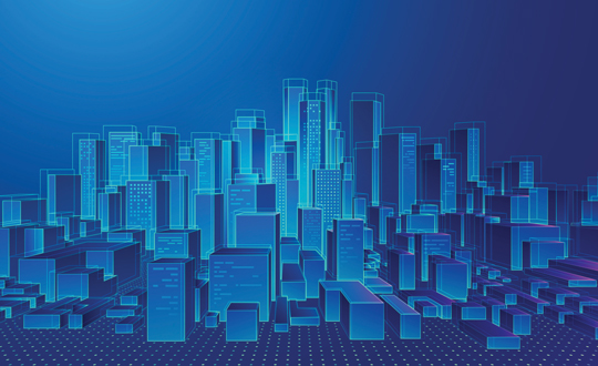
    Through innovation, GIS has grown beyond the bounds of mere 2D map layers to generate maps that are, in effect, 1:1-scale 3D models we call geospatial digital twins.

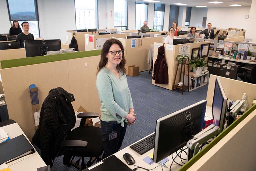
    The major benefit of geospatial digital twins is the ability to provide maximum context. This is especially useful for smart planning of our urban environments. For example, architects can use a digital twin to test how their proposals will fare in such situations as flooding and extreme heat brought about by climate change. City planners can understand the effects of large-scale shifts in the urban environment with interventions focused on enhancing livability. The combination of visualization and hard data allows them to predict impacts and modify plans before making expensive changes to the physical world.

    Spatial Computing and Digital Twins

    Each advance in GIS technology has improved our ability to visualize, link and manipulate real objects and spaces in a digital realm.

    GIS has evolved to offer truly immersive experiences. In particular, the combination of GIS and game engines such as Unreal and Unity has transformed the process of large-scale infrastructure projects.

    In Brisbane, Australia, for example, a digital twin of the ongoing subway construction has been used to display progress. People can walk virtually through planned subway tunnels and stations. This contextual experience helps project leads show Brisbanites how the work is shaping up.

    The experience also allows planners, architects, engineers and construction workers to make decisions with more information than could be provided by a paper map or even a traditional digital twin. They can stand on a platform and see how the design elements of a station will look to people moving through it.

    Spatial Computing to Visualize What Could Be

    Digital twins can be crystal balls. The virtual spaces can be reconfigured to model different versions of an environment. In practical terms, digital twins allow various stakeholders to have the same vision. This is especially useful in the age of climate change.

    Planners and architects can test different versions of a project. If they are designing a subdivision in a coastal community, they can calculate the flooding and storm surge that will likely occur from storms of different magnitudes. Just as important, they can visualize this data, inhabit it, and study it with maximum context.

    At root, what they are doing is investigating spatial relations against a realistic backdrop of the world. For the subdivision, these objects include homes, streets, streetlights, and parks, and what matters is their existence in relation to water under multiple scenarios. This is spatial computing: manipulating referents to real objects in a virtual world that, unlike the real one, can be changed at will.

    Spatial Computing to Visualize Hidden Real Spaces

    Immersive environments also offer the promise of displaying a world that is real and already exists yet remains largely invisible.

    Public utilities and other companies involved with underground infrastructure have been some of the most enthusiastic adopters of digital twins because the experience can reveal critical connections buried beneath the earth — made visible without the need to dig.

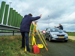
    In 2017, the Toms River Municipal Utilities Authority (TRMUA) in Toms River, New Jersey, began using mixed reality (MR) headsets to help crews find underground utility assets for electric, gas, water, telecommunications and sewer services.

    GIS stores the location of these assets, and MR displays the underground infrastructure. Traditionally, utilities display this detail on a 2D map. What MR provides is maximum context. Workers in the field can visualize exactly what is under their feet—and see how it’s related spatially to what is all around them.

    TRMUA credits MR with saving time and lowering the chances of breaking connections in the networks residents rely on for modern living — savings in the tens of thousands of dollars every day.

    Many utilities have since followed TRMUA’s lead. MR setups serve multiple purposes, including training new employees and sharing information between teams in the field and staff in the office.

    One utility industry publication recently noted that what these systems ultimately provide is the elimination of guesswork. The ability to know exactly where an asset is located — and to understand how changes will affect the area around it — leads to increased efficiency and customer satisfaction.

    The World in Sharper Focus

    Apple’s Vision Pro headset is not the only recent example of XR rebranded as spatial computing. Meta and Microsoft have also marketed their XR headsets — Quest 3 and Hololens, respectively — as spatial computers.

    Spatial computing will continue its mainstreaming. Eventually, it will likely be the norm. As XR hardware increases in number and power, more organizations will look to unlock the value of all the spatial data recorded in GIS. Being able to experience data will add further value to the systems and workflows that create it.

    GIS pioneers began exploring the outer limits of spatial computing a half-century ago. More recently they have realized its potential for smarter urban planning, climate risk mitigation, management of operations across industries and virtual exploration of real-world systems or scenarios via geospatial digital twins. Someday soon, those limits will be reachable by anyone.

    As GIS users have learned through the decades, when we get a better sense of where we are in relation to things we care about, we can create the world we want to see.

    To explore immersive spatial computing experiences in browser, visit 360 VR Experiences. Read more about Esri XR experiences in ArcGIS.

    This article originally appeared on Esri Blog.

  • Seen & Heard: Driving blind and keeping ballots valid

    Seen & Heard: Driving blind and keeping ballots valid

    “Seen & Heard” is a monthly feature of GPS World magazine, traveling the world to capture interesting and unusual news stories involving the GNSS/PNT industry.


    From paradise to panic… Or not

    Tourists at the Honokohau Small Boat Harbor in Kailua-Kona, Hawaii, drove their car into the harbor after following directions on a mobile map application, and were surprised when the car filled with water, reported Insider and the Washington Post. A witness to the incident took a video showing two women in a Dodge Caravan driving “confidently” into the harbor. The witness also stated that the women were not panicked and were smiling as the car tipped forward into the water. The driver and passenger eventually climbed out of the car and were not injured in the incident. An information specialist for the Hawaii Department of Transportation stated that mobile mapping applications are inaccurate and tourists should always be aware of their surroundings.


    Image: Lorado/E+/Getty Images
    Image: Lorado/E+/Getty Images

    Apple tags to the rescue again

    New York City will give out free Apple AirTags to residents in an effort to stunt an increasing number of car thefts, reported the New York Post. A local nonprofit donated 500 AirTags to the city to be handed out to residents, especially those in New York Police Department’s (NYPD) 43rd Precinct in The Bronx. NYPD encourages drivers to purchase the device if they are not able to receive one from the city. An equitable distribution plan is being designed by the Crime Prevention Unit of NYPD’s Community Affairs Bureau. The city will also be fundraising to purchase more AirTags or similar devices.


    Image: adamkaz/iStock/Getty Images Plus/Getty Images
    Image: adamkaz/iStock/Getty Images Plus/Getty Images

    Keeping ballots valid

    The Ottawa County Clerk’s office in West Olive, Michigan, is using location data to track vital election data around the county in real time, reported KATV News Channel 7. Once the election machine scans the results of a ballot, the data is uploaded to a flash drive and sealed with a tabulator. Then, a bipartisan group of election workers places the flash drive in a sealed container with a GPS receiver and a radio transmitter that communicates the container’s location in real time to the county clerk’s office. Ottawa County Clerk, Justin Roebuck, believes the receivers add an extra layer of security and will instill faith in voters that nobody is tampering with their ballots.


    Credit: vvectors/iStock/Getty Images Plus/Getty Images
    Credit: vvectors/iStock/Getty Images Plus/Getty Images

    Driving blind

    GPS plays a quiet, but integral role in Formula 1 (F1) racing. In a sport where split-second reactions are vital, GPS helps drivers and their teams improve race to race and navigate tracks safely. The importance of live location data was seen in the opening practice session at the 2023 Australian Grand Prix FP1. A red flag was flown due to loss of location data triggered by a glitch in the distribution of live tire information. This caused several near-misses on the track because drivers no longer received traffic advisory calls from their teams, reported Autosport. It took more than nine minutes to restore the real-time location data.

  • Seen & Heard: Tracking pythons and wild camels

    Seen & Heard: Tracking pythons and wild camels

    “Seen & Heard” is a monthly feature of GPS World magazine, traveling the world to capture interesting and unusual news stories involving the GNSS/PNT industry.


    Image: Apple
    Image: Apple

    Apple Products Meet Accuracy with GPS

    Apple launched the Ultra Watch, which contains a dual-frequency GPS antenna that can receive L5 signals, as well as the iPhone 14, which features a dual-band GPS receiver combining the L1 and L5 signals. The company is also harnessing signals from more than 70 satellites to boost the accuracy of its services such as SOS alerts and alerting emergency responders, per The National News. The dual-frequency abilities of the new products provide accurate location for calculating distance, pace and routes. The L5 signals also are a critical component of Apple’s health and safety features, providing more accuracy than in previous products.


    Image: dwi septiyana/iStock/Getty Images Plus/Getty Images
    Image: dwi septiyana/iStock/Getty Images Plus/Getty Images

    Collar Accidently Tracks Python

    Wildlife researchers in Key Largo, Florida, accidently discovered a way to locate and eradicate invasive Burmese pythons, per WFLA News Channel 8. The team of researchers were observing racoons and possums that were fitted with tracking collars to note their behavior. After months of observation, a possum collar sent a mortality signal due to lack of movement. To the researchers’ surprise, the collar then started moving again. They later discovered the possum had been eaten by a python. While this was not the intent of the team’s research, they proved this could be an effective way to lower the increasing population of the invasive python species.


    Image: Pavliha/ iStock/Getty Images Plus/Getty Images
    Image: Pavliha/ iStock/Getty Images Plus/Getty Images

    Remote-Sensing Finds Wild Camels

    Scientist Liu Shaochuang and his team have used satellite remote-sensing technology to study and track wild camels. Shaochuang studies the interrelationship between endangered animals and their environments, which may help protect the species against climate change. To track a camel, Shaochuang attaches a GNSS-enabled collar, which transmits the camel’s location every day. The short message function is provided by China’s BeiDou satellite system, which transmits and receives signals in real time. Based on the data, Shaochuang and his team can observe migratory paths, living environments and possible threats.


    Image: Screenshot of CNN video
    Image: Screenshot of CNN video

    Former South Carolina Attorney Convicted with Location Data

    On March 3, Alex Murdaugh was convicted of killing his son Paul Murdaugh and wife Maggie Murdaugh. With limited evidence, the prosecution used a phone video and vehicle navigation data to prove Alex’s guilt. During the trial, Alex claimed he was visiting his mother during the time the murders took place. However, General Motors OnStar data accessed by investigators from his Chevrolet Suburban contradicted the alibi, putting Alex at the scene of the crime during the time of the murders. Plus, in a smartphone video taken by Paul that night, Alex’s voice could be heard, placing him at the scene.

  • Seen & Heard: Can GPS forecast rain?

    Seen & Heard: Can GPS forecast rain?

    “Seen & Heard” is a monthly feature of GPS World, traveling the world to capture interesting and unusual news stories involving the GNSS/PNT industry.


    Image: Licence plate, Reviver
    Image: Reviver

    Digital license plates gone wrong

    A security research team has gained administrative access to Reviver, the only company in California that sells digital license plates, which has allowed them to track the physical location of all of Reviver’s customers. With this vulnerability, anyone could remotely update, track and delete someone’s Reviver plate. The access also enabled the researchers to change a section of the text at the bottom of the plate, designed for personalized messages, to anything they want, according to Vice.com. California launched the option to buy a digital license plate in October 2022, and Reviver has since addressed the license plates’ security vulnerability.


    AirTag. (Image: David Peperkamp/iStock / Getty Images Plus/ Getty Images)
    Image: David Peperkamp/iStock / Getty Images Plus/ Getty Images)

    Bill makes secret tracking illegal

    Indiana state legislators have filed a bill that would make tracking someone with a GPS-based device without their knowledge a crime, reported WTHR of Indianapolis. The bill is in response to the growing number of criminal cases involving Apple AirTags and other GPS-based tracking devices. Tracking someone secretly is not currently a crime in Indiana; however, laws vary from state to state. Under the proposed bill, the penalty would be increased from a Class C misdemeanor to a Class A misdemeanor if the person tracked is under a protective order. The penalty could be enhanced for someone convicted of using a tracking device when committing a felony. Similar incidents are on the rise around the United States involving the use of AirTags and other tracking devices for criminal purposes.


    Image: big-dan/ iStock / Getty Images Plus/ Getty Images
    Image: big-dan/ iStock / Getty Images Plus/ Getty Images

    Cellphones cause demise

    On New Year’s Day, six rockets were launched from a United States-made Himars rocket system at a vocational college in Ukraine, killing at least 89 Russian soldiers. Russia is blaming this on illegal cellphone usage by Russian soldiers, defying a ban. Ukrainian officials say 400 Russian soldiers were killed and another 300 were wounded, contradicting Russia’s report. However, this is the largest number of deaths Russia has acknowledged during the war. Russia says that the obvious cause of the attack was the use of mobile phones, as the enemy was able to locate and determine the troops’ coordinates for the strike. Two of the rockets were shot down before reaching Makiivka in the occupied Donetsk area of Ukraine. 


    Image: Angelo F-/ iStock / Getty Images Plus/Getty Image
    Image: Angelo F-/ iStock / Getty Images Plus/Getty Image

    Can GPS forecast rain?

    Researchers at the Department of Marine Geology and Geophysics at the Cochin University of Science and Technology in Kochi, India, say that heavy rainfall can be detected more than six hours in advance using GPS signals, reported The Hindu. During rainy seasons, as GPS signals pass through the atmosphere, how much they are delayed depends on the amount of water vapor present. By using continuous GPS signals and rainfall data collected in Thiruvananthapuram, the study showed that any heavy rainfall could be detected using this delay. 

  • Indiana bill makes secret tracking illegal

    Indiana bill makes secret tracking illegal

    Image: WTHR
    Image: WTHR

    Indiana state legislators have filed multiple bills that would make tracking someone with a GPS-based device without their knowledge a crime, reported WTHR of Indianapolis. The bills are in response to the growing number of criminal cases involving Apple AirTags and other GPS-based tracking devices.

    Tracking someone secretly is not currently a crime in Indiana; however, laws vary from state to state. Under one proposed bill, the penalty would be increased from a Class C misdemeanor to a Class A misdemeanor if the person tracked is under a protective order. The penalty could be enhanced for someone convicted of using tracking devices when committing a felony.

    Similar incidents are on the rise around the United State regarding the use of AirTags and other tracking devices for criminal purposes. In December 2022, two women in California filed a class-action lawsuit against Apple for privacy concerns after being stalked by ex-partners using AirTags.

  • Seen & Heard: Autonomous vehicles and Apple AirTags

    Seen & Heard: Autonomous vehicles and Apple AirTags

    “Seen & Heard” is a monthly feature of GPS World magazine, traveling the world to capture interesting and unusual news stories involving the GNSS/PNT industry.


    Image: iStock/Getty Images Plus/Getty Images
    Image: iStock/Getty Images Plus/Getty Images

    San Francisco Not Keen on Avs

    San Francisco officials aren’t happy with autonomous vehicles (AV) on their streets. They say the AVs are at fault for traffic violations and congestion, delays in emergency response and public transport — even trips onto public sidewalks. California officials granted the first AV deployment permits this year, allowing companies to release self-driving cars onto city streets and to provide passenger service as robotaxis. State governments have the legal power to grant permits to AV companies to conduct testing and ride-hail services, leaving city officials powerless to control self-driving car incidents that affect public safety.


    (Image: Apple)
    Image: Apple

    AirTag under Fire 

    Two women have filed a class-action lawsuit against Apple, claiming its AirTag trackers are being used for malicious and criminal purposes. Both women say they were tracked by ex-partners using Apple AirTags hidden in their belongings. They are seeking damages for negligence and privacy violations, and are hoping to prevent Apple from continuing to manufacture the product with “design flaws.”


    (Image: TU Delft/Frank Auperlé)
    Image: TU Delft/Frank Auperlé

    Navigating Urban Canyons with SuperGPS 

    Researchers at Delft University of Technology, Vrije Universiteit Amsterdam and VSL have developed an alternative positioning system that is more robust and accurate than GPS, especially in urban settings. The aim of the project — SuperGPS — was to develop an alternative positioning system that makes use of mobile telecommunications networks instead of satellites and that has better accuracy than GPS. A prototype of the infrastructure achieved an accuracy of 10 centimeters. The new technology is important for the implementation of a range of location-based applications, including automated vehicles, quantum communication and next-generation mobile communication systems.


    (Image: Allison Usavage/Cornell University)
    Image: Allison Usavage/Cornell University

    Robots Head to Vineyards

    Cornell researchers have designed PhytoPatholoBots (PPB) that will be deployed in vineyards across the country next spring in the first of a four-year project at Cornell, which is led by the University of Minnesota. The autonomous robots will collect data on the health of each grapevine, helping growers to evaluate their vineyards. The robots are part of the Specialty Crops Research Initiative, bringing innovation to the wine and grape industries.

  • Apple sued for privacy concerns regarding Apple AirTags

    Apple sued for privacy concerns regarding Apple AirTags

    Photo: Apple
    Photo: Apple

    Two women have filed a class-action lawsuit against Apple for privacy concerns as Apple AirTags are being widely used for malicious and criminal purposes.

    Both women and their families were tracked and stalked by ex-partners using Apple AirTags hidden in their personal belongings. They are now suing Apple for negligence and privacy violations stating the company failed to protect its customers. They are both seeking damages and are hoping to prevent Apple from continuing to manufacture this product with “design flaws.”

    The location device was designed by Apple in 2021 and its intent is to be attached to such items as keys, suitcases and purses to make them trackable. However, the $29 Bluetooth-enabled AirTags can be used as a weapon by abusers, stalkers and traffickers to easily find and track their victims.

  • India mandates NavIC support for smartphones, no timeline yet

    India mandates NavIC support for smartphones, no timeline yet

    Photo: MStudioImages/E+/Getty Images
    Photo: MStudioImages/E+/Getty Images

    The Indian government is pushing smartphone makers to sell devices that receive NavIC signals along with GPS.

    India originally stated NavIC would be required in smartphones sold starting in January 2023, according to Reuters, but strong reaction from smartphone manufacturers Apple, Xiaomi and Samsung apparently caused the government to push back or remove the deadline.

    A deadline of January 2023 would not allow enough time for smartphone makers to integrate NavIC-enabled receivers to their devices. Steps include redesign, securing parts, testing and assembly. Many smartphones sold in India by the companies are economy-level devices priced under US$200.

    The three tech giants met with government officials, seeking an extended target date of 2025, Reuters reported.

    However, India’s Ministry of Electronics & IT issued a statement via Twitter :

    India has been pushing for adoption of NavIC since at least 2021, while chipmaker Qualcomm has been producing NavIC-enabled modules since 2020.

    NavIC (Navigation with Indian Constellation) is the operational name for the Indian Regional Navigation Satellite System (IRNSS) developed by India’s space agency for military and commercial purposes. NavIC consists of eight satellites that cover the Indian mainland and the region extending up to 1,500 km from its boundaries.

    “NavIC can help in navigation on land, air, sea and also in disaster management,” Science & Technology Minister Jitendra Singh said in a press release. “NavIC satellites are placed at a higher orbit than the GPS of United States. NavIC satellites are placed in geostationary orbit (GEO) and geosynchronous orbit (GSO) with an altitude of about 36,000 km; GPS satellites are placed in medium earth orbit (MEO) with an altitude of about 20,000 km.”

    “NavIC uses dual-frequency bands, which improves accuracy of dual-frequency receivers by enabling them to correct atmospheric errors through simultaneous use of two frequencies,” Singh said. “It also helps in better reliability and availability because the signal from either frequency can serve the positioning requirement equally well.”

  • Using contact tracing and GPS to fight spread of COVID-19

    Using contact tracing and GPS to fight spread of COVID-19

    Tracing Location

    Contact tracing can help stem the spread of the COVID-19 pandemic. It involves tracking the movement and interactions of infected individuals to identify others at risk.

    National and regional responses to the COVID-19 pandemic have included containment through quarantine and restriction of movement. When properly implemented, these solutions limit spread of the contagion to prevent it from overwhelming healthcare and emergency management systems.

    According to the World Health Organization, the Centers for Disease Control and Prevention, and virtually all medical professionals, any effective strategy to return the world to normal requires three components: testing, contact tracing and isolation.

    While testing to find the people who are infected is the absolute top priority, contact tracing is vital for stopping a disease from spreading out of control. It involves tracking the movement and interactions of infected individuals to identify others at risk. Any positive test without contact tracing is bad public health — it misses an opportunity to reduce the spread of the virus.

    While the concept of contact tracing has just entered popular consciousness, it has been a standard public health tool for a century. For example, in the 1930s, Great Britain used it to contain the incidence of sexually transmitted infections. In the 1960s and 1970s, South American, African and Asian countries used it to eradicate smallpox. Additional diseases for which contact tracing is performed include tuberculosis, measles, HIV, Ebola, bloodborne infections, serious bacterial infections and novel infections.


    What Is Contact Tracing?

    The World Health Organization describes three basic steps:

    • Contact identification. Those who have been in contact with someone who has been confirmed to be infected are identified, by asking about their activities and those of the people around them.
    • Contact listing. All persons who have had contact with the infected person are informed of their status and told to receive early care if they develop symptoms.
    • Follow-up. Contacts are monitored for symptoms and tested for signs of infection.

    In some cases, quarantine or isolation is required for high-risk contacts.


    The enormous dimensions of the current pandemic, however, challenge traditional models of contact tracing, which are very resource intensive. In search of a technological assist, several Asian countries already have been taking advantage of the functionalities of smartphones to scale up contact tracing to match the pandemic’s rate of growth, such as the Trace Together app built by the Singapore government. Companies and organizations around the world are following suit, including Britain’s National Health Service, a pan-European initiative, and an unprecedented joint venture by Apple and Google.

    Automating Contact Tracing

    A study published on March 31 in Science concluded that “viral spread is too fast to be contained by manual contact tracing but could be controlled if this process [were] faster, more efficient and happened at scale.” A contact-tracing app that memorizes close contacts and immediately notifies users if they have had contact with infected individuals, prompting them to self-isolate, could control the pandemic without need for mass quarantines if enough people used it, the study argues.

    Privacy versus Protection. A similar app has been deployed in China, where people are required to use it to be allowed to move beyond their neighborhood, enter public spaces, or use public transport. A central database collects data on each user’s movement and coronavirus diagnosis, artificial intelligence analyzes these data, then the app displays a red, amber or green code that determines the user’s freedom of movement. This app has been credited with significantly helping China suppress the pandemic, but has been criticized for its disregard for data protection and privacy.

    Relying on fundamental epidemiological principles and common smartphone functionality, the Science study authors designed a simple algorithm to replace manual contact tracing. “Coronavirus diagnoses are communicated to the server, enabling recommendation of risk-stratified quarantine and physical distancing measures in those now known to be possible contacts, while preserving the anonymity of the infected individual.” Symptomatic individuals could use the app to request testing, and everyone could use it to access COVID-19-related health services, information and instructions, or even to request deliveries of food or medicine during self-isolation.

    Public trust in the app and how the gathered data are used would be critical to its success. The study’s authors lay out a series of requirements for its ethical implementation, then point out that “the algorithmic approach we propose avoids the need for coercive surveillance, since the system can have very large impacts and achieve sustained epidemic suppression, even with partial uptake.”

    The authors of a similar article in the journal JMIR mHealth and uHealth write that a contact-tracing system can limit any central coordination to notifying users who have been in contact with an infected person. Their core idea is that it does not matter where someone contacts an infected person, only that they were in close enough contact to risk infection. Particularly sensitive location data, such as GPS or phone cell data, “is actually neither necessary nor useful.” No one learns who the user is because the app is not linked to an identity, and it neither records nor stores location data.

    The authors argue their proposed app is the most effective epidemiologically because it would determine which people were in close proximity, and it would receive user cooperation. “Only if people trust a system — because it does not spy on them — will the system find broad support in the population.”

    GPS, Bluetooth or Both?

    Technologically, the concepts of location and proximity are embodied in two standard smartphone components: GPS receivers and Bluetooth transceivers. GPS-derived location data makes it possible to map and analyze the movements of individuals and of large numbers of people; for example, it is how we know that many in this country have begun relaxing social distancing rules ahead of the lifting of legal mandates. Bluetooth’s use of low energy, generally a drawback, becomes an advantage here because it can tell us whether two or more people have been within 1.5 to 2 meters of an infected person for at least 10 to 15 minutes — when the risk of infection is highest. This knowledge can enable newly infected, pre-symptomatic people to self-isolate and not infect others.

    Numerous companies are developing and proposing smartphone-based contact tracing apps.

    Vesedia Mobile Technologies proposes that people who test positive to COVID-19 be asked to provide information about public places they visited in the preceding days and at what times, using their phone location history for verification. The information would be anonymized by healthcare officials, and entered into a database that would be publicly accessible via a website and mobile app.

    Ramesh Raskar. (Photo: MIT/John Werner)
    Ramesh Raskar. (Photo: MIT/John Werner)

    Intersections. The COVID Safe Paths phone app and the Safe Places browser tool for contact tracers were created by Ramesh Raskar and other researchers at the MIT Media Lab. If a user tests positive and consents, his or her data is uploaded, redacted by healthcare authorities to remove any personally identifiable information, and downloaded by the app.

    The app then performs “intersections” — it identifies and notifies people with whom the infected person has crossed paths. By clicking on intersections, users can display their timeline for the past 14 days, in a calendar view, which tells them how many intersections have occurred each day.

    The app also provides news reports from authorized local news channels, based on each user’s position or if they tap the URL for their local healthcare authority, said Abhishek Singh, the program’s tech lead, who is helping with the app’s development.

    “We are also building an interoperable architecture,” Singh said. “Because there are many contact tracing apps already in the wild, we want to make sure that they have some common standards and guidelines that enable them to utilize data from other apps securely and through consent.” More than 1,200 people are voluntarily contributing to the project. “It is being led by the open-source community, and all our source code is out there and anybody can contribute,” Singh said.

    Safe Places is helping health authorities by making the data and insights visible, enabling them to make the right decisions such as targeting resources to areas that need them most, helping them impose restrictions such as lockdowns, or reopen the economy. “The economy will not reopen in a single burst, but step by step.” Singh said. “A dashboard that allows them to monitor where the infection is spreading and where it has been contained helps them decide where to take which steps.”

    The GPS Advantage. The uptake required for GPS-enabled contact tracing to be successful is generally lower than for Bluetooth-based contact tracing, Singh argues, citing an Oxford University simulation. “With GPS, you do not need people to have the app already downloaded for it to be effective,” he points out. A person who tests positive for the virus can use the Safe Place web tool to manually create a GPS trail and help healthy people. This is one of the biggest advantages of GPS compared to Bluetooth, because the latter requires exchanging information directly through the hardware, which cannot be done after the fact.

    Because the app is open source, any government can deploy it using its own IT infrastructure. However, a government that wants to adopt Safe Paths must sign a letter that commits it to complying with privacy and ethical guidelines. Preventing authoritarian governments and nosy employers from requiring people to use this app and reveal their data requires stringent guidelines as to how it is deployed and who can access the data, Singh said.

    Apple and Google Join Forces

    Apple and Google have joined in an unprecedented alliance to develop a system for notifying people who have been near others who have tested positive for COVID-19. Eight out of 10 people in the United States own smartphones, and the two companies’ operating systems run more than 99% of them. Apps built directly into iOS and Android, especially if interoperable, could dramatically increase the reach of public health authorities (the only organizations that would receive the data). To avoid fragmentation and encourage wider adoption, Apple and Google will allow only one app per country to use their system, but will allow U.S. states to use it and support countries that opt for a state or regional approach.

    The system will use Bluetooth signals from phones to detect encounters rather than GPS location data. It will not run ads, will require users to opt-in, be decentralized, and use randomized IDs not tied to a user’s actual identity to communicate potential contacts with individuals with a confirmed positive COVID-19 diagnosis.


    With GPS, you do not need people to have the app already downloaded for it to be effective.


    API Coming. On May 20, Apple and Google released an API to developers. Next, they will issue a system update to build in contact tracing at the OS level. Should a user’s phone notify them of a possible contact, they will be prompted to download and install a public health app from their local health authority to obtain trusted instructions.

    Developers of coronavirus-related apps for several U.S. states have argued that GPS location data is vital to identify infection hotspots and track outbreaks. However, for various technical reasons, workarounds designed to bypass the decision by Apple and Google and collect GPS data in connection with their contact tracing system would work poorly.

    Ethical and Equity Concerns

    “The work that we are doing for COVID-19 is pretty similar to work that we do on a routine basis with other reportable communicable diseases,” said Lisa Ferguson, nursing supervisor for Communicable Disease Investigations and Case Management for Multnomah County, Oregon, which includes the city of Portland. Most commonly, her unit is notified of illnesses by the state database, which receives electronic lab reports. “We assign that as a case to somebody on our team, and they call the person, interview them, ask some questions about their illness, their symptoms and where they could have possibly been exposed,” Ferguson explained. “Then, they talk about who that person might have exposed and where they were from two days before they became sick up until the time of the interview or the time that their symptoms were resolved.”

    The Multnomah County, Oregon, Disease Detection Team. (Photo: Multnomah County, Oregon)
    The Multnomah County, Oregon, Disease Detection Team. (Photo: Multnomah County, Oregon)

    How could technology — such as smartphone location data — best help Ferguson’s team conduct contact tracing for COVID-19? “In the public health world, we are not used to having access to technology in that way,” she said. “We need to have some ethical discussions before we are prepared to utilize something like a technology that can track people.” Also, unlike tracking measles, which requires knowing whether someone was in an airspace and who was there after them, “We do not automatically consider someone to have been exposed if they were in the same airspace as someone who tested positive.”

    If the privacy concerns could be adequately addressed, receiving a list of all the people who were less than six feet away for at least 10 minutes from someone who had tested positive could help her team scale up, Ferguson said. Her team would then reach out to those people, using such language as “You may have been exposed,” and “Please watch yourself closely.”

    Ferguson’s team always has “equity concerns,” fearing they might under-identify groups that do not have access to the technology. “It is a supplemental tool, but it certainly would not replace the work that we are doing,” she said.

    Help Wanted

    Safely reopening the United States will require a new workforce of at least 100,000 contact tracers, according to a report from the Johns Hopkins Center for Health Security and other experts. Any technological assist to contact tracing does not diminish this need. For example, smartphone alerts can help filter out those at low or no risk so that human tracers can focus on genuine cases, people at higher risk, or those who are harder to contact.

    Two out of 10 people in the United States do not own a smartphone, and only 42% of those above the age of 65 — who suffer 80% of the deaths from COVID-19 — do, according to a 2017 Pew Research Center poll. Hardly any homeless people own a smartphone. Among those most vulnerable to the pandemic are immigrants who do not speak English and are fearful of efforts to collect their personal information, strengthening the need for this to be done in person by trusted community members.

    Finally, even if Google and Apple’s automated service is widely adopted and works well, it will require many thousands of health workers to conduct tests and follow-ups.


    Feature photo: da-kuk / iStock / Getty Images Plus / Getty Images

  • Apple applies for machine learning GNSS device

    Apple applies for machine learning GNSS device

    Logo: Apple

    Earlier this month, Apple applied to the Federal Communications Commission for to a license to install GPS testing equipment on its headquarters campus.

    This may be related to an application filed by Apple Inc. with the U.S. Patent Office in August 2019, which describes the company’s “Machine Learning Assisted Satellite Based Positioning.”

    From the patent application:

    MACHINE LEARNING ASSISTED SATELLITE BASED POSITIONING

    A device implementing a system for estimating device location includes at least one processor configured to receive an estimated position based on a positioning system comprising a Global Navigation Satellite System (GNSS) satellite, and receive a set of parameters associated with the estimated position.

    The processor is further configured to apply the set of parameters and the estimated position to a machine learning model, the machine learning model having been trained based at least on a position of a receiving device relative to the GNSS satellite.

    The processor is further configured to provide the estimated position and an output of the machine learning model to a Kalman filter, and provide an estimated device location based on an output of the Kalman filter.

    In 2015, Apple acquired the small enhanced-GPS company Coherent to aid the speed and accuracy of its devices’ location services. Presumably, Apple intends to incorporate its machine-learning positioning method into its navigation software.

  • Apple applies for license to install GPS testing equipment at Apple Park

    Apple applies for license to install GPS testing equipment at Apple Park

    Logo: Apple

    Apple has applied for a license from the Federal Communications Commission (FCC) to install GPS testing equipment within Apple Park.

    For the purposes of licensing, GPS transmitters are included in radio broadcasting legislation, and enforced jointly by the FCC and the U.S. National Telecommunications and Information Administration, which is part of the Department of Commerce.

    In its application, Apple named two objectives. The first objective is the “illumination of the part of the the facility, located at 1 Apple Parkway, Cupertino, California, with a GPS signal to allow for the testing and experimentation indoors for continued exploration of utilizing GPS technologies within their devices to provide innovation applications and continue to provide safe products.” Its second objective is the “further design, development and enhancement of existing GPS applications to provide greater efficiency and more effective means of utilizing GPS derived information.”

    According to Apple Insider, this would mean Apple would install a GPS transmitter or repeater within Apple Park in order to better control and test its own GPS devices. Apple plans to use a GPS repeater called Metro GNSS, Apple Insider added.

    The application has not yet been granted, but Apple previously applied three times for licenses to conduct tests regarding cellular and consumer radios, with each application being approved, reported Apple Insider.

  • Apple warns old iPhones, iPads could hit GPS rollover problem

    Apple warns old iPhones, iPads could hit GPS rollover problem

    iPhone 4s. (Photo: Apple)
    iPhone 4s. (Photo: Apple)

    Anyone who owns an older model Apple iPhone or iPad could experience a device-breaking problem on Nov. 3, according to Apple.

    The issue could affect iPhone and iPad models introduced in 2012 and earlier.

    “If you don’t update to the newest version of iOS available for your device before November 3, some models might not be able to maintain an accurate GPS position. And functions that rely on the correct date and time—such as syncing with iCloud and fetching email—might not work,” Apple said in a blog post.

    The problem is because of the GPS time rollover on April 6. Affected Apple devices won’t be impacted until just before 12 a.m. UTC on Nov 3.

    The iOS update will solve the problem, enabling the device to maintain accurate GPS location and keep the correct date and time.

    Devices affected include iPhone 4s and 5, third and fourth-generation iPad, iPad mini and iPad 2. Learn specifics of affected models and how to update the operating system on the Apple website.

    If not updated, these devices might not be able to maintain accurate GPS position or perform functions that require accurate time, such as properly syncing with iCloud or fetching email. The devices also might not be able to receive over-the-air software updates. As a result, the only way to update the device will be to restore it via iTunes or Finder through a tethered connection.