Tag: autonomous vehicles

  • Deepen AI unveils multi-sensor calibration for physical AI applications

    Deepen AI unveils multi-sensor calibration for physical AI applications

    Deepen AI has released its latest targetless calibration platform, built to simplify and accelerate calibration for complex autonomous vehicles, automotive ADAS and robotics sensor suites.

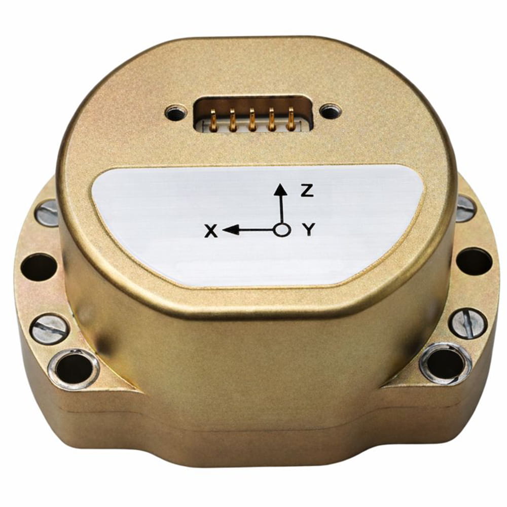
    The platform supports a wide range of configurations including GNSS receives, multiple lidars, radars, cameras and inertial measurement units (IMUs). It processes all inputs in one pass using a single continuous dataset such as a ROS bag.

    As sensor stacks become more sophisticated, traditional calibration methods are increasingly becoming a bottleneck in deploying autonomous systems at scale. These approaches are often manual, iterative and dependent on physical targets. Deepen AI’s solution introduces a fully automated and unified approach that calibrates all sensors simultaneously.

    The platform estimates intrinsic, extrinsic and temporal parameters across the entire sensor suite in a single streamlined workflow, removing the need for sensor-by-sensor calibration. This approach streamlines operations while delivering high performance, achieving up to 0.05° angular accuracy and 0.7 cm positional accuracy, exceeding traditional target-based calibration techniques.

    Capabilities include:

    • Simultaneous calibration across all sensors using a single dataset
    • Support for multi LiDAR, camera, radar, IMU, and GNSS configurations
    • Accuracy of up to 0.05° and 0.7 cm
    • No strict requirement for loop closure or fixed driving patterns

    “Calibration has traditionally been one of the most time-consuming, complex and fragmented steps in deploying autonomous systems,” said Mohammad Musa, founder and CEO of Deepen AI. “With this release, teams can move to a system level approach that delivers both speed and precision using real-world data.”

    The system is designed to work without controlled environments or rigid data collection protocols, allowing teams to seamlessly integrate calibration into existing workflows for both research and large-scale production deployments. It requires only simple and practical conditions, with calibration possible in locations such as parking lots, garages or quiet streets, provided the environment is mostly static with minimal moving objects. A minimum of 30 seconds of continuous driving data is required.

    The platform is already being deployed with customers working on highly complex sensor configurations, where multiple lidars and cameras need to be calibrated together as a single system. In one such deployment, the full sensor stack was calibrated during a normal drive in a parking garage, parking lot, or a small residential street, without any special driving patterns or looped trajectories.

    Using only a short duration of driving data, Deepen AI simultaneously performed intrinsic, extrinsic and temporal calibration across all sensors in a single workflow. This unified approach not only simplifies operations and improves consistency, but also delivers accuracy that surpasses traditional target-based calibration methods, making it well suited for both research and production environments.

  • Micro-Magic offers high-precision MEMS IMU module

    Micro-Magic offers high-precision MEMS IMU module

    Micro-Magic has released the U4930 series, a reliable and cost-effective six-axis MEMS inertial measurement module that can be widely used in navigation, control and measurement fields for vehicles, ships and drones.

    Typical applications include vehicle/ship attitude measurement, UAV attitude reference and trajectory control, mobile mapping, track inspection, underwater high-precision navigation, and Satcom-on-the-Move.

    The U4930 series integrates high-performance MEMS gyroscopes and MEMS accelerometers within an independent structure. The three-axis MEMS gyroscopes sense the angular motion of the carrier, and the three-axis MEMS accelerometers sense the linear acceleration of the carrier.

    The system internally performs compensation for zero bias, scale factor, non-orthogonal error, and acceleration-related terms across all temperature parameters, maintaining high measurement accuracy over a long period of time.

    The module supports custom communication protocols and provides synchronization for GPS/GNSS time data and pulse per second (PPS) signals.

    The U4930A series inertial measurement module can be configured with various hardware and software to meet user needs.

  • ComNav unveils innovative products ‘From Earth to Ocean’

    ComNav unveils innovative products ‘From Earth to Ocean’

    At a recent product launch event, ComNav Technology unveiled a new technological ecosystem for surveying. Under the theme “From Earth to Ocean,” the company presented a suite of next-generation innovations engineered to advance the frontiers of geospatial and hydrographic intelligence.

    ML300 mobile laser scanning system

    Precision surveying in complex environments

    The ML300 mobile laser scanning system is designed for large-scale surveying projects and complex environments. It incorporates multi-mode fusion positioning technology, integrating GNSS, IMU, DMI and laser SLAM, providing a new approach to 3D scene reconstruction.

    This system is designed for environments where GNSS signals are limited or entirely lost, such as tunnels, urban canyons, and densely built-up areas. In these challenging environments, traditional surveying methods often fail to deliver the required precision, but with ML300’s intelligent multi-mode positioning, we ensure accurate 3D scene reconstruction regardless of the conditions.

    The ML300 mobile laser scanning system incorporates multi-mode fusion positioning technology. (Photo: ComNavTech)
    The ML300 mobile laser scanning system incorporates multi-mode fusion positioning technology. (Photo: ComNavTech)

    The core advantages of the ML300 lie in its high precision and flexibility. By combining Laser SLAM and DMI technologies, it can operate effectively without GNSS signals, eliminating errors and improving modeling accuracy. This breakthrough offers new solutions for large-scale land surveys, urban infrastructure monitoring, and smart city planning, among others.

    Designed for operational efficiency, the ML300 boasts a modular and highly flexible design. It can be customized with various sensors, including road cameras, Ladybug 6 panoramic cameras, and wheel encoders, making it adaptable to a wide range of project needs. Additionally, with up to 6 hours of battery life and external power source support, the ML300 ensures stable performance during long working hours.

    Whether for highway surveys, urban power line inspections, dynamic forestry management, or smart transportation system development, the ML300 provides precise and efficient data support, facilitating digital transformation across various industries.

    The SV3 USV is designed to be portable and usable by a single surveyor. (Photo: ComNavTech)
    The SV3 USV is designed to be portable and usable by a single surveyor. (Photo: ComNavTech)

    SV300 unmanned surface vessel

    Intelligent underwater surveying

    The SV300 unmanned surface vessel was designed specifically for intelligent underwater surveying. This autonomous vessel is optimized for operation in complex aquatic environments, integrating high-precision GNSS positioning, AI technologies, and autonomous navigation capabilities, enhancing both the efficiency and accuracy of hydrographic surveys.

    Its design focus on making underwater exploration smarter, safer and more efficient. Its ultra-light design (28 kg) and compact hull (less than 1 meter in length) enable single-person operation. The SV300 can be stored in the trunk of a small vehicle.

    Equipped with a high-performance single-beam bathymetric measurement system, the SV300 can measure depths up to 200 meters, ensuring reliable data. Its streamlined hull and powerful motor enable a top speed of 7 meters per second, accelerating survey speeds without compromising accuracy.

    The intelligent features of the SV300 enhance measurement efficiency and ensure the safety of personnel. Whether used for river, lake or ocean surveys, or in emergency response and pipeline inspections, the SV300 adapts to complex environments inunderwater exploration.

    HYD10 portable echo sounder

    Compact and precise

    The HYD10 is a lightweight, high-precision echo sounder designed for modern surveying tasks. Weighing 0.3 kg for the main unit and 1.5 kg for the transducer, its portability means a single operator to carry and operate. Its compact design and Bluetooth capability allow it to function seamlessly in tight spaces and complex environments, removing the need for cumbersome cables.

    With a measurement depth range of 0.3m to 200 m, the HYD10 provides high-precision readings with accuracy ±1 cm + 0.1% of water depth and 1 cm resolution. The 200 kHz depth module and narrow 6° beam angle ensure precise, clear data, while an adjustable sound speed range (1300-1700 m/s) adapts to different water conditions.

    For greater operational flexibility, the HYD10 integrates with Survey Master software, supporting real-time monitoring, data processing and wireless connections through Wi-Fi and Bluetooth. It is compatible with a variety of positioning devices, including the P6H and P8H tablets, as well as a wide range of RTK receivers. The P6H provides centimeter-level positioning accuracy, while the P8H offers flexible antenna adjustments for various field conditions.

    The R80 GNSS Data Collector is designed for modern surveying. (Photo: ComNavTech)
    The R80 GNSS Data Collector is designed for modern surveying. (Photo: ComNavTech)

    R80 GNSS data collector

    Precision in surveyors’ hands

    The R80 GNSS data collector is designed to improve field technology, engineered for demanding tasks in construction, mining, surveying and GIS. The R80 has an octa-core processor, delivering rapid CAD and map loading to ensure smooth operation and boost productivity. The ergonomic design with an 18-degree grip angle maximizes one-hand comfort, reducing fatigue during long hours of operation.

    The R80 features ultra-wide mechanical keys with tactile feedback, offering precise control with a 0.8 mm travel and pressure sensing. It includes custom quick-measure keys for easy access to measurement functions. The 51-key backlit keyboard and a 6-inch 1080P display ensure clear visibility even in direct sunlight. With a 9000 mAh battery, it supports more than 16 hours of continuous operation. It holds an IP67 rating for water and dust resistance and has passed a 1.5-meter drop test.

    It supports 4G LTE, Bluetooth, Wi-Fi and NFC, and has a 13MP autofocus camera for high-definition imagery. Survey Master software, integrated with a CADX engine, enables instant opening of large drawings and ensures smooth field operations.

  • Voyant Photonics expands FMWC lidar platform

    Voyant Photonics expands FMWC lidar platform

    Voyant Photonics has released new versions of its Carbon lidar platform, adding 32-line and 64-line variants designed for compact, cost-sensitive and compute-limited systems.

    The new models, which will be displayed at CES 2026 (booth 4875, Las Vegas Convention Center West Hall), complement existing 128-line configurations and are optimized for industrial autonomy, robotics, drones and smart infrastructure applications.

    Building on the same semiconductor foundation as Voyant’s flagship Carbon platform, the new versions offer lower data rates and simplified integration while maintaining core FMCW advantages including velocity measurement, interference immunity and high dynamic range.

    “With these additions, we’re extending our FMCW lidar to applications where cost and compute budgets are essential and where historically the only available options were over-engineered sensors built for automotive and not designed with industrial needs in mind,” said Clément Kong, vice president of sales at Voyant Photonics. “Carbon 32 and Carbon 64 make it possible for developers to embed true 4D perception in the smallest and most constrained devices, accelerating the shift from autonomous vehicles to autonomous everything.”

    Platform capabilities

    The Carbon family uses Voyant’s proprietary silicon-photonics architecture that integrates beam steering and coherent detection on a single photonic chip, enabling mass-production economics, reduced calibration drift and unit-to-unit consistency.

    The new variants include high-precision depth sensing and real-time velocity measurement, exceptional ambient light immunity and compact design for industrial and mobile environments.

    With line resolutions spanning 32, 64 and 128, original equipment manufacturers and system integrators can tailor performance, bandwidth and compute load to specific use cases, from robotics and automated guided vehicles to drones and embedded edge platforms.

    According to the company, Voyant’s commercialization strategy focuses on transforming lidar from a niche automotive sensor into a core component of machine perception across industries. Its chip-scale FMCW technology delivers both motion and depth per pixel, enabling spatial reasoning capabilities for industrial automation, robotics, smart infrastructure, logistics and defense.

    By partnering with semiconductor foundries and leveraging the global photonics supply chain, Voyant aims to achieve scalability and cost efficiency, opening markets previously closed to traditional time-of-flight lidar solutions.

    “We’re entering a new era of physical AI, where devices and machines interpret and interact with the world around them,” said Clément Nouvel, CEO of Voyant Photonics. “Voyant’s vision is to make high-performance 4D sensing as ubiquitous and affordable as any other embedded component, bringing real-world autonomy to every sector.”

  • New mini UAV designed for border patrol

    New mini UAV designed for border patrol

    CopterPIX, an Israeli developer and manufacturer of autonomous multi-rotor UAV solutions, has unveiled its newest platform: the ERE95 Mini.

    CopterPIX made the announement at UVID Dronetech 2025, which took place Nov. 26 at Expo Tel Aviv.

    The ERE95 Mini is designed as an operational platform for border protection, long-range surveillance, and ISR missions. It is fully capable of GNSS-denied missions and integrates a long-range, anti-jamming communication system supporting distances of over 20 km.

    According to the company, the ERE95 Mini has an endurance of 2 hours and can carry up to 5 kg of payload for up to 1 hour. It also has integrated daylight and thermal imaging for advanced surveillance. With a fully foldable frame, the platform collapses into a compact backpack-sized kit, making it suitable for rapid mobility and field operations.

    Its modular “puzzle” architecture allows quick adaptation of SDR modules, optical payloads, and navigation solutions, enabling mission-specific configurations with unprecedented flexibility. To support rapid field deployment, the ERE95 Mini features a mechanical and electrical quick-connect interface, allowing operators to switch payloads in seconds and maintain continuous operational readiness across all missions.

  • UAVOS partnership to advance HAPS technology for high-altitude missions

    UAVOS partnership to advance HAPS technology for high-altitude missions

    UAVOS has successfully completed of a test flight of Mira Aerospace’s high-altitude pseudo-satellite (HAPS) ApusNeo 18, with UAVOS providing full engineering and technical support. A key objective of the flight was to evaluate the jointly developed optoelectronic, gyro-stabilized aircraft payload onboard device (POD) by obtaining imagery from altitudes between 3,000 and 12,000 meters.

    During the mission, the POD captured high-resolution imagery with precise geolocation data from an altitude of 12,000 meters, achieving a Ground Sample Distance (GSD) of up to two meters. The test took place in Abu Dhabi, UAE, and lasted continuously for 48 hours.

    “The data-relay station trials were conducted in preparation for upcoming commercial flights in Europe, planned for the coming months,” Aliaksei said.

    The optoelectronic gyro-stabilized aircraft POD is equipped with an innovative automatic temperature control system for  heating and cooling  electronic modules, ensuring reliable operation in the stratosphere at temperatures as low as -70°C under rarefied air conditions.

    The system also provides radio communication at distances exceeding 100 km. The gimbal’s optical unit allows observation within a ±90°C range with high-precision angular positioning. The payload housing features an aerodynamically optimized design, and the total payload weight is 3.6 kg.

    “The successful cooperation with Mira Aerospace reflects our commitment to continuously advancing the capabilities of both companies,” said Aliaksei Stratsilatau, founder and CEO of UAVOS. “We also continue to work toward our ultimate goal of leveraging the HAPS platform for multiple applications, including mobile connectivity, border monitoring, mapping, forest fire detection, and emergency response.”

    To extend the HAPS operational range, the test flight also incorporated a data-relay network based on ground modem repeaters. Each repeater is capable of providing a coverage area of up to 200 km.

    “The data-relay station trials were conducted in preparation for upcoming commercial flights in Europe, planned for the coming months,” Aliaksei said.

  • SPH Engineering’s new high-resolution GPR antennas for UAVs extend subsurface mapping

    SPH Engineering’s new high-resolution GPR antennas for UAVs extend subsurface mapping

    SPH Engineering is offering two new ground-penetrating radar systems optimized for UAV integration: MALÅ GeoDrone 600 and Zond Aero 600 NG.

    Both 600 MHz antennas significantly enhance high-resolution subsurface investigations with drones, supporting applications in engineering surveys, utility mapping, archaeology, environmental studies and geophysical research. They enable surveyors to capture consistent, high-quality subsurface data in areas difficult, slow, or unsafe to access with traditional ground instruments.

    Operating at 600 MHz, the antennas offer a balance between penetration depth and fine near-surface resolution. Typical penetration from the drone is up to 2 meters, depending on the surface conditions, while SPH Engineering’s True Terrain Following ensures stable antenna height to maintain data quality and repeatability.

    Compared to ground-based carts or vehicle systems, the UAV-borne configuration enables operators to:

    • Survey rocky, uneven, vegetated, or steep terrain
    • Achieve consistent grid spacing and uniform antenna coupling
    • Cover large areas significantly faster than manual GPR methods
    • Improve safety by reducing personnel exposure in risky field conditions

    The MALÅ GeoDrone 600 combines the reliability of MALÅ instrumentation with SPH Engineering’s fully integrated drone workflow. Designed for precision engineering, utility detection, and geophysical mapping, the antenna produces clear, high-quality radargrams suitable for detailed structural assessment and shallow subsurface characterization.

    Key Specifications

    • Central frequency: 600 MHz
    • Operating Bandwidth: 250-900 MHz
    • Typical penetration: up to 2 m (soil-dependent)
    • Sampling: MALÅ HDR technology
    • Antenna design: Shielded
    • Weight: 2.7 kg
    The Zond Aero 600 NG antenna package. (Photo: SPH Engineering)
    The Zond Aero 600 NG antenna package. (Photo: SPH Engineering)

    The Zond Aero 600 NG is a next-generation shielded antenna designed specifically for airborne GPR operations. It offers a strong signal-to-noise ratio, improved ground coupling at low altitudes, and robust performance over natural terrain, making it particularly suitable for geophysical research, archaeology and environmental geoscience.

    Key Specifications

    • Central frequency: 600 MHz
    • Operating Bandwidth: 300-950 MHz (-12 dB)
    • Typical penetration: up to 2 m (soil-dependent)
    • Sampling: Real-Time Sampling (RTS) with high hardware stacking
    • Antenna type: Shielded
    • Weight: 1.7 kg

    Both antennas are fully compatible with SPH Engineering’s UgCS flight planning software and the SkyHub drone onboard computer, enabling:

    • Automated terrain-following flights over complex topography
    • Precise altitude control for optimal GPR signal geometry
    • Synchronized GNSS + radar trace logging (for Zond Aero 600, MALÅ GeoDrone 600 has built-in data recorder).
  • Topcon’s autonomous steering package designed to help farmers

    Topcon’s autonomous steering package designed to help farmers

    1. AUTONOMOUS STEERING PACKAGE

    Allows upgrades of older machinery for smaller farms

    Topcon’s has created a Value Line Steering solution for farmers using mid-range tractors on small- to medium-sized farms. It makes autosteering technology — typically used on larger machinery — accessible to a broader range of farmers. Farmers with older or smaller machinery, or small specialty farms, can boost the value of their machinery with the autosteering technology. The integrated system is designed to work across a wide range of applications, machinery and brands. It includes compliance with ISOBUS-UT  to offer universal compatibility and ease of use. The package includes a GNSS receiver, electric steering wheel controller, touchscreen console and Horizon Lite software, compatible with front-wheel-steer tractors. Farmers can add local, satellite or RTK correction services such as Topcon’s Topnet Live for enhanced precision. 

    Topcon, topconpositioning.com 

  • Airwayz unveils dynamic UTM update and wins INDI3 research award

    Airwayz unveils dynamic UTM update and wins INDI3 research award

    Airwayz, an AI-based unmanned traffic management company, has released a new version of its Dynamic UTM service and was awarded a research contract under the third round of the Israel National Drone Initiative (INDI3) research programs.

    The new version introduces significant advancements in automation, intelligence and efficiency, providing clearer situational awareness, mitigating air risks and reducing the cognitive workload for airspace managers and drone operators, the company said.

    “With the new version of the Dynamic UTM, we’ve refined intelligence, usability and automation to deliver real operational value — from planning and approval to execution and debriefing — while paving the way toward autonomous airspace management of the future,” said Yair Yosef, co-founder and chief product officer of Airwayz.

    The updated system enhances workflow efficiency, communication across airspace layers and data-driven decision-making, enabling authorities to manage more missions simultaneously, safely and with greater precision, the company said.

    It now provides periodic analytics and insights for authorities such as ports, airports and airspace regulators — offering visibility into trends like traffic density, mission types and operational loads. These insights support resource planning, safety strategies and potential future monetization models. Data is compiled periodically, such as monthly or at customized intervals, turning operational data into actionable intelligence.

    The updated interface and AI-driven logic provide a more intuitive experience that enhances situational awareness and decision confidence, enabling users to focus on outcomes rather than system complexity, Airwayz said.

    The company also upgraded its Airwayz Airplan platform, the mission management tool for drone operators.

    New features include an improved drone database that speeds up flight request submissions, improves UTM communication and delivers more accurate mission statistics; duplicate flight requests that replicate recurring missions in seconds, saving more than 75% of submission time; and updates to existing flights that allow real-time changes to active or scheduled missions without cancellation.

    The company’s next evolution will focus on “democratizing tactical airspace command and control,” extending from strategic oversight to mission-level defense and security.

    The company also was awarded a grant to research UTM technologies and procedures as part of the INDI project, a joint venture led by the Israel Innovation Authority and partnering agencies.

  • Hexagon to acquire Inertial Sense, strengthening its positioning portfolio

    Hexagon to acquire Inertial Sense, strengthening its positioning portfolio

    Hexagon, a global leader in measurement and positioning technologies, has entered an agreement to acquire Inertial Sense, a provider of tactical-grade global navigation solutions and inertial navigation systems (INS), to strengthen the breadth of its positioning portfolio.

    Inertial Sense’s capabilities seek to complement Hexagon’s assured positioning, navigation and timing (PNT) portfolio, which provides an affordable, high-performance navigation solution to users across aerospace and defense, robotics and UAV industries.

    Inertial Sense has established itself as a trusted provider of high-performance navigation solutions across a wide range of defense and commercial applications, with more than 30,000 inertial systems deployed worldwide. Its patented designs and proprietary technology enable tactical-grade solutions for space-constrained applications, delivering centimeter-level accuracy with a competitive price point.

    “Assured PNT is critical to success of our customers,” said Anders Svensson, president and CEO of Hexagon. “The team at Inertial Sense has developed an impressive array of GNSS+INS solutions which address the assured PNT requirements of our customers and fit seamlessly into our aerospace and defense product portfolio, while also providing opportunities for expansion into robotics and UAV applications.”

    Inertial Sense, headquartered in Utah, is expected to generate revenues of around $5 million in 2025, with strong growth rates and profitability in line with Autonomous Solution’s average levels. Inertial Sense will be reported within Hexagon’s Autonomous Solutions business area. Completion of the transaction is subject to regulatory approvals and other customary conditions and is expected to be finalized in the first half of 2026.

  • Advancing vehicle autonomy with reliable GNSS

    Advancing vehicle autonomy with reliable GNSS

    GNSS technology has had a reputation for unreliability in safety-critical applications, such as advanced driver assistance systems (ADAS). This perception has shaped automotive design and manufacturing: some ADAS developers have avoided GNSS altogether, instead relying on cameras, lidar and other sensors. Here, Manuel Del Castillo, VP of business development at Focal Point Positioning, explains how, with the right reliability, GNSS can offer a powerful layer of redundancy and support these other sensor types.


    The hesitation to include GNSS in ADAS stacks is historical. Traditionally, this technology was unreliable, especially in dense, urban environments where satellite signals were obstructed. Consequently, many automakers turned to alternative sensors. For example, cameras can identify lane markings, traffic signs and objects, while lidar can build highly detailed 3D maps of the vehicle’s surroundings.

    Each of these sensors provides important navigational data. However, they all describe a car’s location relative to its immediate environment. With no reliable source of absolute positioning, these relative measurements can’t confirm the vehicle’s exact place in the world — information that is critical for safe navigation.    

    Why ADAS Needs GNSS

    Cameras, lidar and other sensors provide rich environmental data. However, they are limited by what they can directly observe. A camera can identify lane markings but can’t confirm which road the vehicle is on when multiple lanes or junctions overlap. Similarly, lidar can map obstacles in 3D, but without a wider frame of reference, it will struggle to anchor that map to the road network. HD maps provide another valuable layer, but without an accurate global position, they too can be misaligned with the real world, limiting their value.

    GNSS can help plug this gap. By supplying absolute latitude and longitude, it ensures that the relative information from the other sensors is grounded in the correct location. GNSS helps calibrate and initialise other sensors, while also providing a cross-check against their measurements to detect potential errors or drift in sensor performance over time. Therefore, reliable GNSS is not an alternative to cameras, lidar or radar. It complements these sensors and boosts accuracy and the reliability of the overall system.

    The Importance of Redundancy

    Increasingly, the importance of GNSS in ADAS stacks is being recognised. As automotive production moves toward L3 automation and beyond, the demand for absolute positioning increases, along with the need for safe, layered sensing. GNSS, alongside cameras, lidar and radar, can help automakers improve navigational resilience without reinventing vehicular architectures.

    Reliable GNSS isn’t about replacing other technologies. It is about reinforcing them. Having a global frame of reference helps ensure that the relative data from other sensors is grounded in the correct place. For automakers, the next step is recognising that GNSS can improve safety and trust in ADAS stacks, supporting the transition toward autonomous driving.

    Advancing GNSS Reliability

    Even with GNSS integrated into the vehicle’s sensors, challenges remain. Urban canyons and dense foliage can  attenuate or even block satellite signals and create reflections, reducing accuracy. Since ADAS systems need reliably accurate absolute positioning, these challenges need to be addressed if we want  GNSS to play a role in ADAS.

    Newer, more sophisticated GNSS solutions are needed. The progression to Level 3 does not require an entirely new technology stack but rather extracting the very best from each of the existing components. For GNSS, this evolution involves implementing software-based solutions to achieve the necessary reliability improvements without overhauling hardware components. Pursuing cost-effective upgrades enhances performance without necessitating complete system redesigns, thereby keeping costs under control.

    FocalPoint’s S-GNSS Auto software enhances GNSS accuracy in autonomous vehicles, providing reliable, absolute location to improve overall ADAS safety and efficiency. By boosting line-of-sight signals and rejecting non-line-of-sight signals, this simple firmware upgrade can help vehicles maintain accuracy in challenging environments.

    By reducing positional uncertainty, these enhanced GNSS solutions strengthen the overall sensor stack. Together, these layers improve resilience, safety, and confidence in higher levels of vehicle automation.

    As the automotive industry moves further towards L3 automation and beyond, reliable data on absolute position will be essential and will only reinforce the insights captured by cameras, lidar and other sensors.

    To find out how S-GNSS Auto can help automotive OEMs transition to L3 autonomy, download FocalPoint’s white paper here.

  • TruePoint launches European NRTK service TruePoint.CM

    TruePoint launches European NRTK service TruePoint.CM

    BDStar Navigation subsidiary TruePoint has introduced the TruePoint.CM network real-time kinematic (NRTK) service across Europe, the latest in BDStar’s expansion into international high-precision positioning markets.

    Supporting all major GNSS and QZSS, the service is designed to improve signal reliability in complex European environments. TruePoint.CM is built on the company’s chip-cloud integration architecture and works with both BDStar’s Unicore and third-party GNSS hardware through standards-based interfaces.

    The service provides wide-area coverage throughout Europe, the company said, offering centimeter-level accuracy with fast convergence times. Before launch, TruePoint conducted extensive validation testing in more than 40 cities across 12 European countries, including more than 300,000 kilometres of dynamic field trials.

    The platform uses an adaptive data protocol to reduce bandwidth consumption by up to 70% while maintaining full positioning accuracy, a feature aimed at helping customers reduce operational data costs. Remote diagnostics and over-the-air firmware updates are incorporated to support more efficient device management in the field.

    TruePoint.CM operates on a fully redundant cloud infrastructure spanning data sources, data centers and service-delivery interfaces. The system is designed to ensure continuous uptime, backed by a stated service availability of 99.9%.

    At launch, the company reported that it has already secured commercial adoption in the European robotic lawn mower market, with additional opportunities expected in autonomous robotics, UAVs, precision agriculture, automotive and consumer IoT.