Tag: autonomous vehicles

  • Trimble launches POSPac complete post-processing software

    Trimble launches POSPac complete post-processing software

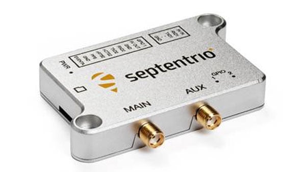
    Trimble as released its new post-processing software, Trimble Applanix POSPac Complete.

    The solution combines Trimble ProPoint positioning engine, post-processed Trimble CenterPoint RTX (POSPac PP-RTX) and Applanix IN-Fusion+ multi-sensor aided inertial engine. This integration offers geospatial professionals the ability to deliver accuracy and efficiency in the crewed and unmanned systems, land and marine mobile mapping and surveying industries.

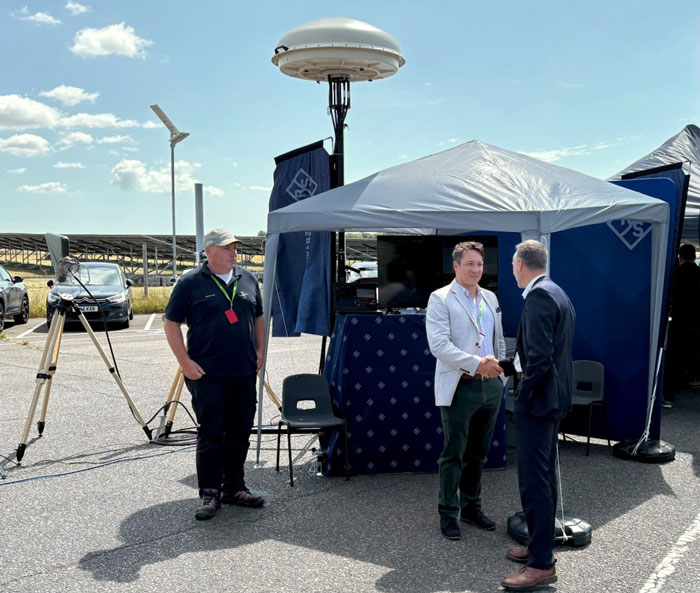
    POSPac Complete will be showcased at INTERGEO 2025.

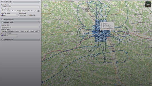
    A redesigned software solution embedded with POSPac PP-RTX, Applanix POSPac Complete is available exclusively as an all-in-one term license that bundles essential GNSS augmentation options — single base, Applanix SmartBase post-processed VRS and POSPac PP-RTX service — into a single, transparent annual fee. This eliminates hidden costs, simplifies budgeting and ensures access to software updates, while Trimble RTX removes the need for base stations and provides global coverage.

    Because Trimble RTX is embedded into the software, users around the world can attain seamless and efficient workflows with centimeter-level accuracy, even in remote or inaccessible areas, increasing productivity in their mapping process. Additional time savings are gained with the elimination of the time-consuming and challenging task of setting up and managing base stations that may be in different local datums or epochs.

    “The new POSPac Complete is more than just a software update; it’s a paradigm shift in how geospatial professionals achieve high-accuracy results because of Trimble’s unique RTX factor,” said Nico Jaeger, product manager at Trimble. “By integrating the power of PP-RTX directly into the software, we’ve eliminated the logistical headaches of base stations and streamlined the entire workflow, making mobile mapping more accessible than ever before. Altogether, it helps new and experienced users to produce survey-grade results with unprecedented speed and simplicity, truly representing the next generation of geospatial processing software.”

    Additional features in the new POSPac Complete include:

    • Modernized user interface: A new look and feel with a background map and a streamlined project wizard for easier and more efficient workflows, and a better user experience.
    • Trimble IonoGuard: Trimble’s latest technology that detects and mitigates the effects of ionospheric scintillation, which is especially important during the solar activity peaks, supported in single base and PP-RTX processing modes.

    Optional add-on features available for purchase:

    • Camera QC tools: The robust successor to CalQC, providing rapid IMU to camera boresight calibration for single-head and multi-head (oblique) camera constellations with minimal user interaction.
    • Lidar QC tools: Trimble’s leading software application for IMU to lidar boresight calibration and trajectory adjustment using SLAM techniques is now enhanced with support for automatic ground control point (GCP) detection, the RIEGL lidar native file format and reduced RAM requirements for faster processing.

    The POSPac Complete solution will be available in November 2025 through the Trimble sales channels. For more information or to request a demo, click here.

  • Septentrio starts mass production of mosaic-G5 modules

    Septentrio starts mass production of mosaic-G5 modules

    Septentrio, part of Hexagon, has started volume shipments of its mosaic-G5 modules. Measuring 23 mm by 16 mm and weighing 2.2 g, mosaic-G5 enables reliable positioning without performance compromises for commercial UAVs, robots, geographical information system devices (GIS) and many other size and power-constrained industrial applications. The company’s GNSS technology provides enhanced positioning availability in challenging environments where signals are degraded or obstructed.

    “We have had a lot of interest in the mosaic-G5 module series since its announcement earlier this year. After successful beta testing with various customers, I am pleased to say that we have now started shipping volume orders,” commented François Freulon, director of product management at Septentrio.

     The mosaic family offers users a range of receiver modules to balance performance and cost. The quad-band mosaic-G5 P3 and the triple-band heading module mosaic-G5 P3H provide positioning availability in challenging environments for applications such as mapping or light show UAVs. The modules complement the mosaic product line, including the mosaic-X5 receiver, which the company positions as a benchmark for GNSS open-signal anti-jamming and anti-spoofing² resilience in a small form factor.

    The mosaic-go G5 evaluation kit is available through the Septentrio webshop for testing and prototyping. It offers direct autopilot connections, and the free RxTools user interface assists with setup and evaluation.

    Septentrio will showcase the mosaic-G5 modules at Intergeo in Frankfurt, Germany, Oct. 7-9, in Hall 12, Booth 114.

  • TSR unveils tactical drone system with 3-hour flight time

    TSR unveils tactical drone system with 3-hour flight time

    TSR Inc. (Tactical Surveillance Reconnaissance) has launched the AVRIO series autonomous drone systems — cutting-edge European-made unmanned aircraft designed to redefine aerial surveillance, reconnaissance, and precision-strike capabilities.

    The AVRIO family, which includes the Falcox and Nebris platforms, delivers unmatched performance and resilience for defense, security and critical infrastructure missions, according to TSR. The company designed the AVRIO series for a wide range of defense and homeland-security missions, including:

    • Border security and coastal defense
    • Rapid-response reconnaissance and force protection
    • Counter-UAS operations using RF seeker payloads
    • Critical infrastructure protection and disaster-response intelligence.

    “The AVRIO series combines European aerospace engineering with U.S.-based deployment and support, giving governments and security agencies a next-generation toolset for ISR and tactical defense,” said Rick Clarke, CEO of Safe Room Designs/TSR Inc. “This is autonomous aerial defense, reinvented.”

    Specifications of the AVRIO

    • ISR (intelligence, surveillance, reconnaissance). Real-time EO/IR video, day/night operations, target tracking and identification.
    • Quick-launch and versatility. Vertical takeoff and landing, <1-minute preparation, runway-independent operation, and mission abort/return-to-base features.
    • Extended reach. Endurance of up to three hours and a range of up to 30 km, depending on payload and mission configuration.
    • Precision engagement. Options for smart munition payloads with precision super-quick impact fuzes and effective 15 m radius, plus anti-personnel and armor-piercing warheads.
    • Resilient design. Low radar cross section, GNSS-denied operation, MIL-STD-810G-qualified ground control, and operational temperature from –20 °C to +50 °C.
    • Naval and special missions. Capable of surface-mine detection, sweeping operations, and beyond-line-of-sight (BLOS) intelligence gathering.

    TSR is now accepting government and defense-sector inquiries for the AVRIO Falcox and AVRIO Nebris systems. For detailed specifications, demonstrations, or procurement discussions, contact TSR.

  • Maxar helps accelerate the resilience of Taiwan’s UAV industry against GPS interference

    Maxar helps accelerate the resilience of Taiwan’s UAV industry against GPS interference

    Maxar Intelligence is partnering with Taiwan’s Aerospace Industrial Development Corporation (AIDC) to deploy the Maxar Raptor software suite across Taiwan’s unmanned aerial vehicle (UAV) industry. The move will help the country accelerate the resilience and reliability of autonomous systems in GPS- and GNSS-denied environments.

    Raptor is a vision-based software suite that enables autonomous drones to navigate precisely and extract accurate ground coordinates in the absence of GPS. Designed for lightweight integration with any autonomous platform, Raptor products use a drone’s native camera and Maxar’s 100 million-plus sq km of global 3D terrain data to help the platform navigate with extreme precision and extract accurate ground coordinates in real-time without GPS. Raptor can operate at night and in low-altitude flight operations without the need for any additional hardware.

    The partnership follows a successful field demonstration of Raptor software in Taiwan earlier this year, in which the test platform was able to maintain precise navigation under GPS-denied conditions using only its native camera and Maxar’s software.

    The test platform was able to maintain precise navigation under GPS-denied conditions using only its native camera and Maxar’s software.

    “Taiwan is rapidly building one of the most advanced UAV industries in the world, and AIDC is one of the companies leading the charge,” said Anders Linder, general manager, International Government at Maxar Intelligence. “Taiwanese UAV manufacturers are acutely aware of the importance of building resilience against GPS jamming, and AIDC has validated the unique capabilities of our Raptor software. By combining our geospatial intelligence with AIDC’s aerospace expertise, we’ll help Taiwan’s UAV industry maintain its forward momentum, accelerating autonomy across warfighting, humanitarian, and commercial operations.”

    AIDC will drive the adoption of Raptor across Taiwan’s UAV supply chain and promote use of the software across the Taiwan Excellence Drone International Business Opportunity Alliance (TEDIBOA), an organization that AIDC chairs.

    “This collaboration opens a new chapter for precision vision-based positioning in Taiwan’s UAV sector,” said AIDC President Chin-Ping Tsao. “We will jointly build a Taiwan-focused integration and testing center, highlight GPS-jamming resilience as a core differentiator, and unlock opportunities across Taiwan and the broader Asia market — advancing both defense resilience and commercial value.”

  • Military drones advance as law enforcement seeks expanded counter-UAS mitigation authority

    Military drones advance as law enforcement seeks expanded counter-UAS mitigation authority

    General Atomics Aeronautical Systems Inc. (GA-ASI) is in the news again, as it got its prototype version of the U.S. Air Force (USAF) Collaborative Combat Aircraft (CCA) into the air for the first time, with an anticipated lengthy flight test campaign to follow. This latest CCA iteration, refered to as the YFQ-42A CCA, was derived from an earlier jet-powered XQ-67A Off-Board Sensing Station, a platform that enabled the company to not only develop and build but also fly this latest aircraft in just one year.

    GA-ASI CAA makes first flight Aug.t 27, 2025. (Credit: GA-ASI)
    GA-ASI CAA makes first flight Aug. 27, 2025. (Credit: GA-ASI)

    The UAV features significant autonomous capabilities developed over nearly five years of training using the MQ-20 Avenger unmanned jet aircraft. The strategy of beginning with a company-developed baseline aircraft (Avenger), securing USAF support for an initial derivative and then for the YFQ-42A CCA, appears to be accelerating development of the Loyal Wingman concept toward USAF operational manned-unmanned airborne teaming.

    Previously, in July, GA-ASI began preparations to enable friendly European countries to rapidly participate in the future CCA-capabilites by teaming with its German affiliate General Atomics Aerotec Systems GmbH (GA-ATS). The agreement appears to enable high-volume local manufacture of a European CCA, and press releases have implied that potential content is expected to be provided by other high-tech local suppliers.


    Following earlier reports that Reliable Robotics (RR) has been busy automating all phases of aircraft operations, including a Cessna Caravan cargo aircraft, USAF has awarded RR a $17.4 million contract to install a Reliable Autonomy System (RAS) in another Cessna. The resulting automated Cessna 208A Caravan is to be used in an estimated two-year program toward obtaining FAA certification that should enable flight within the U.S. National Airspace System (NAS). The system has been demonstrated — with a remote pilot in the loop — to be able to take an aircraft from startup on the ramp, through taxi, takeoff, en route flight, landing and taxi return to the ramp for unloading.

    RR autonomous Cessna 208B takes off from Mojave Air and Space Port, California, on Aug. 8, 2024. (Credit: RR))
    RR autonomous Cessna 208B takes off from Mojave Air and Space Port, California, on Aug. 8, 2024. (Credit: RR)

    Cessna Caravans have been heavily used for cargo transport across the U.S. (and around the world) with a range of 1000 miles, carrying up to 1000 lb of cargo. The RR certification program is intended to allow these types of automated unmanned commercial and military operations on a regular basis throughout FAA controlled US airspace, alongside manned aircraft. Flying military unmanned aircraft in the NAS currently requires extremely highly-coordinated, continuous activity. The hope is that eventually it could become an easier more regular form of autonomous cargo/people air transport.


    The cost of the continuing war in Ukraine may be affecting the Russian economy — a major drone manufacturer apparently is facing bankruptcy despite Russia currently using thousands of drones in attacks on Ukraine. The situation is difficult to understand, but this is an expensive war.

    However it appears that, AO Kronshtadt, one of the major drone suppliers in Russia is also beset by civil lawsuits from several organizations to which it owes lots of rubles. Its Orion and an updated version Inokhodets drone are apparently somewhat similar to the US MQ-9 Reaper UAV.

    AO Kronstadt employees assemble the Russian Orion UAV. (Credit: open source)
    AO Kronstadt employees assemble the Russian Orion UAV. (Credit: open source)

    Russia has apparently converted the Orion/Inkhodets medium-altitude surveillance drone into a strike version, but with limited success. Nevertheless, Kronshtadt apparently has made some progress, selling an export version in Asia.

    Meanwhile, Russia still is apparently producing up to 6,000 Shahed one-way drones per month by another manufacturer in the Alabuga Special Economic Zone at a unit cost of around $70,000. This is significantly lower than drones that were originally purchased from Iran at $370,000 each.

    Shahed suicide drone. (Credit: Olena Bartienieva / iStock / Getty Images Plus / Getty Images
    Shahed suicide drone. (Credit: Olena Bartienieva / iStock / Getty Images Plus / Getty Images)

    The U.S. Federal Government through its transport agencies apparently has the exclusive right to control drones, including bringing malicious UAVs down from the sky. Most people understand that the Federal Aviation Administration (FAA) regulates who flies what and where, but who is in charge of reducing and removing drone threats? It may have been difficult to understand during recent unauthorized overflights of military installations on the East Coast why someone didn’t shoot down the offending drones.

    Now, a group of police agencies has approached members of Congress to ask for the right to “detect, track, identify and mitigate” the unlawful, negligent or malicious use of drones that threaten public safety. Citing a number of incidents — including drone incursions at airports and other incidents where unmanned aircraft have interfered with firefighting and disaster response, instances where law enforcement activities have been overflown and disrupted, and the practice of using drones to drop drugs, guns and mobile phones into prisons — the law enforcement group sees a need for permission to engage. With several major events scheduled across the U.S., it likely is time to support law enforcement with the appropriate powers needed to protect the public.

    It is true that several bills are already pending before Congress to enable state, local, tribal and territorial law enforcement agencies to find, identify and possibly mitigate inappropriate drone activity, but the group is urging action now. And they clearly demonstrate the need to be able to stop drone activity when necessary — the federal government cannot cover the whole country all the time, so it makes more sense to adequately train law enforcement and to distribute authorized local mitigation activity whenever it is found to be necessary.


    So a mixed bag this month — progress for the U.S. Collaborative Combat Aircraft initiative, more steps toward automation for air cargo transport, problems for one Russian drone supplier while others increase volume and the United States seeks options for better defense against them, and U.S. law enforcement seeks the capability to help mitigate drone incursions where they are not wanted — plenty of different angles to consider around unmanned aerial vehicles.

  • Dimetor, SkAI partner on GNSS interference monitoring for digital airspace

    Dimetor, SkAI partner on GNSS interference monitoring for digital airspace

    Dimetor and SkAI Data Services are announcing a strategic partnership to increase global airspace security.

    SkAI Data Services developed a real-time ADS-B GPS spoofing and jamming tracker — GPSwise. Dimetor is a global leader in connectivity and data analytics for the communications, defense and aerospace industry.

    The companies aim to deliver a comprehensive, holistic solution for monitoring GNSS disruptions, covering both lower and upper airspace, for crewed and uncrewed flight operations and other users worldwide.

    SkAI Data Services created GPSwise in partnership with the Zurich University of Applied Sciences – Centre for Aviation. The platform is already trusted by airlines, air navigation service providers, and authorities worldwide to provide ADS-B-based awareness of GPS threats.

    Dimetor’s NAVSentry platform is an AI-powered solution for detecting GNSS disruptions in real time, combining different technology layers, and securing position, navigation and timing (PNT) data across autonomous and crewed systems, from multiple data sources, including:

    • Cellular network data
    • Satcom based detection mechanisms
    • Other network-based sensors
    • Dedicated ground-based receivers.

    According to the company, this multi-layered approach delivers actionable, real-time intelligence to aerospace, critical communications, UTM/ATM, UAV operators, logistics, critical infrastructure sectors, law enforcement, spectrum authorities, defense and intelligence.

    The companies have signed a Memorandum of Understanding (MoU) to combine two fundamentally different yet highly complementary data streams, ADS-B-based information and data from terrestrial sensor networks such as 5G. The integration creates a unified view of GNSS health across the full airspace, both crewed and uncrewed, at all altitudes in real-time.

  • Transport Canada approves Volatus Aerospace automated drone service

    Transport Canada approves Volatus Aerospace automated drone service

    Transport Canada has issued a Special Flight Operations Certificate (SFOC) to Volatus Aerospace Inc., authorizing the company to conduct beyond visual line of sight (BVLOS) drone operations using MatrixSpace’s radar technology integrated with Kongsberg Geospatial’s IRIS Terminal platform.

    The certification allows Volatus to use MatrixSpace‘s compact, low-power radar system that can detect smaller aircraft including other drones. The technology is integrated with Kongsberg’s airspace awareness software and operated through Volatus’ remote Operations Control Center.

    The system enables automated drone-in-a-box networks, distributed monitoring operations and autonomous services that require continuous detect-and-avoid capabilities. Market research indicates the global drone-in-a-box sector was valued at approximately $1 billion in 2024 and is projected to reach $5 billion to $9 billion by the early 2030s, representing annual growth rates of 20% to 23%.

    Volatus previously held nationwide SFOCs for BVLOS operations in low-risk airspace, atypical airspace, high-altitude missions and nighttime operations. The new certification expands the company’s ability to provide automated drone services for infrastructure security, utilities monitoring, industrial inspection, forestry operations, wildfire monitoring and environmental oversight.

    The company has previously conducted approved BVLOS medical delivery operations at Halton Healthcare in Ontario. According to the comapny, the new certification builds on those capabilities by incorporating the detect-and-avoid system for broader commercial deployment.

  • SPH Engineering launches multibeam echosounder payload for UAVs

    SPH Engineering launches multibeam echosounder payload for UAVs

    SPH Engineering has released a multibeam echosounder system for UAVs that uses the Cerulean Surveyor 240-16, a compact bathymetric sensor designed for shallow-water mapping.

    The system expands drone-based hydrographic surveying capabilities by providing high-resolution bathymetric data collection over shallow waters. The Surveyor 240-16 operates at 240 kHz with a measurement range of 0.5 m to 50 m, targeting inland waterways, reservoirs, ports and environmental monitoring locations.

    The multibeam system generates an 80° cross-track swath with a 16-element receive array and 1° angular resolution, allowing operators to map wider bottom coverage compared to traditional single-beam payloads.

    The payload integrates with SPH Engineering’s UgCS flight planning software and SkyHub onboard computer for automated missions. Weighing 2.4 kilograms with all components and consuming 15 watts of power, the system works with UAVs including DJI M300, M350 and M400 models, as well as Inspired Flight IF800 and IF1200 aircraft.

    SPH Engineering conducted field validation at Titutga Lake in Latvia in August 2025. Survey flights operated at an average speed of 1.2 m per second, balancing data collection density with UAV battery endurance.

    Testing compared the multibeam system’s performance against single-beam payloads, which engineers noted remain useful for quality control verification of multibeam datasets. The combined approach demonstrated capabilities for high-resolution mapping in areas previously difficult to access with boat-based systems.

    Software compatibility includes full support in BeamworX, with Hydromagic integration planned for future releases.

    “The payload based on Cerulean Surveyor 240-16 represents a milestone in drone-based bathymetry,” said Alexey Dobrovolskiy, CEO of SPH Engineering. “By combining multibeam technology with UAV platforms, we are enabling hydrographers to collect dense bathymetric datasets at a fraction of the time and cost of conventional systems. This integration opens new opportunities for surveying reservoirs, lakes, and coastal areas that were previously inaccessible or unsafe.”

  • UAV Navigation, Septentrio to enhance anti-jamming capabilities for UAVs

    UAV Navigation, Septentrio to enhance anti-jamming capabilities for UAVs

    UAV Navigation-Grupo Oesía has collaborated with Septentrio, a division of Hexagon, to enhance navigation resilience for unmanned aircraft systems. The partnership focuses on ensuring compatibility between UAV Navigation’s guidance, navigation and control systems and Septentrio’s GNSS receivers.

    The collaboration integrates Septentrio’s high-precision real-time kinematic (RTK) capabilities with AIM+ anti-jamming and anti-spoofing technology. The anti-spoofing protection utilizes the Galileo Open Service Navigation Message Authentication (OSNMA) service alongside Septentrio’s proprietary algorithms to defend against signal interference and manipulation.

    UAV Navigation’s flight control system now automatically detects when a Septentrio OSNMA-enabled receiver is connected and prioritizes its data within the navigation logic. This integration demonstrates the interoperability capabilities of the Spanish company’s systems while providing enhanced protection against GNSS jamming and spoofing threats.

    Both companies seek to advance secure, reliable and high-precision navigation solutions for unmanned systems operating in challenging electromagnetic environments. The integration aims to maintain navigation accuracy and mission effectiveness when traditional GNSS signals face interference or manipulation.

  • Rohde & Schwarz demonstrates counter-drone technology at Defense Expo

    Rohde & Schwarz demonstrates counter-drone technology at Defense Expo

    Rohde & Schwarz has demonstrated its latest advancements in counter-drone technology at CUAS Expo 2025 at Thorney Island. The display featured an integrated system that included the ARDRONIS Wi-Fi detection solution and ARDRONIS Locate Advanced localization solution, along with the newly released ARDRONIS Effect configured as a multiband jammer.

    At the event, Rohde & Schwarz showcased how its comprehensive counter-drone system detects, identifies and neutralizes rogue drones regardless of their operating frequency. The demonstration showed the system’s ability to manage non-cooperative and non-compliant devices operating outside established regulations.

    ARDRONIS Effect in the Multiband Jammer configuration was a key highlight, demonstrating its unique wideband architecture which enables it to simultaneously jam multiple frequency bands, providing unparalleled protection against a diverse range of drone threats. Unlike traditional jamming solutions, ARDRONIS Effect in the Multiband Jammer configuration doesn’t rely on pre-defined frequencies, making it highly effective against drones operating on unconventional or rapidly changing frequencies.

    ARDRONIS Locate Advanced complemented the jammer by providing precise drone detection and localization, allowing attendees to witness the system’s ability to quickly identify the location of drones and enable informed response decisions. The integrated system delivered a comprehensive view of situational awareness and robust protection capabilities.

    Rohde & Schwarz said it received interest from attendees at CUAS Expo 2025 and had conversations about customer requirements. The company is following up with agencies and CUAS system integrators to discuss potential deployments of the ARDRONIS system.

    “Discussions with attendees underscored the growing concern surrounding non-compliant drone activity and the need for adaptable, wideband solutions like ours,” said Christopher Mantle, business development manager for UK Land EW and Communications at Rohde & Schwarz.

  • New eVTOL and UAV platforms mark key advances in urban air mobility

    New eVTOL and UAV platforms mark key advances in urban air mobility

    As we are always looking for news on electric vertical take-off and landing vehicle (eVTOL) progress, the United Kingdom has recently stepped up with Gloucestershire-based Vertical Aerospace in the Cotswolds area, a beautiful part of Southwestern England.

    The company flew its new VX4 prototype from Cotsword airport to RAF Fairford (a military airport) for the Royal International Air Tattoo (RAIT), one of the world’s largest military airshows. This demonstration marked the first flight between two public airports in the country. The VX4 was also the only eVOTL on display at RAIT.

    RAF Fairford, which also serves as a base for the U.S. Air Force in Europe, has hosted aircraft including the U.S. B-52, B-1, B-2 bombers and U-2 reconnaissance aircraft. This year, RAIT featured several hundred aircraft from 30 countries, with around 200,000 attendees.

    The VX4 is equipped with eight tilt-and-lift propellers that provide redundancy for takeoff, landing and horizontal flight. The aircraft is designed to carry four passengers and one pilot.

    The avionics include proven Honeywell flight controls, and the lightweight airframe is constructed from carbon composite materials. Vertical Aeropspace said the eVTOL is designed to meet the same UK and European certification requirements as existing conventional passenger aircraft.

    The VX4 is designed with extremely low noise characteristics in both hover and horizontal flight at up to 150 mph. The company plans to use a hybrid-electric power unit in its production models.

    VX4 in flight.(Credit: Vertical Aerospace)
    VX4 in flight.(Credit: Vertical Aerospace)

    With a range of 100 miles and a max speed of 150mph, VX4 is being touted for short hops to overcome crowded city roads, or in London, avoiding changes on the underground while toting cumbersome luggage, and flying between downtown and one of London’s busiest airports.

    The VX4 can be reconfigured to carry cargo and is powered by specially designed batteries built for high output and rapid recharging, enabling quick turnaround for trans-city passenger transport.

    While aiming to replace helicopters for short hops over the city, Vertical Aerospace claims the VX4 offers far quieter, less maintenance-intensive and lower operating costs. There has been no mention of autonomous operations at this stage, but with all the necessary capabilities in hand, it’s possible that pilotless, automated flight could be possible at some future stage.


    Reliable Robotics (Reliable) has been around since being founded in 2017 – they have the objective of automating flight for General Aviation (GA), passenger airlines and cargo aircraft. Reliable reports that roughly 400 people are killed each year in GA through loss of flight and controlled flight into terrain accidents. Reliable believes that about 70% of issues could be prevented by their automation systems. For airlines, 1397 people died in 75 fatal accidents between 2017 and 2021.

    Working with the US Air Force (UASAF), FAA and NASA, Reliable first equipped and flew an unmanned Cessna 172 and later did the same with a Cessna 208B Caravan, similar to those operated by Federal Express (FedEx). In the process, they developed their own detect and avoid (DAA) system and qualified their own actuators to FAA standards. With the intention of developing a certifiable autopilot which would manage taxi, take-off, en-route flight, and landing, Reliable implemented a multiple flight management system which is supervised by a remote pilot.

    Unmanned Cessna 208B Caravan (Credit: Reliable)
    Unmanned Cessna 208B Caravan (Credit: Reliable)

    With the extensive use of simulations, around 140 landings were first accomplished and the third landing of the actual equipped aircraft was fully automated. It may have seemed a little unnerving at first to see the aircraft taxi out to the runway with no pilot in the cockpit!

    Nevertheless, it was clear that the system worked extremely well, with a remote voice interface, ground control, data link control, and monitoring of the aircraft system. With over 5000 airports available around the US, only 130 actually experience commercial operations, so the scope of enabling automated cargo transport activity more extensively across the nation appears to have room for expansion.

    Reliable has just begun more simulation work with NASA — automated aircraft human-in-the-loop detect and avoid (DAA); loss of the command and control (C2) link and the necessary reversionary recovery systems, and management of the automated aircraft alongside manned aircraft as they both enter and leave airports. Work is intended to figure out the level and type of automated systems required for safe integration of large volumes of cargo-carrying unmanned aircraft systems (UAS) into the National Airspace System (NAS).


    Northrop Grumman had Scaled Composites (SC) build a prototype (Model 437) manned UAV, which, according to the company, is now destined to become a testbed for autonomous systems development.

    Now called Beacon, the testbed originally flew in August 2024, possibly as a contender for the Loyal Wingman Collaborative Combat Aircraft opportunity, with a Pratt & Whitney 3400 lb thrust jet engine and an internal weapons bay capable of carrying 2000 lb of weapons. SC originally built the M437 as a platform to demonstrate Northrop’s digitally engineered wings.

    Model 437 in flight. (Photo: Scaled Composites)
    Model 437 in flight. (Photo: Scaled Composites)

    Now, Northrop is providing the airframe to enable collaborative partners to further develop autonomy capability to be used in future Northrop programs.

    Nice to see some VTOL air taxi development in the UK, an outfit focusing on the insides of UAV autonomy and even an aircraft platform for developers to use — all together interesting times for autonomous UAV growth.

  • Swift Navigation, Taiwan Mobile advance centimeter-accurate positioning for autonomy

    Swift Navigation, Taiwan Mobile advance centimeter-accurate positioning for autonomy

    Swift Navigation has partnered with Taiwan Mobile, a major telecommunications company in Taiwan, to introduce the Skylark Precise Positioning Service to the Taiwanese market. This collaboration aims to meet the increasing demand for high-accuracy positioning solutions across various industries.

    Skylark is a real-time GNSS correction service that enhances positioning precision to the centimeter level by correcting signal errors from GNSS. It is the first cloud-based precise positioning service developed specifically for large-scale applications, designed to deliver accuracy, reliability, and safety worldwide. The service utilizes advanced atmospheric modeling to reduce errors from ionospheric disturbances, clock drift and satellite orbit inaccuracies, improving location accuracy from several meters to just a few centimeters.

    The service is supported by a carrier-grade network consisting of modern ground reference stations, which have been designed and operated collaboratively by Taiwan Mobile and other mobile network operators globally. Skylark’s highly reliable and precise positioning capabilities are expected to support emerging applications in automotive, robotics, and fleet management sectors. In automotive applications, it is the first and only automotive safety integrity level (ASIL) certified, real-time cloud-based positioning service compliant with ISO 26262:2018, enabling safe operation of advanced driver-assistance systems (ADAS) and autonomous vehicles.

    For robotics, Skylark’s proprietary atmospheric modeling offers centimeter-level accuracy with extended baselines and automatic failover, ensuring reliable performance for devices such as robotic lawnmowers and surveying drones. In fleet management, the service provides a cost-effective, dependable positioning solution optimized for battery-powered devices, facilitating efficient last-mile and final-inch logistics, and integrating with a broad range of compatible GNSS hardware.