Harxon has released a 900-megahertz modem designed for unmanned aerial vehicle (UAV) customers.
The HX-DU1018D is a miniature high-performance OEM 900-megahertz multi-frequency modem with advanced data-processing architecture, which can offer customer selectable ISM 900-megahertz or licensed 400-megahertz modes in the same module.
The HX-DU1018 features an extremely small footprint for tight integration and design flexibility.
The modem supports a transmission rate of 200 kilobits per second over narrow channel bands using digital signal processing technology. It comes with a development kit, which the company says makes it easy to install and operate.
Key applications
Automatic vehicle location.
Traffic monitoring and control.
Differential GPS navigation.
Water and wastewater management.
Irrigation control.
Oil and gas field monitoring.
Security system management.
UAV market.
Features
Supports 400 megahertz or 900 megahertz bands.
Transmission rate: 200 kilobits per second.
Point to point, point to multipoint.
Frequency-hopping spread spectrum.
Low cost, high performance and high reliability.
Longer transmission distance over 50 kilometers in open air.
Adjustable transmit power 100 milliwatts to 1 watt.
High interference rejection.
Industrial temperature: negative 50 degrees Celsius to 80 degrees.
All-in-one time-and-frequency master time and clock server
Spectracom’s VelaSync time server and grandmaster clock.
When the VelaSync time server platform was introduced in 2014, it met the needs of financial trading networks’ move to 10 gigabit-per-second networking. Now available with 40-GbE network interfaces, it offers high-performance synchronization for time-sensitive networks. Matching network speeds between timing and data on a single low-latency high-throughput network enhances synchronization accuracy and eliminates queuing delays and hidden time errors caused by slower connections. The availability of a network timing appliance with 40-GbE interfaces benefits any deployment of critical network infrastructure at high data rates.
The TW3970 / TW3965 antennas have superior cross polarization rejection to enhance multi path signal rejection, tight phase center variation and an excellent axial ratio. The TW3970 is a pole mount or through-hole mount antenna; the TW3965 is an embeddable form. Bothemploy Tallysman’s Accutenna technology and are capable of receiving GPS L1/L2/L5, GLONASS G1/G2/G5, BeiDou B1/B2, Galileo E1/E5a+b plus L-band correction services (1164 MHz to 1254 MHz + 1525MHz to 1606 MHz). The antennas are designed for precision agriculture, autonomous vehicles and other precision applications. The ability of the antennas to access L-band correction services extends its utility to a wider range of applications.
The Tactical Series of inertial navigation systems (INS) is a next-generation family for high performance. Built on a common tactical-grade proprietary micro-electro-mechanical (MEMS) inertial sensing core, the Tactical Series includes the VN-110 inertial measurement unit and attitude heading reference system (IMU/AHRS), the VN-210 GPS-aided INS (GPS/INS), and the VN-310 dual-antenna GPS/INS. The Tactical Series offers the same functionality and features as the Industrial Series for integrators of SWaP-C (size, weight, power and cost) constrained manned and unmanned systems. The Tactical Series takes advantage of the latest developments in solid-state MEMS technology to incorporate a three-axis gyro with <1°/hour in-run bias stability, leading to an attitude accuracy of 1 to 2 milliradian. In addition to the improved IMU core, the Tactical Series enclosure is designed to DO-160G airborne standards and rated IP68 for deployment in harsh and extreme environments.
Plug n’ fly control system for UAV, UAS, USV and UGV systems
Veronte Autopilot is a miniaturized fail-safe avionics system with an embedded suite of sensors and processors for advanced control of unmanned systems. The OEM version weighs 90 grams, and the version with an aluminum enclosure weighs 200 grams. Both versions include a datalink radio. The control system is fully configurable — payload, platform layout, control phases, control channels and the user interface layout can be user defined, making it cost effective for a wide range of professional applications. The embedded GPS module offers RTK-like positioning with centimeter precision. It meets DO-178C / ED-12, DO-254 and DO-160G aircract regulations.
Critical coverage for autonomous driving development
TomTom’s HD (high-definition) Map and RoadDNA are highly accurate digital map products helping automated vehicles precisely locate themselves on the road and plan maneuvers, even when traveling at high speeds. These technologies are being rolled out in strategic geographies and are the subject of key partnerships with other automotive suppliers. TomTom now offers more than 122,000 kilometers of HD Map coverage globally, including Interstates in Connecticut, Delaware, District of Columbia, Georgia, Idaho, Kansas, Louisiana, New Hampshire, New Mexico, North Carolina, Ohio, Pennsylvania, Rhode Island, South Dakota, Tennessee, Texas, and Vermont; Interstates and highways in California, Michigan and Nevada; and the Autobahn network in Germany.
Applications range from infrastructure to infotainment
Smart Antennas by Laird Technologies combine antenna elements and radio receivers in the same robust package. Compared to traditional architectures, the Smart Antenna provides signifcant performance improvement and system-wide cost savings. Custom solutions are available, including 4G LTE cellular, GNSS, Wi-Fi and Bluetooth, as well as the emerging dedicated short-range communications (DSRC) technology with a 1,000-meter range for V2X. Applications include navigation systems, vehicle-to-vehicle communication,vehicle to infrastructure communication and infotainment. Operating temperature range is –40 C to 85° C.
The CEESCOPE-USV is a waterproof one-box echo sounder, GNSS and broadband radio telemetry package that can be installed on practically any remotely operated unmanned surface vehicle (USV). The self-contained unit requires no interface with the USV, eliminating challenges of instrument data integration on the vehicle. Using real-time broadband radio telemetry, detailed 20-Hz dual-frequency soundings, up to 20-Hz RTK GNSS and a 3200-sample-per-ping digital echogram are available to the USV operator on shore via the CEE-LINK radio base station. Data from the CEESCOPE-USV telemetry link allows the operator to steer the USV along the survey line like in any manned boat survey. The CEESCOPE-USV offers users a range to their vehicle of more than 1,000 meters.
The new ALS80-UP airborne sensor enables even more flexible data acquisition with extended range measurement capability. It takes advantage of the dual-output optical system pioneered in the ALS70 and enhanced in the originl ALS80. The AL80-UP has higher Multiple Pulse in Air (MPiA) operation settings, enabling data collection in extreme terrains with minimal variation in swath width due to terrain elevation variations. The ALS80-UP works perfectly in a wide variety of scenarios, including wide-area mapping, detail mapping from high-flying heights and detail mapping over mountainous terrain. With its expanded maximum range, the system has demonstrated good results at up to 6,000 meters above terrain and with terrain relief of up to 2,300 meters.
The Settop Repeater allows rover-RTK network users in areas of low or no GSM coverage to receive differential corrections via radio. It can connect to any external radio model on the market for precision agriculture systems or machine control. Repeater field application versatility is managed by an intuitive software controlled using a touchscreen. It can also be used for land surveying and marine work. It reduces the need for an RTK base station and offers flexible field configuration.
Expanded toolsets and capabilities for speed and accuracy
FieldGenius 8 software takes advantage of the high-power processors, high-definition displays and larger memory in modern Windows Mobile powered data collectors and Windows 7 powered tablets. It provides tight control through expanded toolsets. Features include easy GNSS local transformation with the ability to export and import localization files; enhanced DXF support; advanced point averaging, which allows users to take multiple GNSS measurements and calculate an averaged position; support for integrated inertial sensors; native unicode support;and simplified GIS mapping. FieldGenius 8 also has improved road alignments, an onboard basic measurement mode, dynamic screen rotation and expanded ASCII export options. Supported coordinate systems, geoids, instruments and data collectors have been expanded, making it easier to integrate into existing survey operations.
The FLIR Vue Pro R adds radiometric functionality to the Vue Pro camera, giving drone operators the ability to save pictures for post-flight image analysis and accurately measure the temperatures of individual image pixels. Calibrated radiometric imaging allows it to capture the temperature data of every pixel in an image. When saved in Radiometric JPEG format, still images can be imported into FLIR Tools software for detailed analysis and reporting. FLIR Tools, a free download on FLIR.com, lets drone operators adjust settings including object emissivity, background temperature, target distance, relative humidity and thermal sensitivity, as well as assigning various color palettes for each image. The Vue Pro R records digital thermal video, along with radiometric thermal still images, to an on-board micro-SD card. For applications such as electrical inspection, infrastructure assessment and precision mapping, the onboard recording allows operators to capture high-quality thermal data for post processing and analysis.
Reconnaissance for disaster relief, time sensitive situations
The Digital Mapping Reconnaissance Toolkit (DMRT) creates up-to-date orthomosaic maps and 3D models. Users can fly a drone to survey the landscape for real-time solutions, and geotag reference points in impacted areas without a time lag. Seeing what the drone sees, pilots can create search patterns and map with situational awareness. Modular aerial and land-based solutions are available.
Skyward and senseFly are partnering to deliver a custom operations management software and consulting services package for senseFly aircraft.
The package, available for customers in North America through the senseFly distribution network or Skyward, gives operators a preconfigured Skyward account with senseFly flight log import, senseFly manuals, customized preflight checklists, and other information specific to senseFly operations.
These features are part of the Skyward drone operations management platform that includes up-to-date airspace information and tools to plan and log flight; manage personnel, equipment and flight hours; and meet regulatory reporting requirements.
Customers will also have access to a team of regulatory and drone operations experts and benefit from Skyward expertise to define their flight operations procedures and write related operating manuals.
“Ensuring the highest level of safety and ease of use has always been essential in the design of our lightweight drones,” said Jean Christophe Zufferey, senseFly CEO. “By providing easy access to Skyward, we are now extending this seamless experience toward operation and fleet management. Our professional customers will get an elegant and efficient way to keep up with the constantly evolving regulations, while making sure they operate their fleet of drones efficiently and in full compliance.”
Operators using Skyward and senseFly together are able to meet regulatory compliance and insurance requirements. The partnership will create an end-to-end solution that delivers professional results for drone operators in mapping, surveying, GIS, industrial inspection and agriculture.
“Businesses operate drones because they return value, and senseFly builds some of the best professional drones in the industry to provide that value,” said Jonathan Evans, Skyward CEO. “Many of our customers are flying eBee and albris drones already because, quite simply, they get the job done. We will continue to deepen the technical integration across our platforms to provide a seamless and elegant user experience for our joint users.”
Drone-maker 3DR is teaming up with Esri to integrate 3DR’s Site Scan software with Esri Drone2Map.
3DR made the announcement at the Esri User Conference, held last week in San Diego.
Designed for the field professional, Site Scan is an intuitive, powerful and open aerial data capture and analytics platform that delivers an end-to-end solution ready-made for existing mapping and survey workflows, 3DR said in a news release. With Site Scan and Drone2Map, Esri customers can safely, quickly and easily conduct surveys with the Solo smart drone and effortlessly deliver that data to ArcGIS and ArcGIS Online.
“Aerial data capture technology is bringing about a revolution in surveying and mapping,” said Lawrie Jordan, Director of Imaging and Remote Sensing at Esri. “We are thrilled to partner with 3DR to streamline the creation of professional imagery products with Site Scan and Drone2Map for ArcGIS. Together we will accelerate the development and use of remote sensing across all industries.”
Site Scan automatically calculates a flight plan and Solo autonomously executes both flight and image capture. Images are processed and integrated with Esri Drone2Map to create high-resolution georeferenced maps and digital elevation models to share as tile or feature services in ArcGIS and ArcGIS Online.
“Capturing site data today is costly, time consuming and often dangerous. Drones can easily go where it’s inefficient or unsafe for field personnel, making it easier to accurately measure our world so we can better analyze and manage it,” said Chris Anderson, CEO of 3DR. “We’re delighted to partner with such a great industry leader and integrate Site Scan with Esri Drone2Map. Together, we offer a complete solution for site capture that will help our customers create maps that tell stories, record change over time and perform analysis all while saving time, saving money and keeping humans out of harm’s way.”
Site Scan makes it safer and easier than ever for people in land management, GIS, mapping, energy, infrastructure and related fields to aggregate and process multiple forms of aerial imagery and data and easily incorporate them into the Esri tools they use every day, 3DR said.
Engineering and survey firm McKim & Creed, based in Fort Worth, Texas, is one customer. “Utilizing the 3DR Solo and SiteScan allowed McKim & Creed to confidently collect accurate spatial information in dangerous and demanding environments where it would have been difficult to use traditional survey methods,” said Christian Stallings, R&D Manager at McKim & Creed.
“Using Esri’s Drone2Map software, surveyed ground control and 3DR’s Solo, we were able to collect detailed elevation information and high-resolution orthophotography over a dredging containment pond operated by the United States Army Corps of Engineers (USACE). This approach proved to be accurate and kept people out of harm’s way — which would only be achievable using this approach,” Stallings said.
3DR designed Site Scan as an open and extensible platform. On the hardware side, the Solo smart drone has open gimbal and accessory bays, which give both 3DR and their global technology partners the ability to integrate additional cameras and sensors.
Additionally, Solo firmware updates optimize the drone’s flight profile and performance. On the software side, 3DR continually updates the Site Scan application so that customers can take advantage of the most recent and advanced analytics technologies.
With Site Scan, even users new to drone technology will fly with confidence from day one. The Site Scan app includes 3DR’s airspace safety information software, which alerts users if they’re about to fly in restricted airspace. They can then pull up a map of the area with all restrictions around them clearly marked.
To support enterprise customers further, 3DR offers Success Services, including the Premier Success Plan. Included with their purchase of Success Services, all Site Scan users will have access to experts on Site Scan and Solo. They will also have a Solo overnight replacement guarantee should anything go wrong with one of their drones.
Site Scan with Solo Enterprise is available immediately for order on store.3dr.com, priced at $3249 with a monthly service fee of $499 paid annually with a 12-month commitment.
Measure, a United States’ commercial operator of drones, and DJI, manufacturer of unmanned aerial vehicles, are partnering to pair advanced UAV technology with operational excellence so commercial enterprise customers can achieve their most demanding business goals.
“Our partnership with DJI allows Measure to enhance technical capability and scale business operations across all verticals,” said Measure CEO Brandon Torres Declet. “This alliance will allow our companies and franchisees to be the vanguard of innovation for commercial UAV operations, using DJI’s proven technology and our experienced pilots.”
“Businesses increasingly recognize that having a knowledgeable and experienced operator at the controls is key to using UAV technology most effectively,” said Jan Gasparic, Strategic Partnerships and Business Development, DJI.
“Measure’s application-specific pilot training and deep knowledge of flight regulation allows them to set the standard for commercial UAV operations in the field,” Gasparic said. “We are looking forward to expanding our successful relationship with Measure, allowing more businesses to perform critical functions faster, safer, more efficiently and at a lower cost.”
Alongside the service collaboration, Measure and DJI will assist organizations to develop and deploy UAV operations in the fields of agriculture, energy and media. Organizations will now have a comprehensive partner to explore demanding operations such as spraying with DJI’s Agras MG-1 agricultural drone, or broadcasting live directly from a UAV to a newsroom. This partnership demonstrates Measure and DJI’s commitment to fostering a vibrant commercial ecosystem to accelerate the economic growth and innovation of the drone industry.
Today at the Esri User Conference, 3DR announced that it has teamed up with Esri to integrate 3DR’s Site Scan with Esri Drone2Map.
Designed for the field professional, Site Scan is an intuitive, powerful and open aerial data capture and analytics platform that delivers an end-to-end solution ready-made for existing mapping and survey workflows, 3DR said in a news release. With Site Scan and Drone2Map, Esri customers can safely, quickly and easily conduct surveys with the Solo smart drone and effortlessly deliver that data to ArcGIS and ArcGIS Online.
“Aerial data capture technology is bringing about a revolution in surveying and mapping,” said Lawrie Jordan, Director of Imaging and Remote Sensing at Esri. “We are thrilled to partner with 3DR to streamline the creation of professional imagery products with Site Scan and Drone2Map for ArcGIS. Together we will accelerate the development and use of remote sensing across all industries.”
Site Scan automatically calculates a flight plan and Solo autonomously executes both flight and image capture. Images are processed and integrated with Esri Drone2Map to create high-resolution georeferenced maps and digital elevation models to share as tile or feature services in ArcGIS and ArcGIS Online.
“Capturing site data today is costly, time consuming and often dangerous. Drones can easily go where it’s inefficient or unsafe for field personnel, making it easier to accurately measure our world so we can better analyze and manage it,” said Chris Anderson, CEO of 3DR. “We’re delighted to partner with such a great industry leader and integrate Site Scan with Esri Drone2Map. Together, we offer a complete solution for site capture that will help our customers create maps that tell stories, record change over time and perform analysis all while saving time, saving money and keeping humans out of harm’s way.”
Site Scan makes it safer and easier than ever for people in land management, GIS, mapping, energy, infrastructure and related fields to aggregate and process multiple forms of aerial imagery and data and easily incorporate them into the Esri tools they use every day, 3DR said.
Engineering and survey firm McKim & Creed, based in Fort Worth, Texas, is one customer. “Utilizing the 3DR Solo and SiteScan allowed McKim & Creed to confidently collect accurate spatial information in dangerous and demanding environments where it would have been difficult to use traditional survey methods,” said Christian Stallings, R&D Manager at McKim & Creed.
“Using Esri’s Drone2Map software, surveyed ground control and 3DR’s Solo, we were able to collect detailed elevation information and high-resolution orthophotography over a dredging containment pond operated by the United States Army Corps of Engineers (USACE). This approach proved to be accurate and kept people out of harm’s way — which would only be achievable using this approach,” Stallings said.
3DR designed Site Scan as an open and extensible platform. On the hardware side, the Solo smart drone has open gimbal and accessory bays, which give both 3DR and their global technology partners the ability to integrate additional cameras and sensors.
Additionally, Solo firmware updates optimize the drone’s flight profile and performance. On the software side, 3DR continually updates the Site Scan application so that customers can take advantage of the most recent and advanced analytics technologies.
With Site Scan, even users new to drone technology will fly with confidence from day one. The Site Scan app includes 3DR’s airspace safety information software, which alerts users if they’re about to fly in restricted airspace. They can then pull up a map of the area with all restrictions around them clearly marked.
To support enterprise customers further, 3DR offers Success Services, including the Premier Success Plan. Included with their purchase of Success Services, all Site Scan users will have access to experts on Site Scan and Solo. They will also have a Solo overnight replacement guarantee should anything go wrong with one of their drones.
Site Scan with Solo Enterprise is available immediately for order on store.3dr.com, priced at $3249 with a monthly service fee of $499 paid annually with a 12-month commitment.
Septentrio will showcase its latest GNSS systems and software solutions for GIS professionals at the 2016 Esri User Conference in San Diego, June 28-30, with a special focus on the rapidly growing market for drone-based aerial survey.
The AsteRx-m UAS by Septentrio.
At center stage will be Septentrio’s suite of products designed specifically for aerial surveys. They include the compact AsteRx-m UAS onboard GNSS receiver and GeoTagZ high-accuracy drone positioning software, which is optimized for automatic interface with Esri ARCGis and Drone2Map platforms.
“Demand for drone imagery is booming in the GIS marketplace as a fast and efficient alternative to ground-based surveys for applications such as mapping, photogrammetry, infrastructure inspection and natural disaster monitoring,” said Neil Vancans, vice president of Septentrio Americas. “To meet that demand, we are bringing to market a range of hardware and software solutions that will make it easier than ever for Esri users to capture, georeference, process and visualize drone-captured imagery.”
Septentrio is also introducing new firmware for its versatile NR2 GNSS receivers and the PinPoint-GIS utility software for terrestrial applications. NR2 V1.2.0 offers a host of new connectivity features, including direct dial-up, dynamic DNS, base-rover Wi-Fi point-to-point connection and other new features that will streamline field work. PinPoint-GIS has also been enhanced to provide seamless integration with Esri’s Collector for ArcGIS.
“Septentrio is pioneering the way by which Esri users collect data,” said Gustavo Lopez, product manager at Septentrio. “GeoTagZ and PinPoint-GIS bring more accuracy and flexibility into the field by combining the power of Septentrio’s GNSS products with the user-friendly interface of Collector for ArcGIS. From the air to your own device, you are guaranteed accuracy and reliability in your GNSS positioning by using GeoTagZ to georeference aerial photos and PinPoint-GIS to harness the power of GIS data.”
Esri User Conference attendees are invited to visit Booth 2633 for a first-hand look at Septentrio’s solutions for the full range of aerial and ground-based GNSS solutions for GIS, including the new-generation APS-3G multi-constellation RTK receiver, which was just introduced to the market.
Insitu has been awarded a US$71 million follow-on contract to produce six RQ-21A Blackjack unmanned aerial systems (UAS), with options for two more, from U.S. Navy Naval Air Systems Command (NAVAIR).
The RQ-21A is recovered with the flight recovery apparatus cable aboard the San Antonio-class amphibious transport dock USS Mesa Verde after its first flight at sea. The tests were held in the Gulf of Mexico on Feb. 10, 2013.
The RQ-21A Blackjack has significantly larger payload mass, volume and power than other small UAS currently being used in theater, according to Insitu, a subsidiary of The Boeing Company. The system includes electro-optic and mid-wave infrared sensors with a laser rangefinder and infrared marker.
The Low Rate Initial Production (LRIP) Lot V contract also includes an option year for nine Full Rate Production (FRP) systems. The FRP decision review is expected this fall.
“This contract award paves the road for Blackjack’s continued and future fleet integration,” said Col. Eldon Metzger, program manager for the Navy and Marine Corps Small Tactical Unmanned Aircraft Systems Program Office. “It is at the tactical edge for Marine and Navy units and the foundation to support future system enhancements.”
“Blackjack delivers an organic intelligence, surveillance and reconnaissance UAS that is runway-independent and founded on an open architecture that allows for implementation of innovative payloads to meet critical operational demands,” said Ryan M. Hartman, Insitu’s president and CEO. “We are proud to provide the sailors and marines with reliable, capable systems that support their warfighting needs.”
NAVAIR awarded the STUAS Engineering Manufacturing Development contract to Insitu in 2010 to begin the development of RQ-21A Blackjack, a variant of the company’s Integrator unmanned system. The program achieved Milestone C in 2013, delivered the first LRIP system in 2014, and achieved initial operational capability in January.
Daniel Sällstedt (left), CEO of Sky Eye Innovations, and Erik Eklund, business development manager of Spacemetric, discuss their new partnership to develop inspection drones. (Photo: Patrik Hellström, Sky Eye Innovations)
To meet the growing demand for advanced industrial airborne inspection tools, Sky Eye Innovations and Spacemetric have entered a strategic partnership to provide turnkey solutions for collection, storage and management of data from airborne sensors.
Sky Eye Innovations produces a UAV solution with capabilities to control advanced sensing technologies, and Spacemetric is a provider of image data management software solutions.
More and more organizations see the enormous potential for increased efficiency in inspection, monitoring, asset assessment and preventative maintenance through use of drones (UAVs) equipped with various sensor technologies. The huge growth in drone use has been helped by software tools that support data collection and data processing, many of them provided through the cloud.
The new partnership connects a leading image management tool with a very high-performance UAV solution built for daily use in the most demanding conditions. The result is an integrated and highly effective inspection tool for preventative maintenance and decision making that uniquely combines imagery from UAVs, satellites and handheld sensor units.
“At Spacemetric we’ve actively developed our software to handle the growing volumes of data coming from UAVs. We’ve actively been looking for a UAV partner and are very impressed by Sky Eye Innovations and their unique offering, which is much in demand,” said Erik Eklund, who is responsible for Spacemetric’s new Airborne business area.
The partnership creates a unique set of expertise. Spacemetric specializes in solutions to manage large volumes of imagery and streamline the process of efficient capture and storage to accelerated sharing and delivery of geospatial imagery for users like the Swedish Air Force.
Sky Eye Innovations contributes with development and manufacturing of extremely performant UAV platform solutions that alone in the world are able to lift and control FLIR System’s most advanced cameras used for industrial inspection and monitoring tasks.
“Sky Eye Innovations are constantly working on improvements and looking at new ways to address the challenges the industry is experiencing. Our ultimate goal is to offer cost-effective solutions that drive productivity and improve working conditions. To achieve this we need our UAV platform to excel and collaboration with world-leading expertise is critical to providing high quality customized solutions that are in demand. Therefore we are proud to announce our partnership with Spacemetric, and the next generation of industrial inspection tools this will lead to,” said Daniel Sällstedt, founder and CEO of N.M.M Innovation Sweden AB (also known as Sky Eye Innovations).
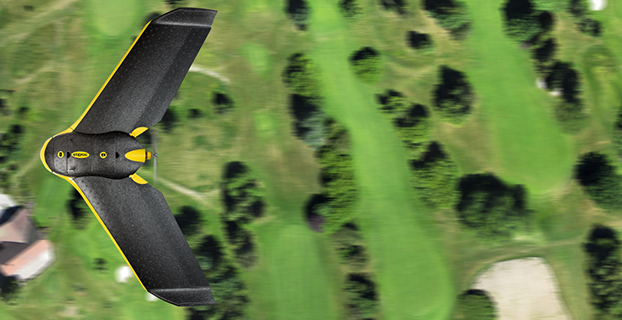
Sentera LLC, a global provider of UAV hardware, sensors and data management platforms, has launched the Phoenix 2 fixed-wing unmanned aerial vehicle (UAV). The Phoenix 2 is light-weight and highly durable, and can follow precise grid patterns.
“The Phoenix 2 brings a level of precision and accuracy to UAVs that hasn’t been seen before,” said Todd Colten, chief aerospace engineer for Sentera. “Users can now collect highly detailed data quickly, and with complete certainty about its accuracy.” Colten went on to describe the professional-grade autopilot: “The grid pattern you specify is mapped pre-flight. The drone knows exactly what line to follow to get the exact looping radius, and the exact flight level needed for perfect tiling.”
Sentera Phoenix 2.
At only 4 pounds, the Phoenix 2 is easily hand-launched in just a few steps, and can carry multiple sensor options for up to an hour of flight time. The professional-grade autopilot is part of what makes the precision possible. It constantly auto-calculates and auto-optimizes according to the grid pattern specified to ensure the data collected meets exact specifications.
“Growers are using the Phoenix 2 with agriculture-specific sensors to collect RGB, NIR, and NDVI imagery. That imagery is so precise – [the growers] tell us they’re targeting and treating specific parts of their fields, and then they’re using fewer chemicals, saving money and increasing yields,” continued Colten. “Follow-up flights can be programmed to use the same pattern for exact data comparison at multiple times throughout the growing season. We’re getting great feedback from our customers.”
Attributes
Payload Solutions: The Phoenix 2 is a highly-versatile UAV that accepts multiple sensors, including the Sentera Double 4K Sensor, providing true RGB and normalized difference vegetation index (NDVI) data in a single flight. The Sentera Quad Sensor, a multi-spectral six-band imager with red edge capabilities is also popular in agriculture applications. Other compatible mapping sensors include the Sentera-Q for high-resolution orthomaps and the Radiometric Thermal Sensor, which quickly builds high-resolution true temperature maps. Sentera also offers EO and IR gimbaled payloads for live video public safety missions.
Precision: Up to a 60-minute endurance and cruise speed of 30 mph, the Phoenix 2 is capable of covering broad areas that other UAVs of the same size cannot. The highly reliable and accurate Kestrel OnBoard autopilot ensure images are captured with precise, even spacing and overlap that is auto-calculated and can be adjusted by the user at the click of a button.
Ease-of-Use: Effortlessly hand-launched in just a few steps, the 4-pound Phoenix 2 flies autonomously on a predetermined flight pattern that can be updated during flight by accessing the easy-to-use ground station software. Upon completion, the Phoenix 2 automatically returns to safely land.
End-to-End Solution: The Phoenix 2 includes the aircraft, ground station, transportation cases, batteries, chargers, and software with multiple training options available. Sentera offers a wide variety of sensors, ensuring every application has the perfect imagery solution. Sentera’s AgVault and OnTop Open Software Platforms manage the multitude of images and data collected during flight, and allow near-real time reading and analysis of the data, including working with other data sources via APIs.
Today, the Federal Aviation Administration (FAA) has finalized the first operational rules for routine commercial use of small unmanned aircraft systems (UAS), opening pathways towards fully integrating UAS into the nation’s airspace.
These new regulations work to harness new innovations safely, to spur job growth, advance critical scientific research and save lives, the FAA said in a press release.
“We are part of a new era in aviation, and the potential for unmanned aircraft will make it safer and easier to do certain jobs, gather information, and deploy disaster relief,” said U.S. Transportation Secretary Anthony Foxx. “We look forward to working with the aviation community to support innovation, while maintaining our standards as the safest and most complex airspace in the world.”
According to industry estimates, the rule could generate more than $82 billion for the U.S. economy and create more than 100,000 new jobs over the next 10 years.
The new rule, which takes effect in late August, offers safety regulations for unmanned aircraft drones weighing less than 55 pounds that are conducting non-hobbyist operations.
The rule’s provisions are designed to minimize risks to other aircraft and people and property on the ground. The regulations require pilots to keep an unmanned aircraft within visual line of sight. Operations are allowed during daylight and during twilight if the drone has anti-collision lights. The new regulations also address height and speed restrictions and other operational limits, such as prohibiting flights over unprotected people on the ground who aren’t directly participating in the UAS operation.
The FAA is offering a process to waive some restrictions if an operator proves the proposed flight will be conducted safely under a waiver. The FAA will make an online portal available to apply for these waivers in the months ahead.
“With this new rule, we are taking a careful and deliberate approach that balances the need to deploy this new technology with the FAA’s mission to protect public safety,” said FAA Administrator Michael Huerta. “But this is just our first step. We’re already working on additional rules that will expand the range of operations.”
Under the final rule, the person actually flying a drone must be at least 16 years old and have a remote pilot certificate with a small UAS rating, or be directly supervised by someone with such a certificate. To qualify for a remote pilot certificate, an individual must either pass an initial aeronautical knowledge test at an FAA-approved knowledge testing center or have an existing non-student Part 61 pilot certificate. If qualifying under the latter provision, a pilot must have completed a flight review in the previous 24 months and must take a UAS online training course provided by the FAA. The TSA will conduct a security background check of all remote pilot applications prior to issuance of a certificate.
Operators are responsible for ensuring a drone is safe before flying, but the FAA is not requiring small UAS to comply with current agency airworthiness standards or aircraft certification. Instead, the remote pilot will simply have to perform a preflight visual and operational check of the small UAS to ensure that safety-pertinent systems are functioning property. This includes checking the communications link between the control station and the UAS.
Although the new rule does not specifically deal with privacy issues in the use of drones, and the FAA does not regulate how UAS gather data on people or property, the FAA is acting to address privacy considerations in this area. The FAA strongly encourages all UAS pilots to check local and state laws before gathering information through remote sensing technology or photography.
As part of a privacy education campaign, the agency will provide all drone users with recommended privacy guidelines as part of the UAS registration process and through the FAA’s B4UFly mobile app. The FAA also will educate all commercial drone pilots on privacy during their pilot certification process; and will issue new guidance to local and state governments on drone privacy issues. The FAA’s effort builds on the privacy “best practices” the National Telecommunications and Information Administration published last month as the result of a year-long outreach initiative with privacy advocates and industry.
Part 107 will not apply to model aircraft. Model aircraft operators must continue to satisfy all the criteria specified in Section 336 of Public Law 112-95 (which will now be codified in Part 101), including the stipulation they be operated only for hobby or recreational purposes.
Brian Wynne, president and CEO of the Association for Unmanned Vehicle Systems International (AUVSI), issued the following statement:
“Today’s release of the final small UAS rule by the FAA is a critical milestone in the integration process, and a long-awaited victory for American businesses and innovators. It establishes a clear regulatory framework and helps to reduce many barriers to civil and commercial operations, allowing anyone who follows the rules to fly in the national airspace.
“Accelerating civil and commercial UAS operations will not only help businesses harness tremendous potential of UAS, it will also help unlock the economic impact and job creation potential of the technology. Once UAS are fully integrated into the national airspace and become more widely used, the industry will continue to grow as a job creator and generate significant economic impact.
“Our economic report projects that the expansion of UAS technology will create more than 100,000 jobs and generate more than $82 billion to the economy in the first decade following integration. Whether it’s aiding search and rescue missions, advancing scientific research, responding to natural disasters, or helping farmers care for their crops, UAS are capable of saving time, saving money and most importantly, saving lives.
“The final rule allows for many uses of small UAS and a streamlined waiver process to expand applications. We are looking forward to additional rulemaking which has already begun with AUVSI’s support, to enable more complex operations. We need to make sure we are doing all we can to support the UAS industry’s growth and development; otherwise we risk stunting a still-nascent industry and restricting the many beneficial uses of this technology.”
National Association of Realtors (NAR) President Tom Salomone called the rules a win for the industry.
“We’ve worked hard to strike a responsible balance that protects the safety and privacy of individuals, while also ensuring Realtors can put drones to good use,” said Salomone, broker-owner of Real Estate II Inc. in Coral Springs, Florida. “That effort just took another big step forward. The rules unveiled today will help more real estate professionals take flight, making the efficiency and innovation that drones have to offer available to a much broader base of operators.”
The FAA’s announcement marks a long-fought victory for Realtors. Since early 2014, NAR has worked with the FAA and industry partners to integrate drones into the national airspace for commercial use. NAR wrote to the FAA on numerous occasions to weigh in on the final Small UAS Rule, and testified before Congress to support the use of drones in real estate.
Despite eliminating the requirement that operators hold a pilot’s license, anyone looking to fly drones commercially will still have to comply with strict requirements designed to protect people on the ground.
Drones are useful in a number of real estate-related applications, including marketing properties, assisting with appraisals, facilitating insurance claims and overseeing utility work. While many real estate professionals with pilot’s licenses have already put drones to use in these arenas, the new rules are expected to open the door for additional operators to do the same.
Despite the significant progress made in the FAA’s final rule, NAR’s work on this issue will continue. NAR is calling for eased restrictions on a “micro” category of drones; drones in this category weigh less than four pounds and present a much smaller safety risk than certain drones in the under-55 pound category covered by the rule released today.
NAR also believes there is an ongoing need for a drone strategy that allows for “beyond visual line-of-sight” flights, or those where the operator cannot physically see the drone throughout the entire operation. These flights are particularly important for aerial photography across large buildings or tracts of land.
Salomone praised the FAA for their efforts in crafting the rule.
“Getting here wasn’t easy, and the FAA is to be commended for listening to the concerns of real estate professionals throughout the rulemaking process,” he said. “We’re entering a new stage of drone use in real estate, and no doubt there will be additional questions and challenges ahead. NAR will continue educating its members on issues important to the safe, responsible use of drones so they can grow their business and better serve their clients.”
The National Association of Realtors, “The Voice for Real Estate,” is America’s largest trade association, representing more than 1.1 million members involved in all aspects of the residential and commercial real estate industries.
A new report from business intelligence provider Visiongain offers market insight and analysis of the emerging counter UAV (C-UAV) market. In “Counter UAV (C-UAV) Technologies Market 2016-2026,” Visiongain assesses that the C-UAV market will generate revenues of $2,483 million in 2016.
In May 2016, Blighter Surveillance Systems, Chess Dynamics and Electronic Control Systems had their AUDS C-UAV system selected by the U.S. Federal Aviation Administration for evaluation at U.S. airports as part of its Pathfinder Program.
Visiongain’s report provides an objective analysis of how the AUDS selection will impact companies and the industry more broadly. It provides clear detailed insight into the global C-UAV market and reveals the key drivers and challenges affecting the market.
The 205-page report includes 249 in-depth tables, charts and graphs, plus an exclusive interview with Mark Radford, CEO of Blighter Surveillance Systems.