Tag: California

  • GPS and AI collaborate on lifesaving emergency service solutions

    GPS and AI collaborate on lifesaving emergency service solutions

    Image: Kara Capaldo/iStock/Getty Images Plus/Getty Images
    Image: Kara Capaldo/iStock/Getty Images Plus/Getty Images

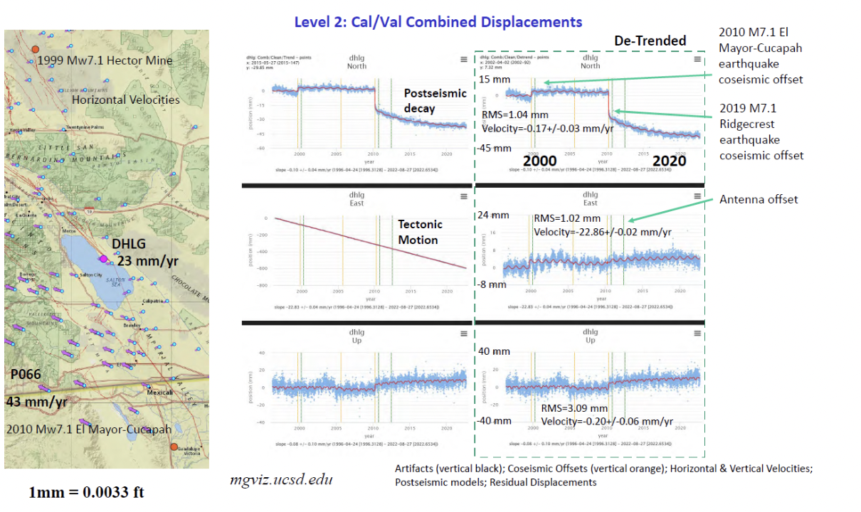
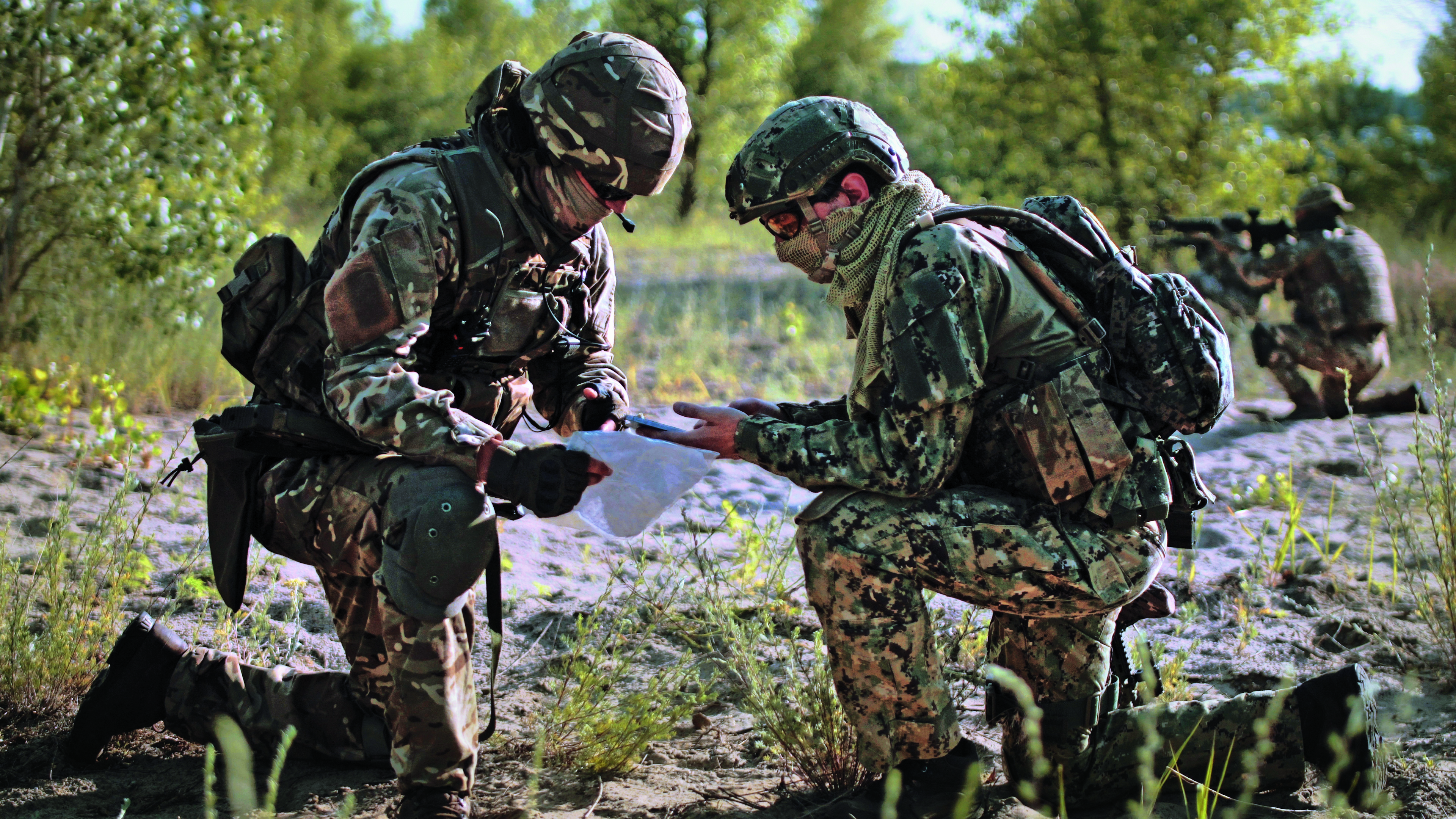
    Whether preparing for natural disasters or responding to everyday emergencies, first responders depend on the accuracy and dependability of GPS data to keep our communities safe. However, the increasing number and intensity of natural disasters, such as wildfires and hurricanes, and ongoing first responder staffing shortages have pushed the industry to look for ways to combine the tried-and-true benefits of GPS with new artificial intelligence (AI) technology to alert sooner, respond faster, and restore better than ever. The integration of AI’s adaptive learning capabilities with the ability of GPS to operate in areas of low or no connectivity make for cutting-edge emergency service solutions.

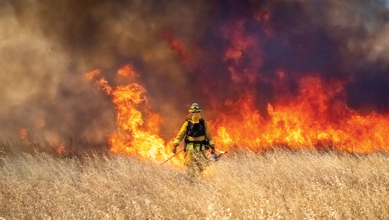
    New technologies incorporating both AI and GPS have already proven to save time and protect lives by quickly identifying and assessing potential fires. For example, in 2022, Sonoma County, California, used FireScout — an AI-powered fire detection solution — to monitor live footage for signs of fire and alert authorities. In one instance, the county found that FireScout’s AI solution detected and located — using GPS data — a fire 10 minutes before the 911 service was alerted about it, giving responders a head start on containing the fire. FireScout looks to integrate GPS functions more fully into their AI-enabled cameras with exact coordinate information. Investments in innovations that facilitate rapid response to natural disasters will lead to greater safety for first responders and their communities across the country.

    One way the industry is investing in GPS-powered AI innovation is through problem-solving competitions such as XPrize Wildfire, which encourages the development of cutting-edge solutions to wildfires. Teams will compete in one of two tracks: the Autonomous Wildfire Response track, which requires teams to combine AI and GPS data to differentiate between high-risk actual fires and decoy fires and then quickly suppress the real fires, and the Space-Based Wildfire Detection and Intelligence track, which requires teams to use satellites to accurately pinpoint fires across vast areas then relay that information to stations on the ground. GPS industry leader Lockheed Martin is providing a $1 million Accurate Detection Intelligence Bonus Prize to the winner of the XPrize Wildfire competition. Competitions such as XPrize Wildfire will result in products that can identify fires faster, reducing response times and minimizing damages to communities.

    Additionally, new GPS-powered AI solutions are bringing emergency resources to more people in the wake of hurricanes. In the aftermath of hurricanes, emergency personnel are tasked with identifying and allocating resources to restoration efforts. GPS-powered AI technologies such as the University of Connecticut’s hurricane monitoring system, compare pre-storm and post-storm satellite imagery to spot potential environmental and safety issues, such as flood water or damaged neighborhoods. The system then highlights those areas on a map and shares the coordinates of high-damage areas with emergency personnel. Services such as these support communities and allow restoration efforts to begin sooner with less risk to surveyors and responders.

    Beyond natural disasters, GPS also is being used with AI technology to shorten response times for emergency vehicles. Many towns, including St. Louis, Michigan, and Leon Valley, Texas, have implemented AI traffic light systems that use location data to detect the location of ambulances and fire trucks to give the vehicles a path of green lights, clearing out any traffic that might have slowed response times. Similarly, researchers at the University of Southern California are using UAVs — guided and tracked using GPS data — to carry automated external defibrillators (AEDs) to remote locations. These UAVs use coordinates provided by GPS receivers to operate in areas of limited connectivity and AI to determine the most efficient landing locations for different terrains. Ongoing research and further investment into the critical intersections of GPS and AI technology will help promote a safer future by supporting first responders and protecting communities in emergencies.

    The GPS Innovation Alliance (GPSIA) welcomes innovations in GPS and AI technologies that continue to revolutionize the way we respond to natural disasters and life-threatening emergencies. GPSIA is proud to support the expansion of these disaster-mitigating solutions by uplifting innovative research and design efforts, promoting new ideas, and ensuring adequate regulation is in place to protect users across the globe.

  • California Spatial Reference Center (CSRC) 2023 Spring Meeting

    California Spatial Reference Center (CSRC) 2023 Spring Meeting

    On April 27, I attended (virtually) the spring 2023 meeting of the California Spatial Reference Center (CSRC) coordinating council. See the agenda below. This column will highlight some activities with which the CSRS is involved and how it’s advancing the science of geodesy. Anyone who has been following my latest columns knows that I am an advocate for any person or organization that promotes the advancement of geodesy and recognizes that the United States is experiencing a geodetic crisis.

    First, I would like to state that Yehuda Bock, the director of CSRS, has been instrumental in advancing accurate geodetic positioning for as long as I have known him. I first met Bock in 1978 while I was attending the Ohio State University.

    A video of the meeting is available from the CSRC here.

    During the meeting, Bock presented the director’s report. He started with mentioning how geodetic infrastructure and methodologies are essential to mitigating the effects of natural hazards. That is something that affects everyone in the world, especially California, and one of the reasons that I always end my email messages and presentations with the following statement: “Geodesy is the foundation for all geospatial products and services.”

    Geodetic infrastructure and methodologies. (Image: Yehuda Bock, Scripps Institution of Oceanography)
    Geodetic infrastructure and methodologies. (Image: Yehuda Bock, Scripps Institution of Oceanography)

    Bock highlighted how GNSS is important to explaining natural phenomena and hazards of the Earth. Most individuals use GNSS to know where they are on a map on a phone, but GNSS (and geodesy) is so much more important to the average citizen than just knowing their location on Earth. As you can see from the image below, GNSS positioning provides information about many of Earth’s systems, such as changes in local mean sea level, the values of atmospheric parameters, the status of water resources, and the movement of the Earth’s surface due to tectonic plates, glaciers, earthquakes and volcanoes. One or more of these activities are important to every individual in the world.

    (Image: Yehuda Bock, Scripps Institution of Oceanography)
    (Image: Yehuda Bock, Scripps Institution of Oceanography)

    Bock provided examples of how GNSS has been used to investigate and monitor earthquakes, which is extremely important in California. See the image below  

    Displacement due to earthquakes. (Image: Yehuda Bock, Scripps Institution of Oceanography)
    Displacement due to earthquakes. (Image: Yehuda Bock, Scripps Institution of Oceanography)

    He highlighted a methodology of a kinematic datum that uses an intra-frame velocity model to estimate positions at any location and at anytime with respect to a reference frame and epoch.  This concept is part of the National Geodetic Survey’s new, modernized, National Spatial Reference System (NSRS). Several of my previous columns have discussed NGS’ NSRS and time-dependent coordinates (for example, see my August 2022 column). 

    (Image: Yehuda Bock, Scripps Institution of Oceanography)
    (Image: Yehuda Bock, Scripps Institution of Oceanography)

     California’s geodetic network is significantly affected by crustal movement. To help address this issue, the CSRS updated the NAD 83 coordinates. It’s denoted as CSRS epoch 2017.5 (NAD 83). See the image below for the project report on the update. This is important to anyone surveying in California because of the crustal movement affecting the coordinates of the monuments. California is well positioned to implement NGS’ NSRS. Part of the implementation of the CSRC epoch 2017.50 (NAD 83) was to have the new epoch-date coordinates transmitted with RTCM 3.0 data streams. This is something that other RTN operators from around the nation will have to do after NGS publishes the NSRS coordinates. The CSRS is a model from which others can learn. 

    Excerpt from CSRC epoch 2017.5 project report. (Image: http://sopac-csrc.ucsd.edu/index.php/epoch2017/)
    Excerpt from CSRC epoch 2017.5 project report. (Image: http://sopac-csrc.ucsd.edu/index.php/epoch2017/)

    Users that access CSRC’s epoch 2017.50 website, can find the coordinates of marks published in CSRC epoch 2017.50 (NAD83). See the image below for an example. 

    Mark p530 in CSRC epoch 2017.50 (NAD83). (Image: CSRC Website)
    Mark p530 in CSRC epoch 2017.50 (NAD83). (Image: CSRC Website)

    Bock discussed the integration of InSAR and GNSS to estimate accurate land changes over large areal extents. This type of research can help in developing an accurate intraframe deformation model (IFDM) to account for movement between survey epoch coordinates (SEC) and reference epoch coordinates (REC). See my August 2022 column for more on NGS’s definition of SEC and REC coordinates.   

     (Image: Yehuda Bock, Scripps Institution of Oceanography)

    (Image: Yehuda Bock, Scripps Institution of Oceanography)
     (Image: Yehuda Bock, Scripps Institution of Oceanography)

    (Image: Yehuda Bock, Scripps Institution of Oceanography)
    (Image: Yehuda Bock, Scripps Institution of Oceanography)
    (Image: Yehuda Bock, Scripps Institution of Oceanography)

    The rest of the director’s report included the following topics: 

    • reference surfaces for unified reference frame 
    • observation systems: terrestrial and marine geoids 
    • unified reference frame 
    • GNSS-IR 
    • airborne gravity 
    • geoid model 
    • machine l;earning 
    • tracking atmospheric rivers with GNSS meteorology 
    • tracking extreme weather events with GNSS meteorology 
    • cluster analysis to unsupervised analysis of GNSS time series isolate geophysical effects 
    • proposed geodesy curriculum at SIO. 

    The last one was the most important one to me because developing educational curriculums that include geodetic topics will help advance the science of geodesy.   

    (Image: Yehuda Bock, Scripps Institution of Oceanography)
    (Image: Yehuda Bock, Scripps Institution of Oceanography)


    Other speakers at the coordinating council meeting discussed the use of geodetic science in projects such as measuring sea level rise along the California coast as well as performing geodesy on the seafloor.  

    There was an interesting presentation by Humberto Gallegos discussing how to fill the skill gaps through the Geo-Spatial Engineering and Technologies (GSET) program at East Los Angeles College (ELAC). This program is helpful in developing future surveyors and geodesists. 

    (Image: EarthScope)
    (Image: EarthScope)

    There also was a presentation on EarthScope by Bill Funderburk. See below for a few slides from Bill’s presentation. The presentation discussed the update on the Network of the Americas (NOTA). Bill provided information on NOTA partners, NOTA network and data, NOTA in California, and the EarthScope merger. His presentation also highlighted the many partners that support the NOTA, which includes 1,147 GPS/GNSS stations across the United States, Mexico and the Caribbean. Many individuals may not know it, but UNAVCO and IRIS merged on January 1, to become the EarthScope Consortium. Readers can find more information on this new organization here

    Photo:
    (Image: EarthScope)
    (Image: EarthScope)
    (Image: EarthScope)

    I only highlighted a few items from the meeting. Please see the video of the meeting for more details.  

    During the meeting, Bock was also presented with the CSRC Founders Award. It was a great honor for me to say a few words recognizing the important contributions that Bock has made to the geodetic community over the past five decades. It is in large part due to his leadership that California has progressed so much in geospatial positioning services. The following are a few photos from the ceremony and a statement from the CSRS. 

    Recognition Statement from the California Spatial Reference Center

    “Distinguished Research Scientist, Yehuda Bock, was recognized by the California Spatial Reference Center (CSRC: http://sopac-csrc.ucsd.edu/index.php/csrc/) with the Founders Day Award. Presented by Dana Caccamise, Bock was honored for the “thriving science and community outreach facilitated through [his] vision and implementation of the Center for decades.” With Bock’s guidance, CSRC was established in 1997 as a partnership with surveyors, engineers, GIS professionals, the National Geodetic Survey (NGS), the California Department of Transportation (Caltrans), and the geodetic and geophysical communities, and has become of IGPP’s most successful outreach efforts.”

    (Image: Karissa Duran, Scripps Institution of Oceanography)
    From left to right: Gregory Helmer, Sharona Benami, Yehuda Bock, Dana J Caccamise II (Image: Karissa Duran, Scripps Institution of Oceanography)
    The dedicated plaque and monument. (Image: Karissa Duran, Scripps Institution of Oceanography)
    The dedicated plaque and monument. (Image: Karissa Duran, Scripps Institution of Oceanography)


    In my opinion, integrated and collaborative organizations are necessary for the successful development of geospatial products and services.  

    I would like to highlight how the Ohio State University is integrating geodesy in a geology program. The Ohio State University Geology Field Camp is a geology class that is held every year. This year, the OSU Geodetic Department is going to participate in the program to explain how the science of geodesy is helpful to geologists. The plan is to provide exercises to explain how the camp’s activities can be enhanced with geodetic techniques. 

    The 2023 geology summer field course lasts six weeks. This year, the course starts on Thursday, June 1, and ends on Friday, July 14. Students receive six semester credit hours for completion of the course. 

    The course emphasize the following: 

    • observation of stratigraphic units and their characteristics 
    • interpretation and synthesis of structures, paleoenvironments, and geologic history 
    • presentation of results by means of geologic maps and cross-sections 
    • experience with 3D visualization, GIS, GPS and computer analysis of field data 

    In conclusion, on June 22, NGS is hosting a webinar that will discuss some of the benefits and challenges of transitioning to the modernized NSRS. The presenters are not NGS employees.  They are guest speakers from the geospatial community. I would encourage all users to register for this webinar. 

    (Image: NGS Website)
    (Image: NGS Website)
  • Xona Space Systems certifies Spirent’s SimXona

    Xona Space Systems certifies Spirent’s SimXona

    Image: Spirent Federal Systems
    Image: Spirent Federal Systems

    Xona Space Systems has fully certified Spirent Federal System’s SimXona, a Xona satellite constellation simulator. Spirent will launch SimXona at the ION Joint Navigation Conference, June 12-15, 2023, in San Diego, California.

    SimXona can simulate the Xona low-Earth orbit (LEO) constellation on its own, and in tandem with Spirent’s positioning, navigation, and timing (PNT) and threat simulation capabilities. Spirent has developed LEO simulation solutions for both the military and commercial sectors, including modeling software that combines the simulation of precise LEO orbits and highly accurate GNSS signals — delivering greater realism for applications that have no margin for error.

    Spirent will be accepting orders for SimXona soon.

  • TrustPoint launches commercially funded PNT microsatellite

    TrustPoint launches commercially funded PNT microsatellite

    On April 15, TrustPoint, an aerospace startup that provides GNSS products and services, launched its first satellite. The satellite, named It’s About Time, enables TrustPoint to demonstrate core technologies as it progresses towards delivering GPS-independent global time and positioning services.

    “TrustPoint’s platform is the first commercially funded, purpose-built PNT microsatellite,” Patrick Shannon, CEO of TrustPoint, said. “With this mission, we are expediting the impact of commercial technologies and innovation cycles on the world of timing and navigation, arguably one of the most far reaching and critical satellite services today.”

    Maverick Space Systems, a launch services provider and rideshare aggregator, supported the launch of It’s About Time on SpaceX’s Transporter-7 mission out of Vandenberg Space Force base in California. This first mission focuses on testing, calibration and optimization of TrustPoint’s microsat-compatible GNSS payload technology.

    After an initial commissioning period, TrustPoint will take control of the satellite and operate it through a series of tests and demonstrations.

    TrustPoint aims for its constellation to deliver secure high precision time and positioning services within the next few years. This capability will help fortify existing critical applications and enable the proliferation of nascent use cases in autonomous navigation, national security and smart infrastructure.

  • Seen & Heard: Can GPS forecast rain?

    Seen & Heard: Can GPS forecast rain?

    “Seen & Heard” is a monthly feature of GPS World, traveling the world to capture interesting and unusual news stories involving the GNSS/PNT industry.


    Image: Licence plate, Reviver
    Image: Reviver

    Digital license plates gone wrong

    A security research team has gained administrative access to Reviver, the only company in California that sells digital license plates, which has allowed them to track the physical location of all of Reviver’s customers. With this vulnerability, anyone could remotely update, track and delete someone’s Reviver plate. The access also enabled the researchers to change a section of the text at the bottom of the plate, designed for personalized messages, to anything they want, according to Vice.com. California launched the option to buy a digital license plate in October 2022, and Reviver has since addressed the license plates’ security vulnerability.


    AirTag. (Image: David Peperkamp/iStock / Getty Images Plus/ Getty Images)
    Image: David Peperkamp/iStock / Getty Images Plus/ Getty Images)

    Bill makes secret tracking illegal

    Indiana state legislators have filed a bill that would make tracking someone with a GPS-based device without their knowledge a crime, reported WTHR of Indianapolis. The bill is in response to the growing number of criminal cases involving Apple AirTags and other GPS-based tracking devices. Tracking someone secretly is not currently a crime in Indiana; however, laws vary from state to state. Under the proposed bill, the penalty would be increased from a Class C misdemeanor to a Class A misdemeanor if the person tracked is under a protective order. The penalty could be enhanced for someone convicted of using a tracking device when committing a felony. Similar incidents are on the rise around the United States involving the use of AirTags and other tracking devices for criminal purposes.


    Image: big-dan/ iStock / Getty Images Plus/ Getty Images
    Image: big-dan/ iStock / Getty Images Plus/ Getty Images

    Cellphones cause demise

    On New Year’s Day, six rockets were launched from a United States-made Himars rocket system at a vocational college in Ukraine, killing at least 89 Russian soldiers. Russia is blaming this on illegal cellphone usage by Russian soldiers, defying a ban. Ukrainian officials say 400 Russian soldiers were killed and another 300 were wounded, contradicting Russia’s report. However, this is the largest number of deaths Russia has acknowledged during the war. Russia says that the obvious cause of the attack was the use of mobile phones, as the enemy was able to locate and determine the troops’ coordinates for the strike. Two of the rockets were shot down before reaching Makiivka in the occupied Donetsk area of Ukraine. 


    Image: Angelo F-/ iStock / Getty Images Plus/Getty Image
    Image: Angelo F-/ iStock / Getty Images Plus/Getty Image

    Can GPS forecast rain?

    Researchers at the Department of Marine Geology and Geophysics at the Cochin University of Science and Technology in Kochi, India, say that heavy rainfall can be detected more than six hours in advance using GPS signals, reported The Hindu. During rainy seasons, as GPS signals pass through the atmosphere, how much they are delayed depends on the amount of water vapor present. By using continuous GPS signals and rainfall data collected in Thiruvananthapuram, the study showed that any heavy rainfall could be detected using this delay. 

  • Directions 2023: Advancing GPS to Meet the Future

    Directions 2023: Advancing GPS to Meet the Future

    GPS is the gold standard for precise positioning, navigation, and timing (PNT), impacting the lives of more than six billion users worldwide. The United States economy alone depends on the free, government-provided service across 900 million GPS receivers supporting vehicle navigation systems, general aviation, financial transactions, the electrical grid, precision agriculture, surveying and construction. The GPS enterprise must remain consistent and reliable, while keeping pace with emerging technology without interruption for the end user.

    Space Systems Command (SSC) at Los Angeles Air Force Base in El Segundo, California — the U.S. Space Force’s space development, acquisition, launch and logistics field command — is responsible for maintaining and modernizing the GPS enterprise. The enterprise consists of three segments: the space segment, the control segment and the user segment. Each achieved specific milestones during an exciting and productive 2022.

    Military people navigating on battlefield
    A new MGue for warfighters is moving closer to completion. (Image: EvgeniyShkolenko/iStock /Getty Images Plus/Getty Images)

    Space Segment

    There are currently 37 GPS satellites on-orbit with 31 set healthy. The constellation requires 24 operational satellites for worldwide coverage and a receiver needs to receive transmissions from four of them to determine its position in three dimensions. GPS continues to operate impressively with an average 45-cm accuracy throughout the past year with the most precise day on record at 31.5 cm. The space segment of GPS modernization focuses on GPS III and GPS IIIF satellite development with significant milestones rounded out in 2022.

    For GPS III, after the successful launch of Space Vehicle 5 (SV05) on June 17, 2021, it was set healthy (usable) on May 25, 2022. The significance of SV05 is its full operational capability of the improved civilian L2 (L2C) signal. L2C improves service speed for commercial users via access to two frequencies, improves accuracy when combined with legacy civil GPS signals (L1 C/A), and is less susceptible to ionospheric interference. SV05 is the 24th satellite enabled with the Military Code (M-code), providing worldwide M-code coverage. M-code is designed to give military receivers better defense against jamming, improved accuracy, a more secure and flexible cryptography architecture, and the ability to detect and reject false signals.

    On Jan. 18, 2023, SV06 successfully launched into orbit aboard a SpaceX Falcon 9 Block 5 rocket from Cape Canaveral Space Force Station, Florida. The launch of SV06 marks a key step in the larger goal of modernizing the GPS constellation. Additionally, the 10th and final satellite in the GPS III fleet finalized production and has a target launch date of 2026. GPS III Space Vehicles 7–10 are in storage and available for launch.

    The next generation of GPS satellites continues development. The October 2022 contract award for GPS III Follow-On (GPS IIIF) satellites will onboard additional capabilities. In addition to introducing new civil signals designed to enhance search-and-rescue efficacy and aviation safety, laser retroreflector array for precise ranging, and a fully digital navigation payload, the GPS IIIF satellites will offer a new Regional Military Protection (RMP) capability providing up to 60 times greater anti-jamming measures. A new port on the Lockheed Martin LM2100 Combat Bus supports a substantial increase in flexibility, providing rapid integration of payloads in response to emerging threats in space.

    GPS Enterprise interrelated segments. (Image: Space System Command)
    GPS Enterprise interrelated segments. (Image: Space System Command)

    Control Segment

    The Next Generation Operational Control System (OCX) will replace the current GPS Operational Control System (OCS), supporting the latest U.S. Department of Defense standards and practices for cybersecurity. The updated system includes a modernized and expanded monitor station network, improved anti-jam capabilities, and enhanced operational capability to control modernized military signals.

    In March 2022, OCX completed its fourth and final legacy ground antenna element (LGAE) installation on Kwajalein Island in the Republic of the Marshall Islands. OCX Block 1 and 2 are undergoing Hewlett Packard (HP) Formal Qualification Test (FQT). This event will qualify much of the system’s previously certified mission software functions. The event will also demonstrate system maturity and readiness for system acceptance, operator training, and specific developmental testing milestones with both GPS space and user segments.

    The next-generation control system, OCX 3F, will modify OCX Blocks 1 and 2 to use the enhanced capabilities of GPS IIIF satellites. OCX 3F received Milestone B and Acquisition Program Baseline (APB) approval from the Milestone Decision Authority (MDA) and was authorized to enter the Engineering and Manufacturing Development (EMD) phase in May. In November, the OCX 3F program deployed 3F mission software into OCX’s Near Operations Environment (NOE) for the first time after completion of the program’s first Integration Readiness Review (IRR). The IRR event ensures that the software meets integrity standards and receives approval to be integrated and tested on the NOE prior to software releases to the operational users. OCX 3F anticipates achieving operational acceptance in 2027.

    The GPS III government and industry team recently core mated GPS III SV10 and nicknamed it “Hedy Lamarr” after the actress and inventor. (Image: Lockheed Matin)
    The GPS III government and industry team recently core mated GPS III SV10 and nicknamed it “Hedy Lamarr” after the actress and inventor. (Image: Lockheed Matin)

    User Equipment Segment

    Among the arsenal of GPS user equipment, very few pieces have the technology to use the M-code signal. Maintaining a competitive advantage against the adversary requires use of these signals; the GPS Enterprise is focused on developing Modernized GPS User Equipment (MGUE) capable of accessing these signals. The MGUE program is a joint service program developing modernized M-code-capable military GPS receivers. The program is broken into two increments (Inc 1 and Inc 2). Both are designed to deliver secure PNT performance, allow navigation warfare operations, enhance anti-jam, enhance anti-spoof and anti-tamper, and enable Blue Force Electronic Attack.

    As part of the multiple elements under the MGUE Inc 1 umbrella, L3Harris delivered its final Build 7 ground card to the government on Nov. 16, 2021, and completed regression testing on that kit in February 2022. The final Delta Security Certification and Approval were completed on April 13 and April 29, 2022, respectively. Development of the L3H Ground-Based GPS Receiver Applications Module (GB-GRAM-M) card, which delivers geolocation and precise positioning capabilities for space-constrained applications while providing increased security and anti-jam capabilities, is complete and available for services procurement. MGUE Inc 1 completed qualification testing for the aviation and maritime cards on Sept. 9, 2022, with updated software builds. This build allows the program to progress to 98% of the requirements verified and enables B-2 Bombers and Guided Missile Destroyers (DDG) to continue progress toward operational testing. Completion of this commitment means significant progress toward operational testing for stakeholders and warfighters.

    MGUE Inc 2 held Preliminary Design Reviews for the Miniature Serial Interface (MSI) in summer 2022, bringing the project another step closer to finalizing the EMD phase. Once all closure and action items are completed for the reviews, the government will consider each event complete. Critical Design Review (CDR) is scheduled for this summer and will validate the system design and the ability to meet system performance requirements. MGUE Inc 2 continues to execute the second competitive objective under Phase I for the Joint Modernized Handheld component; the effort is moving closer to completion of the handheld prototype and will ultimately make for a more seamless transition to operations.

    GPS ground antenna at Schriever Space Force Base in Colorado. (Image: U.S. Air Force)
    GPS ground antenna at Schriever Space Force Base in Colorado. (Image: U.S. Air Force)

    Conclusion

    The SSC’s mandate is paramount to maintaining our modern way of life. The space professionals dedicated to developing GPS technology are committed to delivering advanced capabilities to the warfighter, the civil sector, and the world. An interconnected world is ready for us. We’re on our way.

    SSC is the U.S. Space Force field command responsible for acquiring and delivering the capabilities needed by warfighters to protect our nation’s strategic advantage in and from space. It manages an $11B budget for the U.S. Department of Defense and works in partnership with joint forces, industry, government agencies, academic and allied organizations to outpace emerging threats.


    For analogous updates on the other three GNSS constellations, please see:

  • Who runs GPS?

    Who runs GPS?

    Who Runs GPS

    Nearly 50 years ago, in December 1973, the Defense Systems Acquisition Review Council approved the Navstar Global Positioning System for entry into Phase I of development. Since then, through its development, deployment and continuing modernization, GPS has grown into a complex program. It is operated by the Department of Defense based on legislation from Congress, executive orders from the White House, and policies established jointly with the Department of Transportation. It supports U.S. military missions as well as myriad scientific, commercial and consumer applications around the planet. Of course, the last category, with its billions of users, now dwarfs all the other ones combined.

    The GPS program, with an annual budget of nearly $2 billion and no user fees, is a gift from U.S. taxpayers to the world. It has staff in Washington, D.C.; at the Pentagon in Arlington, Virginia; at Schriever Space Force Base, Colorado; at the Space Systems Command at Los Angeles Air Force Base, California; at Cape Canaveral, Florida; at the U.S. Coast Guard Navigation Center in Alexandria, Virginia; and at GPS ground antennas in additional locations around the world. From the White House to Congress to aerospace companies, from military officers to civilian civil servants, from policy makers to engineers, from the East Coast to the West Coast to remote islands in the Pacific, Indian  and Atlantic Oceans, GPS is a vast enterprise — most of which is little known even to people in the industry and virtually unknown to the public.

    The Global Positioning System is a vast and mostly unknown enterprise. This section — the first in an occasional series of authoritative reference pieces in this magazine — aims to clarify who does what to maintain GPS as a fantastic global utility. The relevant missions of agencies or units are in italics.

    After I researched and drafted the piece, I asked the experts listed below to review it and provide corrections and additions. While grateful for their substantial feedback, I take sole responsibility for any remaining errors or omissions.

    Thank you to the following experts:

    • Harold W. Martin III, Director, Space-Based Positioning, Navigation & Timing, National Coordination Office
    • Michael J. Dunn, Capability Area Integrator for PNT, Space Systems Command, United States Space Force
    • Lt. Col. Robert O. Wray, Commander, 2nd Space Operations Squadron, United States Space Force
    • Scott R. Calhoun, Commanding Officer, Navigation Center, United States Coast Guard
    • Paul Benshoof, Technical Director, 746th Test Squadron (AFMC), Central Inertial and GPS Test Facility
    • Bernard Gruber, Senior Director, Northrop Grumman

    Please return to this page periodically to read corrections and updates to this special section. If you spot any significant inaccuracies or omissions, please bring them to my attention by writing to me at [email protected].

  • Raytheon claims Navy contract to provide JPALS to Japan

    Raytheon claims Navy contract to provide JPALS to Japan


    Image: Raytheon Technologies video screenshot
    Image: Raytheon Technologies video screenshot

    Raytheon Intelligence and Space has been awarded a contract from the United States Navy’s Naval Air Traffic Management Systems Program Office to deliver the Joint Precision Approach and Landing Systems (JPALS) to the Japan Maritime Self-Defense Force (JMSDF). The GPS navigation and precision landing system will be deployed on the JMSDF JS Izumo carrier.  

    The JPALS system guides aircraft onto carriers and assault ships in all weather and surface conditions and is integrated on all F-35 aircraft. JPALS is also being deployed on all U.S. Navy aircraft and assault ships. 

    In addition, JPALS will be deployed on two international platforms, including the United Kingdom Royal Navy’s HMS Queen Elizabeth, and an Italian aircraft carrier, the ITS Cavour, to support its F-35 squadron. 

    The primary work locations for JPALS are in Largo, Florida and Fullerton, California.   

  • GPS could have high accuracy and counter spoofing, if…

    GPS could have high accuracy and counter spoofing, if…

    It was 2018. Representatives from the European Space Agency were visiting Google headquarters in Mountainview, California.

    Under discussion was Europe’s plans to introduce a high accuracy and authentication service to their Galileo satellite navigation system. Galileo would broadcast precise point positioning corrections on the E6-B band and provide users decimeter-level accuracy. They would also be including a navigation authentication message enabling receivers to distinguish genuine messages from deceptive ones sent by spoofers.

    Wouldn’t Google like to incorporate these capabilities in future versions of Android phones?

    The answer from Google Distinguished Engineer, Frank van Diggelen, was a resounding “yes.”


    Technologically Possible

    Van Diggelen also had another thought. It should be possible to deliver precise positioning corrections and authentication data via the internet. This could allow phones with an internet connection to access the services as well. With an app, older smartphones would be able to take advantage of the services, and it wouldn’t be necessary to add new hardware to new phone designs.

    The next logical step was to establish an internet-based high accuracy and authentication service for the United States’ GPS. Unlike the newer European Galileo and Chinese Beidou systems, GPS satellites don’t have the ability to transmit data to improve accuracy and authenticate signals.

    Technologically, providing corrections for high accuracy and authentication data to users via the internet is entirely possible, according to van Diggelen and other experts serving on the president’s Space-based Positioning, Navigation, and Timing (PNT) Advisory Board (PNTAB).

    Yet a couple of process challenges in the United States could make establishing such a service difficult and might prevent its creation entirely.


    Data collection and use not yet an official program

    The first is related to the way in which the U.S. collects and handles real-time tracking data of the Global Navigation Satellite Systems (GNSS) ­­— GPS, GLONASS, Galileo, and BeiDou ­­— to derive corrections needed for a high accuracy service.

    NASA’s Jet Propulsion Laboratory (JPL) operates NASA’s Global GNSS Network (GGN) of more than 60 stations around the globe, which provide their tracking data to JPL’s Global Differential GPS (GDGPS) System. The GDGPS System also has access to real-time tracking data from hundreds of additional sites, all of which track GPS and other GNSS. This allows the GDGPS System to generate precise corrections for the navigation messages of GPS and other GNSS. It also enables real time decimeter-level accuracy for positioning applications anywhere in the world. These corrections are provided to some government agencies and commercial entities on a reimbursable basis.

    NASA’s GDGPS capabilities are not part of a formal, official government program, though. Rather they have grown organically as part of JPL’s efforts to push boundaries in scientific and engineering applications of GNSS, and its ability to take on work paid for by other agencies. Thus, GDGPS efforts lack a sufficient and established government funding line, formal programmatic tasking, and other structures and procedures needed to ensure its long-term viability as a government-provided service.

    NASA and JPL officials recognized this and in 2020 established a working group to advise on how they should go forward. The following year that working group made several recommendations to NASA and the PNTAB. Among them were to establish a consistent level of NASA funding, create a Level-1 capabilities document for GDGPS, and start discussions towards an interagency memorandum of understanding (MOU) for long-term government funding.

    At the same time, a PNTAB task force investigated the GDGPS activity and made recommendations to the PNTAB. They included: that NASA/JPL document GDGPS capabilities, including architecture, facilities, functions and products; that a stable government funding line for GDGPS be established; that a security review of GDGPS be undertaken; and to maintain GDGPS entrepreneurial aspects in pursuing multi-agency usage of its services.


    Civil GPS rarely needs addressed

    The second challenge to establishing high accuracy and authentication service for GPS appears to be the lack of an identified agent or mechanism within the federal government to do so.

    Europe’s Galileo is a civilian system established and operated to support economic activity and development. The U.S’s GPS is run by the military.

    First created to “put five bombs in the same hole,” it was built and run for years by the U.S. Air Force and is now the responsibility of the U.S. Space Force. Its primary mission is support of military missions and almost all funding comes through the Department of Defense (DOD).

    Yet, indisputably, 99% of GPS users are not in the military and the system has become essential to most technologies and nearly every facet of the U.S. economy.

    Official government policy has long recognized this, at least at the strategic level. Presidential policies issued in 2004 and in 2021 provided for improvements in functionality for civil users – as long as they were required by and entirely funded by a civil agency.

    At a more tactical level, though, attempts to fund civil requirements have always faced great difficulty and rarely succeeded.* Mandates in presidential directives for civil signal monitoring, interference detection and mitigation, increased resilience, alternative PNT, and responsible use have all faced uphill battles and received little funding.

    According to former senior government officials, this difficulty stems from civil GPS use being caught in a bureaucratic “Catch-22.”

    On the one hand, executive branch policy dictates that funding for GPS capabilities and applications benefiting civil users must flow through the Department of Transportation (DOT). On the other, within government programming and budgeting circles, GPS is seen as an expensive military capability funded through the DOD. Requests for GPS and PNT-related funding through DOT are more difficult to explain and are easier to deny.

    Compounding this difficulty is the lack of a clear and empowered national leader to advocate for a comprehensive and national approach to GPS and PNT issues and overcome bureaucratic snags.

    As a result, the path forward for adopting the recommendation for a GPS high accuracy and resilience service is, at best, unclear.

    Yet many on the President’s advisory board and in government are hopeful. “Establishing a high accuracy and resilience service for GPS is the right thing to do” said one. “We have all the pieces to make this happen. We just need to bring them together.”

    And as one of the board members commented at the recent meeting, if the U.S. doesn’t do this “It stinks.”

    Photo:
    Image: Slide from the National PNT Advisory Board Meeting in November 2022

    *The exception to difficulties funding civil GPS-related capabilities is the Federal Aviation Administration’s Wide Area Augmentation System. It was established as the result of heavy lobbying by the airline industry, which continues to give it strong support.

  • Climate change in the Big Basin mapped with GNSS and lidar technology

    Climate change in the Big Basin mapped with GNSS and lidar technology

    Photo:
    Image: demerzel21/iStock/Getty Images Plus/Getty Images

    CyArk, a California-based nonprofit, used UAVs, lidar and GNSS equipment to scan Big Basin Redwood State Park in Santa Cruz, California and create a model of it. The model shows drastic changes from climate change and the after-effects of the 2020 CZU Lightning Complex Fire.

    CyArk was contracted by the California park system and Google Art & Culture to document climate-related changes in the state forest, including the 2020 CZU Lightning Complex Fire, which burned more than 97% of the oldest park in California, destroying historic structures and most of the park. The fire was detrimental to the park’s landscape, which is still plagued by drought.

    DJI quad-rotor UAVs, a fixed-wing senseFly UAS, lidar and photogrammetry data brought in by RealityCapture software, and Topcon Positioning Group GNSS receivers among other technologies were used by CyArk to map the large-scale project.

    The model created from the flyover of the Big Basin can be seen here.

    CyArk digitally documents culturally historical places around the globe in 3D to preserve each site’s story using GNSS and lidar technology. They have worked at more than 200 sites in more than 40 countries.

  • Self-driving cars: Innovative or a nuisance?

    Self-driving cars: Innovative or a nuisance?

    Photo:
    Image: iStock/Getty Images Plus/Getty Images

    San Francisco local officials are questioning the safety of autonomous vehicles (AV), also known as self-driving cars, due to frequent reports of traffic violations, delaying public transportation and emergency vehicles, causing traffic congestion as well as driving onto public sidewalks.

    California officials granted the first AV deployment permits this year, allowing companies to release self-driving cars onto city streets and to provide passenger service as robotaxis. Since granting permits to AV companies such as Waymo and Cruise, self-driving vehicles have been creating a multitude of issues with public safety, including a recent incident of a Cruise AV stopping a bus on its route for over seven minutes.

    As state governments have the legal power to grant permits to AV companies to conduct testing and ride hail services, city officials are left powerless to control self-driving car incidents that affect residents and public safety. City officials also struggle to obtain information regarding AV-induced road blockages and even a comprehensive list of all companies have deployed self-driving vehicles onto their roads.

  • CalEnviroScreen helps fight pollution with justice

    CalEnviroScreen helps fight pollution with justice

    An interactive map sheds light on which California communities are disproportionately burdened by pollution

    Image: OEHHA
    Image: OEHHA

    CalEnviroScreen was built by the Office of Environmental Health Hazard Assessment (OEHHA), part of the California Environmental Protection Agency. In it, pollution and population data combine to shed light on which communities bear the brunt of environmental and health hazards. Addressing this inequality is known as environmental justice.

    “It is both a map and a way to think about the power of maps, in this case facilitating a geographic approach to realize the goals of environmental justice,” explained Stephen Gay, Equity & Social Justice blogger for Esri.

    Using modern geographic information system (GIS) technology, CalEnviroScreen ranks and color codes California’s more than 8,000 census tracts to reflect vulnerability to pollution. The formula behind CalEnviroScreen considers the presence of various types of pollution, the prevalence of health problems that can be worsened by pollution, and population data.

    The main map shown here illustrates the combined Pollution Burden scores, made up of indicators from the Exposures and Environmental Effects components of the CalEnviroScreen model. In addition to an overall score, CalEnviroScreen provides map-building tools to isolate 21 specific datasets.

    Communities with a heavy pollution burden often experience high poverty that makes them more vulnerable to pollution’s effects. Pollution data includes cleanup sites, water quality (such as groundwater contamination, lead exposure, pesticide runoff) and air quality (including traffic exhaust, ozone, particulate matter). Deleterious health effects include asthma, heart disease, low birth weight and more.

    The map itself is only the most visible manifestation of CalEnviroScreen, which CalEPA said is a screening methodology “to help identify California communities that are disproportionately burdened by multiple sources of pollution.”