Tag: defense

  • The changing face of defense PNT

    I have mixed emotions as I write this column. Delighted, absolutely, to be given the opportunity to write for GPS World on topics that I am so passionate about; but also sad that we will not see any more articles from Don Jewell, whose excellent columns I followed so religiously over the years. I never had the opportunity to meet Don personally but, to me, he is irreplaceable. But let’s talk about the changing face of defense positioning, navigation and timing (PNT) — not in the editorial sense, but in the technology sense.

    As we all know, PNT and GPS are no longer synonymous. With a host of innovative technologies on the horizon, PNT is about so much more than GPS these days, and the military knows it. Sure, GPS has been the workhorse of PNT for many years, and it’s not going anywhere anytime soon. I’ll be clear on that: GPS is not going anywhere. But it’s not a complete solution either.

    Let me paraphrase what a friend in the infantry tells me, by saying GPS is a 60 percent solution to their navigation needs. What does that mean? Well, it goes something like this:

    • 60 percent of the time: GPS is great, it does what we need.
    • 20 percent of the time: We are indoors or underground, and GPS is simply not available.
    • 15 percent of the time: We’re in an urban canyon. GPS availability is intermittent, and the accuracy is poor.
    • 4 percent of the time: We’re in forests or dense vegetation, and GPS is sporadic.
    • 1 percent of the time: GPS is jammed.

    You can argue the numbers depending on the mission, but you get the idea. What, then, is the answer for the soldier? Well, first things first: We don’t want to reinvent the good 60 percent so, once again, GPS is here to stay. The question is how do we push past that 60 percent figure and get ourselves closer to 100 percent? Let’s go from the bottom up, and address GPS jamming.

    Overcoming interference

    The classic solution to jamming is an adaptive antenna, also known as a controlled radiation pattern antenna (CRPA). More on this another time but, for now, suffice it to say that CRPAs are a well-understood and mature technology, and can offer very high levels of jamming resistance.

    The often-cited disadvantage of a CRPA antenna is its size, weight and power: As CRPAs employ multiple antenna elements, they are inherently larger and heavier. The electronics can pretty much be covered by a single chip these days, leaving the antennas themselves as the problematic aspect, but advances in antenna technology have also made big hurdles.

    For airborne platforms, conformal antennas designed as part of the structure or fuselage can be used; whilst for the dismounted soldier, the trend is towards wearables, where the antennas may be an inherent part of the clothing or helmet design.

    Aside from adaptive antennas there are a whole host of other techniques in your anti-jam kit bag, including receiver-based techniques.

    It’s a numbers game

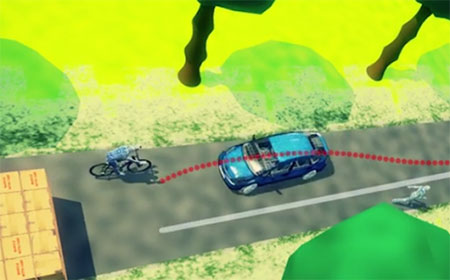
    For forests and urban canyons, this is where multi-frequency multi-GNSS comes into its own. It really is a numbers game: The more constellations you use, the more satellites you can choose from, and the greater your chances of seeing enough satellites to derive a reasonable navigation solution. You also have more options for mitigating the effects of multipath and other errors.

    Of course, this gives rise to a potentially difficult question for some governments: In defense applications, do you want to rely on foreign GNSS constellations as part of your PNT solution? The attitude here depends on your own country’s policy and a trade-off of perceived gains against perceived threats. The UK, for example, has chosen to embrace all available constellations and frequencies in future military navigation systems.

    That’s probably about as far as GNSS gets you, because now we’re looking at the 20 percent of the time where the user is indoors or underground. In other words, environments where GNSS simply isn’t available. This 20 percent is perhaps more tricky to address, and is the realm of alternative and complementary PNT technologies.

    Beyond GNSS

    Fusing different sensor modalities to create a combined navigation solution is anything but a new idea. The benefits of combining GPS with an inertial sensor were recognized a long time ago, and this classic pairing continues to be the subject of research today.

    The two technologies are highly complementary in various ways: GNSS offers absolute position, low short-term accuracy, and high long-term accuracy. On the other hand, an inertial sensor offers the opposite: relative position, high short-term accuracy, and low long-term accuracy. It’s a match made in heaven.

    But whilst GNSS plus inertial may be a good choice for, say, airborne platforms, it doesn’t solve the in-building and underground problem. Without GNSS, you need something else.

    Indoor navigation has been one of the hottest research topics of recent times, but there are really two types of indoor scenario: the first is when you’re in a shopping mall or airport. You can use an inertial sensor, Wi-Fi, mobile base stations, and various other bits of infrastructure to help you navigate.

    The second scenario is the military one: You’re in an unfamiliar enemy compound or underground tunnel complex. In this case, there is no GNSS, no Wi-Fi, no mobile communications; and, for navigation, you can only really rely on the sensors you bring with you.

    So what other sensor works underground, and complements inertial?

    Visual/inertial integration

    Visual odometry is an established, yet often overlooked, navigation technology that is undergoing a resurgence of interest, in both military and civilian applications. In simple terms, visual odometry uses sequential camera images to determine motion in a six degrees of freedom reference frame. Using either single or multiple cameras a platform can estimate both its 3D position and orientation, providing much the same information as an inertial sensor — but with a few added benefits.

    Visual/inertial sensing allows 3D reconstruction of a road incident (https://www.youtube.com/watch?v=eBw-DH2p5uo&t=2s)
    Visual/inertial sensing allows 3D reconstruction of a road incident. (Screenshot: Roke)

    Because cameras and associated vision-processing algorithms are capable of detecting corners and features, a 3D model of the environment in which the soldier is operating can also be built up. In other words, we can perform simultaneous localization and mapping (SLAM).

    But like any navigation technology, visual odometry has its limitations. It likes well-defined features in the environment, such as corners, but can get confused by moving objects like trees and clouds. Its performance also depends on factors such as the quality of the camera and lens, and how well the system is calibrated. Like an inertial sensor, it provides a relative positioning solution and is subject to accumulation of errors over time. It’s a great technique, but it really comes into its own when combined with another navigation sensor, such as an inertial unit.

    And it’s not just the military guys who are taking advantage of visual/inertial integration. Just take a look at Google’s Tango project, or what Qualcomm is doing, or Roke’s black box for driverless cars, to name but a few examples.

    Bringing it all together

    Over the course of the last decade or two, the operational landscape for soldiers has changed significantly, with far greater focus on urban warfare. The military realized some years ago that the answer to robust navigation for dismounted soldiers was going to require a range of sensor modalities: no single navigation technology is ideal in all environments. That’s why this has been the focus of so many defense programs of recent years.

    By way of example, the UK Ministry of Defence (MoD) initiated a research program in 2013 called Dismounted Close Combat Sensors (DCCS). The contract addressed a range of soldier capabilities, one of which was the ability to provide reliable soldier position and orientation in all environments.

    The DCCS programme evaluated a whole bunch of technologies, but eventually converged to an integration of three primary sensors: multi-constellation GNSS, a low-cost inertial measurement unit (IMU) and a video camera. The single monocular video camera was used to strap down the IMU, in a very tightly-coupled system. It makes sense: when GNSS is available, use it. When GNSS isn’t available, the integrated visual/inertial navigation sensor continues to provide both location and orientation for the duration of the mission. As it should be for a tightly integrated navigation system, the performance of the combined system outperforms any individual sensor in isolation.

    Whilst integrated sensor systems enable our soldiers to position, orientate and navigate themselves, the performance of individual sensors continues to be pushed to new limits. Inertial technology is advancing all the time, and defense is again pushing the boundaries. Take a look at what DARPA is up to, as an example.

    The missing ‘T’

    Haven’t we missed something? Ah yes, there’s a “T” in PNT. So whilst there would seem to be various options for achieving a robust positioning and navigation solution, we mustn’t forget precise timing for those applications that need it. Quantum technology is flavor of the month here and, once more, the defense agencies are furthering developments: DARPA with its ACES program, and MOD/DSTL via the Quantum Technology Program, to illustrate just a couple of examples.

    So whilst GPS will continue to remain the workhorse, defense PNT is migrating from GPS-only to being a many-faced beast. And I haven’t even gotten started on pseudolites, signals of opportunity, eLoran, and cooperative navigation.

    The future of defense PNT looks pretty good to me.

  • New system designed to protect avionics from GPS jamming

    New system designed to protect avionics from GPS jamming

    Israel Aerospace Industries (IAI) has unveiled ADA — an advanced system that protects avionic systems from GPS jamming.

    ADA has already been integrated into several systems and platforms operating both in Israel and abroad. The system recently won a tender from Israel’s Ministry of Defense for integration into one of the main platforms of the Israel Air Force.

    ADA was developed by IAI’s MALAM division, a national center of excellence for anti-jamming protection of GNSS receivers.

    Anti-GPS jamming system (ADA) by Israel Aerospace Industries.
    Anti-GPS jamming system (ADA) by Israel Aerospace Industries. Photo: Israel Aerospace Industries

    Under the terms of the project with the Israeli Air Force, IAI will deliver a turnkey solution based on its multi-channel Controlled Reception Pattern Antenna (CRPA) technology.

    The ADA integration will ensure the operational continuity of the aircraft fleet, allowing avionic systems which rely on satellite navigation systems to continue uninterrupted operation even under direct electronic attack, when the enemy uses GPS jammers or other methods of interference.

    “We are excited to receive this important contract, it is a great compliment for IAI,” said Jacob Galifat, general manager of the IAI MALAM division, “Facing today’s threats to GNSS, these systems are a must, for any platform using GPS, or any other global satellite navigation systems. Our operationally proven systems will ensure the availability of GPS- and GNSS-based systems, even in the most contested, EW-saturated battle space. Considering the operational challenges, we believe this system has considerable export potential for many air forces and armies who experience GNSS jamming in combat zones.”

    The ADA system was successfully evaluated recently in the United States, at the NAVFEST event, where foreign military forces contest anti-jamming systems against various electronic-warfare challenges.


    Modern navigation, communications and intelligence collection and electronic warfare systems integrated in modern platforms rely on the uninterrupted availability of satellite-based navigation and timing for their operation. Despite this dependency, most platforms do not use electronic counter countermeasures (ECCM) systems to protect those essential assets. Remaining exposed, even low-power jammers can disrupt or even deny the operation of GNSS systems, thus degrading the platform’s capability to fulfill its mission.

    Based on an advanced electronic architecture and the implementation of sophisticated digital processing, the agile ADA system, developed by IAI MLM, protects a broad range of GNSS systems operating on manned and unmanned combat aircraft and helicopters. ADA variants are also used in land-based platforms such as main battle tanks and APCs, and on naval systems. Other derivatives of the system are integrated in various guided weapons.

    The ADA system will be displayed at the Aero- India exhibition in Bangalore, India, Feb. 14-18, 2017 (Hall A, Booth A1.1a).

  • Israel defence to fly BlueBird UAVs

    Israel defence to fly BlueBird UAVs

    BlueBird Aero Systems' Thunderbird-B UAV.
    BlueBird Aero Systems’ ThunderB UAV. Photo: BlueBird

    BlueBird Aero Systems has won a contract to supply a target variant of an unmanned air vehicle to the Israeli Air Force (IAF), to enable it to train its air defense units.

    The IAF selected BlueBird’s ThunderB after it completed a series of test flights in which it reached a speed of 150 kilometers per hour and a ceiling of 15,000 feet.

    The target version of the ThunderB will carry a simple optical payload.

    The ThunderB is a small-sized tactical UAV (28 kilograms, 4-meter wingspan), with intelligence, surveillance, target acquisition and reconnaissance (ISTAR) capabilities previously found only in much larger UAVs, usually with weight of above 200 kilograms. It is suitable for ISTAR because of its long endurance capability (6–24 hours), its extended control range and its cooled/uncooled infrared and optional laser pointer payload.

  • DT Research provides rugged tablets to US Army

    The U.S. Army continues to expand the use of DT Research’s DT311 series of ultra-rugged tablets into additional army facilities to support training missions and other logistics. In 2016, the U.S. Army awarded DT Research three rugged tablet contracts.

    DT Research is a designer and manufacturer of purpose-built computing solutions for vertical markets. The company is headquartered in Silicon Valley, California, with offices in China and Taiwan.

    “We are honored to have the U.S. Army choose our rugged tablets again,” said Daw Tsai, president of DT Research. “The U.S. Army has strict requirements for advanced durability, powerful computing, robust connectivity, and fully integrated data capture options for the rugged tablets they use. We are proud to meet these high standards and deliver a specialized tool that will serve the U.S. Army well in their diverse environments.”

  • LizardTech certified by US Army for GeoExpress and Express Server

    LizardTech, a provider of software solutions for managing and distributing geospatial content, has received Certificates of Networthiness (CoN) for GeoExpress 9.x and Express Server 9.x from the U.S. Army Network Enterprise Technology Command (NETCOM).

    The CoN signifies that GeoExpress and Express Server are configured to the current Army Golden Master (AGM) baseline and comply with all U.S. Army and Department of Defense (DoD) standards for security, compatibility and sustainability.

    A CoN is required for all enterprise software products in the Army Enterprise Infrastructure Network and applies to the U.S. Army as well as National Guard, Army Reserve and DoD organizations using the Army network.

    GeoExpress is LizardTech’s flagship software product, enabling geospatial professionals to manipulate digital satellite/aerial image and lidar data and compress them to industry-standard MrSID or JPEG2000 files for easy and cost-effective processing, storage and transmission.

    Express Server software is the LizardTech solution for high-performance cataloguing, delivery and publication of geospatial data that lets users access geospatial data on any device with any connection.

    “Receiving Certifications of Networthiness for our most recent geospatial software products is a significant achievement and a testament to LizardTech’s continued engagement with the U.S. Army and other U.S. DoD user communities,” said Terry Ryan, LizardTech federal government sales manager. “These CoNs give our users confidence that LizardTech solutions will meet their IT safety and stability requirements, and we look forward to supporting our users at home and abroad.”

    The current CoN applies to all 9.x releases of the GeoExpress and Express Server software. LizardTech has pursued and received CoNs for earlier versions of GeoExpress and Express Server, demonstrating a long-term commitment to ensuring U.S. Army forward-deployed personnel have rapid access to geospatial imagery and related data when and where they need it.

  • New defense signals offered, new defense editor sought

    New defense signals offered, new defense editor sought

    Two important new signals — or rather, one signal and one group of signals — became available for military users worldwide last week. Satelles made an exciting announcement of what amounts to a new dimension in satnav: a whole new constellation in low-Earth orbit, bringing global coverage and most critically, a signal strength hitherto unknown to GNSS users. The satellite time and location (STL) has primary application in the timing realm, which is vital in many applications.

    Higher in the sky, Europe’s GNSS satellites constituting the Galileo system officially began offering their services, and the multiple frequencies available here mean robustness, greater availability in obstructed environments, and — some say, though this is controversial — greater positioning accuracy, largely through more precise timing onboard.

    Meanwhile, GPS World seeks a new defense editor for this column, and adopting the concept of “promoting from within,” now turns to its readership for interested parties to volunteer.

    A New SatNav That’s Not GNSS

    A strategic alliance announced on Dec. 15 between companies Orolia and Satelles includes will provide positioning, navigation and timing (PNT) solutions provided by the Iridium satellite constellation, independent of GPS/GNSS signals. The companies intend to provide PNT solutions to military, defense, government and commercial customers worldwide. Their new satellite timing and location (STL) service can supply much-needed robustness to GPS-dependent operations.

    Orolia, the parent of GNSS-active companies Spectracomm, McMurdo, and  Spectratime, has extensive experience in the defense realm. The company says it is #1 worldwide in the manufacture of military beacons outside the U.S. with a 60% market share, and #2 within the U.S., and that it is the first-ranked provider of Medium-altitude Earth Orbit Search and Rescue system (MEOSAR) worldwide.  In partnership with Satelles, it will provide the STL service independent from traditional GPS and other GNSS satellite signals. STL is reported to be less susceptible to vulnerabilities such as spoofing, interference and jamming that are associated with GPS/GNSS — and the stronger signal penetrates buildings where GPS/GNSS cannot reach.

    Iridium satellite, courtesy Iridium.

    Iridium satellite, courtesy Iridium.

    Based on the low-Earth orbit (LEO) Iridium satellite constellation, STL signals are up to 1,000 times stronger than GPS/GNSS; this signal strength, due in part to the constellation’s closer proximity to users, helps to prevent jamming and enables signal reach into buildings and other difficult locations. STL’s additional cryptographic security also enhances performance, productivity and security.

    For further background on Iridium, see the June 2016 Defense PNT column by Don Jewell,“Iridium and GPS revisited: A new PNT solution on the horizon?

    Projected key applications and use cases include energy/utility grids, enterprise data networks including financial systems, maritime/aviation navigation, fleet/asset tracking management, search and rescue and data center management.

    “The timing signal is very accurate and close enough to GPS for most timing applications, although the positioning accuracy is lower than what GPS users are used to,” said Orolia CTO Jean-Yves Courtois. “It is an augmentation for timing primarily, and secondarily for positioning.”

    “In terms of timing accuracy, it provides on the order of tenths of microseconds in accuracy, and this covers a lot of timing applications, very familiar to us and to our customers. This is an ideal timing backup or augmentation of GPS. As number 2 worldwide in high-precision timing, we know this market and its applications very well.”

    “In positioning it’s closer to fifty meters or more. Much better for fixed objects than for mobile objects. The more mobile, the faster the vehicle, then the lower the positioning accuracy. It’s not directly usable for GPS applications that require a few meters accuracy, but it can be associated with inertial navigation for much better results.”

    “The signal is encrypted, so you have to subscribe to a service to receive a key, allowing access to the signal. Applications are developing based on equipment that will be STL-enabled. For the user it will be transparent. The user will have a different antenna.”

    “We are also active in tracking and emergency location devices, where this is also of interest. It has some authentication capability, to guarantee that the person who accesses the signal is in the location that he pretends to be.”

    Galileo, live at last!

    Also on Dec. 15, the European Commission issued the Galileo Initial Services Declaration. The Declaration of Initial Services means that the Galileo satellites and ground infrastructure are now operationally ready. These signals will be highly accurate but not available all the time, since the constellation is not yet complete and users cannot always count on four satellites being visible at one time at all points on the Earth.

    Galileo has a significant role to play in military operations. It adds multiple frequencies to the GNSS palette, important for resistance to jamming. It adds satellites, and will add more in the new future, very important for signal availability.  And its Public Regulated Service (PRS) is specifically designed with special features for security, defense and military operations.

    I attended a GNSS Symposium recently in Australia where an academic expert repeated the oft-made assertion that Galileo is the only GNSS that is civil-designed and civil-controlled. At which point an industry expert leaned over, grabbed the microphone and growled “Yeah, right.”

    No matter how you look at it, Galileo add important benefits to GPS for  the suitably equipped warfighter.

    This Newsletter Enters a New Era

    Beginning in January 2017, this Defense PNT newsletter will combine with our GeoIntelligence Insider e-newsletter to offer broad coverage of both hardware and software matters, driven by GPS/GNSS, and enhancing the capabilities of security, defense, military and other government forces. Readers of both newsletters will receive the new combined edition as a matter of course.

    Many readers will know of  the recent passing of Don Jewell, the longtime editor of Defense PNT.  We must soldier on, and GPS World hereby extends an invitation to readers of this newsletter — many of whom, we know, are military experts in your own right — who may wish to volunteer to fill Don’s position.  Please write to [email protected] to request details, and please provide a brief outline of your background and experience.

    Until next time,

    Happy Navigating.

  • New report covers global military GPS device market

    GPS-enabled devices render large amount of assistance to a country’s armed forces on battlefields. In the modern-day scenario of combat, the need to be technically advanced and the ability to achieve precision strike with minimum self-loss are taking center stage.

    This has resulted in greater use of GPS-guided devices and weapons by soldiers, which are considered in a new report by Research and Markets.

    In Global Military GPS Device Market 2016-2020, analysts forecast the global military GPS device market to grow at a compound annual growth rate (CAGR) of 3.69 percent between 2016 and 2020.

    The report covers the present scenario and the growth prospects of the global military GPS device market for 2016 to 2020. To calculate the market size, the report considers the expenditure of each of the three regions (Americas, EMEA and APAC) to acquire these military GPS devices for enhanced performance of warfighters.

    The report has been prepared based on an in-depth market analysis with inputs from industry experts. It covers the market landscape and its growth prospects over the coming years.

    The report also includes a discussion of the key vendors operating in this market.

    Key questions answered in the report include:

    • What will the market size be in 2020 and what will the growth rate be?
    • What are the key market trends?
    • What is driving this market?
    • What are the challenges to market growth?
    • Who are the key vendors in this market space?
    • What are the market opportunities and threats faced by the key vendors?
    • What are the strengths and weaknesses of the key vendors?

    Companies mentioned include:

    • BAE Systems
    • Lockheed Martin
    • Northrop Grumman
    • Raytheon
    • Rockwell Collins
    • Garmin
    • Harris
    • Thales

    Buyers can request one free hour of the analyst’s time when purchasing thye market report. Details are provided within the report.

  • Insitu ScanEagle completes maritime search at Unmanned Warrior

    Insitu ScanEagle completes maritime search at Unmanned Warrior

    At the Royal Navy’s Unmanned Warrior demonstration, Insitu showcased its newest wide-area maritime surface search and identification technology for representatives from the Royal Navy as well as military and industry officials from across the globe.

    During the event, held in Benbecula, Scotland, the Insitu team was tasked to perform a range of maritime missions using ScanEagle equipped with the ViDAR payload. Developed in collaboration with Australia-based Sentient Vision Systems, ViDAR is a maritime surface search with automatic target finding capability on a group two unmanned platform.

    ScanEagle with ViDAR. (PRNewsFoto/Insitu)
    ScanEagle with ViDAR. (PRNewsFoto/Insitu)

    ScanEagle flew more than 55 hours, covering an area more than twice the size of Wales (41,500 km²) and using fewer than eight gallons of fuel.

    Despite sometimes challenging weather, ScanEagle with ViDAR autonomously detected hundreds of large and small objects in sea state six conditions. These included spotting and positively identifying two mine sweepers by number, spotting smaller objects such as stationary jet skis and buoys at 5 nm and locating 28 contacts from one sortie in fewer than two hours.

    ViDAR successfully and reliably detected objects through changing environmental conditions ranging from clear sun to wind, rain, haze and fog.

    ScanEagle flew more hours than any other participating platform.

    “During one flight our team spotted a target 19 nm away before the exercise began,” said Suzanne McNamara, vice president of business development for Insitu. “ScanEagle with ViDAR is a force multiplier that will establish a new standard for global navies. We are extremely proud of the successes we achieved during Unmanned Warrior and look forward to supporting our customers with this advanced capability.”

    In May, Sentient and Insitu confirmed the signing of an exclusive global distribution agreement for the ViDAR software for unmanned systems within the small UAS weight class. ScanEagle is the first and only unmanned platform to fly this payload.

  • US military plans autonomous cargo-hauling and combat vehicles, drone swarms

    US military plans autonomous cargo-hauling and combat vehicles, drone swarms

    Soldier-borne sensors, leader-follower cargo-hauling technology and tiny, handheld unmanned aircraft are in the forefront of new technologies planned for U.S. warfighters, according to Maj. Gen. Robert M. “Bo” Dyess. The deputy director of the U.S. Army Capability Integration Center told AUVSI’s Unmanned Systems Defense keynote audience that developing tools and systems demanded by soldiers is key. He cited a recent demonstration exercise, in which soldiers responded enthusiastically to small, backpackable UAS that would let them see over the next hill or fence.

    The Army is also developing autonomous ground systems including an unmanned combat vehicle, fully autonomous convoy operations and swarming unmanned aircraft. Autonomous weapons are seen as key in combatting both relatively low-tech guerilla and militia groups as well as high-tech “near-peer” combatants from organized industrial powers. A contested electromagnetic spectrum is emerging as a critical battlefield in the contemporary and future warscape, Dyess said. Cyberspace, racked by fundamental threats of spoofing, jamming and hacking, becomes the new killing ground.

    Shad Reese, Tactical Warfare Systems, Unmanned Vehicles coordinator for the Office of the Undersecretary of Defense, said DoD is elaborating a new unmanned systems roadmap, which should be published in the first quarter of 2017. The roadmap will cover the period 2016-2041.

    Reese said that a key aspect of the new roadmap is swarming technology, although at present there is little work underway in industry to support this. “Everyone and their mom is talking about swarming, but if you step back and look at what’s going on in industry, there are no real players in industry working on swarming.” Some work is underway in academia, but “we would like to have commercially available swarming technology.”

    The Army's squad mission support transport robot (SMET).
    The Army’s squad mission support transport robot (SMET).

    Army’s Ground Robots

    The Army has put a robotic vehicle, the squad mission support transport robot (SMET), designed to carry heavy loads for troops, into an accelerated acquisition program. SMET is a 1,000-lb. tracked or wheeled platform carrying rucksacks, water or ammunition. A SMET version was recently tested in Afghanistan.

    An Army spokesperson said the SMET has also been chosen as a pilot program a new way to do acquisitions that could shave time off development and fielding of new technologies, with industry involved from the start in specifications and requirements.

    Swarms

    Hordes of flying, thinking armed robots that autonomously coordinate amongst themselves, altering attack strategies in mid-mission and pushing through to strike targets kamikaze-style, are also seen as critical to future combat. The Air Force Research Laboratory calls the tactical weapons “distributed collaborative systems.”

    Three drones work together to beam back information about an enemy’s location, and blocks their radar signals. (Image: DARPA)
    Three drones work together to beam back information about an enemy’s location, and blocks their radar signals. (Image: DARPA)

    The Air Force seeks to put “that next level of decision making and capability on the platform. Not only can it maintain itself, but it can work other parts of the team, whether those be airmen, or whether those be other machines to perform a mission task.”

    Swarming micro-drones can be “really fast, really resistant. They can fly through heavy winds and be kicked out the back of a fighter jet moving at Mach 0.9, like they did during an operational exercise in Alaska last year, or they can be thrown into the air by a soldier in the middle of the Iraqi desert.”

    “Swarming is a way to gain the effect of greater intelligence without each individual unit needing to be intelligent,” added one strategist. Last year Gen. Ellen Pawlikowski, commander of the Air Force Material Command, called swarming drones “very much a game-changing reality for our Air Force in the future.”

    One consultant added that a human operator may not be able to compete with a fully autonomous system that identifies, analyzes and geolocates a target, especially in such a scenario where the swarm is moving rapidly. “The power and the sheer speed of execution would give them a huge advantage over their adversaries.”

    Kristen Kearns, autonomy portfolio lead at AFRL, said that a major challenge with any autonomous system is verifying and validating that the decisions it is making are correct. Trust, or “verification and validation,” becomes paramount with artificial intelligence, Kearns added. “How do we assure safe and effective operations when we put decision making in the platforms?”

    Steve Walker, deputy director of DARPA, said his agency has been working on developing battle management systems with a blend of manned and unmanned vehicles. “You have humans and unmanned systems and you need data fused together quickly and things are happening fast and you don’t want to overload the human with all that information. … You want to give him or her exactly what he needs to make a decision and have all these distributed effects work together,” he said.

    One official noted the presence of many YouTube videos demonstrating robots flying, sailing or moving in formation. “It’s a good illustration of how so much of the advancement in this space is happening outside the defense world.”

  • Spectratime launches Force 2020 atomic clock for defense

    Spectratime launches Force 2020 atomic clock for defense

    The Spectratime Force 2020 Rubidium clock is designed for the defense market.
    The Spectratime Force 2020 Rubidium clock is designed for the defense market.

    Spectratime, a provider of high precision atomic clocks and a business of the Orolia Group, has launched the Force 2020.

    The Force 2020 is a rugged, anti-vibration, GPS/GNSS-lockable, ultra-low-noise Rubidium atomic clock for highly dynamic defense platform applications.

    According to Pascal Rochat, managing director of Spectratime, “Next-generation defense airborne radars, drones, helicopters, secure shipboard and radio communications systems use high K-band frequencies which require ultralow noise performance. In tactical missions, ultra-low-noise performance can only be minimally degraded during exposure to dynamic vibration and high-g environments to maintain the integrity of the battlefield systems. Spectratime’s Force-2020 rubidium atomic oscillator is perfect for such critical applications, and thus we are currently working with large defense contractors to integrate our new product into their highly dynamic defense platform systems.”

    Product features

    • Output frequency up to 500 MHz
    • Can use the patented SmarTiming+ technology, disciplining an external SAASM or a non-SAAMS GPS or GNSS 1PPS reference up to 100,000 seconds with an auto-adaptive loop time operating at 1-ns resolution
    • State-of-the-art frequency and timing signal stability performance
    • Integration of an ultra-low-noise OCXO oscillator with optional low g-sensitivity and a single or dual vibration-isolated tray for the OCXO and/or the Rb oscillator to meet various dynamic application requirements.
  • Mayflower selected for submarine antenna anti-jam upgrade

    Mayflower selected for submarine antenna anti-jam upgrade

    An antenna upgrade for U.S. Navy submarines is being provided to improve GPS anti-jamming capabilities.

    Mayflower Communications Company, subcontractor to Lockheed Martin Sippican, is applying its Submarine Anti-Jam GPS Enhancement (SAGE) capability to the U.S. Navy Multifunction Mast Antenna System (OE-538B) upgrade to improve submarine communications and meet Navigation Warfare (NAVWAR) requirements.

    The SAGE (NavGuard 501) GPS anti-jam unit.
    The SAGE (NavGuard 501) GPS anti-jam unit.

    The Mayflower SAGE — a variant of Small Antenna System (SAS) — was developed specifically for inclusion on Submarine Platforms to support U.S. Navy requirements for GPS anti-jam.

    The SAGE’s small size and feature set make it capable for ease of integration by Lockheed Martin Sippican into the OE-538B antenna mast.

    The SAGE is a high performance and low size, weight and power (SWaP) cost-effective antenna system that will enable the U.S. Navy submarine fleet to operate in GPS contested or denied (NAVWAR) environments.

    The SAGE (NavGuard 501) can supply clean GPS Signals to multiple GPS receivers from a single antenna and is compatible with C/A, SAASM P(Y), and M-code receivers. The SAGE fits he small SWaP requirements of the OE-538B antenna mast.

    The SAGE is Mayflower’s latest federated, affordable anti-jam solution that leverages proven small antenna system (SAS) technology and provides Iridium capability in an integrated antenna. The SAS solution has been extensively tested by the federal government on multiple platforms.

    The SAGE is the highest performance and smallest GPS anti-jam federated solution with Iridium capability in the market. The SAGE AJ solution offers an affordable SWaP-C alternative over larger and more expensive existing anti-jam systems.

    The Space and Naval Warfare Systems Command (SPAWAR HQ) awarded the sole source contract for the development of an OE-538B antenna upgrade and procurement to Lockheed Martin Sippican/Granite State Manufacturing Submarine Antenna Joint Venture. The contract is in support of the Program Executive Office for Command, Control, Communications, Computers, and Intelligence (PEO C4I), Undersea Integration Program Office (PMW/A 770).

    Mayflower was selected by the U.S. Navy and Lockheed Martin Sippican to design, develop, and integrate the Submarine Anti-Jam GPS Enhancement (SAGE) (NavGuard 501) product.

    Joseph Thomas, Mayflower’s Director of Government Programs, said, “The SAGE product has given Mayflower the opportunity to support a U.S. Navy National Strategic Level Platform and to expand into the next generation of small SWaP NAVWAR GPS Anti-Jam systems. The SAGE ensures we can continue to offer the warfighters the very latest and most efficient technology to support operations in an A2AD Environment”.

    Mayflower is working closely with Lockheed Martin Sippican to complete integration and environmental qualification of the SAGE to support the OE-538B program requirements.

  • Incident software honored with Intergeo award

    Hotspot Map: Hotspots indicate some form of clustering in a spatial distribution. In this Incident Analyzer screenshot, the map layers are toggled on, showing how the hotspot layer provides insight into distribution and frequency of incidents.
    Hotspot Map: Hotspots indicate some form of clustering in a spatial distribution. In this Incident Analyzer screenshot, the map layers are toggled on, showing how the hotspot layer provides insight into distribution and frequency of incidents.

    The Incident Analyzer Smart M.App, by Hexagon, won the Wichmann Innovations Award 2016 for Best Software on Oct. 13 at Intergeo in Hamburg, Germany.

    The Smart M.App helps a variety of industries visualize trends and identify correlations in mapping incident data.

    Incident Analyzer provides an intuitive, user-friendly environment for consuming incident data in a dynamic information experience, according to Hexagon.

    With Incident Analyzer and a few mouse clicks, almost anyone can create, manage, disseminate, share, and host a wide array of dynamic intelligence reports that depict meaningful spatial patterns within incident data sets in an interactive fashion, Hexagon said.

    The app is useful for professionals in law enforcement, utilities, transportation, government, health and commercial enterprises.