Tag: digital edition

  • Increasing surveying accuracies and productivity

    Increasing surveying accuracies and productivity

    Land surveying is an ancient practice, dating back at least 5,000 years to when Egyptian rulers used it to tax land plots. Over the centuries, it has been repeatedly transformed by new technologies — the compass (about 200 B.C), the theodolite (1550s), Gunter’s chain (1620), the sextant (1757), electronic distance measurement (1950s), and total stations (1970s). Then came GPS, followed by the other GNSS and corrections services.

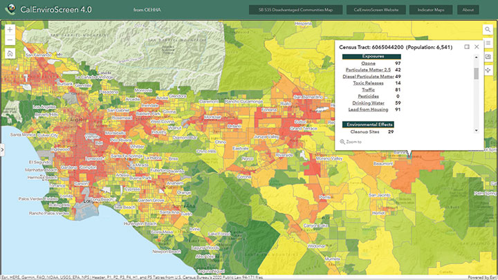
    Now comes sensor fusion, which aims to compensate for the limitations of GNSS — orbit and satellite clock errors, ionospheric and tropospheric delays, multipath, dilution of precision, urban canyons, jamming, extremely weak received signal, etc. — by integrating it with other sources of positioning data, including inertial measurement units (IMUs), lidar sensors and cameras. Even crowdsourced geolocation data collected with cell phones help expedite surveys by guiding surveyors to landmarks.

    In the following article, representatives of five companies share their perspectives on recent advances in surveying and the remaining challenges.

    Many More Satellites

    City Rail Link is New Zealand’s first underground rail network and the largest transportation project ever undertaken there. In this photo, taken at Karangahape Station, the Mined Tunnel Team installs a lattice girder secondary support structure using a Trimble SX12. (Photo: Link Alliance)
    City Rail Link is New Zealand’s first underground rail network and the largest transportation project ever undertaken there. In this photo, taken at Karangahape Station, the Mined Tunnel Team installs a lattice girder secondary support structure using a Trimble SX12. (Photo: Link Alliance)

    Compared to just a few years ago, there are many more GNSS satellites, signals and options for correction services. Over the past decade, the average number of satellites in view has more than doubled to more than 40 today. Some parts of the world have more than 70 satellites in view, said Boris Skopljak, vice president, Surveying & Mapping Strategy and Product Marketing at Trimble Inc.

    “The developments in GNSS field systems have always been geared toward simplifying workflows, improving accuracies and increasing productivity,” Skopljak said. “In the last few years, we’ve seen that on a massive scale. In some of our materials, we no longer even quote how many signals our GNSS receivers are tracking.”

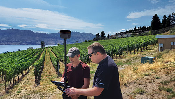
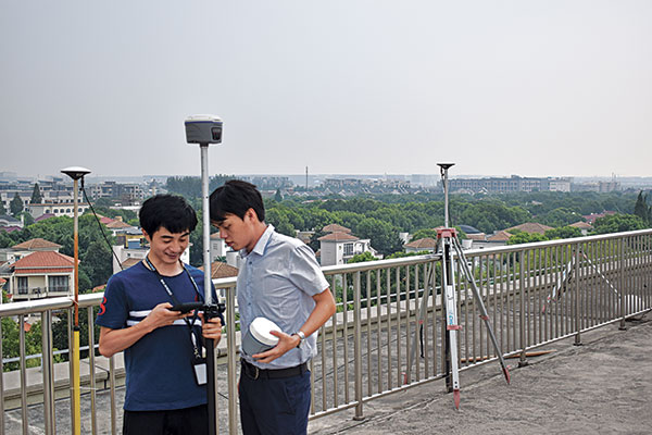
    The vast increase in the number of satellites has extended high-precision applications to the robotics and automotive markets. The challenge now is “position solution,” not just GNSS, said Simon Peng, director of the Overseas Department at ComNav Technology. The improvements in the satellite constellations, antenna technologies and algorithms also enable surveyors and other users to obtain results faster and to operate in environments previously impervious to GNSS, such as under heavy canopy and very close to buildings.

    “Our customers can now operate in environments where there is no virtual reference station (VRS) infrastructure or real-time kinematic (RTK), by leveraging precise point positioning (PPP) solutions, such as the Trimble RTX corrections service,” Skopljak said.

    “Additional satellite signals and constellations (like Beidou),” Skopljak said, “improved antenna technology and continuously evolving algorithms are contributing to improving the RTX accuracy while bringing the convergence times to almost instantaneous in normal conditions and making technology available in more regions.”

    “When I first started surveying, if we had a 12-channel receiver, that was doing very well,” recalled Jesse Huff, head of Sales and Marketing, JAVAD GNSS. “Now, we’re tracking 36 birds in the sky at one time with an 874-channel receiver. That’s phenomenal.”

    Huff described a patent-pending feature called real-time post-processed kinematic (RTPK). “It combines RTK, PPK and PP techniques, with multiple core processing engines and a single solution coming out of that. It is impressive standing underneath a giant oak tree and surveying that monument with GPS and knowing what your accuracies are. We’re not even chasing RMS values; we can report the actual positional uncertainties, which is amazing.”

    pole tilt compensation enables surveyors to precisely and easily localize points that are difficult or dangerous to access. (Photo: ComNav Technology Ltd.)
    Pole tilt compensation enables surveyors to precisely and easily localize points that are difficult or dangerous to access. (Photo: ComNav Technology Ltd.)

    “With so many signals and the new ways of how we compute positions based on PPP technology, we can almost globally get to centimeter-level positioning within a couple of minutes from just one global correction link,” said Bernhard Richter, vice president of Geomatics at Leica Geosystems AG, part of Hexagon. “Under optimum conditions, you can have almost an instantaneous global accuracy of a couple of centimeters.” In mature areas, he added, a local RTK network infrastructure enables achieving centimeter accuracy within a couple of seconds.

    Galileo, Richter pointed out, will be fully operational in 2023 with great signals, though he’s “a bit skeptical” about the system’s target date for its high-accuracy service. “So, we will basically get global constellation corrections that allow us also centimeter-level positioning.” BeiDou has been fully operational since 2020. “GLONASS is more unpredictable,” Richter said. “It looks like modernization is slowing down a bit, in particular the CDMA developments.” Additionally, he pointed out, it is possible that one or more governments may decide not to use those signals, for military or political reasons. “It’s not the manufacturers who decide which signals to take.”

    “In open-sky conditions, additional satellites have added redundancy — which is always good for position integrity — but it’s only when obstacles start to appear on the horizon, blocking out parts of the sky, that all-in-view RTK really comes into its own,” said François Freulon, Head of Product Management at Septentrio. When they did not have a full view of the sky, he recalled, GNSS users used to have to carefully schedule their work to coincide with times of high satellite visibility. “Nowadays, by using multiple constellations and signals, RTK can reach the parts that receivers in the past could not tread. More signals and constellations have also helped in easing the collection workflow for surveyors, making the capture of data in difficult conditions much quicker and more efficient.” New correction services are further simplifying the workflow “thanks to new positioning techniques, pricing business models and simplified network density.” However, corrections companies still face challenges in ensuring that centimeter accuracy can be uniformly achievable at a global scale.

    Sensor Fusion

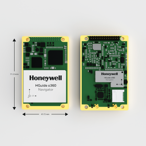
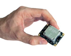
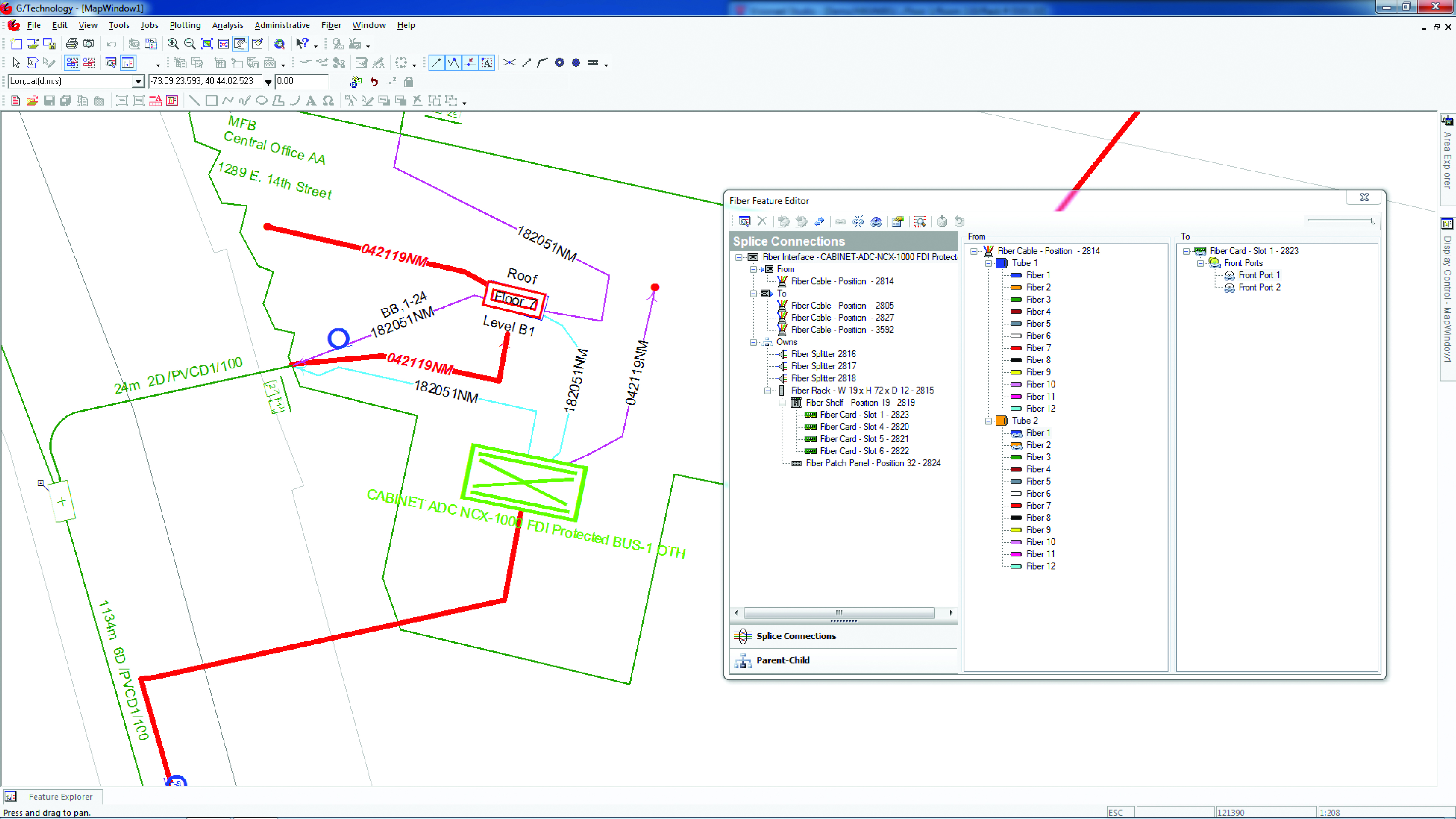
    The ongoing evolution in computing power and communication technology “leads to many more sensor combinations,” Skopljak said. “We are not talking about GNSS alone anymore. We are talking about integrating a GNSS antenna, a receiver, an IMU, power and communications into a single compact housing.” The integration of inertial sensors makes it possible to localize the instrument rod tip when the pole instrument is tilted. “That allows our customers to measure more safely in dangerous environments.”

    “We are reaching a maturity stage of what we can do only with GNSS,” said Richter. “It’s all about sensor fusion. The problem when signals are obstructed, that’s not solved, even though we can do positioning from Wi-Fi hotspots or from local pseudolites.” So, fusing data from cameras, lidar, GNSS and IMUs in better ways is the way to go and presents “a huge open research ground.”

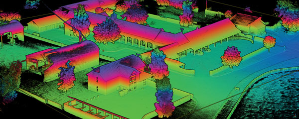
    For Richter, the challenge is not just positioning, the orientation of objects is almost as important as that, especially for such tasks as machine control. “It’s also about what you do with the data that you collect. Hexagon’s vision is of an autonomous future where we put data to work in connected ecosystems to boost efficiency.” However, he pointed out, this requires large amounts of data, such as those from aerial photogrammetry, lidar and mobile mapping systems used to create city models and digital twins of buildings. “If you really want a car to drive autonomously through a city with all the things that could happen, you must rely on a perfect replication of the real world,” he said. Other examples he cited are more efficient evacuation plans and flooding simulations. “GNSS will never be enough, but it will always be a very good enabler because it works.”

    Classes of Receivers

    JAVAD GNSS designed its TRIUMPH-LS Plus receiver to work under heavy tree canopy. (Photo: JAVAD GNSS)
    JAVAD GNSS designed its TRIUMPH-LS Plus receiver to work under heavy tree canopy. (Photo: JAVAD GNSS)

    Two decades ago, we would often group GNSS receivers by accuracy into three buckets: consumer grade, resource or mapping grade, and survey grade. As accuracy has increased for all GNSS receivers, the boundaries between those categories — especially between mapping and surveying — have blurred. “The performance of GNSS has increased so much that we are not using the traditional accuracy-based differentiation between surveying and GIS,” said Skopljak. “For mapping professionals, 10 years ago it was all about points, lines and polygons; now it is all about locating assets and adding the most accurate positions as attributes to those assets. For our survey and engineering customers, what matters is still geometry and working with the models to serve the connected construction in the field.” As for the pure GNSS technology stack, “we are seeing fewer differences between mapping and surveying receivers, but we are focusing on serving the customer in terms of product-as-a-service or as a productivity tool.”

    Huff made two points. First, that “survey grade” does not necessarily equal RTK. “Some education needs to happen so that people understand RTK as a technique, not an accuracy. You can get poor accuracy and poor fixes with RTK, even when you’re using good techniques. So, when I say ‘survey grade’ I’m still talking about the full frequency receivers, using all available signals.” Second, that consumer-grade receivers, such as the chipsets in our phones and computers, do not require the same robustness as professional ones. “While they may be achieving the same precision, surveyors must be able to defend their position in a court of law.”

    Further Reading: Making possible robotics, rails and tunnels

    Crowdsourcing

    Huff cited the “phenomenal” success of the simultaneous localization and mapping (SLAM) movement with all kinds of positioning challenges. “From a survey perspective,” he said, “we’re dealing with a much more feature-rich dataset than we were even just 10 years ago, with everybody having some type of GPS device on their phones. There are location tags on everything. That creates evidence for the surveyor to be able to go out and recreate things, reduce trips to the field, reduce rework times — all those things that make a surveyor’s life much easier.”

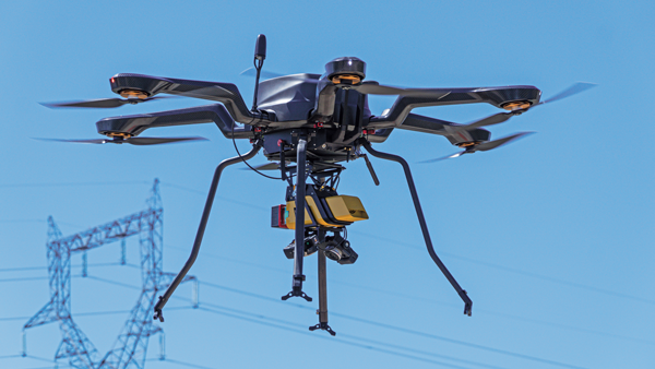
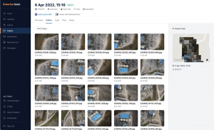
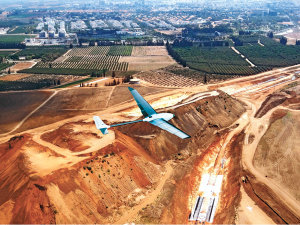
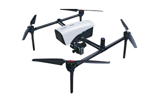
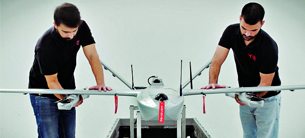
    Surveyors now can fly aerial surveys of hundreds of acres in less than half an hour using drones with RTK, Huff said, instead of having to wait for the flying season with traditional airborne photos. If needed, they can pick a few ground-control points for ground truthing. “We’re able to do that with photogrammetry techniques, but using GNSS technology to position drones, whether it’s real time or post-processing, has definitely made surveying jobs easier.”

    Correction Services

    The adoption of GNSS in construction is growing and receiver manufacturers are making it easier to use their equipment in the field. (Photo: Leica Geosystems)
    The adoption of GNSS in construction is growing and receiver manufacturers are making it easier to use their equipment in the field. (Photo: Leica Geosystems)

    Correction services — such as satellite-based augmentation systems (SBAS), the ground-based Wide Area Augmentation System (WAAS) and the European Geostationary Navigation Overlay Service (EGNOS) — make a big difference along with PPP and similar techniques when base stations are not available. “We have the whole CORS network here in the United States,” Huff pointed out. “We also have services available from the National Geodetic Survey.”

    Those who don’t want to have to fully engage in post-processing can upload their data to the Online Positioning User Service (OPUS), AUSPOS (a free online GPS data-processing facility provided by Geoscience Australia) or other corrections services that will post-process positioning data. “It has made it more accessible for all the surveyors all the way around, especially as the technology has improved and the cost barrier to entry into a survey-grade GPS receiver has come down significantly as well,” Huff said.

    Growing Adoption of GNSS

    The greater number of satellites in orbit significantly reduces convergence time and increases the accuracy of the solution, which makes the technology much more user-friendly for professionals and nonprofessionals alike.

    For surveyors and mapping professionals, the increasing levels of GNSS performance means that “GNSS continues to be the dominant equipment and they can operate in challenging GNSS environments while still meeting the accuracy and precision requirements,” Skopljak said. GNSS usage is also growing in such industries as agriculture, construction, transportation and logistics. “Now, when farmers are on a combine, they don’t have to wait for an RTX or PPP solution to converge for 20 minutes. The solutions just work, and they can perform their task.”

    Skopljak also pointed to “more flexible business models, such as pay-as-you-go or equipping seasonal workers or fleets of spatially enabled consumers to use GNSS,” that reduce the required upfront investment. “Surveyors now can go for longer and be productive in more areas where they could not use GNSS technology before. The non-surveying professionals — such as in natural resources, farming or construction — now can just turn on the machine and things work for them. They don’t have to worry about coordinate transformations and things like that.”

    Further reading: Surveyors: Who are they? 

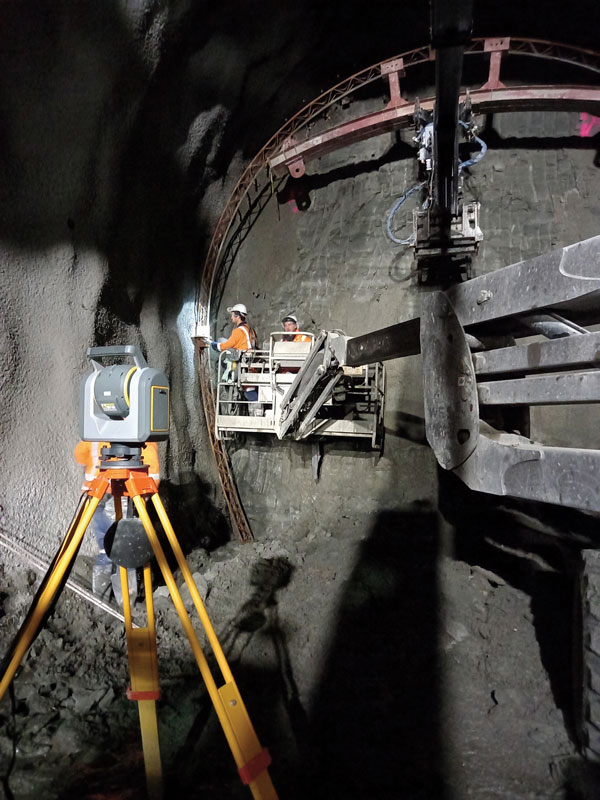
    The Role of Total Stations

    “Twenty years ago, when RTK and networks kicked in and then became popular, we were discussing whether it was the end of the automated total station,” Richter recalled. “Yet, the number of automated total stations has grown ever since.” To him, this is proof that GNSS alone will never solve all surveying problems. GNSS’ weak signal will always require surveyors to supplement it with other sensors, such as reflectorless total stations. “These instruments always need to work in harmony,” Richter said.

    Success on both construction sites and in machine control require a very good robotic total station and a very good GNSS receiver, Richter said. “The simple problem of leveling a pole is actually solved, and we are using the technology that we developed for tilt-compensating GNSS receivers. We’re leveraging this now into the world of the total station.” This has solved one of the fundamental problems surveyors have long had, because they no longer need to level up and can measure tilted poles with a total station and with a GNSS receiver. “We have also made it very seamless for surveyors to switch between using GNSS receivers and total stations,” Richter said.

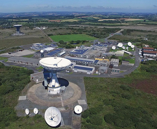
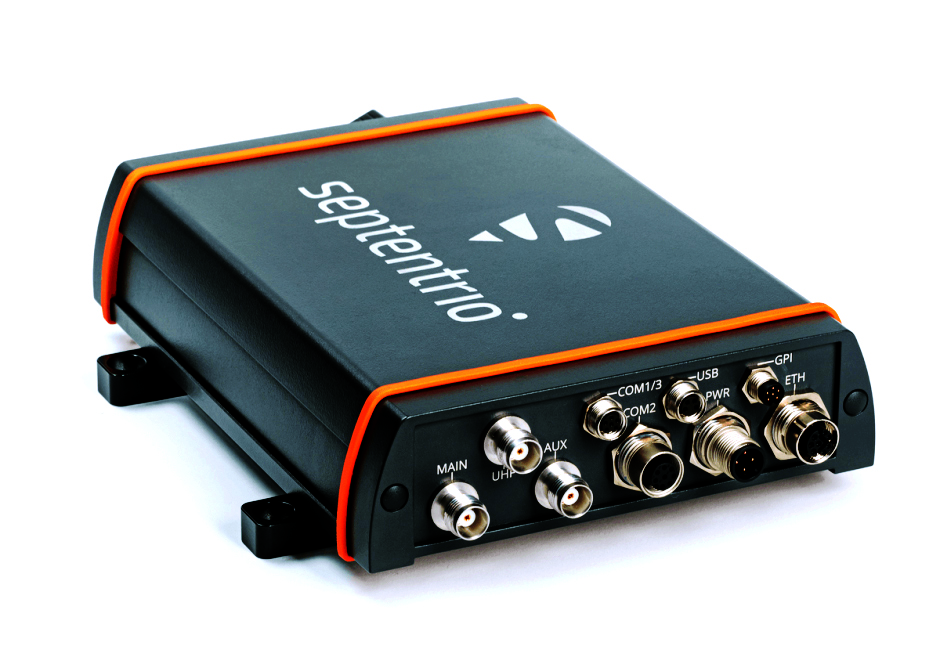
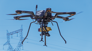
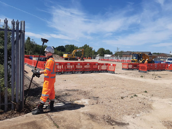
    Featured Photo: Septentrio

  • Contrasting the use of drones on Mars and in Afghanistan

    Contrasting the use of drones on Mars and in Afghanistan

    NASA and the European Space Agency (ESA) have been cooking up a way to get some of Mars back to Earth, so that samples can be analyzed in detail — just like the rocks the astronauts brought back during the Apollo missions, which gave us a deeper understanding of our Moon.

    The Perseverance rover already on Mars has been seeking promising areas to investigate that might provide evidence of ancient past life, with the help of the Ingenuity helicopter drone. Recently, the two worked together to drive the rover to an old river delta, expected to be a prime location where such samples could be found.

    The rover has been drilling and saving rock and dirt samples in onboard storage tubes. The difficulty is that getting them back to Earth requires another major undertaking.

    Returning the Samples

    Termed the “Sample Return Mission,” the two space agencies have been discussing for months how best to bring the samples back, and have now refined an approach. Given that Perseverance has been so good at the job it was given, the NASA/ESA team has decided that the rover should be used for the return mission in 2030 when things would be in operation on Mars. (We’re not sure if the warranty sticker on Perseverance will still be valid in 2030, but if past performance is an indication, all the rovers have significantly outlived their initial design lives.)

    Its partner Ingenuity has graduated from proving it can fly in the thin Martian air to actually scouting routes for the large rover. Because Ingenuity has proven reliable and capable of traveling significant distances, NASA and ESA have decided that two new helicopter drones will become part of the return mission. They will be based on the successful Ingenuity design, but will be fitted with wheels, one on each of the four landing legs, to enable movement on the ground.

    They will also be fitted with a device which is capable of picking up and carrying a sample tube. Since the prototype drone helicopter was designed to be as light as possible, this infers  a substantial increase in lift capacity will be required. The original mission included a sample-collection rover, but this task will now be assigned to Perseverance, with the two sample-carrying helicopters acting as backup, if needed.

    An earlier concept had the rover dropping sample canisters behind it as it progressed around the surface for subsequent pick up. This concept appears to have been shelved for the moment. Keeping the canisters onboard the rover throughout perhaps simplifies transfer to the return lander.

    NASA Return Sample concept illustration includes wheeled helicopters. (Image: NASA)
    This NASA return sample concept illustration includes wheeled helicopters. (Image: NASA/JPL-Caltech)

    The Mars Ascent Vehicle would then carry the samples into orbit, to a waiting Earth Return Obiter, where the samples would be transferred to a return system for onward transit and atmospheric re-entry to Earth. Some of these details are a little sketchy, but there sure are a lot of moving (autonomous, robotic?) parts. This, of course, means a lot of opportunities for something to go wrong. No doubt continuing refinement of the mission will reduce the risks. The Jet Propulsion Lab (JPL) and AeroVironment designed and built Ingenuity — they may face some challenges developing the successor helicopter drones.

    Meanwhile, Here on Earth…

    Drones led the news Aug. 1, when President Biden announced the killing of Ayman al-Zawahiri in Kabul, Afghanistan. Al-Zawahiri topped the U.S. 9/11 wanted list, and his removal was all about the offensive use of drones. Presumably fired from a General Atomics Reaper variant drone at quite some altitude, two Hellfire AGM-114R9X “knife bomb”missiles took out al-Zawahiri as he stood alone on the balcony of a home in Kabul.

    This means that video/infrared from high altitude was sufficiently clear to determine that the man was alone on the balcony, presumably confirming information on the ground that his family was elsewhere. So long-distance, high-level authorization was then granted to fire on him in a foreign country now run by the Taliban.

    Suspected damaged al-Zawahiri house in Kabul (Photo: Secunder Kermani/BBC News)
    Suspected damage at the al-Zawahiri house in Kabul. (Photo: Secunder Kermani/BBC News)

    To minimize inadvertent casualties, the Hellfire R9X missile was used, which lacks explosive armaments. The weapon is a nasty piece of work, weighing ~100 lb with an inert payload, and fitted with six long knives that deploy before impact. This missile has previously been used in perhaps 11 other instances to take out terrorist individuals and minimize collateral damage.

    Bladed R9X missle lacks warhead (Image: Newsy/Bellingcat)
    Bladed R9X missile lacks a warhead (Image: Newsy/Bellingcat)

    This is another instance of how the U.S. use of military drones has become less devastating, but is still very deadly to the specific target.

    To Sum Up

    We’ve taken a quick glimpse at how NASA and ESA are planning more drones for the surface of Mars, and a much more aggressive use of drones here on Earth.

  • Editorial Advisory Board Q&A: The role of AI and ML

    What role do artificial intelligence (AI) and machine learning (ML) play in analyzing GNSS signals? How might that evolve?


    Ellen Hall
    Ellen Hall

    “ML is gaining adoption across many GNSS application areas due to its ability to extract data and classify signal information often within complex operational environments. By combining ML with AI, systems are now able to characterize receiver correlator outputs and ranging residuals, and then fuse this with identified environmental features — all potentially increasing GNSS accuracy, integrity and availability. As AI and ML mature, we can expect to see new novel methods to optimize PNT sensor-fusion engines. This will include the combination of GNSS signals with other sensor signals such as inertial and vision.”

    — Ellen Hall
    Spirent Federal Systems


    Bernard Gruber
    Bernard Gruber

    “AI will come to the battlefield and I would like to think that AI and ML will play a large part in GNSS solutions and specifically protection from adversaries in the future. As AI can ‘anticipate’ threats (i.e., spoofing, jamming, poor coverage) based upon what it sees and knows one should be able to reduce the cycle time to combat that threat (e.g., find/fix/identify and then target, change frequencies, evade). Seeing this data, ML can adapt to morphing threats as well as ‘fuse’ data from all different domains (air, space, sea and land) to provide solutions.”

    — Bernard Gruber
    Northrop Grumman


    Jules McNeff
    Jules McNeff

    “I would like to turn the question around and ask ‘How does GNSS contribute to enabling AI and ML to function in physical space?’ Many AI and ML experts don’t think about this aspect of the technologies. Of course, timing is essential to AI and ML operation, but both must be spatially oriented as well if they are to interact effectively with things in the ‘real world.’ The more complex the interactions, the higher the need for precise, continuous PNT information. Depending on the applications, the relationships can become synergistic.”

    — Jules McNeff
    Overlook Systems Technologies


    Greg Turetzky Principal Engineer Intel
    Greg Turetzky

    “AI and ML have a great opportunity to fundamentally change the way GNSS signals are used for positioning. In particular, the new modernized signals with wider bandwidths and higher chipping rates create a fundamentally richer data set than classic range/range rate measurements. By analyzing the channel response and using AI/ML techniques, the entire signal environment of LOS and NLOS signals can all be used to make more accurate measurements. In fact, in deep urban canyons with appropriate training, it is even possible to accurately position using only multipath signals such that more multipath makes the position more accurate, not less.”

    — Greg Turetzky
    oneNav

  • Seen & Heard: Drones donated to Ukraine

    Seen & Heard: Drones donated to Ukraine

    “Seen & Heard” is a monthly feature of GPS World magazine, traveling the world to capture interesting and unusual news stories involving the GNSS/PNT industry.


    Photo: SeventyFour/iStock/Getty Images Plus/Getty Images
    Photo: SeventyFour/iStock/Getty Images Plus/Getty Images

    Drone Donation

    Ukrainian TV host Serhiy Prytula crowdfunded $20 million to buy Bayraktar drones for the nation’s defense against Russia. Baykar, a Turkish defense manufacturer, turned down the money and opted instead to donate three military drones to the country. The Turkish-made Bayraktar TB2 drone has been a key instrument used by the Ukrainian military to repel Russian forces, with the ongoing war the first major conflict in which the Bayraktar drones have been deployed.


    Photo: Nicola Lercari, assistant professor of World Heritage, UC Merced
    Photo: Nicola Lercari, assistant professor of World Heritage, UC Merced

    Arrested Decay

    Scientists from the University of California (UC) Merced have mapped the fragile remains of Bodie, a Gold Rush ghost town. With harsh weather conditions, wildfires and earthquakes, only 10% of the original town is still intact. Researchers used a GeoSLAM handheld scanner to document more than 100 structures over four days. The scans preserve Bodie’s archaeological signature and enabled a 3D reconstruction of Bodie at its height in the 1870s.


    Photo: Singapore skyline, NeoPhoto/iStock/Getty Images Plus/Getty Images
    Photo: Singapore skyline, NeoPhoto/iStock/Getty Images Plus/Getty Images

    Singapore Not Coasting

    Sea-level changes are critical to the island nation of Singapore. To help map ground deformation, researchers from the Earth Observatory of Singapore will access GNSS data collected by the Singapore Satellite Positioning Reference Network (SiReNT), along with a decade of archived GNSS data. SiReNT, an initiative of the Singapore Land Authority, produces precise positioning data with up to 3-cm accuracy. With four new coastal GNSS reference stations installed, EOS is beginning to study more accurate ways to measure deformation and climate effects.


    Photo: guvendemir/iStock/Getty Images Plus/Getty Images
    Photo: guvendemir/iStock/Getty Images Plus/Getty Images

    To Your Health

    A new indoor positioning system is helping hospitals and other healthcare facilities. PenguinIN connects to a facility’s Wi-Fi infrastructure to help staff track and locate key items, a task any nurses say takes an hour of every shift. In emergency rooms, it can track how long patients have waited and how long a physician has spent with each patient. Facilities also can use it to track air quality including dust, temperature and possible water leaks. PenguinIN applies advanced machine learning to establish the location of indoor objects, people and smartphones with up to 1-meter accuracy.

  • Ultra-wideband brings signals indoors

    Ultra-wideband brings signals indoors

    Other sources, such as lidar, can be used to aid navigation in the absence of GNSS signals. (Photo: OxTS)
    Other sources, such as lidar, can be used to aid navigation in the absence of GNSS signals. (Photo: OxTS)

    We discussed complementary PNT with Peter Rylands, senior product manager at OxTS.

    What are some of the most promising approaches to complementary PNT and how does simulation technology help?

    There are two approaches of particular interest. The first is looking at LEO satellite systems that can provide supplementary and potentially more secure methods of navigation, with global coverage from a single system. But these will still suffer from some of the issues GNSS systems experience, namely, what happens when you can’t obtain a signal?

    The second is the use of visual aiding through sensor fusion, such as lidar and cameras, that can provide relative positioning (or absolute positioning once you have a space mapped) using SLAM algorithms. While this may increase onboard hardware dependencies, it creates a localized navigation system that can be better protected from malicious actors.

    In contrast, closed-loop systems can look to an infrastructure-based system, allowing free movement within the specific area in which the infrastructure is located and a potentially more reliable source of PNT, especially indoors, where GNSS is not available. Ultra-wideband is definitely the up-and-coming technology here, but systems using Wi-Fi, cameras, Bluetooth and others also are being used.

    Simulation, as within many domains, allows users to test on a large scale with fewer barriers to entry than real-world testing and an ease in making iterative changes to find an optimal solution. Whether that is to benchmark performance in locations of interest or to change configuration settings to improve visibility or positioning, simulation allows you to do this without the expense of going straight into the environment itself or configuring the actual vehicle under test.

    How does OxTS fit in that mix?

    OxTS provides customers with the ability to navigate anywhere; whether for reference data in R&D, georeferencing for survey and mapping, or active navigation of autonomous solutions. To do this we provide an IMU-first offering that we then complement with other technologies. Traditionally, this is with GNSS, to form an INS that can provide centimeter-level accuracy. However, we are also aware of the vulnerabilities of GNSS. For us, this is when it becomes an unreliable source of PNT in denied areas, such as indoors, in urban canyons or under tree canopies.

    Because of this, we are also investigating and developing complementary solutions that can enhance our offering for users who need confidence in their position even when GNSS is not available. Whether that is through sensor fusion, our Pozyx UWB solution for indoor navigation or other proprietary software and firmware capabilities.

    What kinds of complementary PNT are most useful in addressing specifically the challenges posed by jamming and spoofing and how does simulation help?

    We need to look at systems that cannot be impacted by, or have mitigations from, the impact of jamming and spoofing. Solutions that are independent of radio communications or satellite use are then valuable in providing this layer of protection. This is where we could look toward OxTS’s use of IMU technology and visual aiding systems. Simulation technologies would then allow you to run hardware-in-the-loop testing, where the primary GNSS solution can have simulated jamming and spoofing to understand the performance of your complementary and protected systems when GNSS cannot be trusted.

  • 5G promises deeper connections

    5G promises deeper connections

    Orolia developed the Skydel GSG-8, a PNT test solution in its GSG family of simulators, to deliver GNSS signal testing and sensor simulation performance in an easy to use, upgradable and scalable platform. (Photo: Orolia)
    Orolia developed the Skydel GSG-8, a PNT test solution in its GSG family of simulators, to deliver GNSS signal testing and sensor simulation performance in an easy to use, upgradable and scalable platform. (Photo: Orolia)

    We discussed complementary PNT with Erik Oehler, marketing director at Orolia.

    What are some of the most promising approaches to complementary PNT and how does simulation technology help?

    5G is the most promising for the future. I believe the benefits in infrastructure, speed, precision, reliability, and the industry incentives 5G offer are superior to GNSS. Alternative signals of opportunity and new commercial satellite-based providers are always valuable as extra layers of resilience. However, PNT from 5G is not quite ready yet. There will be a transition period during which systems use GNSS and these signals of opportunity simultaneously, so simulation enables receivers of any complementary signal to be tested in the same environments and with the same potential threats faced by primary constellation signals.

    How does Orolia fit in that mix?

    Orolia has the most atomic clocks in orbit, including those aboard the Galileo constellation. We integrate anti-jam antennas and build Interference Detection and Mitigation (IDM) into our products. We partner with companies that offer alternative signals, such as STL from Satelles. Our SecureSync NTP and PTP time servers live in the world’s biggest data centers and support encrypted signals, such as M and Y code for our militaries. We innovate with industry leaders such as Meta on building a better PCIe Time Card. We offer edge time servers with the ability to automatically add Hoptroff’s Traceable Time as a Service. If 5G PNT becomes a standard, we are already providing industry leaders such as Anritsu with solutions for acceptance testing on a major carrier’s backbone. With our pending acquisition by Safran and access to a world-leading portfolio of INS components, we are one of the most qualified companies in the world to solve nearly any PNT challenge.

    What kinds of complementary PNT are most useful in addressing specifically the challenges posed by jamming and spoofing, and how does simulation help?

    In two technical notes published by NIST, they recognize STL as one of four recommended solutions for PNT resilience and the only one being both independent of GNSS and capable of sub-microsecond accuracy. Being closer to Earth, it is a stronger signal, making it 1,000 times less susceptible to jamming. Additionally, because it is encrypted it is inherently immune to spoofing. The aforementioned Hoptroff TTaS is time delivered over VPN, removing the outside environment component completely. For positioning and navigation, the integration of an IMU provides a contiguous PNT solution even during periods of GNSS denial, analogous to how an atomic clock provides precise time holdover during these denial periods. Combined with anti-jam antenna technology and IDM software, a robust PNT solution is always available.

    Simulation helps by (1) identifying the vulnerabilities your PNT system might have (or could have in the future to evolving threats) and (2) verifying the total integrated resilient system. Our GSG-8 Advanced GNSS Simulator supports hundreds of GNSS full spectrum signals, custom signals, and hardware-in-the-loop testing of integrated IMUs at up to 1000 Hz iteration rate. Our Skydel Wavefront and Anechoic simulators can verify the most complex GNSS anti-jam antenna systems.

  • Upgrade your survey GNSS — now

    Upgrade your survey GNSS — now

    jason poitras (left) and MARC VEINOTTE of MicroSurvey test a multi-constellation OEM rover with the FieldGenius for Android field controller software. (Photo: Gavin Schrock)
    Jason Poitras (left) and Marc Veinotte of MicroSurvey test a multi-constellation OEM rover with the FieldGenius for Android field controller software. (Photo: Gavin Schrock)

    It’s about more than advances in technology — peak times demand peak productivity

    Trusty legacy rovers have served surveyors well. Under the right conditions and with proper procedures, a 20-year-old rover might still deliver precisions that could match the latest and greatest.

    We’ve become so used to the limitations of legacy gear that we’ve built our workflows, expectations, and job estimates around them. However, in the past few years, the state of GNSS rovers has experienced a sea change, with gains in productivity, the ability to work in mixed environments, ease of use, and increased speed, repeatability and reliability — these developments have come at an opportune time.

    Peak Times

    Surveying always has been a feast-or-famine prospect; the rises and dips in economics are felt sharply within the profession.

    In many places, there is more work than surveyors can accommodate, with competition to recruit and retain enough field personnel to meet demand. It is unclear how long this peak will last. Surveying firms recognize this and do their best to take on as many projects as they can.

    Staffing is an acute challenge. Firms have had to dip into incentives beyond the usual pay and benefits packages to attract and retain qualified field personnel. Having the latest gear is a definite plus. Experienced surveyors know much they struggled with legacy gear: GPS-only or GPS + GLONASS only, slow processors, poor multipath performance, and field-data-collector operating systems and software that are obsolete or no longer supported.

    Despite the immediate need, it’s generally less desirable to hire people with no surveying experience and train them from scratch. However, newer rovers and field software often do not have the same steep learning curve posed by legacy systems and methods.

    Productivity Now

    It is hard to say how much of the productivity gains, stated by various manufacturers for their newest systems, will be realized for your specific workflows, but simple testing can give you an idea.

    When surveyors try out new rovers, they tend to find themselves so impressed by the first unit tried, they conclude it must be “the best” and eschew due diligence in the selection process. That aside, I believe it is safe to say that there is a near across-the-board productivity improvement with the latest generation of rovers.

    Most rovers now provide no-calibration tilt compensation. (Photo: Gavin Schrock)
    Most rovers now provide no-calibration tilt compensation. (Photo: Gavin Schrock)

    A Confluence of Factors

    We haven’t seen such a sea change in GNSS rover technology in decades; most gains have been incremental. Similar jumps in the past included going from the static-only world to real-time and the first additional constellation beyond GPS.
    While the early days of GLONASS were rocky, and most manufacturers were hesitant to productize an unreliable and noisy solution, it did eventually improve. The effect of nearly doubling satellites in view translated to productivity gains. But that was two decades ago.

    The recent advent of true, multi-constellation GNSS has had a profound impact on the state of rovers. In 2020, both the Galileo and BeiDou constellations reached a full level of global coverage and signal integration.

    Many rovers were already equipped to utilize some (but not all) of the newest satellites and signals. Interface control documents (ICD) for some of the signals have only been released by the constellation providers in the past few years. ICDs provide signal specifics that manufacturers need to integrate them into GNSS solutions.

    Some rovers (and base receivers) developed four or more years ago may not be able to take advantage of the full complement of signals. And many did not have the processing power to utilize so many signals from so many satellites in real-time solutions.

    By contrast, nearly every new GNSS board released in the past few years has greatly increased processing power, often double that of legacy gear.

    Newer rovers are able to work better in sky-view-challenged and multipath hazard-prone places than rovers from only a few short years ago. And it is not just about the total number of channels on a rover datasheet, it is about how many are actually being utilized, how much of that data the processors and real-time kinematic (RTK) engine can handle, and how modernized signals are being leveraged.

    Modernized signals are yielding additional advantages. The expected benefits of L5 for the GPS constellation have been widely promoted. L5 was designed to be robust enough for certain safety-of-life applications. The L5 signal is being deployed incrementally to the GPS constellation and should be broadcast from 24 satellites by 2027.

    Modern receivers incorporate multi-GNSS signals that can improve performance under tree canopy. (Photo: Gavin Schrock)
    Modern receivers incorporate multi-GNSS signals that can improve performance under tree canopy. (Photo: Gavin Schrock)

    I have heard surveyors say they won’t bother upgrading until L5 is complete. But wait — two other constellations already have third-signal capabilities. Indeed, there are 3, 4, 5, even 6 usable signals (in the case of Galileo) already available — modernized, robust signals.

    Although L5 will only make this better, you can reap the benefits of signal modernization right now. Some of the innovation put into these modernized signals contributes to reducing certain sources of error. For instance, the Galileo E5a-E5b AltBOC — multiplexing signals in a wide band — is particularly beneficial for dealing with multipath.

    Rovers have evolved in other ways besides multi-constellation integration. The decades between these sea changes brought developments such as electronic bubbles, better operating systems, and automation of some functions, but essentially the form factor and functionality of a surveying rover has not changed much. There have been some gadgets and gimmicks along the way, but otherwise rovers had remained pretty much standard in those intervening years.

    Real-time precise-point positioning (PPP) has matured to the point that it could be viewed as survey-grade (at least in the horizontal). The delivery of clock, orbit and other data broadcast from geostationary communications satellites (as a service) for PPP means that, for many applications, high-precision positions can be processed by a rover over much of the globe — no base, no radio, no network and no cell phone connection required.

    Once research and development removed the lengthy convergence times that plagued legacy PPP, it became commercially viable for many applications. Commercial providers such as Trimble (RTX), Hexagon | Leica (SmartLink), Hemisphere GNSS (Atlas) and others provide subscription services for surveying, construction, agriculture and the growing autonomy market. Most new survey rovers have a PPP option.

    Multi-sensor integration, particularly of inertial measurement units (IMU), is becoming standard on new rovers. While there was some value from magnetometer-oriented tilt compensation in the past (though it could be cumbersome and somewhat unreliable), it served as a precursor to modern-day integrated GNSS/IMU no-calibration tilt.

    The first no-calibration tilt system hit the market as recently as 2017; now it is hard to find a rover without it. Accessing hard-to-reach points and improved stakeout workflows are some of the benefits of tilt compensation. The development of reliable IMU/GNSS processing was also the key to fully integrating camera-based offset point capture — and soon other sensors such as lidar might be incorporated.

    Market Choices

    Another set of changes in the high-precision GNSS industry coincided with the above developments, growing a more competitive marketplace. This equates to more choice. The secret sauce of high-precision GNSS is no longer in the hands of the few. The glass floor has been broken, with more rovers than ever available.

    Many tiers for choice have emerged.

    The Top End. The manufacturers traditionally considered to be the top end continue to innovate and are usually the first to productize developments such as multi-sensor integration and PPP. They continue to lead in integrated surveying solutions, track record, performance, quality, service, support and peer user networks — which continues to appeal to many users. However, they also have second-tier offerings to suit various markets, regions and value propositions.

    Whether to Use OEM Devices. For many users, there are compelling reasons to stick with top-end solutions, but there always has been room for other price point options. Until recently, most lesser-known rover brands exclusively integrated GNSS boards from a handful of well-known original equipment manufacturers (OEMs) such as Trimble and NovAtel. Sometimes new developments hit the OEM market quite rapidly — for instance, IMU integration. These third-party manufacturers may add their own touches, but in effect, nearly every rover out there offered a narrow set of DNA — until recently.

    Rolling Their Own. Globally, technical universities are graduating GNSS engineers at an unprecedented rate; the prospect of mass applications such as vehicular autonomy and robotics are driving demand. With this expanding pool of engineers, it is now much more practical to develop GNSS solutions from scratch and to fully leverage multiple constellations.

    Some third-party manufacturers began working with OEMs but have started developing their own boards and related technologies. I’ve tried several, and performance is, in most cases, as good as that of new boards from traditional sources..

    The Rise of Mid-Price Rovers. There are a growing number of breakout rovers from lesser-known brands or rebranded models. These are about half the price of some of the top-end models, yet performance is in most cases nearly par. Some include OEM boards, or the new wave of independent boards.

    I’ve seen a sharp rise in the popularity of mid-level rovers among small and mid-sized firms. However, there has not been a corresponding drop in sales of top-end rovers. It seems that surveyors are simply buying more rovers during this peak time.

    Receivers-as-a-Service. Another approach for surveying and asset-mapping rovers is pay-as-you-go. This means you do not have to make large up-front investments in hardware. Instead, you pay for high-precision capabilities through subscriptions or tokens when you need it. This can be a good choice for occasional or seasonal users.

    One example is Trimble’s Catalyst system. For Catalyst, the hardware investment is an inexpensive antenna, and then you access a subscription service via your mobile field data collector, tablet or smartphone to activate the software-defined receiver (SDR).

    Another such model is Flex. With Flex, you have the option to pay full price for the full receiver/antenna to operate as a conventional rover. Alternatively, you can choose to pay a lower up-front price for the rover and use tokens to activate the high-precision capabilities.

    Surveyors should put new rovers through their paces before choosing. (Photo: Gavin Schrock)
    Surveyors should put new rovers through their paces before choosing. (Photo: Gavin Schrock)

    Low-Priced Rovers. Two external factors have fostered a mini boom in low-cost rovers: R&D for mass markets such as autonomy, and RTK/post-processed kinematic (PPK) solutions for drones, which are often used to reduce the need to set ground control points.

    In both segments, inexpensive and often small GNSS boards have been developed. For drone applications where a base was needed for RTK/PPK methods, developers sometimes took the same GNSS board in the drone and packaged it as a base. It did not take long for some of these developers to package the rover for surveying or asset mapping (with geographic information system, or GIS).

    While these rovers can perform just as well as top-end or mid-priced rovers in optimal conditions, they may struggle in mixed environments. I’ve tried some, and I can see why every surveyor I’ve asked about performance adds “for the price” to their assessment.

    Other developers have taken this a step further, selling a bare-bones rover for less than $1,000, though these can take a lot of tinkering and extra attention to fit into a production workflow. There are even folks creating do-it-yourself rovers. I am not seeing many large firms, who have high-ticket projects and need to conduct integrated surveying, opting for lower priced systems.

    We are riding a new wave of GNSS rovers, awash with more choices than ever. In this period of increased demand for surveying services, it might be a great time to upgrade and boost productivity.


    New Players

    A “roll your own” example is Tersus GNSS, which has designed and manufactured in-house GNSS boards and RTK engines since its inception in 2014. I asked Winston Wen, founder and CEO of Tersus, why they chose this strategy. 

    “I’m a hardware guy; electronics, computer science, signal processing, etc.,” Wen said. “In 2014, I took a look at the price and portfolios for high-precision, and for equipment for surveyors — the price point looked exceptionally high. From my point of view, it looked like there was room for a new player, and I felt we could do better. There are also growing markets for applications for high-precision GNSS, such as the internet of things (IoT) and autonomy.” 

    Tersus has experienced solid reception for its products globally. I asked Wen if he felt GNSS for surveying has reached a new level of performance. “Yes, nowadays with 50 satellites, that is huge. Surveyors will be very happy with performance, especially in environments with limited sky view. At this time, there don’t appear to be any new signals announced, so rovers bought today should be top performers to, say, 2025 and beyond.”


    Industry Insights

    GNSS executives told Gavin Schrock about recent developments in their companies.

    Neil Gerein, Senior Director of Marketing,
    Autonomy & Positioning Division, Hexagon

    As satellite constellations were modernized, GNSS receivers kept pace to offer multi-constellation and multi-frequency capabilities to culminate in the latest technologies in PPP corrections. 

    For example, Hexagon’s RTK From the Sky technology is able to achieve highly available corrections with centimeter-level accuracy globally. However, modern GNSS receivers also offer other benefits, such as interference mitigation and spoofing detection for improved positioning robustness, multipath mitigation, and more powerful sensor fusion.

    Miles Ware, Vice President,
    Marketing & Global Customer Care, Hemisphere GNSS

    Much like the constantly evolving world of smartphones, tablets, and computers, the improvements in multi-constellation GNSS receiver performance have been significant, even over just the past few years.

    Many legacy rovers, bases and reference stations that are older than four years cannot track some of the newest signals, such as from BeiDou Phase 3 satellites. This means some of the highest performing signals available are now accessible to many users. As fewer BeiDou Phase 2 satellites continue to transmit, many legacy receivers will no longer have the performance they once did. 

    With upcoming services such as OSNMA (the Galileo GNSS data authentication service) and global PPP signals, many receivers from a few years ago do not have the CPU capacity to employ them. Today’s GNSS engines track more satellites, more signals per satellite, and have more CPU to perform advanced operations, all while consuming the same or less power than previous generations.

    Francois Martin, Vice General Manager,
    CHC Navigation

    The latest GNSS RTK rover technology evolutions are based on the maturity and enhancement of satellite navigation systems, as well as the integration of IMU sensors into the receivers. 

    The most recent generation of our GNSS rovers, such as the CHCNAV i83, is based on the sophisticated iStar algorithm that significantly improves the efficiency of GNSS satellite signals tracking for unmatched performance in GPS, GLONASS, BeiDou, Galileo and QZSS constellations, utilizing all available frequencies, including BeiDou 3. 

    Moreover, the fusion of GNSS and IMU technologies enables centimeter-level positioning, maintains fixed and reliable RTK accuracy, and collects points faster than ever before, even in challenging conditions. GNSS survey productivity is increased by up to 30%, and the user base expands from experienced users to new users such as construction site foremen.


    Gavin Schrock, PLS, is a practicing land surveyor, the operator of a cooperative real-time GNSS network in Washington state, and a technology writer.

  • Seen & Heard: Tracking tar balls, testing SBAS for UK

    Seen & Heard: Tracking tar balls, testing SBAS for UK

    “Seen & Heard” is a monthly feature of GPS World magazine, traveling the world to capture interesting and unusual news stories involving the GNSS/PNT industry.


    Photo: spxChrome/E+/Getty Images
    Photo: spxChrome/E+/Getty Images

    Citizens Clean Up Coasts

    Two citizen groups are taking action with the help of Esri ArcGIS mapping tools. North Coast World Earth uses Esri Ireland’s platform on the Northern Irish coast to record litter hotspots and engage with local communities. The volunteer group has collected nearly 3 tons of litter. In California, the Surfrider Foundation employed ArcGIS Hub to streamline cleanup operations after a major oil spill off Huntington Beach in October 2021. Citizens submitted more than 1,100 reports using the ArcGIS QuickCapture photo app to share the date, time and coordinates of toxic tar balls on beaches from Oxnard to San Diego.


    Photo: ©Goonhilly
    Photo: ©Goonhilly

    UKSBAS Put to the Test

    A new series of tests will assess whether the United Kingdom satellite-based augmentation system (UKSBAS) for GNSS can develop into full operational capability to support safety-critical applications post-Brexit. Inmarsat, Goonhilly Earth Station and GMV NSL are conducting the UK Space Agency-funded tests. The signal is now stable and operational, enabling ongoing testing and validation by industry, regulators and users. If successful, UKSBAS will enable assessment of more precise, resilient and high-integrity navigation for maritime and aviation users in UK waters and airspace.


    Image: ESA
    Image: ESA

    Smart GNSS Monitoring

    More than 11,000 people around Europe and the world have turned their smartphones into GNSS monitoring tools by downloading the CAMALIOT app, so far delivering more than 53 billion measurements of meteorology and space weather patterns to researchers, reports the European Space Agency (ESA). ESA asks CAMALIOT volunteers to leave their smartphones by a window each night with GNSS on. The phones record small variations in satellite signals, gathering data for machine-learning analysis. More than 50 smartphone models with dual-frequency receivers can use the app.


    Image: guirong hao/iStock/Getty Images Plus/Getty Images
    Image: guirong hao/iStock/Getty Images Plus/Getty Images

    Home Grown vs. Imported

    Indian Prime Minister Narendra Modi gave his stamp of approval to his country’s indigenous NavIC during a drone festival May 27. Despite that, the Indian Army purchased three GNSS receivers from Baidu, a Chinese company, instead of relying on home-grown companies as the contract required, reports The New Indian Express. The receivers are for survey stations of the College of Military Engineering. A few Indian manufacturers objected to the purchase, the newspaper said, but their concerns were brushed aside by the Department of Military Affairs.

  • CalEnviroScreen helps fight pollution with justice

    CalEnviroScreen helps fight pollution with justice

    An interactive map sheds light on which California communities are disproportionately burdened by pollution

    Image: OEHHA
    Image: OEHHA

    CalEnviroScreen was built by the Office of Environmental Health Hazard Assessment (OEHHA), part of the California Environmental Protection Agency. In it, pollution and population data combine to shed light on which communities bear the brunt of environmental and health hazards. Addressing this inequality is known as environmental justice.

    “It is both a map and a way to think about the power of maps, in this case facilitating a geographic approach to realize the goals of environmental justice,” explained Stephen Gay, Equity & Social Justice blogger for Esri.

    Using modern geographic information system (GIS) technology, CalEnviroScreen ranks and color codes California’s more than 8,000 census tracts to reflect vulnerability to pollution. The formula behind CalEnviroScreen considers the presence of various types of pollution, the prevalence of health problems that can be worsened by pollution, and population data.

    The main map shown here illustrates the combined Pollution Burden scores, made up of indicators from the Exposures and Environmental Effects components of the CalEnviroScreen model. In addition to an overall score, CalEnviroScreen provides map-building tools to isolate 21 specific datasets.

    Communities with a heavy pollution burden often experience high poverty that makes them more vulnerable to pollution’s effects. Pollution data includes cleanup sites, water quality (such as groundwater contamination, lead exposure, pesticide runoff) and air quality (including traffic exhaust, ozone, particulate matter). Deleterious health effects include asthma, heart disease, low birth weight and more.

    The map itself is only the most visible manifestation of CalEnviroScreen, which CalEPA said is a screening methodology “to help identify California communities that are disproportionately burdened by multiple sources of pollution.”

  • Editorial Advisory Board Q&A: What will OCX bring?

    What improvements will the Next Generation Operational Control System (OCX) bring?


    Ellen Hall
    Ellen Hall

    “The OCX system is a part of an enormous modernization effort to enhance the ground control segment of the current GPS. This enhancement alone increases accuracy, but coupled with modernized satellites, the next generation OCX will increase and improve coverage and security of GPS. In terms of coverage, the Next Generation OCX will be able to fly twice as many satellites, including both legacy equipment as well as GPS IIIF satellites. In terms of security, the modernized receivers host anti-jam capabilities and information assurance features.”
    — Ellen Hall
    Spirent Federal Systems


    Bernard Gruber
    Bernard Gruber

    “The latest GPS modernization program was envisioned in the 1990s and started with the U.S. Air Force awarding the Lockheed Martin Team a $1.4 billion contract in 2008 to build the GPS III space system. As part of the modernization effort the initial OCX contract award was given to Raytheon two years later, in 2010, while a series of development contracts have been awarded, primarily Inc 1 and Inc 2, for the Modernized GPS User Equipment (MGUE) programs to L3Harris, Raytheon and then Rockwell Collins. The improvements of OCX aligned to the space and user efforts and substantially increased security protection of this world asset. Specifically, OCX controls all legacy satellites (GPS II) and civil signals (L1 C/A) and military signals (L1P(Y), L2P(Y)). It also controls the new modernized civil signal (L2C) and the aviation safety-of-flight signal (L5). Moreover, it also will have control functions for the MGUE signals (L1M and L2M (M-Code)), and the globally compatible signal (L1C). The next Block IIIF will finally upgrade capabilities to synchronize the entire system to include a worldwide network of dedicated monitoring stations, ground antennas and backup capabilities.”
    — Bernard Gruber
    Northrop Grumman


  • Launchpad: Adjustable drones, mobile mapping camera

    Launchpad: Adjustable drones, mobile mapping camera

    A roundup of recent products in the GNSS and inertial positioning industry from the July 2022 issue of GPS World magazine.


    OEM

    RTK Receiver

    Hybrid high-precision GNSS

    Photo: PP Solutions
    Photo: PP Solutions

    The handheld RTAP2U is a hybrid high-precision, dual-frequency GNSS receiver. It can receive and process GPS, GLONASS, BeiDou, Galileo and QZSS signals. Its user-friendly web interface accesses and configures signal reception, skyplot, data collection, stop-and-go surveying, map display and more. With u-blox’s ZED F9P module, RTAP2U provides 2 cm or better accuracy within a few seconds. A firmware upgrade can provide precise point positioning (PPP) and real-time kinematic (RTK) capability.

    PP-Solution, ppsoln.com

    Marine Receiver

    L-band corrections aid bathymetry, dredging

    Photo: Septentrio
    Photo: Septentrio

    The AsteRx-U3 Marine GNSS receiver offers accurate positioning near shore and offshore via centimeter-level real-time kinematic (RTK) or the built-in Fugro precise point positioning (PPP) sub-decimeter subscription service, delivered either over NTRIP internet or L-band satellite. Corrections delivered over L-band allow dredging, bathymetry or marine construction projects even in areas where there is no internet service. The AsteRx-U3 Marine receiver, enclosed in an IP68-rated housing, offers a dedicated L-band demodulator with a separate L-band RF input, which allows for the use of dedicated antennas for excellent reception of L-band signals even at high latitudes.

    Septentrio, septentrio.com

    Navigation System

    For air, land and sea vehicles and equipment

    Photo: Honeywell
    Photo: Honeywell

    The HGuide o360 is a compact single-card, all-attitude GNSS/inertial navigation system (INS) that delivers accurate and robust position and attitude even in GNSS-challenged or denied environments to industrial and autonomous applications. The HGuide o360 contains a multi-frequency, multi-constellation, real-time kinematic (RTK) GNSS receiver with dual antennas, Honeywell’s i300 inertial measurement unit (IMU) technology, and a high-grade calibrated magnetometer. It is designed for platforms that require high-performance navigation data in an ultra-low size, weight and power (SWAP) package.

    Honeywell, honeywell.com

    Inertial Navigation System

    Offers optimal heading performance and resistance to vibration

    Photo: SBG Systems
    Photo: SBG Systems

    The Quanta Micro GNSS-aided inertial navigation system (INS) offers a high level of navigation performance despite its low size, weight, power and cost (SWAP-C). It brings direct georeferencing to UAV and land-based surveying. Quanta Micro leverages a survey-grade inertial measurement unit (IMU) for optimal heading performance in single-antenna applications, and high immunity to vibrating environments. An optional secondary antenna enables fast heading initialization in low dynamic applications.

    SBG Systems, sbg-systems.com

    Utility Time Server

    Solution for power plants and substations

    Photo: Microchip Technologies
    Photo: Microchip Technology

    The GridTime 3000 GNSS time server is a software-configurable solution for utilities, providing redundancy, security and resiliency to protect against surges, adverse weather and cyberattacks. It generates precise time and frequency signals to synchronize analog and digital communication systems. The resilient timing platform incorporates multiple timing inputs for protection in the event of a GNSS signal disruption caused by severe weather, environmental disturbances or signal jamming or spoofing.

    Microchip Technology, www.microchip.com


    UAV

    UAV Mapping Workflow

    For high-precision mapping missions

    Photo: Auterion
    Photo: Auterion

    The Auterion OS serves enterprises that need component and payload flexibility, alongside a centralized and streamlined software workflow. Features include availability of precise mapping data in real time, automated processing for fast decision-making, standardization across Auterion-powered vehicles, connectivity that enables automated end-to-end workflows with no need for manual data transfer, and integration with third-party data-processing software such as Esri Site Scan or Propeller.

    Auterion, auterion.com

    Lidar Scanner

    Designed to meet the need for highly accurate data

    Photo: YellowScan
    Photo: YellowScan

    The YellowScan Vx20 lidar is the most accurate, fully integrated system of YellowScan’s product range. It can fly up to 330 feet (100 meters) while maintaining high accuracy throughout the point cloud. The Vx20 series is designed for applications that require sharp, accurate descriptions. Its Applanix APX-20UAV GNSS/inertial sensor provides precision of 1 cm and accuracy of 2.5 cm. With battery, the lidar scanner weighs 6.25 pounds (2.84 kg). It can be integrated with either multirotor or helicopter drones.

    YellowScan, yellowscan-lidar.com

    Expandable-wing drone

    Stretches to seven feet and carries heavy loads

    Photo: WingXpand
    Photo: WingXpand

    The WingXpand seven-foot expandable-wing drone folds to fit in a backpack. Its U.S.-made patented design combines the small size of a quadcopter with the horsepower of an airplane. The drone expands in less than 2 minutes and weighs less than 10 pounds. It can carry high-resolution cameras and other modular payloads such as a real-time pattern analysis system. More than 10 WingXpand UAS can fit in a public safety vehicle, more than 30 in a pickup, and 250 on a standard airlift pallet. WingXpand maximizes capability, efficiency and safety for the military and public safety officials. It also can be used by farmers, surveyors and inspectors.

    WingXpand, wingxpand.com

    Drone Package

    Capable of centimeter-level positioning

    Photo: ComNav
    Photo: ComNav

    The E300 drone package includes the E300 real-time kinematic (RTK) drone, flight-control software and an optional camera. It is suitable for topographic survey, urban construction, forestry investigation, emergency rescue, 3D modeling, mining and surveying. The drone is embedded with a high-precision K8 GNSS module that supports GPS L1/L2/L5, BeiDou B1/B2/B3/B1C/B2a, GLONASS L1/L2, Galileo E1/E5-a/E5-b/AltBOC/E6 and QZSS L1/L2/L5. With its intelligent recognition algorithms, the E300 can capture high-resolution images consistently even in complex environments.

    ComNav Technology, comnav.com

    Adjustable Drone

    Switches from horizontal to vertical takeoff

    Photo: Tekever
    Photo: Tekever

    The AR3 unmanned aerial system (UAS) now has a “hot-swappable” vertical-takeoff-and-landing (VTOL) capability, able to switch from horizontal launch to vertical. It also now has integrated synthetic aperture radar (SAR). The AR3 is a shipborne UAS that supports multiple types of maritime and land-based missions up to 16 hours. With the upgrade, the AR3 becomes more operationally flexible. The newly added SAR provides the AR3 with a vastly greater operational range, and the ability to effectively detect, recognize and identify targets under any weather condition. Covering more than 20,000 square nautical miles per mission, the new AR3 is suitable for wide-area surveillance missions.

    Tekever, tekever.com


    SURVEYING

    Rugged Tablet

    Provides enhanced heading and positioning

    Photo: ComNav Technology
    Photo: ComNav Technology

    The P300 is a high-precision, in-cab Android tablet designed for precision agriculture, autonomous driving and machine control. Embedded with the K8 OEM module, the P300 tracks GPS, BeiDou, BeiDou-3, GLONASS, Galileo and QZSS signals to achieve centimeter-level accuracy. It provides enhanced heading and positioning performance for everyday field use. The P300 series is available as the P300 Plus (10.1-inch) and P300 Mini (8-inch).

    ComNav Technology, comnav.com

    Advanced GIS

    Deployment option provides greater security, lower cost

    Photo: Hexagon
    Photo: Hexagon

    Intergraph G/Technology, an advanced utility geographic information system (GIS), enables utility companies to plan, design and document networks. It acts as a definitive source of reliable, location-based information that can be shared with users and systems across an organization. Available on the Oracle Cloud Marketplace, G/Technology provides utility operators with a scalable, secure and highly available GIS solution with reduced start-up costs and needed infrastructure. Running G/Technology on Oracle Cloud Infrastructure eases initial system deployment, enhances performance and automates scalability, availability and cybersecurity protection, ensuring the system is always up to date with the latest features and enhancements.

    Hexagon, hexagon.com

    Mobile Mapping Camera

    Provides photogrammetry at highway speeds

    Photo:
    Photo: Mosaic

    The Mosaic X mobile mapping camera captures extremely accurate photos and 360° videos, while simultaneously creating photorealistic 3D photogrammetry models, without the use of lidar. It can achieve 1-cm accuracy on road surfaces. The built-in CPU and GPU allow users to operate the camera and capture data without the need for a computer within the vehicle. Meticulous mechanical engineering and design ensure reliable and dependable use in harsh conditions such as moisture, mechanical shock and extreme temperatures. It can create high-quality 3D models, 3D reconstructions, and dense point clouds without the use of lidar. It comes with an AUX port to connect with external GNSS devices or lidar.

    Mosaic, mosaic51.com

  • Complementary PNT Takes Center Stage

    Complementary PNT Takes Center Stage

    Of the 60 exhibitors at the Institute of Navigation’s Joint Navigation Conference (JNC) in San Diego this year, 16 make inertial navigation systems (INS). Many of the other exhibitors integrate INS with GNSS receivers or make simulators to test those integrations. Several exhibitors make a variety of other navigation systems, using active and passive optical sensors, wheel encoders and RF systems that map beacons of opportunity. Only seven manufacturers of GNSS receivers were present.

    That’s because the conference — which took place June 6-9 and focused on technical advances in positioning, navigation and timing (PNT) — was hosted by ION’s Military Division for the Departments of Defense (DOD) and Homeland Security. “From an operational perspective,” said the conference program, it focused on “advances in battlefield applications of GPS; critical strengths and weaknesses of field navigation devices; warfighter PNT requirements and solutions; and navigation warfare.” In other words, it was mostly on how to navigate in environments in which the use of GNSS is challenged or denied due to jamming.

    The conference program told the story of the GNSS/PNT community’s interests and concerns. Several sessions were on complementary PNT using terrestrial RF signals of opportunity, IMUs, geophysical fields (including gravity and Earth’s magnetic field), celestial objects, ground vision and new commercial sources of space-based PNT, such as satellites in low Earth orbit (LEO).

    Other environments in which reliance on GNSS is hard or impossible — such as urban canyons, deep inside buildings, underground and underwater — pose the same navigation challenges to both military and civilian applications. Likewise, jamming is a threat to both. Therefore, several sessions focused on critical infrastructure, demonstrating that the concerns about GNSS vulnerabilities are not just military ones.

    Hence the presence among the exhibitors of three manufacturers of atomic clocks, which continue to shrink in size, weight, power and cost (SWaP-C) and are used to assure holdover — that is, the time period required to keep networks synchronized when their primary timing source, usually GNSS, is disrupted or temporarily unavailable. Networks affected include cellphone providers, radio and television broadcasters, financial networks, and the biggest network of all, the Internet.

    The JNC “experienced record attendance in both conference participants and exhibitors, hosting more than 1,000 attendees,” Lisa Beaty, ION executive director, told me. She attributed the increase to “the importance of PNT in the nation’s critical infrastructure, current innovation, programmatic funding, and the desire by the DOD community to collaborate and reconvene.” She confidently anticipates additional growth next year.

    I am equally confident that much of the cutting-edge technology on display at this conference will find its way into civilian applications in the next few years. Whether in war or in urban canyons, GNSS navigation faces some of the same challenges.