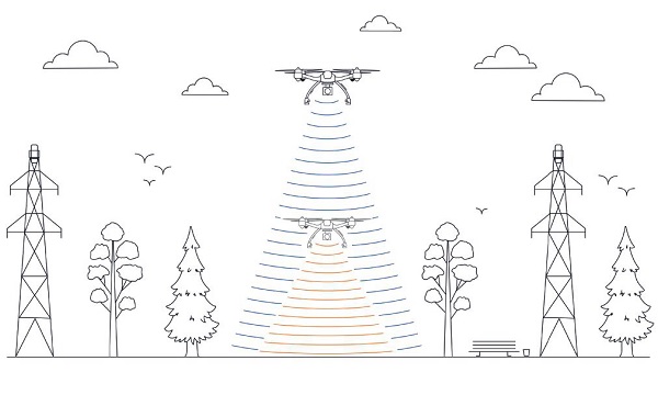
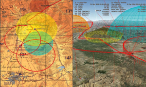
This image shows the effect of increased elevation on surface area and obstacle avoidance. (Image: Advanced Navigation)
By Simon Harris, Advanced Navigation
Lidar-based surveying is increasing in demand across a range of industries. Recent market analyses indicate that lidar surveying is a multi-billion dollar industry that is expected to deliver sustained growth for years to come. As lidar technology matures and performance increases, its range of use is broadening into surveying more complex and difficult terrain or at speeds and in environments previously unsuited to such technology. Naturally, increasing diversity and performance brings about demands for greater reliability, speed and accuracy whilst remaining within physical and regulatory limitations.
Keeping pace with market demands in UAV and rail sector lidar surveying is increasingly challenging and requires an evolving synthesis between the acquisition and processing of lidar and GNSS-INS georeferencing data. Companies such as Cordel and its subsidiary Nextcore are taking advantage of the latest technologies to develop systems that are setting new benchmarks in these sectors.
Benefits of Altitude, Faster Lidar and Precision INS
UAV lidar surveying is capable of high-resolution surveys of complex terrain, vegetated areas and in light conditions that may be unsuitable to photogrammetry. These qualities make it a preferred option in many applications. However, it must remain cost-competitive with alternative solutions to become widely adopted by the surveying industry.
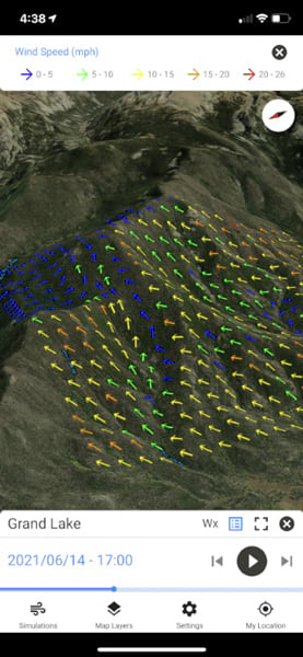
Typical UAV lidar surveying is performed at ~40m AGL. This altitude commonly presents collision risks with terrain and vegetation and imposes limits where the topography changes dramatically, such as voids that increase AGL beyond acceptable limits. Higher altitude surveying, therefore, offers obvious advantages, but also deeply challenges lidar sensors and the INS. Any mismatch in operational performance and accuracy between these inevitably degrades survey quality and severely limits use of the system.
Nextcore accepted the challenge and set about developing a viable solution that could maintain a point cloud density of 200-500 points per m2 from a target altitude of 70 m. This equates to generating lidar point cloud data at millions of points per second. Achieving this required a GNSS-INS that provided suitably precise georeferencing data. Because survey data is derived from a source that is in constant motion in 3D space, the capability of the GNSS-INS is paramount in producing a digital twin of value and is critical to mission success.
After testing and evaluating various INSs from different manufacturers, Nextcore coupled its lidar with Advanced Navigation’s MEMs-based Certus Evo INS, which provides near-FOG performance and has a drift rate of 0.2 degrees/hour. This combination yielded exceptional results that allowed them to vastly extend the altitude ceiling to 120m while retaining consistent, accurate survey data.
“Operation at this altitude not only reduces the risk of collisions with trees, it enables surveyors to cover larger areas, greatly improving the solution’s efficiency,” said Ashley Cox, founder and COO of Nextcore.
Higher altitudes tend to increase the lidar swath width. The typical swath width at ~50m altitude is ~120m, depending on actual altitude and the resulting angle of incidence of lidar toward the edges of the swath. At 120m, a reliable swath width of 180m was achieved. This is a 50% increase over previous, equating to approximately 33% fewer flight-lines to survey a given area — a notable boost for productivity and efficiency to surveyors.
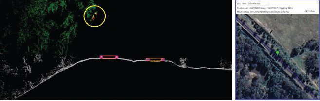
Example of rail track lidar showing encroaching vegetation, with associated map and location information. The yellow circle in the lidar data shows vegetation that is starting to intrude into the train’s path. (Images: Advanced Navigation)
Payload minimization also was a critical aspect in the search for an INS, as surveyors are always seeking longer flying time. This only can be achieved with a lighter technology stack payload. The team used an OEM version of the INS for a smaller form factor that could be integrated within a single ruggedized housing. This allows a design with greater strength, weather resistance and efficient payload setup.
“The industry is constantly seeking lighter payloads for longer flight times and to fit on smaller, safer UAVs,” Cox said. “Regulatory restrictions challenge the industry to meet certain specifications. The same is true for UAV lidar. We hit a ceiling. We need to be able to improve on that, although what we’re achieving now is a real game changer.”
The resulting survey material contains lidar point cloud data and the geo-referencing data from the INS. All data processing is performed post-flight to ensure the highest possible accuracy. PPK is used for correction of GNSS-INS position, roll, pitch and heading data. The processed INS data is then combined with the processed point cloud data to provide absolute position to the point cloud. This system realized consistent 30~40mm precision at 120m AGL. Nextcore has integrated the lidar and INS processing platforms to automate the synthesis of data sets, reducing the survey completion time. Depending on the survey’s size and complexity, this solution can process survey data into a 3D map within 30 minutes of mission completion.
Nextcore used a Certus Evo GNSS receiver, which internally uses the u-blox ZED-F9P chip. It logs GPS L1, L2, GLONASS L1, L2, Galileo GalE1, E5, and BeiDou B1, B2 frequencies at 8 Hz. It used the Kinematica correction service running a PPK filter.
Lidar sensors have become light enough to mount on UAVs (Photo: Advanced Navigation)
Scanning Rail Corridors Super Fast
Aerial surveying is not the only environment to present challenges to lidar and INS.
Train-mounted lidar for automated track and rail corridor surveying is another burgeoning market. This application typically uses lidar and position data to detect and identify areas of the railway that require maintenance and, perhaps more importantly, preventive maintenance. Rail surveying presents unique demands, including operating at speeds of 160km/h (100mp/h) or more, maintaining position accuracy during GNSS outages and variable environmental conditions.
Land-based surveying provides flexibility for selecting an INS compared to aerial applications, as size and weight are usually irrelevant. Rail surveying also requires an INS that provides the necessary performance while tolerating vibration and erratic movement from junctions, points and signals, and be absolutely dependable in GNSS-denied situations. Cox’s team found that the greater accuracy and better drift stability of FOG INS over MEMS provided an ideal platform for generating reliable and accurate paths of train trajectory.
Cordel tested Advanced Navigation’s Boreas digital FOG INS as a potential solution. Testing was carried out using cars as a simulation, travelling complex routes in two directions then overlaying the lidar point clouds to check for discrepancies or unsynchronized areas. The results provided the confidence to put the Boreas into service.
Railways typically traverse deep cuttings, lengthy tunnels and other environments that disrupt GNSS. It is mission-critical that the INS can apply dead reckoning the instant GNSS is disrupted and maintain accurate position for the entirety of the outage. Reliable path and location data during GNSS disruptions is central to the viability of automated rail surveying. Blind spots or zones of unreliable route data cannot be tolerated by rail operators from safety, track availability and financial perspectives.
The Cordel AI lidar analysis system can be “tuned” to the required metrics and is capable of self-learning. The AI enables the system to pre-emptively identify and flag areas of concern before they become an actual problem or hazard. Examples include measuring track gauge and alignment, ballast distribution and coverage, and clearance between potential hazards to the train. The entire route is logged, creating a “Google map” of the railway that maintains a historical record of survey data each time the track is used.
Clients can then view a representation of the lidar data to get a clear understanding of any issues and how to respond before sending personnel or assets to a location. This enables intervention before safety is compromised or remedial works become large-scale and disruptive. As a result, rail service providers can maintain safer railways, deliver more reliable services, and minimize operating costs.
“Seen & Heard” is a monthly feature of GPS World magazine, traveling the world to capture interesting and unusual news stories involving the GNSS/PNT industry.
A “BeiDou positioning system for subways” began construction March 20 on the Beijing subway capital airport express line. The project will cover a 30-kilometer-long section of the express line, including five stations. To provide positioning, the BeiDou Navigation Satellite System (BDS) will be combined with 5G for indoor positioning or in areas where the satellite signals are blocked. The system will improve the positioning accuracy in subways to less than 2 meters, making it available for vehicle dispatching, passenger transport organization and emergency response. In addition, it allows passengers to use their phones to navigate and position in complex environments in subway stations through three-dimensional navigation.
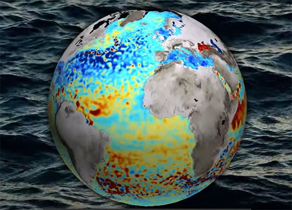
Image: ESA
THE SHAPE OF OCEAN WATER
The European Space Agency (ESA) investigated a technique to precisely measure sea-surface topography based on an idea submitted by the Institute for Space Studies of Catalonia (IEEC). The technique involves GNSS reflectometry — signals that have been reflected off of the sea surface at very low angles. The ESA-funded activity involved developing a GNSS receiver and setting up an experiment in the Balearic Islands to collect GNSS signals reflected off the sea surface. The team linked the coherence of the reflected signals to wave height and elevation angle of GNSS satellites. The team then processed the signals for optimized measurements of the shape of the sea surface, useful in applications such as ocean current forecasting, climate research, ship routing, cable laying and debris tracking.
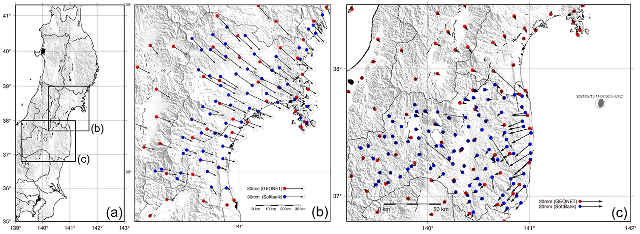
Image: Japan network/Ohta and Ohzono, Tohoku University
CELLPHONE NETWORK DETECTS EARTHQUAKES
A paper published Feb. 9 in Earth, Planets and Space by Japanese Earth science researchers analyzed the potential of a dense network of GNSS receivers, installed at cellphone base stations, to monitor crustal deformation as an early warning indicator of seismic activity. Results showed that data from a cellphone network can rival the precision of data from a government-run GNSS receiver network, while providing more complete geographic coverage. Japanese cellphone carriers have constructed networks of GNSS receivers to improve locational information for such purposes as automated driving. The study examined the potential of a GNSS network built by SoftBank Corp. to play a role in monitoring crustal deformation.
Photo: Falklands Maritime Heritage Trust
ENDURANCE IN POLAR ICE
Researchers have discovered the remarkably well-preserved wreck of polar explorer Ernest Shackleton’s ship, Endurance, a century after it was swallowed up by Antarctic ice. A team of marine archaeologists, engineers and other scientists used an icebreaker ship and underwater drones to locate the wreck at the bottom of the Weddell Sea, near the Antarctica Peninsula. The ship is at a depth of 3,008 meters, 4 miles south of the position originally recorded by navigator Frank Worsley. The expedition team used two Saab autonomous underwater vehicles to explore in a pre-programmed search pattern. After the ship was located, technicians swapped out sonar equipment for a high-resolution camera and a laser-surveying device to make highly detailed scans of the site.
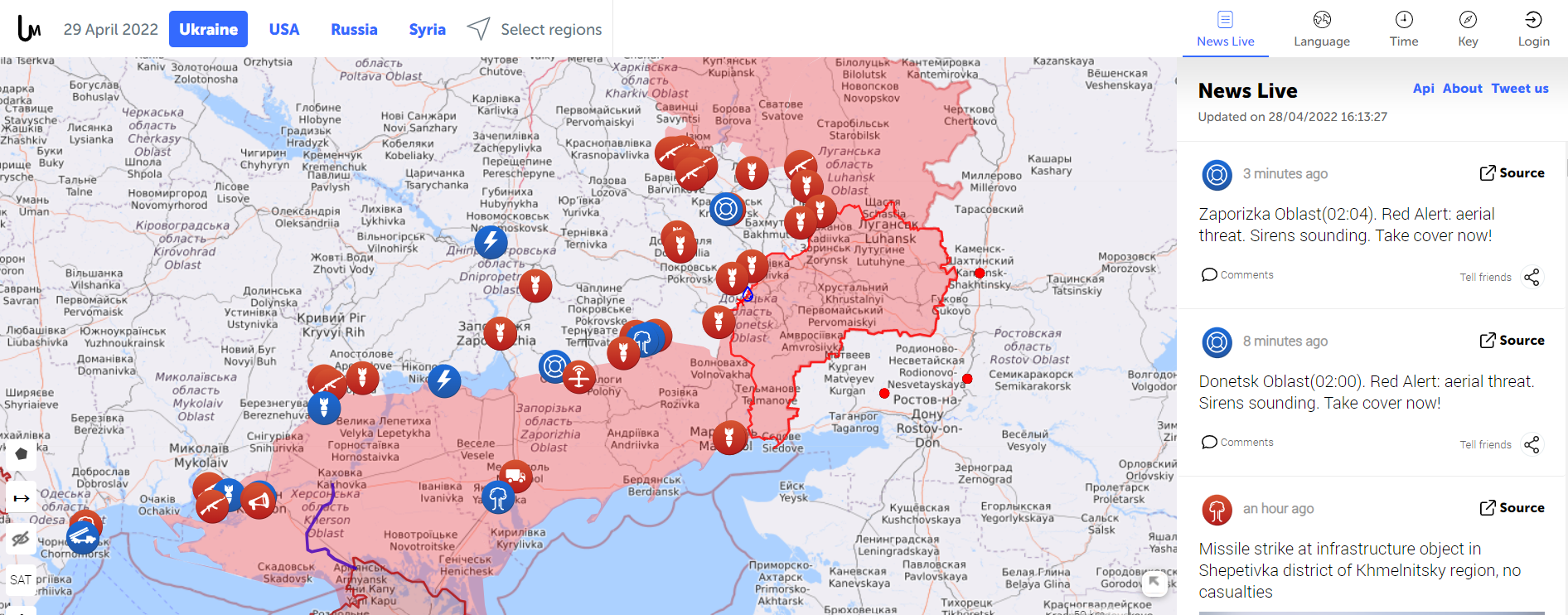
Amapping service provider birthed during the 2014 Ukraine conflict is tracking the current war through crowdsourced photos, Tweets, posts, news and other channels.
The Live Universal Awareness Mapwas founded by a team of software developers and journalists to inform the world about the Ukraine conflict. By viewer request, it quickly expanded to cover other regions, including Syria, Israel-Palestine and “Islamic State war” news. Today, it covers more than 30 regions and topics, offers translations in several languages, and can be used on mobile browsers via its own Android and iOS apps.
The independent global news and information site is dedicated to factual reporting of important topics such as conflicts, human rights issues, protests, terrorism, weapons deployment, health matters, natural disasters and weather-related stories from a vast array of sources.
Its map-centric approach to the organization of information allows viewers to quickly find relevant stories in geographies of their interest. Events are archived, and can be reviewed for analysis or historical trends. “Through our big-data analysis methods, we aim to help predict and prevent future conflicts, minimize the impact of disasters, and assist travelers around the world in making conscious decisions about their security throughout their journeys,” the service states.
Liveuamap uses proprietary software tools, such as artificial-intelligence web crawlers, to find newsworthy stories. These sources are then forwarded to a group of expert analysts for fact checking. In the final step, editors decide which facts and stories should be displayed on the map to minimize spam.
An improvement under development will enable viewers to create and manage their own maps.
Russia’s brutal aggression on Ukraine changed the world in a few days. Devastation and displacement in Europe already are on a scale unseen since World War II, and the risk of a catastrophe greater by orders of magnitude has not been as high since the Cuban Missile Crisis of 1962, the year I was born. Given the long production timeline of a monthly magazine, I will not venture a guess as to what the headlines will be on the day you read this.
The Russian assault has sharply raised concerns about GNSS vulnerabilities. In a March 17 bulletin, the European Union Aviation Safety Agency (EASA) warned of a GNSS outage leading to the degradation of navigation and surveillance. Reports analyzed by EASA indicate that since Feb. 24, GNSS spoofing and jamming has intensified in the Baltic Sea, neighboring states, Eastern Finland, the Black Sea and the Eastern Mediterranean. “The effects of GNSS jamming and/or possible spoofing,” the bulletin stated, “were observed by aircraft in various phases of their flights, in certain cases leading to re-routing or even to change the destination due to the inability to perform a safe landing procedure.”
Russia already has aided in the proliferation of handheld GPS jammers, the deployment of road-mobile jammers, and even development and testing of space-based jammers. Now, it could turn its substantial cyberspace hacking capability against the ground-control segments of GPS and Galileo.
When Russia tested an anti-satellite weapon on Nov. 15, 2021, the Kremlin claimed on state television that this capability “means that if NATO crosses our red line, it risks losing all 32 of its GPS satellites at once.” This threat was particularly dangerous because GPS satellites carry, as a secondary payload, the U.S. nuclear detonation detection system.
At a panel discussion about resilient GPS that I moderated at the International Wireless Communications Expo in Las Vegas on March 24, Diana Furchtgott-Roth, an adjunct professor at George Washington University and former deputy assistant secretary for Research and Technology at the U.S. Department of Transportation (DOT), titled her presentation “Russia Proves America Needs Backup GPS.” She cited the National Defense Authorization Act of 2017, the National Defense Authorization Act of 2018, and the National Timing Resilience and Security Act of 2018, which instructed DOT to provide a complement and backup for civilian GPS. The legislation required the Secretary of Transportation to put in place a backup system for GPS by the end of 2020, subject to congressional appropriations. However, she pointed out, these funds have not yet materialized.
Multiple technologies can and should be used to complement GPS. Several of them are mature and commercially available, including signals from low Earth orbit satellites and terrestrial broadcast stations.
Meanwhile, the United States should accelerate the launch schedule for GPS III satellites already produced. They provide better accuracy, anti-jamming capabilities, and opportunities for civilian connectivity that could offer critical assistance to its European allies.
A roundup of recent products in the GNSS and inertial positioning industry from the April 2022 issue of GPS World magazine.
OEM
GNSS+5G Antenna
9-in-one combination antenna with dual-band GNSS
Photo: Taoglas
The Taoglas MA990 Guardian antenna is a 9-in-1 combination antenna with dual-band GNSS (L1/L2) and globally supported cellular (5G/4G). It has been designed to support emerging market demand for modules that cover specific 5G/4G bands. Two of its eight cellular MIMO antennas cover from 600 Mhz to 6,000 MHz, while another two are optimized for 3,000 MHz to 6,000 MHz to cover high-band 5G and C-band/CBRS applications. The customizable antenna is designed to operate on all global carrier networks and is future-proofed to work with the latest 5G routers on the market. Housed in a low-profile, robust, IP67-rated waterproof, adhesive-mount external enclosure, the MA990 is designed for space-constrained, mission-critical applications, including asset and vehicle tracking, first-responder vehicles and high-definition video sources such as surveillance cameras.
The Boreas fiber-optic-gyroscope inertial navigation system (INS) is an ultra-high accuracy, strategic-grade INS offering a reduction in size, weight, power and cost. It is based on Advanced Navigation’s new digital fiber-optic gyroscope (DFOG) technology. The Boreas is targeted at applications requiring always-available, ultra-high accuracy orientation and navigation including marine, surveying, subsea, aerospace, robotics and space. It delivers strategic-grade bias stability of 0.001 deg/hr. This allows it to achieve ultra-high roll/pitch accuracy of 0.005 degrees and heading accuracy of 0.006 degrees. The Boreas allows for full independence from GPS with dead-reckoning accuracy of 0.01% of the distance traveled with an odometer or Doppler velocity log. In addition, the Boreas features ultra-fast gyro compassing, taking only two minutes to acquire heading in both stationary environments or on the move. Gyro compassing allows the system to determine a highly accurate heading of 0.01 degrees secant latitude without relying on magnetic heading or GPS.
Seven new GNSS active ceramic-patch antennas support global GNSS applications including GPS, Galileo, GLONASS, BeiDou, NavIC and QZSS systems in the L1/E1/B1, L2/E5/B2B, and L5/E5/B2A bands. Each antenna integrates a high-gain low-noise amplifier (LNA) and right-hand circular polarization (RHCP) to provide a high-performance solution for GNSS signal reception. Each active GNSS antenna has either a 60-mm or 100-mm coaxial cable terminated in a MHF1/U.FL-type plug (female socket) connector. They also meet the need for multi-band L1/L2, L1/L5, and L1/L2/L5 GNSS offerings.
The Pulse-40 inertial measurement unit (IMU) is a tactical-grade IMU designed for high performance in harsh conditions but miniaturized for applications where precision and robustness matter in all conditions. Use cases include warfare systems, satellite communications, robotics, lidar devices, gimbals, cameras and inertial navigation systems (INS). The Pulse-40 IMU provides six degrees of freedom. It integrates micro-electromechanical (MEMS) three-axes accelerometers and gyroscopes in a unique redundant design that allows the device size to shrink while pushing performance to its maximum. Among the performance specifications, the Pulse-40 features excellent gyro and accelerometer bias instability of 0.8°/h and 6 µg respectively, enabling long dead-reckoning and maintaining excellent heading performance. With sensors featuring extremely low vibration rectification error (VRE), the Pulse-40 can sustain high vibration environments, up to 10 g root-mean-squared. An embedded continuous built-in-test ensures data reliability during operation, a key parameter for critical applications. Features include 12 grams, 0.3W power consumption; ultra-low noise gyro (0.08°/√h) and excellent gyro bias instability (0.8°/h); high-precision accelerometers (6 µg); MIL-STD 810-qualified for shocks and vibrations; high bandwidth (480 Hz) and high data rate (2 KHz); highly tested and calibrated from –40° C to 85° C; and no export restrictions.
Adds online services for field surveying and mapping
Photo: CHC Navigation
LandStar version 7.3.7 adds cloud-based services and remote support features to simplify surveyors’ daily tasks. Online data storage and file sharing greatly facilitates interactions within a company and between field operators. LandStar 7’s remote assistance feature allows support personnel to take control of the field crew’s devices. Users simply provide a remote code to grant control of their data controller and be guided efficiently to the solution. The new version of LandStar 7 further improves support for CAD files and operates faster when importing 20MB DWG or 200MB DXF basemap files. Users can directly click on points, lines and blocks to stake out. In addition, object symbols and colors are displayed in the same way as in the original CAD design, making it easier for users to identify them.
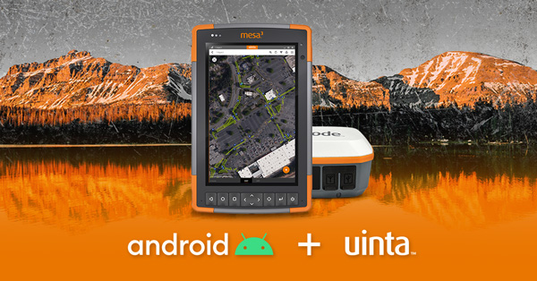
Uinta is now available for devices running on Android. This is particularly valuable for workers who prefer to use an Android tablet or smartphone as a data collector. Uinta’s intuitive and customizable user workflow makes land measurement and asset mapping easier for data collection in the field. Uinta can now be used on a range of smartphones and tablets, including Juniper Systems’ Cedar CT8X2 and Mesa 3 rugged tablets running on Android. When using Juniper’s Geode GNSS receiver and running Uinta on an Android phone or tablet, users create a total mapping solution. They can collect high-accuracy GNSS data on the Geode, record the data in Uinta software, and see the data on a mobile or tablet. The intuitive software includes project templates that can be modified to meet individual project needs. Uinta is commonly used in utility mapping; commercial and agricultural irrigation; industrial asset inspections and rounds; and numerous environmental sciences in forestry, wetlands, wildlife and vegetation mapping.
Visualize the present and simulate the future of Scottish cities
Photo: Bluesky
Scottish cities Edinburgh and Glasgow have been added to the growing coverage of MetroVista 3D city models. The data is available as ultra-high resolution 5-centimeter aerial photography with 16 points per meter (ppm) lidar. The data also is being processed to create a fully rendered mesh model suitable for use in a range of GIS, CAD and modeling software packages Acquired using the Leica CityMapper aerial sensor that simultaneously captures vertical and oblique imagery together with high-point density lidar, MetroVista data is becoming increasingly popular for smart city applications. Providing a geographically accurate and detailed 3D representation of the urban environment, MetroVista data provides insight for applications such as urban design, defense and security modeling, insurance assessments and utility and telecom planning.
WindNinja is a high-resolution wind modeling app created for firefighters who need to quickly compute and visualize wind direction and speed simulations. The simulations provide them with situational awareness, help keep them safe, and help them conduct work such as burnout operations. The mobile app, developed using ArcGIS AppStudio from Esri, provides high-resolution, near-surface wind forecasts that include wind speeds and directions displayed on a map. The user selects an area of interest of 50 square kilometers or less, names the simulation, chooses a forecast duration of up to 15 hours, selects whether to receive an email or SMS notification when the simulation is ready to view, and then submits the request. The user also can select from a variety of basemaps and turn on data layers — vegetation, atmospheric, oceanic, land-surface imagery — collected by NOAA satellites.
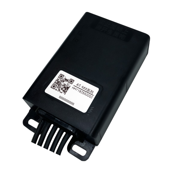
Intelligent control system meets urban transport requirements
Photo: Xiaoan Technology
The AT-MX intelligent control system for shared electric bicycles uses the latest ultra-low-power u-blox M10 GNSS technology to enhance the positioning performance of their fleet for improved compliance with increasingly stringent Chinese policy requirements. The growing popularity of shared micromobility solutions for short-distance urban travel has led municipal authorities around the world to introduce new legislation to mitigate their perceived negative impacts, for instance, with restrictions on where users can drive and park their vehicles. Meanwhile, vehicle operators and maintenance personnel need to efficiently locate vehicles requiring maintenance and gather reliable vehicle usage data to balance bicycle placement and operational safety. Enforcing regulatory compliance and optimizing operations both require the safe, accurate and efficient bicycle positioning solutions.
Ensures safe operations through reliable, robust and continuous positioning
Image: Hexagon
SPAN technology delivers a deeply coupled GNSS and inertial navigation system (INS) that provides robust, reliable and continuous centimeter-level positioning for operators to maintain safety and maximize uptime. Now available for the dynamic positioning of vessels, the GNSS+INS solutions can bridge outages in GNSS tracking and through short periods of radio-frequency interference, jamming or spoofing. It provides vessels with an added layer of resiliency and achieve continuous centimeter-level accuracy across all conditions. SPAN GNSS+INS technology is compatible with commercial inertial measurement units (IMUs) and scalable with the LD900 GNSS receiver, Quantum visualization software and APEX correction services. Features include continuous centimeter-level positioning made more robust and reliable through enhanced GNSS tracking and deep coupling of inertial measurements; rapid reacquisition of GNSS signals after outages or interruptions through a deep coupling process; constant monitoring of GNSS absolute positioning combined with heading, velocity and attitude measurements; and added positioning redundancy with system robustness against potential signal outages, interference or disruptions.
Ibtechar, one of Qatar’s top providers of practical innovation and turnkey solutions, has developed a drone tracker and a GPS-based system that ensure the safety and security of critical infrastructure, VIP residents, national borders, and military facilities. The customized solution is made by a Qatar-based team of researchers and technologists with extensive knowledge and expertise in applied research and counter-drone systems. It aims to secure airports, power lines, and other vital assets that can be targets for drone attacks. Prototypes have gone through 487 flight tests in 19 locations, as well as 676 drive and walk tests. Features include compatibility with GPS, GLONASS and BDS; real-time tracking, popup notifications and SMS alerts; smart geo-fencing; drone whitelists/blacklists; base-station triangulation (cell ID); IMU, tilt, vibration sensor, and NFC; and offline mode. The new tracking system can identify the operating drones by displaying the drone itself, its serial number, the commercial frequency used, and motion details (speed, altitude, azimuth, path, etc.).
DroneDeploy lets users capture, process and analyze data in one platform. Users can create high-resolution 2D and 3D interior and exterior maps and models accurate to between 1 cm and 5 cm. It is designed for individuals, teams or enterprises and is suitable for all use cases and industries. However, primary markets include agriculture, construction, mining, energy, roofing and inspection. Features include Mobile Flight App to capture images directly from
an iOS or Android device; Live Map to create real-time, sharable
2D maps; Autonomous Flight to preprogram routes; as well as
360 Walkthrough for a 360-degree, virtual tour through a 3D model of a site. Industry-specific features are available, such as Plant Health to help farmers measure crop health and viability.
the former Loran-C transmission antenna at Værlandet, Norway. (Photo: UrsaNav)
By Alan Grant and Dana Goward
In my “First Fix” editorial in the January 2022 issue of this magazine, I listed 10 questions about eLoran I had received from a PNT expert in response to an article about eLoran I wrote for the November 2022 issue. I encouraged eLoran proponents to address these questions. Two well-known authorities, neither of whom have a financial interest in the technology, stepped forward to help. Below, again, are my 10 questions about eLoran and their answers.
Alan Grant is head of Research and Development for the General Lighthouse Authorities of the United Kingdom and Ireland (GLA). He is an expert in radionavigation systems and leads the team that established the U.K.’s eLoran system, which operated from 2007 to December 31, 2015 in support of maritime users.
Dana A. Goward is president of the Resilient Navigation and Timing Foundation and a retired U.S. Coast Guard Captain. He also served in the federal Senior Executive Service as the maritime navigation authority for the United States. He has decades of experience with navigation policy and leading government policy and programs.
— Matteo Luccio, Editor-in-Chief
Accuracy specifics. While my November article stated that eLoran would have a two-dimensional accuracy of “better than 20 meters, and in many cases, better than 10 meters,” is that RMS, 95%, or some other statistic?
AG: Like any radionavigation system, the achievable accuracy will depend on several aspects, including the user’s location with respect to the broadcast stations and how error sources are modelled. The GLA eLoran service, when in operation in 2015, provided positional accuracy in the order of 8-10m (95%) to seven ports on the east coast of the UK. These ports had local reference stations to help manage temporal errors and the ports had been mapped to correct for additional secondary factors (ASF).i
DG: Others have reported greater accuracies using differential corrections.
Performance standard. GPS provides a commitment to users in a published performance standard. What specific measures of positioning accuracy, integrity and continuity would you recommend the proposed eLoran system be committed to provide (using the architecture described in the answer to Question 6)?
AG: The target performance would need to be tied to the target use cases to ensure the appropriate requirements are met. IALA provides guidance in this area for maritime services with general maritime requirements provided by the IMO within resolutions A.1046 and A.915.
Coverage. Would you recommend this eLoran positioning performance hold for the entire United States (including Alaska, Hawaii, Puerto Rico and other territories), only for the “lower 48” states, or only parts of these 48 states?
DG: The primary goal of any effort to complement and back up GPS/GNSS would be to make the nation and its citizens safer in at least two ways. First, to provide an alternative PNT source or sources in the event that signals from space were not available for any reason. Second to make GPS satellites and signals (and therefore the nation) safer by “taking the bullseye off GPS.” Having one or more alternatives will greatly reduce incentives for malicious disruption. To achieve these two goals the alternatives must be widely available and easily accessed. How widely available and easily accessed the United States or any other country wants to make such systems is a policy decision.
Current users. By number of users, the predominant common current civil uses of GNSS for positioning are consumer devices (mostly cellphones). By contribution to the U.S. economy, the predominant uses are high-precision applications. For what fraction of these uses would eLoran positioning be adequate? Could an eLoran receiver and antenna fit in today’s consumer devices?
DG: Lots of presumptions and assumptions in this question. Several overall thoughts, though. First, determining users’ real requirements can sometimes be difficult. I have a nice new full-size sedan. So, I think that is my requirement even though I could get to work almost as quickly and much less expensively if I owned a used compact car or caught the bus at the corner.
Second, GPS/GNSS will, hopefully, always be the primary source. The questions then are 1) how accurate can eLoran positioning become with additional work, and 2) how accurate does a fallback system need to be?
Durk van Willigen of Reelelektronika b.v. displays a combined GPS, GLONASS and eLoran receiver at the 2017 Munich Satellite Navigation Summit. (Photo: Reelelektronika)
Finally, as to equipment size, I recall seeing a photo of the first GPS receiver sitting on a pallet with two chairs for operators. Today, receivers are made at chip scale. Huge reductions in C-SWAP have been the growth arc for all kinds of technologies as they are implemented more and more widely.
In 2017 the Dutch company Reelektronika showcased a combination eLoran, Chayka, GNSS receiver that was only 6 cm long. This was achieved without a whole lot of investment in research and development. Who knows how low C-SWAP for eLoran receivers will go?
Future uses. Emerging civil uses of GPS for positioning include autonomous ground and air vehicles, navigation to space and in space, and lane-accurate car navigation. Which of these could be served by eLoran?
AG: The overall concept of having a mix of dissimilar position sources remains sensible for all modes. GNSS is expected to remain the primary means of position determination, with different use cases selecting different complementary systems based on their needs. eLoran may support some use cases but may not be the answer for all.
DG: Many believe GPS alone is not sufficient to serve some of the applications cited. This is the basis for language in both the European Radionavigation Plan and a U.S. Presidential Executive Order cautioning against over-reliance on GNSS. Perhaps GPS and eLoran together might be deemed sufficient. Or, perhaps a more diverse and resilient PNT architecture will give rise to additional applications such as precise positioning from 5G that will be sufficient.
Architecture. To maintain accuracy during a prolonged GPS outage, eLoran would require reference stations to calibrate time-varying propagation errors, as well as a certain number of transmitters for good nationwide geometry and for redundancy, ensuring service even if a transmitter is attacked or is taken off-line for maintenance. What architecture would you recommend to achieve this?
AG: The MarRINav projectconsidered a similar question for the UK and the project’s approach could be employed to consider this question for the United States.iv
DG: A good starting point for the United States might be the sites used by the shuttered Loran-C system. The federal government still retains custody of most of them. Also, considerable thought has been given to the questions of eLoran reference stations and integrity in the United States. PNT expert Mitch Narins, formerly of the FAA and now Strategic Synergies, advises that much of this work has been done. The FAA and Coast Guard conducted a study to deploy eLoran in the United States to support aviation non-precision approach, maritime harbor entrance and approach, and precise time and frequency users. The proposed architecture supported aviation’s demanding integrity requirement (1×10⁻⁷), maritime’s demanding accuracy requirement (8-20m), and time and frequency users’ precision requirements (100 ns/Stratum 1).
7. Infrastructure cost. What would be the cost of installing the required transmitters, power supplies, reference stations, communication links and control system for the architecture described in the answer to Question 6? Can you reference a recent and independent estimate? To a ballpark figure, what cost fixed-price contract would you accept to implement it? Similarly, what would be the annual costs for operating and maintaining this infrastructure?
AG: The MarRINav project produced a cost-benefit analysis report that addresses some of these questions, albeit aligned to the approach proposed for the UK. The documents are open source and available on the MarRINav website.
DG: To quote President Kennedy, “There are costs and risks to a program of action, but they are far less than the long-range risks and costs of comfortable inaction.”I agree with Dr. Grant that the capital costs in MarRINav are roughly transferrable to the United States. As another data point, the 2010 operating cost for Loran-C in the United States was about $36M/year. That number included several hundred employees, though. Plans to automate the system projected reducing annual costs to $15M/year in 2010 dollars.
Impact. eLoran transmitters are large and high-power. Providing positioning across the United States could require building some of them from scratch or significantly reconstructing old Loran sites. What issues — such as environmental, aviation safety and security — would this raise, and how would you recommend they be addressed?
DG: These issues would be dealt with the same way they are for any construction project. eLoran transmission sites are essentially the same as commercial AM radio stations. Reusing sites still owned by the government could make the process even easier. Compared to the cost and difficulty of putting PNT assets in orbit, these challenges should be relatively easy to overcome.
Receivers. Assuming all the above were achieved, it would accomplish nothing unless eLoran receivers were widely purchased, installed and used. How much would that cost? Who would pay? Should we assume that “if we build it, they will come”?
AG: This is a valid concern and has different answers depending on the planned use case and the level of national/international standardization required. Within the maritime sector, the IMO has approved a multi-system receiver performance standard that supports the use of all GNSS and terrestrial systems within one device, rather than having a separate eLoran receiver.
DG: I completely agree — adoption and use are absolutely key. Fortunately, government leaders have a wide variety of levers to influence adoption and use. These range from education and encouragement to regulation, legislation, and subsidies.
Alternatives. Given the widespread development of other positioning technologies over the past decade, much has changed since the earlier recommendations for eLoran. How do we know that eLoran is the right investment — or even a needed part of the solution or needed system in a system of systems — for the future of U.S. PNT?
AG: The MarRINav project researched and compiled details of different positioning, navigation and timing technologies supporting maritime navigation, within Deliverable D4. The recommended system-of-systems approach recognized that there was no one-fit-all solution, rather it sought to allow for a scalable solution that reflects users moving from location to location and between systems. It considered global, regional and local solutions, recognizing the cost vs. usable coverage tradeoff for each. The proposed solution of GNSS, supported by eLoran in combination with VDES R-Mode and radar absolute positioning, was deemed as the most appropriate mix for the UK, given geographical and political constraints. The approach can be ported to investigate the appropriate options for the United States.
DG: The U.S. Department of Transportation’s January 2021 report to Congress has findings similar to those in MarRINav. It described a system of systems that included fiber, satellites and terrestrial broadcast. The department subsequently said that a critical factor for a terrestrial broadcast system would be the coverage area per unit of required infrastructure. Of the systems discussed, eLoran met this criterion best. This recent finding is consistent with numerous other government reports, two previous government announcements that it would build eLoran, two recommendations from the President’s National Space-based Positioning, Navigation, and Timing Advisory Board and the technology’s on-going use around the world. Likely someday there will be something to replace GPS and other legacy technologies. We must work with the combination of technologies we have now until that day arrives.
Common Threats
Common threats to GNSS and eLoran could include the following:
1. Cyber attacks. Given that GPS’s OCX is said to be the most cybersecure system built by the U.S. Department of Defense, how would eLoran’s control system be even more cybersecure than OCX, to avoid a common cyber-vulnerability?
AG: Cybersecurity is a key concern and one that any navigation and safety of life system must consider. I will leave manufacturers of each system to comment on how secure they are. However, if we consider signal interference and data manipulation within this category, then using a stronger signal at a different frequency to GNSS provides some protection against jamming. While any radio signal can be jammed, the perpetrator would need more power and physically larger equipment to jam at lower frequencies.
DG: Yes, the security of control systems is very important and must be included in the design up front. Authentication and security of signals, and the cybersecurity of receivers must be as well. This is especially true for complementary systems for GPS since GPS signals are so open and vulnerable, and so many receivers are largely unprotected. We will have the opportunity to do better with a new system and avoid the huge expenses of OCX, the new GPS control system.
Additionally, let us not forget that cybersecurity is needed for much more than control systems. Signals and receivers need to be much more secure than civil GPS is right now. A new system, be it eLoran or another technology, will be able to build cybersecurity in from the beginning.
Physical attacks. Given concerns about possible physical attacks on GPS satellites, which move at multiple km/sec 20,000 km from Earth, would it not be easier to physically attack eLoran transmitters, which are stationary, terrestrial, in remote locations, and hundreds of feet tall and require massive power sources?
AG: We should not lose sight that any ground infrastructure can be attacked, regardless of whether it is a satellite uplink station or part of a terrestrial communications or positioning system. Careful selection of the transmitter location, along with suitable site security options should help deter the attack and mitigate the impact where possible.
DG: Every physical asset and every signal is vulnerable to some degree to attack by a host of malicious actors, and damage by a variety of natural occurrences. The key to resilience and making PNT sources less attractive targets is to have diverse sources with the smallest number of common failure modes.
Space weather. GPS is potentially vulnerable to severe space weather that could damage satellites or temporarily hinder signal propagation from space to Earth. However, severe space weather could also damage the power grid upon which megawatt eLoran transmitters rely. How would eLoran service be protected from the effects of severe space weather, such as a Carrington Event?
AG: Space weather has the potential to affect all radio broadcasts. Depending on the type of event it can affect performance several different ways, including ionospheric scintillation, applying forces to satellites or disrupting power networks. The aim is to use systems where the underlying failure modes are as different as possible. Using a combination of satellite and terrestrial signals, at different frequencies, with local power generation where possible can help mitigate the impact. Whether it’s possible to mitigate all the implications of a Carrington type event is not clear and perhaps one for the experts.
DG: With the available warnings about solar events, it is conceivable that both GNSS and terrestrial systems could be powered off or otherwise secured for such an event to minimize damage. A new-build terrestrial system could also be constructed with surviving a Carrington Event in mind. And, of course, terrestrial systems will be easier to access, repair, and replace than those in space. As for other possible issues with the power grid, generators, uninterruptable power supplies, and other backup methods can easily be installed. Before 2010, several U.S. Loran-C transmitters were in such remote locations, they never had grid power and were always powered by generators.
Because of circumstances following Russia’s invasion of Ukraine, Hexagon AB has made the decision to freeze all business activities in Russia. Hexagon AB is a global leader in digital reality solutions combining sensor, software and autonomous technologies.
Hexagon already suspended all exports of hardware and software licenses to Russia and is now taking further steps to adapt to the current business situation.
Given the uncertainty of the outlook, these steps are constantly under review and will be adjusted if the situation changes.
About 2 percent of Hexagon’s annual turnover can be attributed to business in Russia, with approximately 200 people employed in the country.
On March 24, the U.S. Department of Energy (DOE) released information about a program designed to provide resilient timing to the electrical grid by fiber.
More than just an academic center for research, CAST is building a network of atomic master clocks and methods of time delivery by fiber that will ensure power grids always have failsafe and resilient time.
Timing is essential to a wide variety of equipment and network functions essential to electrical grids. Most of these use time signals that come directly from, or can be traced back to, signals from GPS.
Electrical-grid timing dependent equipment and networks
Transmission-line fault detection
Frequency measurement
Synchrophasors/phasor measurement units
Internet-based market transactions
Substation control/resynchronization
Disturbance monitoring event recorders
Protective relays
Bulk metering
SCADA networks
Synchrophasor networks
An industry expert once observed, “Electrical grids won’t fail without accurate time signals, but they are impossible to manage. And who wants an unmanageable grid?”
According to David Wells, program leader for CAST at DOE headquarters, “It has been no secret there are vulnerabilities within the timing and synchronizations platforms used by the energy sector.” Wells said that for grid timing “a secure, verifiable, and reliable solution is paramount.”
He sees CAST as a necessary part of tech evolution for electrical grids and service. “The sector has been going through a transition from analog to digital and then from digital to internet protocol (IP). Technologies have been bolted on, but with each bolt-on added, access vulnerabilities are added as well. Embedded stratum timing systems based through digital carriers allowed our networks to be closed-loop (zero-trust) for 50 years. During the age of IP conversion, the ability to provide timing via stratum was lost, so the sector moved to GPS and NTP, which provided precision at the locations, but lack security, validation and true wide-area synchronization.”
CAST’s goal is to establish “true closed-loop (zero-trust) with secure bi-direction timing validation and synchronization over IP networks,” with multiple clocking sources, according to Wells. The system, he said, will be able to reach all power substations and remote locations.
While Wells, his office and ORNL are the primary players, a whole cast of other organizations contributes to the effort. These include DOE’s Office of Electricity; its Office of Cybersecurity, Energy Security and Emergency Response; Savannah River National Laboratory; Sandia National Laboratory; and industry partners.
CAST will not be creating new infrastructure, but rather leveraging fiber already in place. “This is not a dedicated fiber network for timing,” said Wells. “CAST uses existing fiber in the form of dark fiber (underutilized fiber), commercial fiber and optical ground wire, and works with wireless technologies to extend secure timing and synchronization to users.”
While CAST is narrowly focused on electrical grids and fiber, some see a potential for it to be the basis of a wider national security effort.
Marc Weiss is a timing expert and consultant who served for more than 40 years as a theoretical physicist for the National Institute of Standards and Technology. “CAST could be part of the foundation of an architecture that benefits all sectors and citizens, not just power grids,” he said. “The Department of Transportation has identified the need for Americans to have access to timing signals from space, from terrestrial wireless transmitters, and via fiber to have the kind of resilience they need. So, CAST is certainly a big step in the right direction.”
DOE’s DarkNet initiative is a joint initiative by the Office of Electricity and the Office of Cybersecurity, Energy Security, and Emergency Response (CESER). Additional information on DarkNet and CAST can be found at https://darknet.ornl.gov
“Seen & Heard” is a monthly feature of GPS World magazine, traveling the world to capture interesting and unusual news stories involving the GNSS/PNT industry.
Photo: Anton Rodionov/iStock/Getty Images Plus
UNWANTED HITCHHIKERS
Antarctica’s pristine marine ecosystem, isolated for 15–30 million years, could be threatened by species such as mussels, barnacles, crabs and algae arriving on ships from 1,500 ports worldwide. A research team from the British Antarctic Survey and the University of Cambridge used automatic identification system (AIS) data, which relies on GNSS navigation data, and shipping databases to determine traffic to the Antarctic. The study is published in the Proceedings of the National Academy of Sciences, January 2022.
Photo: FrankRamspott/iStock/Getty Images Plus
QUAKE PREDICTION
Within the next 30 years, a highly destructive Nankai Trough megathrust earthquake is predicted to hit southwest Japan. Understanding long-term slow slip events under the Bungo Channel is essential for pinpointing when such an earthquake will happen. Kobe University’s Yoshioka Shoichi and Seshimo Yukinari analyzed the 2018–2019 Bungo Channel slow-slip event using longitudinal GNSS data provided by the Geospatial Information Authority of Japan. The data revealed that even though the 2018–2019 event was shorter than others, it was bigger in terms of slippage and slip velocity, as well as magnitude. Results appear in Scientific Reports, Jan. 10, 2022.
Photo: Bluesky
SUPPORTING SOLAR
British aerial mapping company Bluesky is helping Derby Homes roll out integrated solar photovoltaic systems across its housing stock. A project to identify suitable roof coverings assessed more than 8,000 addresses for size, pitch, aspect, existing structures and infringing vegetation. Using its ultra-high-resolution imagery, Bluesky determined the solar suitability of each property, the number of panels needed, and their potential output. Derby Homes recently installed its first integrated solar array on an initial batch of trial properties identified by Bluesky.
Photo: JohnCarnemolla/iStock/Getty Images Plus
TAKING MOM TIME
CQUniversity’s precision livestock management research team is using GNSS to detect calving events in extensive grazing herds. The discovery could provide beef producers in Australia with a way to remotely monitor their cattle and improve calf survival rates, one of their biggest challenges. The research project used GNSS collars with motion-detecting accelerometers on 30 cows in a 28-hectare paddock over an eight-week period at Belmont Research Station. The collars captured the animals’ location information every 10 minutes. Because the distance between mother and herd increases during calving, the data helped predict calving events, which were then visually confirmed by the research team.
In our 11th annual Simulator Buyers Guide, we feature simulator tools, devices and software from 11 prominent companies that aid GNSS receiver manufacturers in product design.
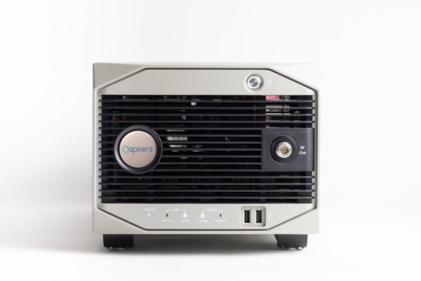
Alternative RF Navigation Simulator (Photo: Spirent Federal Systems)
New Alternative RF Navigation Simulator. Authorized users of Spirent’s alternative PNT simulation system can generate alternative RF navigation signals individually or concurrently with GNSS signals.
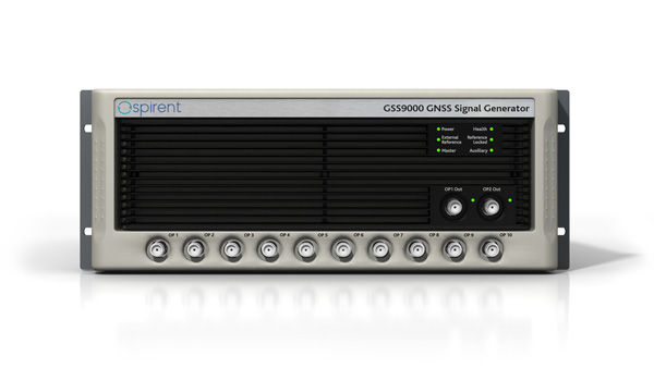
GSS9000. The GSS9000 Series multi-frequency, multi-GNSS RF constellation simulator is Spirent’s most comprehensive simulation solution. It can simulate signals from all GNSS and regional navigation systems and has an unrivaled update rate of 2 kHz (0.5 ms), enabling ultra-high-dynamic simulations with accuracy and fidelity. The GSS9000 supports M-code, Y-code, alternative PNT and non-GNSS sensors, and comes with built-in jamming, spoofing and flex power.
SimMNSA. Spirent Federal has the first fully approved MNSA M-code simulator. Authorized users of the GSS9000 series of simulators will be able to utilize the advanced capabilities of SimMNSA to create robust military GPS user equipment (MGUE) solutions.
Spirent GSS9000 Series constellation simulator (Photo: Spirent Federal Systems)
CRPA Test System. The CRPA Test System is scalable, testing antennas from 4 to 16 elements and beyond. More than 1,000 independent GNSS, jamming and spoofing signals can be generated/simulated across a phase-calibrated precise wavefront.
SimINERTIAL. Supporting the leading embedded GPS/inertial systems (EGI) and inertial measurement units (IMU), SimINERTIAL enables the controllable generation of inertial sensor outputs, synchronous with simulated GNSS, to test integrated GPS/inertial systems in the lab.
Anechoic Chamber Testing. Spirent’s GSS9790 multi-output, multi-GNSS RF constellation wavefront simulator system can be used in both conducted (lab) and radiated (chamber) conditions.
Mid-Range Solutions. Spirent offers solutions for every application and price point. The GSS7000 multi-constellation simulator provides an easy-to-use solution for GNSS testing that can grow with users’ requirements. The GSS6450 RF record-and-playback system enables replay of real-world GNSS tests in the lab.
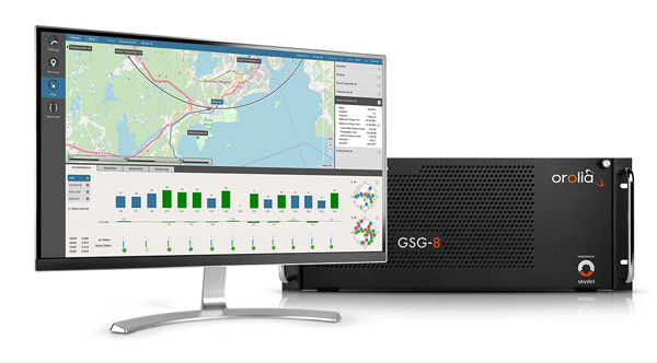
Based on the Skydel GNSS Simulation Engine, Orolia’s advanced and essential GNSS simulators offer a wide breadth and depth of tools to test mission-critical positioning, navigation and timing (PNT) applications and scenarios.
Skydel Simulation Engine. The highly flexible, high-performance Skydel Simulation Engine transmits GNSS signals in real time to many kinds of software-defined radios. Skydel uses graphics processing units (GPUs) to compute the digital GNSS signal of all simulated satellites, easily scaling from simple to complex use cases. Skydel simulates civil signals from global and regional navigation satellite systems with a 1000-Hz update rate, many kinds of GNSS receiver trajectories with high dynamics, and advanced jamming and spoofing. The Skydel ecosystem also includes features such as open-source plug-ins and API, and the ability to create custom signals. The custom-signal feature allows users to experiment with new signals, such as navigation from low-Earth-orbit satellite systems.
GSG-8. A scalable software-powered turnkey simulation solution, GSG-8 is configurable to meet virtually any testing requirements. It can support multi-constellation, multi-frequency and hundreds of signals with a 1000-Hz iteration rate. This advanced hardware platform is suitable for space trajectories, custom PNT signals, hardware-in-the-loop, multi-antenna simulation, and more. Encrypted EU signals will be available soon.
Skydel CRPA Testing. With self-calibration, integrated advanced jamming and spoofing, and the ability to generate thousands of signals, Skydel CRPA test systems provide everything needed to test CRPA systems, with a focus on ease of use and the testing experience from the user point of view. Two flexible configurations, Skydel Anechoic and Skydel Wavefront, have been carefully designed to provide the advanced simulation features required for CRPA testing in a well-thought-out package. Both provide COTS hardware benefits: configuration flexibility and cost-effectiveness.
GSG-5 and GSG-6. Orolia’s essential simulation platform is a proven, cost-effective simulation solution. Combined with the freely available StudioView software, these simulators provide high-end capabilities in a standalone, portable system that allows operation via a front panel interface. GSG-5 and GSG-6 are available with support for multi-frequency and multi-constellation GNSS signal simulation, pre-built scenarios and test packages, and the features neded to integrate it into ATE systems.
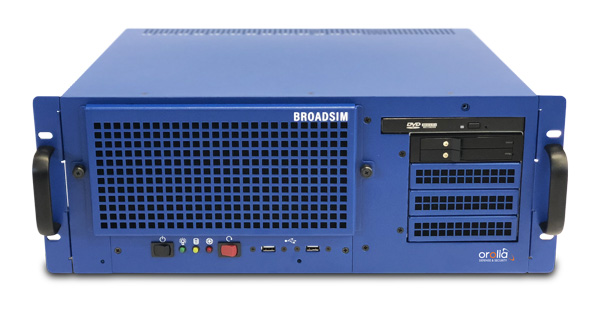
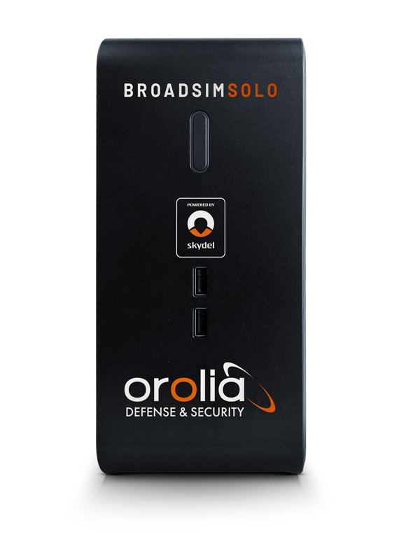
BroadSim 4U, Advanced NAVWAR simulations, MNSA and Y-Code (Photo: Orolia)
Advanced GNSS Simulation for Government & Defense
BroadSim
Powered by the Skydel Simulation Engine, BroadSim provides superior NAVWAR performance, sharing the same benefits and key features of its software-defined platform.
Key Applications
BroadSim Solo: Multi-GNSS simulations on the desktop. (Photo: Orolia)
MNSA M-Code. BroadSim offers a fully flexible implementation of the Modernized NavStar Security Algorithm, giving you full control over scenario settings with the real encryption used on the M-code signal. Any aspect of your scenario can be changed, such as time, date, location, constellation, downlink data, signal configuration, and visible satellites. It is security-approved by SMC Production Corps and shipping as soon as today.
CRPA Testing. BroadSim leverages Skydel’s CRPA testing solution to up the ante for demanding NAVWAR scenarios. BroadSim Anechoic allows you to test an entire system as-is. Skydel auto- calibrates the system, maps the antennas, and is designed to streamline chamber setup and reduce hardware. Broadsim Wavefront tests the antenna electronics, prioritizing the ability to have dynamic trajectories and allowing you to model any scenario with an unlimited number of interferences. The system is scalable from 4 to 16 elements, is phase coherent, performs real-time automated phase calibration, and has built-in jamming and spoofing.
BroadSim Wavefront: Phase-aligned NAVWAR simulator for CRPA (Photo: Orolia)
Advanced Jamming and Spoofing. With Advanced Jamming, users can add ground- and space-based emitters to scenarios, generate an unlimited number of jamming signals on 1 RF output, and simulate flight profiles where interference power levels at the UUT dynamically change depending on the scenario motion. With Advanced Spoofing, users can simulate multiple spoofers simultaneously. Each spoofer can generate any GNSS signal and has an independent trajectory and antenna pattern. Signal dynamics between each spoofer and receiver antenna are automatically determined so no time is wasted.
More Features. Inertial and alternative RF navigation, built-in Flex Power, real-time performance with ultra-low latency of 5ms, high dynamics, terrain modeling, and RMF STIG compliance.
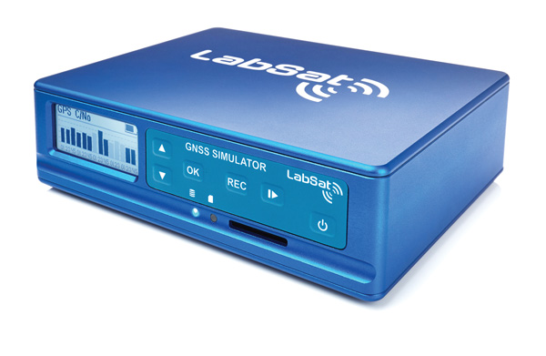
Test Anywhere with LabSat 3 Wideband and SatGen Simulation Software
LabSat 3 Wideband. The LabSat 3 Wideband is a compact yet powerful multi-constellation and multi-frequency GNSS testing solution. The easy-to-use, one-touch record-and-replay function provides an efficient way to test and develop GNSS-based technology without the cost and limitations of live-sky signals.
It is lightweight and portable, enabling easy collaboration with colleagues by sharing scenario files over the internet, and making it a suitable test partner for remote working. Additionally, the removeable solid-state drive (SSD) of up to 7 terabytes and a two-hour runtime provided by an internal battery is ready for field testing in any environment.
LabSat 3 Wideband can record and replay up to three different channels at 56-MHz bandwidth across all major constellations and signals, including:
GPS: L1/L2/L5
Galileo: E1/E1a/E5a/E5b/E6
GLONASS: L1/L2/L3
BeiDou: B1/B2/B3
NavIC: L5/S-band
QZSS: L1/L2/L5
L-band correction services including SBAS
2x CAN and 4x digital input channels tightly synchronized with GNSS data
future signal launches are also supported, including L2C, L5 and L1C
SatGen Simulation Software. SatGen software allows users to quickly create bespoke, accurate scenarios with their own time, location and trajectory that can be replayed via a LabSat GNSS simulator.
The latest version of SatGen can be used to create a single scenario containing all the upper and lower L-band signals for GPS, Galileo, GLONASS, BeiDou and NavIC.
When getting the job done right the first time — and every time — matters, CAST Navigation’s suite of simulator solutions delivers precision, accuracy and repeatability. From simple integration testing to complex mission simulations, CAST Navigation solutions scale to meet user requirements.
Powered by multi-frequency, multi-constellation GNSS and interference signal-generation technology, CAST Navigation simulators provide coherent, highly accurate and fully programmable signals. Advanced, configurable vehicle trajectory capabilities meet project requirements ranging from antenna testing to simulations of squadrons maneuvering in contested environments.
Intuitive Graphical Interface. A comprehensive and intuitive graphical interface unifies all simulator capabilities so users can configure complex simulation scenarios quickly. For example, CAST Navigation simulators can model many vehicle types with static and dynamic motion profiles: airborne, terrestrial, aquatic or space-based. Using configured scenario profiles or vehicle truth data, CAST Navigation simulators create high-dynamic, 6-DOF real-time trajectories.
High-Fidelity Simulations of Real-World Conditions. CAST Navigation solutions can reproduce terrain, sea-state and atmospheric effects to simulate missions with high fidelity. Jamming capabilities recreate natural, urban and hostile interference to produce precisely controlled waveforms with high output power and exceptionally low intermodulation noise.
Multi-Frequency, Multi-Constellation Simulations. The GPS/GNSS simulators generate accurate, programmable signals to each antenna element with up to 16 satellites in view from as many as four constellation types. GPS simulations can generate any positioning signal (C/A-code, P-code, Y-code, SAASM, M-code AES and M-code MNSA).
Modular, Scalable Solutions. Proprietary synchronization technology lets CAST Navigation configure customer solutions with multiple simulator capabilities — GPS/GNSS, inertial, jamming, and CRPA — to meet specific project needs. As those needs evolve, these solutions do not become obsolete. Rather than replace a functioning system, customers can rely on modular architecture to meet their new requirements.
The NCS NOVA GNSS simulator is a high-end, powerful and easy-to-use satellite navigation testing and R&D device. It is fully capable of multi-constellation and multi-frequency simulations for a wide range of GNSS applications. It is one of the leading solutions on the market, providing multiple GNSS frequencies in one box.
Because of the modern and flexible software-defined radio (SDR) design of this simulator, testing requirements will be met with the minimum of equipment, facilitating logistics and reducing the cost of ownership. The innovative multi-constellation and multi-frequency simulation capability sets new standards in the field of GNSS simulation in terms of fidelity, performance, accuracy and reliability. Designed to deliver maximum flexibility, users are no longer faced with configuration limitations.
The NCS NOVA GNSS simulator is also able to coherently generate GNSS RF signals on two independent RF outputs simultaneously. The user may freely allocate GNSS signals and RF channels to each of the RF outputs. This feature allows simulation of GNSS signals at two antenna locations simultaneously (this could be two antennas on a vehicle, two separate vehicles maneuvering independently, or a static location plus a mobile unit).
A new key enhancement to the NCS NOVA GNSS simulator is comprehensive support of new Galileo OS signal message improvements on E1B. By enabling real-time simulation of the Galileo OS message improvements, the NCS NOVA expands a user’s Galileo signal capability.
In the future, the NCS NOVA also will fully support the new Galileo E1B OS Navigation Message Authentication (OS-NMA) and Galileo E6B High Accuracy Service (HAS) capabilities.
The NCS NOVA GNSS simulator is the first choice in signal simulation for a wide range of applications including space, aviation, automotive (including autonomous driving testing) and many others.
About IFEN. IFEN is a leading provider of GNSS navigation products and services. Its technology portfolio includes GNSS RF-signal simulators, GNSS software receivers, simulation and data processing tools. IFEN’s outstanding satellite navigation expertise is provided to customers for services including GNSS system studies, research and development of navigation and integrity algorithms, design and development of GNSS software and hardware, on up to engineering of turnkey facilities and systems.
The MGSE product family creates a versatile GNSS test and simulation environment that improves the development, qualification and certification process of GNSS receivers within development phases and for validation and certification in end-to-end tests.
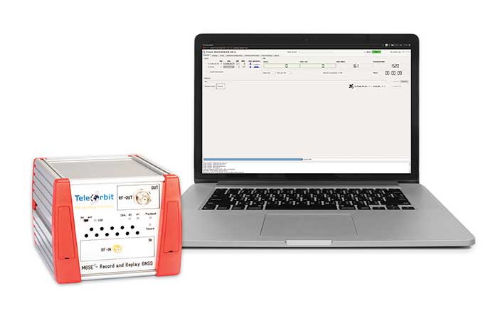
MGSE enables mobile and stationary interference monitoring, for example, for protecting critical infrastructures. It can be used for interference mitigation if combined with TeleOrbit’s GNSSA-6E (six-element antenna array) or its GNSS DCP (dual circularly polarized)antenna.
With MGSE REC-REP 2.0 users can, among other tasks, record Galileo PRS signals in a real user environment and replay them for Galileo PRS receiver testing.
MGSE SIM-REP supports the development of software-defined radios/receivers or specialized algorithms by creating a simulation environment that provides the possibility and flexibility to use synthetically generated GNSS data and recorded real-world samples.
For jamming and spoofing test and evaluation, TeleOrbit offers a sophisticated solution based on the MGSE simulation, recording and replaying product family. For spoofing mitigation, the GOOSE-OSNMA receiver platform is available.
Technical Background
The multi-band RF front-end (MGSE REC) receives the GNSS RF signals in different frequency bands simultaneously to obtain digital IF data, which can be used for GNSS multi-system signal analysis and comparison. All GNSS L-band frequencies and the NavIC S-band are supported.
The MGSE Replay Unit includes a flexible multi-band RF replay device that streams simulated and recorded raw IF data to a digital baseband output or to an analog RF signal. Up to two independent RF channels and up to four GNSS signals (L1, E1, B1, G1) can be provided.
GOOSE is a powerful yet compact GNSS receiver lab and the rapid prototyping solution for leading-edge GNSS receiver development.
The GNSSA-DCP (dual circularly polarized antenna) receives RHCP and LHCP signals simultaneously (full L-band). It clearly detects signals which have been corrupted by diffraction and reflections.
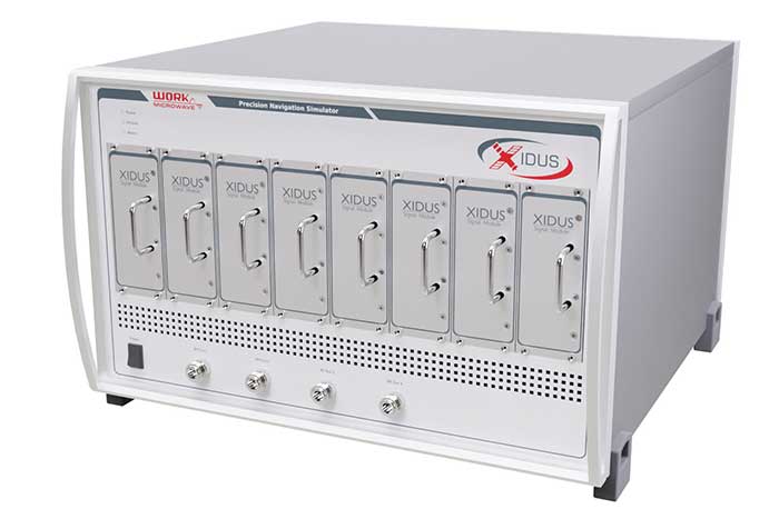
WORK Microwave’s Xidus is well-known for meeting all requirements regarding multi-GNSS; for its multi-frequency and multi-RF signal generation; for its innovative Signal Extension and Enhancements (SEE) technology; for its advanced customization and configurability; and for world-class remote support with updates, training and even scenario execution.
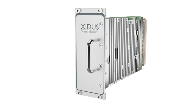
Xidus Signal Module
Compact and powerful, the Xidus Signal Module provides new capabilities of signal generation. Users can perform rigorous and extensive testing of present and future positioning systems when conducting navigation research or developing products.
Possible applications: pseudolite generation, massive multipath or navigation signal generation on various orbits.
Extensive increase of supported channels: >250.
Unlimited number of multipath channels with delay >3,000km.
Interference signal generation on up to four independent frequencies.
Acts as a software-defined radio (SDR) to replay signals.
Xidus-648 (Photo: Work Microwave)
Xidus Hardware Series
Xidus-424 GNSS Simulator
Up to 4 signal modules
2 RF outputs
Wide dynamic power range
Xidus-648 GNSS Simulator
Up to 8 signal modules
4 RF outputs
1,000 Hz update rate
Xidus-Studio Client Software
Xidus-Studio provides a user-friendly graphical interface to configure any GNSS scenario. Its advanced and outstanding features include:
QA707 is the cutting-edge solution for global threat GNSS awareness and management. It is a GNSS simulator specifically designed to test cyber-attacks and authentication, and includes the simulation of GNSS interference, deception, jamming, spoofing and advanced cyber-threats such as data- and code-level attacks.
The high flexibility in the creation of the scenarios and the definition of the type of attacker allow cyber-threat and vulnerability testing for several applications,These applications may include, for example, autonomous driving and vehicle tracking, aeronautics and high dynamics applications, space GNSS receivers and timing.
OSNMA Support. The Galileo Open Service Navigation Message Authentication (OSNMA) simulation is an opportunity to test the new Galileo data protected service against several known vulnerabilities in GNSS applications. The OSNMA simulator is also available as a standalone tool, allowing the generation of OSNMA data that can be used with third party simulators.
PC-capable. QA707 runs on a standard PC. It is compatible with several third-party hardware RF up-converters, including National Instruments’ USRP. Additionally, it can support customer-specific hardware through the hardware API interface.
QA707 Main Features
Multi constellation (currently GPS L1, GALILEO E1, SBAS L1)
Galileo OSNMA
RF simulation, binary file dump, signal record and replay
Support to SDR platforms and open API for custom RF upconverters
Runtime streaming of scenario information over UDP (motion, channel data)
Data level cyber-attacks
Accurate spoofing signals control, trajectory spoofing, signal replay attacks
Narrow band, wide band, frequency modulated jamming
Integrity threats (on request): evil waveform, erroneous ephemerides, code/carrier divergence, low satellite signal power, excessive range acceleration
The StellaNGC all-in-one testing platform. (Photo: M3 Systems)
High-end multi-constellation and multi-frequency GNSS Simulator and Record & Playback
M3 Systems offers a fully integrated all-in-one testing solution for GNSS. Thanks to a versatile SDR approach, StellaNGC provides on a single HW platform GNSS simulation and GNSS record & playback functionalities. It answers user challenges from aerospace, defense, ground transportation and telecommunication fields when testing the PNT functions of their GNSS-based systems.
StellaNGC Plug & Play. This fully scalable and customizable simulator is based on a layered architecture to provide PNT data to the user at different levels (RF, IQ, GNSS raw data, trajectory).
Based on COTS platforms from National Instruments (NI), StellaNGC P&P allows the simulation of civil signals from GNSS as well as ground-based and satellite-based augmentation systems. It covers terrestrial, aerial and spatial trajectories (including high dynamics). It also enables assessment of GNSS solution robustness with jamming, meaconing and spoofing capacity.
Multi-antenna (CRPA applications) and multi-trajectories
Jamming and spoofing simulation
Cm-level positioning
Low latency HIL simulation
SBAS and RTK augmentation systems
3D multipath generation
IMU sensors modelization
Configuration of all scenario parameters
Signal control during run-time
Intuitive and easy to use GUI
StellaNGC Record & Playback. As a complement to simulation, StellaNGC RP allows test and validation of PNT functions through high-fidelity record-and-playback of GNSS signals. It allows recording by selection of a center frequency (65 MHz–6 GHz) or with a predefined list of GNSS frequencies for each of its 4 RF channelw, with a bandwidth of up to 120 MHz.
StellaNGC R&P Main Features
Multi-bands record & playback
Programmable center frequency and bandwidth
Single or multi-channel (up to 4) simultaneous records
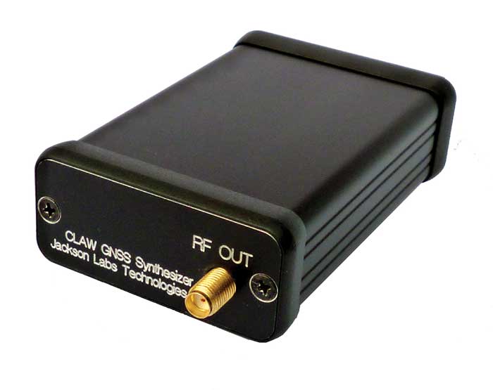
The 18-channel miniature full-constellation CLAW GPS Simulator is a fully self-contained, low size, weight, power and cost (SWaP-C) miniature GPS simulator. It is very popular in manufacturing environments as well as R&D applications that require consistent and repeatable local GNSS signals at low price points.
The CLAW simulator does not require external computers for processing and control — it works fully self-contained by simply applying power, and storing location/time/date data in internal non-volatile memory, or by storing complex vector data to simulate highly dynamic scenarios. The CLAW also can be used to transcode NMEA or SCPI position/velocity/time (PVT) data into GPS RF signals. For 2022, JLT added driver support for a large number of additional GNSS front-end receivers when using the hardware-in-the-loop (transcoding) feature of the unit to, for instance, transcode from one GNSS system to another.
JLT offers an easy-to-use, highly configurable and cost-free SimCon Windows application program that is downloadable from the JLT website. SimCon allows random scenario generation and is thus usable to simulate leap-second events, Week 1023 rollover events, or any other GPS live-sky scenarios, including highly complex yet easy-to-create dynamic vector simulations.
For authorized U.S. government users, a version that does not have altitude and velocity limitations is popular for low-Earth-orbit (LEO) simulations. Multipath simulation allows use of the entire 18-channel simulator capability.
The unit can be field-upgraded with an easy-to-use in-field software upgrade feature. The CLAW is also very useful in GNSS receiver sensitivity testing for R&D or mass-production assembly lines as it allows accurate control of RF output power ranging from –100 dBm to less than –130 dBm with 0.1-dB resolution and typically better than 1-dB accuracy over the controllable power range.
The CLAW GPS Simulator also has a built-in RF signal generator with sweep, CW and random noise functions that are useful in simulating GNSS jamming scenarios, as well as GPS spoofing scenarios. The simulator comes in an FCC-certified metal desktop enclosure with numerous accessories.
The CLAW firmware has been updated to allow live-sky almanac and ephemerides to be automatically uploaded from various externally connected GNSS receivers. This makes simulations using real-time live-sky constellations (such as used in simulating spoofing attacks) an easy task. A free firmware update is available from JLT.
High-end GNSS simulation solutions for R&D, integration and product testing
Syntony GNSS specializes in GNSS/PNT software-defined receiver (SDR) technologies, operating from receivers to test and measurements solutions. Its products and solutions address multiple markets and use cases in the space, defense and transportation industries.
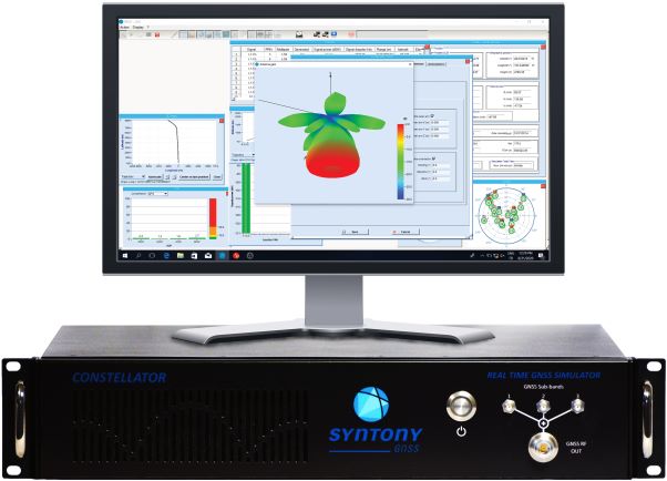
Constellator. (Photo: Syntony)
Constellator GNSS Simulator. Scalable, cost-effective, and high-fidelity SDR software-based platform supporting multi-constellation signals and frequencies (open, restricted and custom), hundreds of signals at 1-kHz iteration rate at zero effective latency, space trajectories and high dynamics. Multiple upgradable hardware configurations are available.
Constellator CRPA. Synchro-phase SDR by design, advanced jamming and spoofing, thousands of signals, 4 to 16 elements.
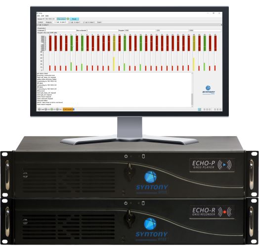
Echo. (Photo: Syntony)
Echo Recorder & Replayer. High-fidelity record-and-replay devices characterizing group-delay, scintillation, and jamming and spoofing interference, from space to ground market segments.
3 RF channels of 200Mhz sampling rate
16 bit I/Q
Up to 1.6 GB/s write/read speed.
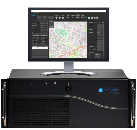
SubWAVE manager. (Photo: Syntony)
SubWAVE GNSS/GPS Coverage Extension. Universal and seamless GPS/GNSS coverage extension for rail, road and mining infrastructures. SubWAVE signals are natively compatible with every GNSS-enabled device, and the solution uses existing telecom infrastructure to broadcast GNSS signals.
Flanders uses Septentrio receivers to guide automated blasthole drills, such as at this South African mine run by AngloGold Ashanti. Photo: Anglogold Ashanti/Flanders
Flanders, a U.S.-based company with expertise in electrical machinery and control systems, has developed its proprietary ARDVARC advanced drill-rig control system to control mine-drilling machines, making them safer and more efficient. The drill rigs equipped with ARDVARC create holes with centimeter precision. This ensures optimal rock fragmentation, simplifying and expediting subsequent jobs such as stone extraction and removal.
Mines close to the poles or to the magnetic equator, such as those in the Amazon, are challenging for GNSS receivers because they tend to experience the most intense ionospheric scintillations, resulting from rapid fluctuations in the electron density in the ionosphere. These scintillations affect GNSS signals that travel from space to Earth, causing degradation of positioning accuracy or even positioning loss.
To address this challenge, ARDVARC uses Septentrio AsteRx-U GNSS receivers. They are housed in a tough IP67 enclosure and run Septentrio’s proprietary GNSS+ algorithms including IONO+, which ensures high-accuracy positioning even during ionospheric scintillations.
ARDVARC’s benefits include a faster drill cycle time, increased drill hole location precision, increased drill-rig component operating life, improved fragmentation and greater operator safety. The system is available in several levels.
The Intelli-rig manual control system also delivers data on the position of each blast hole, the machine operation and the drilling conditions; it incorporates mine-planning functionality using the mine’s existing or Flanders’ optional GPS equipment.
One-touch converts a manually operated machine to one operated with a single touch, increasing productivity. Once the machine operator positions the drill rig over the desired target, One-touch initiates the automated drilling process, which includes machine leveling, hole collaring, drilling to elevation and angle, rod handling, bit retraction and jack reset.
The fully autonomous drilling solution removes the operator from the cab, allowing one operator to monitor multiple drilling operations from a safe distance. The solution increases productivity by enabling drilling during blasting and shift changes. It uses Flanders’ HazCam to monitor the surroundings, preventing the drill from operating in unsafe conditions.
A SolarCleano F1A robot tackles a tough cleaning challenge on a solar farm in Saudi Arabia. (Photo: SolarCleano)
SolarCleano, based in Garnich, Luxembourg, makes robots that clean large solar panel installations using GNSS receivers and corrections from Swift Navigation. We asked Christophe Timmermans, SolarCleano’s managing director, a few questions about its technology.
How often do solar panels need to be cleaned?
For decades, it was believed that solar panels did not need to be cleaned due to their angle to the ground and rain. Nowadays, however, the cleaning of solar panels is widely accepted as necessary to optimize a plant’s return on investment (ROI).
How much time per sq. meter do your machines take to clean solar panels?
To provide the fastest possible ROI to our customers, we developed a range of robots to best address the needs of various solar plant layouts. A large utility-scale project with high level of soiling losses in a desert environment will need a very fast and reactive cleaning solution such as our SolarBridge B1, which can clean 24/7/365 fully autonomously. The most suitable solution for a farm rooftop in Germany that needs to be cleaned three to four times a year might be our F1 model, which can clean the equivalent of up to two soccer fields a day. It is designed for rooftops, floating panels and mid-size plants up to 50 MW. While the speed of cleaning is a very important variable, the quality of cleaning is often considered as the driver to performance, which is why we propose different types of brushes depending on the soiling types. Plus, the robot speed can be modified according to the soiling level.
Why do robots need GNSS receivers to clean solar panels?
Moving on inclined, wet glass surfaces makes odometry unreliable because robots might occasionally slip. Therefore, GNSS is the most reliable way to continuously monitor their exact position. Our robots also need path planning because they cannot operate randomly like lawn mowers. Safety is obviously a major concern; we need a very high localization accuracy to ensure that robots don’t fall off the panels. Finally, the largest solar plants are developed in dry, remote locations with high irradiation such as the Sahara, Atacama and Australian deserts. GNSS allows us to have very accurate localization even in those remote areas. In addition, this solution can easily be installed on already-existing solar plants with little capital expenditure.
What spatial accuracy requirements do the robots have for this task?
Safety is our absolute priority. Therefore, our robots need an accuracy of less than 3 cm. They also need to be aware, in real time, of changes in their surroundings, such as maintenance teams, animals and uneven ground.
On large solar farms, GNSS receivers always have a clear line of sight to the satellites and do not suffer from multipath. So, what are the key technical challenges?
Our robots have the additional advantage that they do not need to drive very fast. However, we need to manage fleets of robots on the other side of the world in regions difficult to access and with harsh weather conditions, such as very high or low temperatures and the accumulation of dust behind panels due to air vortices. We need to be able to perform remote maintenance and solve any issue from our control center in Luxembourg. These challenges make our robots increasingly robust. With a current fleet of more than 300 robots around the world, we collect lessons every day to ensure a greater reliability for our upcoming generations of robots.
Why did you choose to partner with Swift Navigation?
We share a vision with Swift: “Accessible automated solutions serving sustainable goals.” We also share other important values, such as “iterate quickly” and “focus on what matters.”