Rockwell Collins has been selected by the Defense Advanced Research Projects Agency (DARPA) to develop technologies that could serve as a backup to GPS. The research, being conducted as part of DARPA’s Spatial, Temporal and Orientation Information in Contested Environments (STOIC) program, aims to reduce warfighter dependence on GPS for modern military operations.
Under the terms of the agreement, Rockwell Collins will develop innovative architectures and techniques to enable communication systems that will support time transfer and positioning between moving platforms independent of GPS, with no impact on primary communications functionality.
“STOIC technology could augment GPS, or it may act as a substitute for GPS in contested environments where GPS is degraded or denied,” said John Borghese, vice president of the Rockwell Collins Advanced Technology Center. “The time-transfer and ranging capabilities we are developing seek to enable distributed platforms to cooperatively locate targets, employ jamming in a surgical fashion, and serve as a backup to GPS for relative navigation.”
Borghese added that the goal of the STOIC program is to develop positioning, navigation, and timing (PNT) systems that provide GPS-independent PNT, achieving timing that far surpasses GPS levels of performance. The program is comprised of three primary elements that, when integrated, have the potential to provide global PNT independent of GPS, including long-range robust reference signals, ultra-stable tactical clocks, and multifunctional systems that provide PNT information between cooperative users in contested environments.
For this third technical element, Rockwell Collins is tasked with developing multifunction communication system solutions that yield DARPA STOIC objective picosecond-accurate time transfer and enable GPS-levels of relative positioning accuracy in contested environments.
“Future applications of STOIC technology could include a variety of precision relative navigation operations, such as autonomous aerial refueling and cooperative navigation and collision avoidance within unmanned aerial vehicle swarms,” said Borghese. “It also could support precise time transfer for networking operations in contested environments.”
The Federal Aviation Administration (FAA) has entered into a Pathfinder agreement with CACI International Inc. to evaluate how the company’s technology can help detect Unmanned Aircraft Systems (UAS) in the vicinity of airports.
In testimony today before the House Aviation Subcommittee, FAA Deputy Administrator Mike Whitaker said that flying an unmanned aircraft near a busy airfield poses an unacceptable safety hazard. During the hearing “Ensuring Aviation Safety in the Era of Unmanned Aircraft Systems,” Whitaker told the congressional panel the FAA signed an agreement this week to assess the safety and security capabilities of CACI’s product within a five-mile radius of airports, and the agency also will collaborate with its government partners.
A steep increase in reports of small unmanned aircraft in close proximity to runways is presenting a new challenge for the FAA. It is the agency’s responsibility to identify possible gaps in safety and address them before an incident occurs.
CACI’s prototype UAS sensor detection system will be evaluated at airports selected by the FAA. The agency and its federal government partners will work with the company to evaluate the effectiveness of the technology, while also ensuring that it does not interfere with the safety and security of normal airport operations.
The CACI partnership is part of the larger UAS Pathfinder Program, which the FAA announced in May. Pathfinder is a framework for the agency to work closely with industry to explore the next steps in unmanned aircraft operations beyond those proposed in February in the draft small UAS rule.
“Safety is always the FAA’s top priority, and we are concerned about the increasing number of instances where pilots have reported seeing unmanned aircraft flying nearby,” said Whitaker. “We are looking forward to working with CACI and our interagency partners to identify and evaluate new technologies that could enhance safety for all users of the nation’s airspace.”
“CACI is proud to partner in the FAA’s Pathfinder cooperative research and development agreement to address the escalating Unmanned Aircraft Systems safety challenges that airports are facing nationwide,” said John Mengucci, CACI’s CEO and president of U.S. operations. “The agreement provides a proven way to passively detect, identify, and track UAS — or aerial drones — and their ground-based operators, in order to protect airspace from inadvertent or unlawful misuse of drones near U.S. airports. This CACI-built solution will help ensure a safe, shared airspace while supporting responsible UAS users’ right to operate their aircraft.”
Denver International Airport and the Federal Aviation Administration (FAA) are partnering to raise awareness about safe unmanned aircraft operations.
The agencies teamed up on a public service announcement that will run on the video towers in the airport’s main terminal. The PSA uses the “No Drone Zone” slogan to drive home the point that flying an unmanned aircraft near a manned aircraft is illegal and dangerous. It refers viewers to the FAA’s unmanned aircraft website and to the knowbeforeyoufly.org website for further information and guidance on flying unmanned aircraft safely and responsibly.
The PSA will air all day today following its unveiling at an unmanned aircraft safety press event that the airport organized and hosted. After that, it will air for two weeks surrounding the winter holidays — a time when many people will be getting drones as gifts.
Denver also will post the PSA on the airport website so it will reach travelers every day of the year.
The FAA has partnered with leading unmanned aircraft industry and hobbyist groups in the Know Before You Fly education campaign, and the campaign materials are now featured in product packaging for several types of UAS.
Antenova Ltd., manufacturer of antennas and RF antenna modules for M2M and the Internet of Things, has announced a new embedded GNSS antenna named Sinica, which operates on the 1559-1609 MHz satellite bands. The Sinica antenna uses a novel design approach and new materials to achieve high performance from an ultra low-profile antenna, Antenova said.
Sinica is suitable for all positioning applications on the 1559-1609 MHz bands. It operates with all of the public satellite constellations — GPS, GLONASS, Baidou and Gallileo — which means it can provide accurate positioning combined with global coverage.
The Sinica antenna is created from FR4 materials and new dielectric constant laminate substrates. It uses a new approach to antenna design, which has enabled the company to create an antenna with the high performance of a ceramic patch antenna, in a low profile part that can be placed neatly within a small printed circuit board, Antenova said.
Sinica is designed for devices that need accurate positioning or tracking globally, which means it is suitable to use in drones, network devices and wearable electronics, or any other portable device or tracking application.
Antenova’s product designers recently introduced the concept of “Design For Integration” (DFI), which considers how the antenna will operate when it is embedded with a manufacturer’s product. Antenova’s antennas are used within a customer’s design, so they are designed to provide superior RF performance from within the device, and to make the integration of the RF elements easier for the designer, the company said. In addition to this, Antenova provides its customers with technical support during the design, integration and testing phases.
Earlier this year, Antenova announced three new families of antennas for the fast growing M2M, wireless and IoT sectors. Sinica belongs to the lamiiANT family of new antennas for these market sectors.
The antennas are supplied on tape and reel and are available through distributors worldwide. Go to www.antenova-m2m.com for more details, or to request an evaluation board for the Sinica antenna.
Amazon has announced a plan for its package-delivery drones, according to NBC News.
The proposal includes tiered flight zones that would limit small unmanned aircraft systems (sUAS) to slow speeds in airspace below 200 feet and allow them to fly faster for long-distance travel between 200 and 400 feet.
Commercial aircraft are governed by the Federal Aviation Administration’s (FAA’s) Air Traffic Control, and in Amazon’s vision, there would be a similar central command and control network that takes in data about the position of each drone and shares it with every other vehicle connected to the network. The command and control network would also have vehicle-to-vehicle communication, similar to networks proposed for autonomous automobiles.
Amazon’s plan would be to use the space below 500 feet — minus a 100-foot buffer — for small drones such as its Prime Air vehicles.
Access to the various layers of the airspace would be governed by how well a drone can communicate with its pilot, the command and control network and other drone, according to The Verge website. “Everyone can have access to the airspace,” said Gur Kimchi, who heads up Amazon’s Prime Air program. “It doesn’t matter if you’re a hobbyist or a corporation. If you’ve got the right equipment, you can fly.”
Someone operating a radio-controlled quadcopter with no Internet connection would be relegated to the area below 200 feet.
Progressive Technology Federal Systems Inc. (PTFS) has introduced Droneware, a geospatial content management system (GeoCMS) for unmanned aerial systems. Droneware facilitates the storage, discovery and dissemination of virtually any type of sensor data captured by a UAS or unmanned aerial vehicles.
PTFS is the provider of the Knowvation Enterprise Content Management System (ECMS) for users of geospatial data. PTFS unveiled the new system at the 2015 Esri User Conference being held July 20-24 in San Diego, Calif. PTFS will demonstrate Droneware GeoCMS in booth #N1332 at the San Diego Convention Center.
“Unmanned Aerial Systems capture large volumes of data that must be quickly organized, interrogated and disseminated immediately,” said Dan Quinn, PTFS vice president. “Droneware makes it easy to manage enormous archives of UAS data so the right image, video or other sensor data can be found and accessed instantly.”
A thin client/server-based solution requiring only a web connection, Droneware runs on a PC in the office or handheld device in the field enabling the user to interrogate local or remote UAS data storage anytime from anywhere. Droneware is built on the Knowvation ECMS technology, which commercial and government organizations use to manage raster and vector geospatial data as well as video, audio and text-based content across multiple large data archives.
The primary appeal of Droneware to UAS and UAV data users is its simple and intuitive search and browse capability for data discovery. Users can perform geospatial queries by typing a geographic name or word, entering latitude/longitude coordinates or preforming a visual search by drawing a rectangle on a map interface. Droneware performs the search on the entire archive regardless of data type or file format.
“Droneware is configured and ready for use in minutes for fast and effective support of any UAS data application,” Quinn said.
PTFS offers the option of deploying Droneware as the client’s repository of record in which all UAS content is ingested, stored, managed and searched inside the application. Droneware can be purchased on the Amazon Marketplace and deployed in various EC2 cloud instances for commercial use or for the hobbyist.
AWS Marketplace enables customers to compare options, read reviews, and quickly find the software they want. Visitors seeking Droneware in AWS Marketplace can purchase and launch Droneware with 1-Click deployment. Droneware is then available for consumption on an hourly or annual basis.
Flightline Geographics and Tablerock Land Survey have partnered to provide industry-leading premium 3D aerial imagery from Unmanned Aerial Systems (UAS) for pipeline and electric transmission projects across North America. The announcement was made at the International Right of Way Association annual conference and trade show.
FlightlineGeo is a GIS company that has been involved in professional UAS since 2012 and is able to provide base mapping and 3D terrain modeling through the use of drones for energy corridors and other areas of interest. Resolution and delivery times are far better than traditional manned sources and costs are significantly lower. “GIS is a technology that depends upon up-to-date content and UAS is now a cost-effective way to provide aerial visual intelligence for GIS, in the form of stunning 3D Imagery. All delivered in days, not months,” said FlightlineGeo Founder and CEO Devon Humphrey.
Tablerock provides complete survey, right-of-way, and project management/inspection services for projects of all sizes. “One of the challenges we have faced has been obtaining current aerial imagery and topographic information that meets industry needs for project design and GIS within the United States. On most projects, our clients are limited to whatever current satellite imagery is available on the Internet, but it is often dated and of low quality. Content from FlightlineGeo changes all that,” said Andrew Darlington, President of Tablerock Land Survey.
FlightlineGeo is an ESRI Partner Network Company based in the Austin, Texas, area, and Tablerock Land Survey is based in Denver, Colo.
The U.S. Department of Transportation’s Federal Aviation Administration (FAA) today announced a partnership with industry to explore the next steps in unmanned aircraft operations beyond the type of operations the agency proposed in the draft small unmanned aircraft systems (UAS) rule it published in February.
“Government has some the best and brightest minds in aviation, but we can’t operate in a vacuum,” said U.S. Transportation Secretary Anthony Foxx. “This is a big job, and we’ll get to our goal of safe, widespread UAS integration more quickly by leveraging the resources and expertise of the industry.”
FAA Administrator Michael Huerta announced the initiative today at the Association for Unmanned Vehicle Systems International Unmanned Systems 2015 conference in Atlanta, Ga. See more coverage of the show from Geospatial Solutons.
The FAA is working with industry partners on three focus areas, including:
Visual line-of-sight operations in urban areas: CNN will look at how UAS might be safely used for newsgathering in populated areas.
Extended visual line-of-sight operations in rural areas: This concept involves UAS flights outside the pilot’s direct vision. UAS manufacturer PrecisionHawk will explore how this might allow greater UAS use for crop monitoring in precision agriculture operations.
Beyond visual line-of-sight in rural/isolated areas: BNSF Railroad will explore command-and-control challenges of using UAS to inspect rail system infrastructure.
“Even as we pursue our current rulemaking effort for small unmanned aircraft, we must continue to actively look for future ways to expand non-recreational UAS uses,” Huerta said. “This new initiative involving three leading U.S. companies will help us anticipate and address the needs of the evolving UAS industry.”
The three companies reached out to the FAA to work on research continuing to expand use of UAS in the nation’s airspace. CNN and the FAA already have been working together through a Cooperative Research and Development Agreement (CRDA). BNSF has a draft CRDA that is nearly complete and PrecisionHawk has been working with the FAA on a possible research partnership.
Further developing these operational concepts supports the FAA’s overall strategy to expand UAS access, which currently includes rulemaking, reviewing operational data from the six national UAS test sites, expanding commercial operations via the Section 333 exemption process, and issuing operational authorizations for type-certified UAS.
The FAA published a proposed rule for small UAS on February 23, 2015 and received nearly 4,500 public comments by the end of the comment period on April 24. The agency will work as quickly as possible, but must address all the comments submitted before finalizing the rule. The number and complexity of the comments will play a role in determining the timeline for a final rule.
The National Association of Broadcasters meeting in Las Vegas draws 100,000 attendees annually, making it one of the largest trade shows in the country. However, besides timing and some very niche markets, it has not been a big show for location companies. That is, until now, when NAB welcomed drone manufacturers, all of which embed GPS in their flying aircraft.
Kevin Dennehy
LAS VEGAS — Commercial drones, a growing market for location companies, was one of the most popular topics at the National Association of Broadcasters Show, held here April 13-16.
The market for drones has grown nearly five times in the last few years, said Eric Cheng of DJI, which uses GPS in its virtual positioning system that monitors and controls the aircraft. The company markets what they call “flying cameras” that look suspiciously like drones. “The market was initially hobbyists, but now some major broadcast players are buying the cameras,” Cheng said at the Showstoppers trade event the day before NAB.
Most of the drones offer GPS-based automatic flight stabilization technology. Some even offer a long-range wireless signal and low-latency video transmission.
Many of the drones are programmed so they don’t go higher than mandated FAA rules or go into restricted, no-fly aviation zones — and all use GPS to do this. Some of the drones even return to the user automatically when their batteries run low.
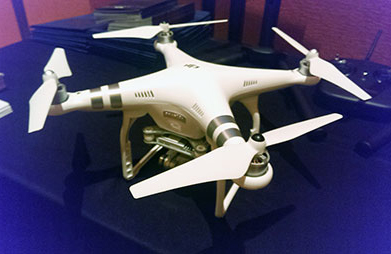
DJI drone with embedded GPS.
DJI offers three cameras for the drones. The high-end Phantom 3 Advanced offers 1080P HD video at 60 frames per second. The 1080P version costs $995.
In terms of privacy and government regulation, U.S. regulators are way behind Europe, Cheng said. “Other countries are way ahead of the [United States] in terms of working with drone companies,” he said. “In terms of privacy, the step ladder was the first tool for the invasion of privacy. They haven’t outlawed step ladders.”
The slow U.S. regulatory process has forced some manufacturers to go to other countries to test their drones, said Roger Sollenberger, 3D Robotics’ editorial director. “[U.S. regulations] have moved slowly here — despite the government knowing about worldwide drone rollouts. In Japan, they have been using drones to crop dust for 20 years,” he said.
Furuno’s Don Hanham with GNSS modules at NAB.
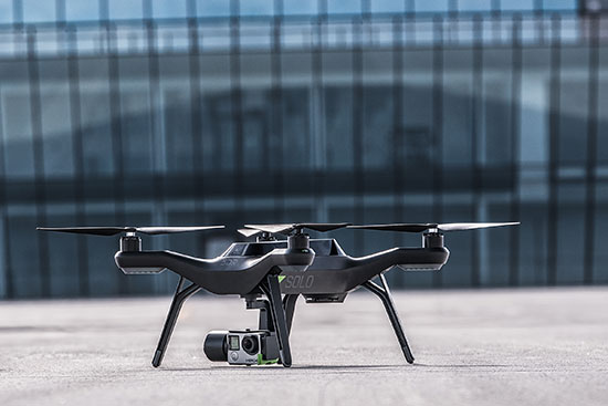
To signal increased interest in the commercial drone market, 3D Robotics raised $70 million dollars in funding, led by investor Qualcomm, Sollenberger said. The company, which partnered with action camera giant Go Pro, says its Solo drones can be used not only by broadcast companies, but for railroad track and building inspections.
As GPS World reported, Furuno Electric Co.’s latest multi-GNSS receiver module, GN-87, has been adopted for the new quadcopter Bebop Drone. The broadcast market has been a good one for company’s timing products, drone integration and even weather prediction, said Don Hanham, a Furuno sales and marketing consultant.
Furuno is marketing its Doppler Weather Radar System for broadcast. The system allows weather predictors to follow the development of short, localized rainstorms and extreme weather conditions.
Booz Allen Hamilton Releases Report on 2015 Automaker Priorities
The era of automotive connectivity, and subsequent heavy competition, is the focus of Booz Allen Hamilton’s new report, “Getting the Customer Experience Right: Auto Industry Priorities in 2015.”
The company says that automakers should consider six key priorities this year: deliver innovation in months, not model years; differentiate with new partnerships to catch customers’ attention; secure connectivity to reinforce a relationship of trust with customers; address the “so what” of connected cars; personalize the customer experience via the tremendous potential buried in data; and find and build the market for alternative fuel vehicles.
In terms of big connected vehicle technologies this year, Jon Allen, a principal with Booz, cites 4G pipe in GM and Audi vehicles and over-the-air updates by Ford and BMW, among others. “New parental controls in the Chevy Malibu report average speed and near misses while also preventing drivers from turning on the stereo until seatbelts are fastened. It’s easy to imagine this across vehicles, with parents receiving text messages in real time,” he said.
Allen said, in terms of vehicle connectivity, automakers must answer the “so what” to set themselves apart from the competition. “We have yet to see the seminal, game-changing connectivity plays. Most companies are still in the ‘features’ mindset, offering new à la carte enhancements,” he said. “They’re not yet articulating a top-down strategy for re-envisioning the customer experience with connectivity.”
One of the company’s six priorities concerns connected security, which has been a big industry issue since the recent release of the Markey Report, which focused on how vehicles can be hacked. “We have clients who get it. They’ve identified a senior leader to champion vehicle cyber security and backed them up with a cross-functional team that works closely with counterparts across the organization — in product engineering, supply chain, safety, privacy and IT,” Allen said. “Other OEMs are still formulating their approach. That said, there are pockets of cyber security across every organization, focused on implementing security controls on individual parts. The challenge is taking the next step —moving from this segmented, ‘assembly line approach’ to a more unified program that focuses on securing the complete vehicle ecosystem.”
Allen said the company has to speak honestly to customers and regulators about how to manage vehicle cyber security risk. “Industry leaders must prioritize their security approach to ensure that higher risk scenarios are addressed first, rather than try to take on all elements of the challenge at once,” he said.
Another priority addresses the long lead times, by automakers, to develop and roll out new features, which is a challenge, Allen said. “Consumer electronics, telecommunications and software companies are redefining the traditional industry boundaries that once distinguished them from OEMs. These companies focus on connectivity and services from the start of their product design process,” he said. “The key for automakers going forward is to continue learning from these new competitors, particularly around rethinking the vehicle lifecycle, connected product design, and managing vehicle software updates after purchase. In the near future, automakers will need different approaches to building and enhancing infotainment systems that can keep pace with customer demands.”
The marriage of autonomy and connectivity is a game-changer, Allen said. “It isn’t just about plugging vehicles in to the Internet of Things. Autonomy transforms transportation,” he said. “When a car drives you, it becomes a retail outlet, a personal assistant, even a trusted chaperone — that all depends on getting both autonomy and connectivity right.”
The rise of autonomous vehicles gets to the fundamental need for industry leaders to be willing to reimagine their product, Allen said. “Autonomous capabilities are not just about engineering a safer, more efficient, and more appealing mode of transportation. That’s important, but it’s really about a distinctly different product, one that creates a sustained, services-based relationship with the customer,” he said. “It will focus on the driving experience not just behind the wheel, but sitting comfortably inside of a self-driving vehicle. The connected, autonomous vehicle will change automotive for the better — and forever.”
Allen said his company is seeing OEMs look beyond their individual vehicles to see the emerging connected society that includes ride sharing, multi-modal transportation and connected cities. “The way we go from point A to point B will look and feel drastically different 25 years from now; many OEMs are beginning to accept the change and embrace the challenge,” he said.
The unmanned drone RQ-4 Global Hawk in flight in 2007 (Image credit: U.S. Air Force photo by Bobbi Zapka)
By Art Kalinski, GISP
For more than a decade, the military has been struggling with cataloging and retrieving its huge libraries of full motion video (FMV). The video, captured by both manned and unmanned aircraft, rapidly reached unmanageable levels. If you have ever tried to organize vacation photos after returning home from a long trip, you know that it’s easy to lose track of where each photo was taken. Date/time stamps help, but the effort is still difficult if your vacation took you to numerous locations.
The manned U.S. Air Force Beech King Air 350 and 350ER MC-12W Project Liberty Aircraft are designed for intelligence, surveillance and reconnaissance (ISR).
Now imagine trying to retrieve several critical minutes out of thousands of hours of video of barren land or repetitive-looking villages, and you get a sense of the magnitude of the problem. Without some way to catalog the video, critical details can be lost, because finding the right video clip becomes impossible in a reasonable period of time. Everyone agreed that the solution to the problem is to index the video clips by date/time and location, preferably with an exact georeferenced footprint. This is now possible with tools from Esri, Hexagon Geospatial and others.
Several years ago, at the USGIF GEOINT Tech Days, Sarnoff (SRI) demonstrated a system that pinned aerial video to its geographic footprint and maintained that registration despite the movement of the aircraft. It was an achievement that impressed everyone in the audience. I changed jobs soon after that conference and lost track of developments in the FMV field. At the February Esri Federal Users Conference, I was thrilled to see Jack Dangermond briefly demonstrate the same kind of FMV georeferencing capability in ArcGIS 10.2 during his opening plenary session. I learned that Esri developed the capability in 2013, and later learned that Intergraph (Hexagon Geospatial) also developed a similar capability in 2010.
MISB: The Critical Improvement
The key technical development that made this possible was NGA’s creation of “Motion Imagery Standards” and the Motion Imagery Standards Board (MISB). The MISB developed standards for a consistent way to capture and record telemetry data during the video capture as metadata that becomes part of the video stream. This “Open Standard” metadata includes information such as the accurate xyz location of the aircraft, attitude, tilt, camera angle, and camera characteristics. This information travels with the individual video frames and permits the GIS/viewing software to perform the georeferencing.
This process is very similar to the oblique imagery capture system used for years by Pictometry, which at 20 FPS was technically FMV. MISB like Pictometry requires accurate GPS and IMU data to continuously capture and record the metadata. The MISB also gets involved with video compression standards such as the newer H.264 used on Blu-Ray discs and streaming video. H.264 has, for the most part, replaced MPEG2 and older MPEG4 as the video compression standard of choice. Much of the video captured by low-end small UAVs is just a simple video stream with no MISB telemetry data. However, I’m sure that lower prices, increased capability and smaller size of sensors will fix that with time. Sorry, no one has yet figured a way to “hack in” the metadata for legacy video captured without the MISB telemetry data. The one exception is those videos that contain usable telemetry data that was burned into the video and can be read with OCR. It might be possible to insert that information as MISB-compliant data.
The ArcGIS Full Motion Video Add-In
The ArcGIS Full Motion Video 1.2 Add-In (for ArcGIS 10.1, 10.2 and 10.3) is a free tool for ArcGIS users. It permits users to play georeferenced live or previously recorded video files in the map view. The screen capture below shows several features of this tool and is from an online video.
The re-sizeable smaller window displays the video as it runs. The map view shows a changing footprint (green trapezoid) of the video as the aircraft flies over the site. The short green line shows the flight path of the aircraft. Demonstrating the interconnectivity of the two data sets, the user in the demo video drew a light blue polygon on the map view. Note that the Esri Intersect function re-projects and displays the same polygon correctly in the video view.
Frames from the video can be extracted as single georeferenced images or groups of images and stored as a mosaic dataset. Playback of time-stamped video data can be synchronized with other time-enabled data and played together on the map. Features can be digitized directly on the video player and will appear on the map and vice versa.
The extension supports playback and management of multiple simultaneous video feeds. The Add-In also allows you to record the sensor, frame center, and footprint data in a geodatabase so the Bookmark Manager can perform searches for bookmarked video scenes. For more information regarding the Esri FMV tool, visit this ArcGiS site.
Hexagon Geospatial GeoMedia Motion Video Analyst Professional
Another robust FMV system that takes advantage of MISB telemetry is GeoMedia Motion Video Analyst Professional (MVA) from Hexagon Geospatial. The Hexagon Geospatial system includes tools to catalog videos as geospatial features with attributes extracted from the metadata, and has some elegant graphic selection tools that help an operator search and retrieve needed video clips.
In the screen capture below, you can see the map view with the geo-registered color video overlaid on the black-and-white ortho base image. As the video plays, the georeferenced video footprint continuously moves to the correct location as the tracking graphics in red show the position of the aircraft. The transparency of the video can be adjusted so an operator can compare features between the base image and the video and digitize directly in the map window.
MVA also includes a full set of tools for placing clipmarks as geospatial features with attributes and linked to the cataloged video, extracting snapshots and videos clips, on-the-fly enhancements, stabilization, registration and more. The system also facilitates rapid report generation so as an operator searches and plays appropriate video clips, the same operator or a partner can rapidly generate reports as documents or PowerPoint presentations in minutes. Another feature of the system is a “de-hazing” tool that removes a surprising amount of haze or smoke.
See a very good video overview of GeoMedia Motion Video Analyst Professional on this Hexagon Geospatial page. Like the Esri video, both are far better at explaining the capabilities than I can in this short column.
Other defense contractors are taking advantage of the MISB metadata, so check with your provider. Although these systems found their first home with military analysts, the Esri and Hexagon Geospatial reps indicated that many other users are finding the capability valuable in their work. Emergency operations centers come to mind first, but more mundane uses include rail and utility property management, the news media and video used in court proceedings. So, if you shoot lots of aerial video and need to catalog and retrieve video clips quickly, consider using MISB in your capture process.
That means you can’t fly drones if it’s related to business, no matter if you charge a fee or not. But, you can fly drones in the United States as a “hobbyist” as long as you adhere to certain rules (such as flying lower than 400 feet above the ground).
In a new twist, the FAA has cracked down on at least one person who posted a drone video on YouTube because YouTube generates revenue, reports the website Motherboard. Even though it appears the drone was being flown by a hobbyist for recreational purposes, it smells to the FAA like a commercial use of drone. Even though the hobbyist isn’t generating revenue from it, Google is.
Jason Hanes’ YouTube channel.
While it appears the U.S. drone community is going nuts using drones for all kinds of non-commercial and commercial purposes, despite the FAA rules, it appears there are too many violators for the FAA to chase after since enforcement notices sent by the FAA have been few and far between. In this case, safety concerns may have been the prompt. The FAA says it’s now looking further into how its safety inspectors send letters like this. Read more about the case at the Motherboard website.
Geospatial Data Interest Crosses Political Party Lines
Senator’s Mark Warner (D-Va.) and Orrin Hatch (R-Utah) introduced the Geospatial Reform Act, targeted at leveraging geospatial data acquired by the U.S. federal government. This bill argues that the federal government is the largest purchaser of geospatial data, yet agencies aren’t required to report details of geospatial data purchased. The bill aims to change that.
“Geospatial data has endless possibilities for transforming both the private and public sectors — from helping local governments develop emergency preparedness plans to fueling the creation of apps that let you find parking spots, restaurants, and even homes for sale based on where you’re standing,” said Sen. Warner. “The federal government is the largest purchaser of geospatial data but some very basic questions about how and where agencies are already investing in this data can’t be answered. Our bill would bring transparency and accountability to the collection of this data and ensure that taxpayer dollars are not being wasted on duplicative efforts.”
In what DigitalGlobe claims is a world’s first, the company began offering commercial 30-cm satellite imagery via its WorldView-3 satellite, which was launched August 13, 2014. DigitalGlobe announced that the imagery is available worldwide (with some restrictions). As part of its press release, DigitalGlobe offered the following quote from PhotoSat, a consumer of imagery.
“DigitalGlobe’s WorldView-3 satellite data is the highest quality satellite photo data that PhotoSat has ever processed,” said Gerry Mitchell, President of PhotoSat, a leading satellite elevation mapping provider for energy, mining, and engineering firms. “In one test, an elevation mapping grid extracted from stereo WorldView-3 satellite photos matched a highly accurate LiDAR elevation grid to better than 15 cm in elevation. This result takes satellite elevation mapping into the engineering design and construction markets and directly competes with LiDAR and high resolution air photo mapping for applications like flood plain monitoring.”
According to DigitalGlobe, WorldView-3 is the first and only commercial imaging satellite capable of collecting imagery with 30-cm ground sample distance, and claims it is five times the detail of the company’s nearest competitor. See a sample by clicking here.
Satellite imagery is approaching aerial photogrammetry quality. I recall Lawrie Jordan, founder of ERDAS (sold to Leica) and now director of imagery at Esri, saying that eventually every square inch of the earth will be imaged constantly by satellite.
Esri and Drone Data Up until now, you haven’t heard the words “Esri” and “drone” mentioned in the same sentence very often. Last week at the Esri Developer Summit in Palm Springs, Esri provided a live map-creation demo using a small quadcopter.
Look for a follow-up article, data example and possibly a video of the event.