Sierra Wireless, a provider of fully integrated device-to-cloud solutions for the Internet of Things, has completed the acquisition of GlobalTop Technology’s GNSS embedded module business for $3.2 million.
GlobalTop’s GNSS embedded module portfolio will become part of the Sierra Wireless OEM Solutions product line, and the GNSS staff from GlobalTop will join Sierra Wireless.
GlobalTop’s GNSS products generated $5 million in revenue in the last 12 months, and the business is break-even, Sierra Wireless said.
“Building on our portfolio of cellular, Wi-Fi and Bluetooth modules, we will have additional products to offer to our customers in markets where positioning data is critical, including high-value asset tracking, telematics, drones and automotive,” said Dan Schieler, senior vice president and general manager of OEM Solutions for Sierra Wireless.
The TitanX1 GNSS antenna.
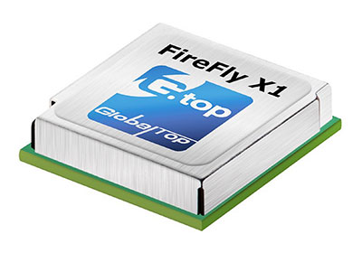
GlobalTop GNSS modules include the Firefly, Ivory and Hummingbird series (GNSS standalone), and the Titan and Ladybird (GNSS with antenna). GlobalTop launched the Titan X1 module in February.
“With a wide array of modules and established sales channels, as well as a proven engineering team, we believe that the GlobalTop GNSS business is an important addition to Sierra Wireless,” Schieler said.
Assessing the health of an entire industry is not an easy task, but talking with industry leaders and looking for examples of growth and investment can help.
Our “State of the UAS/UAV Industry” inquiries have lead to discussions with General Atomics, Association for Unmanned Vehicle Systems International (AUVSI), Aeryon Labs and SensoFusion. SensoFusion might be a little well less known that the others, but we felt the need to include the views of an anti-drone system supplier to counterbalance the industry’s perception of itself.
Discussions included questions around the following issues:
The level of maturity of common technologies in use on UAV platforms and systems?
The level of maturity of integration of those technologies?
A sketch portrait of the industry?
Rough numbers or percentage of small players versus large ones?
The rate of consolidation of companies (has it happened or has it yet to happen?)
The financial underpinnings of the market — does it have real “legs” or will it be like the first Internet boom/bust?
If we start with a top-level overview of the industry, as a whole we find that on the commercial side it’s an industry trying to figure out what it is and who its customers might be. But there is also a well-established military part of the industry that is quite mature. A large number of multi-rotor UAV suppliers use simple handheld controllers, all aimed at different applications where they are seeking a niche. The FAA’s release of regulations last year for use of small unmanned vehicle systems (sUAS) has provided a real boost to many more commercial pay-for-service ways these vehicles are now being used.
Multi-rotor UAVs are being put to use in surveying, filmmaking, newsgathering, real estate, crop and pipeline inspection, firefighting, law enforcement, security, search and rescue, and disaster monitoring and relief, just to mention a few applications. And, of course, home/hobby flying your own drone in your backyard or open areas has fueled the Chinese DJI drone manufacturers’ growth significantly. While the FAA requires registration of these private drones, it has not prevented an increase in commercial passenger aircraft pilot reports of UAV incursions into controlled airspace, which appear to be on the increase.
Then there are small, medium and large fixed-wing UAVs that appear to have been mostly developed for and used by the military. Hand-launched surveillance drones for small groups of ground troops; mid-sized, longer range surveillance drones finding applications in commercial inspection; and the bigger General Atomics Predator type aircraft which have become the U.S. military’s search and destroy long-range vehicle, which can carry significant ordinance. At the top end, we have UAVs like Global Hawk which are used for very high altitude, long-endurance surveillance. Not forgetting target drones like the Northrup Grumman BQM-74E, which earns its living pretending to be an enemy anti-ship cruise missile for the U.S. Navy.
Global Hawk (Photo: USAF)
BQM-74E target drone.
Commercial Growth Anticipated
Brian Wynne, president and CEO of the Association for Unmanned Vehicle Systems International (AUVSI), believes for the commercial segment that, “The UAS industry is primed for incredible growth. UAS are being used in all 50 states by industries like real estate, agriculture and the oil and gas industry for more than 40 different types of business applications, including aerial photography, emergency management and utility inspection.”
More than 500,000 people have registered their UAVs with the FAA in the U.S., and around 20,000 of those are looking to start commercial operations. AUVSI expects more than 100,000 jobs will be created when UAS are integrated into and allowed to operate in the U.S. National Airspace System (NAS).
However, Wynne went on to comment, “This this can only happen if the government puts in place a true, holistic plan for full UAS integration that includes flights over people, as well as beyond line-of-sight operations, access to higher altitudes and platforms above 55 pounds.” AUVSI estimates that in the first decade after full UAS integration into the NAS, these commercial operations could generate more than $82 billion is economic impact.
Even before the FAA’s release of formal regulations (known as Part 107) for use of sUAS in June last year, more than 5,500 businesses received approval to fly for commercial purposes. AUVSI published a report that analyzed these applications — the analysis provides an overview of the developing commercial UAS industry in the U.S.
AUVSI analysis of initial UAS applications.
Over 90 percent of these businesses make less than $1 million in annual revenue and have fewer than 10 employees. This also provides an indication that the engine behind this growth comes from small, independent business.
Nevertheless, big organizations such as CNN are also exploring visual line-of-sight operations over people and safely using UAS for newsgathering in populated areas. PrecisionHawk is testing extended visual line-of-sight operations in rural areas, aimed at precision agriculture, and BNSF Railway is testing beyond visual line-of-sight (BVLOS) operations, in rural and isolated areas, for the inspection of rail system infrastructure. These tests are being conducted as part of the FAA’s Pathfinder Program.
More recently, anti-drone systems have joined the party to help defend against unwanted UAV incursions into secure areas already protected by conventional systems like radar, acoustic and optical detection systems. Secure areas include such places as prisons, government buildings/facilities, utility companies (including nuclear power stations) and airports. Sensofusion in Finland is one such company, with its Airfence anti-drone system — one of three anti-drone systems tested last November by the FAA at Denver airport. The other systems were supplied by CACI International and Liteye Systems.
Kaveh Mahdavi, VP of Operations for Sensofusion, thinks that, relatively speaking, the UAV industry is quite mature — what’s still being developed are systems to enable autonomous drone flight. The regulations published so far only address ground-pilot-controlled operations, even though BVLOS testing is progressing well.
Anti-Drone Systems
On the other hand, the maturity level of anti-drone systems range from proven to embryonic. As many as 50 companies with different technical solutions are vying to succeed in this new segment. But as the UAV segment continues to grow, so does the need for detection and prevention of drone incursions.
These systems employ three basic technologies: radar, optical and RF. Radar and optical need direct line of sight and cannot see “over the horizon.” That makes them quite short-range, and detection and defense has to be exceptionally quick to prevent unwanted UAV flying visits. Whereas, the Airfence RF system is omnidirectional and can even detect UAS preparing for take off up to six miles away, as demonstrated at the Denver airport.
So, intrusion warnings at a geo-fence distance of, say, 3-4 miles can be generated, and automatic defense/prevention is readily achieved. For instance, some utility companies want to have detection, warnings and control of intruder drones within a mile of their facilities.
Mahdavi went on to describe how Airfence uses a library of drone control RF signatures for all known UAS, with new signatures being added on a regular basis. They can detect, intercept and directly take control of the offending vehicle. During the Denver tests, Airfence initially only detected one third of the target UAVs, but the RF signatures of all targets were acquired. Then, using remote engineering updates to the library, by day three all were detected. With lower prices, consumer drones are becoming a real threat for these sensitive areas.
The anti-drone industry will no doubt face considerable consolidation over the next couple of years, but Mahdavi feels that Sensofusion is well placed with significant military and government business, which is funding their growth without external investment. “Securing the right contracts with the right customers,” as he says, has well positioned the company for now and the future.
General Atomics Aeronautical Systems Inc. (GA-ASI), makers of the well-known Predator, Reaper and other Medium-Altitude Long-Endurance (MALE) drone systems, has been in this business for almost 25 years. GA considers its products to be proven, mature and resilient for the military and government markets that demand them to be so. The company uses “best of breed” in-house products and technology across the range of air and ground systems that make up its highly successful drone systems.
In an effort to align with European customer interest, GA-ASI has been investing in a “certifiable” version of the Predator-B, recently named SkyGuardian. A derivative for marine applications will be known as the SeaGuardian.
SeaGuardian.
SkyGuardian.
Just as military transport aircraft want to transit through civilian airspace and, in order to do so, have been equipping with certified navigation systems for a number of years, military drone operators want to be compatible with Europe’s high-density commercial flight regulations and to operate within existing air-traffic control corridors. To arrive in time for these European programs, GA-ASI has invested to get ahead of the market. This has entailed assessment of all on-board and ground components, and has led to upgrades and re-designs where necessary.
“Nevertheless, on existing product lines, there is a large degree of commonality across common systems on multiple platforms,” said Mike Cannon, VP of international programs. Common systems include datalinks, power avionics, de-icing systems, and some airframe components.
GA-ASI has developed and integrated its own flight control system in its aircraft for more than 20 years. This has proven to be a key element of the success for the Predator family of products. Because all these systems have been flying for so long, they have been proven and become very reliable, dependable elements of the company’s unmanned systems.
Having said that, Hughes Network Systems has just announced that its Defense and Intelligence and Systems Division (DISD) has been selected by GA-ASI to provide satellite communications on the “Type-Certifiable” Predator B Remotely Piloted Aircraft (RPA) system. Working with GA-ASI, Hughes will customize the aircraft’s satellite communications system with modified Hughes HM series modems. The advanced modems will enable a significant increase in data transfer rates, using an enhanced waveform that ensures resilient and secure communications when operating in challenging environments.
So, its very difficult for new start-up companies to enter this top level segment of the UAV market — its very expensive to develop, demonstrate and prove large airframes, control systems and avionics that customers can rely on. GA-ASI has a unique position alongside major suppliers such as Boeing, Northrup Grumman, Israel Aerospace Industries (IAI), and Lockheed Martin — however, Chinese UAS are beginning to show up in the marketplace, apparently as a result of significant, focused investment.
Nevertheless, with an enviable position as a major supplier of platforms used in multiple applications, with sufficient internal resources to fund their initial vehicle developments, GA-ASI has secured a large number of programs with multiple follow-on orders and funding for increasingly more capable derivative UAS. As the company now looks towards the “certifiable” segment using another internally funded product launch, it is again reinforcing its leadership position in its chosen unmanned market segment.
Small UAS by Aeryon Labs
Meanwhile, the world of small unmanned air vehicles (sUAS) continues to thrive, given the release of FAA regulations last year, and many commercial applications are blossoming, using increasingly capable small multi-rotor drones. David Kroetsch, CEO and co-founder of Aeryon Labs in Ontario, Canada, thinks that the sUAS segment is maturing from an early adoption phase into providing utility to a growing number of organizations. Aeryon is an established player in the sUAS market and has been around for more than 10 years, so it has also had time to prove its platforms and internal systems. Aeryon also built its own flight-control hardware and software, which enables the company to gain substantial power savings and get longer endurance from how it automatically manages rotor speeds.
“The quad platform has been around since 1938, so the concept is hardly new; however, over the last decade, Aeryon Labs has substantially matured and ruggedized our platform, the Aeryon SkyRanger sUAS,” said Kroetsch. Their focus is on not only on the UAV platform, but also on supplying complete systems that meet the various needs of their customers. With electro-optical and thermal-imaging camera payloads and an on-board georeferencing data collection/processing system, Aeryon provides integrated solutions for customers, such as AeryonLive Video and Telemetry and AeryonLive Fleet Management using real-time software tools.
Aeryon SkyRanger sUAV.
AeryonLive tools.
For the oil and gas industry, providing compatibility for off-line flight planning software inputs and importing compatible aerial imagery into existing GIS systems is a significant feature for these customers. The SkyRanger UAS has benefited from many years of use in the field, and has been designed with modularity and ease of use with snap-on/off parts that make operating in bad weather a lot easier.
Aeryon’s business is currently 50%military, 25% oil and gas and 25% public safety (such as rapid traffic accident data gathering). Other entrants to these segments might find it easy to put together an unmanned system from parts bought on the internet; what comes considerably harder is proving reliability and interoperability with existing customer systems. Actually, to develop an industrial-grade UAV takes lots of investment and requires experience gathered over many years. Customers have learned how to differentiate between those dabbling in the market and those with serious capabilities.
Consolidation is inevitable in this market segment — perhaps within the next six months, certainly over the next two years — just because there are so many companies trying. Investment is getting harder to find for these start-ups and it may be too late for most, as the leaders are already well established.
“It’s essential to pick a niche within the increasingly competitive UAV industry,” Kroetsch said. “This is why Aeryon chose early on to focus on enterprise-level offerings in commercial, public safety and military.”
Recall what happened to 3D Robotics. Even though 3D Robotics raised many millions in funding, its Solo quadrotor fell from grace, perhaps due to continuing design issues and being higher priced compared to rapidly declining DJI Phantom 3 prices. “‘Competition and consolidation look to be very similar to that which happened with digital cameras,” Kroetsch said.
For Aeryon, being Canadian appears to be an advantage right now, as U.S. export regulations seem to be handicapping U.S. drone manufacturers. Aeryon sells in 35-40 countries because its product does not contain military-restricted components and only uses commercial parts. Canadian regulations for drone system exports do not prohibit world–wide sales for such products, while U.S. regulations can be difficult for U.S. suppliers to negotiate.
Nevertheless, unexpected hurdles to adoption still exist, such as company policies related to health and safety, union restrictions, and potential internal clashes on responsibility for implementation. But with 100% test, and a hardened design for tough environments, Aeryon sees itself well positioned to grow in its chosen industrial sector.
Conclusion
This has been a brief and incomplete overview of the UAV/UAS industry — a first try, if you will. Nevertheless, it’s a summary that we can use a benchmark for where we are right now, and a departure point for future growth.
We have quite mature capability in both large and small UAS, with integration focused on flight-control and navigation systems. The larger UAS enjoy a relatively mature market with established suppliers of lower numbers of expensive systems, while the sUAS segment is larger, younger and less expensive, with not as many barriers to entry.
Nevertheless, there are mature industrial segments with harder, more integrated requirements that make it hard for new entrants to climb the steps into more difficult commercial operations. The recreational segment is dominated by DJI, and it remains strong with well-performing, easy-to-operate drones.
Because of the ease of access to smaller drones, despite FAA and other countries’ regulations, people seem to want to penetrate secure facilities such as utilities, airports, military bases, prisons and other government locations. Therefore, anti-drone systems using optical, radar and RF are becoming available, and facilities are being equipped to prevent unwanted drone incursions.
AUVSI xPONENTIAL
I’ll be roving the show floor at the upcoming AUVSI xPONENTIAL show in Dallas, and I welcome your added insight, from all corners of the UAV industry, for a continuation of this assessment in an upcoming Professional OEM & UAV e-newsletter column (subscribe free at gpsworld.com/subscribe).
OriginGPS has released its new ORG 4500 series, which is a fully-integrated product that supports ultra-compact applications for both GPS and GLONASS.
The ORG 4500, kin to the ORG 4400 series introduced in 2016, addresses the increasing demand for high precision with the smallest possible footprint, and takes the company’s ultra-small form factor to a new level.
OriginGPS ORG 4500 is designed for ultra-compact IoT applications such as wearables, smartwatches, clothes and pet trackers, drones, connected cars, and health testing and tracking devices.
“The newest GNSS product perfects the industry’s most comprehensive GNSS/GPS family of solutions,” said Haim Goldberger, CEO of OriginGPS. “Our modules readily resolve the industry’s acute pain points of unreliability and sensitivity in the commercial, engineering and defense sectors, enhancing the quality of experience and helping our customers remain competitive.”
OriginGPS offers a range of fully-integrated GNSS/GPS and antenna solutions, encompassing a wide gamut of standard and essential tools for navigation. The small form factor and high sensitivity of OriginGPS’s modules enable new business models, like “machine as a service,” and are suited for a variety of applications, such as wearables, like smart watches and pet tracking, as well as smart cities and drones.
OriginGPS modules are deployed around the globe in key sectors, such as transportation, civil engineering, precision agriculture and time reference.
Narrowband IOT platform. Ramping up the race to offer the best Narrowband IoT (NB-IoT) products, OriginGPS continues to expand its presence in the global navigation market with a steady stream of new IoT-enabled solutions, such as its recently released IoT platform (ORG 2100).
A key theme again at this year’s Mobile World Congress was the Internet of Things, with an additional focus on the challenges of ensuring interoperability of home and industrial applications. OriginGPS’s IoT Platform effectively removes usability challenges with a plethora of customizable sensors, such as temperature, pressure, accelerometer, light and humidity.
OriginGPS will showcase its range of mini + mighty GNSS/GPS modules at Embedded World 2017, Germany, March 14-17, hall 3, booth 121.
The project, Drones2GNSS, also took home the Special Prize offered by the European GNSS Agency (GSA).
Space Geomatica Ltd.’s Tripolitsiotis Achilles joined with Panagiotis Partsinevelos, SenseLab Research, Technical University of Crete, to develop Drones2GNSS.
In the tracking procedure, the engineer with the surveying pole might move around, yet the UAV tracks in real time and provides the GNSS coordinates.
Drones2GNSS includes a prototype drone equipped with a highly accurate GNSS receiver and a camera/laser measuring system that retrieves the coordinates of custom surveying poles featuring Wi-Fi, a prism and a target marker.
The team’s image processing algorithms and error correction techniques provide real-time, centimeter-level coordinate estimation and can simultaneously measure multiple moving surveying poles.
The processing is performed on-board the UAV without any ground-based hardware. In this way, Drones2GNSS provides a fast, reliable, cost-effective alternative for absolute coordinate positioning in obstructed environments where GNSS fails. It can cover multiple targets, including cars, people and vessels.
It also offers a basis for other related challenges, including UAV GNSS networks, indoor positioning and error mitigation.
“Although Galileo Initial Services are expected to enhance the accuracy of existing solutions, Drones2GNSS proposes an off-the-shelf application that uses European GNSS (Galileo, EGNOS) as the primary means of positioning,” Tripolitsiotis said. “As GNSS signals are degraded in obstructed environments by skyscrapers, vegetation and geomorphology, our project proposes using drones as intermediate carriers of high-precision GNSS signals that can then transfer the geolocation accuracy to the ground.”
Drones2GNSS relies heavily on multi-constellation GNSS signal, which is where Galileo will make the difference. “As current constellations like GPS and GLONASS have proven inefficient in confronting the aforementioned surveying problem, the sector continues to rely on traditional surveying techniques,” Tripolitsiotis said. “However, with the launch of the Galileo era and the utilization of the Drones2GNSS approach, we can now provide surveying engineers a cost effective, accurate and fast positioning solution.”
NASA’s concept for a possible UTM system would safely manage diverse UAS operations in the airspace above buildings and below crewed aircraft operations in suburban and urban areas. (Image: NASA)
Silent Falcon UAS Technologies participated in the NASA UTM (unmanned traffic management) project headed up by the NASA Ames Research Center, held this month in Reno, Nevada.
NASA and the Federal Aviation Administration (FAA) are working together to identify ways to safely enable large-scale UAS operations in the low-altitude airspace. The growing number of UAS and commercial UAS applications has led to this critical project.
The UTM flight tests took place the week of Oct. 17. Silent Falcon, along with 11 other partners in the UTM program, flew their aircraft in typical UAS scenarios.
The tests focused on the ability to alert and inform airspace users of potential dangers and conflicting situations that go BVLOS (beyond visual line of sight) as well as within VLOS (visual line of sight). Safety is of utmost importance and visual observers will be put in place to ensure aircraft stay on their designated paths and won’t interfere with other aircraft in the area.
Silent Falcon
Silent Falcon is a solar electric, carbon fiber, modular small Unmanned Aircraft System (sUAS) designed for numerous commercial, public safety, military and security applications.
Silent Falcon’s solar electric propulsion systems gives it the unique ability to stay in the air for extended periods of time — five or more hours depending on environmental conditions. It’s also what gives the Silent Falcon its ability to be virtually silent. Once the Silent Falcon reaches 100 meters, it’s effectively undetectable.
The composite structure of the Silent Falcon provides exceptional durability while flying in all types of conditions, as well as for launch and recovery. It’s also very lightweight for ease of transport and in-air maneuverability.
The Silent Falcon UAS prepared for launch. (Photo: Silent Falcon)
Using a highly sophisticated mesh network, wave relay communication system, the airborne network nodes provide seamless dissemination of voice, video and data. With an internet connection on the ground, users can provide secure and encrypted voice, video and data to anyone, anywhere in the world on a private Silent Falcon communication network.
The large, open payload bay of the Silent Falcon has been designed with an open interface and open architecture to accommodate a wide range of sensors, cameras and payloads. This allows the Silent Falcon to perform a large variety of extended range and endurance missions.
“We are extremely fortunate to be a part of this very important project – both in the actual flight operations, as well as the development of the UTM software,” said John Brown, Silent Falcon UAS Technologies president and CEO. “This project is extremely important to the UAS industry and is of particular interest to us as we manufacture a long-range, long-endurance fixed-wing UAS that was designed for BVLOS applications. We are grateful to NASA for including us and we look forward to further participation as the project continues to move forward.”
Drones could soon be inspecting powerlines in India, thanks to a partnership between Sharper Shape and Sterlite Power.
Sharper Shape, based in Palo-Alto, California, offers automated drone-based asset inspections. Sterlite Power is a power transmission company in India.
The Sharper Shape Sharper A6 drone is designed for beyond-visual-line-of-sight (BVLOS) flights.
Sharper Shape has already spearheaded the adoption of long-distance commercial drone flights for utilities in Europe. In the U.S., Sharper Shape is part of the EEI Sharper Utility partnership, an industry collaboration aimed at demonstrating and developing commercial long-distance drone flights for electric companies.
As part of the cooperation, Sterlite Power will make a minority investment in Sharper Shape to foster Indian market growth and continued technology development. The companies signed a partnership agreement during Make in India Week in Mumbai in February, an event held to spur innovation, design and sustainability.
Sterlite Power and Sharper Shape are awaiting approvals from India’s Directorate General of Civil Aviation for large-scale, long-distance inspection flights. Long-distance drone flights could provide significant benefits with safe, efficient and fast inspections compared to manned helicopter flights.
Utilities in India. The partnership also intends to provide services for other utilities in India. India has a power transmission network of more than a million circuit kilometers, which undergoes double-digit growth annually. The use of drones will increase the uptime of the grid, reduce transmission tariffs, avoid grid blackouts, and save the environment by reducing deforestation along the line corridors.
Sterlite Power has already introduced lidar for surveys and helicopters to avoid disturbances to farm activities and speed the process to commission much-needed infrastructure in India. Soon, it will deploy heli-cranes to erect transmission towers in the challenging terrains of Jammu and Kashmir.
In the United States…
In August, Sharper Shapesubmitted a waiver application to the U.S. Federal Aviation Administration (FAA), requesting approval to perform beyond-visual-line-of-sight (BVLOS) flights. The waiver would allow members of the Edison Electric Institute (EEI)-Sharper Shape partnership to demonstrate and develop commercial long-distance flights for electric company asset inspections.
BVLOS flights are able to travel 10–20 miles, compared to roughly one-third of a mile under visual-line-of-sight regulations.
The test flights will leverage Sharper Shape’s new Sharper A6 drone and Sharperscope 5.0 payload. The A6 is optimized for BVLOS asset inspections, using four redundant cellular networks to make it virtually impossible for the drone to lose communication with ground-control operators, the company said.
Sharper Shape leverages the LTE commercial multi-billion-dollar networks, while other vendors use point-to-point, which can’t communicate beyond line of sight, or satellite connection, which suffers from high costs and invariable latency that increases the response time and impedes a pilot’s ability to make quick adjustments during flight.
The first operational rules for routine commercial use of small unmanned aircraft systems, announced June 21, officially take effect today.
“People are captivated by the limitless possibilities unmanned aircraft offer, and they are already creating business opportunities in this exciting new field,” said U.S. Transportation Secretary Anthony Foxx. “These new rules are our latest step toward transforming aviation and society with this technology in very profound ways.”
“The FAA’s role is to set a flexible framework of safety without impeding innovation,” said Administrator Huerta, Federal Aviation Administration (FAA). “With these rules, we have created an environment in which emerging technology can be rapidly introduced while protecting the safety of the world’s busiest, most complex airspace.”
The provisions of the new rule — formally known as Part 107 — are designed to minimize risks to other aircraft and people and property on the ground. A summary is available.
Effective today, the FAA has several processes in place to help users take advantage of the rule:
Waivers. The agency is offering a process to waive some of the rule’s restrictions if an operator demonstrates the proposed flight will be conducted safely under a waiver. Users must apply for these waivers at the online portal.
The FAA is issuing more than 70 waivers today, based on petitions for Section 333 exemptions. These waivers will be posted on September1. The majority of the approved waivers were for night operations under Part 107.
Airspace Authorization. Users can operate their unmanned aircraft in Class G (uncontrolled) airspace without air traffic control permission. Operations in Class B, C, D and E airspace need air traffic approval. Users must request access to controlled airspace via the electronic portal at www.faa.gov/UAS.
The FAA will evaluate airspace authorization requests using a phased approach. Operators can submit their requests starting today, but air traffic facilities will receive approved authorizations, if granted, according to the following tentative schedule:
Class D & E Surface Area: Oct. 3, 2016
Class C: Oct. 31, 2016
Class B: Dec. 5, 2016
The FAA will make every effort to approve requests as soon as possible, according to the agency, but the actual processing time will vary, depending on the complexity of an individual request and the volume of applications the FAA receives. The agency is urging users to submit requests at least 90 days before they intend to fly in controlled airspace.
The FAA will use safety data from each phase to ensure appropriate mitigations are in place as small UAS operations are integrated into controlled airspace.
Aeronautical Knowledge Test. Testing centers nationwide can now administer the Aeronautical Knowledge Test required under Part 107. After an operator passes the test, he or she must complete an FAA Airman Certificate and/or Rating Application to receive a remote pilot certificate.
It may take up to 48 hours for the website to record that the applicant has passed the knowledge test. The FAA expects to validate applications within 10 days. Applicants will then receive instructions for printing a temporary airman certificate, which is good for 120 days. The FAA will mail a permanent Remote Pilot Certificate within 120 days.
In the future, the FAA also will address operations not covered by Part 107 without a waiver, including operations over people, beyond line of sight operations, extended operations, flight in urban areas, and flight at night.
Part 107 does not apply to model aircraft. Model aircraft operators must continue to satisfy all the criteria specified in Section 336 of Public Law 112-95 (which is now codified in part 101), including the stipulation they be operated only for hobby or recreational purposes. Click here for more information on hobby or recreation uses.
The report also provides suggestions for how local governments can craft their own drone ordinances to encourage innovation while also protecting their cities.
In 2015, world sales of drones hit 4.3 million. Cities are using drones in a variety of ways, including for law enforcement and firefighting, as rural ambulances, and for inspections, environmental monitoring and disaster management. Commercial uses include precision farming, aerial photography, and — in the near future — package delivery.
“This report serves as a primer on drones for local officials,” said National League of Cities (NLC) CEO and Executive Director Clarence E. Anthony. “Whether they are revolutionizing search and rescue capabilities or helping realtors show off their homes, drones are lowering the cost and increasing the reach of airborne services. As our skies are becoming more crowded, cities must be able to decide how and when they want to see drones used in their communities.”
According to NLC, city officials must tackle three spheres of drone activity: private use, public use and commercial use. “To protect communities, promote innovation and avoid preemptive regulatory action, cities should focus on the following issues when enacting a drone related ordinance: using land use and zoning powers to designate when and where drones may take off, land and operate, as well as any operational limitations or criteria; creating an ordinance that punishes operators for operating an unmanned aircraft in a manner that recklessly endangers persons or property while considering appropriate enforcement infrastructure.”
The National League of Cities (NLC) is dedicated to helping city leaders build better communities. NLC is a resource and advocate for 19,000 cities, towns and villages, representing more than 218 million Americans. www.nlc.org
The Olympics are great for technology. Yes, the competition held every four years highlights amazing athletes. But its vast support network relies on numerous technologies, including GNSS.
GNSS technology helped fans follow the canoe sprint and rowing events in Rio in more detail than before. With GPS devices attached to every vessel, spectators were able to see key data such as speed and direction — information that helps when following a lengthy race taking place offshore.
For the first time, Olympic athletes used high-tech wearables to give them an edge. Solos Smart Eyewear was designed for the USA’s Cycling team with features that allowed cyclists to see key metrics such as speed, power, distance, cadence and heart rate, plus more data from any number of connected sensors.
Drones Aloft. Drone technology has exploded since the London 2012 Olympics. In Rio, broadcasters experimented with hovering cameras. The BBC worked with Open Broadcast Service to provide international broadcasters with drone coverage of the rowing.
As for hobbyists, drone-maker DJI updated its firmware with Olympic geofences, preventing drones from flying over events. Not every drone manufacturer implements geofences, so the Brazilian military was equipped with new devices to jam drone-control signals mid-flight. The IACT DroneBlockers blast incoming drones with radio signals, effectively jamming the signal from the controller.
Beware Zika. Meanwhile, mapping technology is helping to track the spread of the Zika virus. Before the games, the World Health Organization launched a Zika app to provide information about the disease.
After the Olympics, IBM will provide local authorities with ways to track weather, social media data and travel patterns. Esri is supporting local authorities and coordinating field workers to track and contain the disease in Brazil and elsewhere.
The White House has joined in to support continued growth of the emerging unmanned aerial vehicle (UAV) industry. Unmanned aircraft systems (UAS) technologies are powering a revolution in unmanned flight.
Already used by government, by research organizations, and by industry for more efficient and safe applications, drones are now becoming a developing part of the United States economy. A new initiative by the Office of Science and Technology Policy (OSTP) brought together 150 UAS community leaders for a recent workshop at the White House. The event was held to find out more about the UAS industry, where it’s headed, and to seek ideas for how government might contribute.
Given that the current administration has only limited time remaining, the group proposed some significant issues that could be launched, or at least where there should be focus. The only short-term goal that could be achieved by the end of the year is the release by the Federal Aviation Administration (FAA) of a Notice of Proposed Rulemaking for UAV operations over people.
One principle objective should be for the Federal Communications Commission (FCC) to develop rules in concert with industry for licensing allocated frequency spectrum. While the FAA has yet to develop rules for higher altitude, larger-UAV operations, the UAS industry requires spectrum for command and control of aircraft at high altitudes and for beyond visual line of sight operations. The FAA and FCC regulations should be developed in parallel.
The group felt another problem that should be tackled is UAS Traffic Management (UTM). While NASA has been investigating prototype UTM options and various industry leaders have been advocating a number of different approaches, the group seemed to indicate that unless government took some form of leadership role, a number of different, incompatible solutions might be developed.
Finally, there was discussion about how a number of states are implementing local UAS regulations, while the FAA believes it has responsibility for all U.S. airspace. However, large numbers of small UAS (sUAS) are expected to operate at lower altitudes, so local authorities believe they should assert more control, even though they were comfortable in the past ceding control of manned aviation to the FAA. However, nationwide, uniform safety regulations appear to be just as critical for UAS as for manned aircraft, which seems to imply that the FAA should lead the effort.
So, some good issues were identified that need serious work to enable UAS operations, but it’s always a problem when someone else gets stuck with the responsibility to find solutions — which will be the case when the administration changes. Hopefully the new guys will also believe how beneficial UAS will be for the economy and will chase down and help overcome these barriers.
Package Delivery
Meanwhile, on the package delivery front, Google’s Project Wing has been approved by FAA to begin testing, albeit within the confines of Northern Plains UAS test site in North Dakota. The heavier Google delivery drones will be tested from the ground up to 29,000 feet with external loads, and efforts will be made to fly them beyond line of sight without chase aircraft. Google will also prototype a low-altitude airspace management system for the tests that uses inexpensive comms and data technologies.
While authorization in the U.S. was still pending, Google went looking for somewhere to test its prototype drone delivery system, and in August 2014 undertook testing in Queensland, Australia. At that time Google was using a vertical take-off UAV system — they delivered portable radios and water bottles to farmers.
Google tests delivery drones in Australia.
Word is that Google is now looking at fixed-wing UAVs and cargo slung from them — maybe for transporting heavier packages.
Google’s new delivery drone?
And further North in Ontario, Canada, Drone Delivery Canada (DDC) is moving forward with the development and implementation of a commercial drone delivery platform for retailers, service organizations and government agencies. In remote parts of Canada, access to some communities can be difficult to impossible for conventional means. DDC expects to add additional sites later this year for beyond visual line of sight (BVLOS) testing, working with the Canadian government towards obtaining its operator status. DDC also just announced an agreement with a Canadian retailer to test and integrate its drone system with the retailer’s existing depot-to-depot delivery logistics.
DDC prototype drone delivery system.
And not to be left out of this picture, 7-Eleven has been working with drone manufacturer Flirtey to test autonomous delivery of convenience store items. Dispatched from a Nevada 7 Eleven store, two deliveries were completed to a local customer’s house using precision GPS, where the Flirtey drone hovered and gently lowered each package of goodies.
Flirtey drone delivers 7-Eleven goodies.
So, while the White House now seems to be actively engaged in supporting the introduction of UAS into commercial operations in the U.S., we still have many significant obstacles to overcome — not least are access to control frequencies, the development and introduction of drone traffic-control systems, and the coordination of federal and state rule-making. But this apparently has not deterred several organizations, including Google, DDC, Flirtey/7-Eleven, Amazon, Walmart and others, to trial drone package delivery. U.S. states have also recognized the promise of everything connected with UAVs and their operations, and are collaborating with the FAA to establish large swaths of the airspace for UAV testing.
What with the White House and states already on the UAV bandwagon, surely it won’t be long before we crack the nut and get significant commercial operations approved and underway.
Gamma 2 Robotics introduced its new RAMSEE security patrol robot at Hexagon’s international conference HxGN LIVE, which is being held June 13-16 in Anaheim, California. The launch is part of a new partnership with Hexagon Safety & Infrastructure.
RAMSEE is a physical presence that patrols autonomously without supervision and provides real-time data on intruders, motion, heat, fire, smoke, gas and more. the company says in a news release.
“RAMSEE will change the world of security because it never rests and operates at a fraction of the cost paid for other security services,” says Lew Pincus, chief executive officer, Gamma 2 Robotics. “We built RAMSEE to be ideally suited for the overnight dull, dirty and dangerous patrols nobody wants to do. These are the jobs for which the security industry struggles to find staffing.”
RAMSEE can be used by companies that provide security personnel, as well as end users of security services, to provide safety and security at a lower cost than staffing with greater reliability.
“Mobile sensor platforms, such as robots and drones, have the potential to disrupt public safety and security markets,” said Kalyn Sims, chief technology officer, Hexagon Safety & Infrastructure. “Through our partnership with Gamma 2 Robotics and other efforts, Hexagon is exploring the integration of mobile sensor platforms, command-and-control software and advanced analytics to enhance public safety and security.”
The robot can be integrated with other safety and security assets, such as video surveillance systems, access control systems, building automation systems and others, into command-and-control software for a comprehensive solution for threat detection, assessment and response.
At HxGN LIVE, Hexagon Safety & Infrastructure and Gamma 2 Robotics are demonstrating the capabilities of a comprehensive physical security information management (PSIM) solution featuring Hexagon’s command-and-control software and multiple security systems and sensors, including RAMSEE.
“We teamed with Hexagon Safety & Infrastructure and chose to launch our new line of security robots at HxGN LIVE because Hexagon’s global footprint and reputation for innovative solutions provide an international platform for our game-changing, disruptive technology in security services,” Pincus says.
Drone-maker DJI and Shapeways, a 3D printing service and marketplace, are challenging designers to create unique 3D printed accessories for drones to improve search-and-rescue products and make it easier to help save lives.
DJI wants to encourage creativity and enable its customers to design their own products through its Software Development Kit. Since 2013, drone enthusiasts have used Shapeways to create add-ons for their personal drones and offer them for sale in the Shapeways marketplace.
DJI’s Phantom 4 with its integrated camera and long range can be used as a search drone. DJI said the challenge is to make it the “ultimate rescue drone.”
For instance, severe weather and rough waters are classic hallmarks of ocean rescue, complicating an already challenging rescue operation — finding a person or a vessel in a large area of water.
By adding 3D-printed accessories that can improve a drone’s visibility, carry payloads and land on water, first responders could cover more area, cutting response times while monitoring difficult waters.
“This challenge means more lives could be saved with fewer first responders put at risk,” said Eli Morgan Harris, DJI business development director. “The 3D-printed drone modification products developed through this challenge could make a huge difference — even save lives.”
In Europe, the POSEIDRON UAV took top honors in the 2015 European Satellite Navigation Competition with its remote-controlled multicopter built to support maritime search-and-rescue services.