Tag: emergency response

  • TU Graz develops navigation system for underground rescue teams

    TU Graz develops navigation system for underground rescue teams

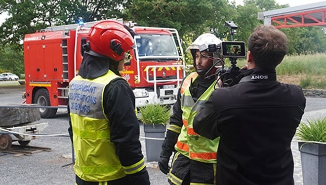
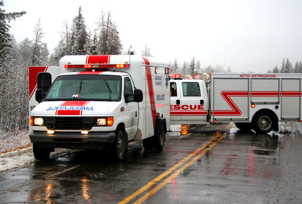
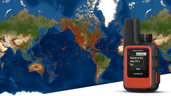
    Using a wide range of sensors and an ultra-broadband network created by team members, emergency services can orientate themselves and coordinate effectively even without GNSS, light or external communication.

    In the NIKE MATE project, the focus is on navigating tunnels in difficult circumstances — collapse of infrastructure, GNSS outages, presence of smoke and debris, all of which make orientation challenging.

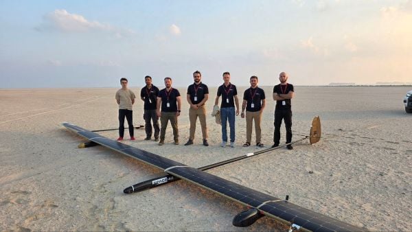
    NIKE MATE is funded by the Austrian Research Promotion Agency (FFG), a research team consisting of Graz University of Technology (TU Graz), the University of Leoben, the Federal Ministry of Defence, OHB Austria and the Laabmayr Engineering Office.

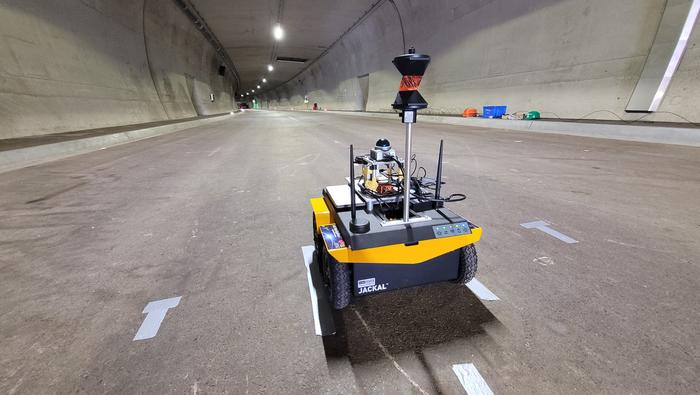
    The NIKE MATE team has developed a system for tough tunnel missions that combines sensor data from robots and rescue teams with a self-built UWB (ultra-wideband) network. The result is a dynamic map of the environment in which the team can locate and coordinate itself.

    A human/robot team

    The central innovation of the project is “teaming”. A robot with highly developed sensor technology first explores the surroundings and creates the dynamic map. The position information obtained is exchanged via a UWB transmitter with emergency personnel following behind or working in parallel, who are themselves equipped with UWB tags and who place UWB anchors along their route.

    In addition to stable data transmission, the anchors also enable distance measurements between all participants even without a direct line of sight. This creates a network of distance measurements in which the positions of robots and people can be determined with an accuracy of closer than one meter.

    “This precise localization is a decisive safety factor, for example if there is an open lift door or a precipice in front of a person,” said project manager Philipp Berglez, Institute of Geodesy, TU Graz.

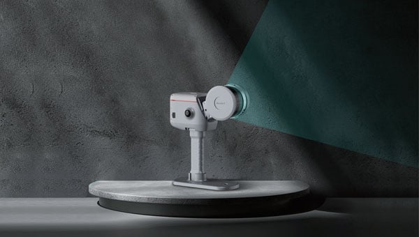
    Sensor technology plays an important role in localization. The robot uses a laser scanner, a camera, and wheel sensors to create a map of its surroundings. This means emergency services do not have to rely on plans that may be outdated or no longer correct due to damage.

    The rescue workers who follow have inertial sensors (accelerometers and angular rate sensors) on their shoes. Using AI-based analysis, the system recognizes various movement patterns such as walking, crawling on all fours, or belly crawling. 

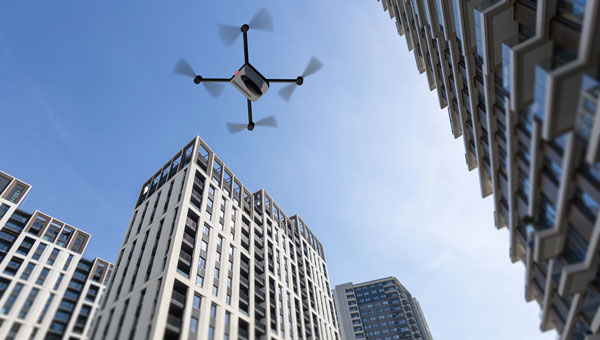
    Drone data to be included

    To ensure that the position calculations are not only accurate but also reliable, the project team uses factor graph optimization methods. These originate from robotics and make it possible to take past measurements into account again, and thus better determine the current position. If robots or people pass the same place at different times, their data can be linked and the map continuously improved.

    “The prototype we developed proved its suitability for use during our tests at Zentrum am Berg at the University of Leoben,” Berglez said. “For real-life use, we now need to make the individual components even more robust so that they can withstand real-life conditions and function reliably.

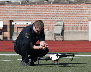
    “We would also like to expand the system to include mini-drones in order to obtain additional data from a slightly higher position in the event of an emergency, which could significantly help emergency services in their work.”

  • UAVOS partnership to advance HAPS technology for high-altitude missions

    UAVOS partnership to advance HAPS technology for high-altitude missions

    UAVOS has successfully completed of a test flight of Mira Aerospace’s high-altitude pseudo-satellite (HAPS) ApusNeo 18, with UAVOS providing full engineering and technical support. A key objective of the flight was to evaluate the jointly developed optoelectronic, gyro-stabilized aircraft payload onboard device (POD) by obtaining imagery from altitudes between 3,000 and 12,000 meters.

    During the mission, the POD captured high-resolution imagery with precise geolocation data from an altitude of 12,000 meters, achieving a Ground Sample Distance (GSD) of up to two meters. The test took place in Abu Dhabi, UAE, and lasted continuously for 48 hours.

    “The data-relay station trials were conducted in preparation for upcoming commercial flights in Europe, planned for the coming months,” Aliaksei said.

    The optoelectronic gyro-stabilized aircraft POD is equipped with an innovative automatic temperature control system for  heating and cooling  electronic modules, ensuring reliable operation in the stratosphere at temperatures as low as -70°C under rarefied air conditions.

    The system also provides radio communication at distances exceeding 100 km. The gimbal’s optical unit allows observation within a ±90°C range with high-precision angular positioning. The payload housing features an aerodynamically optimized design, and the total payload weight is 3.6 kg.

    “The successful cooperation with Mira Aerospace reflects our commitment to continuously advancing the capabilities of both companies,” said Aliaksei Stratsilatau, founder and CEO of UAVOS. “We also continue to work toward our ultimate goal of leveraging the HAPS platform for multiple applications, including mobile connectivity, border monitoring, mapping, forest fire detection, and emergency response.”

    To extend the HAPS operational range, the test flight also incorporated a data-relay network based on ground modem repeaters. Each repeater is capable of providing a coverage area of up to 200 km.

    “The data-relay station trials were conducted in preparation for upcoming commercial flights in Europe, planned for the coming months,” Aliaksei said.

  • How underground GNSS is revolutionizing rescue operations

    How underground GNSS is revolutionizing rescue operations

    Syntony GNSS, the SDMIS of Lyon and CS-Group have released a demonstration video of the SubWAVE system, filmed at La Mine Bleue near Angers. The video highlights how GNSS signal emulation enables real-time tracking of first responders and victims in GPS-denied environments such as tunnels and mines. This advance allows for precise localization of responders and 112 emergency calls, while significantly enhancing tactical situational awareness during rescue operations.

    Emergencies that occur underground — in tunnels, mines, or parking garages — present a critical challenge to first responders: the inability to rely on GNSS signals. Satellite navigation systems cannot penetrate dense materials like concrete or rock, often leaving firefighters and rescue teams without essential positioning data. This lack of visibility can delay victim care and increase risks for responders who are already operating in complex, unfamiliar environments.

    The SDMIS of Lyon, noted for its expertise in deep confined-space operations, recognized this operational barrier. In partnership with Syntony GNSS and CS-Group, they produced a demonstration of the SubWAVE system at La Mine Bleue, a tourist site near Angers, aiming to show how real-time GNSS signal emulation can improve safety and efficiency in underground rescue missions.

    Central to this development is SubWAVE, a solution created by Syntony GNSS. Unlike GPS repeaters, which only retransmit surface signals underground, SubWAVE generates realistic GNSS signals in real time, including altitude data adapted to different underground layers. These signals are fully compatible with standard GNSS-enabled devices, ranging from professional radios to everyday smartphones. SubWAVE broadcasts these signals through antennas or existing underground radio infrastructure, ensuring a smooth transition between surface and subterranean environments. As a result, responders can be continuously tracked without requiring specialized equipment or recalibration.

    The demonstration video clearly illustrates the system’s effectiveness. Firefighters equipped with radios or using the Réseau Radio du Futur (RRF) were tracked in real time, enabling commanding officers to coordinate operations with new levels of reliability.

    With GNSS coverage and responder localization now possible underground, a wide range of advancements are within reach. It becomes feasible to locate victims or lone workers, even without active signal transmission, by utilizing GNSS capabilities in mobile phones. Guidance and alert systems can be integrated into helmets or masks for first responders, and artificial intelligence can help map and analyze intervention zones, anticipate hazards, and enhance situational awareness. The technology also allows for interoperability between fire, police and EMS services through shared geolocation data, and may expand precise localization capabilities to complex indoor environments such as shopping malls or high-rise buildings where GPS is often unreliable.

    These improvements represent more than mere technical upgrades. They mark a fundamental shift in how emergency services can operate in GNSS-denied zones. By embedding intelligence and connectivity throughout the emergency response chain, SubWAVE aims to redefine standards of safety and coordination in some of the most challenging rescue scenarios.

  • ComNav enables advanced level 3D scanning

    ComNav enables advanced level 3D scanning

    ComNav Technology has revealed the LS600, a handheld 3D laser scanner that integrates SLAM technology, a built-in RTK module and dual 16MP wide-angle cameras. The device employs multi-sensor fusion, including lidar, IMU and cameras, to deliver high performance in both indoor and outdoor environments. It offers 16- or 32-line lidar options, with a scanning range of up to 300 m and a speed of 640,000 points per second for rapid data collection.

    The LS600 features an advanced GNSS module that provides centimeter-level accuracy with full-frequency GNSS support. A built-in surveying antenna enhances signal reliability. The dual-lens camera, combined with visual SLAM (V-SLAM), produces detailed color point clouds for realistic and precise visuals. The scanner supports both backpack and pole configurations, making it versatile for applications such as land surveying, engineering, urban renewal, mining, agriculture, forestry and emergency response.

    Its automated post-processing capabilities — such as stitching, denoising, and rendering — along with flexible coordinate systems streamline workflows and ensure accurate results. This design allows professionals to achieve precision and efficiency in the field.

  • NYPD to use UAVs for 911 calls

    NYPD to use UAVs for 911 calls

    Photo: aerogondo / iStock / Getty Images Plus / Getty Images
    Photo: aerogondo / iStock / Getty Images Plus / Getty Images

    The NYPD will soon improve its crime-fighting efforts with the Drone as First Responder (DFR) pilot program. Announced by New York Police Department (NYPD) Deputy Commissioner of Operations Kaz Daughtry, the program will deploy UAVs in response to specific 911 calls for serious crimes in progress, such as shootings, robberies, and missing persons.

    UAVs will launch from five precincts: the 48th Precinct in the Bronx, the 67th, 71st and 75th Precincts in Brooklyn, and Central Park, New York. The UAVs will provide real-time video and telemetry to officers to enhance situational awareness and safety.

    “The information provided by DFR will be shared with responding officers. It will enhance officers’ situational awareness as they arrive on scene, promote officer safety, and help us deploy resources more effectively,” Daughtry said.

    The NYPD uses 85 UAVs for various tasks, including monitoring major events and inspecting structural stability after accidents. Despite a 400% increase in UAV use last year, Daughtry emphasized they cannot be used for “warrantless surveillance” or “traffic enforcement.”

    According to the NYPD, these UAVs will be deployed in response to 911 calls for service within the next few months. The program will start with four precincts in Brooklyn and the Bronx, chosen “based on recent crime trends.”

  • Hexagon and Pitkin County update dispatch, emergency communications

    Hexagon and Pitkin County update dispatch, emergency communications

    PImage: rodehi/iStock / Getty Images Plus/Getty Images
    Image: rodehi/iStock / Getty Images Plus/Getty Images

    Hexagon’s Safety, Infrastructure & Geospatial division has partnered with Pitkin County Regional Emergency Dispatch Center to upgrade its digital mapping and response for 911 calls in Colorado’s premier mountain tourist destination. The partnership aims to make the county safer for residents and visitors.

    By using HxGN Connect software, Pitkin County can bring modern mapping capabilities to its computer-aided dispatch (CAD) system, as well as incorporate Smart Advisor, Hexagon’s assistive artificial intelligence solution.

    Pitkin County, home of Aspen and its four major ski areas, hosts 1.5 million tourists per year. The upgrades will improve emergency response capabilities for major events such as the X Games and JAS Aspen music festival, the company says.

    The cloud-based solution, hosted in Microsoft Azure, is designed to map 911 calls and conduct long-term resource planning. Smart Advisor will work in the background to help dispatchers and first responders connect related incidents and provide geofencing to concentrate resources on large events. Officials plan to expand the system to take advantage of its cross-organization collaboration capabilities by potentially linking the county’s CAD system with the fire department’s network of mountaintop smoke detectors and the Department of Public Works’ snowplows.

    Pitkin County dispatchers will use HxGN Connect for digital mapping within its CAD system in the mountainous tourist destination.

  • Another Orolia ELT receives Cospas-Sarsat certification

    Another Orolia ELT receives Cospas-Sarsat certification

    New-generation aircraft ELT meets new European Union Aviation Safety Agency (EASA) and U.S. Federal Aviation Administration (FAA) requirements

    Photo: Orolia
    Photo: Orolia

    Orolia has received certifications for yet another survival emergency locator transmitter (ELT), the Ultima-S.

    The news follows Orolia’s announcement that it had received certification for the Ultima-DT model, as well as a personal locator now shipping to the U.S. Army.

    The Ultima-S is a new generation ELT installed in either the cabins or liferafts of aircraft. It relays accurate aircraft location information to search-and-rescue teams.

    Once activated, a 406-MHz distress signal is transmitted and includes the ELT’s location thanks to the Ultima-S internal GNSS receiver. This built-in GNSS capability increases both probability and speed of detection of the distress signal.

    “With these key certifications for the Ultima-S, Orolia brings a long-awaited solution to the industry,” said Jérôme Ramé, Orolia’s Aviation & Military Product Line Director. “We have developed strong partnerships with several of the leading aircraft manufacturers that will enable operators worldwide to benefit from the Ultima-S for both their linefit and retrofit needs, allowing fleet standardization.”

    The Ultima-S provides free, global coverage service through the dedicated Cospas-Sarsat infrastructure while meeting the highest aviation safety standards. Orolia offers non-rechargeable lithium batteries compliant with the latest FAA and EASA special conditions standards, also known under TSO-C142b/DO227A. The Ultima-S also meets the most recent ELT performance and environmental standards through TSO-C126c.

    “What makes the Ultima-S unique is a new feature called the Return Link Service (RLS),” said Ramé. “Through this capability, the user is automatically notified when the distress signal is detected and located by the Cospas-Sarsat ground infrastructure. The Ultima-S links directly to the European Galileo GNSS satellite constellation, providing the most reliable and timely information for reaching aircraft crew members in distress.”

    In addition to being available on a linefit basis on major aircraft programs, Orolia has launched an exchange program to make retrofit activities easier for airlines, especially those upgrading to safer battery technology.

  • Orolia’s rescue beacons head to US Army

    Orolia’s rescue beacons head to US Army

    Latest Orolia Defense & Security personal rescue beacons deliver Cospas-Sarsat second-generation signaling

    Photo: DVIDS
    Photo: DVIDS

    Orolia Defense and Security is now shipping its PRSS1b Personnel Recovery Devices to the U.S. Army. The beacon uses a commercial GNSS chipset that can be replaced by SASSM or M-Code-capable receivers depending on customer needs.

    Orolia’s PRSS1b PRD provides second-generation Cospas-Sarsat signaling that delivers faster and greater location accuracy than previously fielded tactical location devices.

    Photo: Orolia
    Photo: Orolia

    Cospas-Sarsat is an international, humanitarian search-and-rescue system that uses space-based technology to detect and locate model 406 emergency beacons carried by ships, aircraft or individuals venturing into remote areas, often inaccessible by mobile phone. The system consists of a network of satellites, ground stations, mission control centers (MCCs) and rescue coordination centers (RCCs) that work together when a 406 beacon is activated.

    Through collaboration with the Army, Orolia produced a robust, user-friendly and highly reliable device to locate personnel who become isolated, missing, detained or captured.

    Orolia conducted a demonstration in October simultaneously on multiple continents, showing its technology working with the worldwide coverage provided by the Cospas-Sarsat infrastructure. The demonstration yielded beneficial data to support the qualification of Orolia’s Personnel Recovery Device and helped inform government stakeholders on the readiness of the second-generation ground and satellite infrastructure.

    A U.S. Army HH-60 Black Hawk helicopter lowers a volunteer from Central Washington Mountain Rescue via the hoist system during a training exercise.(Photo: U.S. Army)
    A U.S. Army HH-60 Black Hawk helicopter lowers a volunteer from Central Washington Mountain Rescue via the hoist system during a training exercise.(Photo: U.S. Army)

    Also in October, Orolia received Cospas-Sarsat certification for its Ultima-DT ELT emergency transmitter, designed for use on aircraft. All 406-MHz emergency beacons are digitally coded and transmit distress signals immediately upon activation on a proprietary radio wavelength.

    The three main types of 406 distress beacons and the kinds of situations each are designed for wilderness use, marine and aviation. (Image: Cospas-Sarsat)
    The three main types of 406 distress beacons and the kinds of situations for which each is designed: wilderness, marine and aviation environments. (Image: Cospas-Sarsat)

  • Drones key to Hurricane Ian response

    Drones key to Hurricane Ian response

    A photo taken in the aftermath of Hurricane Ian shows the massive destruction on Fort Myers Beach. (Photo: felixmizioznikov/iStock/Getty Images Plus/Getty Images)
    A photo taken in the aftermath of Hurricane Ian shows the massive destruction on Fort Myers beach. (Photo: felixmizioznikov/iStock/Getty Images Plus/Getty Images)

    Not to harp on an event that’s already passed out of the headlines and national coverage, but Hurricane Ian — a Category 4 storm that hit Florida in September — was full of destructive winds and caused major damage that could be with us for years before things get fixed. One source also indicated that so far we have lost 157 people, mostly from drowning — nothing will ever fix those losses.

    So harp on I will, especially about the role drones and drone pilots played in rescuing survivors, and determining and mitigating effects of the storm.

    The place that took the hurricane hardest was Fort Myers on the southwest Florida coast. The following video is from a security camera.

    While Hurricane Ian was making a mess of Cuba and crawling over the Caribbean and into the Gulf of Mexico, drones were already flying over areas where the storm could cross from the Gulf onto land — initially forecast around Tampa. But the forecast landfall continued to drift south, over where I live in Venice and 150 miles south of Tampa to Fort Myers.

    Before landfall, drone operators in Fort Myers were gathering video/geolocation information on buildings and streets in the path that the forecast 14-foot storm surge might take. They identified areas of potential damage and places people might need rescue.

    Map plotting the storm's track and intensity using data from the National Hurricane Center and a NASA image. (Image: public domain/FleurDeOdile/Wikipedia)/
    Map plotting the storm’s track and intensity using data from the National Hurricane Center and a NASA image. (Image: public domain/FleurDeOdile/Wikipedia)/

    After the storm hit, first responders began searching more than 400 destroyed houses in Fort Myers, some using the pre-storm drone video to rescue any trapped survivors.

    The need was not only for access in difficult conditions, but also for communications. AT&T reportedly got cell coverage up quickly in a couple of areas, and Verizon flew tethered drones (capable of flying for up to 1,000 hours) to restore phone coverage over a circular radius area of five to seven miles. Verizon also hooked up generators and engaged satellite internet coverage for local use, and took a portable cell-site on a barge out to Sanabel Island, which had been cut off from the mainland. T-Mobile put generators at cell-sites that lost power and deployed satellite and ground-based portable cell coverage.

    Photo: Verizon
    Verizon tethered drones provided cellular service for first responders. (Photo: Verizon)

    Powerful Drone

    Loss of power was another issue. Florida Power and Light (FPL) flew its recently acquired fixed-wing FPLAir One drone to assess damage to its power distribution infrastructure, which supplies about 12 million people on Florida’s west coast.

    FPL drone used in power loss assessment (Photo: FPL)
    FPL drone used in power loss assessment. (Photo: FPL)

    Using the drone in damage assessment efforts enabled FPL to get suitable crews to the right places early in the recovery effort.

    FPLAir One is a group 4/5 large UAV. It appears to be a Navmar Applied Sciences Corporation (NASC)/Sonex Aerospace TEROS unmanned aircraft, which is based on an earlier Sonex-powered glider design introduced in 2003. Because of this heritage and its rugged airframe, the TEROS is ideally suited for flights in high wind conditions — great for FPL’s long-range pre- and post-storm assessment application using FLIR and video cameras.

    The drone’s extensive prior airframe proving is assisting NASC/Sonex in its quest for certification of TEROS by the Federal Aviation Administration (FAA). FAA certification will ultimately support its integration into the National Airspace System (NAS) and allow operators to move on from the individual FAA approvals required for each operational drone scenario.

    Drones to the Rescue

    The principal application for hundreds of drone flights by several organizations was search and rescue for missing residents, mostly in the flooded area in and around Fort Myers. Drones also helped rescue people in North Port, where floodwater was as high as four feet, collapsing roofs and trapping people in their homes.

    Skydio provided drones for several search-and-rescue programs by police and other agencies, as well as coaching personnel who might lack experience in flying them. More than 500 drone flights were accomplished in the first days after the storm, a large number using autonomous flight capability, greatly assisting rescue efforts to locate trapped people. First responders were also able to determine whether access was possible, or what steps were initially needed to even enable access.

    Insurance companies are also using drone assessment video, determining the level of damage to homes and vehicles, in an effort to put assistance where it was most needed early on. Using artificial intelligence to align food-stamp users with badly damaged homes identified on satellite images in Lee, Collier and Charlotte counties, GiveDirectly offered immediate $700-assistance to many survivors. If all these offers were accepted, the cost could be as much as $2.4 million in no-strings-attached immediate aid for those worst hit.

    In the aftermath of the largest, most damaging hurricane to hit the United States since 1935, volunteers, first responders, drone pilots, aid agencies, and power, communication and insurance companies all made use of drones. These agencies and companies are still helping many thousands of people to survive and start the long task of picking up the pieces of their lives.

  • Garmin inReach helps in 10,000 emergencies

    Garmin inReach helps in 10,000 emergencies

    A Garmin inReach with a map showing incidents. (Photo: Garmin)
    A Garmin inReach with a map showing incidents. (Photo: Garmin)

    InReach devices have provided SOS assistance on seven continents in more than 150 countries

    Garmin International has announced that 10,000 SOS incidents have been aided with its inReach handheld device. InReach technology allows for location tracking, two-way text messaging, and critical SOS emergency-response services.

    The Garmin inReach provides two-way communication and a coordination center staffed 24/7 to serve users engaging in activities such as mountain climbing or camping.

    Garmin provided the following insights into who is using the device’s SOS capabilities, where, and in what situations. For more data insights, visit this blog.

    • The top five activities that produced incidents include hiking/backpacking, driving, motorcycling, climbing/mountaineering and boating.
    • Mountain regions such as the Pacific Crest Trail, the European Alps, and nearly all of New Zealand seem to have a high propensity for SOS incidents. However, cities like Los Angeles, Phoenix and Aspen have all reported SOS incidents ranging from cycling to hiking.
    • Medical emergencies and injuries represent nearly 50% of the global SOS incidents, highlighting the preparedness inReach provides users to meet unexpected or unforeseen events.
    • Nearly one in five incidents were triggered by a good Samaritan, who purchased a device for their own peace of mind but were able to assist someone else in need.
    • The second highest number of SOS triggers (12%) comes from driving incidents. Many driving SOS incidents involve people needing help while on the road and outside of cellphone service.
    • A few InReach incidents are pet emergencies, unexpected natural disasters, and reuniting a child with a parent.

    Garmin Response center

    The inReach devices have a dedicated SOS button and 100% global Iridium satellite network coverage. Users can quickly report an SOS should an emergency occur.

    Once an SOS is reported, even if no other action is taken by the user, the device sends a distress message to Garmin Response, a 24/7-staffed professional emergency response coordination center.

    Garmin Response will communicate with the individual in distress, his or her listed emergency contacts, applicable search-and-rescue organizations and other available local resources. The staff will deliver a confirmation when help is on the way, provide updates on the status of the response effort, and remain engaged until the incident is resolved.

    “The two-way communication of inReach is so important in an emergency situation,” said Sarah Kramlich, Garmin senior director of services and subscription strategy. “After initiating an SOS, Garmin Response will ask questions to learn more about the incident and what appropriate first responses are needed for rescue, whether a tow-truck or helicopter.”

  • Public-sector provider partners with NextNav for vertical location

    Public-sector provider partners with NextNav for vertical location

    Photo: LeoPatrizi/E+/Getty Images
    Photo: LeoPatrizi/E+/Getty Images

    NextNav is partnering with CentralSquare Technologies, a public-sector technology company, to integrate z-axis vertical location capabilities into its computer-aided dispatch products and mobile suite of public safety software solutions.

    CentralSquare works with more than 75% of public safety agencies nationwide, including first responders, law enforcement, fire departments, emergency medical services and local governments, equipping them with real-time data and situational awareness to decrease emergency response times.

    By tapping into NextNav’s Pinnacle network, CentralSquare will be able to provide public safety agencies with critical vertical location data needed to precisely pinpoint the location of civilians in need of assistance during an emergency.

    The integration of Pinnacle into CentralSquare’s product suite will provide users with enhanced knowledge of the most efficient routes within multi-story buildings to further reduce response times.

    “Together with NextNav, we’re helping public safety agencies meet the needs of today’s dynamic world, particularly in densely populated urban cities,” said David Zolet, CEO of CentralSquare. “Adding z-axis enables our systems to not only derive location (x-axis and y-axis) but height (z-axis). This capability is the next logical step, decreasing emergency response times and ultimately helping to protect our communities and those that serve them.”

    CentralSquare’s partnership with NextNav further establishes the company as the market leader in public safety dispatch solutions with the addition of floor-level accurate z-axis location. Once deployed, CentralSquare will deliver z-axis visualization in a 3D view, bringing visualization to their agencies and clients’ first responders. Field trials of the technology will begin towards the end of the summer, with an initial rollout anticipated in the fall.

    The Pinnacle network delivers precise vertical location in 4,400 cities and towns, covering more than 90% of buildings greater than three stories in the United States, enabling better situational awareness for first responders. Earlier this year, a tier-one wireless carrier selected NextNav Pinnacle to bring z-axis capabilities to wireless 9-1-1 phone calls to enhance caller geolocation and emergency response outcomes.

    “Expanding access to the life-saving z-axis capabilities our Pinnacle network provides is a top priority for us. Partnering with CentralSquare allows us to use this technology to positively impact the lives of the majority of public safety workers in the United States,” said Ganesh Pattabiraman, CEO and co-founder of NextNav. “CentralSquare is the largest provider for dispatch solutions signed to our ecosystem to date, bringing actionable floor-level insights to a vast number of individuals and scenarios. We’re growing our user base significantly, and along with it bolstering public safety and saving lives.”

  • FAA awards $2.7M to research drone use in disasters, emergencies

    FAA awards $2.7M to research drone use in disasters, emergencies

    The U.S. Department of Transportation’s Federal Aviation Administration (FAA) has awarded $2.7 million to support research on how drones can assist in disaster preparedness and in emergencies.

    “Every second counts in an emergency, and this funding will allow drones to safely and more quickly deploy in moments when minutes matter,” said Acting FAA Administrator Billy Nolen.

    A policeman works with a drone. (Photo: FAA)
    A policeman works with a drone. (Photo: FAA)Photo:

    The research will explore the use of drones in providing effective and efficient responses to different natural and human-made disasters. It will address coordination procedures among drone operators from federal agencies as well as state and local disaster preparedness and emergency response organizations. The five universities and their award amounts are:

    • University of Vermont: $1,195,000
    • University of Alabama Huntsville: $828,070
    • New Mexico State University: $400,000
    • North Carolina State University: $200,000
    • Kansas State University: $145,000

    Today’s announcement is the third round of Alliance for System Safety of UAS through Research Excellence (ASSURE) grants, which brings the total to 20 grants valued at $21 million for Fiscal Year 2022.

    The ASSURE Center of Excellence is one of six the agency has established to help advance technology and educate the next generation of aviation professionals. Research conducted through ASSURE is focused on helping the drone community safely grow and integrate into the nation’s airspace.

    Earlier in 2022, Transportation Secretary Pete Buttigieg outlined six key Innovation Principles the department will apply when fostering transportation technologies. While continuing to commit to the highest standards of safety across technologies, these awards demonstrate the department’s commitment to exploring ways to leverage innovation to help communities and public-sector partners through experimentation.

    More than 850,000 recreational and commercial drones are in the active drone fleet, and that number is expected to grow.