Tag: Esri

  • NGAUS 2015: National Guard Leaders Meet to Learn and Confer

    Art_NGAUS_still

    Three weeks ago I attended the National Guard Association of the United States Conference (NGAUS 2015) in Nashville, Tenn. Few people understand that — unlike the U.S. Army and Air Force, which are under direct federal control — each state has its own National Guard organization under the control of the individual state governors. They serve as the state’s local militia responding to disasters and civil unrest as directed by the governor.

    The National Guard is also part of the reserve components of the United States Armed Forces, and in that capacity many National Guard units have been called up to serve in overseas operations alongside their active duty counterparts such as in the Mideast. This dual control leads to countless discussions regarding Title 10 or Title 32 funding and jurisdiction.

    Additionally, the National Guard is administered by the National Guard Bureau (NGB), which is the communications channel between the states and the departments of the Army and the Air Force. NGB is headquartered in Washington, D.C., and is a joint activity of the Army and Air Force. NGB provides policies, training requirements and, most important, funds for the state units. This makes the NGAUS annual conference much more than a social gathering. It’s an opportunity for the leadership of each state to learn and coordinate, to view new technology and share best practices. It’s also an opportunity to provide official feedback to NGB regarding policies and all-important funding.

    Behind-the-Scenes History. A panel discussion I found especially fascinating was the Joint Domestic Operations session. One of the speakers was the former chief of the NGB, retired Lt. General H. Stephen Blum. General Blum was the NGB chief during Katrina, and shared some behind-the-scenes discussions he had with President Bush as Katrina unfolded. We now know that the New Orleans mayor delayed giving the order to evacuate the city, resulting in thousands stranded and hundreds dead. You may remember the photo of more than 100 school buses that went unused and ultimately flooded and unusable. The governor also delayed the order to evacuate, and the request for outside help from other National Guard units and the federal government.

    Anxious about the growing disaster, president Bush’s cabinet was pushing him to federalize the National Guard and take charge of the situation. However, General Blum was the single voice against federalization, telling the president that if you seize charge now you will “own the whole problem forever.” Fortunately, the call for help soon came from the Louisiana Governor, and military and National Guard action was almost immediate. General Blum was able to proudly draw the president’s attention to the TV news feed showing the military in action with the under caption “The Cavalry arrives!”

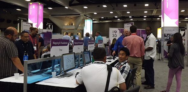
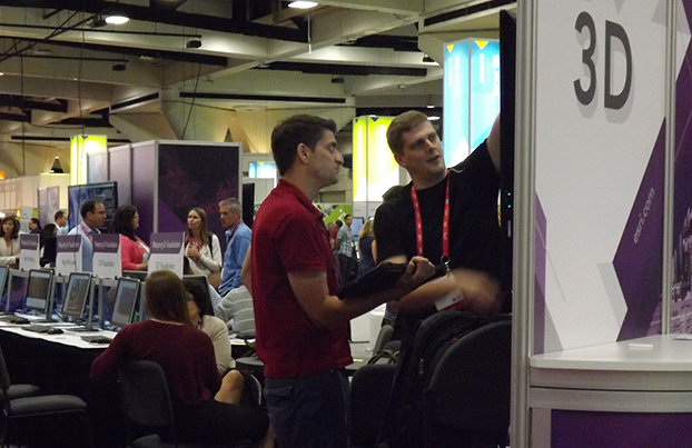
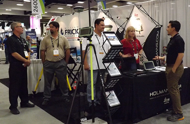
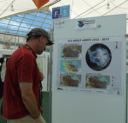
    Conference Exhibitors. The NGAUS conference is held in a different state each year. Last year it was in Chicago, and next year it will be in Baltimore. Although this is not a geospatial-centered event, a number of exhibitors and sessions involved geospatial topics, with the following being good examples. I was able to shoot video clips of some of the exhibitors, since seeing technology in action is always more informative than just writing about it.

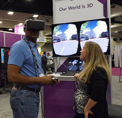
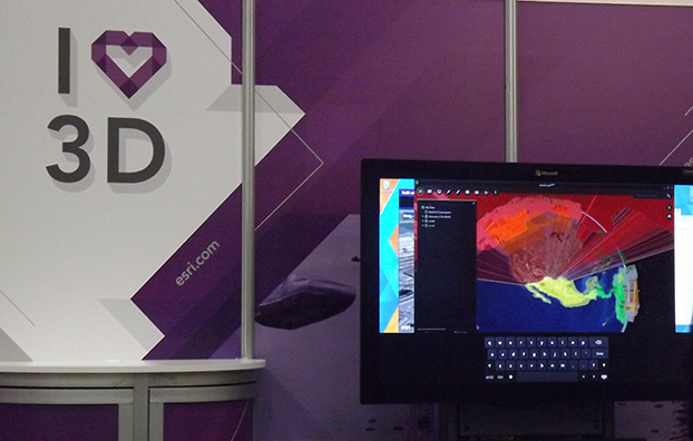
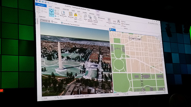
    Esri. For years Esri ArcGIS has been the most common GIS platform used by most states. Several years ago, MajGen William Reddel, Adjutant General of New Hampshire, arranged to consolidate dozens of ArcGIS licenses to one enterprise license for all National Guard units. This greatly simplified GIS software procurement and saved taxpayers thousands.

    ForeFlight. For years you may have seen pilots dragging large document cases through the airport. These contained countless paper maps, charts and documents required for the safe navigation of aircraft. Finally, after years of work and the incorporation of digital content that many of you created, the FAA has approved electronic flight bags. See what they look like in this video.

    ForceX. ForceX and Z Microsystems have numerous tools to register and incorporate full-motion video and imagery into geospatial environments. See their technology in this video.

    Rapid Composites. Rapid Composites builds high-end UAVs for the military and first responders.

    As a UAV user myself (DJI Inspire 1), I’m especially interested in the proposed UAV impact tests that will be conducted by the FAA starting in October. Currently, the FAA authorizes the commercial use of drones up to 55 pounds in non-restricted airspace. However, there is a growing concern that a “Sully on the Hudson” incident could severely curtail drone use. The Mississippi State-led Alliance for System Safety of UAS through Research Excellence (ASSURE) will be doing such testing in conjunction with the FAA. ASSURE will test the effect of UAV impact on aircraft windshields, control surfaces and engines.

    Knowledge Center. The Knowledge Center has an overarching system that manages assets and personnel for first responders. See their system in operation.

    Other exhibitors included Soft Power Solutions LLC, which displayed a geospatial-based personnel and asset management system, and Ball Aerospace, which showed off its new compact real-time 3D collection system that I previously wrote about. The new system has been redesigned to be under 12 pounds and suitable as a payload for many military UAVs.

  • Story Map: Mapping Liquid Water on Mars

    Mars-water-map-O2

    With NASA’s announcement on Monday that liquid water has been discovered on Mars, Esri has put together an interactive story map showing the craters and canyons on Mars that show evidence of water.

    Watch animations of the recurring slope lineae (water stains) across four different craters and explore satellite imagery and elevation data for the Red Planet.

    Below is an animation from the Jet Propulsion Laboratory showing seasonal flows in Hale Crater.

  • Esri Launches Photo Survey Web App for Property Surveys

    esri_photo_survey_W

    Many local governments use large teams of volunteers to evaluate property conditions and identify structures that may be abandoned or in disrepair. Property surveys may take several months to complete and are hard to maintain over time.

    To simplify survey data collection Esri has partnered with the City of New Orleans (NOLA) to create Photo Survey, an ArcGIS for Local Government solution. Photo Survey is a web application that can be used by local governments to publish street-level photo collections and conduct focused property surveys that may identify blight, damaged structures or construction activity. Like all ArcGIS for Local Government solutions, Photo Survey is included with an ArcGIS subscription.

    “Photo Survey leverages location-enabled photos produced by commercially available cameras and simplifies data processing so that street-level photo collections can be combined with relevant survey questions and used to inventory property conditions,” says Chris Buscaglia, Esri local government solutions engineer. “The street-level photo collection can then be published with the Photo Survey application and shared with the general public so property conditions can be crowdsourced from members of the community.”

    In addition to blight inventories, Photo Survey could also be used to identify structures damaged by a natural or man-made disaster, construction activity that may lead to reappraisal efforts, and/or dilapidated buildings that pose public health and safety concerns to fire service personnel, according to Esri.

    “We’re excited to crowdsource the property survey process with the Photo Survey application,” says Greg Hymel, NOLA enterprise GIS manager. “Enabling New Orleans citizens to conduct surveys for us with this app will effectively remove neighborhood bias so that, when we go live, we can make projections about the entire city instead of pockets of special-interest areas.”

    Photo Survey can be downloaded now from the ArcGIS for Local Government solution site.

  • FlightAware Partners with Esri on Flight Tracking and Status Data Mapping

    flightaware-partner-extensive-flight-tracking-status-data-mapping-initiative-W

    Esri and FlightAware have partnered to combine the power of a flight tracking and status company with the ArcGIS mapping platform. The partnership features the ability to view and analyze large amounts of accurate, live-aviation data in one powerful spatial system.

    FlightAware aggregates live flight tracking data from more than 50 government air traffic control authorities, satellite data link partners such as Garmin and ARINCDirect, and FlightAware’s own in-house ADS-B receiver network, consisting of more than 3,400 receivers in more than 100 countries.

    “Esri has the tools and expertise to visualize data in a proven GIS environment,” FlightAware business development manager Max Tribolet said. “FlightAware data is the perfect addition. We’re the largest flight tracking company in the world, based on how many disparate data feeds we have coming into our system. So it’s pretty powerful when you pull our data into GIS.”

    “This is a really good way to provide an additional option to our existing and potential customers, who might not have an easy way to consume larger volumes of flight tracking data,” Tribolet said. “A stand-alone app like Esri’s ArcGIS is adept at handling large quantities of data and is able to visualize it. This relationship with Esri allows FlightAware to focus on what we do best: constantly adding and aggregating quality flight tracking data and providing it to the industry.”

    Airports and agencies have started exploring opportunities to use FlightAware data in GIS to improve proactive noise monitoring and airspace design as well as monitoring airspace congestion in real time. FlightAware visualizes live and historic data — such as altitude, longitude, latitude, ground speed, and estimated and actual schedule times—in 2D, 3D, and even 4D maps.

    “The ability to fuse FlightAware data within the ArcGIS platform unlocks a host of new and innovative capabilities with regard to visualization, analysis and collaboration,” Esri aviation business development lead Stephen Willer said. “That results in a higher level of operational intelligence. We’re excited to bring this to our users across the globe. Real-time information access like this is essential not only today but also to our future air traffic systems.”

  • SAP Accelerates Geo-Enabled Access to Enterprise Data

    SAP-dashboard

    SAP SE is offering new capabilities to turbocharge spatial intelligence by simplifying, accelerating and geo-enabling access to enterprise data.

    In the era of the Internet of Things (IoT), proliferation of low-cost location-aware devices is augmenting enterprise data with the “where” component. The SAP HANA platform can help break the silos between enterprise and GIS systems, enabling companies to get more value from corporate data and uncover trends and patterns in a visually intuitive manner, the company said in a statement.

    The announcement was made at the Esri User Conference (Esri UC) being held July 21–23 in San Diego.

    Accelerating Spatial Processing for Real-Time Insights. The latest release of SAP HANA further enhances in-memory spatial processing capabilities to deliver faster responses for millions of data points, the company said. SAP HANA SPS10 brings new spatial features and enhancements, such as support for multidimensional geometries and on-the-fly spatial coordinate transformations, driven by customer innovation projects such as flight operations for Lufthansa Systems.

    Case Study: Lufthansa

    Lufthansa Systems is using the spatial capabilities in SAP HANA for tracking global flight operations. Changes in airport, meteorological and fleet data are monitored in real time and used to reroute flight trajectories in split seconds while optimizing fuel and crew costs. Lufthansa Systems believes that this innovative technology for dispatching, monitoring and visualizing air traffic by providing instant insights and real-time decision support will help change the face of its business.

    “Together with SAP, we built a prototype of a future operational database for commercial flight support,” said Christoph Krüger, lead architect, Lufthansa Systems. “The spatial engine in SAP HANA has given us the ability to track thousands of flights per day on a rich 3D mapping interface that includes both spatial and temporal coordinates. At the same time, we were able to uncover breakthrough application scenarios that would not have been possible without the SAP HANA platform.”

    Deeper Integration of SAP HANA and Esri

    In addition to the existing read-only query layer integration to SAP HANA released by Esri in 2014, ArcGIS for Desktop now supports feature services providing a method for users to create, read, update or delete spatial data directly in SAP HANA. This simplifies the access and use of spatial data in SAP HANA and provides powerful, transactional spatial data creation and editing capabilities to support real-time operational and analytic applications, opening a broad new range of use cases and workflows for both Esri and SAP users.

    The State of Indiana uses SAP HANA, SAP Lumira software and SAP Predictive Analytics software in combination with Esri for geo-spatial analytics to help ensure safer roads and traffic conditions and improve the lives of its citizens.

    “Our long-standing technical co-innovation with SAP has taken a major step forward with the introduction of the SAP HANA platform and its spatial capabilities,” said Jack Dangermond, founder and president of Esri. “We now have a single platform from SAP that simplifies both integration and the deployment of mapping and spatial analysis across the entire SAP application landscape.”

    Analytics Solutions from SAP Enhanced by Partner Extensions

    The native integration between Esri ArcGIS and data visualization software from SAP, SAP Lumira, provides new capabilities for customers. It includes a rich library of charts and visualizations, overlay charts with geo-spatial data for location-based insight, support to visualize multiple layers of business data on top of Esri base maps and support to embed and create custom extensions with software development kits (SDKs). SAP partners such as Galigeo use these SDKs to extend the value of analytics solutions from SAP with new options for visualizing and analyzing information in SAP Lumira and SAP BusinessObjects Design Studio using Esri cloud and on-premise resources. A free version of SAP Lumira is currently available for download.

    Geo-Enablement of SAP Business Suite powered by SAP HANA

    SAP is delivering geospatial enablement of SAP Business Suite powered by SAP HANA software with a geo-enabling services offering. Geo-enabling allows SAP Business Suite powered by SAP HANA to store spatial data directly on SAP HANA instead of on a third-party database, resulting in faster response times and a simpler architecture.

    Spatial Enhancements in SAP Work Manager

    The SAP Work Manager mobile app has added Esri feature layer integration and offline mapping capabilities. These improve user interaction on mobile devices and enable mobile technicians servicing clients in the field to access their maps and associated information without Internet connectivity.

    For more information, visit the SAP News Center. Follow SAP on Twitter at @sapnews, or view the video below for a demonstration from the 2015 Esri UC.

  • Live from the 2015 Esri User Conference

    Live from the 2015 Esri User Conference

    The Esri 2015 Exhibit Hall. (Photo: Tracy Cozzens)
    The Esri 2015 Exhibit Hall. (Photo: Tracy Cozzens)

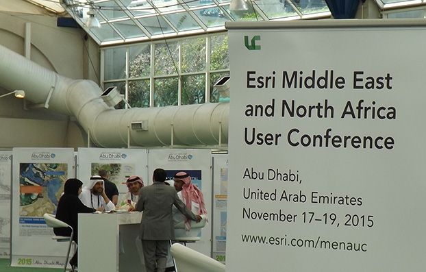
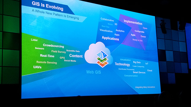
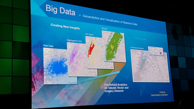
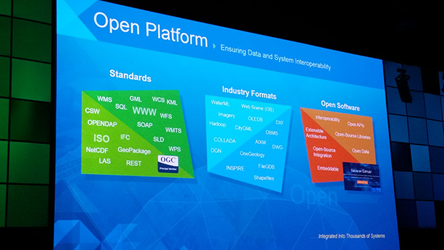
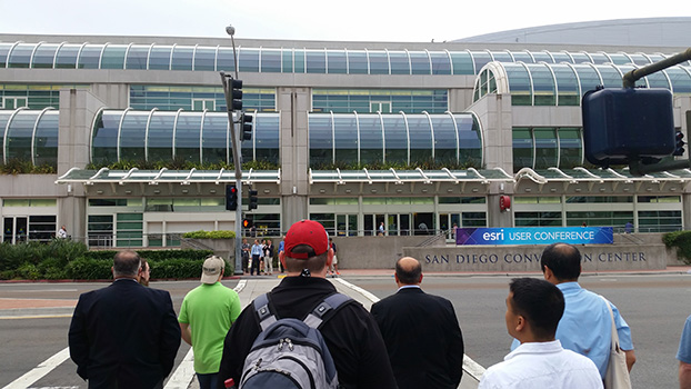
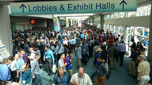
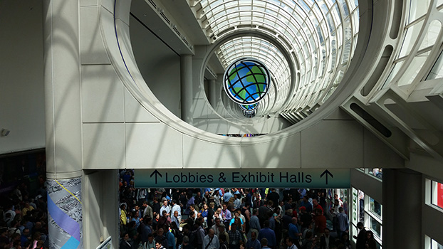
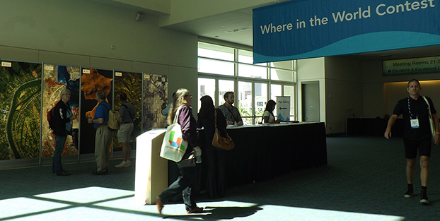
    More than 16,000 people from 120 countries around the world are expected to converge in San Diego, Calif., this week to discuss the power of maps and applying geography at the 2015 Esri User Conference (Esri UC). The Esri UC and related events are taking place July 18–24, featuring a variety of speakers from a presidential candidate to global first responders. Attendees will share ideas and best practices for improving our world through maps.

    GPS World/Geospatial Solutions staff is on site, and we will be posting news, photos and videos live from the show on this page. Also follow us on Twitter at @GSS_NCM and @GPSWorld.

    News

    SAP Accelerates Geo-Enabled Access to Enterprise Data (7/22)

    Esri UC: Irish Water Honored with Enterprise GIS Award (7/21)

    Esri and Leica Geosystems Combine for Mobile Data Collection (7/21)

    Esri UC: Audubon Society Honored for Application of GIS in Conservation (7/20)

    Esri UC: Avineon to Give Away 10 Free Licenses for ArcGIS Metrics Extension (7/20)

    nearmap Partners with Esri on High-Resolution Imagery (7/20)

    Esri UC: LizardTech Launches GeoExpress 9.5 (7/20)

    Esri UC: PTFS Unveils Droneware Geospatial Content Management System (7/20)

    Trimble Unity Software for Water Utilities Adds Support for Esri ArcGIS Online (7/20)

    Map Technology Takes Center Stage in San Diego (7/16)

    Septentrio Launches GIS Software PinPoint-GIS (7/13)

    Esri Publishes Getting to Know ArcGIS, Fourth Edition (7/13)

    Juniper to Exhibit Sub-Meter GPS Solution at Esri User Conference (7/13)

    Avineon to Demo Geospatial Services at Esri User Conference (7/8)

    Videos

    Videos of the entire day of plenary sessions are now available, courtesy of Esri UC.

    YouTube Video Playlist

    Panoramic Photos

    A panorama of the plenary audience. (Credit: Eric Gakstatter)
    A panorama of the plenary audience. (Credit: Eric Gakstatter)
    The Esri Map Gallery. (Photo: Tracy Cozzens)
    The Esri Map Gallery. (Photo: Tracy Cozzens)

    Exhibit Hall Photos

    Map Gallery Photos

    Plenary Photos

    Esri User Conference Photos

  • Esri Publishes Getting to Know ArcGIS, Fourth Edition

    esri-publishes-getting-to-know-arcgis-fourth-edition-lgA new book published by Esri covers the fundamentals of making digital maps, analyzing geospatial data, and building and editing spatial databases using ArcGIS. The workbook Getting to Know ArcGIS, fourth edition, is updated for use with the latest version of Esri’s ArcGIS for Desktop software. 

    Getting to Know ArcGIS teaches geographic information system (GIS) concepts and common tasks such as how to find GIS data online, create a web map, set map projections, symbolize and label maps, edit data, and geocode addresses.

    The workbook also provides a preview of the new ArcGIS for Desktop ArcGIS Pro application. ArcGIS Pro is a new application for quickly creating and working with spatial data on your desktop. It includes scientific tools for spatial analysis, along with the capabilities needed to create and publish 2D and 3D content and to share maps in ArcGIS Online or on an internal server portal.

    The workbook, which provides a comprehensive understanding of all the tools and functionality available in ArcGIS 10.3.1 for Desktop, can be used in classroom settings or for on-the-job training. The data for working through the exercises and a 180-day free trial of ArcGIS are available for download at Esri’s Book Resources website at esripress.esri.com/bookresources.

    Getting to Know ArcGIS was written by Michael Law and Amy Collins. Law is a cartographer with more than 10 years of professional GIS experience. He has worked for Rand McNally Canada and for Esri, where he developed cartography for books and edited and tested GIS workbooks. Collins is a writer and editor who has worked with GIS for 13 years. She is a former technical editor at Esri, where she honed her knowledge of GIS and designed instructional materials for budding GIS professionals.

    Getting to Know ArcGIS is available in print (ISBN: 9781589483828, 808 pages, US$84.99) or as an e-book (ISBN: 9781589484283, US$64.99). The book is available at online retailers worldwide, at esri.com/esripress, or by calling 1-800-447-9778. If outside the United States, visit esri.com/esripressorders for ordering options, or visit esri.com/distributors to contact your local Esri distributor.

  • Esri, NT Concepts Help Transition Google Earth Enterprise Customers

    In coordination with Google, Esri is providing replacement software and training to customers and partners using Google’s enterprise geospatial technology.

    NT Concepts, an experienced Google integrator, is announcing a new partnership with Esri to help customers that have implemented Google Earth Enterprise and Google Maps Engine make a smooth transition to the ArcGIS platform with minimal interruptions to their operations.

    Esri is a longtime provider of geospatial solutions to the defense and intelligence communities and has developed more than 40 specialized applications for their use.

    “NT Concepts has mapped the functionality of Google to Esri’s ArcGIS platform. The current users of Google’s enterprise geospatial products will find the Esri platform to be a key option for meeting their geospatial requirements,” said Chris Powell, chief technology officer at NT Concepts.

    For Google Earth customers that would like to transition to the ArcGIS platform, Esri is offering the new ArcGIS 10.3.1 for Server and related client/app technology. In addition to other advanced functionality, these will allow users to publish 2D data, 3D buildings, and KML files throughout the enterprise.

    “Esri is delighted to have NT Concepts as our trusted partner for this important work,” said Patty Mims, Esri director for intelligence. “The company provides key skills needed to work with both Esri and Google technology.”

  • Location Intelligence Platform Aims at Local Marketing

    Local ID has closed a $1.9 million seed round of funding led by Crosscut Ventures. Local ID is a local intelligence platform that provides multi-unit brands with the data, tools and process needed to maximize their local marketing efforts, according to the company.

    Other investors in the round included Technicolor, TenOneTen, Baroda Ventures, Double M Partners, Tallwave, Wavemaker Partners and Queens Bridge Venture Partners. 

    Founded by a team with more than 60 years of collective retail experience, Local ID is a cloud-based platform that provides brands with visibility into each store’s trade area. For example, Local ID:

    • surfaces local events that present timely and contextual marketing opportunities;
    • identifies competitive intrusions;
    • provides proactive preparation for weather events; and
    • incorporates a wealth of other data on the hundreds of local marketing opportunities taking place each day within a store’s trade area.

    With brick and mortar representing 94 percent of the $4.5 trillion retail sales market, according to eMarketer, Local ID gives multi-unit brands an edge in capturing a larger share of this vast but extremely competitive market, the company said.

    “Local ID is the first local intelligence platform designed to solve at-scale local store marketing for large brick and mortar brands,” said Alex Nocifera, Founder & CEO of Local ID. “Our dynamic, enterprise platform will increase same store sales and traffic for our customers by systemizing the way they plan, execute and track their local marketing activities. This funding, along with the extensive outreach we’ve done over the last year with large brands, has validated the timeliness of our solution to solve brands’ decentralized, inefficient inability to execute and measure local marketing at scale. Overall, I could not be more excited about our team, the early market signals and the product we are taking to the market.”

    Local ID is a single-source solution that will centralize all local store marketing programs, institutionalize market-specific knowledge and systemize best practices across the enterprise. The platform leverages Esri mapping software, integrates multiple data streams and then custom curates brand opportunities for every store in the system. The core pillars include:

     Store Profiles A dynamic database of every store in a brand’s system providing visibility into every location and activity

    People Profiles Details, activities and insights of all employees engaged in local marketing at any level

    Relevant Opportunities Custom curated, brand relevant opportunities in each market

    Marketing Activities   An innovative and engaging task management tool for tracking and systemizing local marketing activities

    The company will use the new funding to invest in product development, research and acquiring key talent. Nocifera previously served as founder and CEO of both Ripple TV and Circle Street, two venture-backed start-ups focused on helping big brands solve complex local challenges. Ripple TV was acquired by TargetCast Networks (now part of Brite Media Group). Circle Street was acquired by Valassis, the largest local advertising company for promotional media to retail and CPG brands.

    “Local ID has the opportunity to be the Salesforce.com of the trillion dollar local marketing space by solving the conundrum large, multi-unit brands face in executing successful local store strategies at the enterprise level,” said Brian Garrett, co-founder and managing director of Crosscut Ventures. “It’s a massive, untapped market and one that the Local ID team, with deep experience in RetailTech, is perfectly situated to address.” 

  • Esri President Looking for a Few Good Images

    Esri President Jack Dangermond is asking for geospatial professionals to provide illustrations for his opening presentation at the 2015 Esri User Conference in July.

    “Each year, the Plenary Session provides an inspiring overview of the state of geospatial technology today, and one of the best ways to illustrate that is by sharing examples of your work,” Dangermond writes in an email. “I invite you to submit up to three images for us to consider including in the presentation.”

    Dangermond said he is interested in:

    • Maps that helped make a decision
    • Maps that helped with collaboration
    • Maps that helped communicate
    • High-quality cartographic displays
    • 3D visualizations
      • Built environment
      • Nature landscapes
      • Cartography (statistics)
    • Maps that illustrate spatial analysis, modeling, and science
    • Web maps

    Image submissions must be received by Friday, June 12, via Esri’s online portal.

    Send any questions to [email protected].

  • Geospatial a Surprising Highlight of eMerge Trade Show

    Two weeks ago I helped a colleague with a trade show in Miami called eMerge Americas. This was a general-interest trade show focused on U.S. and Latin American trade and economic development. It wasn’t GEOINT or an ESRI users conference, so I didn’t expect any significant geospatial exhibitors, but I was wrong.

    In fact, there were so many geospatial-related displays, I decided to build my column around it — not because there were new developments, but to give you a feel for how business in general is being exposed to and shaped by our geospatial technology.

    I found so much visual content that under the “picture is worth a thousand words” philosophy, I shot video clips of exhibitors so that you could quickly hear and see their stories. I discovered a number of true start-up businesses, as well as a large area devoted to showing robotics from local school programs. You may not have the time to view each clip, so the following are brief descriptions of each exhibitor that caught my attention:

    Introduction to eMerge Americas

    Esri. Because Latin America is a large and growing market, Jack Dangermond had his team there.

    Indra. A large Spanish firm demonstrating their end to end solutions including building 3D models overlaid on Google.

    Cisco. Cisco had a very large display showing city management of transportation/utilities/ planning using geospatial tools and management systems.

    Fish. A company that tracks people and assets using RFID tags and indoor location technology.

    Florida International University. FIU had numerous technology displays but their autonomous catamaran doing bathymetry data collection and mapping was impressive.

    CartoData. This was a Mexican firm doing some very impressive end-to-end solutions including the use of Pix4D to build 3D models from UAV data.

    ImPlaces. A small start-up that builds Smartphone GPS location enabled applications for self guided tours such as museums, parks, real estate, etc.

    Baptist Health. Baptist Health demonstrated its 3D remote surgery system that was dimensionally scalable. These systems permit a surgeon to work at a macro level while the surgical tools operate a at microscopic level.

    ICONICS. A company that can zoom from a country or regional map down to the detail of an individual valve in a specific plant using CAD/BIM data.

    RangeVideo. A UAV company with a very flexible platform and 3D operator viewing goggles.

    ALTA Systems. An alternative to powered UAVs.

    SnowLizard Products. A small start up building durable waterproof Smartphone cases with Bad Elf GPS and solar panel recharging.

    Catbird. A data system security oversight system.

    VSN 360. There was a lot of interest in this product. VSN was showing a new 4K HD quality 360-degree video camera a little bigger than a coffee mug with many features. My video of a video didn’t do it justice, so here is a link to the demo video.

    For fun, view these non-geospatial exhibitors:

    Holography Box USA. A portable, rear projection, point-of-sale video display that looks like a 3D hologram.

    TeamSandTastic. A company that provides sand sculptors for trade shows or other events. Doesn’t sound exciting, but just like a Zamboni clearing the ice, you can’t stop watching as an artist turns a pile of sand into a sculpture.

    Robotics. Local students show off their robotic construction efforts and operational talents.

    Because eMerge has been so well received, I’m happy to see plans are in place to make this an annual event. Latin America is a large and growing market with many talented individuals, some of whom I met at this conference. As a country, we seem to take Latin America for granted, but this a region that shares our values. We need to nurture our relationships and work to prevent the kind of attitudes found in areas hostile to American values.

  • INTERGEO Conference in Stuttgart Focuses on Future

    InterGeo-logo

    The conference program and registration for INTERGEO 2015 are now live. Register before July 31 to benefit from the early-bird booking rate.

    The conference will open with keynote speeches by Chris Cappelli (Esri Inc.) on “The Age of the Location Platform: How Mapping and GIS are Transforming the Work Environment” and Prof. Georg Gartner (TU Wien, Vienna University of Applied Sciences), president of the International Cartographic Association, on “The Future of the Map – the Map of the Future.” 

    “The agenda for the INTERGEO conference in Stuttgart is packed with exciting topics that are the focus of ongoing political debate on the digital world and will play a key role in shaping the way we work in future,” reads a statement by INTERGEO. “With keynote speeches and plenary talks delivered in English and simultaneous interpreting provided for one strand of the conference on the second day, it is clear that INTERGEO is also becoming increasingly significant on an international scale.” 

    The major topic of discussion at 2014’s INTERGEO remains a key part of the conference this year — INSPIRE examines geo-issues from a European perspective, providing practical examples and focusing on further development of the European directive. Other central themes include geodata as a basis for construction management and land development, a major concern for future development at regional and local level, as well as issues relating to property markets and valuation. These subjects are all crucial when it comes to discussing the “smart cities” and “smart villages” of the future, according to INTERGEO.

    Another highlight of INTERGEO in Stuttgart this year will be the panel discussion on the second day on “Geospatial Information – A Key Element for Emerging Markets.” The high-profile panel of speakers include Bengt Kjellson (UN-GGIM Europe), Ola Rollen (Hexagon), Steve Berglund (Trimble) and Chris Cappelli (Esri Inc.).

    A further key topic at the conference that is set to have a profound effect on the working world is geoinformation and mobility. DDGI and DVW will be addressing this together and discussing practical examples in two event strands.

    The contributions on big data will focus on the rapid development of data capture, processing and presentation as well as the direct integration of data into business processes. Geoinformation as an element of networked processes is a subject of major international significance, as evidenced by the conference’s high-profile speakers. “In terms of digitization, the conference will be key to paving the path to Geospatial 4.0 and the networking of digital geodata,” said Prof. Karl-Friedrich Thöne, president of the event’s host, DVW, adding, “INTERGEO is the ideal forum for creating processes that could eventually benefit the entire value-added chain.”

    As important as data may be in the digital world, it is also crucial to have the right visualization concepts in place. This will be demonstrated through presentations on the German Cartographers’ Day, which will form part of INTERGEO this year.