In a first for any satellite navigation system, Galileo has achieved a positioning fix based on open-service navigation signals carrying authenticated data. Intended as a way to combat malicious spoofing of satnav signals, this authentication testing began at ESA’s Navigation Laboratory — the same site where the very first Galileo positioning fix took place back in 2013.
These historic first authenticated signal position, velocity and timing fixes were made using a total of eight Galileo satellites for around two hours on Nov. 18. The tests represent a first proof of concept for an eventual operational service offering positioning with authenticated data to users.
Spoofing has, for instance, been demonstrated as a means of forcing down drones or redirecting ships, while some high security locations — as well as disrupted international borders — have become notorious for spoofing signals that prevent the reliable use of satnav in their vicinity.
The Galileo Control Centres send the navigation signal to the GSC for the addition of the authentication code, which is then returned for uplink to the satellites.
“When a receiver picks up a navigation signal from a satellite, up until now it has no way of confirming that was indeed its source,” said navigation engineer Stefano Binda, overseeing the project for ESA. “This can result in spoofing — malicious people and organisations using false signals to mislead users about their actual position. This authentication service offers a way to prevent such deception.”
“In recent years, this problem has become sufficiently pronounced as a weak point that the European Commission, ESA and European GNSS Agency (GSA) decided to develop signal authentication as a differentiator for Galileo,” Binda said.
An ESA Navigation Directorate team at the Agency’s ESTEC technical centre in the Netherlands worked with its GSA counterparts at the twin Galileo Control Centres (GCCs) in Italy and Germany and the Galileo Service Centre (GSC) in Spain. “In everyday authentication you might send a document that has been digitally signed, where both sender and recipient use compatible cryptographic keys to validate the document’s source of origin,” Binda said.
“In this case we were working with a constrained amount of bandwidth within the navigation signal, so instead opted for a ‘delayed key’ approach. This means the initial data come along together a short tag which, within a short stretch of time usually not exceeding 30 seconds, is followed by a key, which is able to validate the tag and authenticate the data associated with it.”
During the test campaign, the Galileo Control Centres send the navigation signal to the GSC for the addition of the authentication code, which is then returned for uplink to the satellites, to be received and authenticated by the test receivers at ESTEC’s Navigation Lab and elsewhere in Europe, in participating laboratories.
To enabled the authentication test campaign, Thales Alenia Space in France served as prime contractor to upgrade of the Galileo Mission Segment — the world-spanning system that determines and create the navigation messages broadcast by Galileo satellites. Thales Alenia Space in Italy was responsible for the system level integration.
No modification of onboard satellite systems has been required to support Open Service Navigation Message Authentication (OSNMA), as spare bandwidth was made use of.
“We used our standard laboratory Septentrio test user receivers with a software add-on,” Binda said. “The beauty of this approach is that receivers will be able to make use of the future authenticated service without needing any new hardware, only software updates — apart from additional measures that might be mandated for operation in practice.”
ESA and GSA are continuing their authentication testing, with a view to introducing an operational Open Service Navigation Message Authentication service for users in the near future.
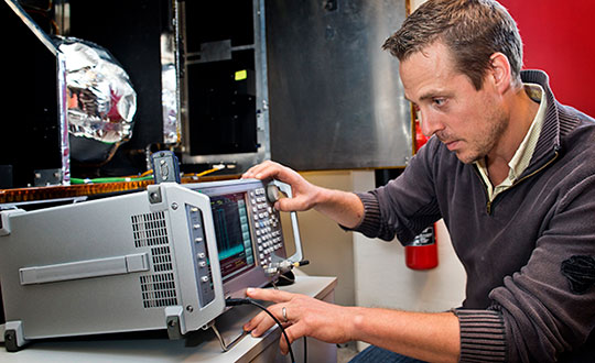
ESA’s Radio Frequency Systems, Payload and Technology Laboratories perform RF research for both the space and ground segments. (Photo: ESA)
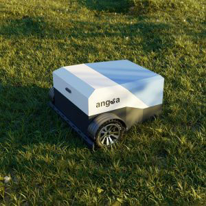
Startup Angsa Robotics was named the overall winner of the Galileo Masters 2020 competition for its autonomous rubbish robot.
According to Angsa Robotics, “Clive” is Germany’s first autonomous rubbish robot. It can move independently and detect and localize individual objects based on its unique artificial neural network architecture, which enables it to clean grass and gravel areas. In addition, individual objects such as crown caps or cigarette butts are targeted for collection, but insects are spared.
The robot’s target use cases include cleaning festival venues after events and the daily cleaning of parks and other green spaces. It can be used where conventional sweeping machines designed for flat asphalt surfaces cannot be used, Angsa Robotics said.
Precise localization via GNSS is essential to its operation, Angsa Robotics added. With better localization, “Clive” can plan a more efficient path and clean a given area faster.
“Angsa Robotics is another concrete example of the innovation and applications that GNSS is enabling for the benefits of business, society and the environment,” said Rodrigo da Costa, executive director of the European GNSS Agency (GSA). “The combination of precise GNSS localization with further state-of-the art techniques such as artificial intelligence and robotics captures in a nutshell the spirit of the three challenges in this year’s edition of Galileo Masters.”
The Galileo Masters’ network of 101 partners from 18 countries focuses on the regional implementation of the competition to ensure a high level of diversity while enhancing both job growth potential and regional development opportunities. At the 2020 Space Awards, seven challenge winners were honored by representatives of the European Commission, GSA, the German Aerospace Center (DLR), and the German Federal Ministry of Transport and Digital Infrastructure.
The Galileo Masters, founded by AZO, DLR and the Bavarian State Ministry of Economic Affairs and Media, Energy and Technology, annually awards the best services, products, and business ideas using satellite navigation in everyday life.
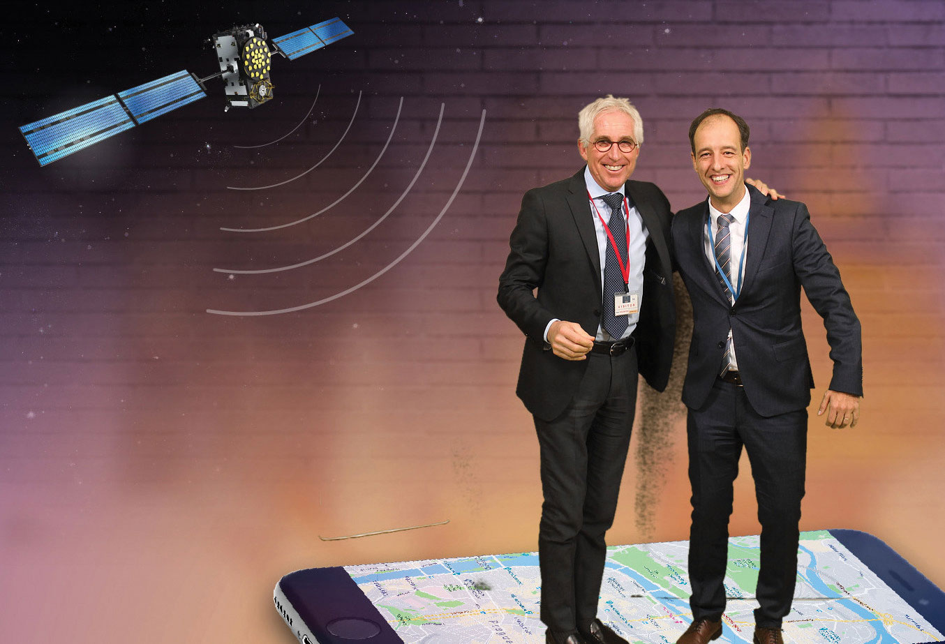
Authors Javier Benedicto (ESA), left, and Rodrigo da Costa (GSA). (Image: ESA)
Throughout 2020, the Galileo Programme under the responsibility of the European Commission, the European GNSS Agency (GSA) and the European Space Agency (ESA), has been delivering continuous and reliable global PNT and Search and Rescue (SAR) services, developed improvements to Galileo First Generation ground and space system infrastructure for increased robustness and new service capabilities, and launched a full modernization program aiming in the future at Galileo Second Generation.
The GNSS User Technology Report 2020 has just been released by GSA, providing a complete overview of the current status and trends of the GNSS worldwide market with focus on user technology and in particular European GNSS (Galileo and EGNOS) applications and services.
In addition to providing a high quality open service based on innovative signals in the E1 and E5 bands, Galileo is also the first GNSS constellation to comprise a SAR capability, including the provision of a return link to users in distress. Galileo also features unique capabilities, such as the provision of Navigation Message Authentication (OS-NMA) and of an encrypted navigation signal on E6, the Commercial Authentication Service (CAS). These functions will offer the first protection against spoofing available to civilian GNSS users.
Finally, Galileo will provide free access to a High Accuracy Service (HAS) through the use of an open data channel used to broadcast high-accuracy augmentation messages.
Performance Meeting Expectations
The Galileo constellation consists today of 22 operational spacecraft (24 satellites are available for the Search and Rescue service). Two additional satellites (GSAT0201/E18 and GSAT0202/E14) are currently under testing with regard to potential operational as auxiliary usage in the near future.
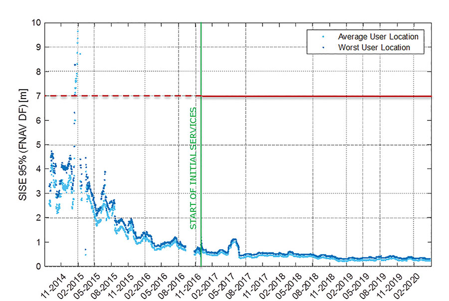
The long-term evolution of performance parameters reveals that the Galileo system is continuously improving. In particular, an excellent quality of the navigation message in terms of ranging accuracy can be observed. Since the Initial Service declaration in 2016, ranging accuracy has steadily improved reaching a level of ~25 cm (95%) by mid of 2020, see Figure 1.
FIGURE 1. F/NAV SISE as observed by user receivers (constellation average, 30 days moving average). (Image: ESA)
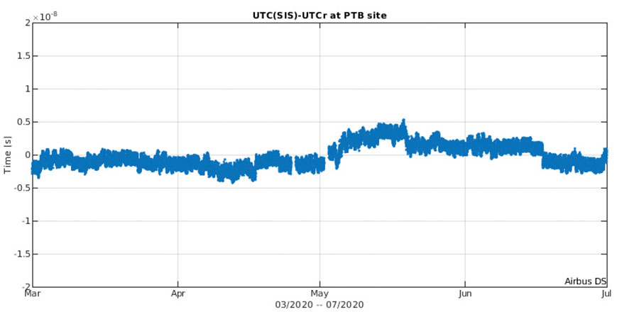
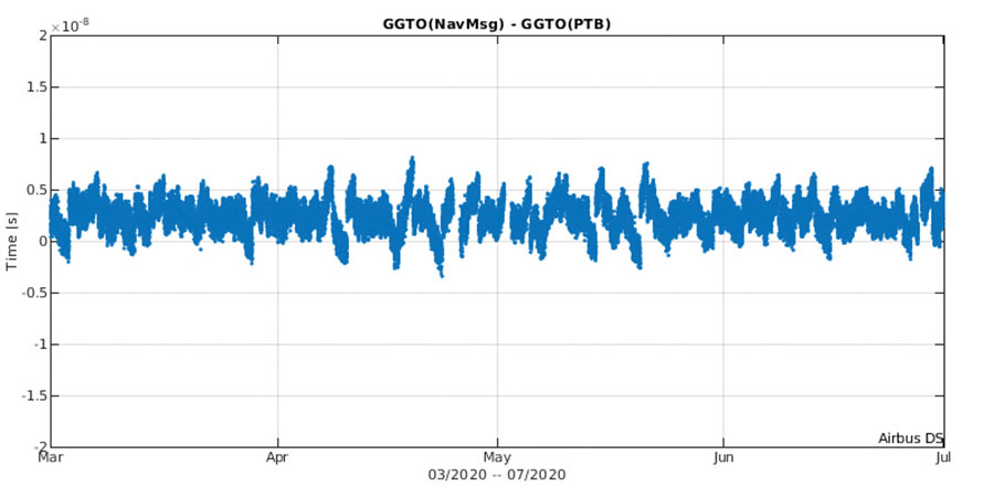
The timing accuracy benefits from the larger number of satellites in service. Figures 2 and 3 present the evolution of the UTC dissemination accuracy and GGTO accuracy performance better than 2.5 nsec and 4.2 nsec (95%) respectively, which are largely within Galileo service commitments.
Probably the most significant discriminator of Galileo versus other GNSS is its capability to broadcast multi-frequency (E1, E6, E5) signal components on all operational satellites. In the high-end and mid-range smartphone chipset market, dual frequency is becoming the norm. All large players have released dual-frequency chipsets, and the first dual-frequency chipsets targeting the budget device market are now becoming available. Dual-frequency receivers offer improved accuracy and robustness, and potential access to high-accuracy techniques. Multi-constellation is now standard for high-volume chipsets and Galileo with its multi-frequency capability is one of the largest GNSS contributors to this emerging dual-frequency PNT market.
Expanding Galileo Services Portfolio
Galileo offers the Galileo Open service (OS) for positioning and timing services, and Europe’s Search and Rescue (SAR) service contribution to COSPAS-SARSAT, equipped with its unique Return Link Message (RLM) declared operational in January 2020. Furthermore, the Galileo system is expanding its infrastructure capabilities such that, once fully operational, it will offer additional high-performance services worldwide.
Public Regulated Service (PRS) is restricted to government-authorized users for sensitive applications that require a high level of service continuity.
Open Service INAV message improvements on Galileo E1-B are under implementation, namely robust symbol level synchronization patterns, additional insertion of clock and ephemeris data with flexible outer encoding and frequent provision of shortened clock and ephemeris for improved robustness in terms of navigation data retrieval in challenging environments, in addition to facilitating a reduced time to first six (TTFF); these improvements ensure backwards compatibility with previously released OS SIS ICDs.
Open Service Navigation Message Authentication (OS-NMA) providing the free authentication of the Galileo Open Service (OS) for geolocation information through the Navigation Message (I/NAV) broadcast on the E1-B signal component.
Commercial Authentication Service (CAS), complementing the OS, providing a ranging authentication function implemented by encrypting the spreading code of the E6C (pilot) channel with a secret key. To ensure backward compatibility, CAS is based on the only civilian signal including cryptographic features (E6). When using both OS-NMA and CAS, users will benefit from data (navigation message) and range authentication, allowing PVT authentication worldwide.
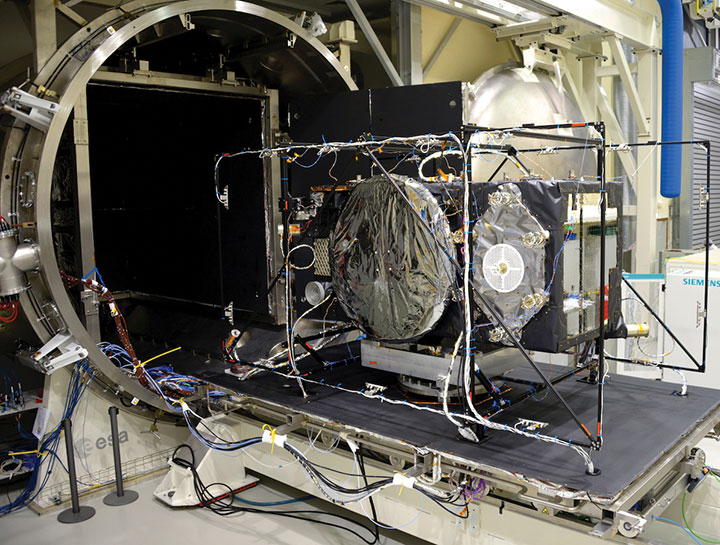
Galileo Batch 3 satellite under test at ESA’s ESTEC facility in the Netherlands. (Photo: ESA)
High Accuracy Service (HAS) complementing the OS by delivering free access high accuracy data and providing better ranging accuracy, enabling users to achieve sub-meter level positioning accuracy.
Support to Safety of Life (SoL) Services through Dual Frequency Multi-Constellation (DFMC) SBAS and supporting the provision of integrity through the concept of Horizontal Advanced Receiver Autonomous Integrity Monitoring (H-ARAIM). In this context, the Galileo Integrity Failure Mode and Effect Analysis (IFMEA) Process is implemented through measurements and review of the system design, including characterization of feared events.
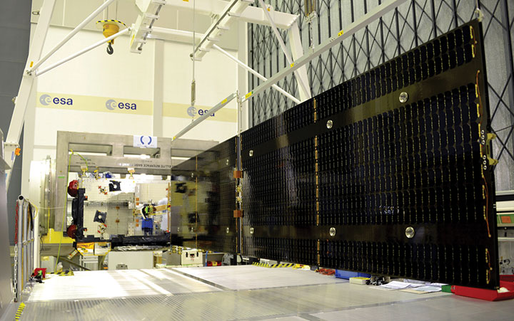
Galileo Batch 3 satellite under test at ESA’s ESTEC facility in the Netherlands. (Photo: ESA)
Infrastructure Modernization
The Galileo System infrastructure is being upgraded and modernized to support the full service portfolio, provide additional robustness and resilience, ensure security and improve operations.
The Galileo Ground Segment is being upgraded implementing ground segment virtualization technologies. This modernized infrastructure will make it possible to easily accommodate technology refresh and will minimize impact to Galileo service operations, under the responsibility of Spaceopal GmbH, during future deployment activities.
Current ground segment upgrades under production by prime contractor Thales Alenia Space in France (in charge of Ground Mission Segment and Security Monitoring) are addressing the deployment of improved robustness of the navigation and precise timing solutions, the full scope of PRS service capabilities, the expansion of the sensor station and up-link ground station networks, and additional security monitoring coverage to protect Galileo ground and space assets.
Ground segment upgrades under production by prime contractor GMV in Spain are addressing the deployment of a new Ground Control Segment providing increased constellation monitoring and control capabilities up to 38 satellites, enhanced operability features, expansion of the TTC network and additional security protection capabilities.
Upgrades of the Galileo Service Facilities are underway as well, notably the evolution of the GNSS Service Center toward the integration of the OS-NMA and HAS capabilities, and the extension of the reference measurement capabilities of the Galileo Reference Centre, by the prime contractor GMV in Spain. The robustness of the SAR service operations, under the prime contractor CNES in France, is also under improvement.
The production of 12 additional Batch 3 Galileo first generation satellites is proceeding, aiming at readiness for launch from mid 2021 onward. Batch 3 satellites are comparable to the 22 FOC satellites launched previously and built by the same prime contractor OHB Systems in Germany. With Batch 3 satellites, Galileo will reach its full constellation capability, including a number of in-orbit spares.
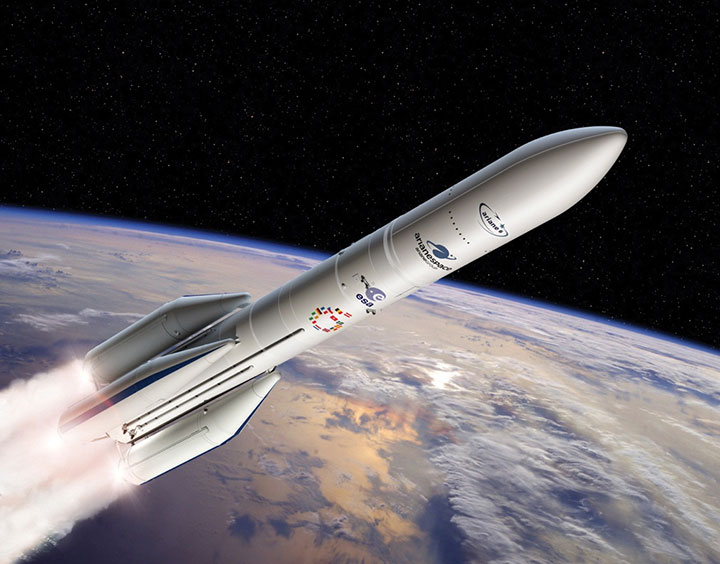
Galileo Batch 3 satellites will be progressively launched with the new Ariane 62 launcher vehicle, the two strap-on solid booster variant of Ariane 6, currently undergoing the final stages of development led by prime contractor ArianeGroup. Meanwhile, France’s space agency CNES is preparing the Ariane 6 launch facilities at Europe’s Spaceport in French Guiana. Ariane 6 is scheduled for its first launch in 2022.
Europe’s new Ariane 6 launch vehicle. (Artist’s concept: ESA)
Toward Galileo Second Generation
The Galileo Programme is fully engaged in the process of developing Galileo 2nd Generation (G2G). Procurement activities for system, satellite and ground segment have been initiated in 2020 with the ambitious goal of starting deployment of the new infrastructure in 2024.
The design of G2G is driven by overarching principles, including backward compatibility, providing an extended portfolio of services and the quality of services, but also the absolute need to meet user demands in a timely and effective manner. The European Commission, in close consultation with EU member states, has converged onto an ambitious set of long term PNT goals for the future European GNSS infrastructures.
G2G Service Portfolio and High-Level Mission Objectives agreed with Programme Stakeholders Service include service evolutions in the areas of signals evolution for increased performance and reduced complexity and power consumption at the user receiver level, time to first-fix, accuracy, authentication and other service attributes, PRS evolutions, advanced timing services, enhanced integration with terrestrial systems (5G/6G), complementarity with external sensors (such as INS, barometer, lidar) and application environments (such as low power devices and internet of things), SAR service evolution, Emergency Warning services, Space Service Volume and Ionosphere Prediction Service.
G2G will build on advanced navigation technology developed over the past 10 years under ESA’s European GNSS Evolution Programme (EGEP) and EU’s Horizon 2020 Programme. This technological leap will allow the early introduction of novel Galileo system features:
Open service capabilities (reduce power consumption and convergence time)
High-accuracy evolution (integrity, availability)
PRS robustness and transmit power
System and SIS in-orbit flexibility, reconfiguration and time-to-market
Inter-satellite links (ranging, mission dissemination, command and control)
SAR second-generation beacons
Reduce operations and maintenance cost
Accelerate time-to-market of new services
Ground technology virtualization and modernization
Acknowledging the changing nature of user requirements, the Galileo second-generation is designed to evolve incrementally and with sufficient flexibility to provide new services or signal features, if and when required, by dynamic reconfiguration of space and ground infrastructure.
In June, Alstom became the first railway manufacturer to integrate certified data-fusion algorithms for fail-safe train localization, using position and speed of trains based on GNSS data coming from multiple constellations, including Galileo.
The added value of Galileo and EGNOS in the European railway sector is widely known, especially when it comes to non-safety applications, such asset management and passenger information services.
In recent years, however, with multi-constellation becoming the norm and multifrequency receivers being adopted rapidly, rail stakeholders view GNSS-based solutions as game-changers for the future of European Train Control System (ETCS).
A recent example of EGNSS adoption in rail operations is the innovative odometry solution deployed by Alstom to measure the location and speed of its trains. The French rolling-stock manufacturer introduced a new sensor type, with a hybridisation of satellite information and inertial sensors. The solution is primarily using GNSS Doppler information, derived from Galileo, GPS and GLONASS constellations (configurable).
Such use allows to improve the overall confidence in the resulting speed, along with specific algorithms to master the resulting location accuracy. The GNSS receiver is an automotive grade receiver manufactured by u-blox. The inertial measurement unit (IMU) used to supplement information in case of GNSS loss is based on enhanced micro-electromechanical systems (MEMS) technology, with temperature compensation.
The new odometry system based on data fusion, which Alstom is currently implementing in Norway, is applicable to all types of trains and all environments, including the harshest weather conditions. It is estimated that by 2026, 450 trains will be equipped with this new feature across Norway.
Increased safety, lower costs for rail companies
Wheel slipping and sliding especially during demanding weather conditions can affect the odometer accuracy and the proper functioning of the different sensors involved. By incorporating Galileo signals as an extra layer of accuracy, Alstom managed to create a system that is capable of providing a more robust speed and location estimate. This space data fusion approach —certified by Belgorail — minimizes the need for the costly external radar components for localisation and speed measurement currently used.
“Industry embedding Galileo in their solutions is the proof that we are on the right path to ensure the market uptake of the EU Space Programme technology,” said Rodrigo da Costa, GSA executive director. “This is a recognition of the capability of EGNSS to reduce the need for infrastructure and related cost, while maintaining the operational safety of ETCS.”
BroadGNSS will procure innovative solutions for applications, synchronization and monitoring of critical mobile broadband communication infrastructure and information assets for public protection and disaster recovery (PPDR) Operations.
The project brings together three members of a joint procurement team:
French Ministry of Interior (lead procurer)
Estonian Infocommunication Foundation
Finnish Erillisverkot
The team will be supported by PSCE and Austrian GNSS company OHB Digital.
The agreement provides for a total budget of €3.6 million over 40 months, beginning this Dec. 1. Of that, €2.5 million is reserved for pre-commercial procurement of innovation solutions. This budget will be made available to industry following an open and competitive process.
BroadGNSS will seek innovative solutions to apply European GNSS to further improve the overall capability of trustworthy information exchange, enabled by new broadband mobile communication.
BroadGNSS will consult key government stakeholders across Europe to scope the specific objectives of the PCP procurement. A “prior information notice” will be released to initiate consultation with innovative industry to contribute their knowledge and capabilities to help our team to prepare a formal request for tender to be released later next year.
BroadGNSS will build upon the success of the BroadWay PCP, which is currently in the prototyping phase. Three innovative prototypes are now in development to address the challenge to enable a pan-European mobile broadband system for PPDR. Prototypes will be evaluated in April 2021, with interim demonstrations to the BroadWay group of procurers this month (November). These prototypes are developed under the leadership of key industry heavyweights, Airbus, Frequentis and Leonardo.
The combination of the results of BroadWay and BroadGNSS will contribute to provide improved mission critical services to public safety responders.
The first drone of Europe’s U-space TRACE project took its maiden flight Sept. 23. It carried an EGNOS-enabled beacon that allows the identification of the aircraft while guaranteeing accurate, robust positioning.
The drone lifted off at the ATLAS experimental flight center in Jaén, Spain, an aerodrome equipped for flight tests with unmanned aircraft systems.
The Regional Minister for Economic Transformation, Industry, Knowledge and Universities, Rogelio Velasco said, “This event shows Andalusia’s commitment to hosting initiatives that promote innovation in the region.”
Using enhanced EGNOS signals, the EU’s regional satellite-based augmentation system, TRACE supports the safe and effective integration of drones into U-space by providing essential services such as e-registration, e-identification and pre-tactical geofencing.
The smart beacon allows for remote identification of drones flying at a very low altitude, enabling safer integration of drones into airspace through the use of U-Space. This makes it easier for traditional aviation pilots to know the position of drones. The smart beacon also enables better traffic separation when integrated with U-space services, thanks to EGNOS.
“TRACE is a pioneering project in Europe that will allow us to demonstrate the advantages of EGNOS, particularly in terms of greater precision in locating drones,” said Luis Gómez, CEO of Alter Technology.
The TRACE project is funded by a GSA EGNOS Adoption in Aviation grant. It designed and developed a smart beacon that leverages the robust signal corrections of EGNOS to improve positioning accuracy, and thus the safety of drone operations at very low altitudes.
Carolina Jiménez, TRACE project manager at Alter Technology added, “TRACE will demonstrate compliance with the European Drone Regulation, an important aspect within the Alter business line, since one of the fundamental requirements in this new regulatory framework is that each system has the capacity for remote identification for future secure integration within the air space for these systems (U-Space).
The TRACE project is led by Alter Technology, and is a result of collaboration among European companies such as Unifly (Belgium), Pildo Labs and FADA-CATEC (Spain).
Vodafone, together with CATEC, presented the 5G Lab of ATLAS within the 5G initiative of RED.ES. A use case of 5G with drones for urgent defibrillator delivery was demonstrated with the participation of Fundación SSG, Vodafone and the technological support of CATEC.
TRACE project partners include:
Alter Technology provides engineering and test services for electronic systems and E.E.E. components within the space and harsh environment markets.
FADA-CATEC, the Advanced Aerospace Technologies Center, promotes and develops creation of technological knowledge and its transfer to the productive aerospace industry.
Pildo Labs is an engineering company that specializes in aeronautics and aerospace technology and services.
Unifly is a software company with a platform for the safe integration of drones into the airspace.
The European GNSS Agency (GSA) manages operations, security and service provisions for Europe’s Galileo and EGNOS.
The drone market is expected to outstrip any other user base in the aviation market. According to estimations, revenues from drone-based services are expected to exceed 150 million euros by 2023. GNSS is a key enabling technology for drones and it is expected that its role will continue to grow. Solutions like TRACE that use European GNSS (EGNOS and Galileo) are differentiators that can be leveraged to safely integrate drones into non-segregated airspace and into the U-Space.
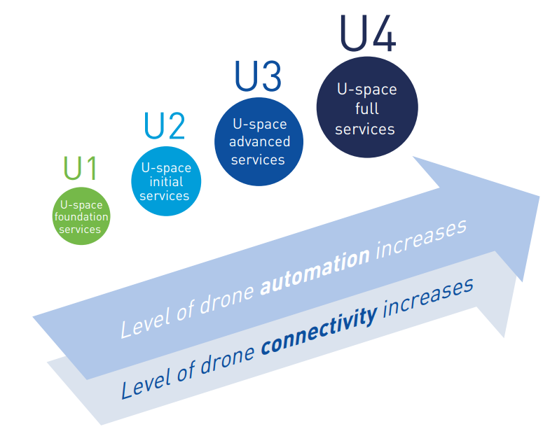
U-space
The progressive deployment of U-space is linked to the increasing availability of services and enabling technologies. Over time, U-space services will evolve as the level of automation of the drone increases, and advanced forms of interaction with the environment are enabled (including manned and unmanned aircraft).
These U-space services have been identified and gathered in four different phases, increasing the drone level of integration. Learn more in the U-space Blueprint.
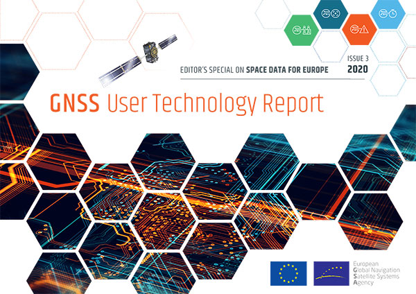
The full GNSS User Technology Report 2020 is available for download. (Cover: GSA)
News from the European GNSS Agency
The European GNSS Agency (GSA) has released its latest GNSS User Technology Report, providing a comprehensive analysis of GNSS trends and developments.
With four GNSS available and more than 100 satellites in operation broadcasting multiple frequencies, the GNSS industry is shifting towards the wide adoption of multifrequency receivers across market segments to meet the diverging user needs of emerging applications.
The report includes contributions from leading GNSS receiver, chipset manufacturers and service providers, and serves as a valuable tool to support planning and decision-making with regards to developing, purchasing and using GNSS technology.
Published biennially since 2016, the User Technology Report has become a point of reference for the GNSS industry, research and policy-makers.
Rapid Evolution
‘’The GNSS industry is evolving at a rapid pace and is shaped by the dynamics of emerging applications and user needs as well as the upgrade of existing and new GNSS and Satellite Based Augmentation Systems (SBAS),” said Rodrigo da Costa, GSA executive director. “The industry has understood the potential of Galileo’s unique features.”
The third edition of the report begins with a chapter devoted to technology trends common to all segments: receiver design, position processing and signal processing. It also discusses protection measures against GNSS jamming and spoofing, such as authentication, including what 5G and other technologies and sensors can do, in combination with GNSS.
With multi-constellation now being the norm, the industry is moving towards the wide adoption of multi-frequency receivers even for usually power- and cost-constrained consumer solutions. The Galileo E5 is becoming the preferred frequency with about 20% of all receiver models in the market already using it.
The report is built around four macro segments defined on the basis of commonalities from a technology point of view:
high volume
safety- and liability-critical
high-accuracy
timing devices and solutions (a new-entry in this edition)
Each chapter starts with the macrosegment characteristics and receiver capabilities, depicts the industry landscape and typical receiver form factor, it then delves into the key current and future drivers and trends, and finishes with the added value of the EGNSS, Galileo and EGNOS, for the macrosegment at stake.
Space Data for Europe
This year editor’s special “Space Data for Europe” sheds light on the role that Copernicus and Galileo play within the European Space Programme in the data management and use, now and in the future. It also provides a vision of major transformations underway within our society and our economy and the benefits expected from this digital transformation, paving the way towards the European Data Strategy and Green Deal.
“Today, Galileo and EGNOS already provide increased capabilities which are being used across a broad range of applications, and are already igniting the next generation of location-based applications. In the future, new services — the Galileo High Accuracy Service (HAS), Galileo Open Service Navigation Message Authentication (OS-NMA) and Commercial Augmentation Service (CAS) — will raise the accuracy and reliability bar even higher, and dramatically enhance positioning, navigation and timing solutions for businesses and citizens.
By bringing insight and understanding into the evolutions of GNSS technology, we are creating opportunities for innovation,” concluded da Costa.
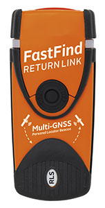
The first Galileo Return Link Service Personal Location Beacon (PLB) developed under the H2020-funded Helios project will be released in December across 19 European countries.
In close collaboration with the European GNSS Agency and within framework of the H2020 HELIOS project, Orolia has been working to equip search-and-rescue beacons with the breakthrough Galileo Return Link Service.
Declared operational in January, the Galileo Return Link Service is a unique feature of Galileo, allowing people in distress to receive an automatic acknowledgement that their signal has been received and their location is known.
How It Works
The FastFind ReturnLink PLB transmits the user’s unique ID and GNSS location via the global network of Cospas-Sarsat search-and-rescue satellites. When a person in distress activates the emergency beacon, the Galileo satellites capture the signal and transmit it to a set of ground-segment facilities — the Galileo Return Link Service Provider (RLSP) based in Toulouse, France.
Once the location of the person in distress is determined, an automatic message is sent through the Galileo satellites, confirming to the user that their position has been detected and the information has been routed to the relevant government authorities. With the FastFind ReturnLink PLB, the person in distress — on land or at sea — will see a blue light blinking on their beacon 10-15 minutes after confirmation that the distress signal and location has been detected.
”At the GSA, our objective is to ensure that EU Space investments and our work on Galileo services are bringing added value to citizens,” said Rodrigo da Costa, GSA executive director. “With the first search-and-rescue beacon worldwide deployed thanks to the H2020 project Helios, we can proudly state that our actions made a difference for innovation but also for the citizens. The ones who need to use this Personal Location Beacon will be reassured by the Return Link Service.”
Cospas-Sarsat rescue beacon activated. Its signals are picked up by satellites in orbit, including Galileo. (Photo: GSA)
Galileo a SAR Game Changer
Galileo’s immediate impact on search and rescue (SAR) has been the addition of 26 new satellites, allowing for greater global coverage and faster detection of the 406-MHz distress frequency. Coupled with Galileo’s robust signal, SAR beacons deliver greater positioning accuracy.
Galileo’s development is part of the European Union’s preparations for upgrading the international distress beacon locating organisation Cospas-Sarsat’s Search and Rescue (SAR) Ecosystem under the MEOSAR program, which requires new Earth-based antenna and a network of 72 GNSS satellites, combining GPS, the EU Galileo and the Russian Glonass systems. The Return Link Service is a unique feature provided by Galileo within its contribution to Cospas-Sarsat.
Survival Booster
By sending a confirmation to the user that the distress signal from the beacon has been localised by the Cospas-Sarsat system and the information relayed to the relevant Search and Rescue l authorities, the Return Link Service provides confidence and reassurance to the people in distress that help is on the way.
“The Search and Rescue community has long known the survival impact of dealing with a distress situation on your own, either as a solo adventurer or as a group that feels isolated due to the lack of communication with the outside world,” said Chris Loizou, vice president of Maritime at Orolia. “The Return Link reassurance signal will reduce the chances of rash decisions taken by those who feel they have nothing to lose, such as leaving the site of an accident or attempting to swim to safety. The psychological impact of knowing that help is on the way cannot be underestimated, and this PLB will provide invaluable peace of mind for those in distress.”
The Galileo Return Link Service increases survival rates by giving an important psychological boost to people in distress. It is estimated by Cospas-Sarsat that the international SAR system, with the contribution of the Galileo Search and Rescue service, saves more than 2,000 lives a year.
Countries Included
The beacons will be sold in the following countries.
Croatia
Cyprus
Denmark
Faroe Islands (DK)
France
Germany
Greece
Greenland (DK)
Iceland
Ireland
Israel
Italy
Latvia
Liechtenstein
Norway
Sweden
Switzerland
United Kingdom
Eventually, the RLS-enabled beacons will be available in most countries in the world.
On Oct. 16, Rodrigo da Costa took up his duties as executive director of the European GNSS Agency (GSA), soon to become the EU Space Programme Agency.
He was elected by the GSA Administrative Board on Sept. 15 and met with the ITRE Committee of the European Parliament on Oct. 12.
Da Costa, a Portuguese national who has worked in a number of EU countries, joined the GSA as the Galileo Services Programme manager in March 2017. In this position he was responsible for leading Galileo, the European Union GNSS, in its service provision phase.
He has previously held several senior project management, business development, and institutional account management positions in space industry, in the areas of human space flight, exploration, launchers and research and development.
Da Costa will now be working on transforming the GSA into the EU Space Programme Agency (EUSPA). He will ensure that its existing activities continue to be successfully delivered while also performing new ones required to undertake with the Agency’s new mandate.
Since its creation in 2004, the GSA has made an unparalleled contribution to the EU flagship satellite systems Galileo and EGNOS, which have significantly contributed to the union’s independence and economic growth.
Staffed with highly skilled and dedicated personnel, the agency has boosted innovation, fostered entrepreneurship, led the provision of services, and stimulated the EU economy, in particular through ensuring Galileo and EGNOS uptake across a wide range of market segments thanks to high-quality and secure satellite services.
Rodrigo da Costa, executive director of the European GNSS Agency. (Photo: GSA)
With eyes fixed on the future, EUSPA will further build on the work of the GSA, and will take on additional new responsibilities for further components to the EU Space Programme, including activities in Copernicus (the European Earth observation programme), GOVSATCOM (the EU secure satellite communication system).
Commenting on his new duties da Costa said: “Becoming Executive Director of the Agency means, above all, to lead a team of excellent, dedicated professionals. I’m immensely excited by the opportunity we have to build a successful EUSPA, a key contributor of the EU Space Programme. I’m looking forward to working with all our stakeholders. The task is vast, but I am confident we will be able to play our part, demonstrating to EU citizens what we can do together in EU space activities as GSA/EUSPA.’’
The European Commission (EC) is seeking help to build a roadmap for high-accuracy Galileo and EGNOS services.
The EC Directorate-General for Defence Industry and Space (DG-DEFIS) has issued an Invitation to Tender for a service contract to address how the future evolution of European GNSS (EGNSS) could be beneficial for innovative demanding applications.
The new service contract will assess the feasibility of an integrity service complementing EGNSS high accuracy in the 2030+ timeframe.
The new service contract will feed into the evolving needs of demanding new applications without disrupting the current business models of established service providers, according to the European GNSS Agency. The tender will assess various steps needed for the Galileo and EGNOS services to evolve.
A webinar to explain the framework and objectives of the procurement and the different tasks in the procurement is planned on September 23 at 16:00 CEST.
Emerging and next-generation applications will require more demanding positioning solutions to be able to offer innovative services. The use of an integrity service complementing European GNSS (EGNSS) High Accuracy in the 2030 horizon could result in the provision of an accurate and reliable positioning solution that would translate into the overall improvement of future innovative and demanding services.
As part of the services provided by Galileo, the Galileo High-Accuracy Service (HAS) will provide high-accuracy positioning and synchronization information, the EC said.
EGNOS version 3 will extend the service area to the entire landmasses of EU Member States. New EGNOS services could be implemented in further releases of EGNOS as an option for the integrity service complementing EGNSS High Accuracy.
The European GNSS Agency (GSA) has launched the MyGalileoSolution competition. The contest is targeting European innovators and entrepreneurs ready to develop location-based solutions, such as mobile applications, wearable-based solutions, asset management and tracking solutions, or robotics, leveraging Galileo as a source of positioning, navigation and/or timing. A wide participation from all Member States is expected.
GSA has a successful track record in supporting and boosting GNSS-based innovative applications. For years, the agency has been leading several research and innovation initiatives such as the Galileo Masters, Horizon 2020 projects, and more recently European competitions like the 2019 MyGalileoApp and Hackathons across Europe and beyond.
Two tracks for 56 prizes
With a prize pool of almost € 1.5 million, MyGalileoSolution is the largest competition ever organized by the GSA. It consists of two independent and parallel tracks, each one with a list of goals and deliverables.
Track 1 , From Idea to Prototype, aims to develop a beta version of an application or a prototype of a solution implementing an idea, reaching a minimum of 50% of its functionality.
Track 2, From Prototype to Product, aims to develop a fully functional solution ready to be commercialised starting from a beta version of an application or a prototype.
Participants are expected to leverage Galileo’s robust positioning and accurate timing and synchronization capabilities, showing how it can enable the development of the next generation of applications and services across a wide range of areas. In this competition the GSA is challenging innovators in four different areas: Crisis & Emergency Response, Smart Transport for Green Deal, Solution for Digital Age, and Cybersecurity.
Galileo for location-based services
With more than 1.5 billion Galileo-enabled smartphones and more than 51 million GNSS-enabled wearable devices in the market, location-based services (LBS) are booming. Accurate positioning and timing are at the heart of the growth and evolution of LBS, in addition the access to Android GNSS raw measurements has allowed for the creation of advanced GNSS positioning algorithms that enable the development of more ambitious smartphone-based applications.
‘’Galileo has set the trend for dual-frequency chipsets, which provide better accuracy and are more resistant to multipath in urban environments,” said Pascal Claudel, GSA acting executive director. “We are looking forward to seeing innovators launching their disruptive GNSS solutions and turning them into real businesses, hence leading to European growth, competitiveness and sustainability. There is ‘space’ for all types of innovation and we expect the participation of all Member States.”
“Competitions like MyGalileoSolution are a great opportunity to quickly move from idea to market,” said Francesco Fiorito, leader of Argeo, the winning team of the 2019 MyGalileoApp competition. “It is a confidence boost for young entrepreneurs and their capacity to grow and generate new solutions and business,” Claudel concluded.
Deadlines and more information
The deadline for submission for both categories is Sept. 30. Projects will be evaluated in terms of their innovative nature, market potential, feasibility and Galileo relevance by a panel of GSA experts.
The European GNSS Agency (GSA), in collaboration with the Council of European Geodetic Surveyors (CLGE), has launched the Geomatics on the Move 2020 competition. The event aims to foster the use of European Union (EU) satellite programs Galileo, EGNOS and Copernicus among students, young professionals, entrepreneurs and small and mid-sized businesses to create innovative geomatics applications and solutions across all over Europe.
Building and expanding on the CLGE Student Contest, which has been held for the past nine years, the new Geomatics on the Move Prize Contest targets applications that integrate the use of additional technologies such as artificial intelligence, machine learning, augmented and virtual reality, as well as supplementary remote sensing data sources like drones, GSA said. Solutions animated through mobile phone applications or other easy-to-use platforms are also accepted.
“This is the ninth year of partnership between the Council of European Geodetic Surveyors and the GSA; over the years we have seen some exciting and innovative solutions emerge that leverage the EU Space Programme to deliver practical solutions for the mapping and surveying community,” said GSA Acting Executive Director Pascal Claudel. “This year, as we recover from this global setback, I look forward to seeing even more novel ideas — from all over the European Union — able to respond to current and future challenges.”
The competition will be organized in two stages. The first phase is an open call for ideas, during which applicants submit posters describing their ideas. The deadline for these submissions is Oct. 16.
The proposals then will be evaluated by the GSA and CLGE, and a maximum of 10 projects will be chosen to present their pitch during the finals. The selected applicants will refine their poster and prepare their pitch, for which technical support and training will be made available.
The official award of the Geomatics on the Move prize contest will take place virtually, during the European Space Week, taking place Dec. 7-11. During this event, finalists will present their solutions to the evaluation board, and winners will be announced on the official contest site.
With an overall prize of €30 000, a set of 10 prizes will be offered in two categories. The first of these categories targets EU space-based traditional geomatics solutions and the second targets integrated geomatics solutions. he first category is looking for solutions in which the main innovation is based on the use of EGNSS, employing traditional equipment such as surveying or GIS grade GNSS receivers for applications such as cadastral, marine and mining surveying or GIS mapping. The integrated geomatics category targets integrated surveying solutions that use Galileo or EGNOS and leverage cutting-edge tools and technologies such as drones, mobile mapping, laser scanners or augmented/,mixed reality, both within geomatics applications or beyond.