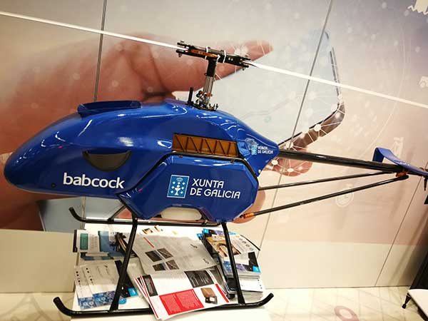
The contest targets the design and development of drone-based applications or services, using a Galileo-enabled receiver, to address the European Union’s (EU’s) key priorities such as the Green Deal, and support the EU Recovery Plan for Europe.
Initial ideas should be submitted by Aug. 31. Wide participation from all EU Member States is expected.
According to ESA, the MyGalileoDrone competition seeks to tap into the EU’s innovative spirit to deliver applications and services to boost Europe’s competitiveness, resilience and sustainability. Applications should leverage and demonstrate Galileo’s added value, such as increased accuracy, availability and robustness of position, as well as integrity for a solution based on drone operations.
The market related to drone applications and services is growing rapidly, and European drone service revenues are expected to reach EUR 250 million by 2025. The European demand is estimated to reach EUR 10 billion annually, in nominal terms, to 2035 and over EUR 15 billion annually to 2050, creating more than 100,000 jobs.
With GNSS receivers implemented on almost all new commercial drones, Galileo’s and EGNOS’ added value is pivotal for the development and growth of drone services and applications.
In addition to designing and developing the application, contestants should prepare their drone- based application or service for commercial launch.
The solution should leverage Galileo to provide a position fix. The use of EGNSS is understood in the broad sense, and Galileo can be integrated in the flying platform, the ground control station, or in other devices supporting the operation, such as a smartphone or even in the frame of U-Space services.
“GNSS is a key enabling technology in this segment, ensuring robust navigation and reliability for a wide range of applications. The MyGalileoDrone competition aims to bring oxygen to European SMEs and entrepreneurs driving innovation. It will create jobs and growth in this promising market,” said Pascal Claudel, acting executive director at the GSA.
Focus on EU priorities
In times of post-COVID recovery focus, submissions should target applications and services that support key EU priorities, but the sky’s the limit. The GSA is looking for trailblazing ideas in applications such as smart mobility, sustainable agriculture or environmental protection, or solutions that exploit synergies between 5G and space data, or support the internet of things, or whatever might be the next big thing.
Deadlines and Prizes
The first prize in the MyGalileoDrone competition amounts to EUR 100,000, with EUR 60,000 for second, EUR 40,000 for third, and a fourth prize of EUR 30,000.
After Aug. 31, projects selected to advance to the development phase of the contest will be announced on Sept. 15. Participants will have until Nov. 30 to develop a demo version of their proposed application or service.
In the finals, the selected teams will perform a live demonstration and pitch their ideas to investors. During the development process, the applicants will receive mentoring and coaching from recognized experts in the drone market. These experts will accompany them as they build their application, develop tests and get ready from the business perspective to attract investors and move to market.
To register or for more information, visit the competition page on the GSA website.
Photo: Philipp Berezhnoy/iStock / Getty Images Plus/Getty Images
Access to the Galileo signal in a multi-constellation environment is providing benefits and opportunities for businesses, thanks to the enhanced performance and increased accuracy on offer, said the European GNSS Agency (GSA).
Swedish geographical information technology company SCIOR Geomanagement AB uses a variety of technology in its equipment, including drone aerial photography, terrestrial laser scanning, GNSS or combinations of these.
SCIOR, a measurement technology producer, incorporates RTK processing techniques into its approach. The company also uses Galileo-enabled receivers to increase the positioning accuracy of its solutions.
According to the company’s findings, which it presented at the 2019 Intergeo conference in Stuttgart, it has been achieving significantly enhanced performance and other benefits in its day-to-day activities from the use of Galileo-enabled equipment, GSA said.
“Our experience with Galileo has shown an improvement in the density of the constellation of visible satellites, and thus an improvement in the time needed to obtain centimeter-level accuracy,” said Javier Corral, an engineer at SCIOR Geomanagement AB. “From my personal point of view, I would recommend using this constellation in combination with the other existing ones, since it provides you with a better and quicker performance.”
According to GSA, the most significant performance improvements are observed at high latitudes and within forest environments. Even taking into account that better results can be obtained in open spaces, using multi-constellation GNSS with Galileo in the woods is sometimes the only way to obtain a satisfactory performance if there is no reference station close enough. performance will be even better in coming years as the number of Galileo satellites increases to reach full operation capability, allowing users to obtain their desired position accuracy and availability in a shorter period of time, GSA added.
Geospatial Solutions and GPS World are offering the latest news and updates concerning the coronavirus (COVID-19) pandemic as it affects the geospatial, mapping and GNSS/PNT industries. Read a message from GPS World here.
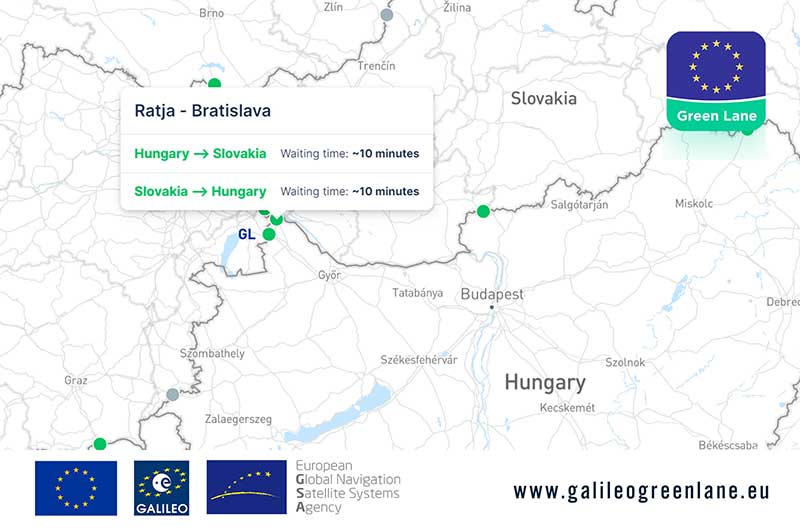
The European GNSS Agency (GSA) has collaborated with the European Commission to develop the Galileo Green Lane app, a mobile solution designed to facilitate the free movement of freight, reduce waiting times at European Union (EU) borders and prioritize essential goods during the COVID-19 pandemic response.
According to GSA, for border control authorities, the app provides a real-time visualization of the situation at border crossings, along with regular updates on the traffic flow situation.
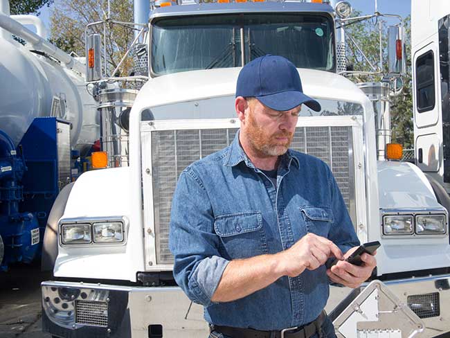
For truck drivers, the app provides a real-time visualization of borders, through an EU-wide map indicating crossing times. This enables logistic companies and drivers to better prepare their routes, having advance knowledge of the waiting time at each border crossing, GSA said.
The app also offers a real-time overview of border traffic hold-ups, built on the foundation of Sixfold’s COVID-19 map. In mid-March, Sixfold began to provide supply chains, retailers and shippers with a free live border crossing map, which is updated in real-time.
“With the Galileo Green Lane app, the GSA is fulfilling its mission to address economic and societal challenges by leveraging the European GNSS capabilities,” said Pascal Claudel, acting executive director at the GSA.
The app has been tested at border crossings in Hungary and the Czech Republic, while other countries, including France, Greece, Italy, Romania and Spain, are about to start testing, GSA added.
The 2020 Galileo Masters are open for submissions. The competition is designed to award applications, services and new ideas that use Galileo and EGNOS, in synergy with other space programs, to respond to pressing needs facing business and society.
The 2020 competition has three European GNSS Agency (GSA) challenges, themed “Space for Future Generations.”
The first challenge, the “Space for our Planet Challenge,” aims to tackle climate change and environmental degradation. Services based on data from Galileo, EGNOS and Copernicus Earth observation can be used to mitigate this threat by supporting more environmentally-conscious life choices, resulting in a healthier planet, GSA said.
The second challenge, the “Space for Being Safe and Healthy Challenge,” seeks out solutions that use downstream space data provided by Galileo, EGNOS and/or Copernicus as key enablers of innovative applications to help stem the spread of COVID-19 pandemic.
The third challenge, the “Space for Fun Challenge,” targets solutions using data from Galileo and EGNOS in the gaming, sports, leisure and tourism markets, where GNSS enables the monitoring of user performance and helps make augmented reality games even more immersive.
For all three challenges, there is a cash price of 10,000€, with another 10,000€ awarded to the overall Galileo Masters 2020 winner.
Registration is free, and entries must be submitted by June 30.
The European GNSS Agency, based in Prague, is providing on its website a list of location-enabled applications that it considers potentially useful in response to the COVID-19 pandemic.
The applications range from those helping public authorities understand the dynamics of the outbreak to supporting citizens in their everyday lives by checking supermarket lines.
The apps are sorted into four categories:
Tracking the COVID-19 pandemic
Queue management
Response management
Information dissemination
If you are an application developer and you want to add your app to the list, contact [email protected].
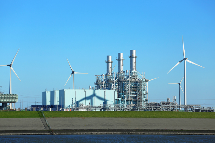
Thales Alenia Space has been awarded a grant under the European GNSS Agency’s (GSA) Fundamental Elements funding mechanism for the development of the GIANO (Galileo-based TIming Receiver for CriticAl INfrastructure Robustness) receiver, which aims to make critical infrastructure more robust against interference, jamming and spoofing.
In an increasingly complex GNSS environment in which there is both unintentional and deliberate disruption of satellite signals, the GSA is funding the development of a timing receiver for professional applications to address the needs of the critical infrastructure user community, mainly energy generation and distribution, telecommunications and financial operators.
Improved resilience
The GIANO receiver will leverage Galileo and EGNOS-driven innovation to improve the resilience of the receiver against interference, jamming and spoofing and increase the accuracy and reliability of the time transfer service. The timing platform prototype to be developed and validated will integrate all the latest innovative technologies, including professional products from Thales Alenia Space, paving the way for future Galileo-based timing receivers that offer improved resilience and accuracy at a reasonable cost.
“Critical infrastructure operators use GNSS for timing and synchronisation and are an important target segment for GSA Market Development because Galileo can make a difference. By funding the development of the GIANO receiver, the GSA aims to provide technological solutions to this community for robust and reliable timing,” said GSA head of market development Fiammetta Diani.
Toward this goal, outreach activities have been conducted among potential final users in the main commercial target groups to collect and analyse their needs. Then, following the definition and consolidation of stakeholders’ needs and the platform specifications, the project conducted a preliminary design review at the end of November 2019.
Europe-wide cooperation
The two-year project, funded under a GSA grant related to the Development of a Galileo-based timing receiver for critical infrastructures (GSA/GRANT/05/2017), will be coordinated by Thales Alenia Space in Italy, in collaboration with four European partners: Business Integration Partners S.p.A (BIP, Italy), PIKTime Systems (Poland), Space Research Centre of the Polish Academy of Science (SRC PAS, Poland) and DEIMOS (Portugal).
The project will also benefit from the support of the European Commission’s in-house science service – the Joint Research Centre (JRC) and the Italian National Metrology Institute (INRIM), which will make available its test facilities for verification activities on the developed equipment.
A version of the NeQuick G algorithm using a new coding approach is now available for download on the GSC website. This version is the result of intensive recoding by engineers at the EU’s Joint Research Centre.
GNSS signals traveling through the ionosphere can be significantly delayed by the electrical charges in this atmospheric layer before reaching the users’ terminal. To compensate for this delay in the signal, Galileo receivers integrate a dynamic model of the ionosphere composition known as the NeQuick G model.
Receiver manufacturers will now be able to benefit from a version of the NeQuick G correction algorithm that implements a new coding approach.
Rigorous testing
The JRC concluded its work recently after successful rigorous testing in the framework of the gLAB tool (GNSS software suite from the Universitat Politecnica de Catalunya). This version of the code has been designed to be highly modular, rendering it more legible for a potential programmer with no specific knowledge about signal propagation in the ionosphere. A library has been also developed to enable its quick integration into existing applications.
This software will be released as free and open source software under the terms of the European Union Public Licence (EUPL), version 1.2.
The open-source code is now ready to be implemented on single-frequency platforms and can be used on a global scale without limitation under the EUPL. This freedom should contribute to a wider adoption of the NeQuick G model at user level.
By Javier Benedicto
Head, Galileo Programme department,
European Space Agency
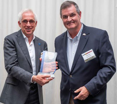
Javier Benedicto, left, accept the 2018 GPS World Satellites Leadership Award on behalf of Giuliano Gatti of the European Space Agency, from Phil Froom of Rockwell Collins. (Photo: Melanie Beus)
Since the Galileo initial services declaration in December 2016, the Galileo Program has been providing global PNT and search-and-rescue services for users worldwide. The European GNSS Agency (GSA) just issued its GNSS 2019 Market Report in October, providing a complete overview of the current status and trends of the GNSS worldwide market with focus on European GNSS (Galileo and EGNOS) applications and services.
In parallel with service provision, the Galileo Program is undertaking extensive infrastructure development and deployment activities to reach Full Operational Capability (FOC), incorporating new service capabilities, but above all aiming at increasing the robustness and resilience of the system infrastructure, operations and service provision.
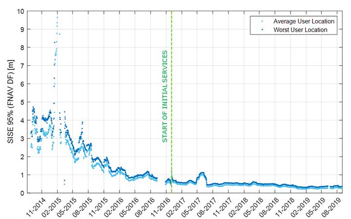
Galileo’s signal-in-space quality has steadily improved over the past few years, reaching in 2019 a best signal-in-space error (SISE) of about 0.25 meters (95%, global average; Figure 1). This has been achieved through a combination of several factors, including the increased number of operational satellites, enhanced versions of the Ground Mission Segment, and higher uplink rate of the navigation message (lower age of data). This performance is well within Galileo’s initial service accuracy commitments, as defined in the public Open Service – Service Definition Document (OS SDD).
Figure 1. Long-term historical SISE plot over a 30-day sliding window, constellation averaged. (Image: ESA)
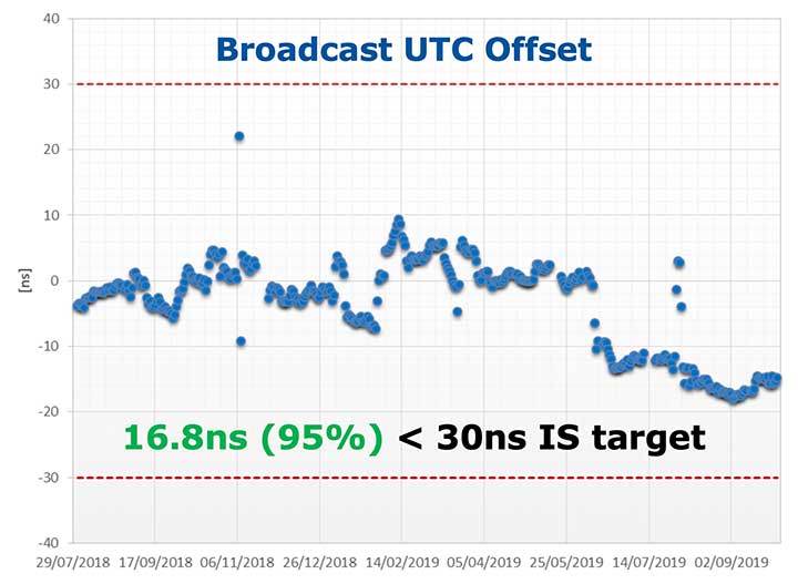
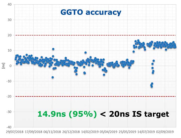
Figures 2 and 3 (see page 40) show Galileo’s timing performance as broadcast UTC offset and GGTO accuracy. The evaluation was performed with calibrated GPS/Galileo timing receivers operated in UTC(k) laboratory (PTB, INRIM). Again, the initial timing service commitments have been fully met.
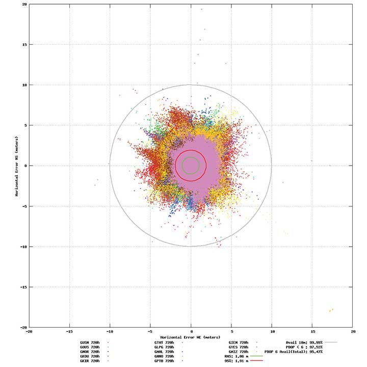
Probably the most significant discriminator of Galileo compared to other GNSS is its capability to broadcast multi-frequency (E1, E6, E5) signal components on all operational satellites. The position performance of a dual-frequency user receiver on-ground is shown in Figure 4. This measurement from June 2019 demonstrates a Galileo position accuracy well below 2 m (95%).
Figure 4. Galileo position accuracy performance, dual-frequency, June 2019. (Image: ESA)
With the aim of further improving the Open Service (OS) performance, three newly introduced I/NAV message improvements on Galileo E1-B are under implementation, namely FEC2 Reed-Solomon Clock and Ephemeris (CED), Reduced CED, and Secondary Synchronization Pattern (SSP). Galileo Open Service (OS) users will benefit from improved robustness in terms of navigation data retrieval in challenging environments, in addition to facilitating a reduced time to first fix. Those I/NAV improvements on Galileo E1-B are backwards compatible with previously released OS SIS ICDs.
In addition, Galileo infrastructure is currently being upgraded to provide means for OS authentication. The protocol proposed uses the E1B External Data Broadcast Service (EDBS) to provide authentication data to the user. The OS Navigation Message Authentication (NMA) is based on an adaptation of the Timed Efficient Stream Loss-tolerant Authentication (TESLA) protocol.
Beyond the OS, the Galileo system has been designed to allow for the dissemination of value-added data, such as high accuracy and authentication, in the E6B signal component. The component has been designed to broadcast the Galileo High Accuracy Service based on the provision of accurate satellite data (clocks, orbits and biases) and atmospheric data (mainly ionospheric corrections) to enable multi-frequency multi-constellation PPP with correction data transmitted through an open format in the Galileo E6B signal.
The introduction in early 2020 of the automatic acknowledgment of the SAR/Galileo Return Link Message (RLM) as part of the Cospas-Sarsat system will enable space assets to be used for search and rescue — persons in distress will get swift acknowledgement that their alert has been detected and located. The Return Link is the means to interact with a SAR beacon, improving the effectiveness of SAR operations. Extensive testing has demonstrated that the median latency for the reception of a return link message on the ground is 14.2 seconds, while 99% of messages are received within 57 seconds, after the request for the RLM transmission is delivered to Galileo (from Cospas-Sarsat to the RLSP). At the same time, the measured rate of reception was 100%, considering line-of-sight availability, thanks to the very robust Galileo navigation data link. This performance has been demonstrated to be uniform across the globe, as shown in Figure 5.
Figure 5. Beacon activation map and RLM delivery latency through the Galileo system. (Image: ESA)
Following the re-profiling of the Galileo Safety-of-Life (SoL) service, Galileo is meant to be exploited through dual-frequency multi-constellation (DFMC) SBAS and will support the provision of integrity through the concept of Horizontal Advanced Receiver Autonomous Integrity Monitoring (H-ARAIM). To allow the exploitation of Galileo for these SoL applications, a thorough analysis of the actual signal-in-space (SiS) performance and of potential feared events critical for SoL users is key. In this context, the Galileo Integrity Failure Mode and Effect Analysis (IFMEA) process is implemented through measurements and review of the system design, including feared-events characterization.
Ground Segment Brings Robustness
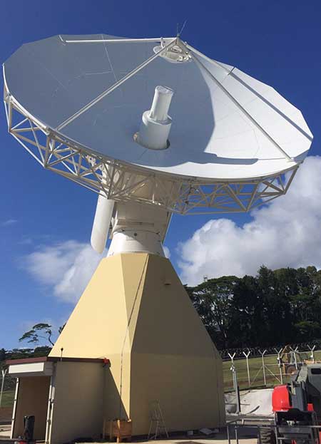
Galileo telemetry and telecommand ground station. (Photo: ESA)
Galileo’s Ground Segment is being upgraded to fully redundant control centers. These include processing and storage, monitoring and control facilities, and security monitoring centers. A worldwide network of Galileo Sensor Stations (GSS) allows monitoring and measuring of satellite signals; uplink stations allow dissemination of the navigation message to users through Galileo satellites; and telemetry, tracking and control (TTC) stations allow monitoring and control of the satellites.
Ground segment upgrades under production by Thales Alenia Space France (in charge of the ground mission segment and security monitoring) and GMV Spain (in charge of the ground control segment) are addressing increased service robustness, through the introduction of a more flexible infrastructure with a significant technology refresh, improved security, service continuity, enhanced service performances, and enhanced operability features.
One important objective of the ongoing upgrades is to implement a modern infrastructure, based on leading virtualization technologies. This modernized infrastructure will make it possible to easily accommodate hardware and software changes without requiring significant redesign or requalification, and will minimize the impact to Galileo service operations — under responsibility of Spaceopal GmbH — during future deployment activities.
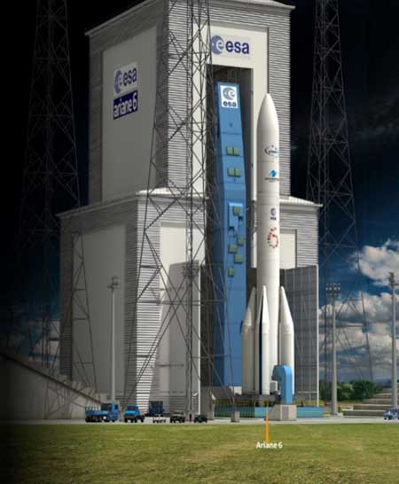
Batch 3, Ariane 6 Under Production
Ariane 6 on the launchpad. (Artist’s concept: ESA)
The production of Batch 3 of 12 additional Galileo FOC satellites is proceeding, aiming at readiness for launch by the end of 2020 onward. The satellite design includes a selected number of improvements compared to the 22 FOC satellites launched previously and built by the same satellite manufacturer OHB Systems.
The different stages of assembly, integration and initial test phase in the OHB production plant in Bremen have already started, before shipment to ESA-ESTEC in the Netherlands for the environmental test campaign consisting of thermal vacuum, mechanical tests, interface verification with the launcher and system end-to-end performance tests with the elements of the Galileo ground segment.
Following the phasing out of the Ariane 5 SE launcher, the third batch of Galileo satellites will be progressively launched with the new Ariane 62 launcher vehicle, the two solid-booster variant of Ariane 6 now in the final stages of development.
Evolution to Meet User Needs
The Galileo Second Generation roadmap has achieved maturity in 2019 and is now entering the preliminary design and implementation phase. Based on the EU’s H2020 Galileo Second Generation activities managed by ESA, and the GSA prospective market analysis, the European Commission, in close consultation with EU member states, has agreed on an ambitious set of long-term PNT goals for the future European GNSS infrastructures.
Technology pre-developments, critical engineering activities and synergic design activities between space and ground infrastructure are being conducted. This will translate into the progressive deployment of a complete set of space/ground infrastructure that is tailored to satisfy the diversified user needs in four main dimensions:
Satellite and ground segment infrastructure with capabilities that can dynamically adapt to current and future user needs. Key drivers are flexibility and robustness, ensuring fast time to market to meet user needs.
Full synergy between GNSS and SBAS systems infrastructure, to complement and enhance the service portfolio. This will allow segmentation and complementarity of safety-critical services and extension to all new PNT services available today, including high-accuracy positioning integrity.
Enhanced integration with terrestrial systems — 5G/6G, signals of opportunity (SOOP), terrestrial beacon systems (TBS). ESA and GSA have been actively leading the 5G positioning standardization worldwide in collaboration with public and private institutions inside 3GPP and will soon move toward the start of standardization of 6G terrestrial positioning and GNSS interconnection technologies.
Full complementarity with external sensors (such as INS, barometer and lidar) and application environments (low-power devices and internet of things) so that the Galileo Second Generation Infrastructure enhances and complements the capabilities provided by these external means.
A key pillar for this long-term strategy is the Galileo transition satellites. The competitive procurement procedure for the first batch of transition satellites is coming in 2020. The flexibility and robustness of these satellites will allow the European PNT infrastructure to satisfy all the different user needs in the next decade. This procurement — together with others at system, ground segment and technology level — will enable the start of the in-orbit validation of second-generation capabilities from 2025 onward.
Additional ground and test infrastructure are in early engineering analysis, design and technology development, in order to proceed with additional procurements for experimental and operational usage, starting early in the 2020s.
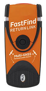
Orolia Maritime has revealed the FastFind ReturnLink PLB with Return Link System (RLS) life-saving beacon system.
Orolia worked closely with the European GNSS Agency (GSA) on the Galileo satellite system since the company was selected to lead development of next-generation search-and-rescue (SAR) distress beacons. Earlier this year, Orolia introduced the first Galileo-enabled personal locator beacons (PLBs).
Building upon this, the new FastFind ReturnLink transmits the user’s unique ID and GNSS location via the global network of Cospas-Sarsat search-and-rescue satellites, and then uses Galileo’s Return Link Service to transmit a return signal back to the user’s device to confirm the alert has been received and location has been detected.
The PLB displays a blue light to inform the user that search-and-rescue professionals are aware of their situation and location and that they are not alone.
“We are dedicated to producing SAR products that keep people safe on land and sea, and the FastFind ReturnLink PLB is Orolia Maritime’s most advanced search and rescue beacon to date,” said Chris Loizou, vice president of Maritime at Orolia. “The psychological impact of knowing that help is on the way cannot be underestimated, and this PLB will provide invaluable peace of mind for those in distress.”
The FastFind ReturnLink PLB uses the latest SAR technology, packed into a simple, rugged and lightweight palm-sized unit. Features include:
Multi-constellation GNSS — both Galileo and GPS receivers.
Belt-attachable buoyancy pouch and life-jacket oral tube clip attachments.
No subscription.
Five-year battery life.
Waterproof to 10 meters.
SOS Morse LED flashing light and RLS Reassurance blue flashing light.
Safe-stow antenna and three-stage activation.
Galileo’s RLS is expected to be fully operational in January 2020.
Galileo and EGNOS were the focus of attention at a special workshop at this year’s Intergeo in Stuttgart, which took place in September. Intergeo is the world’s leading conference and trade fair for geodesy, geo-information and land management.
Intergeo provided an opportunity to give an update on the status of the Galileo and EGNOS programs and to present user case studies at a special workshop focusing on the geomatics market.
In his presentation at the conference, Eduard Escalona, Market Development Innovation Officer at the European GNSS Agency (GSA), stressed the key role of GNSS.
“GNSS is a cornerstone in many areas: It is a fundamental element for cadastral surveying, in the construction sector, in mining, land surveying and mapping activities, for all geographic information systems (GIS), for infrastructure monitoring and for marine surveying. For all of you who are working in these and many other areas, Galileo is now helping to provide the GNSS services you need,” he said.
Dual-frequency boosts market
The European GNSS programs, Galileo and EGNOS, continue to move forward in terms of adoption by the professional market and among general users, thanks in no small part to the development of dual-frequency capability.
Traditionally, mobile, location-based applications have been powered by single-frequency GNSS receivers operating under stringent battery-power and footprint constraints. With a dual-frequency chipset, these devices now benefit from better accuracy, ionosphere error cancellation, improved tracking and better multipath resistance.
Galileo is leading the way in the area of dual-frequency signal delivery, now with more dual-frequency operational satellites in orbit than any other GNSS system. Market uptake of Galileo receivers has been impressive; in addition to the geomatics-related areas of particular interest to the Intergeo public, dual-frequency GNSS chipsets are also appearing in the automotive sector, where connected cars and autonomous vehicles present a clear and pressing need for accurate and reliable positioning information.
New services to come
“To date, more than one billion Galileo-enabled devices have been sold,” said Escalona, “but Galileo isn’t standing still, waiting. We are proposing new services to appear in the coming years.”
These include the much-anticipated High-Accuracy Service (HAS) and a new Authentication Service. “The HAS will be a free, globally available service providing an accuracy of 20 cm, with PPP [Precise Point Positioning] corrections,” Escalona said.
Meanwhile, the Authentication Service (OS-NMA) will provide protection against jamming, spoofing and meaconing on the E1B signal and a separate Signal Authentication Service (SAS) will provide an even higher level of protection on the E6 signal.
“EGNOS is currently working with GPS, but of course we are looking forward to augmenting Galileo in the near future,” said Sergio Cabrera Bona, EGNOS Service Adoption Tools Engineer at the European Satellite Services Provider, whose core activities comprise EGNOS operations and service provision.
“GNSS is critical in all of these fields, whether it is mapping and GIS, farming, forestry, thermal pictures, management of natural terrains,” Cabrera said. He listed other areas, including management and inspection of utilities, power networks, water supply, telecoms, drones, inventory, surveying, field campaigns and determination of perimeters in agriculture as areas where GNSS plays a key role.
“It is not possible to mention all of the activities where you need reliable positioning. What you have to know is that with EGNOS augmentations you already have a horizontal accuracy below one metre and a vertical accuracy below two metres, so this is a very good accuracy,” he said.
There is much more that could potentially be done right now, Cabrera explained. “Most of the professional equipment is already EGNOS-enabled, but in practice users do not always configure their equipment correctly to exploit this capability. EGNOS adoption and support is going ahead full speed, but in the GNSS device market, many users still do not know they can use EGNOS. So the education process remains an ongoing effort,” he said.
Cabrera explained that the EGNOS user support website can be an important part of this educational drive on the top of the help desk. “We have very interesting tools and resources available online. For example, we will have a new EGNOS usability map available very soon on the website. With this tool you will be able to easily see the current availability of EGNOS signals in your location, which will be very useful especially in urban environments, for example. We also have many user support services and there is a new mobile app coming, so please visit our website and take advantage of EGNOS. It is there for you.”
Introducing the GSC
Galileo services improvement expert Pedro Gómez Martínez informed participants about the European GNSS Service Centre (GSC), defining both the concept of operations as well as the procedures necessary to provide the services that the GSA offers to Galileo users.
“The European GNSS Service Centre is the single interface between the infrastructure and users of the Galileo open services, commercial service and search and rescue service (SAR),” said Gómez. “So the GSC is a center that provides experts, know-how, evaluation of capability, distribution of information and support for the provision of value-added services provided by the Galileo system.”
The GSC website is a core resource for Galileo users, Gómez said, reporting real-time system status and incident notifications, with a bank of key documents and a full-time help desk. “It is very important for us that this is a two-way interactive service that includes your feedback. We need you to report any incidents that you might experience related to the product, service and data provision. We are very interested in user satisfaction, and we want to know how you respond to improvements. And of course, in general, we are here to promote GNSS in all its forms, in all areas, for all users.”
The GSC launched a new version of its website in the run-up to the InterGEO event. “More than ever we are making it easier for you to engage in dialogue with us and to provide your feedback. This is very important to us with new services coming up in the future,” Gomez said.
Research fundamentals
“One of the very important responsibilities of the GSA is the management of a number of EGNSS research and development programmes,” said Eduard Escalona. “We have Horizon 2020, the European Union’s research Framework Programme. There we have a final call for proposals coming up in November, with a deadline in March 2020. The GSA also is overseeing the Fundamental Elements programme, which is funding research specifically targeted at developing Galileo-enabled chipsets, receivers and related technologies.”
To illustrate Escalona’s point, the presentations featured EU-funded GNSS-related research projects leveraging the accuracy and integrity offered by Galileo. Pere Molina of Geonumerics presented the MapKite project. Funded under Horizon 2020 and now completed, MapKite integrates an unmanned aerial system (UAS) and a mobile mapping aystem (MMS) for simultaneous capture of geo-data from the air and from the ground. Molina showed data from a successful corridor mapping exercise run using the MapKite system.
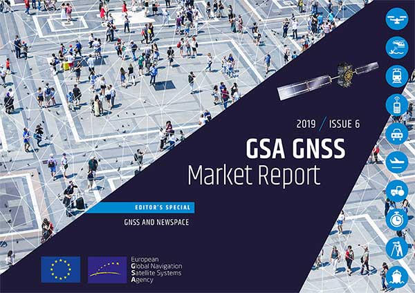
The new GSAGNSS Market Report is now available for download. The report provides a comprehensive overview of the GNSS market and the global industry, as well as a focus on EGNSS differentiators and synergies with Copernicus, according to the publisher, the European GNSS Agency (GSA).
Areas covered include:
A general overview of the GNSS market and a global industry overview.
Analysis of macro-trends affecting GNSS, including climate change and the circular economy, big data, artificial intelligence, the silver economy, cyber security and the sharing economy.
A review of the main GNSS market segments in detail, including trends and developments, forecasts for future shipments, revenues and the GNSS installed base, and a look into GNSS user requirements.
GNSS in Space. This year, the report features the “Editor’s Special: GNSS for NewSpace,” a section that introduces GNSS receivers in satellites and their relation to the evolving space sector.
GNSS market monitoring is a key activity of the GSA. Market monitoring supports GNSS stakeholders in their planning and decision-making, and offers a clear tool to understand GNSS trends and evolutions.
Since its launch in 2010, the GSAGNSS Market Report has become the go-to-source for information on the dynamic, global GNSS market segments and applications.