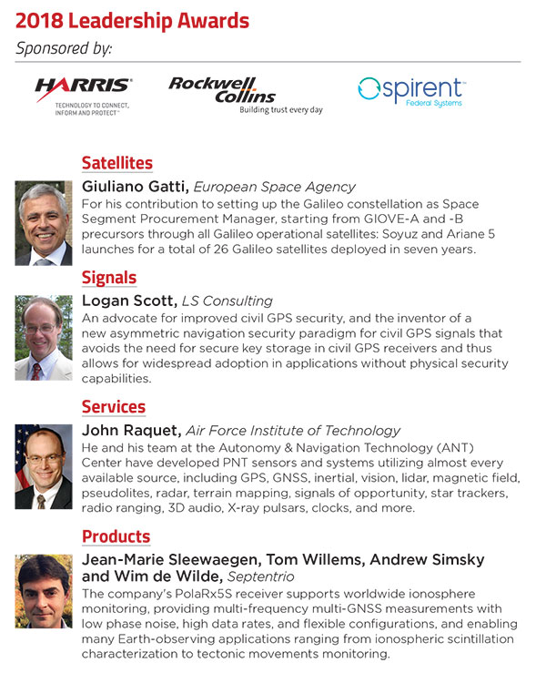
At the GPS World Leadership Dinner and Awards Ceremony in Miami on Sept. 27, 120 VIPs from the international GNSS/PNT community gathered to honor recent significant achievements in four fields: Satellites, Signals, Services and Products.
The honorees, so voted by a panel of their peers, appear below. Also, see our article here.
Their remarks upon receiving the awards will appear in the December issue, along with Future Visions for 2019 by the executive officers of GPS, GLONASS, Galileo and BeiDou.
Rounding out the evening after speeches, dinner and good conversation among good friends, old and new, was the Smart City Jam! We attempted to replicate, on the carpet of the 14th-floor banquet room, an obstructed urban environment, replete with malicious jammers. And we challenged all comers to “autonomously” navigate to a goal in this hostile environment with remote-controlled rock-crawlers. Details on this as well coming up in December.
European students and researchers are invited to compete in a new Galileo smartphone app competition sponsored by the European Space Agency (ESA).
The goal is to develop an app capable of performing fixes using raw Galileo satnav measurements. An earlier Galileo smartphone app competition has already resulted in the winning app becoming publicly available.
This year’s event challenges teams to make use of the dual-frequency capability of the latest Android 8.0 smartphones, to compute dual-frequency positioning solutions from raw satnav signals to compare them with their single frequency equivalents.
The competition is run by ESA in collaboration with the European Global Navigation Satellite Systems Agency (GSA) plus the European Commission with the support of Google.
The Galileo app competition is open to all students from European universities and trainees in posts at European research and development organizations.
“The inaugural Galileo smartphone app competition was open solely to ESA graduate trainees, but the response was so great that this time we have opened up to students and young researchers across Europe, forming teams of three to five people,” explained ESA Galileo Services Engineering Manager Rafael Lucas Rodriguez.
The set objective is to reach sub-meter accuracy worldwide in unobscured sky conditions. The app should allow the user to select Galileo-only positioning, GPS-only positioning and the combination of both on a simultaneous basis, with the potential to include other satnav constellations in turn.
The receiver chipsets inside smartphones routinely make use of Galileo in combination with several other satnav constellations — the U.S .GPS, Russian GLONASS and Chinese BeiDou. These chipsets function in “black box” style, making the resulting positioning fixes accessible to users, but without giving any option to the user to select which constellation to employ — or information on Galileo’s particular contribution to the phone’s overall positioning performance.
However, in newer Android smartphones it has become possible to access the raw signal measurements used to compute position, opening the door to the development of applications where the user can indeed select which constellations to employ.
The very latest models also allow the use of dual satnav frequencies, giving a major boost to positioning precision. The higher chip rate of the additional frequency allows the chipset to compensate for signal propagation errors from the signals’ journey through the ionosphere — the electrically active outer layer of atmosphere — and reduces false ‘multipath’ detections caused by signals reflecting off buildings.
“As a first step, teams submit a proposal of not longer than 20 pages, summarizing the application to be developed,” explained ESA navigation engineer Nityaporn Sirikan. “These proposals will be evaluated by a jury composed of representatives of ESA, GSA, the EC and Google, with the top five proposals selected to develop their app further, receiving on loan a state-of-the-art dual frequency satnav smartphone and receiving general guidance and technical support.”
The competition launched on Sept. 24; teams are invited to submit their proposals to [email protected] by Nov. 12, and will be informed of the jury’s response to their proposal by Nov. 26. The competition final is scheduled for April 18, 2019, at ESA’s ESTEC technical centre in Noordwijk, the Netherlands. Terms and conditions of the competition are posted here.
The first- and second prize-winning teams will win attendance to the ESA and EC International Summer School on Global Navigation Satellite Systems in Portugal. Additional prizes will be available to the most innovative app and the winner of a public online vote, to be undertaken during the final.
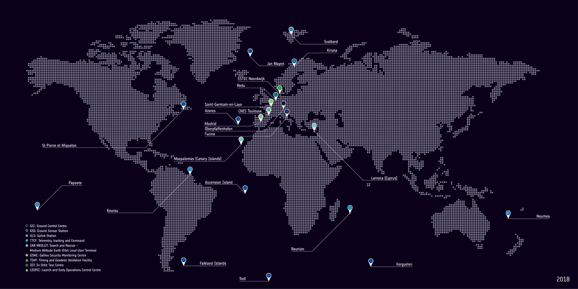
With Europe’s Galileo constellation in space now expanded to 26 navigation satellites — and Galileo Initial Services available to users worldwide — the infrastructure on the ground that controls them is undergoing a corresponding expansion.
ESA has awarded a new work order for the Galileo Control Segment — that part of the Galileo system responsible for the monitoring and control of all the satellites in orbit — to GMV Aerospace and Defence, Spain.
The contract was signed by ESA Director of Navigation Paul Verhoef and Jesús B. Serrano Martínez, CEO of GMV, in a ceremony hosted at Spain’s Ministry of Science, Innovation and Universities in Madrid, in the presence of Spanish Science Minister and former ESA astronaut Pedro Duque.
The ground control contract was signed Sept. 6 at at Spain’s Ministry of Science, Innovation and Universities in Madrid. From left: Verhoef; Secretary General of Transport of Spain’s Ministry of Public Works, María José Rallo, representing Spain in the EU Committee on Satellite Navigation Programmes; Spanish Science Minister and former ESA astronaut Pedro Duque; European Commission adviser on navigation activities Augusto González; and Martínez. (Photo: ESA)
Galileo’s Control Segment is hosted at the Oberpfaffenhofen Control Centre in Germany, with a “hot backup” in place at Galileo’s second Control Centre, at Fucino in Italy. It also extends to a network of Telemetry, Tracking and Control (TT&C) ground stations placed around the globe to stay linked with all satellites in the constellation.
The combination of these Control Centres plus TT&C stations are vital to keep Galileo running at its highest possible performance level. They monitor the overall status of the constellation, gather telemetry and uplink telecommands to each satellite, while also performing two-way radio and Doppler ranging to keep precise track of their position in space, identifying any orbital drift that might degrade the system’s accuracy.
The Galileo Control Segment has been designed to allow the automatic execution of routine operations. It also includes elements supporting flight dynamics analyses, constellation operations short-term planning as well as operations preparation.
Galileo’s global ground segment. (Map: ESA)
This first work order for the “Galileo Control Segment Exploitation Phase” contracts GMV Aerospace and Defence as prime contractor to undertake all necessary activities to upgrade the Galileo Control Segment as part of Galileo’s Exploitation phase.
This work includes upgrading the system architecture to manage a constellation of up to 41 Galileo satellites, updating obsolescent elements in the current system, improving operability linked to the provision of services and the addition of a new, second TT&C station to be based in Kourou, French Guiana.
The integration, qualification, deployment and migration into operational service of the various segments of the upgraded Galileo Control Segment will be undertaken over the next three years.
The Galileo ground station near New Caledonia capital Nouméa incorporates a Galileo Sensor Station (foreground) that monitors the quality of navigation signals and an uplink station (background) to relay navigation corrections to the satellites for rebroadcast to users. An antenna 13 meters in diameter for controlling the satellites has also been built, ready to come online later this year. (Photo: ESA)
This process is to undertaken while maintaining coherence with the other segments of the overall Galileo system – such as the Galileo Mission Segment which oversees Galileo services, the external control centres that carry out initial satellite switch-ons and in-orbit testing and the satellite platform and payload manufacturers, OHB System AG in Germany and Surrey Satellite Technology Ltd in the UK.
ESA has issued this work order in its role overseeing Galileo’s deployment, the design and development of future upgrades and the technical development of infrastructure on behalf of the European Commission, Galileo’s owner.
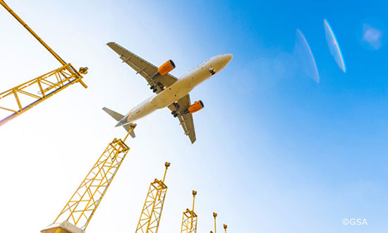
If you’ve taken a flight in Europe recently, then the chances are growing that you’ve been a pioneer EGNOS user. Satellites in orbit would have guided your airliner’s descent, rather than signals beamed from the ground. You wouldn’t have felt any difference — except for possibly a smoother ride.
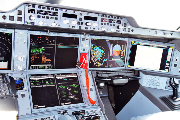
Cockpit of a new EGNOS-equipped Airbus 350 XWB, on show during the inaugural EGNOS Day at Toulouse-Blagnac Airport on May 7, 2015. (Photo: ESA)
More than 180 European airports have now been certified to make use of the ESA-designed European Geostationary Navigation Overlay Service — EGNOS — for approaches to given runways. This includes approaches at major hubs such as Paris Charles de Gaulle, Frankfurt and Amsterdam Schiphol. Thanks to EGNOS, safe landings would still be possible even if an airport were shut down entirely.
Sharpening the precision of GPS satnav signals over most European territory, EGNOS was designed to make satnav reliable enough for safety-critical aviation employment, but has found a wide range of other uses, from agriculture to road, rail and maritime transport.
An EGNOS app is available from the Apple and Google Play stores, offering easy access to all EGNOS-related information, including the different EGNOS services, official documentation, historical and current performance data, support material and contact with the 24/7 EGNOS helpdesk.
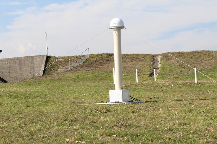
An EGNOS V3 Ranging and Integrity Monitoring Station (RAIMS) being tested at the Santiago de Compostella site in Spain, designed and manufactured by Thales Alenia Space in Italy. (Photo: ESA)
EGNOS is based on a network of monitoring stations across Europe that perform independent measurements of GPS signals, so that corrections can be calculated to boost satnav positioning performance. These results are passed to users immediately via a trio of geostationary satellites.
The service is allowed just a one in 10 million chance of error. If this tolerance is exceeded, EGNOS users are informed within six seconds. The result is that EGNOS-augmented signals meet the extremely high performance standards set out by the International Civil Aviation Authority, adapted for Europe by Eurocontrol, the European Organisation for the Safety of Air Navigation.
EGNOS operations are the responsibility of the European Global Navigation Satellite System Agency (GSA) of the European Commission and run by the ESSP, European Satellite Services Provider.
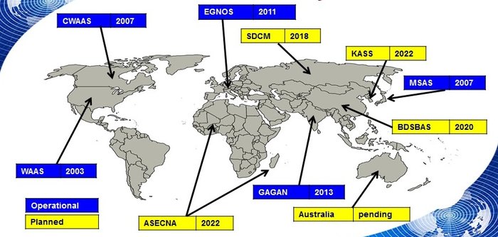
EGNOS is the European equivalent of the U.S. Wide Area Augmentation System (WAAS), which was the world’s first satellite-based augmentation system. The U.S. and European systems have been carefully designed to work together seamlessly.
Additional equivalent regional systems, fully interoperable with the existing ones are either in operation (Japan, India, Canada) or in definition or development (Russia, China, South Korea, West Africa and Australia).
Satellite-based augmentation systems worldwide. (Image: ESA)
Through the LPV-200 procedure, short for “localizer performance with vertical guidance 200 feet,” signals from space guide pilots through any weather down to within just 60 meters (200 feet) of the runway, at which point they make visual contact with the ground for a final go/no go landing decision.
EGNOS offers all-weather access to all certified runway approaches — each side of a runway requiring its own, separate, certification — without the need for expensive ground Instrument Landing System infrastructure. Satellite-based landing approaches can also be tailored to be smoother and more fuel-efficient.
Smaller airports unable to afford ground instrumentation draw the greatest benefit. Employing EGNOS means they get to operate in all weather conditions.
ESA retains the lead role in the future development of EGNOS, working with Thales Alenia Space and Airbus Defence and Space and their subcontractors to design, develop, deploy, and validate and test the new design elements.
While the current system is solely reliant on GPS, the next-generation EGNOS V3 will combine the use of GPS with Europe’s own Galileo satnav system to boost EGNOS accuracy and reliability still further. It is planned to enter service around 2025.
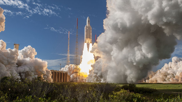
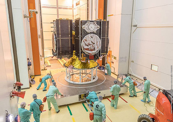
Four more Galileo satellites were launched July 25 by an Ariane 5. Their arrival in orbit brings the Galileo constellation to 26 satellites, extending the global coverage of the constellation.
Ariane 5 flight VA244, operated by Arianespace under contract to ESA, lifted off from Europe’s Spaceport in Kourou, French Guiana, at 11:25 GMT (13:25 CEST, 08:25 local time), carrying Galileo satellites 23–26. The first pair of 715 kg satellites was released almost 3 hours 36 minutes after liftoff, while the second pair separated 20 minutes later.
They were released into their target 22 922 km-altitude orbit by the dispenser atop the Ariane 5 upper stage.
In the coming days, this quartet will be steered into their final working orbits by the French space agency CNES, under contract to the Galileo operator SpaceOpal for the European Global Navigation Satellite System Agency (GSA).
There, they will begin around six months of tests by SpaceOpal to verify their operational readiness so they can join the working Galileo constellation.
“Galileo is ESA’s largest ever satellite constellation, built up to its present size in rapid time, with 22 Full Operational Capability satellites added within just the last four years,” remarked Jan Wörner, ESA’s director general.
“We must thank our industrial partners OHB (DE) and SSTL (GB) for the satellites, as well as Thales Alenia Space (FR/IT) and Airbus Defence and Space (GB/FR) for the ground segment and all their subcontractors throughout Europe for their continued support to the programme. Together with ESA, the entire industrial team has worked hard for the point at which we now are and this cooperation have proven to be very successful, as we can show in the excellent performance of Galileo.”
Paul Verhoef, ESA’s director of navigation, added, “Galileo has been providing Initial Services on a worldwide basis since 15 December 2016, and today has more than 100 million users, and rapidly increasing. Today’s satellites will increase the global coverage of Galileo with a performance that is widely recognized as excellent.
“This is the end of the current phase of Galileo deployment, but our pace is not slacking. A further 12 Galileo ‘Batch 3’ satellites are in preparation as in-orbit spares and as replacements for the oldest Galileo satellites, first launched in 2011, in order to keep the system working seamlessly into the future.
The European Space Agency launched the next four Galileo satellites on an Ariane 5 on Wednesday July 25, at 11:25 GMT (13:25 CEST, 08:25 local time) from Europe’s Spaceport in Kourou, French Guiana.
These latest four Galileo satellites will bring the constellation in orbit up to 26 satellites.
Livestream coverage of the launch starts at 11:00 GMT (13:00 CEST) with liftoff at 11:25 GMT (13:25 CEST).
Live coverage resumes with confirmation of the satellites separating from their upper stage from 14:50 GMT (16:50 CEST).
Separation of the Ariane 5’s upper stage occurs about nine minutes after liftoff, followed by the first 10-minute firing of the upper stage.
The upper stage — carrying four 715-kg Galileo satellites — flies in ballistic configuration for three hours and eight minutes, after which a second upper stage firing lasting just over six minutes will place it into circular separation orbit.
Once stabilized at 3h 36 min after liftoff, the Galileo dispenser will release the first two satellites, followed by the second pair 20 minutes later.
In the meantime, check out ESA’s new Galileo video.
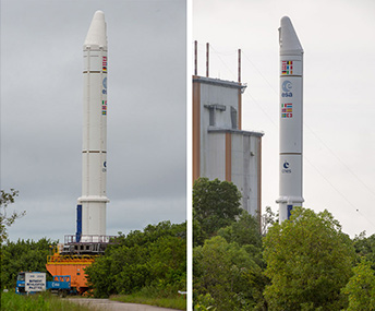
The Ariane 5 carrying Galileo satellites 23-26 is in place at the ZL3 launch site ready for liftoff. (Photo: ESA)
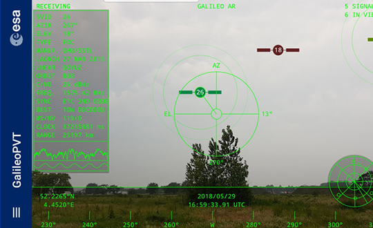
The European Space Agency (ESA) has released an augmented reality view of Galileo satellites in the sky close to its technical centre in the Netherlands.
The image comes from a Galileo-focused satnav app for Android smartphones, developed by ESA engineers. ESA ran an internal competition for its trainees to develop an app capable of making positioning fixes using only Galileo satellites.
“As part of our support for the competition, we developed our own app on a voluntary basis to serve as a benchmark,” said Paolo Crosta of ESA’s Radio Navigation Systems and Technology section. “We included this augmented reality view, so users can ‘see’ the satellites their smartphone is using as they hold it up to the sky.”
Galileo satellites viewed in smartphone app. (Photos: ESA)
The positioning calculations and assistance data functions for the app were developed by Paolo, with telecom engineer Tim Watterton contributing the main structure of the app, together with how it looks and its user interface.
“The satellites are overlaid in real time on the camera view in their predicted positions in the sky, based on ‘ephemeris’ information, assistance data that describes the current satellite orbits with high precision,” Watterton said. “When a signal is being received, the satellite is shown in green, overlaying the predicted position. The satellite shown in red is one of the two placed in elongated orbits, but these satellites are expected to be used soon in the operational constellation. Satellites colored orange are transmitting, but the signal is not detected, which may be due to obstruction by terrain or buildings.”
Panning the phone around to position the crosshair over a green-colored satellite adds additional information, such as its signal status, pseudorange (the uncorrected distance the signal has traveled to reach the receiver) plus the satellite’s manufacturer and launch date, among other items.
The reference app is now being tested with the hope of making it publicly available on the Google Play Store. Following the competition, the trainees are also testing their own apps with the goal of releasing them.
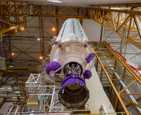
Technicians in SCAPE (Self Contained Atmospheric Protection Ensemble) suits fill Galileo satellites 22-26 with hydrazine fuel. (Photo: ESA)
Europe’s next four Galileo satellites have been fueled at Europe’s Spaceport in Kourou, French Guiana, in preparation for their launch on July 25, according to the European Space Agency (ESA).
The four satellites were placed into their protective containers to be transported from the S1A processing building to the S3B payload preparation building, where they were filled with the hydrazine fuel that will keep the satellites manoeuverable during their 12-year working lives.
The next step is to fit the quartet onto the dispenser that holds them in place securely during launch and then releases them into space once the upper stage of the Ariane 5 rocket reaches its 22,922-kilometer-altitude target orbit.
After that, the satellites plus dispenser will be fitted onto the upper stage then enclosed by the two sides of the protective launch fairing — one of which has had the mission logo added to it.
Meanwhile, the Ariane 5 for this launch (Flight VA244) has undergone assembly inside the Spaceport’s Launcher Integration Building.
Galileo’s Flight VA244 mission logo is attached to the Ariane 5 fairing ahead of the July 25 four-satellite launch. (Photo: ESA)
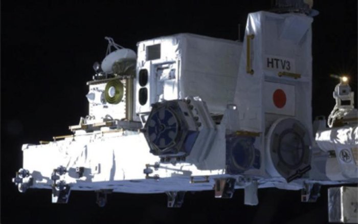
Europe’s satellite navigation system Galileo is already in use worldwide, usable by itself or in combination with the U.S. GPS. Now a combined Galileo–GPS positioning fix has been achieved in space — aboard the International Space Station — through an ESA–NASA collaboration.
In April, the chest-sized SCaN (seen left of center with an antenna on top) was used to make the first combined Galileo-GPS positioning fix in orbit from the ISS. (Photo: ISS)
Low-Earth orbiting satellites routinely make use of satellite navigation signals to pinpoint their position in space and allow their paths through space to be fixed with extremely high accuracy, known as “precise orbit determination.”
So far, such positioning has mainly been performed using GPS, but this new test proves it can also be achieved on a dual-constellation basis with both GPS and Galileo — as well as through the sole use of Galileo.
The experiment is based on the use of a reconfigurable NASA receiver called the Space Communications and Navigation Testbed, SCaN, attached to the exterior of the ISS.
ESA’s Navigation Support Office, based at its ESOC control centre in Darmstadt, Germany, teamed up with its Radio Navigation Systems and Technology team, located at its ESTEC technical centre in Noordwijk, the Netherlands, and Italy’s Qascom company to develop the techniques, software and firmware required for the experiment, which was passed to NASA’s Glenn Research Center in Ohio for upload to the receiver.
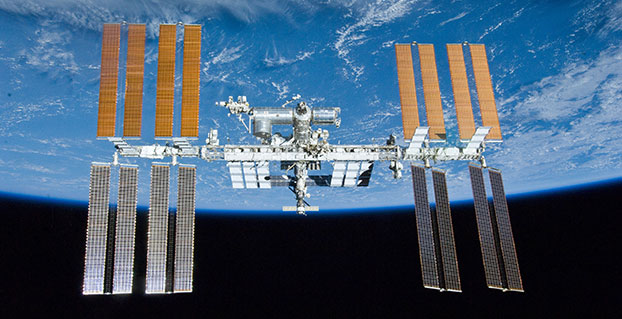
The International Space Station. (Photo: ESA)
“SCaN is a versatile software-defined radio receiver in space for both telecommunications and navigation testing, delivered to the Station back in 2012,” said ESA radio-navigation engineer Pietro Giordano. “It made it possible, with suitable modifications, to demonstrate combined GPS-Galileo positioning determination of the ISS.”
The algorithm developed for the SCaN Testbed had to take account of the high dynamics involved, and resulting Doppler shifting of signals: not only are the Galileo and GPS satellites moving at orbital velocity, so is the ISS itself. Orbital information of all the satellites in both constellations was included in the algorithm, allowing SCaN to make a ‘warm start’ – to search out signals in the correct segments of the sky.
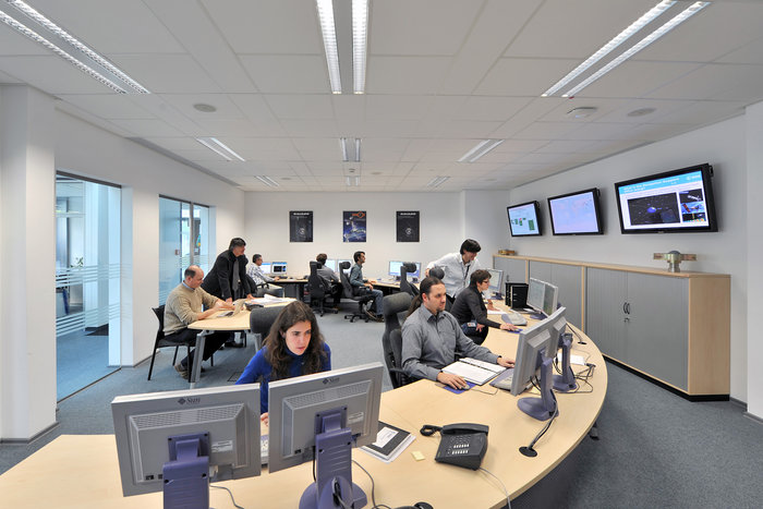
In February 2006, the Navigation Support Office inaugurated its modern Navigation Facility at the European Space Operations Center (ESOC) in Darmstadt, Germany. (Photo: ESA)
In February 2006, the Navigation Support Office inaugurated its modern Navigation Facility, at the European Space Operations Center (ESOC), in Darmstadt, Germany.
“Dual constellation fixes offer many advantages for space, providing extremely robust and high-precision positioning,” Pietro added. “More signals become available overall, and the quality of the Galileo Open service and modernised GPS signals are extremely good.”
Werner Enderle, overseeing the project at the Navigation Support Office noted, “These excellent first results, coming out of great teamwork within ESA, collaboration with industry and with our NASA partners, mark just the beginning of our project data analysis. Many other exciting results are expected related to signal aspects, precise orbit determination and positioning based on optimised algorithms.”
James J. Miller, GPS Sr. Technologist within the SCaN programme office at NASA Headquarters, commented: “We’ve been promoting interoperability of GPS and Galileo through a number of activities within the United Nation’s International Committee on Global Navigation Satellite Systems (GNSS). In particular, NASA, with ESA and other national space agencies, has been identifying benefits to be gained for high altitude users in the multi-GNSS Space Service Volume under development. By further demonstrating multi-GNSS capabilities in low Earth orbit, the drive for additional utility at geostationary orbit and beyond is only strengthened.”
Europe’s Galileo system began Initial Services for users in December 2016, and there are 22 Galileo satellites in orbit. The launch of four more Galileo satellites by Ariane 5 is scheduled for July 25, and will bring the constellation to 24 satellites plus two orbital spares.
ESA is developing dual Galileo-GPS receivers for the next generation of Earth-observing Sentinel satellites. The more precise the orbit determination, the more accurate the environmental data that can be returned to Earth.
Combined use of Galileo and GPS signals on an interoperable basis for positioning and precise orbit determination should bring significant advantages for space users in particular, set to provide a seamless navigation capability from low to high Earth orbits — and potentially beyond.
“This shows the versatility of the Galileo system and the use of the system for scientific and other purposes, way beyond traditional navigation services,” said Paul Verhoef, ESA’s Director of Navigation. “We have also started work to determine whether we can use Galileo, in combination with GPS and other systems, for navigation to the Moon.”
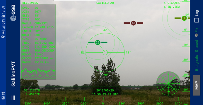
Testing of the three Galileo apps took place in May. (Photo: ESA)
ESA challenged its young graduate and national trainees to develop a smartphone app to perform satnav fixes using only Galileo satellites.
Three teams developed apps in their spare time, presenting their results to a jury of experts from ESA, the European Global Navigation Satellite Systems Agency (GSA) and Google.
“I’m very impressed,” said Javier Benedicto, ESA’s Galileo programme manager. “With little detailed knowledge of satellite navigation, these teams have developed something that didn’t exist just a few months ago. Working on Galileo we love to see that the systems we’re putting together can reach widespread application and inspire new uses.”
The winning Galfins Team put together the GNSS Compare app that promises to turn a smartphone into a “research lab in your pocket” to test Galileo performance in isolation or in combination with other systems. Their prize is to attend an ESA and European Commission-sponsored GNSS Summer School in Austria.
The final presentation and results of ESA’s internal Galileo smartphone app competition took place in the Erasmus centre of ESA’s Erasmus technical centre on May 31. (Photo: ESA)
“Only one of our four-strong team started the challenge with any knowledge about satellite navigation,” said Mateusz Kraiński of the Galfins team. “The rest of us come from different areas — for example, I’m working on the European Robotic Arm project, due to launch at the end of next year. We have learnt a lot and the radio navigation experts at ESTEC were a great source of support.”
“We see a need on the market for such an application, so we will definitely continue with the development. The application will be made available for download when ready, and the project will be released as open source soon after.”
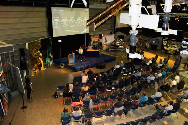
The other two teams were also commended for their work; Chocolateam developed a richly-designed game-based app, giving the user the feeling of observing the Galileo satellites from a spacecraft, while Team 5G distinguished themselves by writing all their own navigation algorithms from scratch rather than relying on open source software.
The challenge was to design an Android smartphone app that allows users to compute and visualize their position based solely on Galileo measurements, as well as the possibility of selecting a combination of satnav constellations to assess their performance.
Testing the three apps entered in the Galileo smartphone app competition in the grounds of ESTEC, working in pedestrian mode. (Photo: ESA)
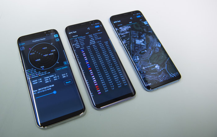
The receiver chipsets inside smartphones make use of Galileo signals in combination with several other satnav constellations — the U.S. GPS, Russian GLONASS and Chinese BeiDou. These chipsets function like “black boxes,” making the resulting positioning fix accessible to users, but not giving any option for the user to select which constellation to employ.
Current phone applications only display general satnav status information, such as which satellites are contributing to the positioning fix, their visibility parameters and overall power levels. This is not sufficient to single out Galileo’s contribution to the phone’s overall positioning performance.
However, in newer Android smartphones it has become possible to access the raw signal measurements used to compute position, opening the door to the development of applications where the user can indeed select which satellites to use.
The teams received one Galileo-enabled smartphone each for developing and testing the app.
ESA’s Director of Technology, Engineering and Quality supported the teams by supplying dedicated software modules to simplify computations of the phone position. During the competition, a technical advisory team also developed an internal app as a benchmark.
The app, named Galileo PVT and developed by ESTEC engineers Paolo Crosta and Tim Watterton, includes an augmented reality system allowing users to “see” the Galileo satellites from which they were receiving signals in the local sky.
“This was a very useful exercise because it helps us understand the needs of satnav app developers in Android,” said the lead advisor, Paolo Crosta. “Then, once the apps were complete, we tested them together, here on the grounds of ESTEC, working in stationary, pedestrian and vehicular modes.”
“Congratulations to all the teams here today,” said Frank Van Diggelen from Google, who had just come from a satnav raw measurements workshop hosted by GSA. “It’s been great to be here and see all the activity around raw signal measurements. Our aim has always been to raise standards by making these measurements available, to let developers see what’s happening inside. And the work you’re doing here is feeding back to chip and smartphone manufacturers, to help change and improve them for the future.”
Ariane 5’s cryogenic main stage is moved into position over the mobile launch table inside the Spaceport’s Launcher Integration Building. (Photo: Arianespace)
Four more Galileo satellites will be launched on a customized Ariane 5 on July 25.
The next Arianespace rocket to orbit Galileo satellites has begun taking shape at the spaceport in French Guiana, reported Arianespace. Build-up of the heavy-lift vehicle is now underway inside the spaceport’s Launcher Integration Building.
Following the established assembly flow, the rocket build-up began with this week’s positioning of the launch vehicle’s central core cryogenic stage over one of two mobile launch tables used for Ariane 5.
Ariane 5’s two solid propellant boosters are rolled out. (Photos: Arianespace)
It was followed by integration of the two large solid propellant boosters — installed directly on the launch table and mated to the core stage — clearing the way for placement of the upper stage, topped off with the vehicle equipment bay.
Once the Ariane 5’s basic build-up is completed under the direction of production prime contractor ArianeGroup, it will be moved to the spaceport’s Final Assembly Building for installation of its four Galileo FOC (Full Operational Capability) satellite passengers, which are undergoing their own pre-flight preparations at the spaceport.
The Ariane 5 will deploy its satellite passengers at a targeted orbital altitude of 23,222 kilometers in circular medium Earth orbit. The launch is designated Flight VA244 by Arianespace.
Galileo satellites arrive
In early June, Galileo satellites 25 and 26 landed at Europe’s Spaceport in Kourou, French Guiana, joining their two predecessors, satellites 23 and 24, according to the European Space Agency (ESA).
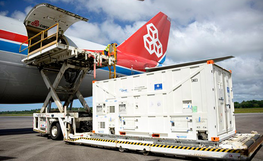
One of the two Galileo satellites 25 and 26 is unloaded from a Boeing 747 cargo jet at Cayenne – Félix Eboué Airport in French Guiana on June 1. The satellites travel inside protective air-conditioned containers. (Photo: ESA)
The pair left Luxembourg Airport on a Boeing 747 cargo jet on the morning of June 1, arriving at Cayenne – Félix Eboué Airport in French Guiana that evening.
After they were off-loaded, they were driven by truck to the cleanroom environment of the S1A payload preparation facility at Europe’s Spaceport, still in their protective air-conditioned containers. In the cleanroom, they joined Galileo satellites 23 and 24, which arrived last month.
The cryogenic main stage of the Ariane 5, known as the EPC — from its French title Etage Principal Cryogénique — arrived by sea at French Guiana’s Port Pariacabo on May 30.
A further 12 Galileo “Batch 3” satellites were ordered in 2017, supplementing the 26 built so far to provide further in-orbit spares and replacements for the oldest Galileo satellites, first launched in 2011.
A steady stream of orbital spares, ready to replace satellites reaching the end of their operational lives, is essential to ensure Galileo continues operating seamlessly, according to ESA.
Looking further ahead, with the aim of keeping Galileo services as a permanent part of the European and global landscape, new satellites will be required by the middle of the next decade, offering improved performance and added features.
An increasingly bitter political and economic argument between the United Kingdom (U.K.) and the European Union (EU) has alternately stalled and unfrozen progress on Galileo.
Why does this matter from a defense and security viewpoint? Because it’s all about access to Galileo’s Public Regulated Service (PRS), the military-grade service and signal — in addition to billions of pounds and euros.
The byzantine maneuvering on both sides may have further implications, in the form of a much-expanded role for the current European GNSS Agency (GSA), with a corresponding reduction in funding scope for the European Space Agency (ESA).
ESA is not directly affected by the Brexit brouhaha, but indirectly, the impacts mount and extend. ESA is technically independent of the EU, but acts as the union’s procurement body for space programs. It is run by the 22 member states on the ESA council — which crucially includes the U.K., as well as non-EU members Norway and Switzerland. Thus, the Brits, while exiting the union in March 2019, will continue to play a voting role in the space agency.
In an second-round gambit, the U.K. had threatened to use its veto on the ESA council to delay procurement of future Galileo satellites. This was seen as an attempt to bring the EU into negotiations over U.K. access to the highly encrypted Galileo PRS.
A navigation and timing signal restricted to use by authorized government agencies, armed forces, police, emergency and other security services, the PRS is designed to be robust to jamming and spoofing and available even in times of crisis.
Under EU rules, only EU member states can access or work on the PRS. Similar to GPS M-code, PRS could be said to be the prime motivating factor for the origins of the European GNSS: the desire, some would say the compelling requirement, to have a military-grade signal under one’s own control.
The U.K. says it will encounter “significant gaps” in a wide range of areas including prisoner transfers, asset recovery, sharing of financial intelligence, victim compensation and access to criminal records for child protection vetting, should it be shut out from the PRS. This doesn’t begin to reveal the real reason: the ability to conduct military, security and defense operations confidently undertaken with a secure and enrypted GNSS signal.
The European Commission maintains that the U.K. will have to “apply” to use the PRS, like any other non-EU country, tacitly as a “foreign entity.” PRS is for EU member states only.
U.K. companies such as CGI U.K. have developed much of the programming and coding of the PRS signal. Current EU rules bar all U.K. companies from bidding on new contracts unless they transfer their work to EU countries before Brexit. The EU wants CGI U.K. to hand its encryption security intellectual property to the Franco-Italian firm Thales Alenia Espace.
This would poke Britain’s defense ministry where it hurts most: access to the key source codes, and a measure of security in military, defense and police operations. The U.K. government also wishes to retain the encryption expertise and personnel, rather than see them outsourced.
Four Galileo satellites placed in the payload container prior to December 2017 launch, which brought the total Galileo constellation to 22. (Image courtesy of ESA)
Whither GSA?
In a separate but closely related debate within the EU, a strategic repositioning is proposed for the GSA: renaming and remaking it into the EU Agency for the Space Programme. This would not only greatly enlarge its sphere of activity and authority, it could create two sparring space agencies in Europe, one wholly under the control of the EU and one with the maverick U.K. on its ruling council.
A draft EU document states ESA’s decision-making procedures “cannot lead to a call into question of the decisions of the [European] Commission or the European Space Agency within the framework of the actions and space programmes of the union.”
ESA is naturally bitterly opposed to its parent organization creating a rival. It has long struggled — behind closed doors — with its semi-independent, semi-subservient role to the EU, which after all holds the ultimate purse strings.
Some in Europe see indications that the GSA rebadging could lead to a gradual transfer of space funding from ESA to the newly rechristened agency if EU discontent rises. “A creep in power” was the term used by one official.
The EU has long expressed concerns over ESA’s governance of the funds handed to it by the EU for space projects. The long stall in Galileo getting up a full head of steam, a period that could be said to have extended from 2002 to 2008 or thereabouts, was seen by some atop the EU as evidence of ESA over-extension: technically expert but fiscally untrained or unqualified.
Opening Salvos
In what now appears to be a dead issue, the U.K. had first demanded reimbursement for the €1 billion it contributed to Galileo. The EU rejected that out of hand, saying it would not negotiate “under threat.”
In a follow-up, the U.K. claimed that while it wished to continue participating in Galileo, it could well start up its own GNSS if it did not receive adequate access to Galileo PRS. The EU stuck to its guns, so to speak: “Third countries [and their companies] cannot participate in the development of security-sensitive matters.”
The U.K. has also bruited blocking Galileo from use of ground tracking stations in British overseas territories, such as the Falklands.
A U.K. minister stated: “The U.K. genuinely wants to remain a major player in the project, with privileged ongoing access from outside the EU, and views its capabilities and contribution to date as giving it the right to that ticket.”
A European spokesperson countered: “For the EU, the decision to leave inevitably entails relegation to a different role and status in the project, and, let’s be candid, offers scope for EU-located firms to take contractual business away from U.K. ones.”