Spectrum regulation is much like land-use zoning: certain services are kept separate to avoid disturbing the neighbors. The U.S. Federal Communications Commission (FCC) has in effect allowed Ligado to build an outdoor concert venue next to a monastery, and by way of compensation, they offer free earplugs.
GPS/GNSS signals are extremely weak and the receivers are extremely sensitive. To give some perspective, by the time they get to the GPS receiver, GPS signals are about a factor of 20 less powerful than cosmic background noise. Ligado’s spectrum was licensed for mobile satellite services (MSS) and so was not likely to interfere with GPS.
“The U.S. Federal Communications Commission (FCC) has in effect allowed Ligado to build an outdoor concert venue next to a monastery, and by way of compensation, they offer free earplugs.”
With its new, and much more valuable license, Ligado now has a legal right to build a terrestrial cellular service. Exhaustive testing over the past 10 years has repeatedly demonstrated that such a system will interfere with high-precision GPS/GNSS receivers used in surveying, timing and Earth observation. The Department of Defense (DOD) has also made strong claims that such a system will cause harm to its systems. In all cases, the effect is much like riding a bicycle at night. You can see fine until someone comes around the corner with the high beams on and blinds you.
In its earlier filings, Ligado had asked for permission to transmit at a power level of 1500 Watts. In an amazing piece of legerdemain, they convinced the FCC, but not the Department of Transportation (DOT) or DOD, that by reducing transmit powers to 10 Watts, there would be no harm. This is a stunningly erroneous claim. As you lower the transmit power, you need many more cellular base stations to cover a given area. To use an analogy from my backyard, I can install one high-flow sprinkler head to cover the entire yard or a bunch of low-flow heads, each covering a small portion. Either way, the grass doesn’t care about anything other than inches of water, and I’m going to get wet if I run across the yard. Ligado’s core argument is equally wet. Nonetheless, it has great appeal to people who don’t understand how cellular systems work.
So, moving forward and assuming the license stands, interference events will become more prevalent and GPS will be deemed “less reliable.” Because interference sources are largely untraceable, blame will rarely attach to Ligado. I expect that GNSS receiver vendors will incorporate improved filters into receivers and pass the cost along to buyers. Ligado, or more likely whoever it sells the spectrum to, will quickly move to petition for increased transmit powers to lower capital costs; after all, more base stations cost more. And so, the Visigoths have arrived, 4G in hand with a 5G label.
Logan Scott is founder and owner of Logan Scott Consulting, www.gpsexpert.net.
Dozens of parties cite evidence of harmful interference and vast economic harm that FCC ignored in favor of dubious 5G marketing claims
Dozens of private-sector interests will file Petitions for Reconsideration of the Federal Communications Commission’s (FCC) recent order to allow Ligado Networks to rezone its satellite spectrum holdings for terrestrial mobile use and “flip” them for a profit, according to the Washington, D.C.-based communications firm Glen Echo Group.
Petitioners will ask the FCC to reconsider its decision, which has generated widespread opposition within the administration, on Capitol Hill and from other aviation and satellite spectrum users. Petitioners include:
Airline Pilots Association
Association of Equipment Manufacturers
Aviation interests (including the Cargo Airline Association, the International Air Transport Association and Airlines for America)
Iridium Communications
Lockheed Martin
Trimble
RNT Foundation
The petitioners argue the FCC’s Order ignored or improperly disregarded the great majority of evidence, including technical analyses submitted by parties showing harmful interference, and relied instead on “easily disproven claims that Ligado will provide a so-called 5G service,” the Glen Echo Group stated in a press release.
“The L-band is not included in any internationally recognized 5G standard, the spectrum is not harmonized regionally or globally for 5G, FCC’s 5G FAST Plan does not include Ligado or L-Band spectrum nor does the company have enough contiguous spectrum,” the release stated.
Airlines for America. “Airlines for America (A4A) strongly supports a broad industry coalition that has led at least 32 U.S. Senators from both sides of the aisle to urge the FCC to stay and reconsider granting Ligado Networks’ petition to repurpose critical frequency spectrum for ‘5G’ terrestrial communications services. The FCC’s rushed order in April ignored testing protocols intended to protect critical users likely to be impacted, including aviation uses of Global Positioning Systems (GPS) for navigation, and satellite communications. Beyond industry opposition, the U.S. Department of Defense also strongly opposed the FCC’s action.
“A4A is joining other industry constituents in directly petitioning the FCC to reverse its course, the effects of which could impact the safety of the flying public and impact operations, especially harmful outcomes in the recovery period following the COVID-19 pandemic.”
Aerospace Industries Association. The association represents more than 300 companies.
“Uninterrupted access to GPS is essential not only for our industry, but also for the American people, our national security, and the strength of the U.S. economy. This access is now threatened by the FCC’s decision to grant Ligado Networks’ application, despite years of evidence and the concerns outlined by several federal agencies about potential interference. With this motion, we are banding together to urge the FCC to reconsider this decision and allow safety and data to drive their decision-making on spectrum.”
The International Air Transport Association (IATA), which represents some 290 airlines or 82% of global traffic said, “Approving Ligado’s spectrum for 5G poses a strong risk of interference with GPS signals, including the potential interruption of GPS signals at low altitudes. The FCC should reverse this decision.”
Air Line Pilots Association (ALPA). President Capt. Joe DePete said, “Throughout its report and order, the FCC uses words like ‘possible’ and ‘feasible’ when talking about whether Ligado can operate. These are not the words you would want to hear your Captain use when talking about successfully completing your flight the next time you are sitting in the cabin. Aviation requires certainty and guaranteed performance from its systems. The FCC’s hasty, arbitrary, and incorrect decision will set a disastrous precedent that will impede ongoing work on spectrum sharing. The Ligado decision must be reversed immediately.”
Aviation Spectrum Resources Inc. “In jointly filing a petition for reconsideration of the FCC’s recent decision on Ligado Networks’ proposal, ASRI joins the wider aviation community in expressing our view that the decision is based on a fundamentally flawed interpretation of the data that have been presented to the Commission. Among other deficiencies, the FCC’s decision ignores the FAA’s reservations cited by the Department of Transportation, having implications for many low-level aircraft operators including helicopters and UAVs. The FCC Order also seems to acknowledge the mounting evidence that aviation safety satellite communications will receive interference, but it relies on the completion of private negotiations to resolve these questions while giving Ligado a green light to proceed, rather than requiring specific mitigations itself. ASRI believes the FCC should revisit its decision in conjunction with aviation experts to ensure the safety of air transport, medivac and other essential aviation operators are not affected by this decision.”
Iridium Communications. CEO Matt Desch said, “The FCC’s Ligado action prioritizes economic windfalls to a few speculators over safety of life, national security and important private sector companies whose customers would be most upended by their harmful interference.”
RNT Foundation. President and Director Dana A. Goward said, “The FCC treated this like a commercial communications issue instead of a decision about safety-of-life navigation. They didn’t even consider the overall cost to the public in lost lives and property.”
In addition to private sector interests, 14 federal agencies and numerous Republican and Democratic members of Congress oppose the FCC’s decision in favor of Ligado.
The five-member FCC voted unanimously in April to approve an order to allow Ligado Networks to deploy a low-power nationwide 5G network.
“The hurried nature of the circulation and consideration of the Order itself — during a national crisis, no less — was not conducive to addressing the many technical concerns raised by affected stakeholders,” wrote the senators.
The senators continued,
“With this specific docket item pending before the FCC for almost 10 years, we are concerned with the pace by the Commission to push through an Order first announced on April 16, the approval for which was declared two business days later. We believe this accelerated timeline was not adequate to address the significant stakeholder concerns for an Order of this magnitude….”
“We are concerned that the FCC has discounted testing and assessments conducted by nine federal agencies in the Interdepartment Radio Advisory Committee process — all expressing concerns that the Ligado plan would interfere with millions of GPS receivers and satellite services across the nation. Further, the FCC did not provide a technical forum to resolve the significant disconnects between this testing and Ligado’s privately funded testing…”
“For these reasons, we urge the Federal Communications Commission to immediately stay and reconsider their Order on this matter, more fully consider the technical concerns raised by numerous federal agencies and private sector stakeholders, and outline a path forward that adequately addresses these concerns.”
A Resilient PNT Foundation editorial on the organization’s website says the main problem seems to be misunderstanding about the differences between radionavigation and communication.
“We share the concerns with the FCC’s actions that are outlined in this letter:
After ten years of deliberations a draft order was processed to a final decision within a couple days during a national crisis
The FCC discounted the testing done by the executive branch and did not say why
No technical forum was held to resolve the differences between Ligado’s and DoD/DoT’s testing
There was no public discussion of these differences and how they might be resolved
“Undoubtedly, a lot of the differences between the FCC and the Executive Branch on this issue boil down to a lack of appreciation of the fundamental differences between wireless communication and radionavigation.” The Resilient PNT Foundation website provides a table outlining the differences.
“When two parties start from completely different places, they are likely to talk past each other and end up in completely different places.
“We think the Federal Communications Commission might not have fully appreciated the needs of radionavigation as a safety-of-life utility and wound up in the wrong place.
“But that’s just us. A lot of folks think differently.
“That’s why we are urging an independent technical review, with both communications and radionavigation experts, to inform public policy decisions on this before anything moves forward.
“This is too important to get wrong.”
Feature photos: Capitol building with flag/Andrea Izzotti/Shutterstock.com Capitol building at night/Brian Kinney/Shutterstock.com
Apple has applied for a license from the Federal Communications Commission (FCC) to install GPS testing equipment within Apple Park.
For the purposes of licensing, GPS transmitters are included in radio broadcasting legislation, and enforced jointly by the FCC and the U.S. National Telecommunications and Information Administration, which is part of the Department of Commerce.
In its application, Apple named two objectives. The first objective is the “illumination of the part of the the facility, located at 1 Apple Parkway, Cupertino, California, with a GPS signal to allow for the testing and experimentation indoors for continued exploration of utilizing GPS technologies within their devices to provide innovation applications and continue to provide safe products.” Its second objective is the “further design, development and enhancement of existing GPS applications to provide greater efficiency and more effective means of utilizing GPS derived information.”
According to Apple Insider, this would mean Apple would install a GPS transmitter or repeater within Apple Park in order to better control and test its own GPS devices. Apple plans to use a GPS repeater called Metro GNSS, Apple Insider added.
The application has not yet been granted, but Apple previously applied three times for licenses to conduct tests regarding cellular and consumer radios, with each application being approved, reported Apple Insider.
Audi of America, the Virginia Department of Transportation (VDOT) and Qualcomm Technologies Inc. are planning for initial deployments of cellular vehicle-to-everything (C-V2X) communication on northern Virginia roadways.
C-V2X employs advanced wireless communications to enhance vehicle safety by using the same portion of the 5.9-GHz band that the Federal Communications Commission (FCC) has proposed to allocate for C-V2X.
In line with the Federal Department of Transportation’s announcement to establish a First Responder Safety Pilot Program, the organizations’ combined efforts are designed to focus on improving safety for construction workers and motorists.
The initial deployment is expected to take place on select roadways in Virginia beginning in the third quarter of this year.
C-V2X will be used to deliver work zone warnings on highways as well as signal timing information on approaches to signalized intersections on arterial roadways. In both cases, C-V2X communications can help deliver critical safety messages between vehicles and infrastructure with minimal latency, while less time-sensitive alerts are designed to be provided via C-V2X using the cellular network.
Photo: Audi
The initial deployments are aimed at expanding safety use cases in the connected vehicle safety spectrum established by the FCC, with the aim to curtail road hazards and fatalities. In a given year, traffic fatalities in the U.S. exceed 36,000 people.
The initial deployment is designed for connected-car systems designed to
boost safety around school buses,
warn motorists about dangerous road conditions,
alleviate congestion at traffic chokepoints and curbsides,
help improve the performance of automated vehicles that are nearing commercialization
The northern Virginia initial deployment involves two primary use cases:
Work zone warnings, which the organizations feel is an important use case on highways, featuring a Qualcomm 9150 C-V2X chipset solution via an in-vehicle display in Audi Q8 SUVs designed to deliver a graduated warning, with the last link being a low-latency, reliable warning to drivers of the workers’ physical presence.
On arterial roadways, the signal phase and timing (SpaT) from a traffic signal, will be transmitted with a Qualcomm 9150 C-V2X chipset solution to Audi Q8 SUVs. These vehicles have the Audi Traffic Light Information (TLI) service that can provide drivers a countdown to the green light. C-V2X from the traffic signal can also provide direct information to the Audi Q8, which will be used by the TLI system to fine-tune the countdown information of the signal phase and timing.
“VDOT has long supported research into the benefits of connected and automated vehicles, particularly those aspects that have the potential to significantly enhance safety,” said Virginia’s Director of Transportation Research and Innovation Cathy McGhee. “The inclusion of shorter-range, direct communication in the 5.9 GHz band using C-V2X is exciting, as it can allow us to evaluate this emerging communication option for essential and practical safety and mobility services, including saving the lives of maintenance and construction personnel in work zones.”
Photo: Audi
“We recognize the immediate value of the spectrum that the FCC proposed to allocate to C-V2X, and we endeavor to show our V2X equipped cars on real roads engaging in how transportation safety and mobility could be jump-started,” said Anupam Malhotra, Director, Connected Vehicle Services, Audi of America. “We are excited about our participation in this pilot deployment as it highlights the broad societal advantages that technology is now poised to deliver through the full 5.9 GHz V2X spectrum near term with far, far more to come as connected and automated vehicle fleets emerge over the next decade.”
Audi’s Traffic Light Information V2X services operate in 25 cities and nearly 10,000 intersections nationwide, including more than 1,700 intersections in the Washington D.C. metropolitan region.
“Qualcomm Technologies is excited to work with the VDOT, through its partner Virginia Tech and Audi to support the C-V2X use cases on the very same spectrum that the FCC has proposed to allocate for C-V2X. Qualcomm Technologies has long been a pioneer in the connected car with over 20 years of experience delivering in-vehicle telematic systems,” said Jim Misener, senior director, product management, Qualcomm Technologies, Inc. “With the advances in cellular communications now enabling us to also offer direct connectivity for safety services, traffic efficiency and emerging automated use cases, we are pleased to work closely with VDOT, Audi of America and Virginia Tech to showcase the commercial maturity and technological sophistication of C-V2X and to start the proliferation of the technology on U.S. roadways.”
The Virginia Tech Transportation Institute (VTTI) will develop the software and systems to support the primary use cases defined for the initial deployment. Following software development, the institute will then conduct a demonstration of C-V2X technology operating in these use cases.
C-V2X Features and Benefits
The C-V2X solution used in this initial deployment is based on third-generation partnership project (3GPP) Release 14 and Release 15 specifications. Direct communication of this solution uses 20 MHz from the 5.905 – 5.925 GHz ITS band, the same spectrum that the FCC has proposed allocating for C-V2X.
A more advanced mode of C-V2X has an evolution path to 5G using 3GPP Release 16 specifications.
Field test results issued by the 5G Automotive Association (5GAA) have proven C-V2X to be an efficient and effective radio access technology, showing that it significantly increases in range and reliability compared to other radio technologies.
C-V2X commercial products are now widely available in the form of multiple chip platforms, wireless modules, vehicular Onboard Units and infrastructure Roadside Units.
C-V2X encompasses both direct short-range communications that operate in the 5.9GHz ITS band and longer-range network communications delivered by mobile network operators; chipsets now offer both direct and network connectivity in the same solution concurrently, aiding in the adoption of the technology.
For more information about the Traffic Light Information technologies on Audi models in select markets, visit www.media.audiusa.com.
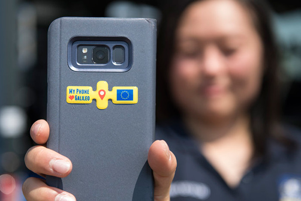
Following a waiver by the U.S. Federal Communications Commission (FCC) of its rules in November 2018, in which it allowed devices in the United States to access signals transmitted by the Galileo Global Navigation System, leading U.S. manufacturers are preparing to roll-out Galileo on U.S. territory.
At a meeting on Nov. 15 last year, the US FCC granted in part a request from the European Commission for a waiver of the FCC rules so that devices in the United States may access specific signals transmitted by Galileo.
This decision means that consumers and industry in the U.S. are now able to access certain satellite signals from the Galileo system, which can be used in combination with the U.S. Global Positioning System (GPS). The improved availability, reliability, and resiliency offered by incorporating Galileo capability into devices is something that U.S. chip manufacturers are eager to pass on to their customers.
“This is an important market development opportunity for manufacturers in the U.S. The FCC ruling means that industry can now benefit from the use of Galileo signals. The added accuracy and robustness offered by multi-constellation and multi-frequency capability will be a key differentiator on the market,” said Carlo des Dorides, Executive Director of the European GNSS Agency (GSA).
“We are glad to see FCC supporting Broadcom’s dual frequency GNSS vision, for which the GPS and Galileo combination is key,” said Vijay Nagarajan, VP Marketing Wireless Connectivity and Communication Division at Broadcom. “We enabled the world’s first dual frequency GNSS phone in 2018 with the simple goal of providing accurate location to the consumer even amidst the skyscrapers in a busy downtown. We are certain that consumers will benefit from this FCC ruling that will further drive the adoption of dual frequency GNSS.”
“As a leader in developing cellular technology — today, as the world launches 5G and dating back to Qualcomm’s legacy in 4G, 3G and 2G — including work to incorporate robust navigation solutions for smartphones, Qualcomm Technologies integrated Galileo across its chipset portfolio because we understand the importance and benefits of accurate, reliable, and rapid position location for consumers,” said Dean Brenner, senior vice president of Spectrum Strategy and Tech Policy, Qualcomm Incorporated. “We’re excited about the FCC allowing access to Galileo signals in the U.S. for commercial Location Based Services because it is a big step forward in improving the user experience, particularly in dense urban environments.”
Activating Galileo in the U.S.
Both Broadcom and Qualcomm Technologies, Inc. already have dual-frequency solutions that support Galileo E1/E5a signals: the world’s first dual frequency GNSS smartphone, the Xiaomi Mi-8, was fitted with a Broadcom BCM47755 chip and, in December, Qualcomm Technologies launched the newest generation in its 8 Mobile Platform Series, the dual-frequency Qualcomm Snapdragon 855 Mobile Platform.
“Approximately 100 smartphone models are already fitted with chipsets from these two manufacturers. Following the FCC ruling, we are expecting to see a significant increase in Galileo users coming from the U.S.,” said Justyna Redelkiewicz Musial, in charge of LBS and IoT market development at the GSA.
Better positioning and navigation
The FCC ruling permits access to two Galileo signals — the E1 signal that is transmitted in the 1559-1591 MHz portion of the 1559-1610 MHz Radio-navigation-Satellite Service (RNSS) frequency band and the E5 signal that is transmitted in the 1164-1219 MHz portion of the 1164-1215 MHz and 1215-1240 MHz RNSS bands.
Access to multi-constellation and multi-frequency capability means that users in the U.S. will be able to benefit from a better positioning and navigation experience particularly in urban environments where the unique shape of the E5/L5 signal makes it easier to distinguish real signals from the ones reflected by buildings, reducing the multipath effect. The simultaneous use of E5/L5 frequencies also mitigates other sources of error, such as ionospheric distortions, and makes the signal more robust against interference and jamming.
Calendar pages allows seem to fly by quickly, and 2018 was no different. While many of the items discussed in last year’s review continued to be topics of advancement, there are several new sources of technology, data collection and potential issues for surveyors going into the new year.
Let’s look back at the stories that affected the surveyor and their use of GNSS technology in 2018.
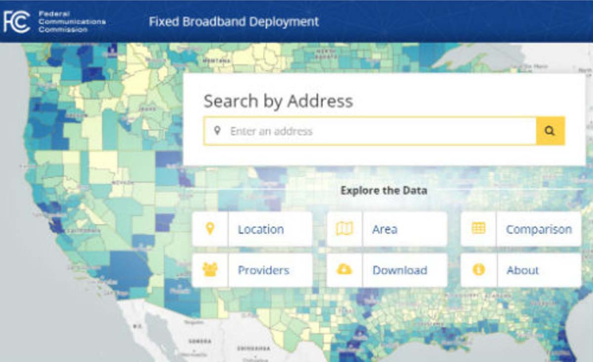
FCC broadband accuracy
The race across America to provide better broadband coverage hit a snag late in 2018 when critics of the Federal Communications Commission (FCC) voiced their displeasure with the accuracy of maps produced to depict the coverage of broadband access.
These critics are pressuring the FCC to verify internet coverage and speed of data availability in rural areas as reported by the broadband companies.
The FCC unveiled a new broadband map in February 2018. (Image: FCC)
These broadband companies are only required to report on the advertised availability and data speeds and not the actual coverage/speed of the installed networks. Critics of the FCC have found that information used from the broadband providers overstates the available speeds and number of internet service providers, thus allowing the FCC to produce mapping of broadband that is not correct.
Because of this incorrect reporting, it is estimated that almost 40 percent of rural America doesn’t have access to broadband data with no formal plan of rectifying this situation. The FCC has stated that they will investigate these coverage maps in order to determine if monies distributed to broadband providers were not used in accordance with the promised delivery of coverage and data speed.
Why does this matter to surveyors? As previously discussed in past columns, the reliance on the real-time network capability of GNSS is one of the biggest time and production savers for the surveyor and for those working in rural America is no exception.
Not just in small towns but out in the open where large parcels are being surveyed for many different reasons, including pipelines, wind and solar installations and title conveyances. By having broadband available use by surveyors, these tasks can be accomplished with shorter timeframes and less steps to keep critical data in compliance with established coordinate systems.
While this bill received lots of attention because of the FAA implications, the portion of the bill concentrating on geospatial oversight will have a lasting effect on the governance and development of the national mapping industry.
For many years, the ever-developing amount and sources of geospatial data has been growing within several different agencies of the United States government. This bill was established to help streamline the efforts and availability of geospatial data by assigning specific agencies to oversee the development and introduction of new technologies.
The biggest takeaway from this bill will be the reduction of agencies working on concurrent data sets for public and private use and therefore streamlining the opportunities to introduce newly acquired information into critical programs, (such as FEMA floodplain mapping, GAO asset management, etc.).
Part of the reason I wish to highlight this bill was the efforts of the National Society of Professional Surveyors (NSPS) to keep the state professional licensing laws intact, the use of private sector businesses for providing surveying services, and to keep quality-based selection (QBS) as the primary tool for awarding contracts for procurement services.
Because of the actions and reasoning by NSPS, the authors of the bill withdrew the language that would allow “low bid” opportunities within these contract awards. This influence by NSPS is a prime example of how a profession can influence legislation through our democratic process.
Galileo implementation, Beidou installation, GPS Block III launches
SpaceX’s Falcon 9 rocket orbited the first GPS III satellite on Dec. 23, 2018. (Photo: SpaceX)
In November 2018, the FCC opened a new chapter in GNSS observation by approving a waiver to allow GNSS receivers to utilize Galileo transmissions for location determination without a specific FCC license. Traditionally, the FCC would require licensing of public, receive-only GNSS equipment used with any foreign-based systems but worked with several US agencies to create a waiver to allow faster implementation to use the Galileo signals.
It should also be noted that the Chinese government has been rapidly building the latest stage of their own GNSS constellation, the BeiDou system. The United States and China have been promoting cooperation to allow each side to better understand the current workings of GPS and BeiDou, (GPS-BeiDou Statement). China is currently completing its third phase of the navigation system that potentially will surpass the United States GPS constellation in data availability and accuracy, (See GPS World“Directions 2019: BeiDou accelerates global deployment,” December 2018).
Not to be outdone, the U.S. has begun its implementation of their next wave of satellites, the GPS III containing the latest technology, the L1C civil signal, with improved accuracy and anti-jamming programming. On Dec. 23, the SpaceX Falcon 9 rocket delivered the GPS III SV01 into its intended orbit (SpaceX Launch) with more launches scheduled for additional satellite vehicles in 2019.
These efforts to increase satellite coverage and accuracy will only improve the use of GNSS receivers by surveyors. While I look forward to software and receiver upgrades to take advantage of the newer birds, we still need a backup plan in case of international conflicts and a reduction/discontinuation of GNSS service.
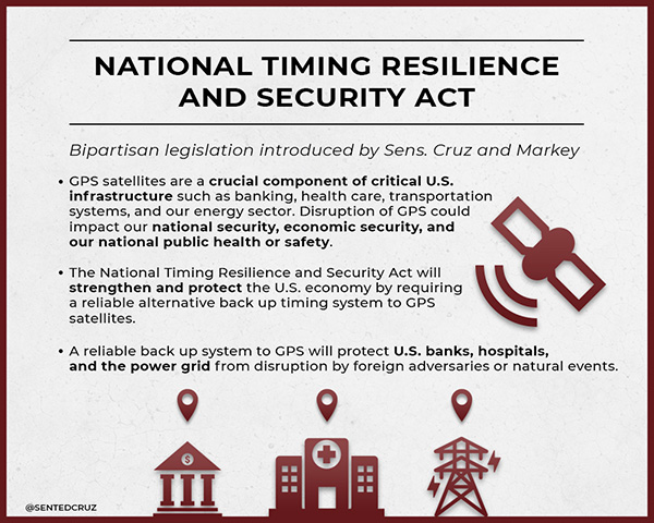
GPS and terrestrial backup
The Frank LoBiondo U.S. Coast Guard Authorization Act of 2018, which also included the National Timing Security and Resilience Act, was signed into law on Dec. 4 and directs the Secretary of Transportation to establish a terrestrial back system for the U.S. satellite navigation system within a two-year period (see “GPS to get terrestrial backup system”).
The bill lays out specific conditions for the backup plan:
terrestrial
wireless
synchronized to UTC
difficult to disrupt
able to penetrate underground and inside buildings
capable of deployment to remote locations
expandable to provide position, navigation and timing (PNT), and
able to work in concert with similar systems such as eLoran.
However, this bill did not provide any funding for the creation of this system but now allows the introduction of appropriations in future bills and acts. As I have written in past columns (see “The day GPS went away,” September 2017), it won’t be a matter of if but when something happens to our current GNSS capabilities and we need to develop this backup plan yesterday.
Dual-band GNSS cellphones as the new norm
My last submission featured the latest in chipset for cellphones and utilizing dual-frequency GNSS signal reception. Xiaomi, based in Beijing, China, introduced the Mi 8 phone with a dual-frequency GNSS chip in the Spring of 2018 to rave reviews.
This chip frequency reception (E1/L1+E5/L5) is targeted to embrace the Galileo and GPS constellations for increased accuracies (within a decimeter) well beyond the current norm for smartphones (typically 1-3 meters +/-).
Since then, Xiaomi has released the Mi Mix 3 and Huawei has released the Mate 20, Mate 20 Pro and Mate 20 X, all with dual-frequency chipsets. However, all of these phones are not available in the U.S., and the security issues with Huawei has been well documented (CNBC Report, February 2018).
The reason I still bring these up for the surveyor is because soon we will have dual-frequency capability on the phone in our pockets here in the U.S. Such phones can greatly increase efficiencies, especially when used during reconnaissance efforts. I believe many more phone manufacturers will begin to incorporate dual-frequency chips in their future models to increase location accuracies for the users and take advantage of upcoming network enhancements (see GPS World“Dual-frequency GNSS smartphone hits the market,” June 2018.)
Surveyors vs. technology disruptors
The Mi 8 smartphone offers dual-frequency capability. (Image: Xiaomi)
One of the biggest stories in the surveying world made national headlines after a start-up “GEO-spatial” consultant created by retired bankers was sued by the Mississippi Board of Licensure for Professional Engineer and Surveyors for having “engaged, and continues to engage in the practice of surveying while not licensed by the Board.” (Madison County, Mississippi, Chancery Court.) While the initial suit remained under the national radar, the countersuit by the consultant and subsequent articles in national websites brought the situation to the front page.
The issue at hand is the creation of “plats” combining a legal description for a parcel with a high-resolution photo (captured by various means, including UAV) and depicting said legal description on the photo for use by banks and other financial institutions for risk evaluation. Their argument is that they have “First Amendment rights” to provide public information (the legal description) on a recent aerial photograph in order to provide an exhibit for lenders to review and make loan decisions. Banks are now paying much less in fees to this company for an exhibit instead of a Plat of Survey provided by a licensed surveyor, yet the exhibit provides no assurance (or certification) to its validity and/or any metadata for the represented information.
The subsequent articles by both Bloomberg and Ars Technica writers liken the situation to Airbnb versus hotels and Uber/Lyft versus taxi drivers as a new “disruption in technology” brings forth change to previously licensed professions. In fact, the author of the Bloomberg article stated, “the clients are sophisticated, and they’re not complaining.”
Using this mentality, we could apply it to any licensed profession and allow services normally regulated by laws to be administered by non-professionals, as long as the client “is sophisticated and not complaining.” This means anyone can provide accounting, medical, dental or even law services if the client is satisfied. As previously published here, (see GPS World“Accuracy, precision and boundary retracement in surveying” July 2017), a boundary survey is not simply a mathematical figure from a legal description. It takes a trained person to know how to properly relate a legal description to a physical parcel and professional licensing provides that assurance (and protection) to the public.
This situation falls squarely in the GNSS wheelhouse for surveyors, especially as technology advances and accuracies become smaller with progress, (i.e. GPS Block III, BeiDuo, Galileo, etc.) and the ability to measure with higher positional accuracy, (i.e. Xiaomi Mi 8 and other to follow).
The surveying profession has joked for years that when these technologies do come forward, many unlicensed “professionals” will come forward with their measuring devices (phones) and locate property lines as part of their service.
But for now, it isn’t just the physical location by GNSS measurement we should worry about; it is the high-resolution photo software, GIS data sources and those folks enterprising enough to put all this information together. The surveying profession will need to ramp up its message to public to help better define what the licensed surveyor provides versus the “we can do it much cheaper and faster” stories. More often than not, you get what you pay for.
Data collection advancements
Emlid Reach RS with iPad. (Photo: Tim Burch)
While 2018 didn’t see any revolutionary changes to GNSS data collection, several small advances are noteworthy. Besides the previously mentioned dual-frequency cellphones, we are also seeing more integration with the cellphones themselves as data collectors in conjunction with stand-alone GNSS receivers (see GPS World“University research uses smartphones for precision GNSS,” September 2018).
Several of the major survey equipment manufacturers are joining a group of small GNSS start-ups by introducing single- and dual-frequency receivers to work with both Android- and iOS-based phones and tablets for more cost-effective positional solutions.
Another trend that is becoming very popular is the use of post-processing kinematic (PPK) solutions with many of the newest models of multi-rotor and fixed wing UAVs. The early (and expensive) trend of aerial vehicles produced by the major surveying equipment manufacturers insisted on installation of a dual-frequency RTK receiver in order to provide a more robust control system for the orthometric photo process. Because there is still a need to combine the still photos from the UAV flight via various “stitching” software, the need (and expense) of RTK within the receiver, while a nice feature, has become overkill for most aerial needs. However, there are times and applications when a fixed-RTK location could be useful, especially during emergency situations when needing to utilize the UAV for live streaming purposes.
The last big trend to gain popularity comes from Propeller, a young tech company from Australia that provides both a control point product and data reduction/reporting service. Their revolutionary ground control point (GCP) target, the Aeropoint, is becoming a very popular item for UAV pilots worldwide. These 24-inch (61-CM) square foam targets contain a single-frequency GNSS receiver that collects RINEX data while performing your UAV flight. Spread these targets around your site, setup and perform your survey, then download the target data to the Propeller app on your phone/tablet. The app automatically uploads the data to the company’s site and processes the geographical location for each target into your chosen coordinate system. It truly is that simple and the Propeller folks have made it easy to use. Their online software, Propeller Platform, is also available for photo/data processing and site analysis/visualization/volume computations. They, too, are now teaming with DJI to offer PPK solutions combining Aeropoint data along with Phantom 4 RTK photo data in a convenient, streamlined process.
For 2018, our firm (SPACECO Inc) expanded our UAV program in several ways to take advantage of these trends. First, we been using the Emlid Reach RS single-frequency GNSS receiver utilizing a Bluetooth connection to an iOS-based tablet to GCP’s for our UAV program. The receiver’s low cost and ease of use with an RTN network has been a pleasant change from typical surveying equipment. We also use Propeller’s Aeropoints in locations where the RTN coverage is not readily available. For sites that are substantial (typically 300 acres+), we often send our data to the Propeller Platform for photo stitching and data reduction to take advantage of their computing power.
WingtraOne. (Photo: Brian Kravets, SPACECO Inc.)
Lastly, we wanted to expand our fleet of quad-rotor UAV’s to include a fixed wing model for larger sites. A visit with the Wingtra crew at InterGeo 2017 in Berlin convinced me that a vertical take-off and land (VTOL) model would be a great addition, so we took delivery of our WingtraOne this past summer. The ease of use and amount of project space the Wingtra can cover was already great but we’ve added the PPK module to reduce the amount of GCP’s necessary, especially in inaccessible areas. All these additions to our survey department (carefully vetted and purchased; no freebies from any of the manufacturers!) have provided new ways to expand our services to our clients and allows us the opportunity to enjoy what we do along the way. It is my pleasure to report from personal experience that these trends are solid and will continue to increase our abilities and productivity for days to come.
What’s next for 2019?
Some of the items I see gaining traction in 2019 will include additional sensors for UAV’s (LiDAR, hyperspectral, infrared), continued improvement in cost effectiveness of laser scanners and LiDAR, increased interest in SLAM (simultaneous localization and mapping) technology and, of course, more geolocation services tied into autonomous vehicles/delivery. Will 2019 be the year Amazon drops my packages by UAV at my front door? As fast as these technologies are developing, I wouldn’t bet against it.
Iridium Satellite Communications Inc. filed comments to the U.S. Federal Communications Commission (FCC) on Oct. 29 regarding outdated Ancillary Terrestrial Component (ATC) rules.
The company, operator of the Iridium satellite constellation — 66 low-Earth orbit satellites used for global voice and data communication from handheld satellite phones and other transceiver units — called for the rules to be removed by the FCC and replaced by new rules that better serve the spectrum ecosystem.
“Fifteen years ago, the FCC had a vision of satellite companies integrating terrestrial service into their core satellite business as a supplemental service. This vision has been never been successfully achieved — not once,” said Iridium spokesperson Jordan Hassin. “Instead, the result has been a constant whittling away at the rules to the point they have become irrelevant with a whole lot of collateral damage along the way. Given this history, it is appropriate for the FCC to consider the elimination of these outdated ATC rules while taking into account the realities of existing services and users.”
“ATC is an outdated concept that never developed as intended,” Rob McDowell, former commissioner of the FCC added.
The rules have resulted in proposals to get around them, such as Ligado, and significant fights over harmful spectrum interference to incumbent satellite systems. Ligado has sought to waive three gating criteria established by the FCC.
The U.S. Federal Communications Commission (FCC) granted in part the European Commission’s request for a waiver of the commission’s rules so that non-federal devices in the United States may access specific Galileo signals. While private users were free to use the European GNSS, with this ruling entities such as telecommunications companies can now also use Galileo.
With today’s action, consumers and industry in the United States will now be permitted to access the E1 and E5 Galileo signals to augment GPS.
Since the debut of the first consumer handheld GPS device in 1989, consumers and industry in the United States have relied on the U.S. GPS to support satellite-based positioning, navigation, and timing (PNT) services that are integral to everyday applications ranging from driving directions to precision farming.
The order, approved Nov. 15, finds that Galileo is uniquely situated as a foreign GNSS system with respect to the U.S. GPS, since the two systems are interoperable and radiofrequency compatible pursuant to the 2004 European Union/United States Galileo-GPS Agreement.
Specifically, the order permits access to two of the Galileo system’s satellite signals — the E1 signal that is transmitted in the 1559-1591 MHz portion of the 1559-1610 MHz Radionavigation-Satellite Service (RNSS) frequency band, and the E5 signal that is transmitted in the 1164-1219 MHz portion of the 1164-1215 MHz and 1215-1240 MHz RNSS bands. These are the same RNSS bands in which the U.S. GPS satellite signals operate.
The order does not grant access to the Galileo E6 signal, which is transmitted over the 1260-1300 MHz frequency band, since this band is not allocated for RNSS in the United States or used by the U.S. GPS to provide PNT services.
The commission noted that granting access to the Galileo E6 signal could constrain U.S. spectrum management in the future in spectrum above 1300 MHz, where potential allocation changes are under consideration.
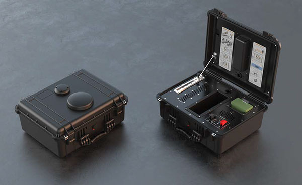
DroneShield has launched DroneNode in response to end-user requirements.
DroneNode is an evolution of the company’s DroneCannon product. It is a portable, compact and inconspicuous counter-drone jamming device that law enforcement can use at large outdoor events without raising public concern.
DroneNode comes in a portable case approximately 50 x 50 centimeters square. It can be set up in seconds and requires very little training to operate, the company said.
It can simultaneously jam 2.4 GHz, 5.8 GHz and GNSS L1 and L2 bands up to one kilometer, causing drones to return to their point of origin or land. DroneNode is also effective against swarm attacks. Emergency broadcasts, cellphone communication and other dedicated channels will not be affected.
According to the company, DroneNode’s covert design makes it a suitable counter-drone solution for public events where protection from drone threats is a priority. Designed within a rugged carry case, DroneNode is easy to transport and is protected from the elements.
DroneNode is powered by a NATO-approved self contained battery with room for a second battery stored in the accessories tray.
“The release of DroneNode continues DroneShield’s leadership in drone security for public events,” said Oleg Vornik, DroneShield’s CEO. “DroneShield’s recent credentials in the area include the 2018 Olympics, the 2018 Commonwealth Games, 2018 ASEAN-Australia Special Summit, the 2017 Hawaii Ironman World Championship, and the 2015 to 2017 Boston Marathons. The company’s products are well positioned to protect large public gatherings globally.”
According to DroneShield, the product is particularly relevant given the recent drone attack on the Venezuelan president and the high-profile mail bomb terrorist attacks in the United States, heightening the awareness of law enforcement globally to potential threats to high-profile political targets.
A Venezuela soldier received head injuries in a the drone attack against the president. (Photo: Released by Xinhua News Agency)
FCC Authorization Pending. DroneNode and DroneCannon have not been authorized as required by the U.S. Federal Communications Commission (FCC). The devices are not, and may not be, offered for sale or lease, or sold or leased, in the United States, other than to the U.S. government and its agencies, until authorization is obtained.
The use of such devices in the United States by other persons or entities, including state or local government agencies, is prohibited by federal law. Laws limiting the availability of such devices of certain types of users may apply in other jurisdictions, and any sales will be conducted only in compliance with the applicable laws.
The U.S. Federal Communications Commission will vote in November on whether to allow U.S. devices to access Galileo.
The Galileo Order is tentatively on the agenda for the Open Commission Meeting scheduled for Thursday, Nov. 15:
Galileo Order – The Commission will consider an Order that addresses waivers of certain satellite licensing requirements for receive-only earth stations operating with the Galileo Radionavigation-Satellite Service. (IB Docket No. 17-16)
“Enabling the Galileo system to work in concert with the U.S. GPS constellation should make GPS more precise, reliable and resilient for American consumers and businesses alike ,” said FCC Chairman Ajit Pai.
In 2015, the National Telecommunications and Information Administration (NTIA) submitted to the FCC a request from the European Commission to waive certain of the commission’s earth station licensing rules to permit non-federal U.S. receive-only earth stations to operate with Galileo.
The NTIA recommended grant of the requested waivers, and the International Bureau issued a Public Notice seeking comment on the potential public interest benefits and technical issues associated with the waiver request.
The FCC is proposing to waive its licensing requirements for non-federal operations with Galileo signals known as E1 and E5, subject to certain technical constraints, officials said.
The FCC includes conditions to ensure users of satellite-based positioning, navigation and timing services in the United States will benefit from Galileo signals. The systems are interoperable under a 2004 agreement.
Below is a summary of the order; the full text can be downloaded here.
Grant in part the request of the European Commission for waivers of certain of the Commission’s earth station licensing rules to permit non-federal U.S. receive-only earth stations to operate with specific signals of the Galileo GNSS without obtaining a license or grant of market access.
Find that the Galileo GNSS is uniquely situated as a foreign GNSS system with respect to the U.S. GPS, since the two systems are interoperable and radiofrequency compatible pursuant to the 2004 European Union/United States Galileo-GPS Agreement.
Find that there are significant public interest benefits associated with operations of non-federal U.S. receive-only earth stations with the Galileo GNSS, including increased availability, reliability, and resiliency of position, navigation, and timing services in the United States.
Grant the request for operations with the Galileo E1 signal, which is transmitted over the 1559-1591 MHz frequency band.
Grant the request, and a waiver of the non-federal portion of the U.S. Table of Frequency Allocations, for operations with the Galileo E5 signal, which is transmitted over the 1164-1219 MHz frequency band.
Deny the request for operations with the Galileo E6 signal, which is transmitted over the 1260-1300 MHz frequency band, since there is no federal or non-federal allocation for RNSS in the U.S. Table of Frequency Allocations in that band and grant of waiver could constrain our future spectrum management for non-federal operations in the U.S. in spectrum above 1300 MHz, where potential changes in the non-federal allocation are under consideration.
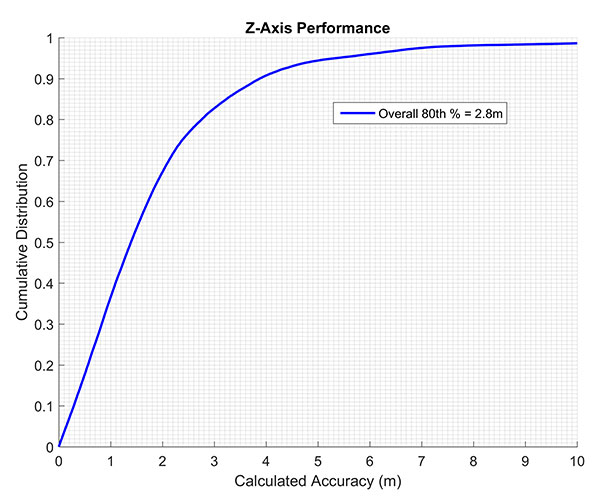
The company states that by using actual test call data to emulate active sensor compensation, its solution improved from 4.8- to 2.8-meter accuracy at the 80th percentile, which exceeds the commonly accepted definition of floor-level accuracy of under 3 meters.
The testing focus was to evaluate barometric-based solutions in advance of the Federal Communications Commission (FCC) establishing a vertical location accuracy metric for compliance by wireless carriers in the Top 50 markets, beginning in 2021.
Polaris Wireless was one of two technology vendors selected to participate and was the only solution tested in all buildings in all three cities: 48 buildings, 312 test locations and 55,592 test calls. The Polaris Wireless test included the widest variety of device and barometric sensor manufacturers.
Polaris Wireless achieved an official Stage Z vertical accuracy of 4.8 meters, 80th percentile, with a minimal one-time compensation of the barometric sensor outside of the test cities. However, this one-time compensation did not present a true test of Polaris Wireless vertical location accuracy.
Barometric sensor compensation is arguably the leading source of error in vertical location determination. During the test, Polaris Wireless did not enable active, in-market compensation of the baro sensor and instead relied solely on just a few test calls outside of the test market.
Polaris Wireless vertical accuracy from CTIA test data. (Chart: Polaris Wireless)
After learning that the other vendor included active, in-market compensation, Polaris Wireless submitted a comparable set of results using the same methodology to the CTIA for consideration in the report. This data was drawn exclusively from actual test calls, in the period before final results were published, to emulate the original performance as if active compensation had been activated.
These are referred to as “limited active compensation” results because sensor bias estimates were updated monthly instead of in real time. The figure shows the increase in Polaris accuracy when allowing for this active compensation.
Polaris Wireless says it continues to improve on its three-dimensional accuracy for both public safety and commercial applications, and is exploring additional forums for independent performance evaluation.