Tag: FCC

  • Intel’s Mini-PC: A Cheap Server for an RTK Base

    I’ve written this many, many times in the past eight years that I’ve written for GPS World magazine, but I have to write it again — this is an exciting time for GNSS!

    For me, high-precision GNSS is particularly exciting. I’ve been traveling like crazy, and involved in a number of really fun projects that incorporate high-precision GNSS. Of course, on these various projects I usually incorporate many types of technologies that support GNSS, such as computing, communications, power, and mechanical.

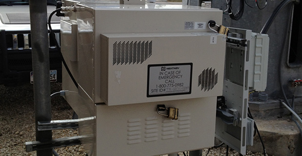
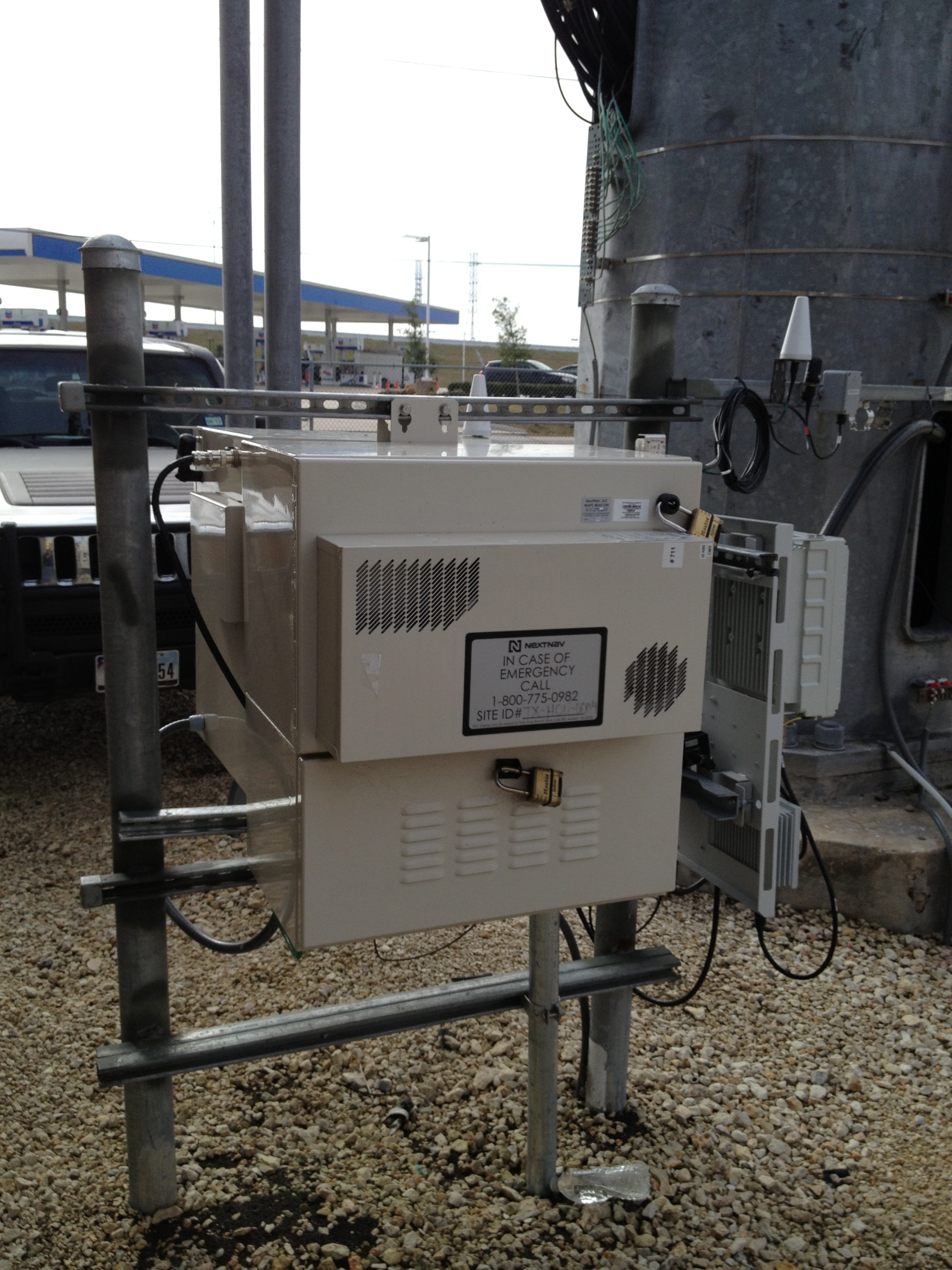
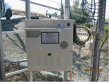
    Along those lines, I find myself more and more frequently setting up custom RTK bases for companies because they’re getting cheaper and cheaper, regardless of the fact that  there are an increasing number of publicly available real-time kinematic (RTK) base stations. Setting one up doesn’t just involve plugging power into a RTK base receiver and hitting the on/off switch. As I mentioned above, setting up an RTK base involves several different types of technologies. Sometimes, I set up a desktop computer next to the RTK base to act as a server to manage the RTK GNSS base and communications (both network and RTK communications) equipment.

    In your mind, when you think of a desktop computer, you probably envision something that occupies 2-3 square feet (~one square meter) of desktop space, along with a keyboard and monitor. So, a consideration when deploying an RTK base is finding desk space somewhere in the user’s office to accommodate the desktop PC and other equipment.

    Recently, I took a different approach. I found (actually, my client found) an incredibly small computer to be our server. Just as high-precision GNSS receivers are getting smaller and smaller, so are computers. The Intel Mini-PC measures 4 inches x 4 inches (10.16 x 10.16 centimeters) and has no hard disk. It uses solid-state drive (SSD) memory for storage. SSD technology is still somewhat expensive ($1+ per gigabyte), but it is small compared to a classical disk drive, and doesn’t have any moving parts. Furthermore, the Mini-PC has ethernet ports: when we connect a network cable to it, we could access the Mini-PC via Remote Desktop. That meant we didn’t need a keyboard or monitor. The Mini-PC had all the power we needed, and we could load any sort of control software on it because it runs the standard Windows 7 (or 8) operating system. Last but not least, the Mini-PC costs only $149. However, you need to add memory, SSD, and so on, so the real cost is ~$400 depending on your configuration. While not cheaper than similarly performing “boxes” available, it’s certainly one of the smallest.

    Intel Mini-PC Measuring 4" x 4"
    Intel Mini-PC Measuring 4″ x 4″

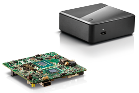
    In fact, it’s so small that we stuffed it inside a 14” x 12” electronics enclosure box along with the RTK GNSS base and other network equipment, and hung it out of sight on a closet wall. No desktop space required. Without stretching your mind much, you can see where desktop computing is headed; very small and inexpensive enough to be dedicated to specific tasks. Think about this and then consider the Internet of Things concept. It’s very exciting.

    More RTK on Mobile Devices

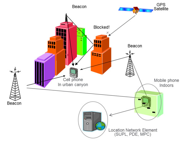
    Later this week I’ll be experimenting with RTK on mobile devices with the CRTN (California Real Time Network), a collection of 330 RTK bases located throughout California. I’ll be using a Panasonic ToughPad running ArcGIS Mobile (and maybe ArcPad) and an iPad using a cloud-based mapping service. The latter is particularly interesting because there are lots of cloud-based GIS data collection apps on the market and under development. Specifically, there’s a lot of subscription-based, cloud-based software. The challenge is that they are even less geodesy-intelligent than the “professional grade” GIS data collection software on the market. In other words, they read coordinates (NMEA format) from GNSS receivers and feed them directly into their app. No datum transformations are provided, neither horizontal nor vertical. That’s going to be a problem.

    FCC Levies Record Fine Against Chinese Supplier of GPS and Mobile Phone Jammers

    The Federal Communications Commission (FCC) announced that it plans to issue the largest fine in its history against C.T.S. Technology Co., Limited, a Chinese electronics manufacturer and online retailer, for allegedly marketing 285 models of signal jamming devices to U.S. consumers for more than two years. The FCC plans to levy a $34.9 million fine against CTS. The FCC reported that CTS sold 10 high-powered signal jammers to undercover FCC personnel.

    The FCC is asking people to report the sale or use of an illegal jammer by contacting the FCC Enforcement Bureau through the FCC online complaint portal, or by calling 1-888-CALL-FCC (or 1-888-225-5322). To voluntarily relinquish a signal jammer, e-mail [email protected]. Additional information, including the FCC Consumer Alert on the jamming prohibitions and the FCC Enforcement Advisory to retailers regarding the marketing of illegal signal jammers, is available at www.fcc.gov/jammers.

    You can view the FCC enforcement action against C.T.S. here.

    Satellite Launch Pads are Warming Up

    Two GPS Block IIF satellites, one launched in February and one launched in May, were set healthy in the past three weeks, making a total of six IIF GPS satellites in orbit broadcasting on three civil frequencies; L1, L2C, L5.

    On July 31, the seventh GPS IIF satellite is scheduled for launch, followed by an October 2014 scheduled launch of the eighth GPS IIF satellite.

    On June 14, Russia launched a GLONASS-M satellite. It has not been set healthy yet. There are a total of 24 healthy GLONASS satellites in orbit. You can check the current status of GLONASS satellites here.

    On August 22, Europe is scheduled to launch the first two Galileo FOC (Full Operational Capability) satellites to add to the four test satellites in orbit that will be integrated into the final operational constellation. A second pair of Galileo satellites is scheduled for launch in November 2014. These are projected dates and subject to slippage.

    Dorese and Milena rest side by side in  clean room S1A.
    Galileo Satellites in the Clean Room

    Live Webinar from the Esri International User Conference on July 17

    In a GPS World first, we’ll be producing a live Webinar from the Esri International User Conference next month on Thursday, July 17 @ 10 am Pacific Time in the exhibit hall at the San Diego Convention Center. Of course, the webinar will be focus on one of the hottest topics, high-precision GNSS on mobile devices; from iPads to Android tablets to smartphones.

    Tune in or join us live from the exhibit hall floor! Register here.

    Thanks, and see you next month.

    Follow me on Twitter at https://twitter.com/GPSGIS_Eric

  • Association Says Indoor Location Technology Not Ready

    Association Says Indoor Location Technology Not Ready

    Kevin Dennehy
    Kevin Dennehy

    Not everyone is talking up the accuracy of indoor positioning. Arlington, Virginia-based Telecommunications Industry Association says the technology, which is seen as the one way location-based services providers will be able to capture consumer interest, is not ready. In other LBS news, AT&T has come out with data pricing for its connected vehicle initiatives.

    In a recent FCC filing, the Telecommunications Industry Association said that indoor positioning technology is not sufficiently developed to support ongoing wireless E-911 location accuracy requirements.

    While TIA supports the FCC’s goal to improve location accuracy, “Imposing location accuracy mandates at this time would be premature, given the nascent stage of the technology that will be needed to accomplish the Commission’s objectives, and should neither favor nor disfavor specific technologies,” said the association in its filing.

    The NPRM proposes a requirement to achieve “rough” indoor location information, TIA said. It proposes to require providers to provide horizontal information for wireless 911 calls that originate indoors, specifically a caller’s location within 50 meters.

    TIA also disagrees with an FCC proposal to require mobile operators to provide z-axis, which is vertical location within 3 meters of a caller’s location, for 67 percent and 80 percent of indoor wireless 911 calls — ranging from three to five years after adoption. Again, TIA says that the technology is not fully developed.

    TIA quoted AT&T’s filing: “[The] time [is] right to begin discussing Indoor Location Accuracy for E-911” but the “FCC should be careful to ensure that any proposed rules on location accuracy are aligned with proven capabilities of the current state of technology and they should set realistic accuracy benchmarks that the industry and public safety can embrace.”

    The location industry has been counting on indoor positioning, with its beacons and Wi-Fi enhancements, to jump-start a location-based services market that always seems to have tremendous potential, but the numbers don’t back it up. Some big-time analysts have said that while the promise of indoor positioning is huge, it just isn’t there technically yet.

    In fact, one analyst said that the biggest technological breakthrough last year was indoor mapping. Such major retailers as Home Depot and Lowes launched indoor maps with product search locators. These same analysts say that indoor Wi-Fi positioning is not accurate enough for macro location.

    The big deal coming up is how FCC positioning accuracy regulations will affect beacons or Bluetooth low energy for micro location and proximity services.

    TIA said it supports initial FCC location accuracy requirements back to 2007. However, don’t ask TIA for more location regulation. “To date, the development of 911 and E911 location accuracy technologies and applications has been fostered by a voluntary and consensus-based standards process. This process has proven quite successful to date, and the Commission should refrain from imposing regulations that could slow additional development,” the association said.

    AT&T Announces Connected Car Pricing

    AT&T Mobility said standalone pricing for new LTE-enabled OnStar service will be $5 or $10 per month, depending on whether the driver is an OnStar subscriber. The company said it will allow customers, with a GM LTE-capable vehicle, to add the car as another device for $10 — which is the same price as a tablet.

    OnStar subscribers will get coverage ranging from $5 for 200 MB of data per month to $50 for 5 GB. GM is also allowing customers to buy one-time data packages.

    At this year’s CES, General Motors announced its first LTE-enabled vehicles — in which AT&T Mobility is powering the LTE network for GM’s OnStar service. The first LTE-enabled vehicles, which will be available this summer, are Impala, Spark, Volt, Orlando, Spark RV, Silverado, Silverado HD, Malibu, Equinox and Corvette Stingray. GM plans to have 30 Chevrolet, Buick, GMC and Cadillac vehicles LTE-equipped by the end of the year.

    AT&T also made recent deals to provide connectivity for Ericsson Connected Vehicle Cloud which connects to the AT&T Drive platform for automakers.

    CEA Hosts CES on the Hill

    Members of Congress and their staff had the opportunity to observe location technology during the Consumer Electronics Association’s recent CES on the Hill event in Washington. Exhibiting companies include Origo Safe, distracted driving; AT&T Drive; DashIt; Qualcomm, which showed off a geofencing product around schools; and RideScout.

    Washington-based Ridescout is a cool, and free, mobile app that allows a user to find the nearest subway, bus, taxi, bikeshare, sedan service, carshare, pedi-cab or carpool. A user can choose from a list of options by proximity, cost or arrival time.

    “We launched in November in Washington, D.C. We are in Austin, San Francisco, Boston, Chicago and planning several new markets,” said Steve Carroll, Ridescout vice president of operations.

    The app, which is on the iOS and Android platforms, generates revenue by sharing with the ride providers, large organizations and universities and the public transport network, Carroll said.

    Some of Ridescout’s partners include Mozio, RidePost, Metro of Washington, Bandwagon, Sidecar, Car2Go, Arlington Transit, Capital Bikeshare, Yellow Cab, DC Circulator and Dash.

    RideScout, founded by two Army veterans, was hatched when founder and CEO Joseph Kopser wanted an application to show him the best way to get to work in the Washington area. He could not find one and started the company with Craig Cummings. The company initially launched an alpha product at South by Southwest in 2013.

    Though it was the first to combine all modes of transportation in a single application, the company has some competition. Of course this competition is from the 800-pound location gorilla, Google.

    Google, with its Google Maps platform, shows the directions to the nearest transportation mode. Now it is incorporating Uber, which is an on-demand transportation provider.

    This is not the first time Google has launched a product in an effort to dominate a market place or niche. When it launched Google Maps in 2009, it put the hurt on many companies in the location industry, which underwent a three-year period of consolidation, company closings and layoffs.

  • Public Safety Organizations Support FCC Rule to Help Find Wireless 911 Callers

    Many of the nation’s leading public safety and public health organizations submitted comments this week in support of a proposed Federal Communications Commission (FCC) rule to help emergency responders more quickly and accurately find 911 callers using wireless phones from indoor locations.  More than 300 individuals and organizations filed during the initial comment period with the overwhelming majority supporting the FCC proposal.

    Among those supporting the rule were many of the largest and most respected organizations representing 911 professionals, police officers, fire fighters, EMS workers, public safety professionals, older Americans, heart attack and Alzheimer’s patients, and the deaf and hard of hearing.  They were joined by hundreds of individual 911 dispatchers and first responders who submitted personal comments through the FCC’s web site or in survey responses that were filed with the FCC.

    “The support for this rule across the public safety and public communities is truly breathtaking,” said Jamie Barnett, director of the Find Me 911 Coalition and former chief of the FCC’s Public Safety and Homeland Security Bureau. “These organizations are on the front lines of emergency response, and they know that lives are being lost every day because 911 professionals cannot quickly find indoor callers using wireless phones.  The urgency of this rulemaking is unquestionable, and we commend Chairman Wheeler and the other commissioners for their leadership by taking fast action on it.”

    According to the FCC’s estimates, at least 10,000 lives a year could be saved by improvements in response time through the FCC’s proposed rule. All of the comments submitted are online.

    Find Me 911 is an effort supported by more than 200,000 individuals, as well as national and local organizations. The individuals and organizations represent a broad range of 911 operators and first responders — emergency medical services personnel, fire fighters and police. Find Me 911 seeks to ensure that the FCC moves forward quickly to establish a reasonable, measurable level of location accuracy for emergency calls made indoors, enabling first responders to locate emergency calls from wireless phones from all locations rapidly and efficiently.

    Among the organizations filing joint or individual comments in support of the FCC’s proposed rule were:

    • Law Enforcement
    • International Association of Chiefs of Police
    • National Sheriffs’ Association
    • Fire Fighters
    • International Association of Fire Fighters
    • International Association of Fire Chiefs
    • Emergency Medical Professionals
    • National Association of State Emergency Medical Services (EMS) Officials
    • National Association of EMS Physicians
    • National Association of EMTs
    • National EMS Management Association
    • American College of Emergency Physicians
    • 9-1-1 Professionals
    • National Association of State 911 Administrators
    • National Emergency Number Association
    • Association of Public Safety Communications Officials
    • CALNENA
    • Texas 9-1-1 Alliance
    • Texas Commission on State Emergency Communications
    • [Texas] Municipal Emergency Communication Districts Association
    • San Francisco Department of Emergency Management
    • Nebraska Public Safety Commission
    • Older Americans
    • AARP
    • Alliance for Retired Americans
    • Public Health
    • Alzheimer’s Association
    • American Heart Association
    • Public Safety
    • National Association of Regulatory Utility Commissioners
    • National Public Safety Telecommunications Council
    • Deaf and Hard of Hearing
    • Telecommunications for the Deaf and Hard of Hearing
    • National Association of the Deaf
    • Association of Late-Deafened Adults
    • Cerebral Palsy and Deaf Organization
    • California Coalition of Agencies Serving the Deaf and Hard of Hearing

    Deaf and Hard of Hearing Consumer Advocacy Network

    Technology Access Program, Gallaudet University


  • FCC Ready for Indoor Location Rules for 911 Calls

    FCC Ready for Indoor Location Rules for 911 Calls

    Janice Partyka
    Janice Partyka

    Last week, the FCC proposed to update 911 regulations to require carriers to be able to locate 911 calls that are made indoors. The current rules were made in 1996 and only required carriers to locate outdoor calls. Then, the outdoor-only rule made sense. We used wireline indoors, and complex indoor technology wasn’t in sight. That is no longer the case. Nearly 73 percent of 911 calls in California are made from wireless phones. The FCC wants to start small; in the near term, wireless carriers would need to identify the building, as well as the floor, from where the call is being made. I’ll get to the proposed long-term rules in a bit.

    How do I think this will play out? Dialing back in time to the turn of the century, you will recall that the carriers were stomping their feet in outrage over FCC rules that required carriers to send the location of an outdoor 911 call to dispatch centers. The word onerous was used generously by the carriers. K Street filled its pockets lobbying the FCC to water down location accuracy requirements and reporting. There were certainly some challenges complying with the FCC rules, but they were greatly overstated.

    Back then, I served two terms on the board of the E911 Institute, which supported a caucus in Congress devoted to promoting emergency response. The board included wireless carriers, vendors and public safety professionals. While, on the face of it the carriers were providing support for E911, at the same time, they were working hard to take teeth out of the implementation. We will see how the carriers respond this time.

    So let’s look at the FCC’s proposed rules for the long-term. The commission is proposing more detailed indoor location accuracy standards that would require identification of the specific room, office or apartment where a wireless 911 call is made. Imagine a call being placed from a college dorm or arena and the value is clear. And with regard to the technology, my retailer in the mall can trace my location throughout the mall, before and after I enter their store. As usual, the commercial arena has showed us what’s possible. Let’s see what the carriers say this time about stricter rules on location.

  • FCC Acts to Help Emergency Responders Locate Wireless 911 Callers Indoors

    WASHINGTON, D.C. – The Federal Communications Commission today proposed rules to help emergency responders better locate wireless callers to 911. The proposed updates to the FCC’s Enhanced 911 (E911) rules respond to Americans’ increasing use of wireless phones to call 911, especially from indoors, and take advantage of technological developments that allow for more accurate location information to be transmitted with 911 calls.

    The FCC’s current E911 rules require wireless providers to automatically transmit information to 911 call centers on the location of wireless 911 callers within certain parameters for accuracy. These rules, which were adopted in 1996 and underwent their last major revision in 2010, enable wireless providers to meet this accuracy standard based solely on the performance of outdoor wireless 911 calls.

    However, many Americans are replacing landlines with wireless phones, and calling patterns are changing. For example, reports indicate that nearly 73 percent of 911 calls in California are made from wireless phones, and approximately 80 percent of all smartphone use occurs indoors.

    In light of these trends, the FCC today proposed changes to its E911 rules to include indoor location accuracy — particularly location accuracy in challenging indoor environments such as large multi-story buildings, where first responders are often unable to determine the floor or even the building where the 911 call originated. Determining the location of indoor wireless callers is more challenging than determining an outdoor location, but innovation and technological developments in this area are making it easier to locate mobile devices wherever they are, the FCC said.

    The FCC proposes in the near term that wireless providers meet interim location accuracy metrics that would be sufficient to identify the building for most indoor calls. The FCC also proposes that wireless providers deliver vertical location information that would enable first responders to identify the floor level for most calls from multi-story buildings.

    In the long term, the FCC seeks to develop more granular indoor location accuracy standards that would require identification of the specific room, office, or apartment where a wireless 911 call is made, according to the statement by the FCC. These standards would rely on the advancing capabilities of indoor location technology and increasing deployment of in-building communications infrastructure.

    The FCC also proposed additional steps to strengthen its existing E911 rules to ensure delivery of more timely, accurate, and actionable location information for all wireless 911 calls. In addition, the FCC is seeking comment on whether to revisit its timeframe for replacing its current handset- and network-based location accuracy standards with a single standard in light of technological developments.
    While seeking comment on its proposals, the FCC also encouraged industry, the public safety community, and other stakeholders to work collaboratively to develop alternate proposals for its consideration. The FCC emphasized that its ultimate objective is that all Americans – whether they are calling from urban or rural areas, from indoors or outdoors – receive the support they need in times of emergency.

  • NextNav and Broadcom Partner for Indoor Accuracy

    NextNav and Broadcom Partner for Indoor Accuracy

    A NextNav beacon.
    A NextNav beacon.

    On October 2, NextNav announced that Broadcom Corporation acquired a commercial license to NextNav’s Metropolitan Beacon System (MBS) technology, a so-called terrestrial constellation that brings GNSS-like performance to indoor and urban environments where satellite-based positioning is either unavailable or significantly degraded.

    The agreement enables Broadcom to integrate NextNav’s location technology into its mass-market GNSS connectivity and mobility platforms, used primarily in cell phones and tablets.

    NextNav President and Founder Ganesh Pattabiraman characterized the deal in a conversation with GPS World:  “This is a commercial license to a Tier 1 chipset provider, whose products are in a vast number of smart and feature phones in the country. The partnership enables our technology in a low-cost, high-volume form factor. This is important for us since we don’t make chips. We rely on partners such as Broadcom.  This is the first of many such agreements; we’ll have more through the year.”

    Most wireless companies have a mobility group addressing cellular modems, the central clearinghouse for so-called connectivity: the combination of Wi-Fi, Bluetooth, GNSS, and other technologies. Standard assisted GNSS (A-GNSS) packages to date in such cases generally consist of  ephemeris from all GNSS satellite constellations supported by the wireless company’s chips, cell ID and Wi-Fi ID from base-station databases, and additional proprietary assistance mechanisms.

    The NextNav MBS concept shares many operating principles with GNSS satellite constellations, but because the NextNav beacons are installed terrestrially instead of in space, they transmit sufficient signal strength for reliable reception indoors and in urban canyons where a clear view of the sky is unavailable. MBS is deployed much like a cellular network, to provide consistent indoor positioning to every building within a covered metropolitan area. MBS offers both accurate horizontal positioning and highly accurate altitude information, a particularly important capability for emergency responders in urban and indoor areas where GNSS systems tend to be most challenged.

    NextNav built its MBS network across forty large U.S. markets (see list at end of story) with its own Federal Communications Commission (FCC) licensed spectrum. “We bring more a managed network providing consistency and reliability of position information,” continued Pattabiraman. “Also the vertical component that other systems do not provide.” He characterized Wi-Fi, for example, as “an unmanaged network,” subject to frequent changes without a centralized and continually updated source of certified data.

    NextNav location performance was recently highlighted in side-by-side technology tests conducted by the Communications Security, Reliability, and Interoperability Council (CSRIC) of the FCC, and published in March of this year; see reportage and analysis of these tests at The Inner Edge: Who Holds the Key to Indoor Nav?

    The trial compared the performance of location systems across urban, suburban, and rural areas in the San Francisco Bay Area for determining the location of callers during emergency calls (E911), a critical case for mobile-phone users. NextNav was the only technology capable of reporting a valid height or altitude estimate, enabling floor-level positioning. NextNav’s horizontal accuracy results also reduced first-responder “search rings” by 90 percent over its nearest competitor.

    Don Fuchs, director of business development at Broadcom, added “Nextnav is a metropolitan area location system, which is typically a wider area than that covered by Wi-Fi. Wireless emergency assistance calling (E911) needs a wider venue covered. And across 40 metro areas. Nextnav is wide area, while Wi-Fi is essentially local area.”

    Pattabiraman said that in a typical metro area, NextNav’s terrestrial constellation of beacons is deployed for maximum coverage and minimum GDOP, and is not constrained by capacity like a cellular network. He stated that the San Francisco Bay area covered by NextNav extends to 900 square miles, from South San Jose into Marin County and East Bay. “With a fraction of the beacons required for cellular coverage in the same area, which would be in the neighborhood of a few thousand antenna installations, our deploy and operating costs are much less. Less than 20 percent of that for a cellular network.”

    In comparison with Locata, another recently rolled out terrestrial constellation designed to fill GNSS gaps, Pattabiraman said,Locata and NextNav are two entirely different systems serving different needs.  We are in the mass-market commercial cell phone wide area use case, filing that gap, providing 5–10 meter accuracy, with vertical as a critical component, and full market coverage. Locata covers centimeter-level precision application in localized environments. The two companies could both eventually get to the other side [of the market-sector spectrum], but currently each of us is focused on the particular requirements of our designated market areas. Also, we operate with licensed spectrum versus the Locata operation in 2.4 GHz unlicensed.”

    “At the highest level, they are both multi-lateration systems.  Time of arrival, time difference of arrival.  We arrive at our core synchronization via GPS, which has its own synchronization, but we’ve got our IP  on top of that to improve it.  Each beacon is autonomous.  You can drop it anywhere with a clear view of the sky, and it is synchronized to the rest of the network, it has its own self-synchronizing mechanisms.  Locata is a synchronized network.

    “Another way of looking at it, they have a replacement for GPS. We do more complementing for GPS, we count on GPS being there.”

    Broadcom’s Fuchs added, “From the perspective of a company designing GPS and GNSS client-side semiconductors, we view NextNav as a terrestrial constellation, no more difficult or challenging than adding support for any new or legacy constellation like BeiDou or GLONASS.  We see this integration as being very straightforward, we have lots of IP in the area of signal processing, these sort of signals, this sort of positioning algorithm. We add NextNav as a secondary technology for challenging urban conditions. We view this as a piece of location technology to develop and integrate as the market demands.

    “In six years at Broadcom and seven before that at Global Locate (acquired by Broadcom in 2007), we have a history of turning support like this, we’ve been able to do this very quickly.  Depending on market demand, in less than a year.  I can’t lay out a roadmap at this point.  We expect to see market demand for this, certainly expect regulatory demand.  We wanted to get to the point where we can react to that in less than a year. That was the motivation to get this agreement into place, and we are now positioned.”

    “We all operate under standard operating environments as specified by the FCC. We’re metro-wide just like paging towers or broadcast TV,” continued Pattabiraman. “We’re not necessarily doing anything different as regards the indoor environment.  We’re not adding anything additional to the noise spectrum or floors. Our maximum transmission is 30 watts, very small compared to cell transmission in kilowatts. It is bits per second by the time it hits the receiver.  Because it’s calibration for navigation, the network design is optimized for location. We take into account GDOP and coverage, maximizing the latter, minimize the former. There is a very low throughput. It’s a tradeoff between power and coding.  We code the heck out of this thing.  We just new a few bits to get our information through, not like cellular that needs to get megabits through.”

    As to any data or issues about the human health impacts of an RF-rich indoor environment, Pattabiraman concluded, “There’s none of this concern about power into your head. We transmit only at the tower, receive only at the user. It is very, very heavily coded, like GPS, and very low-powered.  It’s not even close [to cell transmission power].  We’re a feather, they’re a hammer.”

    List of NextNav Covered Metro Areas

    NextNav characterizes San Francisco as built to “commercial grade” and the other markets as “Initial Builds.”

    • Boston-Worcester-Lawrence, ME
    • Syracuse, NY-PA
    • New York-North New Jersey, NY-NJ
    • Philadelphia-Wilmington-Atlantic City, PA-NJ-DE-MD
    • Washington-Baltimore, DC-MD
    • Greensboro-Winston-Salem-High Point, NC-VA
    • Raleigh-Durham-Chapel Hill, NC
    • Jacksonville, FL-GA
    • Charlotte-Gastonia-Rock Hill, SC
    • Orlando, FL
    • Miami-Fort Lauderdale, FL
    • Tampa-St. Petersburg-Clearwater, FL
    • Atlanta, GA-AL-NC
    • Cincinnati-Hamilton, OH-KY-IN
    • Columbus, OH
    • Pittsburgh, PA-WV
    • Cleveland-Akron, OH-PA
    • Detroit-Ann Arbor-Flint, MI
    • Grand Rapids-Muskegon-Holland, MI
    • Milwaukee-Racine, WI
    • Chicago-Gary-Kenosha, IL-IN-WI
    • Indianapolis, IN-IL
    • Nashville, TN-KY
    • Memphis, TN-AR-MS-KY
    • New Orleans, LA-MS
    • St. Louis, MO-IL
    • Kansas City, MO-KS
    • Oklahoma City, OK
    • Dallas-Fort Worth, TX-AR-OK
    • Houston-Galveston-Brazoria, TX
    • San Antonio, TX
    • Denver-Boulder-Greeley, CO-KS-NE
    • Salt Lake City-Ogden, UT-ID
    • Las Vegas, NV-AZ-UT
    • Phoenix-Mesa, AZ-NM
    • Los Angeles-Riverside-Orange County, CA-AZ
    • San Diego, CA
    • San Francisco-Oakland-San Jose, CA
    • Portland-Salem, OR-WA
    • Seattle-Tacoma-Bremerton, WA


  • FCC Order Enables NextNav to Commence Commercial Operations

    NextNav-bldg
    Photo: NextNav

    On June 6, the FCC, following a unanimous vote of the commission, issued an order enabling NextNav, LLC to begin commercial operation of its advanced positioning network, which is designed to support 911 emergency first responders.  NextNav is deploying its nationwide network using Part 90 Multilateration Location and Monitoring Service licenses that are held by its affiliate, Progeny LMS, LLC. NextNav has been operating a fully-deployed location network for trial, testing and other non-commercial purposes in the San Francisco Bay Area for more than three years.

    “We are pleased that the Commission has unanimously approved our ability to enter into commercial service,” said Gary Parsons, CEO of NextNav. “The commission conducted an extremely thoughtful review of the technical characteristics of our innovative system, and this order will allow us to offer location services that have the potential to significantly enhance 911 and public safety applications.”

    NextNav’s high-performance terrestrial positioning network is designed to complement GPS in urban areas and inside structures, places where GPS is significantly degraded or denied due to blockage of the fainter, satellite-based GPS signal. The FCC-chartered Communications Security, Reliability and Interoperability Council Working Group III found that NextNav’s system delivered 90 percent smaller search rings then existing technologies in challenging indoor urban environments, and was the only technology tested capable of providing floor-level height accuracy.

    The operation of this system is significantly enhanced by its use of Part 90 M-LMS spectrum licenses, which are designated for the location of mobile devices.  The spectrum licenses used by NextNav cover nearly all major U.S. urban centers and over 93 percent of the U.S. population.

  • Indoor Trial Results, Next FCC Chief

    The long awaited results from the independent field trial of indoor wireless location technologies are here. The FCC-chartered Communications Security, Reliability and Interoperability Council (CSRIC) tested NextNav, Qualcomm and Polaris. NextNav bested the others.

    Speakers from NextNav and Polaris, as well as test adminstrator Technocom, will take part in a GPS World webinar on April 18. Registration is free.

    Also, there is a guessing game in town and stakes are high. Who will President Obama nominate to replace FCC Chief Julius Genachowski? Tom Wheeler, popular in the telecom community, has been a front runner, but the tide may be turning against him with some charging that he is too snug with our industry.

    Developers will be even more enticed to utilize indoor location now that Apple has signaled its market intents with the purchase of indoor-GPS company WifiSLAM. Safety and security mandates around the world are spurring a wave of telematics offerings by automotive OEMs. For more, read on.

    Who Will Be the New FCC Chief? A coalition of public interest groups sent a letter to Obama warning that Wheeler is too close to the industry that he would be regulating. “You can’t have an objective chairman of the FCC that’s got 20 years of his life invested in being the head lobbyist for industry,” Sascha Meinrath of the New America Foundation said in an interview. In his past life, Wheeler was an industry lobbyist and also served as head of both CTIA and the National Cable and Telecommunications Association.

    Adding to Wheeler’s woes, 37 Democratic senators have signed a letter supporting FCC Commissioner Jessica Rosenworcel. Since she already sits on the commission, Rosenworcel would not need Senate confirmation to ascend to the chairmanship. That could be appealing to Obama, who has faced GOP opposition to many of his second-term nominees.

    However, it could also put Obama in a sticky spot, as he would have to jump over the FCC senior Democrat, Commissioner Mignon Clyburn, the daughter of Rep. James Clyburn, a member of the House Democratic leadership who has strong African-American support. Obama has been criticized for low minority leadership appointments in his second term.

    Genachowski’s term was a disappointment to people on many sides of the fence, but not the all-out disaster of his predecessor, Kevin Martin. Genachowski will be remember for the introduction of the National Broadband Plan, as well as plans for a complete overhaul of the Universal Service Fund. During his time as chairman, Genachowski took the lead on killing AT&T’s proposed $39 billion acquisition of T-Mobile. The next FCC chair will need to navigate hefty issues including media ownership, Internet rules, universal and affordable broadband, and locking of phones.

    CSRICHow Good Is It Indoors? The FCC chartered CSRIC to test the indoor performance of location systems across urban, suburban and rural areas in the San Francisco Bay Area. TechnoCom, an independent agent, conducted the trial with more than 13,000 test calls placed from different technologies in 75 unique indoor locations. Three vendors submitted technologies for evaluation: Qualcomm, NextNav and Polaris. They were scored for horizontal and vertical accuracy, speed of location, and reliability and consistency of results. NextNav stood out for its performance on height and horizontal accuracy. The full report is available from the FCC.

    To hear from the experts involved, tune in to GPS World’s webinar, “Indoor Positioning & Navigation: Results of the FCC’s CSRIC Bay Area Trials,” on Thursday, April 18. Speakers include Khaled Dessouky (Technocom); Ganesh Pattabiraman (NextNav); Norm Shaw (Polaris Wireless); and Greg Turetzky (CSR). Registration is free.

    Apple Goes Inside. Apple has acquired indoor-GPS company WifiSLAM, a sign that the indoor mobile location market will be heating up. Apple’s involvement is a significant move that will ignite the developer community to rush to create more innovative apps and solutions based on indoor location. WiFiSlam is a two-year-old start-up that detects a phone user’s indoor location by analyzing the strengths and IDs of Wi-Fi signals in its vicinity. WiFiSlam has been offering the technology to developers for indoor mapping and new types of retail and social networking apps. Retail has been the first adopter of indoor technology.

    Interactive Voice Ads Leverage Location. Nuance Communications unveiled Voice Ads, a new mobile ad format that enables consumers to interact directly with ad campaigns by speaking (or perhaps, yelling) into their smartphones. Voice Ads expands on voice and natural language technologies and leverages capabilities like location to deliver ads that prompt the user to ask questions. In a YouTube video, Mike McSherry of Nuance demonstrates a virtual Magic 8-Ball campaign that answers users’ verbal queries to promote a fictional deodorant brand. “Mobile has a monetization challenge,” McSherry told AllThingsD. “By introducing voice you can transcend the small screen size.”

    Telematics Boom. The telematics market is about to ride a wave of growth. Vehicle OEMS are rolling out safety telematics in advance of safety and security mandates throughout the world including Europe (eCall, 2015), Russia (ERA GLONASS, 2013) and Brazil (Contran, 2013). ABI predicts that the OEM and aftermarket safety/security telematics vendors will see the number of users rise from 72 million at year-end to more than 300 million in 2018.

    GPS Ankle Monitors Not Working. In 2012 the state of California started conducting tests on the GPS ankle devices that monitor more than 4,000 high-risk sex offenders and gang members. Officials discovered that the batteries died early and reported locations were off by as much as three miles. Tampering alerts failed and offenders could cover the devices with foil or use GPS jammers to go undetected. Many of California’s ankle monitors were replaced with devices from a different vendor, but test results of the new system were not made public.

  • Expert Advice: Setting Standards for Indoor Position

    GregTuretzky-W
    Greg Turetsky

    Communications Security, Reliability, and Interoperability Council (CSRIC) Update

    By Greg Turetsky

    Many of us remember way back in 2001 when the FCC first announced E911 position reporting requirements for cell phones. That was a long time ago in many significant ways. Everyone had 2G phones and anxiously anticipated the arrival of 3G, and with it, data. Most people still had a landline at home, and used their mobile sparingly lest they overrun their monthly minutes. Roaming was very expensive and nearly impossible overseas. Very few phones had GPS, and people only turned it on when needed, as it significantly reduced battery life.

    Now, in 2013, all of the technology has changed, but — not unexpectedly — the regulations have not. This is one of the reasons the U.S. Federal Communications Commission (FCC) created CSRIC.

    The Communications Security, Reliability, and Interoperability Council’s mission is to provide recommendations to the FCC to ensure, among other things, optimal security and reliability of communications systems, including telecommunications, media, and public safety. The current council, CSRIC III, was born on March 19, 2011, and ended on March 18, 2013. Working Group 3 (WG-3), the E911 Location Accuracy group, has looked into both outdoor and indoor location accuracy issues to help the FCC shape new guidelines. I don’t think any of us would argue that given the current patterns of cell phone usage, the ability to provide a location indoors to a public safety answering point (PSAP) is something that is now needed, has significant value to the public, and would seem to lie within our grasp technically.

    Working Group 3 is a fairly large group of experts from a wide variety of backgrounds. The actual list of participants is publicly available; what’s more interesting is the groups that they represent. Three main constituencies constitute the Working Group: the public safety community, the wireless operators, and the technology vendors. Each group has a slightly different goal, but they all worked well together to produce clear, unbiased reports that represent all the different members’ views in a way that lends more credibility to the overall report.

    On March 14, the FCC released two reports created by WG-3: the “Indoor Location Test Bed Report,” and “Leveraging LBS and Emerging Location Technologies for Indoor Wireless E911 Report.” I will not review either document here as they are available publicly, but I will summarize the highlights of the reports from my perspective as a member of the location community and a concerned citizen, and attempt to predict where the process might lead next.

    Figure 1. Indoor accuracy in the dense urban environment.
    Figure 1. Indoor accuracy in the dense urban environment.

    Test Bed Report. In my mind, two key results emerged from the Test Bed Report. The first was very positive: the test bed showed that there are technologies capable of yielding positions indoors, and their performance can be compared analytically. This may seem like a bland statement, but it carries a significant amount of weight with both the public safety community and the FCC. It acknowledges that the technology has evolved sufficiently such that in a test bed setting, we can gather and compare, in an apples-to-apples way, the performance of diverse technologies in terms of yield and accuracy. Similar to the LightSquared reports, this report focuses on ensuring that the data itself is valid. The interpretation of the data is far too politically and economically charged to be agreed on by all parties involved. It is a great accomplishment to concur on a methodology by which testing should be done, and to produce a set of results that can be given to the FCC with the entire council’s approval.

    The second highlight from my perspective was less positive. The test bed originally had seven participants, but in the end only three completed the process. This indicates that there are even more candidate technologies for solving the indoor E911 problem — but for a variety of reasons, they were not ready for CSRIC testing at this juncture. Although having three choices is good, seven (or even more) would be better for the FCC to feel confident in its ability to create a new mandate with sufficient flexibility on implementation. There are clearly many ways to skin this cat technically, but we have to ensure that the test bed methodology allows as many as possible viable alternatives to be compared. There is clearly a gap between those technologies that are commercially available and those that can be used for E911.

    Leveraging LBS. The Leveraging LBS Technology report also reached some interesting conclusions. The concept of leveraging LBS was actually how I became involved in the CSRIC. The underlying question that the FCC asked me to explore was “Why can a smartphone user can get a dot on a map indoors (usually with an uncertainty circle, no less), but no location information shows up on the PSAP screen if he makes an E911 call?”

    As we dug into this problem, it became clear that this was less of a technology problem and more of a business/policy one. Quite a few large companies make money by providing that indoor location for various applications, but there isn’t any real money in E911 — although there are lots of liabilities. Also, many of these solutions are proprietary either to the phone, the operating system, or the application, while an E911 solution would need to be standardized across all of those as well as different carriers.

    Figure 2. Indoor accuracy in the urban environment.
    Figure 2. Indoor accuracy in the urban environment.

    Conclusion. The FCC has received two reports with similar conclusions: We have come a long way since 2001, but we might not be there — the indoor E911 promised land —just yet.

    There is still more to come, however. Therefore, many participants and observers hope the work of the current CSRIC will lay the foundation for a rational conversation about indoor E911 right now, and still be around to allow for future improvements. We have recommended that the test bed be maintained so future results can be compared with current ones. At issue is the funding source for the test bed. The FCC has announced the coming of a CSRIC IV, but has not released any further details. It is certainly the hope of WG-3 that the work performed to date to establish and validate the test bed will be available for use by future technologies as they mature.

    Locating emergency callers indoors is a critical capability that we as society must address — not for the callers’ convenience, but for their safety and or public safety generally. The problem has technical, commercial, regulatory, financial, legal, and public safety facets to it, making it a very complex issue.

    I should also note, that although E911 is a U.S. regulation, the problem of indoor location is under scrutiny in nations all over the world. I earnestly hope that all sides can continue working together to find a solution that can be implemented for the benefit of everyone.


    Greg Turetzky is senior director, CTO Office, for CSR. He served on the CSRIC Working Group 3 LBS Subgroup. He will participate in a April 16 GPS World Webinar on this topic. Registration is free.

  • New Organization Advocates for GPS Industry

    A new group, the GPS Innovation Alliance, has formed and announced itself as the voice of the U.S. GPS industry and community of users, to “support the ever-increasing importance of GPS” in the U.S. capital, Washington, D.C.  The organization subsumes and replaces both the U.S. GPS Industry Council, an entity of longstanding, and the Coalition to Save Our GPS, which arose in March 2011 in response to a Federal Communications Commission (FCC) conditional waiver granted to LightSquared.

    The alliance appears to reflect a desire on the part of some industry members to take a more aggressive approach inside the Washington Beltway, a sign, it would seem, of the political times. Some of those involved spoke informally of a desire to take advantage of contacts made on Capitol Hill and in the media during the highly visible LightSquared combat, fought in the glare of media attention heretofore unknown in industry circles.

    Members of the Alliance are drawn from a variety of fields and businesses reliant on GPS, as well as leading manufacturers of GPS equipment. The former group includes, aviation, agriculture, construction, transportation, first responders, and surveying and mapping, and consumer organizations representing users of GPS for boating and other outdoor activities, and in automobiles, smartphones, and tablets.

    Joining John Deere, Garmin, and Trimble — three lead drivers of the Coalition effort at the FCC — are NovAtel Inc. and Topcon Positioning Systems. All five were previously long-time members of the USGIC, and they appear as founding members of the alliance at www.gpsalliance.org.

    Affiliate members listed on the website include the Association of Equipment Manufacturers, General Aviation Manufacturers Association, National Association of Manufacturers, Association for Unmanned Aerial Vehicles International, and Boat Owners Association of the United States.

    The alliance plans to build on “the proud heritage and extensive expertise of the United States GPS Industry Council (USGIC), which was formed in 1991 to promote broader commercial applications of GPS and to expand global markets while assisting in safeguarding the technology’s military advantages. The council has a long history of highly effective advocacy on behalf of the GPS industry, as well as serving as a trusted source of objective information for policy makers, the media and the public both in the U.S. and around the world.” The alliance website gives a longer statement about the history and record of the USGIC, highlighting its role in international negotiations.

    Michael Swiek, executive director of the USGIC, has transitioned to become the executive director, executive branch and international, of the Innovation Alliance. In addition to working closely with leading offices of executive branch departments of the U.S. government, he will continue well-established dialogs with governmental, private sector and academic entities in areas critical to GPS and satellite navigation among key players in Europe, Japan, Russia, Korea, China, and elsewhere.

    Heather Hennessey, a principal of Innovative Federal Strategies LLC, a “comprehensive government relations firm,” has taken the position of executive director, legislative, at the alliance. Hennessey has seven years of service in the House of Representatives, including two years as chief of staff for Congressman Jack Kingston of Georgia.

    An active voice in alliance representations on Capitol Hill will presumably be that of Jim Kirkland, vice president and general counsel for Trimble. Kirkland was the most prominent spokesperson for the coalition during the LightSquared battle, which appears to be either over or nearly so. “The alliance is committed to ensuring constructive, robust dialog between GPS users, manufacturers and policy makers on critical policy issues affecting GPS,” Kirkland said, “a commitment Trimble is pleased to be a part of as the industry continues to innovate and modernize.”

    The alliance mission statement cites the importance of GPS to global economy and infrastructure; vows to aid further GPS innovation, creativity and entrepreneurship; and to protect, promote and enhance the use of GPS.

    The GPS Innovation Alliance officially launched on February 13 with a reception on Capitol Hill, a traditional lobbying tactic that previous efforts had perhaps not envisioned.  The organization has also hired a public relations firm, Prism Public Affairs, and commissioned a logo.

  • Tip Line Encourages Public Participation in the Fight Against GPS Jammers

    Washington, D.C. — The Federal Communications Commission’s Enforcement Bureau today launched a dedicated jammer tip line – 1-855-55-NOJAM (or 1-855-556-6526) – to make it easier for the public to report the use or sale of illegal GPS, cell phone or other signal jammers. It is against the law for consumers to use, import, advertise, sell or ship a GPS or cell jammer or any other type of device that blocks, jams or interferes with authorized communications, whether on private or public property.

    The FCC asks people to call the toll-free Jammer Tip Line immediately if:

    • you are aware of the ongoing use of a cell, GPS, or other signal jammer;
    • your employer operates a jammer in your workplace;
    • you observe a jammer in operation at your school or college;
    • you observe an advertisement for a jammer at a local store; or
    • you observe a jammer being operated on your local bus, train or other mass transit system.

    “We need consumers to be our eyes and ears. Jammers do not just weed out noisy or annoying conversations and disable unwanted GPS tracking, they can prevent 9-1-1 and other emergency phone calls from getting through in a time of need,” Michele Ellison, chief of the Enforcement Bureau, said.

    Calls to the Jammer Tip Line will be handled by experienced Enforcement Bureau staff. Callers are encouraged to provide as much detail as possible, including the time and location of the incident, a description of the jamming device (if available), and the name and contact information of the individual or business using or selling the device.

    While callers may remain anonymous, the bureau urges callers to provide a contact phone number in case additional information is needed. “Every tip can make a difference,” Ellison said. “While our agents are actively pursuing these violations online and on the street, you can help. We encourage concerned parents, commuters, employees, and anyone else with credible information to tip us off. Working together, we can stop the spread of illegal jammers.

    For more information, Frequently Asked Questions about cell, GPS, and Wi-Fi jammers are available at www.fcc.gov/jammers, or email [email protected].