Tag: fleet management

  • CompassCom Previews On-the-Fly Geofencing at Esri User Conference

    CompassCom will offer Esri User Conference attendees a sneak peek at advanced asset tracking capabilities in the upcoming version of its CompassTrac software powered by Esri ArcGIS technology. Scheduled for release in late summer, CompassTrac 6 provides Esri users with custom digitizing tools for geofencing applications and map optimization for any electronic device.

    CompassCom will demonstrate the new CompassTrac 6 capabilities in booth #2307 at the Esri User Conference, being held July 14-18 in San Diego.

    “The newest version of CompassTrac will enable Esri GIS users to keep track of their vehicles and high-value assets with greater ease than ever before whether they are in the office or out in the field,” said CompassCom CEO W. Brant Howard. “On-the-fly geofence alerts increase fleet efficiency and improve crew safety.”

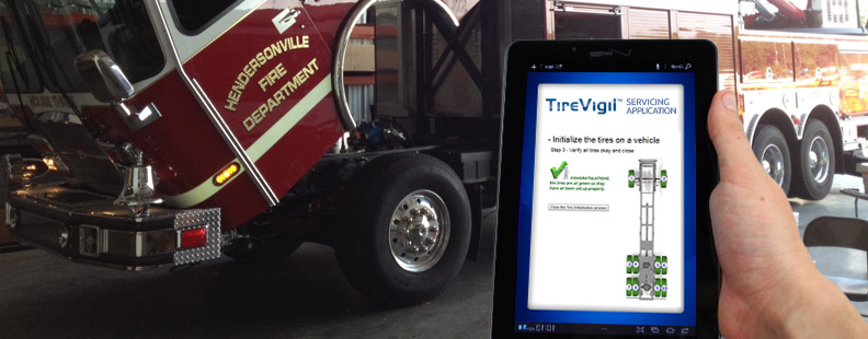
    CompassTrac is the software tool that enables Esri ArcGIS users to view the locations and statuses of vehicles and other high-value assets on their GIS map in real time. Leveraging existing Esri architecture and GIS data files, CompassTrac locates addresses and displays vehicle positions, speeds, and heading on the fly using selected ArcGIS data layers as the map background, including satellite and aerial imagery, the company said.

    Over the past 16 years, CompassTrac has provided field service management services for thousands of vehicles operated by organizations involved in public safety, public works, utilities, road maintenance, delivery and transportation.

    The premier upgrade to CompassTrac version 6 is a set of digitizing tools that allows the user to draw a geofence polygon around any feature or area — a street, neighborhood or town — on the GIS map. If any vehicle or asset being tracked by the system crosses the geofence boundary, CompassTrac will automatically send a text or email alert to select users and highlight the vehicle in question on the map display. These geofence alerts occur instantly and on the fly in real time, providing enhanced tracking of mobile resources to help operators manage their mobile work force.

    Now with version 6, CompassTrac is also hardware agnostic. The software will automatically scale, or optimize, its map view to fit on the screens of desktop computers, laptops, tablets and smartphones, giving Esri users the ability to track assets from any location where they have Internet.

    Visitors to CompassCom’s booth #2307 at the Esri User Conference will also view demonstrations of the new CompassLDE Connector, which provides plug-and-play capabilities to link AVL and mobile resource management tracking to the Esri ArcGIS GeoEvent Processor.

  • TireStamp Chooses Telit for Tire Pressure Monitoring with GPS

    TireStamp Chooses Telit for Tire Pressure Monitoring with GPS

    TireVigil-Telit

    Telit Wireless Solutions has announced that TireStamp, a TPMS 2.0-certified vendor of Tire Pressure Monitoring Systems, embeds Telit cellular and positioning modules into its product.

    For fleet managers, tires represent the second-highest operating cost of running a fleet, second only to fuel. Tire maintenance can significantly impact highway safety, revenue potential, operational efficiency, and maintenance costs.

    The TireStamp TireVigil solution communicates with tire pressure sensors to provide real-time monitoring of tire pressure and temperature across vehicle types, tire brands, and location. The comprehensive tire data enables fleet managers to schedule maintenance, intervene in the event of an emergency, improve on-time delivery, and enhance regulatory compliance.

    Telit's Jupiter JF2 GPS module.
    Telit’s Jupiter JF2 GPS module.

    The TireVigil solution uses Telit’s Jupiter JF2 GPS module, a compact, low-power device that provides enhanced accuracy to help locate vehicles in the event of an emergency or at any time. TireVigil receives tire data from TMPS sensors, then communicates in real-time over the cellular network using the Telit HE910 cellular module. Part of the xE910 module family, the HE910 is pin-to-pin compatible with a suite of modules enabling TireStamp to customize its products to enable connectivity across cellular technologies and geographies.

    “Our customers are typically in the maintenance space,” said Scott Feagan, Chairman and CEO of TireStamp. “Reliability and support are extremely important to them – and to me. Pair that with family compatibility for fast time-to-market and global expansion, the opportunity to bundle connectivity with positioning, affordable pricing and on-time availability, and it’s easy to see why we chose to work with Telit.”

    “Between fleets and personal vehicles, more than a billion tires are sold around the world each year,” said Mike Ueland, president of Telit Americas. “Telit has a long history of supporting fleet telematics and automotive solutions and we’re pleased to enable the world’s leading tire pressure management system.”

  • Azuga Takes on Distracted Driving for Fleet Managers


    To recognize National Safety Month and to highlight the growing dangers of distracted and reckless driving, Azuga has published a Fleet Stats infographic showing the dangers of auto accidents its fleet tracking programs are designed to prevent.

    Of the 41,000 Americans killed each year in traffic accidents, nearly 5,000 die as a result of crashes involving large fleet trucks. An additional 13,000 die as a result of a speeding-related accidents. Azuga offers two programs for fleet managers: SpeedSafe and DriveSafe.

    The programs combine GPS, a driver behavior and rewards system, vehicle health reports, and plug-and-play installation to combat reckless and distracted driving. DriveSafe prevents talking and texting when the vehicle is in motion. The distracted driving technology locks down a driver’s screen and only allows phone numbers that the employer’s policy allows. Policies can be applied at the individual driver level to allow certain calls and texts (for instance, allow incoming calls from home, the office, and school.)

    With SpeedSafe, a fleet manager controls speeding on residential streets, in school zones, and in adverse weather conditions. Going beyond simple control, a fleet manager also gets reporting and analytical tools to help quickly identify problem areas and track and train drivers over time.

    National Safety Month is sponsored by the National Safety Council. According to distraction.gov, using a mobile device while driving causes an estimated 28 percent of traffic accidents. Further, the National Safety Council estimates $40 billion cost to United States citizens each year.

    Azuga says its customers have been able to decrease the number of speeding events by 40 percent and decrease overall liability, which translates into an average 15 percent savings on insurance premiums.

  • Geoforce Releases Tiny Industrial GPS Tracking Device

    Geoforce, Inc., an international provider of asset management solutions for the oil and gas industry, has announced the widespread commercial availability of the GT0, a tiny industrial GPS asset-tracking device. The device is designed to track and remotely monitor assets too challenging for other GPS devices, the company said.

    “Geoforce is constantly trying to gauge what our customers will need next,” said James MacLean III, Geoforce’s president and CEO. “What we’ve been hearing out there is this: smaller, easier and whenever possible — more affordable. We’ve purpose-built this device to try and meet those needs without dropping the quality-level our customers deserve.”

    The GT0 has a powerful omni-directional antenna, allowing for placement in almost any orientation on an asset. The tracking device is engineered with RFID and GPS technology for location and identification, as well as QR coding for mobile scanning of product information. Its compact size allows the tag to fit on equipment where previous larger and bulkier asset-tracking devices could not be implemented. It is an IP67 device (weatherproof) and has an optional metal bezel for added protection. It has an expected five to seven year battery life, making it a simple-to-deploy “slap and track” device.

    More than 300 companies currently use Geoforce’s solutions to manage 100,000 assets across six continents. The GT0 was previously offered in limited release to several service and rental companies beginning in January of this year.

  • GPSTrackIt Monitors Fleet Health With Vehicle Diagnostics

    GPSTrackIt now offers Vehicle Diagnostics through its Fleet Manager dashboard to give fleet operators information about a fleet’s health in real time. The information is the same as that used by professional mechanics to identify why a check engine light is on.

    Since 1996, vehicles sold in the United States have been equipped with an On Board Diagnostics (OBDII) port. Mechanics plug a handheld computer into the port to read the codes produced by the on-board computer. GPSTrackIt offers two ways to gain the benefits of vehicle diagnostics — with its new CP3000V plug-and-play device or the L2000V adapter cable.

    The vehicle diagnostic codes received are used to determine the health of the various systems (ABS, Airbags, etc.) throughout the entire vehicle. In addition to the engine codes themselves, the system reports on a variety of indicators and parameters related to the codes.

    “A key feature is that this engine diagnostic data can be used to trigger SMS text or email alerts,” said Eddie Bermudez, GPSTrackIt’s Product Development Manager. “These alerts would be sent to designated personnel. Being able to identify problems early helps reduce and often times eliminate costly repairs.”

  • Disruption in Australia Traced to User Equipment

    User equipment incorrectly interpreting data from a satellite set “unhealthy” led to an apparent constellation outage for roughly 1,000 fleet vehicles across Australia in April. The problem was traced to the way a GPS/telecomm chip reacted to an extended navigation test aboard SVN-49, having to do with the recently launched IIF satellite, SVN-64.

    Although SVN-49 was set unhealthy at the time, the integrator-equipped fleet vehicles across the continent experienced periods of several hours without satellite visibility, in unobscured environments.

    The U.S. Air Force GPS Operations Center reported that in mid-May tests, “PRN 30 [was] broadcasting almanac datasets that do not reflect constellation changes that occurred since it was last uploaded with navigation message data.  [. . . ] The utilization of these almanacs in a manner that regards the time of week, but neglects or mishandles the week number (effectively executing as if the current week number is the week number associated with these almanac parameters), will result in an increasing error in visibility determination and other almanac based estimations (elevation/azimuth, Doppler shift, SV clock offset from GPS time, etc) as the dataset’s actual week offset from the current week increases.”

    The situation occurred once previously,  in 2011 with Mercedes in Europe. The problem was traced to chips from the same manufacturer, installed by the car-maker’s integrator partner, also misinterpreting data from a satellite set unhealthy while broadcasting system test data.

  • Geotab’s Telematics Connect with Mobileye for Collision Prevention

    Geotab, a telematics engineering company, is announcing its J1939 integration launch with Mobileye’s Advanced Driver Assistance System — the Mobileye 560. In combining these two solutions, businesses with heavy-duty fleets will be able to use advanced warning alerts to reduce the likelihood of vehicle crashes from occurring.

    In addition to the reports provided by Mobileye and Geotab that target unsafe driving practices, the solution also provides lane departure warnings, forward collision warnings, pedestrian and bicyclist warnings, distance keeping (headway) warnings, and speeding alerts. The ultimate goal is to give drivers added visibility and insight in the unexpected moments they need it most.

    Edward Kulperger, VP of Business Development for Geotab, commented on the cooperation by explaining that “fleet management technology has evolved to include proactive and dynamic solutions that incorporate real time data in the vehicle and in a fleet’s operations to predict and alert both safety and efficiency elements of fleets.” Isaac Litman, Mobileye Inc.’s CEO, Mobileye Aftermarket, said, “With Geotab, we have provided businesses with an unbeatable driver monitoring and evaluation system. It is the one of the most effective risk management tools available in the marketplace today.” This enthusiasm was also mirrored by Neil Cawse, Geotab’s CEO, “The ease in which businesses can adopt this technology makes it possible for fleet managers to show real savings that make an impact on the bottom line.”

    According to Mobileye, fleets using this collision avoidance technology typically realize a return on their investment in about 6-8 months. The benefits are abundant: Safe driving habits are significantly improved, costs associated with accidents are reduced or completely avoided, smooth driving patterns are reinforced on a continuous basis, and fuel and maintenance costs are minimized. Geotab and Mobileye are working together to bring the solution to the global market.

  • Omnilink Offender Monitoring and Asset Tracker Now on Verizon Network

    Omnilink, a provider of advanced machine-to-machine (M2M) tracking and monitoring solutions, has been named to the Verizon Partner Program as a Silver member.

    “U.S. government agencies, businesses, and consumers have depended on Omnilink to monitor the location, safety, and condition of offenders, assets, vehicles, loved ones, fleets, employees, and much more since 2004,” said Steve Hudson, Omnilink’s chief development officer. “We help businesses track and monitor virtually anything on almost any device, and set high standards in reliability, accuracy and ease of use. And now we are excited to make these solutions available to Verizon customers.”

    Omnilink FocalPoint Offender Monitoring is an advanced electronic monitoring solution that gives government agencies the ability to reliably track and monitor the location and status of their entire offender caseload across the U.S. on virtually any device. FocalPoint Offender Monitoring combines reliable GPS/AGPS/AFLT/RF hardware, the friendliest software, comprehensive 24/7/365 support services, and state-of-the-art-infrastructure for complete offender supervision.

    Omnilink Asset Tracker helps companies better manage their assets with an award-winning asset optimization, theft prevention, and monitoring and safety solution. Asset Tracker is an all-in-one asset tracking system that gives companies the ability to track and monitor the location and condition of all their physical assets—vehicles, trailers, equipment, retail, ATMs, bank bags, goods in transit, and much more — across the U.S. and beyond via their computer, tablet, and smartphone.

    The Verizon Partner Program tailors regional and national opportunities for systems integrators, value added resellers, agents and solutions providers to accelerate delivery and adoption of solutions for meeting medium business requirements. In addition, the program features a tiered benefits structure that allows members the flexibility to determine levels of commitment, and also includes simple-to-use tools and clear and consistent engagement processes.

    Verizon Enterprise Solutions creates global connections that generate growth, drive business innovation and move society forward. With industry-specific solutions and a full range of global wholesale offerings provided over the company’s secure mobility, cloud, strategic networking and advanced communications platforms, Verizon Enterprise Solutions helps open new opportunities around the world for innovation, investment and business transformation.

  • Pitney Bowes, INRIX Join on Location Intelligence for Traffic

    Pitney Bowes Inc. has entered into a multi-year partnership with INRIX, Inc., provider of traffic information and driver services, to deliver advanced location intelligence solutions through the company’s traffic intelligence platform.

    By integrating location capabilities with traffic analysis, INRIX and Pitney Bowes will enhance the driving experience of today’s connected drivers, the companies said. By delivering this information through INRIX’s mobile app, users are empowered to make better location-based decisions in real-time.

    “Pitney Bowes’ location intelligence solutions can add compelling new capabilities to the existing products of mobile-oriented companies such as INRIX,” said James Buckley, Senior Vice President and General Manager, Location Intelligence, Pitney Bowes. “Our products help unearth non-obvious relationships between specific locations to improve the customer experience and drive loyalty.”

    INRIX has designed a leading traffic intelligence platform that uses smart data and advanced analytics to solve transportation issues worldwide. The company uses a unique approach called “smart crowd-sourcing” that analyzes real-time traffic speed and incident data from a wide variety of public and private traffic sources ranging from road sensors and up-to-the-minute traffic speeds and community reports crowd-sourced from millions of vehicles and mobile devices throughout the day. Whether through an in-car or smartphone navigation application, a local newscast or the company’s INRIX Traffic app, INRIX offers up-to-the-minute traffic information and other driver services to help more than 150 million drivers save time, fuel and money.

    Pitney Bowes Location Intelligence solutions merge organizational data with location data to provide users with the capability to make more informed decisions. For INRIX, this technology compiles and correlates addresses with coordinates from a mobile device to establish real-time location or a desired destination. Combining that with other data such as specific traffic flow, demographics and behavior patterns, users can uncover key points of interest by accessing Pitney Bowes advanced location search. For example, if a consumer is planning to visit a popular department store in a specific region, the technology makes it possible to suggest a relevant restaurant recommendation for lunch, based on the data that is collected about user preferences, convenience, proximity and projected traffic patterns.

    “INRIX had a number of compelling reasons to partner with Pitney Bowes,” said Scott Sedlik, Vice President, Product Planning and Market Development for INRIX. “Our customers are looking to make real-time decisions using location data, and Pitney Bowes has the most comprehensive suite of offerings to fulfill that need. Other key reasons for teaming include a strong customer focus and alignment with our own strategic goals and approach.”

  • PeopleNet Launches Fleet Solutions for Energy Services Suite


    PeopleNet, a Trimble company and provider of fleet mobility technology that optimizes performance and decision-making management, has launched a mapping and navigation solution for its Energy Services suite, serving U.S. fleets in the upstream and midstream sectors.

    “Our Energy Services suite capitalizes on our proven fleet mobility solutions that increase efficiency, safety and compliance for all oilfield service segments, including producers, oilfield construction and well service companies, as well as haulers of fluid and crude oil. In addition, we’re leveraging our parent and sister companies’ industry-standard lone-worker, mapping and navigation technologies to fast-track development of new services to continue improving operations for Energy Services fleets,” said David Buhl, leader of PeopleNet’s dedicated Energy Services Division.

    PeopleNet’s new Energy Services mapping and navigation solutions are based on exclusive, detailed maps of private and leased oilfield roads that facilitate vehicle navigation to and from well sites, coordination of disparate workforces to promote efficiency, location monitoring of equipment to ensure vehicles are on the correct route for least-cost routing. The Oil and Gas Map Portal is a web-based application used by back-office dispatch personnel to manage the navigation needs of vehicles and includes reporting, dashboards, and scorecards that help manage compliance with producer-landowner road-usage agreements.

    CoPilot Oil and Gas Navigation is an in-cab application that uses oil and gas field mapping for providing turn-by-turn directions to the driver to enable on-time arrivals and scheduling. Location data, including wells, is installed onto the in-cab device and is accessible in the points of interest menu. When a location is selected, the application provides turn-by-turn directions to the driver.

    A growing number of energy services fleets are using PeopleNet technology to promote on-time schedules, enhance service levels and improve safety/compliance, including Gibson,  Missouri Basin Well Service, Nuverra Environmental Solutions, Rockwater, and Tankstar USA.

    These new services are based on reliable two-way messaging and GPS, supported by tri-mode communications (cellular, satellite and Wi-Fi). They are being added to PeopleNet’s current Energy Services offerings, which include: Crude Workflow for improving driver efficiency; eDriverLogs HOS application with oil field regulations; Speed Gauge speed monitoring; and Automated Fuel Tax reporting for eliminating manual trip sheets.

  • Navman Wireless Debuts Telematics Portal for Fleets

    Fleet tracking provider Navman Wireless USA has announced a new web-based telematics portal designed to streamline management of mixed heavy equipment fleets by consolidating machine data from all OEM and Navman Wireless-tracked assets into a single interface.

    The new solution complies with the AEMP Telematics Data Standard, provides one-stop fleetwide visibility without adding third-party hardware to machines that already have factory-installed OEM telematics, and supports integration of data into the enterprise office system for broader business use.

    Fleet operators can request data access credentials from each OEM represented in their fleet. Data from each reporting source will be securely transmitted to operators’ servers and then aggregated for use in the portal’s widgets, dashboards, maps and reports.

    Information available from the portal ranges from machine location, fleet utilization, fuel burn, and geofence and curfew violations to equipment use by jobsite, preventive maintenance schedules, and beyond. Related information such as machine inspection data and photographs of machine damage can be imported into the system for further data consolidation.

    Other value-added features include the ability to sort reports by OEM, analyze data by machine category, and click to access real-time weather reporting from each jobsite to help fleet managers and equipment rental companies quickly ascertain the reason for low real-time utilization rates. Future enhancements such as idling data will be added as new versions of the AEMP standard dictate which data elements may be available from OEMs in a common format.

    “For the past decade, contractors with mixed fleets have been increasingly handicapped in their use of telematics by the fractured nature of the reporting. Only the largest fleets with exceptional budgets and large IT teams have been able to afford to consolidate the data from each OEM website,” said Steve Blackburn, VP North America, Navman Wireless. “Our new portal offers a single view of all telematics data regardless of the source, giving operators insights and controls that can help drive new fleet efficiencies and profitability.”

    The new Navman Wireless portal is scheduled to begin beta testing in April. It will be available by subscription and priced according to the number of assets tracked, with Navman Wireless support and ongoing upgrades included in the subscription package.

    Navman Wireless is hosting a hospitality suite, Room B at the Marriott Courtyard Las Vegas Convention Center, at this week’s CONEXPO-CON/AGG conference. For more information, call 877-891-5009 or email [email protected].

  • Blue Sky Network Debuts Mobile Tracker with Geofencing

    Blue Sky Network Debuts Mobile Tracker with Geofencing

    Blue Sky Network's HawkEye 7200 Portable  Tracking Solution.
    Blue Sky Network’s HawkEye 7200 Portable Tracking Solution.

    Blue Sky Network has released the portable HawkEye 7200 with geofencing. The Hawkeye 7200, released in September 2013, is a small mobile device designed specifically for Iridium and GNSS satellite tracking of aviation, land/mobile or marine assets. The company will demonstrate its new AVR (advanced variable response) geofencing capabilities at the upcoming HAI Heli-Expo tradeshow in Anaheim, California, February 25-26.

    “Advanced variable response or AVR delivers functionality and utility one level beyond traditional geofencing alarms or alerts. It allows the asset manager or geofence designer to set a conditional response for what happens or does not happen when an aircraft, vehicle, or vessel is in, or out of a geofenced area,” explains John Peterson, Blue Sky Network’s vice president of Business Development. “For example, position reporting frequencies could be turned off when an asset is at its home base, resume normal reporting after leaving the base, and increase reporting frequency when entering regions considered more dangerous. AVR gives asset managers more control, ultimately making fleet management easier, safer, and less expensive.”

    In addition to AVR, the HawkEye 7200 offers three significant advantages over traditional satcom asset tracking devices

    • An all-in-one design including internal long-lasting lithium ion battery and dual Iridium and GNSS antenna;
    • true concurrent multi-national GNSS for faster, more accurate positioning; and
    • Bluetooth connectivity using Blue Sky Network’s custom APP for iPhone and iPad, facilitating easy messaging and custom form transmission from Apple devices.

    The HawkEye 7200 portable satcom solution works directly with Blue Sky Network’s cloud-based web portal SkyRouter. Skyrouter is a secure online website that provides tracking and management of globally dispersed assets.